![]()
![]()
![]()

Trip 322 - September 16, 2024 (Monday)
Green Mountain Trail Hike
Near Gold Bridge, BC
Page 4 of 4
Liked: Excellent views of mountains, valleys, and lakes. A former fire lookout shack. Shade in the forest. Meeting a marmot. Very few bugs.
Vancouver, Coast & Mountains Backroad Mapbook (2019 edition) Coordinates : Page 50 (Downton Lake) G5.
Follow @ihikebc TweetGreen Mountain Trail is located in the remote southwest part of British Columbia near Gold Bridge. It's takes a 103 km drive via a scenic BC Highway 40 from Lillooet to get to Gold Bridge, and then a drive for over 8 km on washboard-like Hurley River Forest Service Road (2WD regular clearance vehicles - ok, but ensure to have good tires and a spare). After that, there is an access road of about 2.8 km to the trailhead, then just over 3 km to an old and well-preserved fire lookout shack, and then further hiking of about 3 km to the end of the trail.
If you have a high-clearance short-wheelbase 4x4, you might be able to make it all the way to the shack. Otherwise, park by Hurley River FSR and start hiking. It's not a very difficult trail all the way to the shack (gets tougher after that), but there are absolutely no signs (save for one by the forest service road), and several splits where you either need to know where you are going, or have a GPS unit with this trail.
The views of mountains, valleys, and lakes are absolutely great, and the shack is in good enough shape to accommodate an overnight stay - it has 4 bunk beds and a stove. There is also an open air pit toilet (with a view!) near the shack. We first hiked this trail in May of 2021, but stopped about halfway to the shack due to deep snow. Unless otherwise noted, all photographs in this trip report are from the trip we took in September of 2024.
* All trail distances are based on a GPS odometer and are approximate.
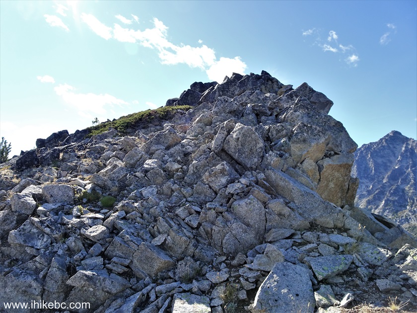
90. At 880 meters from the Green Mountain fire lookout shack, we are approaching a small rock outcropping rather prominently sticking out on the far left side ahead.

Green Mountain Hike
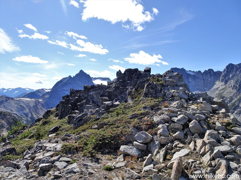
91. Now we are on top of the outcropping. Coordinates: N 50⁰47.285' W 122⁰55.768'. Elevation: 2,160 meters.
Hiking in British Columbia
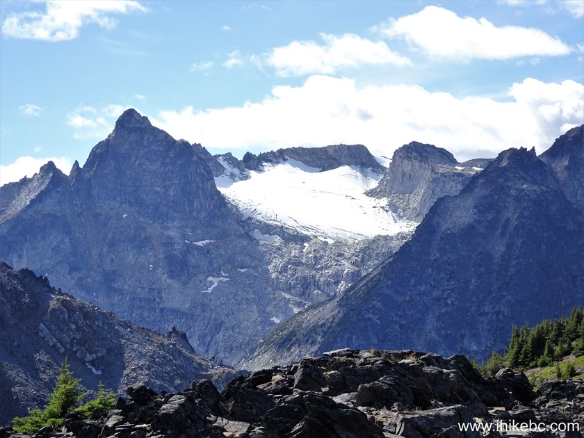
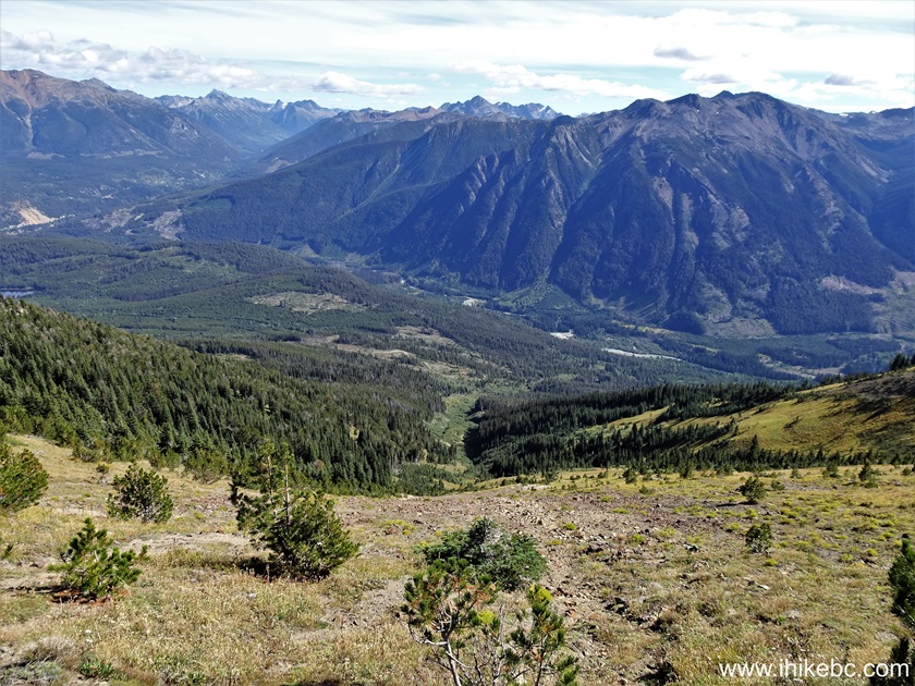
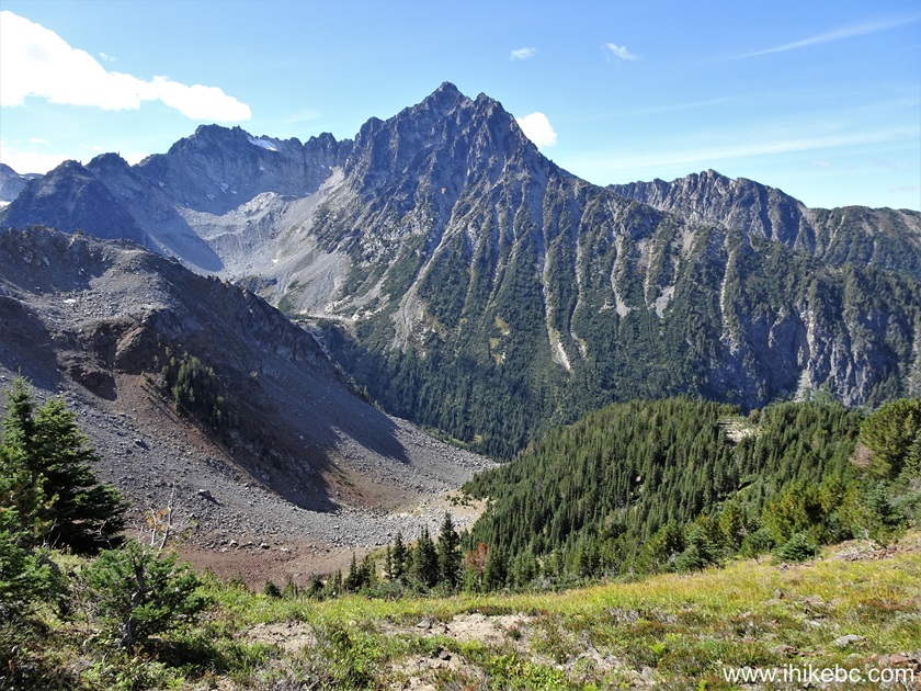
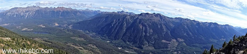
92-99. Very fine views all around from this spot. A 360 degree look-around, followed by a zoomed view of a glacier originally seen in photo #95 in the upper left side.
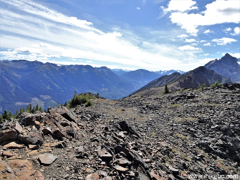


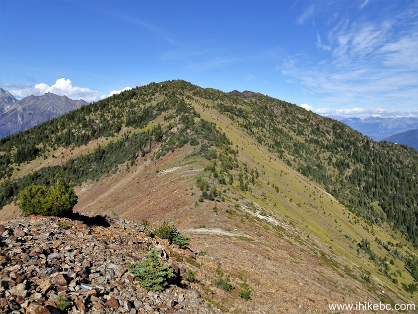
100. At 980 meters from the shack, we are continuing towards a prominent ridge ahead.

Green Mountain Hike near Gold Bridge BC Canada
101. 120 meters later.
Hiking Green Mountain Trail in British Columbia
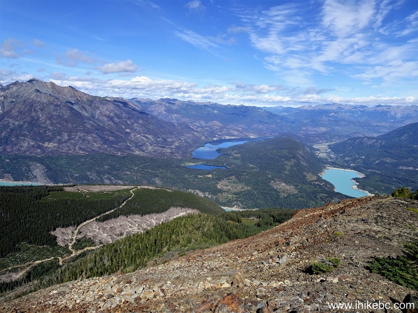
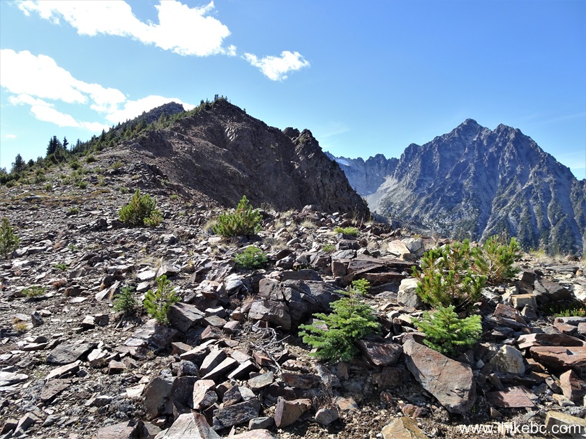
102. Looking left at 1.29 km from the fire lookout shack.
View from Green Mountain in British Columbia Canada
103. And a very fine view on the right side at the 1.42 km mark.
British Columbia mountain
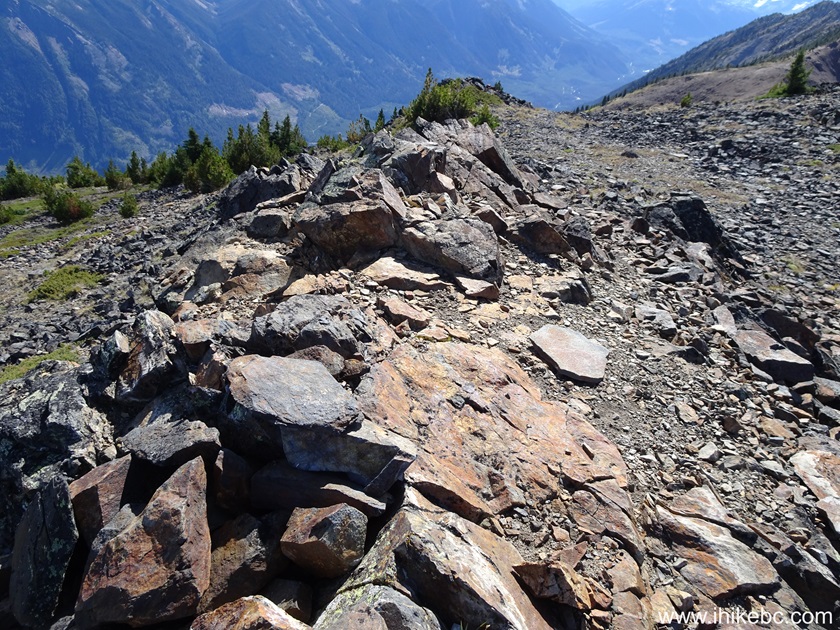
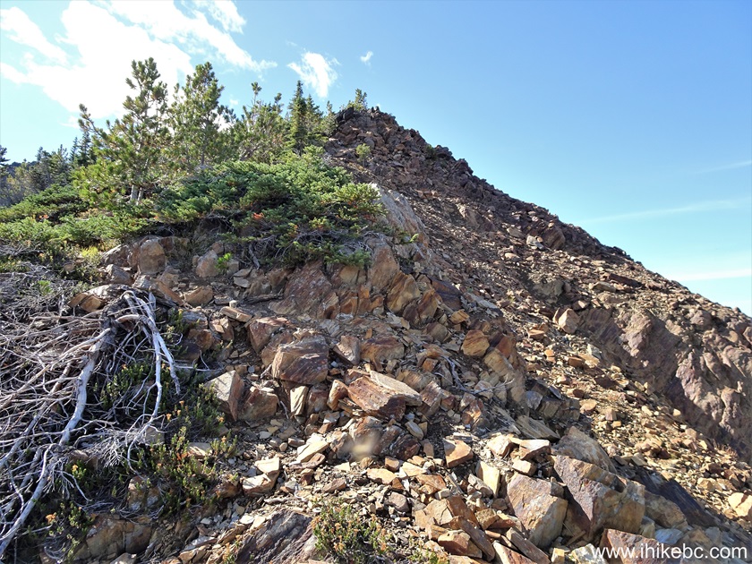
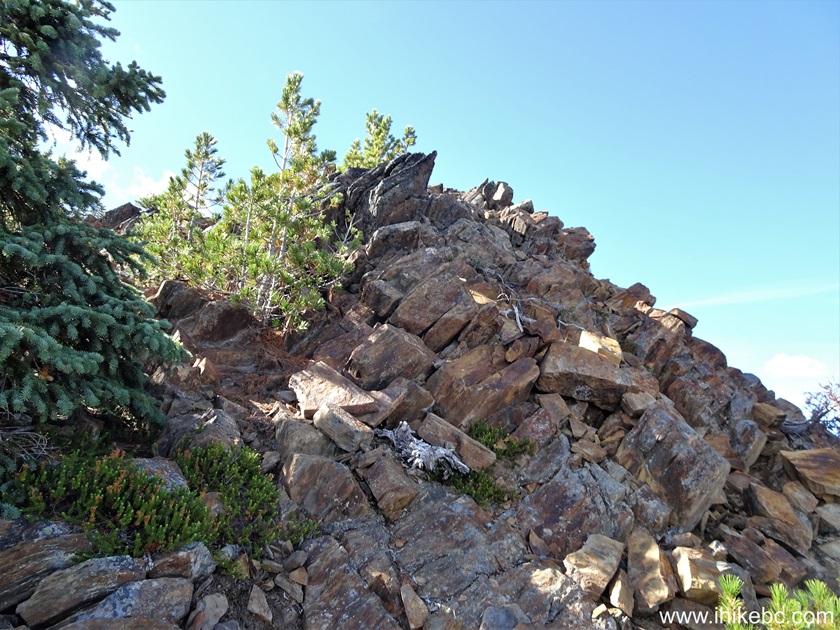
104. At 1.64 km, time to do a bit of steep hiking.
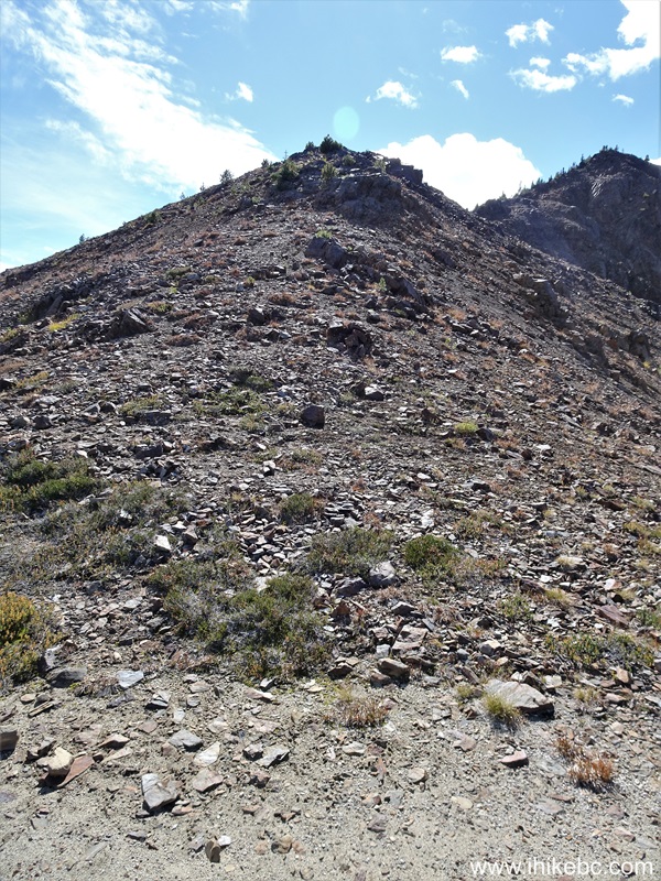
Green Mountain British Columbia
105. 60 meters later.
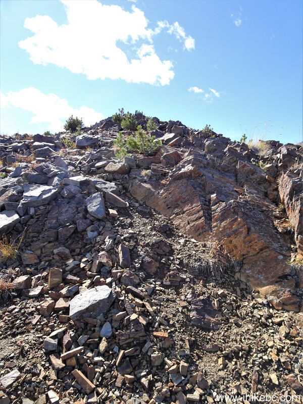
Hiking in Canada - Green Mountain near Gold Bridge BC
106. Looking back at 1.70 km from the shack.
Green Mountain near Gold Bridge British Columbia Canada
107. Now looking forward at 1.72 km.
Hiking in British Columbia - Green Mountain
108. A bit more climbing at 1.78 km of Green Mountain Trail past the fire lookout shack.

Green Mountain Hike
109. Looking ahead 30 meters later.
Hike in British Columbia Canada
110. And looking back from the same location.
Green Mountain
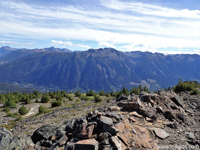
111. Almost at the top at the 1.84 km mark.
Hike in British Columbia Canada
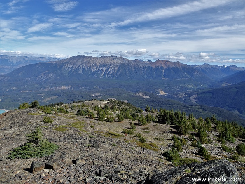
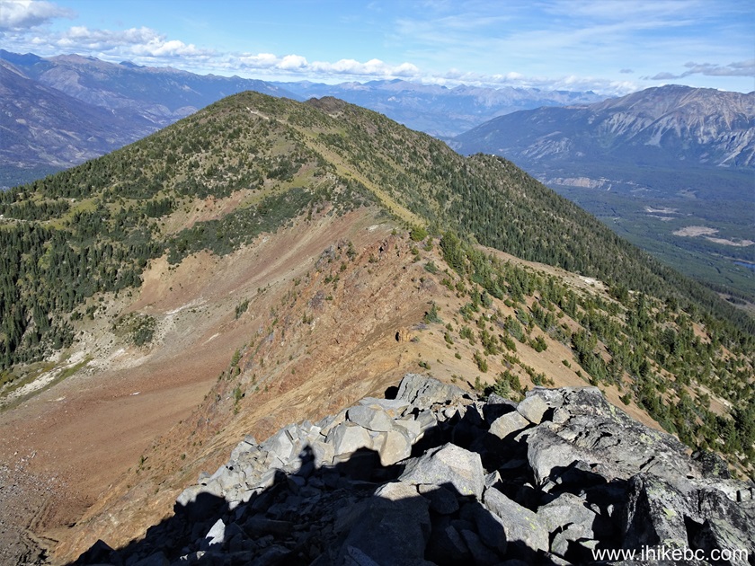
112. And then another ridge ahead. At 1.89 km from the shack here.

Green Mountain Hiking in Goldbridge BC Area
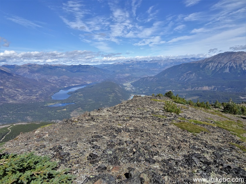
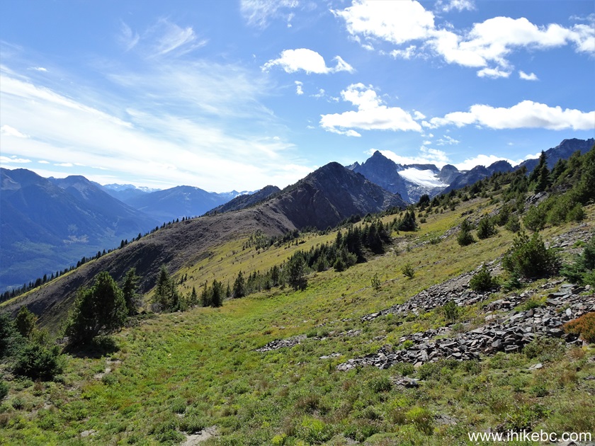
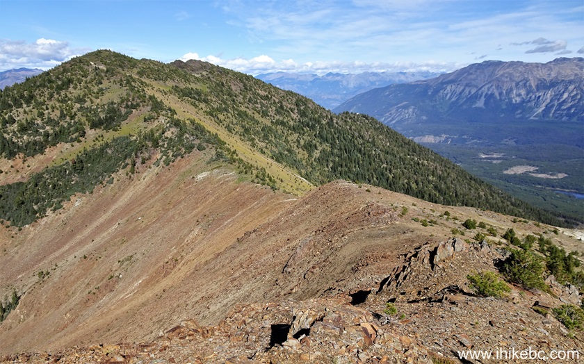
113-114. Very fine panoramic views on the left side at the 2.04 km mark. Left to right.
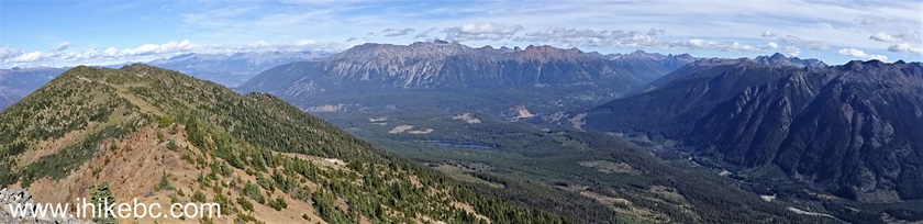
Panoramic View from Green Mountain BC Canada
115. One more short steep stretch at 2.05 km.

Hiking Green Mountain near Gold Bridge BC
116. Looking back 30 meters later.
Hiking Green Mountain near Gold Bridge British Columbia
117. At 2.10km, getting very close to where we finished our hike.
Hike in British Columbia
118. At 2.14 km we see our final destination straight ahead.
Hike in Canada
119. And here is where we stopped due to being pressed for time, at 2.18 km from Green Mountain fire lookout shack. Coordinates: N 50⁰46.791' W 122⁰56.299'. Elevation: 2,210 meters. Our GPS showed the trail ending 500 meters ahead at the far end of the ridge, approximately at a point parallel to the far end of the lake.
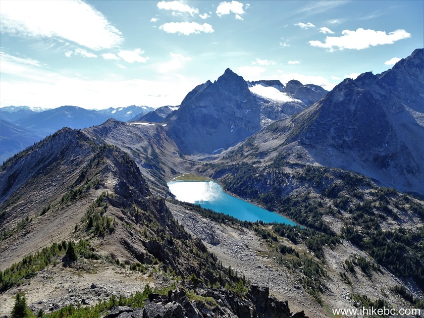
View from near the end of Green Mountain Trail in British Columbia
Canada
120. A zoomed view.
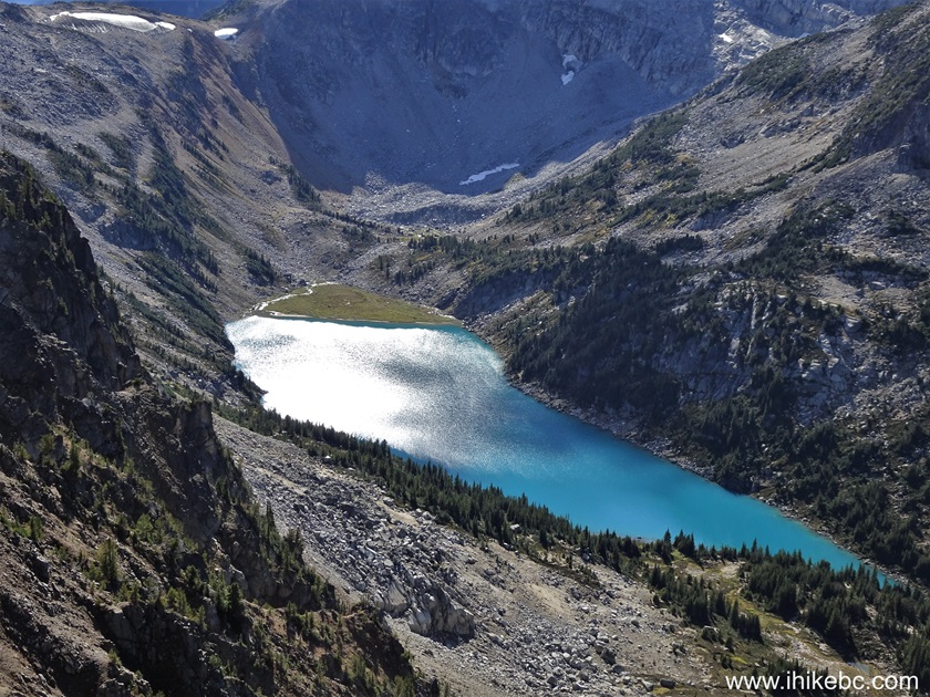
British Columbia Mountain Lake
Here is our video of the views from this location.
More ihikebc videos are on our YouTube Channel.
121-122. A pleasant bonus was meeting this marmot on the way back, not far from the lake. A zoomed view followed by a cropped view.

Marmot in British Columbia
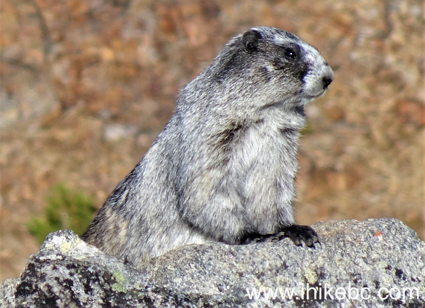
British Columbia Marmot
Green Mountain Trail near Gold Bridge, BC features numerous fine valley, mountain and lake views, as well as a neat old fire lookout shack. Highly recommended.


|
 |
Other Trips:


![]()
![]()
![]()
ihikebc.com Trip 322 - Green Mountain Trail Hike (near Gold Bridge, BC) Page 4 of 4