![]()
![]()
![]()

Trip 322 - September 16, 2024 (Monday)
Green Mountain Trail Hike
Near Gold Bridge, BC
Page 3 of 4
Liked: Excellent views of mountains, valleys, and lakes. A former fire lookout shack. Shade in the forest. Meeting a marmot. Very few bugs.
Of Note: Hurley River FSR towards the trail is like a washboard. Remote wilderness area. High altitude trail. No shade in the sub-alpine and alpine. A GPS with this trail is recommended. Moderately difficult trail to the fire lookout shack - hiking poles and boots are highly recommended. Moderate-to-difficult trail past the shack - hiking poles and boots are essential.Vancouver, Coast & Mountains Backroad Mapbook (2019 edition) Coordinates : Page 50 (Downton Lake) G5.
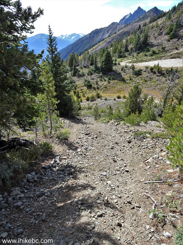
Follow @ihikebc TweetGreen Mountain Trail is located in the remote southwest part of British Columbia near Gold Bridge. It's takes a 103 km drive via a scenic BC Highway 40 from Lillooet to get to Gold Bridge, and then a drive for over 8 km on washboard-like Hurley River Forest Service Road (2WD regular clearance vehicles - ok, but ensure to have good tires and a spare). After that, there is an access road of about 2.8 km to the trailhead, then just over 3 km to an old and well-preserved fire lookout shack, and then further hiking of about 3 km to the end of the trail.
If you have a high-clearance short-wheelbase 4x4, you might be able to make it all the way to the shack. Otherwise, park by Hurley River FSR and start hiking. It's not a very difficult trail all the way to the shack (gets tougher after that), but there are absolutely no signs (save for one by the forest service road), and several splits where you either need to know where you are going, or have a GPS unit with this trail.
The views of mountains, valleys, and lakes are absolutely great, and the shack is in good enough shape to accommodate an overnight stay - it has 4 bunk beds and a stove. There is also an open air pit toilet (with a view!) near the shack. We first hiked this trail in May of 2021, but stopped about halfway to the shack due to deep snow. Unless otherwise noted, all photographs in this trip report are from the trip we took in September of 2024.
* All trail distances are based on a GPS odometer and are approximate.
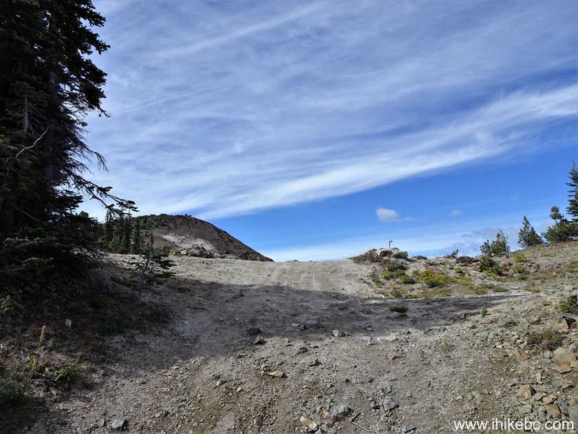
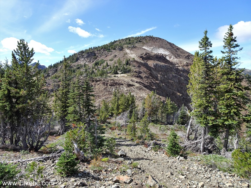
63. At 2.99 km of Green Mountain Trail we are almost at the fire lookout shack.
Green Mountain Trail
64. Looking back where we came from.
British Columbia Hiking - Green Mountain Trail near Gold Bridge BC
Canada
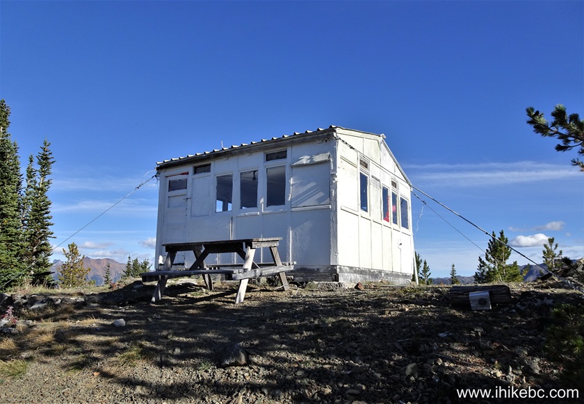
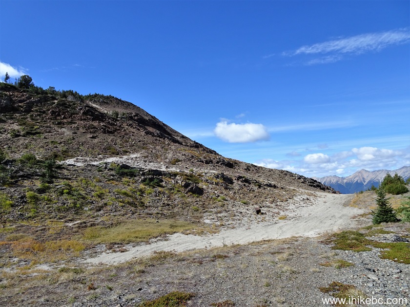
65-67. And here it is, at 3.02 km, Green Mountain fire lookout. Coordinates: N 50⁰47.366' W 122⁰55.242'. Elevation: 2,030 meters (510 meters elevation gain from the trailhead for an average grade of 17%). Inactive for many years like the rest of them in British Columbia. But a very neat backcountry shelter and historical artefact. An open air pit toilet with a fine view is located next to a shed on the other side of the shack. All vehicles should not proceed further, as there is a very steep loose-surface descent coming soon. And, in any case, hiking-only trail begins 500 meters ahead.

Green Mountain Fire Lookout Shack (not in operation) near Gold Bridge BC
Canada
British Columbia Fire Lookout Shack (Not in Operation)
Old Fire Lookout Shack British Columbia
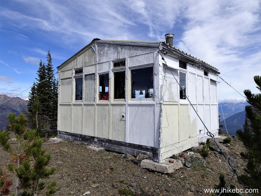
68-69. Inside the shack there are bunks for 4 people, a stove, a sink, a lantern, and numerous small items. Visitors have left their names and dates of visit all over the walls.
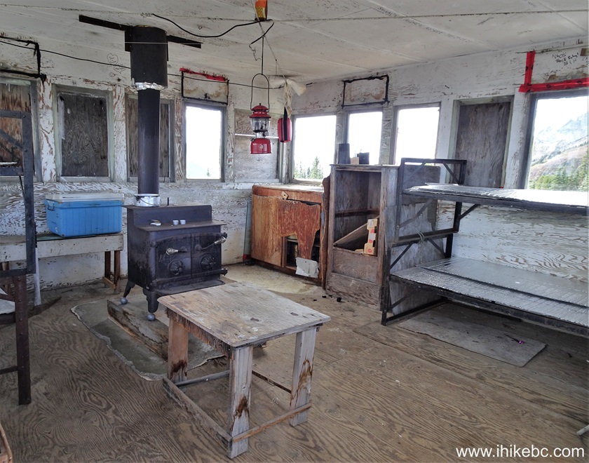
Inside Old Fire Lookout Shack British Columbia Canada
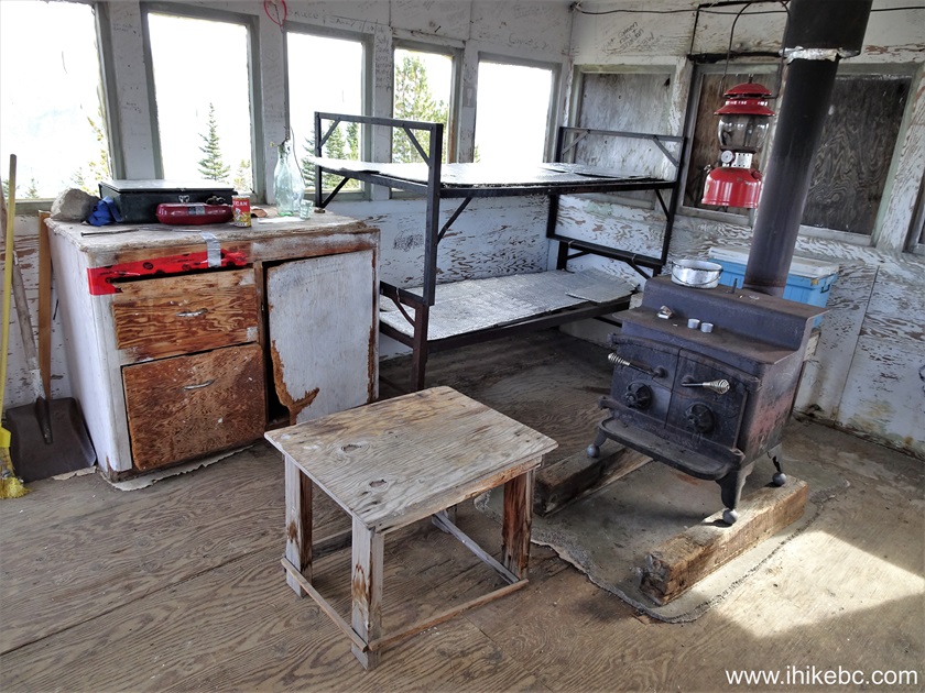
Inside Green Mountain Fire Lookout Shack (not operational) in British
Columbia Canada
70. A fine view from inside the Green Mountain fire lookout shack.
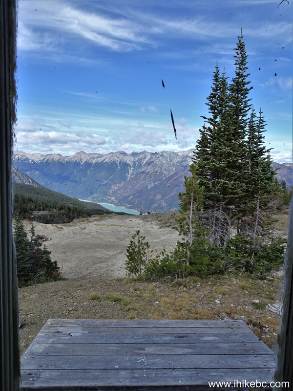
View from Old Fire Lookout Shack on Green Mountain near Gold Bridge BC
Canada
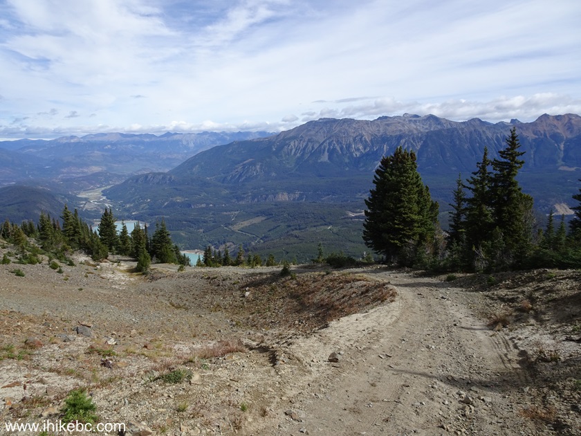
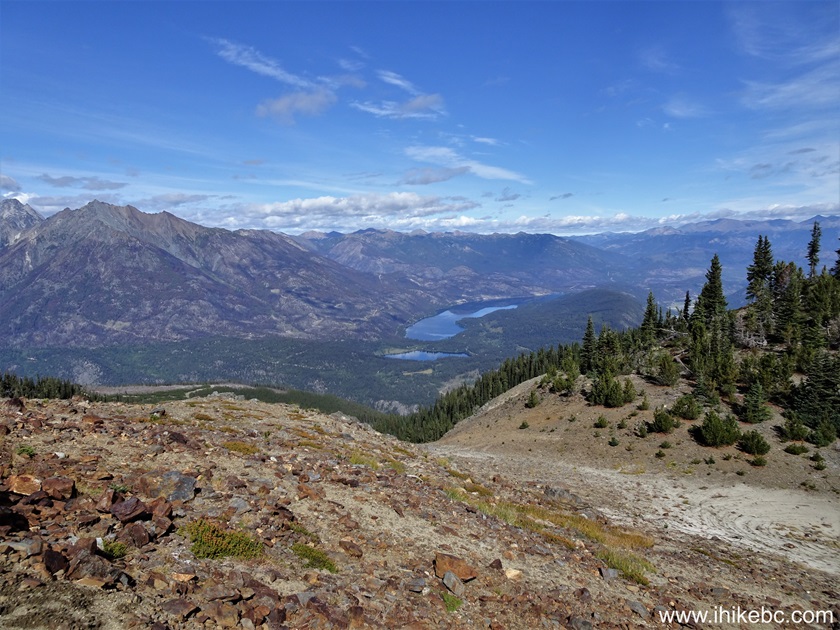
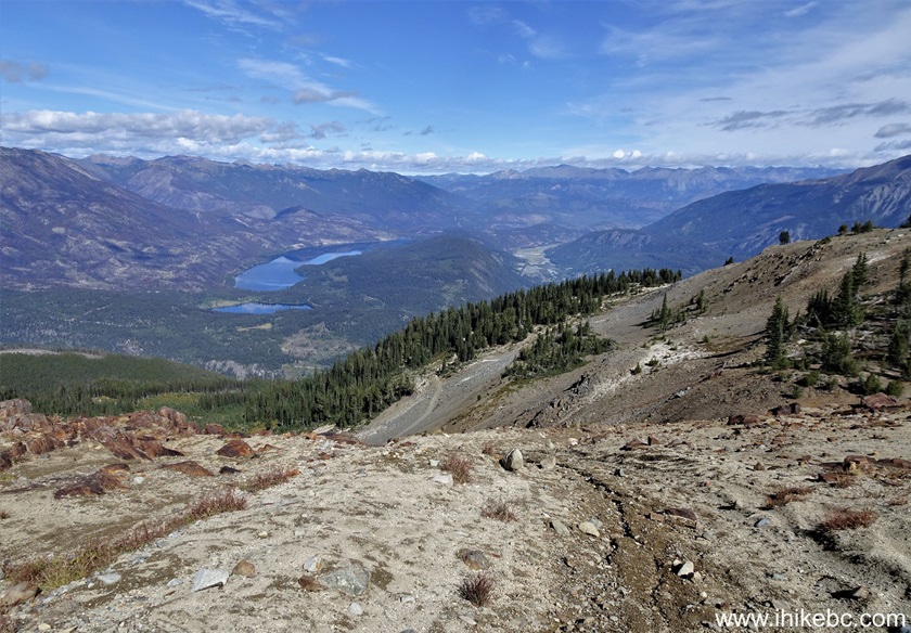
71-73. There is a also neat panoramic view outside the shack. Left to right.
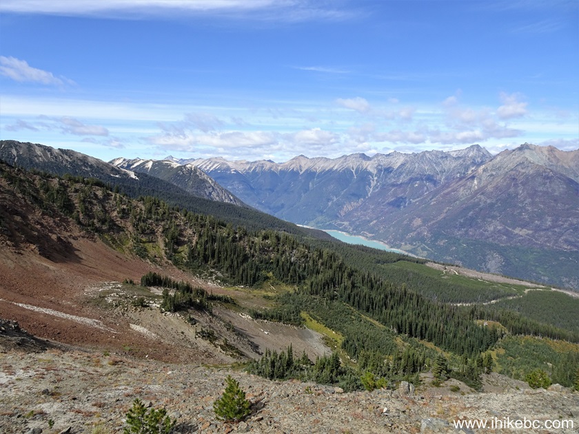
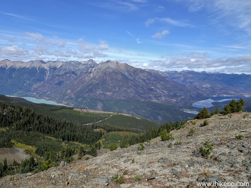
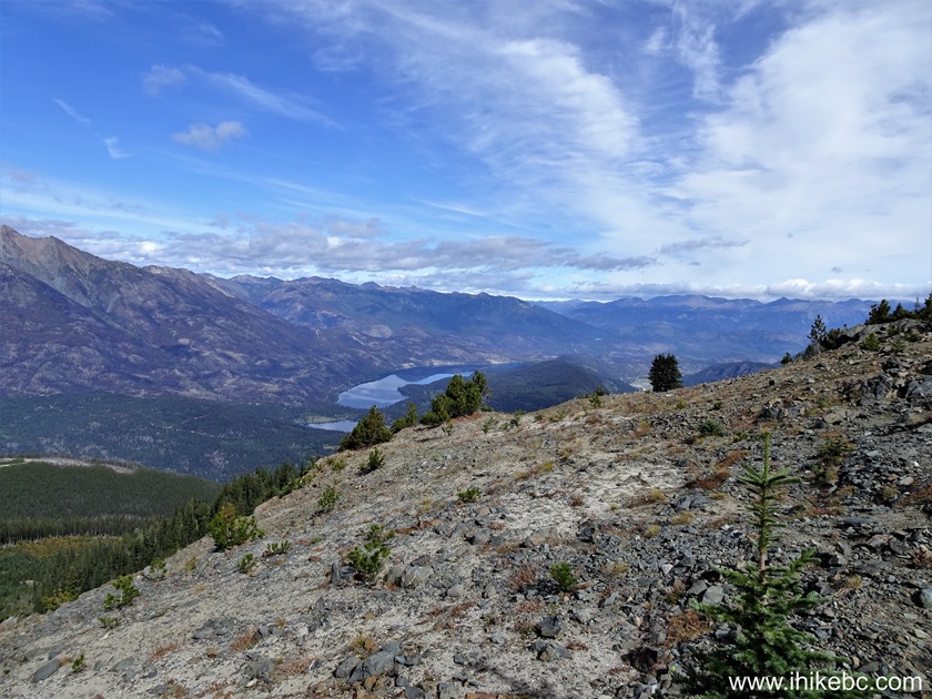
View from Green Mountain in British Columbia Canada
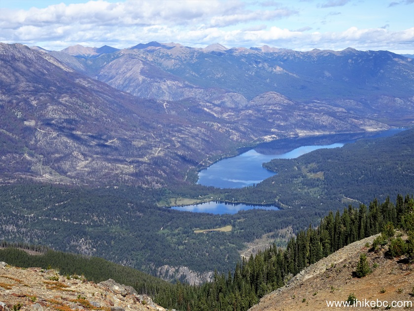
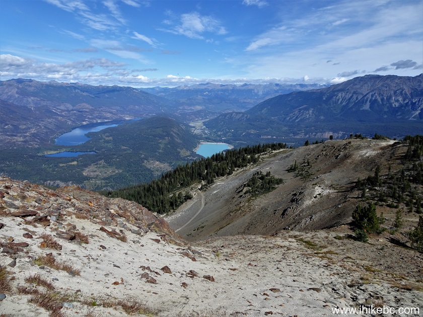
74. A zoomed view of Gun Lake and a small Lajoie Lake in front of it.

Gun Lake and Lajoie Lake view from Green Mountain near Gold Bridge
British Columbia Canada
75. There are several memorial plaques here as well. Commemorating Peter Richley (1921-2000), Ella Richley (1921-2017), and Dale Harwood (1938-2018).
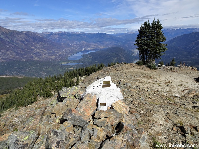
Green Mountain Memorial Plaque
Here is our video of the views inside and outside the Green Mountain fire lookout shack.
More ihikebc videos are on our YouTube Channel.
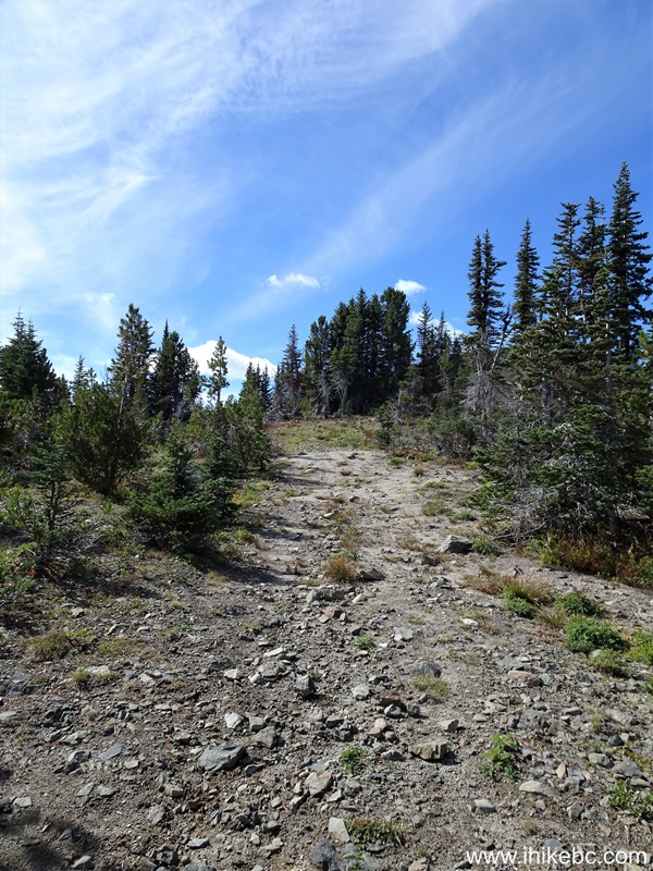
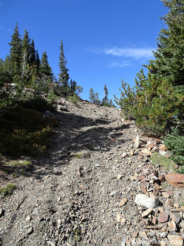
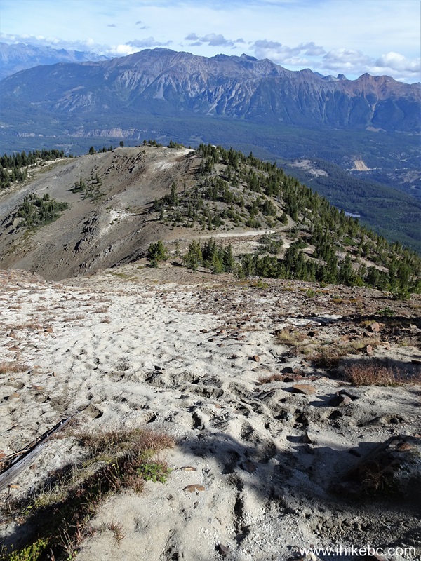
76. From the fire lookout shack, it is about 3 kilometers until the end of the trail. Things get more complicated, and hiking poles and boots are essential going forward. Here we are 35 meters from the shack.
Green Mountain Trail Past Fire Lookout Shack
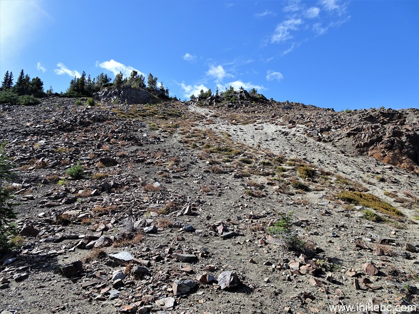
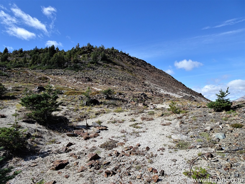
77. At 120 meters, we see our next challenge ahead.
Hiking in British Columbia
78. At 170 meters, here is that steep loose-surface descent. It is even steeper than it looks. Perhaps, with a diff lock it might be possible to climb up, but it likely would not be easy.
Hiking in Canada
79. Make a right turn at the bottom of the hill. At 220 meters from the shack now.
Green Mountain Trail in British Columbia
80. Followed by a left turn at the 350 meter mark.

Hiking in Gold Bridge BC Area - Green Mountain Trail
81-82. Looking back at 390 meters. Plain and zoomed.
Gun Lake British Columba
83. At 470 meters. Looking forward...

Green Mountain Trail
84...and looking back.
Hiking Green Mountain Trail near Gold Bridge BC Canada
85. Rather steep at 500 meters from Green Mountain fire lookout shack.
Green Mountain Hike in Goldbridge British Columbia Canada
86. 40 meters later.
Hike in British Columbia Canada
87. At the 630 meter mark. Still steep.

Canada Hiking Green Mountain Trail near Gold Bridge BC
88. Another fine view looking back from this spot.
Green Mountain British Columbia
89. Looking back at 660 meters at all the steepness out there.
Steep Green Mountain Hike in British Columbia near Gold Bridge
90. At 680 meters, the steep stretch is (almost) over.
Green Mountain Hike
Our Green Mountain Trail Hike trip report Continues on Page 4.


|
 |
Other Trips:


![]()
![]()
![]()
ihikebc.com Trip 322 - Green Mountain Trail Hike (near Gold Bridge, BC) Page 3 of 4