![]()
![]()
![]()

Trip 299 - September 4, 2023 (Monday)
Dallas Road Waterfront Trail Hike
And Ogden Point Breakwater Visit
Victoria, BC
Page 1 of 3
Liked:
Wonderful views of the waterfront and shoreline. Colourful tower at Spiral Beach. Excellent murals at the Dallas Rd Staircase (past the end of the shoreline trail – at the foot of San Jose Ave), Ogden Point and a nearby information stand.Of Note: The trail is popular, some homeless people hanging out, no shade, nudists could be present, uneven ground / rocks – hiking boots are recommended, a used condom observed at the Dallas Rd Staircase past the end of the shoreline trail.
Vancouver Island, Victoria & Gulf Islands Backroad Mapbook (9th edition) Coordinates: Page 5 (Victoria) A4-B4.
Follow @ihikebc TweetDallas Road Waterfront Trail is a very impressive easy hike with minimal elevation change and numerous fine views, and it is located right by the downtown in the city of Victoria, running alongside Dallas Road from St. Charles Street in the east to Lewis Street in the west. The distance via Dallas Road is about 3.5 km one way, but the actual hiking distance is longer because the trail meanders via several lagoons, so it's not a straight line. Dallas Road is never too far, especially in the east, and the trail does get just a touch wilder in the west, if not for too long. Several staircases are available in the "wilder" part of the trail to get back to Dallas Road.
Other than a few homeless people hanging out here and there (they were keeping to themselves), another item of note is that there is a totally unmarked nudist beach right at the trail. It is located at Finlayson Point (just east of Dallas Road at Douglas Street), and featured about ten mostly older men in their birthday suits, though we did observe a rather large woman as well.
Dallas Road Waterfront Trail can be accessed at numerous points. Washrooms are located in several places. Parking is plentiful along Dallas Road, but we left our vehicle at Gonzales Park, several blocks east of the trail, and walked along neat Victoria streets to the beginning of the hike at the foot of St. Charles Street.
Ogden Point Breakwater is located a few hundred meters past the western end of the trail, and is also included in this trip report.
* All trail distances are based on a GPS odometer and are approximate.
1. Here is a Google Maps location of Dallas Road Waterfront Trail in Victoria, BC. The trail is just South of the line showing the way from Dallas Rd at St Charles St to Dallas Rd at Lewis St.
2. We are in Victoria, BC on Dallas Road at the foot of St. Charles Street, looking west.
Dallas Road at St. Charles Street Victoria BC
3. Just to the left is the beginning of Dallas Road Waterfront Trail. Coordinates: N 48⁰24.602' W 121⁰20.186'. Elevation: 20 meters. To the right is a very old Ross Bay cemetery. A washroom is located one block further, at the corner of Dallas Road and Memorial Lane.
Start of Dallas Road Waterfront Trail
4. On Dallas Road at 415 meters from the trailhead. The trail is very close to Dallas Road at this point.
Dallas Road - Victoria - British Columbia - Canada
5. Now on the trail at the 615 meter mark. Uneven ground. Lots of logs and small loose stones. Hiking boots are recommended.
Dallas Road Waterfront Trail
6. Back on Dallas Road. At 690 meters here, just past Memorial Lane. The cemetery ends here too (on the right side). It's a very interesting cemetery with several impressive tombstones and quite a few deer.
Victoria BC Dallas Road
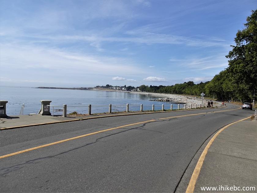
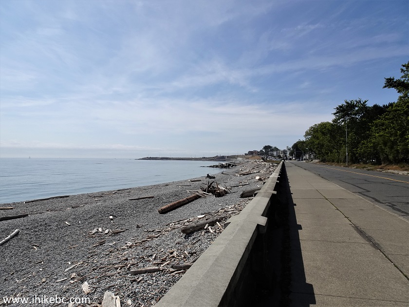
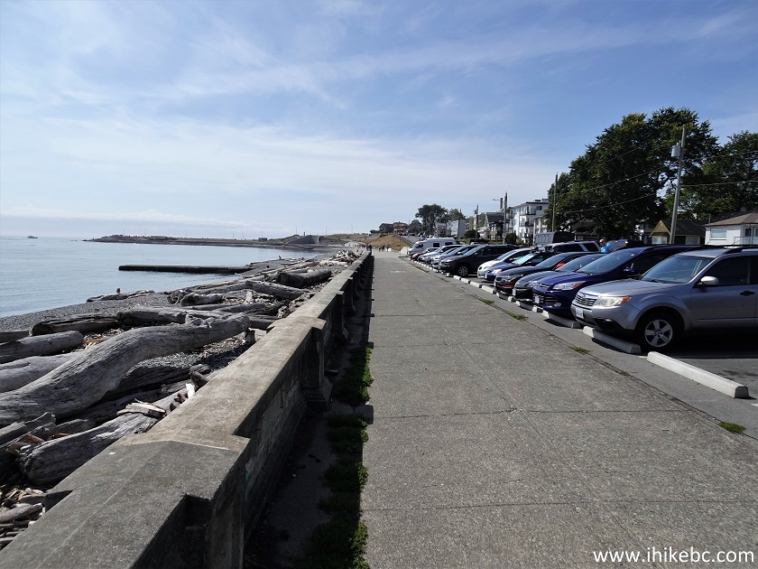
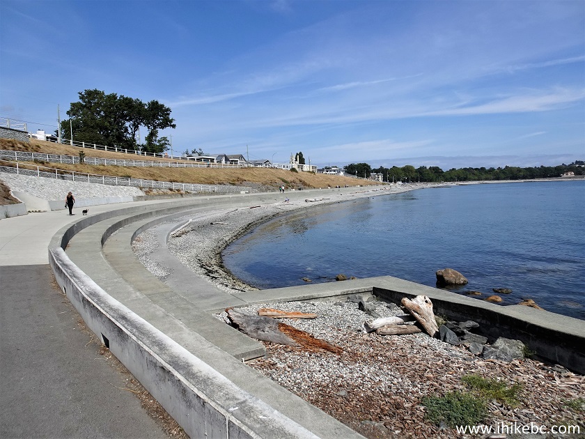
7. At 740 meters, there this very wide seawall several hundred meters long.
Victoria Seawall along Dallas Road
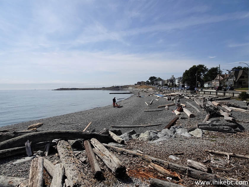
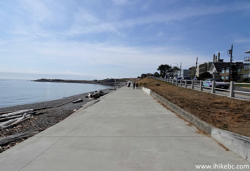
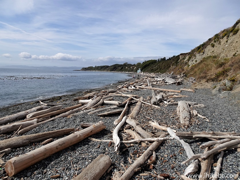
8. Looking back at the 870 meter mark. The beaches along Dallas Road Waterfront Trail are all made of small stones. No sand.
Dallas Road stone beaches in Victoria British
Columbia Canada
9. At 900 meters, we are getting close to Clover Point Park.
Victoria Seawall near Clover Point Park
10. Looking back 50 meters later.
City of Victoria Seawall along Dallas Road
11. At 1.1 km from the start of Dallas Road Waterfront Trail, we have arrived to Clover Point Park. It is a small protrusion into Salish Sea.
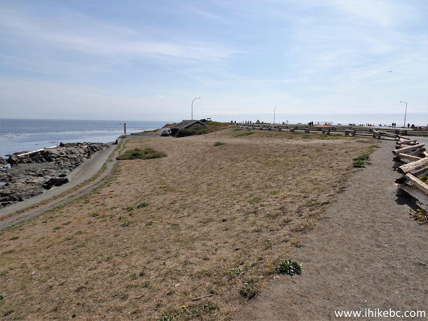
Clover Point Park Victoria BC Canada
12. Lots of benches here. Someone even went paragliding.
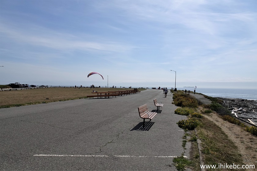
Clover Point Park
13. Chilling at Clover Point Park in Victoria, BC.
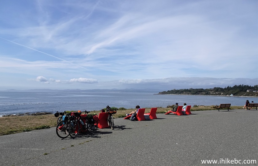
City of Victoria Clover Point Park
14. Dallas Road Waterfront Trail continues past Clover Point Park.
Dallas Road Waterfront Trail near Clover Point Park
15-17. We will return to the trail shortly, but now let's check out a neat Millennium Peace monument at the beginning of Clover Point Park near the foot of Moss Street.


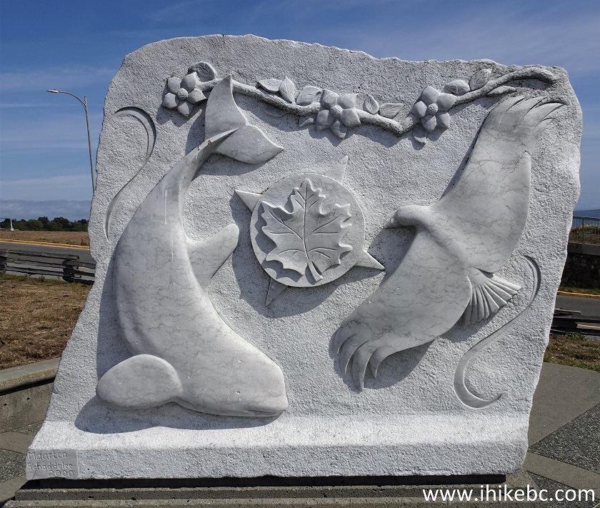
Millennium Peace monument in Victoria BC off Dallas
Road by Clover Point Park
18. Next is a 600 meter-long stretch between Clover Point Park and Spiral Beach.
Dallas Road Waterfront Trail between Clover Point
Park and Spiral Beach
19. Dallas Road Waterfront Trail at 380 meters from Clover Point Park.
Hiking in Victoria BC - Dallas Road Waterfront Trail
20. Approaching Spiral Beach Tower. 520 meters from Clover Point Park.
Dallas Road Waterfront Trail - Victoria - Vancouver
Island - British Columbia
21. Here is that colourful tower.
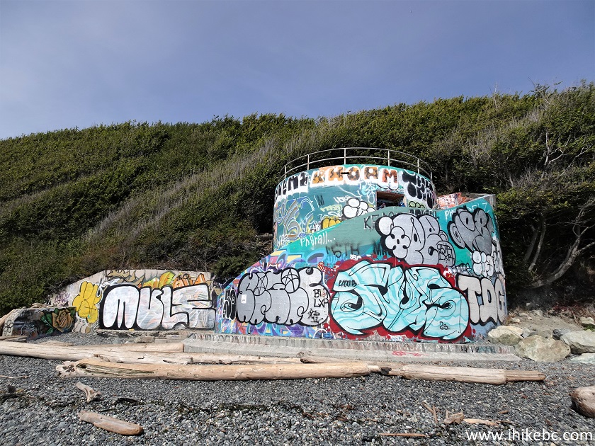
Spiral Beach Tower
22. Going up.
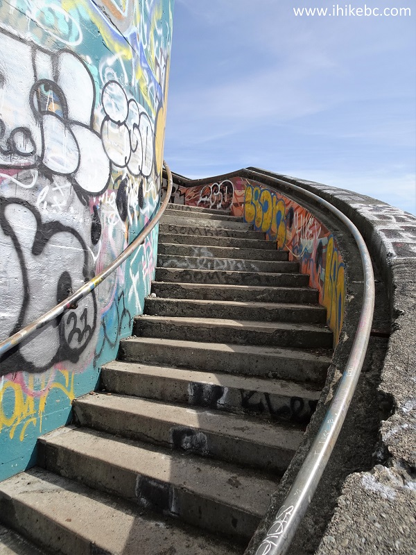
Spiral Beach Tower - Dallas Road Waterfront Trail
23. Two benches at the top of the tower.

Spiral Beach Tower benches
24. Looking right (west).
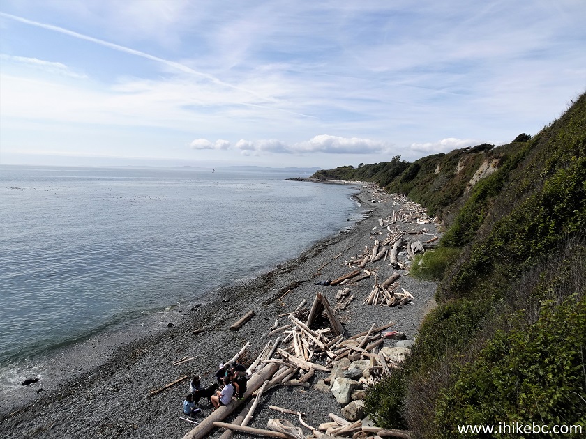
Dallas Road Waterfront Trail view from Spiral Beach
Tower
25. Looking east where we came from.
Dallas Road Waterfront Trail
Here is our video of Spiral Beach.
More ihikebc videos are on our YouTube Channel.
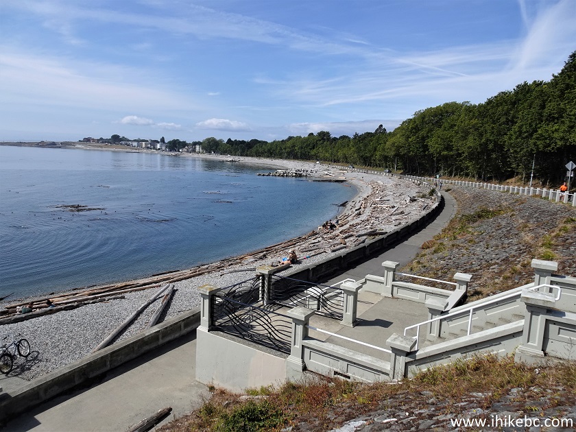
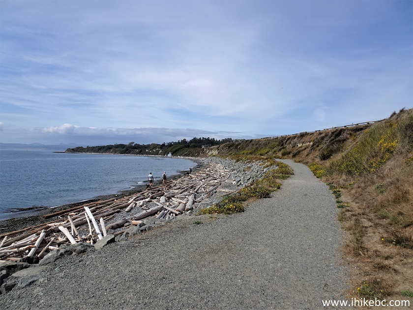
26. Proceeding further from Spiral Beach. It's about 1.7 km from here to the end of the trail (at the foot of Lewis Street) as the crow flies, but the actual distance is longer because the trail meanders around several lagoons.
Dallas Road Waterfront Trail - Spiral Beach -
Victoria British Columbia
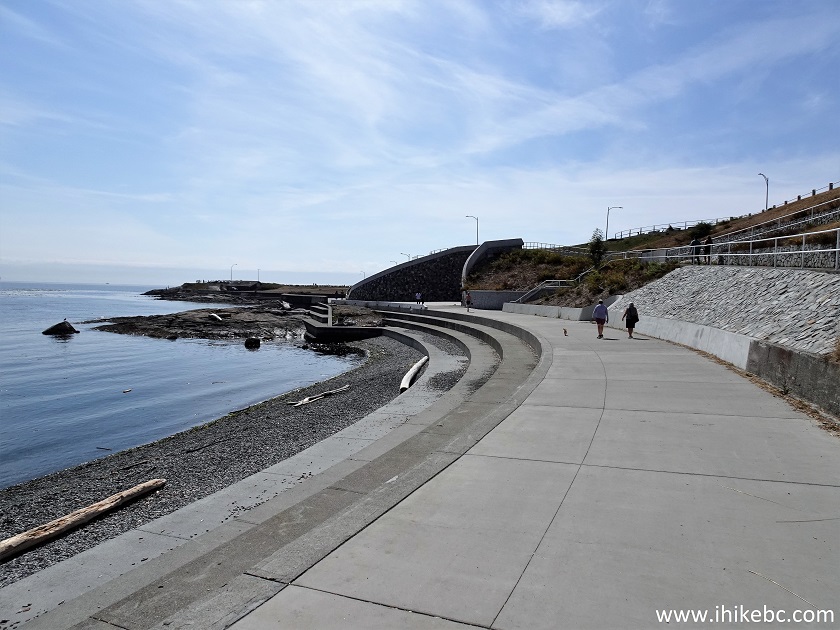
27. Finlayson Point 300 meters from Spiral Beach. Looking back.
Dallas Road Waterfront Trail - Finlayson Point
28. Now at 370 meters from Spiral Beach. Approaching Finlayson Point Beach full of nudists.
Dallas Road Waterfront Trail in Victoria BC Canada
29. And here is Finlayson Point Beach at the foot of Douglas Street. There are no signs of any kind indicating it's a nudist beach. We have stumbled upon about 10 (mostly older) naked men and one naked woman. They were spread around the lagoon, with a few hanging out together.
Finlayson Point Beach
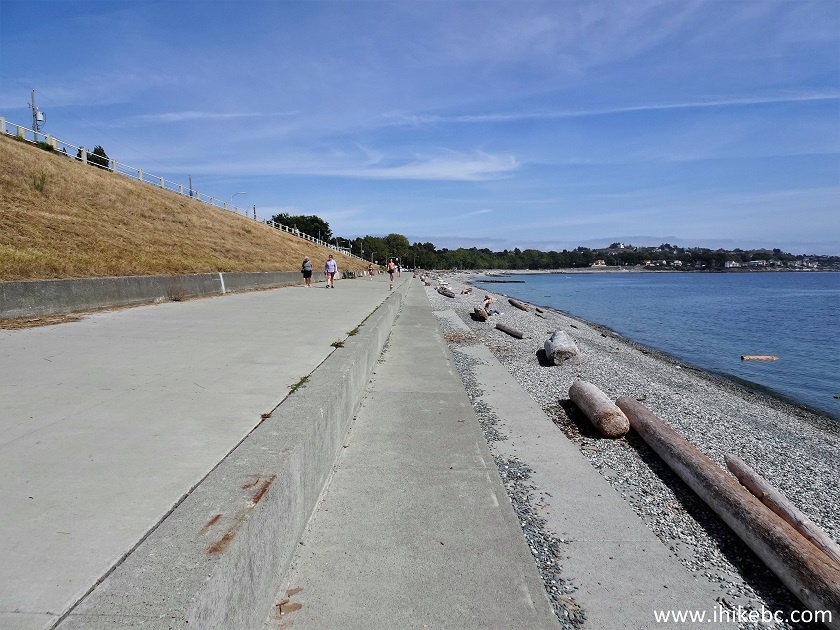
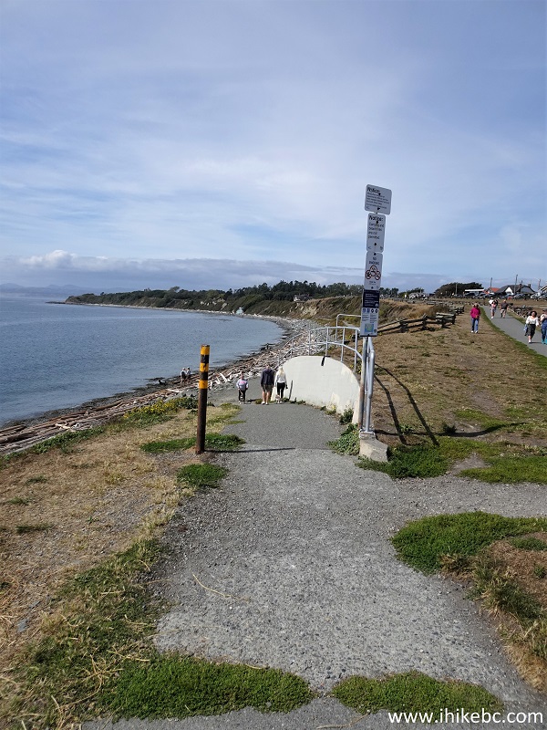
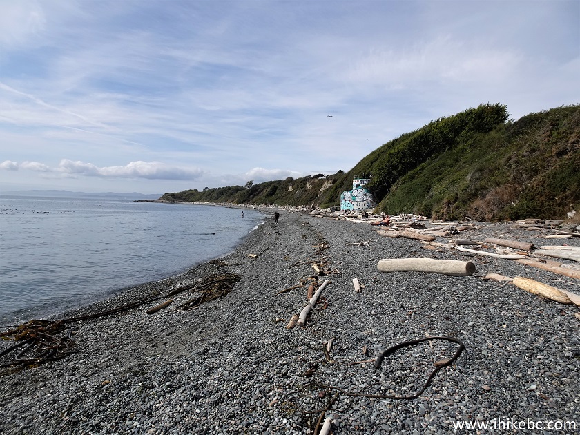
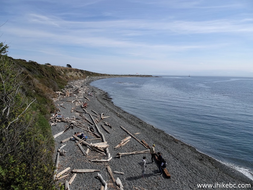
30. At 700 meters from Spiral Beach, Dallas Road Waterfront Trail definitely feels wilder than before. We are a bit further from Dallas Road now, but staircases here and there connect the trail with Dallas Road.
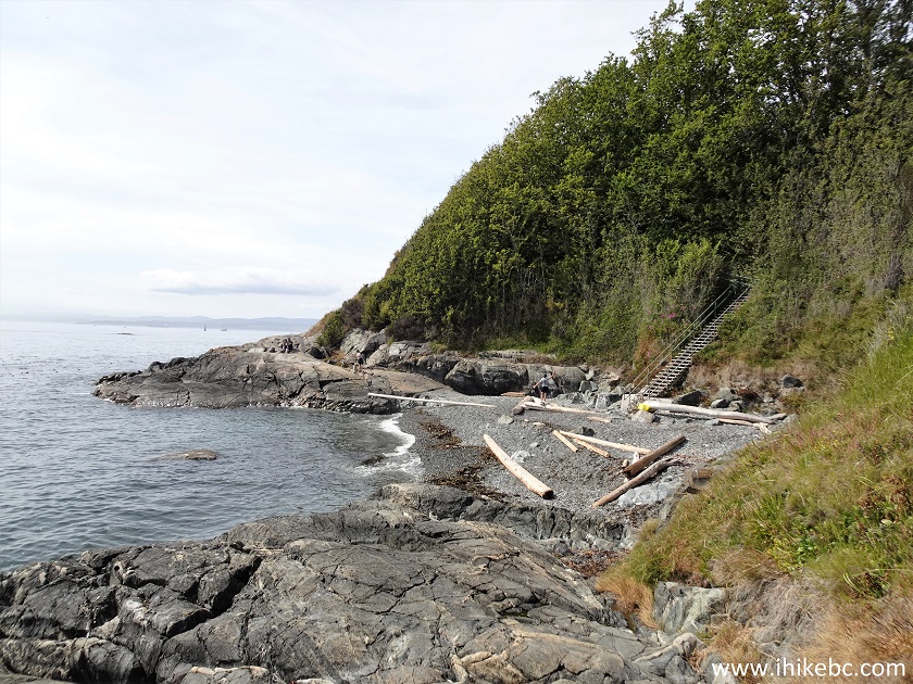
Victoria BC - Dallas Road Waterfront Trail
31. Looking back at the 720 meter mark.
Dallas Road Waterfront Trail
32. Not as many people here.
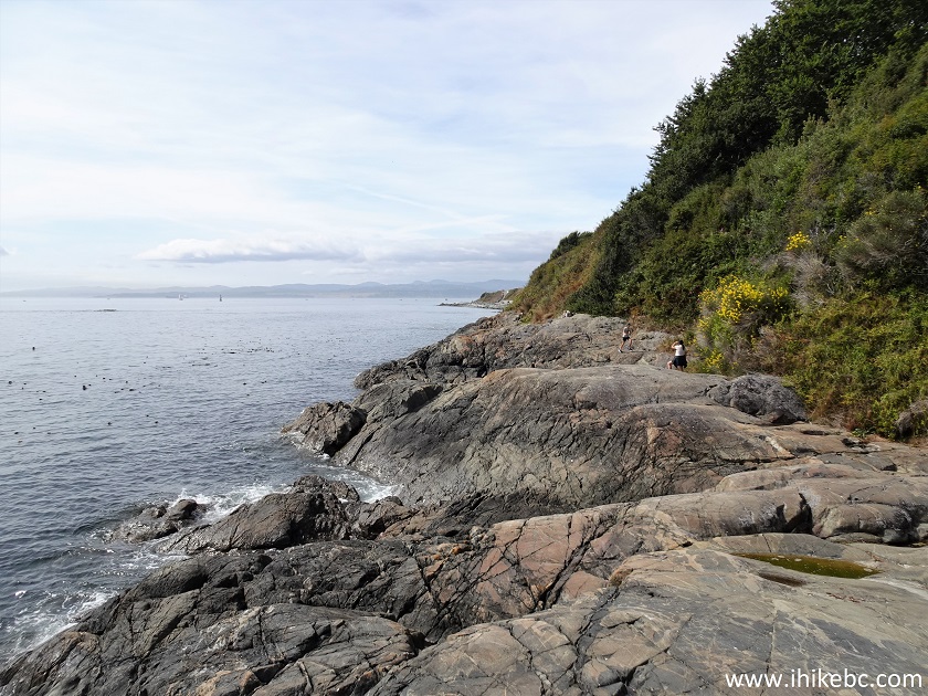
Vancouver Island Dallas Road Waterfront Trail
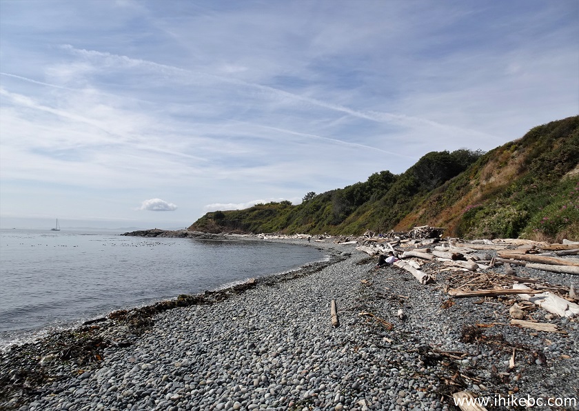
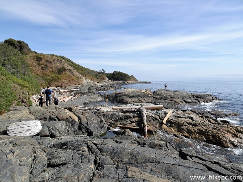
33. Looking back 820 meters from Spiral Beach. Hard to tell we are within Victoria city limits, doesn't it?
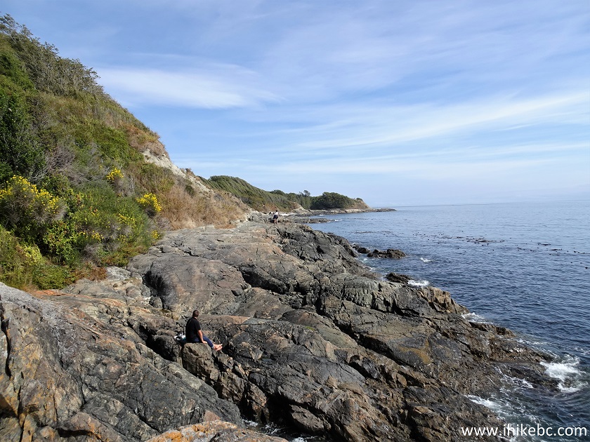
Hiking in Victoria British Columbia - Dallas Road
Waterfront Trail
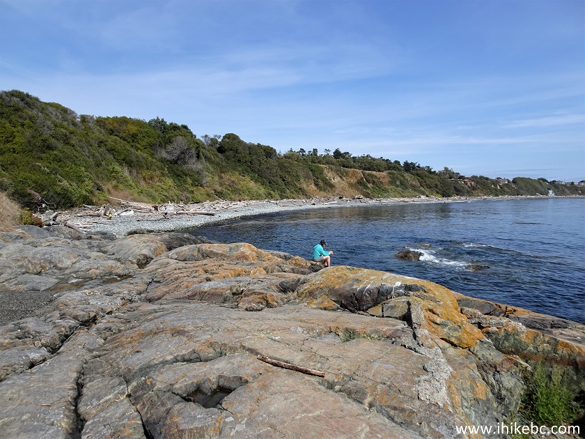
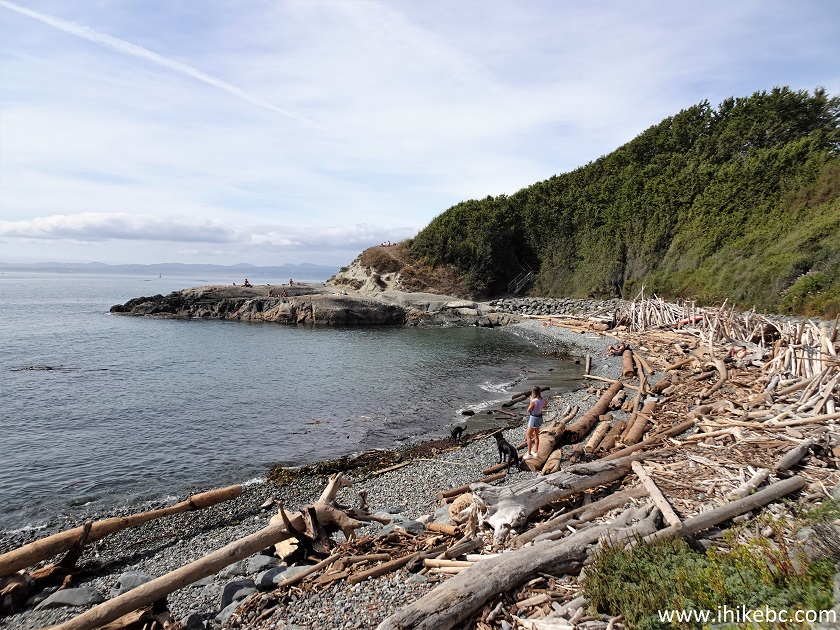
34. Wild. 70 meters later.
Dallas Road Waterfront Trail in Victoria BC Canada
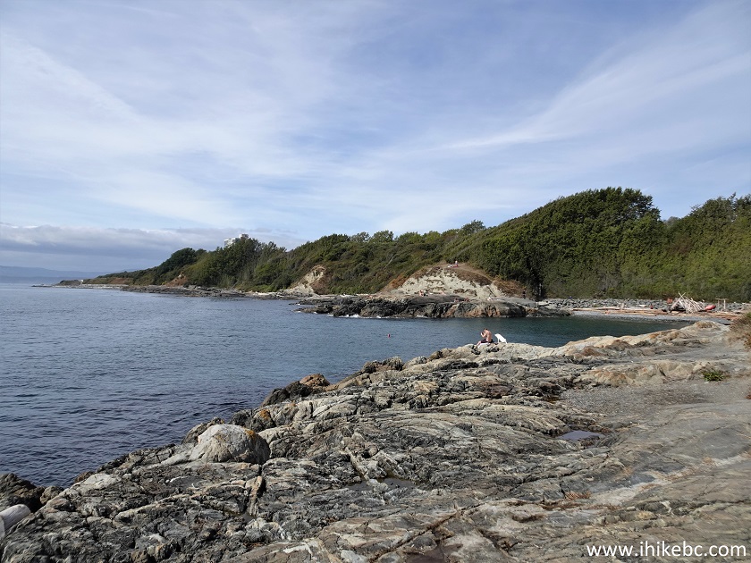
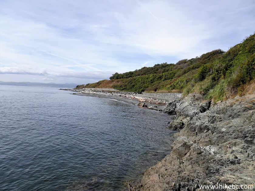
35. At 930 meters from Spiral Beach, we have arrived to Steve Fonyo Beach at the foot of Paddon Avenue. That's pretty much the end of the (relatively) rugged part of Dallas Road Waterfront Trail.
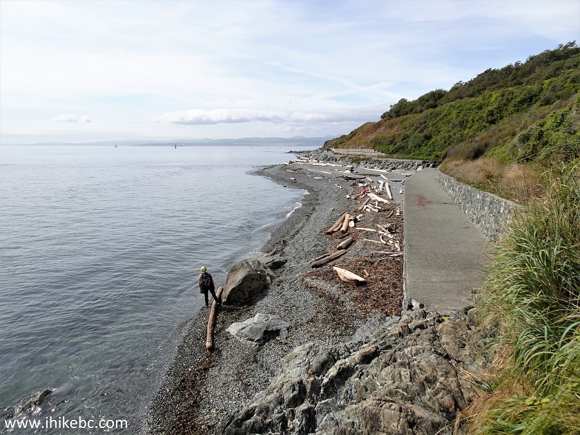
Steve Fonyo Beach
Our Dallas Road Waterfront Trail Hike trip report Continues on Page 2.


|
 |
Other Trips in Victoria BC Area:
|
|
Mount
Tolmie Park
|
|
|
|
Coast Trail Hike
|
|
|
Timberland
Trail Hike
|
|
|
|
Mount Finlayson Hike
|
Ridge
Trail Hike
|


Other Trips:


![]()
![]()
![]()
ihikebc.com Trip 299 - Dallas Road Waterfront Trail Hike (Victoria, BC)
Page 1 of 3