![]()
![]()
![]()

Trip 310 - May 14, 2024 (Tuesday)
Mount Finlayson Trail Hike
Goldstream Provincial
Park near Victoria, BC
Liked: Panoramic views of Langford and the surrounding area (hills), views of remote mountains (including Mount Baker), shade in the forest, no bugs, the ability to walk in a loop.
Vancouver Island, Victoria & Gulf Islands Backroad Mapbook (9th edition) Trailhead Coordinates: Page 4 (Sooke) E3.
Follow @ihikebc TweetMount Finlayson Trail is located on Vancouver Island in Goldstream Provincial Park by Langford, BC, about 15 minutes of driving West of Victoria. This trail has several trailheads, and we started from the one located by the main parking lot of Goldstream Provincial Park, about 200 meters down Finlayson Arm Road after turning from Highway 1. From here, it's just over 2 km to the summit of Mount Finlayson.
The trail first goes for about 1.3 km through a forest with not much to see, but then emerges onto a mostly exposed rocky area with fine views of Langford, a bunch of hills, and remote mountains, including Mount Baker in Washington state. You can also (kind of) see golfers doing their thing at the Bear Mountain Golf Club far below.
Upon reaching the summit, which has rather obstructed views compared to the trail before that, it is possible to proceed further and hike a loop trail via Finlayson Arm Road. Another trailhead is located on Country Club Way, and it connects with our trail (which starts in Goldstream Provincial Park) right where the forest ends and the exposed rock begins.
*All trail distances are based on a GPS odometer and are approximate.
1. Here is a Google Maps location of Mount Finlayson trailhead in Goldstream Provincial Park.
2. And here is the turnoff from Highway 1 onto Finlayson Arm Road in Langford, BC, just West of Victoria.

Vancouver Island Highway 1 at Finlayson Arm Road - Langford BC
3. After the turn, Finlayson Arm Road is straight ahead. A small parking lot is on the right side, and larger parking lots are to the left (but beware of gate closing times for larger parking lots).

Finlayson Arm Road - Langford BC Canada
Here is our video of driving on Highway 1 to Goldstream Provincial Park.
More ihikebc videos are on our YouTube Channel.
4. Proceeding down Finlayson Arm Road. About 110 meters from Highway 1.

Langford British Columbia - Finlayson Arm Road
5. Another 100 meters, and Mount Finlayson trailhead is on the right side. Proceeding further on Finlayson Arm Road would lead to another trailhead, the one you would end up at if you would proceed further upon reaching the summit, as opposed to coming back the same way you came.

Mount Finlayson Trailhead
6. Here is a map posted at the info board seen in the photo above. The red square indicates our current location, and the yellow square is the summit. The distance is just over two kilometers.

Mount Finlayson Trail Map - Langford BC Canada
7. Just 30 meters into the hike, Prospectors Trail appears on the right side. Keep left.

Mount Finlayson Trail at Prospectors Trail
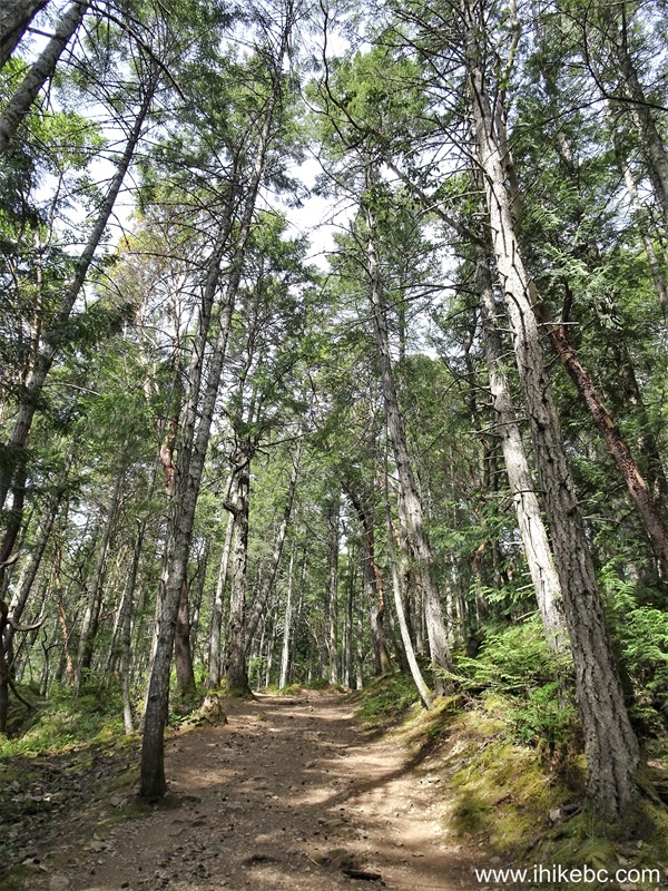
8. Mount Finlayson Trail at 250 meters from the trailhead.

Vancouver Island Hiking - Mount Finlayson Trail
9. At 390 meters, a connecting trail to Prospectors Trail appears on the right. Keep left.

Mount Finlayson Trail at Prospectors Trail connecting trail
10. At 440 meters of Mount Finlayson Trail in Goldstream Provincial Park.

Hiking in Langford BC Area - Mount Finlayson Trail
11. 170 meters later.
Mount Finlayson Trail Hike in British Columbia Canada
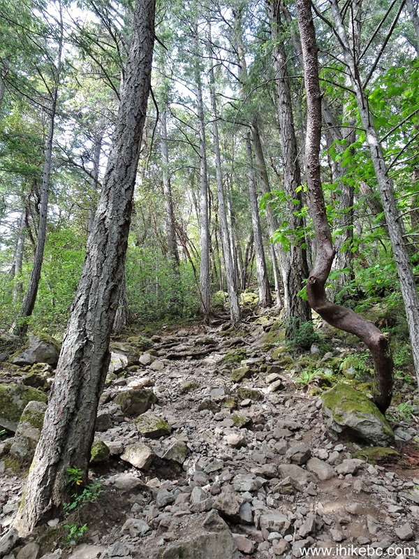
12-13. At 715 meters, Mount Finlayson Trail gets rather rough, though not terribly complicated.

Mount Finlayson Hike on Vancouver Island British Columbia

Mount Finlayson Trail Warning
14. Something like that. At 1.09 km here.

Mount Finlayson Trail
15. At the 1.14 km mark of Mount Finlayson Trail.
Vancouver Island Hiking Mount Finlayson Trail
16. At 1.32 km, the forest ends, and the exposed rock begins. This is also we meet a trail which stars from Country Club Way.

Hiking on Vancouver Island BC - Mount Finlayson Trail
17. Looking back, we can see the intersection very well. It's about 700 meters to Mount Finlayson summit from here. Coordinates: N 48⁰28.796' W 123⁰32.261'. Elevation: 245 meters.

Mount Finlayson Trail junction to Country Club Way
18. After emerging from the forest, the trail gets to be even more complicated (if not by much), but also the views start appearing in earnest. This is right after the intersection.

View from Mount Finlayson Trail near Langford British Columbia Canada
19. Zooming in, we see Mount Baker in Washington state.

Mount Baker zoomed view from Mount Finlayson
20. At 1.60 km, a view of Langford below.

Langford BC view from Mount Finlayson Trail
21. Looking left at 1.65 km. Bear Mountain Golf Club can be seen in the middle-right.

Bear Mountain Golf Club view from Mount Finlayson Trail
22-23. Here it is with much zoom.


Bear Mountain Gold Club zoomed view from Mount Finlayson
24. Looking right from the same location.

View from Mount Finlayson Trail near Langford BC Canada
25. Now at 1.71 km of Mount Finlayson Trail in Langford, BC.

Mount Finlayson Hike on Vancouver Island BC Canada
26. 30 meters later.

Mount Finlayson British Columbia
27-30. At 1.76 km, arguably the best view of the hike. Left to right followed by a panorama.


Panoramic View from Mount Finlayson Trail near Langford BC
Here is our video of the views from Mount Finlayson.
More ihikebc videos are on our YouTube Channel.
31. At 1.80 km from the trailhead. Approaching the summit.

Hike in British Columbia - Mount Finlayson Trail
32. Looking back.

View from Mount Finlayson British Columbia
33. At 2.02 km, we are almost there, with the Mount Finlayson summit marker seen straight ahead.

Hiking in Canada - Mount Finlayson Trail
34. A map at the summit. Coordinates: N 48⁰28
.971' W 123⁰32.300'. Elevation: 420 meters. From here, you can proceed ahead and finish a loop via Finlayson Arm Road, or come back the same way you came.

Map of Mount Finlayson Trail
Mount Finlayson Trail is fairly short, not overly complicated, and has fine views. Recommended.


|
 |
Other Trips in Victoria BC Area:
|
|
Mount Tolmie
Park
|
|
|
|
Coast Trail Hike
|
|
|
Timberland Trail Hike
|
|
|
|
|
Ridge Trail Hike
|


Other Trips:


![]()
![]()
![]()
ihikebc.com Trip 310 - Mount Finlayson Trail Hike
(Goldstream Provincial Park near Victoria, BC)