![]()
![]()
![]()

Trip 141 - August 14, 2018 (Tuesday)
Malkow Lookout Trail Hike
Near Smithers, BC
Location: Near the town of Smithers, approximately 370 kilometers
West of Prince George via Highway 16.
Liked: Easy access to the trailhead, and a fairly easy trail. The ability to bike for most of the trail. Views of the valley and mountains.
Of Note: Bear in the bushes closer to the second half of the trail, the trail is overgrown in places (long pants are recommended), tree roots make it less than a serene bike ride, cows may temporarily block the path.
Northern BC Backroad Mapbook (3rd edition) Trailhead Coordinates: Page 36 (Smithers) B5.
Malkow Lookout Trail is only 3 kilometers long, and passes through several farms (hiker access permitted), so a few gates need to be opened and closed during this hike. The trail goes through an open area, then a forest, then another open area, then again through a forest, and then there is a final climb to the former fire lookout area, where there are two benches and fine views of the valley and mountains. Cows may be blocking the path, so be ready to gently shoo them away. Don't be too gentle with a black bear, which was lurking in the bushes near the trail - make a lot of noise and carry a bear spray. If you decide to bike, this is certainly going to save some time, though there are plentiful tree roots on the path in the forest, making for a very bumpy ride. Going downhill from the lookout area is much more fun, but beware that the surface is loose, and the switchbacks are sharp - speed control is essential.
1. We camped along a forest service road near Smithers the previous night, and were woken up by a gathering of free-roaming cows, who surrounded our vehicle from the front and on both sides.
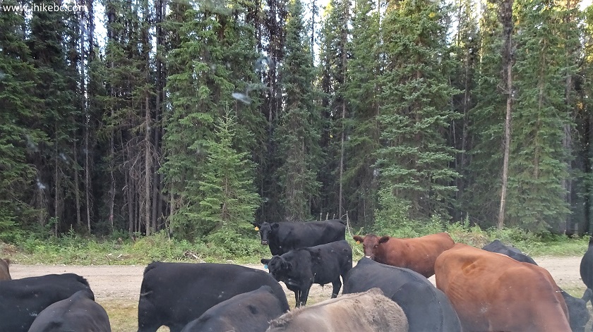
Cows on a Forest Service Road near Smithers BC Canada
2. The left flank was held by these two.
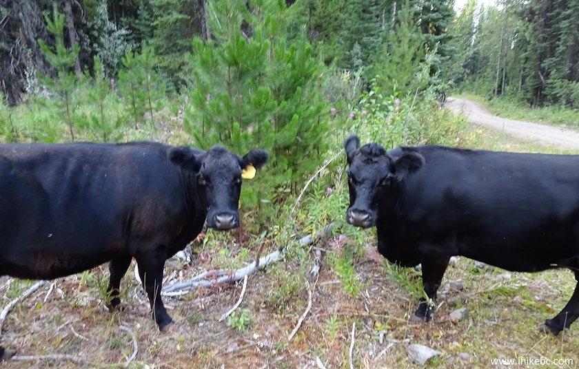
Cows by Smithers British Columbia Canada
3. After some honking, the retreat was on!
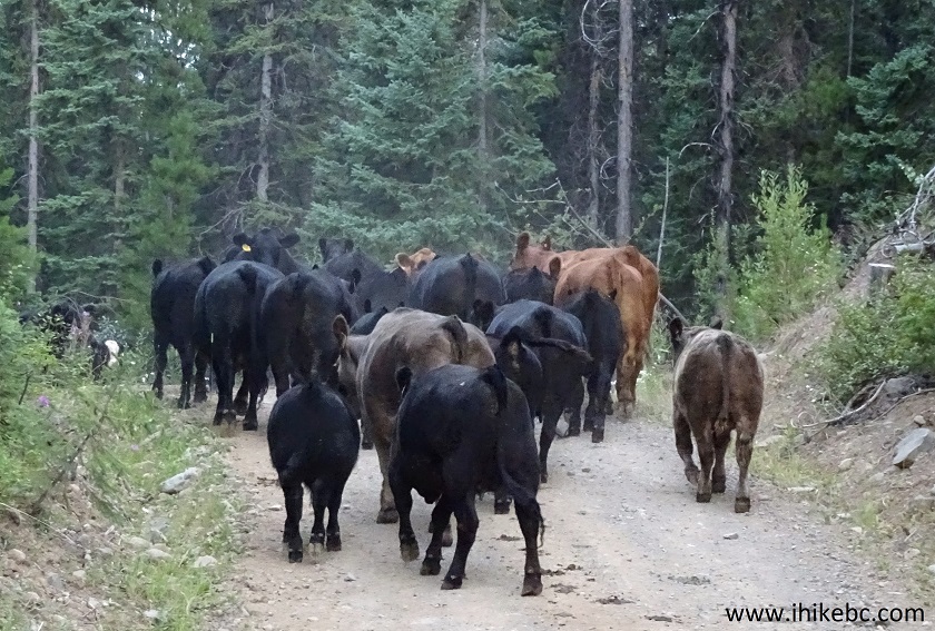
Cows running on Forest Service Road by Smithers British Columbia Canada
4. Cow #33 decided to make a stand, though.
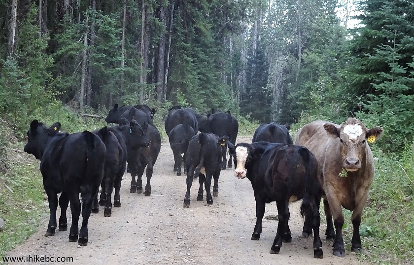
Cows on Forest Service Road by Smithers British Columbia
5. We are now on Highway 16 West, with the town of Smithers a few kilometers ahead. Approaching Old Babine Lake Road, with a sign indicating a right turn is required to reach Driftwood Canyon Provincial Park.
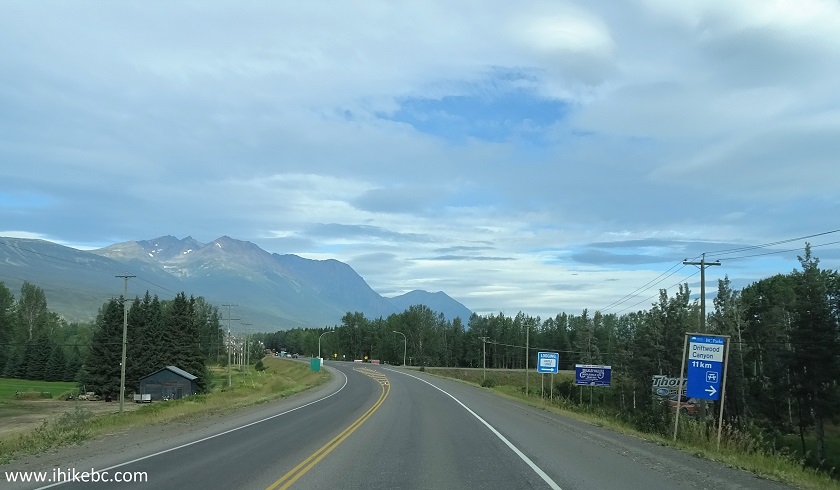
BC Highway 16 West by Smithers BC Canada
6. A few hundred meters later, we are turning right onto Old Babine Lake Road, shortly before the bridge across Bulkley River. Smithers would still be ahead on Highway 16. Coordinates for the turnoff: N 54⁰46.139' W 127⁰07.684'. Elevation: 484 meters.
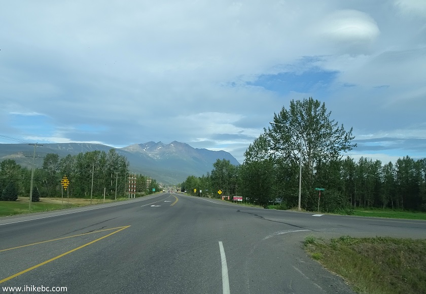
BC Highway 16 at Old Babine Lake Road near Smithers BC Canada
7. Old Babine Lake Road near Smithers, BC.
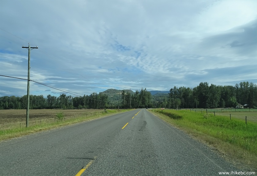
Old Babine Road near Smithers British Columbia
8. 4.7 kilometers later, turn left onto McCabe Road.
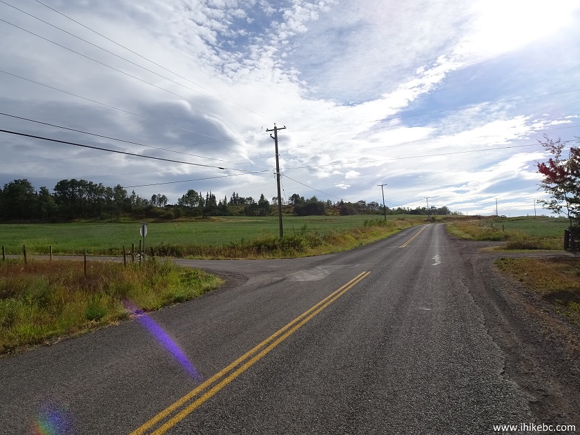
Old Babine Road at McCabe Road by Smithers BC Canada
9. McCabe Road near Smithers, BC.
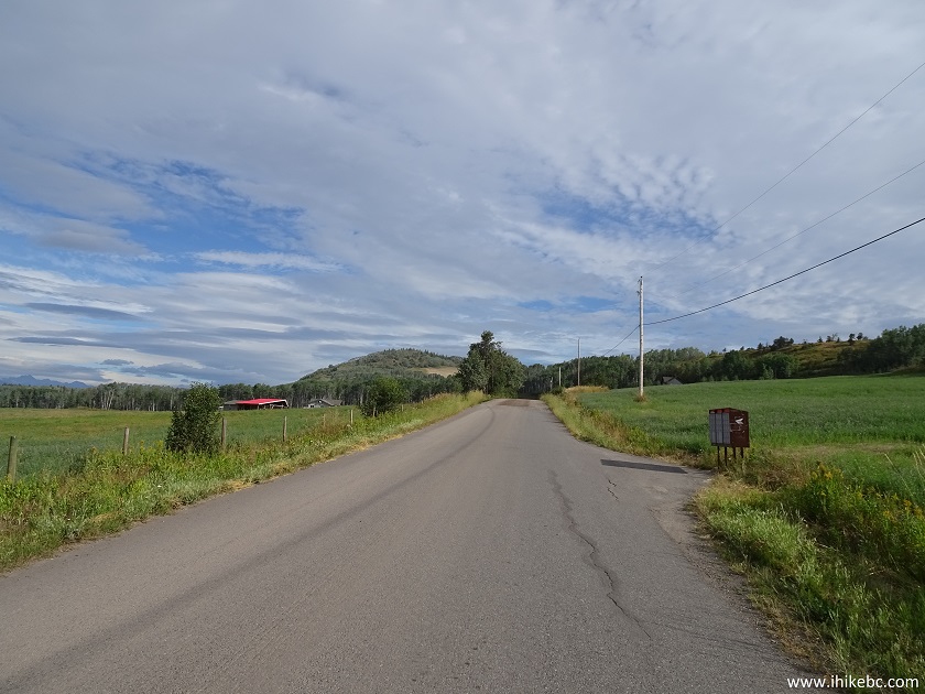
McCabe Road near Smithers BC Canada
10. The access roads are all in very good shape, and any vehicle would make it to the trailhead. The surface is asphalt (most of the way), and hard dirt and gravel (McCabe Road, as seen below).
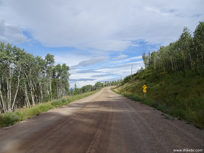
McCabe Road by Smithers British Columbia
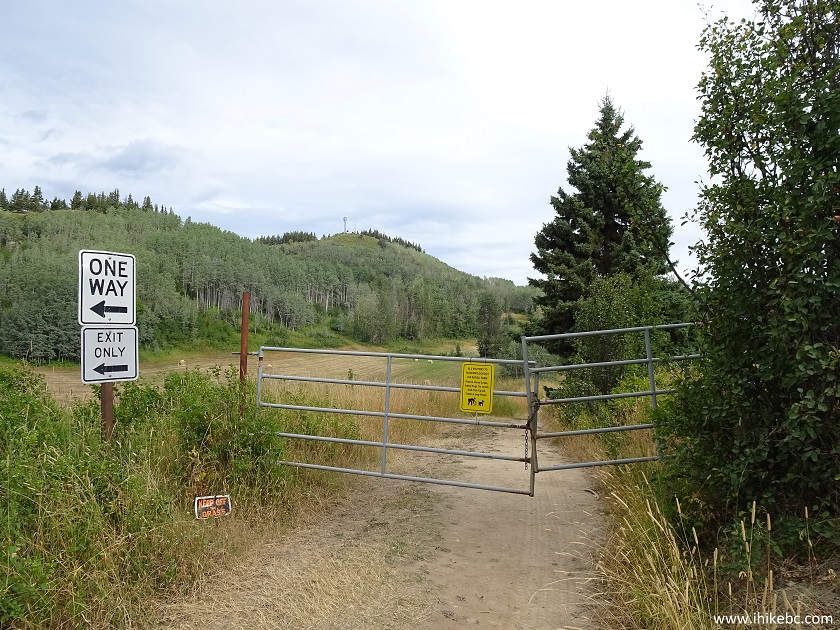
11. 1.6 kilometers after turning onto McCabe Road (6.3 kilometers after turning from Highway 16), the trailhead and parking area would be on the left side. Logpile Lodge would be on the opposite side of the road. Coordinates: N 54⁰48.816' W 127⁰06.351'. Elevation: 606 meters.
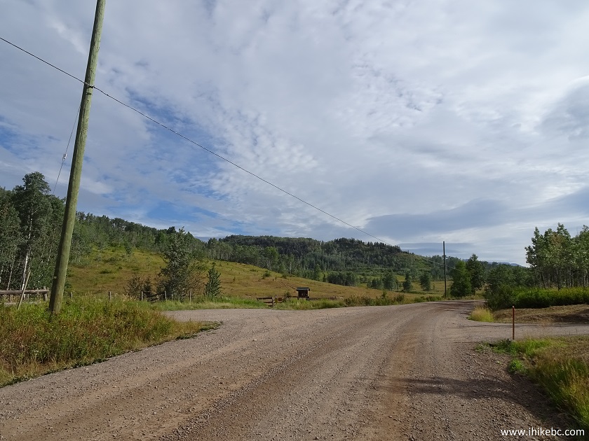
Malkow Lookout Parking Area off McCabe Road by Smithers BC Canada
12. Here is the trailhead. You are now entering private farmland, with hiking access permitted to Malkow Lookout. A sign asks to keep dogs on leash.
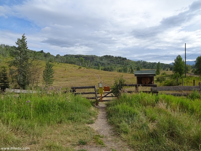
Malkow Lookout Trailhead by Smithers BC Canada
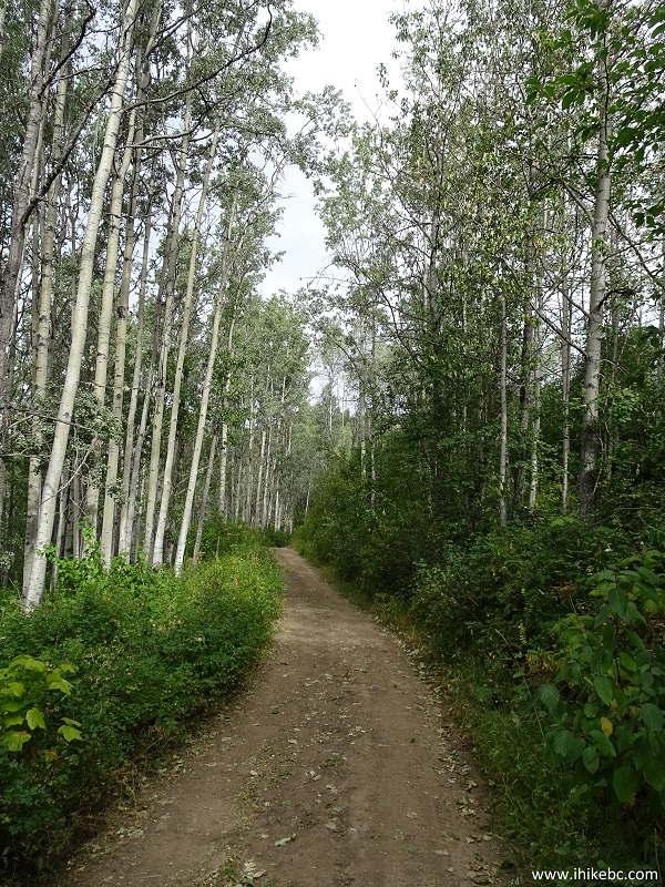
13. After some open land seen in the photo above, the trail enters a forest.
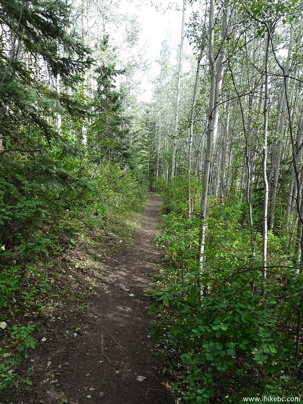
Smithers Hiking - Malkow Lookout Trail
14. And, just before the next gate, our cow adventure continued - the path was blocked, and it took some effort to get the cows to move.
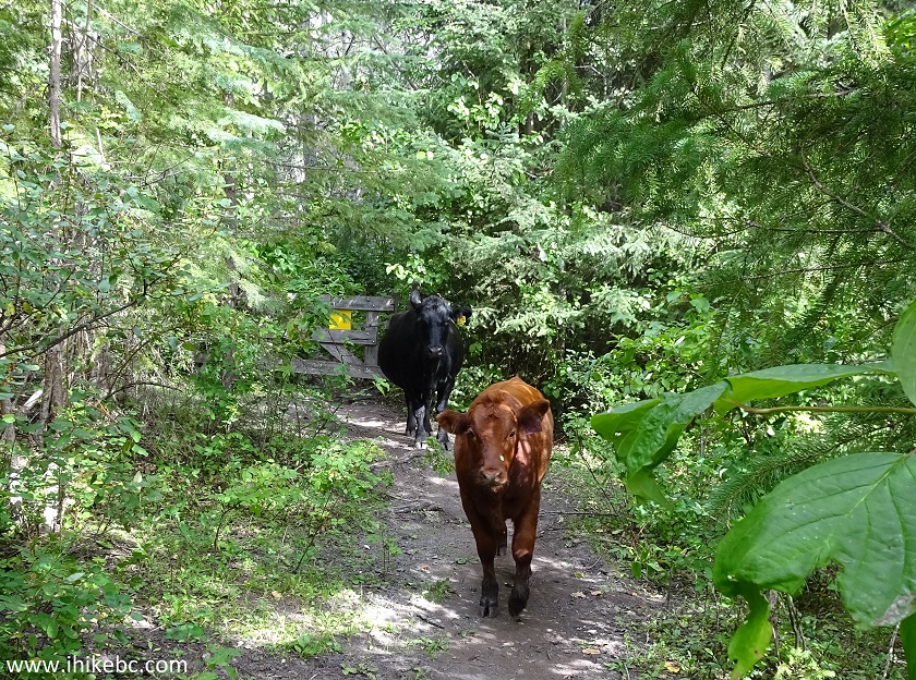
Cows on Malkow Lookout Trail - Smithers Hike
Here is Our Video of the Cow Standoff:
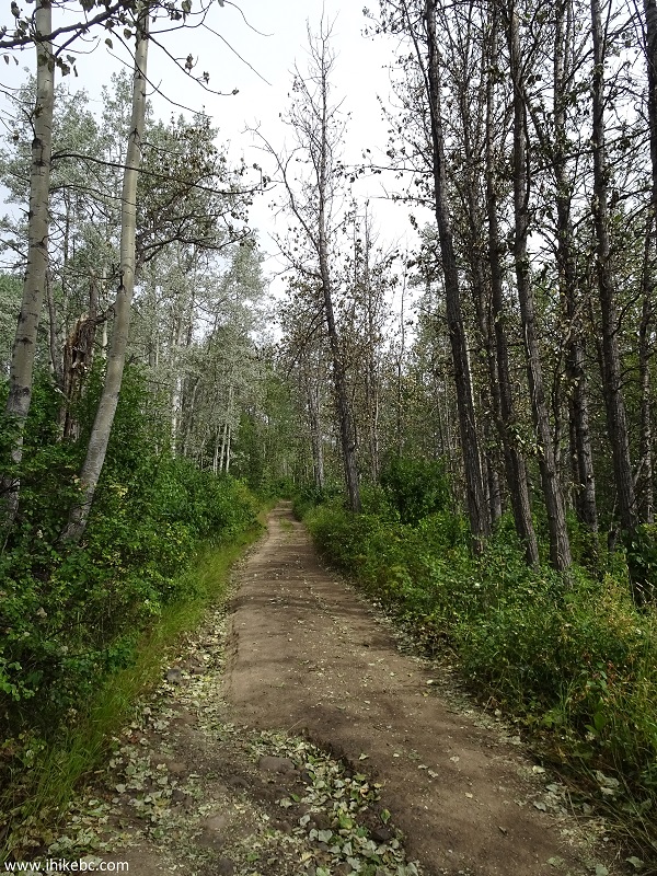
15. The path through the forest features overgrown underbrush, so long pants would protect legs from scratches (especially, if you are biking).
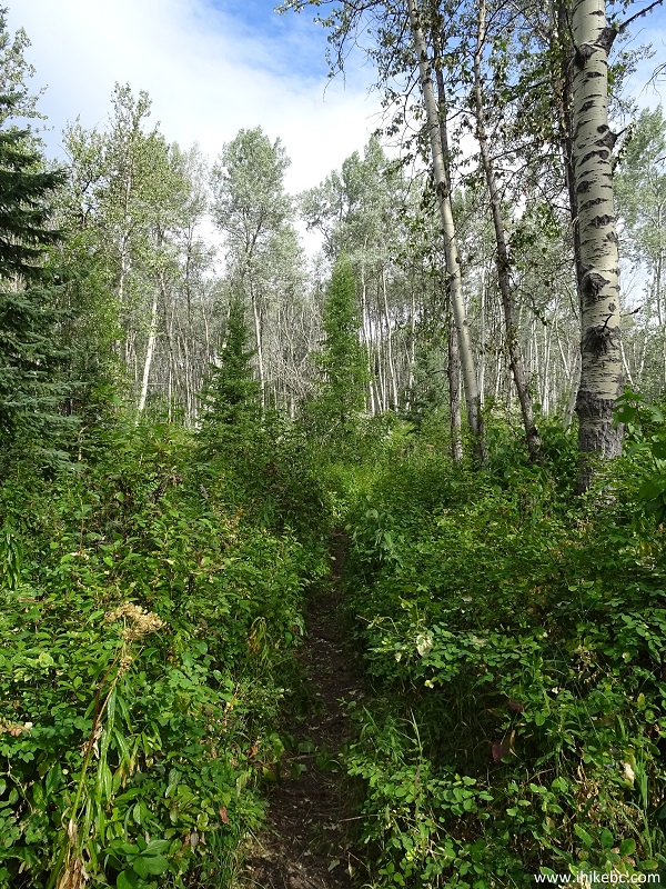
Hiking in Smithers BC Area - Malkow Lookout Trail
16. Half an hour after starting the hike, the path emerges from the forest at a junction with an old forest service road. Turn left. Coordinates: N 54⁰49.479' W 127⁰06.446'. Elevation: 700 meters.
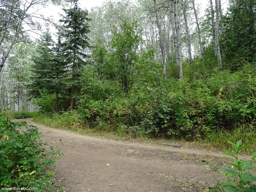
Malkow Lookout Trail - Smithers Trail British Columbia Canada
17. You then hike on the forest service road for a few minutes. There was a fairly large black bear on the right side inside the forest.
Hiking in Smithers BC - Malkow Lookout Trail
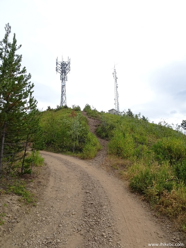
18. Soon, there is another gate, and another farm. The end of the hike can be seen far ahead, where a communication tower is standing on top of a mountain.
Malkow Lookout Trail - Hiking in Smithers BC Canada
19. After walking by a field, we are in a forest again. There are two more gates to open and close.
Malkow Lookout Trail near the town of Smithers BC Canada
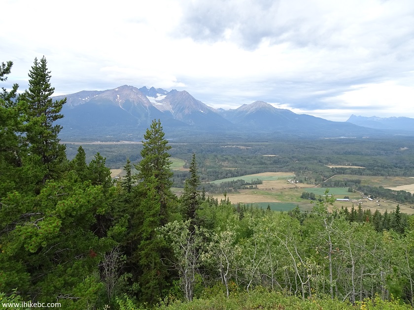
20. The forest soon ends, and we begin a final climb to our destination. Closer to the top, good views start to appear.
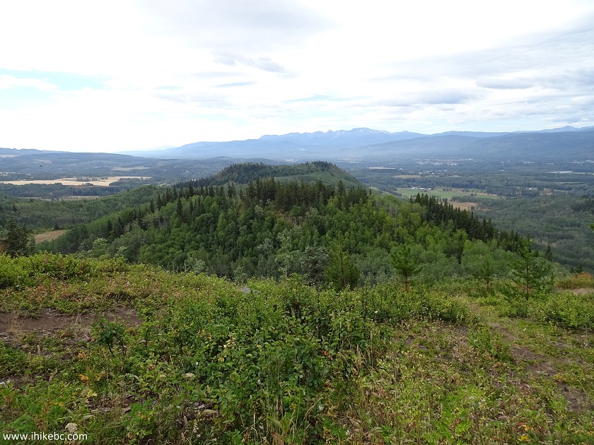
View from Malkow Lookout Trail in Smithers BC Area
21. The end is near.
Hiking in Smithers BC - Malkow Lookout Trail
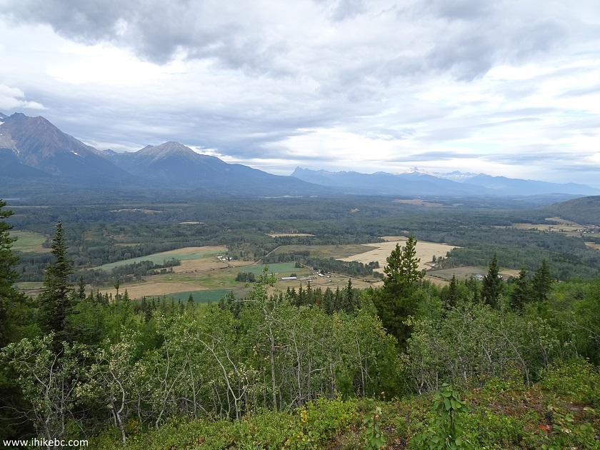
22. The mountain view is actually somewhat better from the forest service road, as the trees do not obstruct it as much as from the end of the trail.
View from Malkow Lookout Trail near Smithers British Columbia
23. More to the right.
View from Malkow Lookout Trail - Smithers British Columbia Hiking
24. And we are at the Malkow Lookout. Coordinates: N 54⁰49.944' W 127⁰06.791'. Elevation: 833 meters (227 meters elevation gain from the start of the trail).
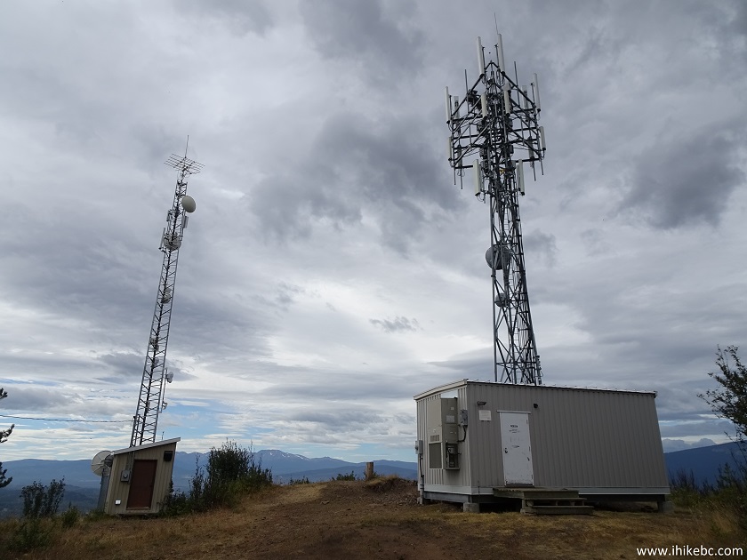
End of Malkow Lookout Trail - Hiking in Smithers British Columbia Canada
25. Two benches to sit down and enjoy the views.
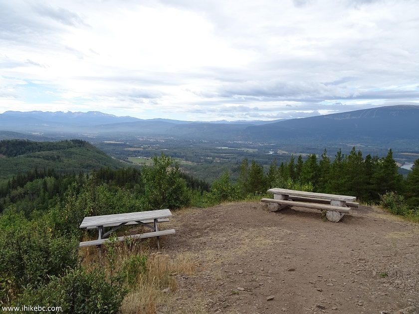
Benches at the end of Malkow Lookout Trail by Smithers BC Canada
26. And the views are quite good.
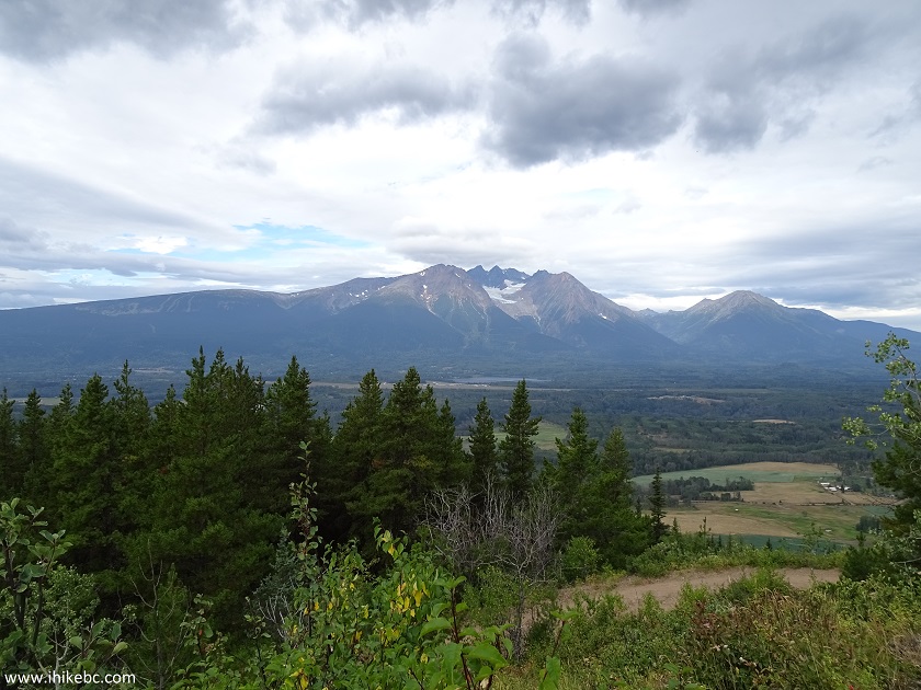
View from the end of Malkow Lookout Trail - hiking in Smithers BC
27. A closer look.
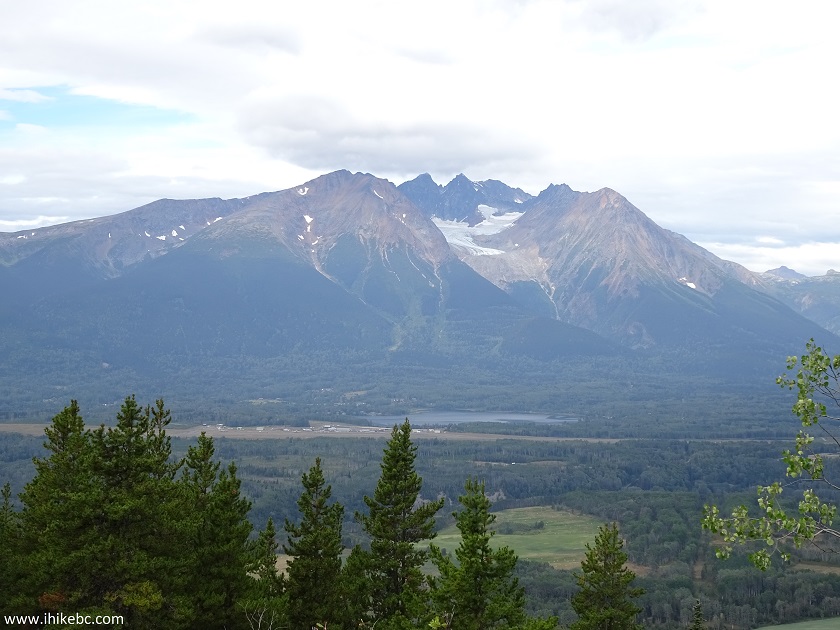
Mountain seen from the end of Malkow Lookout Trail by Smithers BC Canada
Here is Our Video of the Views from Malkow Lookout.
More ihikebc videos are on our YouTube Channel.
It took us just over an hour to get to the top, and slightly more than 20 minutes to get back, bicycle-assisted. Cows and bear notwithstanding, it's a good trail, quite short and with not much climbing. The views are neat too, so certainly recommended.


|
 |
Other Trips in Smithers BC Area:
|
|
|
|
|
|
|
|
|
|
|
|
|
Fletcher-Gardiner Trail  |
Other Trips:


![]()


![]()
![]()
![]()
ihikebc.com Trip 141 - The Malkow Lookout Trail Hike (near Smithers BC)