![]()
![]()
![]()

Trip 321 - September 13, 2024 (Friday)
South Chilcotin Mountains Provincial Park Visit
Near Gold Bridge, BC
Page 1 of 3
Liked: Numerous great mountain and valley views, shade in the forest on the access road, not terribly difficult trails, no bugs.
Vancouver, Coast & Mountains Backroad Mapbook (2019 edition) Park Coordinates : Page 51 (Gold Bridge) B1.
Related Website: South Chilcotin Mountains Provincial Park - BC Parks Official Website.
Follow @ihikebc TweetSouth Chilcotin Mountains Provincial Park is a huge remote park located near the settlement of Gold Bridge, closer to the end of BC Highway 40, which starts 90+ km earlier in Lillooet. There are numerous long trails in the park, and we hiked a small portion of those in the south-eastern corner. To see much more than that one would have to prepare to spend at least one night camping, while we did a day trip, which consisted of hiking a part of High Trail, then Camel Pass Trail, and, finally, Ridge-O-Rama trail to complete the loop.
There were panoramic mountain views everywhere, looking impressive even despite a cloudy day. With the sun out, it would be even more impressive. What was surprising were several motorcycle tracks along our entire route, even where it was rather dangerous. We later learned that this area is popular with mountain bikers, but those tracks were certainly from a motorcycle. So, watch out while hiking in this mountainous area, lest you be run over by a motorcycle! Please, note that only hikers, horse riders, and bicycle riders are allowed in the park.
There are several access point to South Chilcotin Mountains Provincial Park, and we used the one off Tyaughton Lake Road, which begins off BC Highway 40 about 12 kilometers East of Gold Bridge. There are no signs leading to the park, and several not-so-obvious turns, so check out our photo directions, as well as a video of the drive from Highway 40 to Cinnabar Mining Road, which leads to High Trail trailhead.
* All trail distances are based on a GPS odometer and are approximate.
1. Here is a Google Maps location of South Chilcotin Mountains Provincial Park
.
2. We are westbound on BC Highway 40, about 12 km east of Gold Bridge, BC. Lillooet is about 91 km behind us. Making a right turn onto Tyaughton Lake Road. There no signs leading to South Chilcotin Mountains Provincial Park, so you either need a GPS with an appropriate map, or know how to get there.
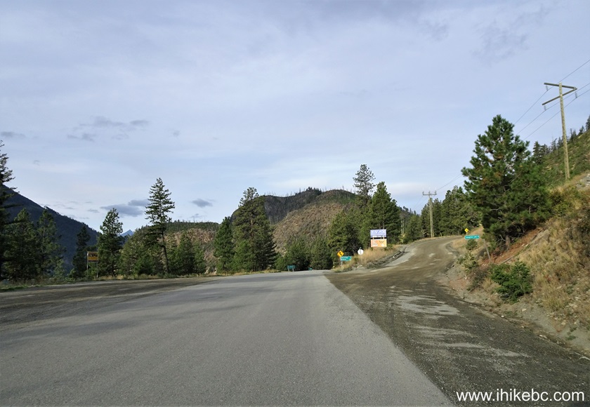
BC Highway 49 at Tyaughton Lake Road
Here is our video of driving on BC Highway 40 from Lillooet to Gold Bridge.
We drive by Tyaughton Lake Road at the 01:50:20 mark of the video.
3. It is 8 km from Highway 40 to Tyaughton Lake, but we will be making a left turn at the 5.8 km mark.

Tyaughton Lake Road
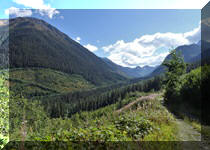
4. Tyaughton Lake Road 600 meters from BC Highway 40. It is an easy, if a bit rough, road all the way to the start of Cinnabar Mining Road, where only short wheelbase high clearance 4x4 vehicles would be able to proceed further.
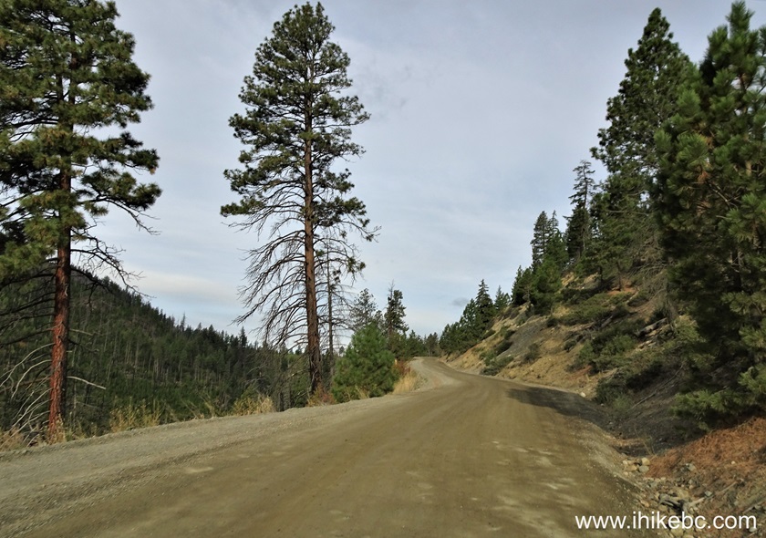
Tyaughton Lake Road near Gold Bridge BC Canada
5-6. At 5.8 km from Highway 40, make a left turn onto this totally unmarked road.

Tyaughton Lake Road at South Chilcotin Mountains Provincial Park Access
Road
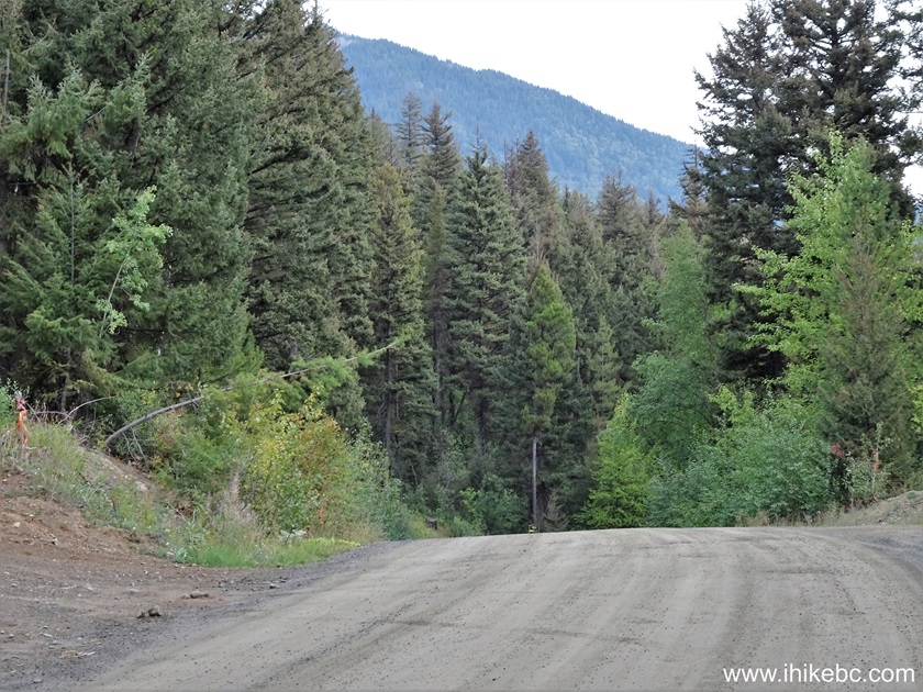
7. 100 meters after the turn. The road is slightly more challenging here, but should still be ok for regular clearance 2WD vehicles all the way to Cinnabar Mining Road.

South Chilcotin Mountains Provincial Park Access Road
8. Stay right at the split 300 meters after the turn from Tyaughton Lake Road. The sign points to Pearson Lake.
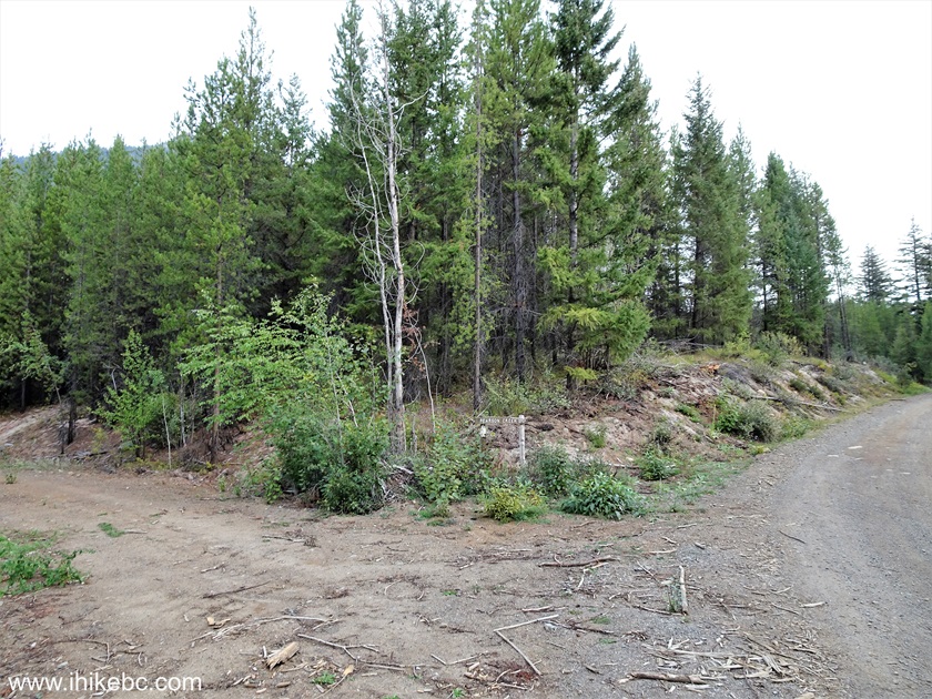
9. One more right turn 200 meters later.
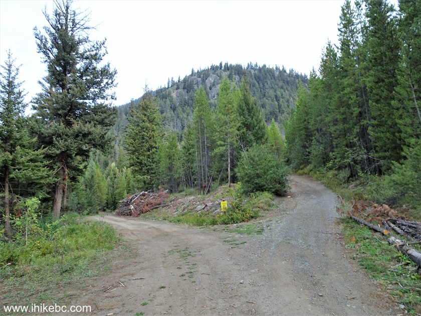
10-12. A hundred meters later (600 meters from Tyaughton Lake Road and 6.4 km from BC Highway 40) Cinnabar Mining Road begins on the left side. Coordinates: N 50⁰55.906' W 122⁰47.548'. Elevation: 1,060 meters. A sign says South Chilcotin Mountains Provincial Park and High Trail. Unless you have a short wheelbase high clearance 4x4 vehicle, the hike begins here, as the road is quite rough going forward. Cinnabar Mining Road goes for 5.5 km until the actual hiking trail.


High Trail Sign South Chilcotin Mountains Provincial Park
Here is our video of driving from BC Highway 40 via Tyaughton Lake Road up to this point.
More ihikebc videos are on our YouTube Channel.
13. We parked nearby and started hiking. At 160 meters of Cinnabar Mining Road.

Cinnabar Mining Road in South Chilcotin Mountains Provincial Park
14. At 1.36 km - quite a rough stretch.
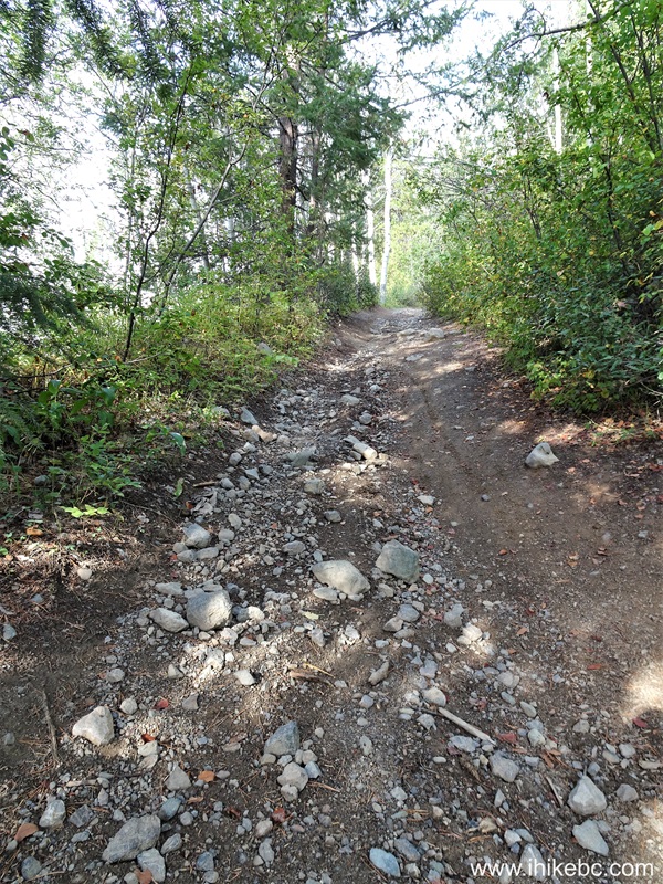
Cinnabar Mining Road near Gold Bridge British Columbia
15. Now at 2.52 km of Cinnabar Mining Road. It is a steady elevation gain with nothing too extreme.

South Chilcotin Mountains Provincial Park - Cinnabar Mining Road
16. At 3.70 km, this fallen tree would stop all vehicles over 2.0 meters high.

Cinnabar Mining Road
17. Another challenge for vehicles is this mud spot at the 4.07 km mark of the road. It doesn't look all that bad now, but this is the end of the season, and much more mud can be expected here in the Summer, and, especially, in the Spring.
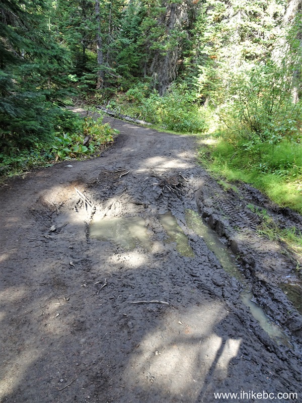
Cinnabar Mining Road Mud Spot
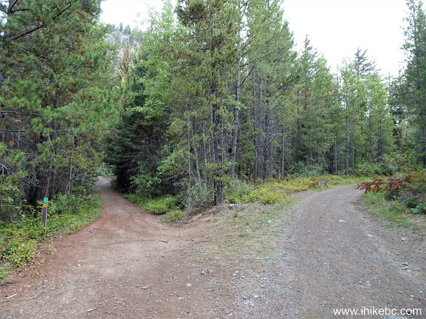
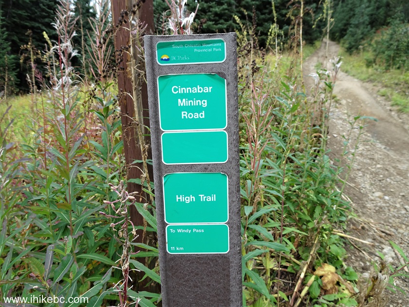
18-20. At 5.5 km of Cinnabar Mining Road, we have arrived to a split. Coordinates: N 50⁰57.506' W 122⁰49.882'. Elevation: 1,785 meters. High Trail hiking (and biking and horse riding) begins on the left side. The road continues straight ahead and goes for a bit longer. We will actually return from that direction after completing a High Trail - Camel Pass Trail - Ridge-O-Rama Trail loop. Do note that motorized vehicles are not allowed in South Chilcotin Mountains Provincial Park, though we did see motorcycle tracks along the entire loop that we hiked.
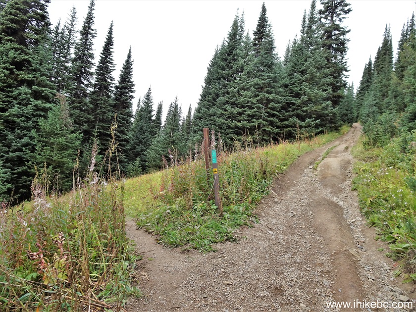
Cinnabar Mining Road at High Trail Trailhead in South Chilcotin
Mountains Provincial Park
South Chilcotin Mountains Provincial Park - High Trail Trailhead
21. Here is a map of the Southeast corner of South Chilcotin Mountains Provincial Park, courtesy of BC Parks. This is just a small portion of the entire park's area. We have indicated our loop hike as follows: red arrow - hike start at High Trail, large blue arrow - right turn onto Camel Pass Trail, yellow arrow - right turn onto Ridge-O-Rama Trail. Small blue arrows show our direction of travel, and black arrows indicate the return travel via Cinnabar Mining Road.
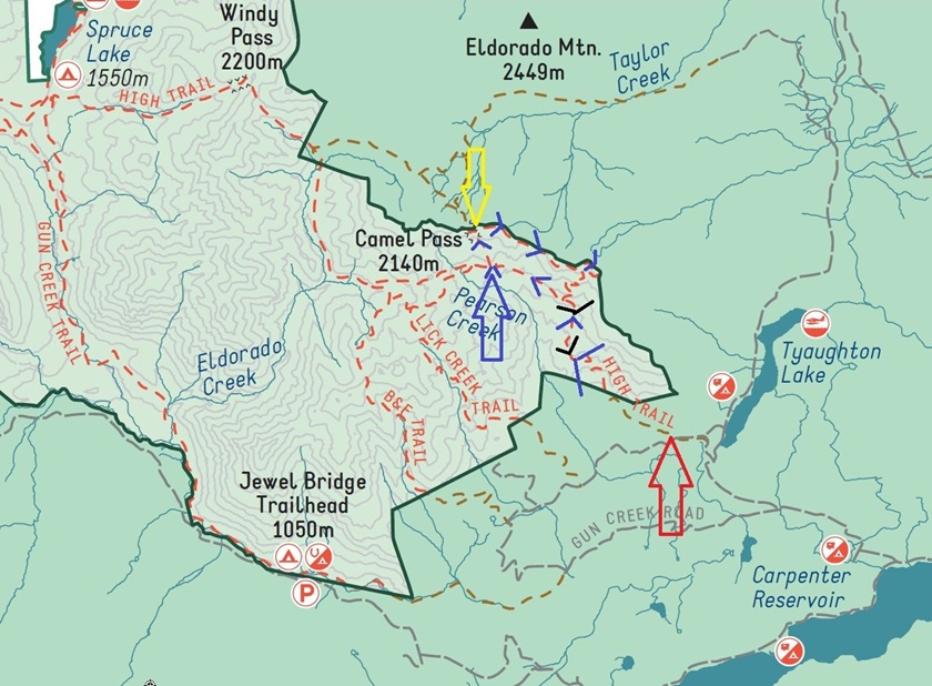
South Chilcotin Mountains Provincial Park - South-eastern Corner Trail
Map
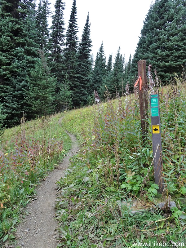
22. At 560 meters of High Trail.
Hiking on Gold Bridge BC Area - High Trail
23. A mud spot at 560 meters of the trail.

High Trail near Gold Bridge BC Canada
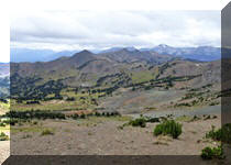
24. Some mountain views at 1.74 km of High Trail in South Chilcotin Mountains Provincial Park, British Columbia, Canada.
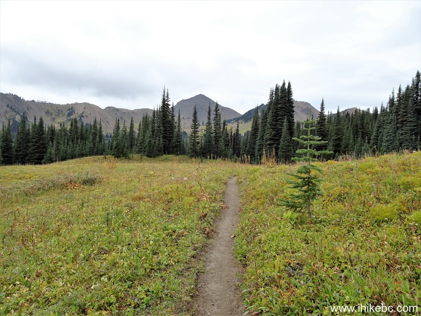
British Columbia Hiking in South Chilcotin Mountains Provincial Park
25-26. At 1.80 km, there is a camping spot on the left side.
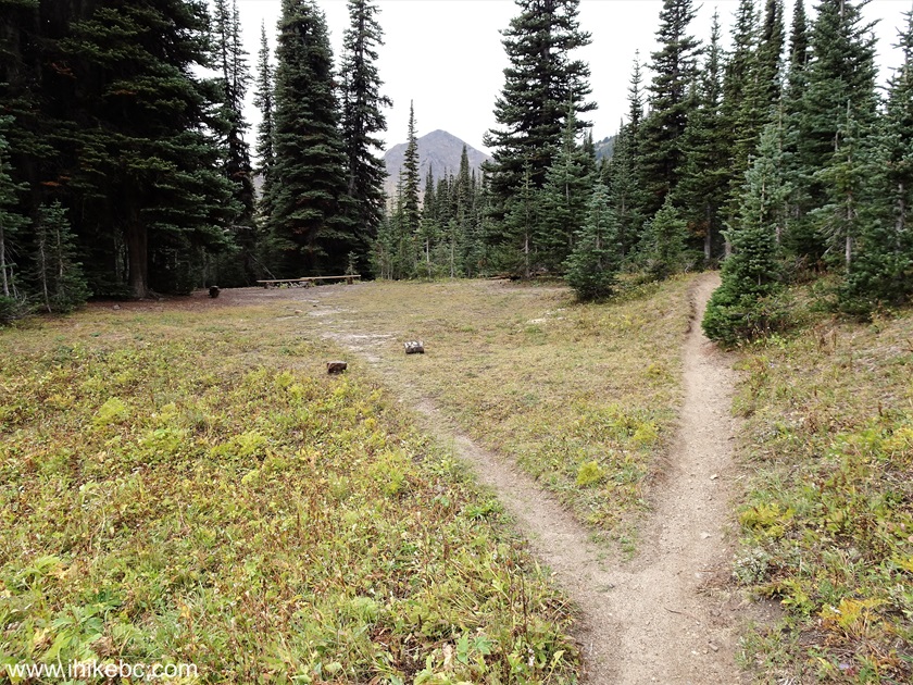
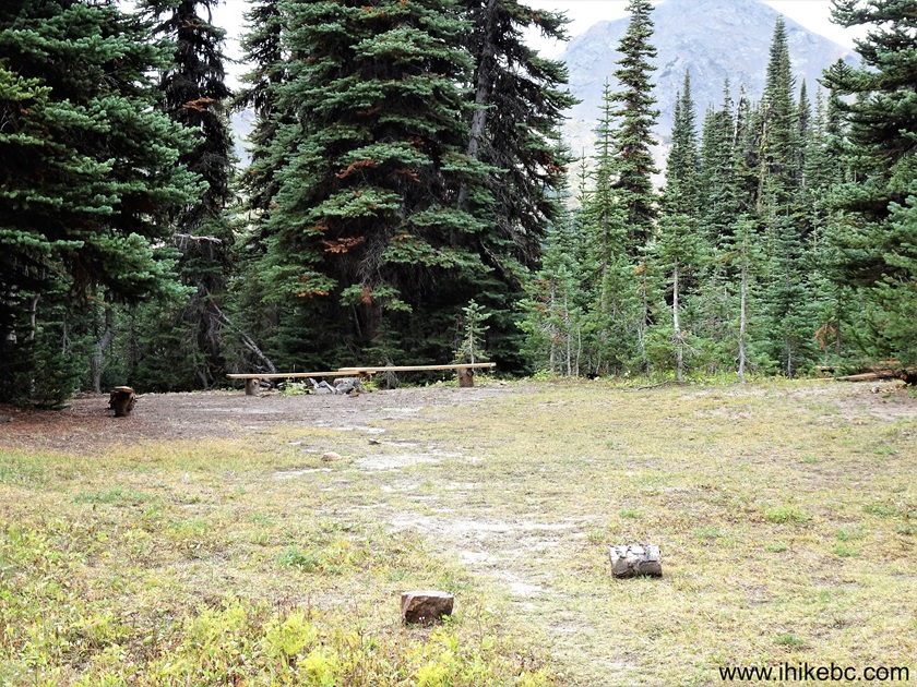
South Chilcotin Mountains Provincial Park Camping Spot off High Trail
27. At the 1.94 km mark of High Trail.
Hiking in South Chilcotin Mountains Provincial Park British Columbia
Canada
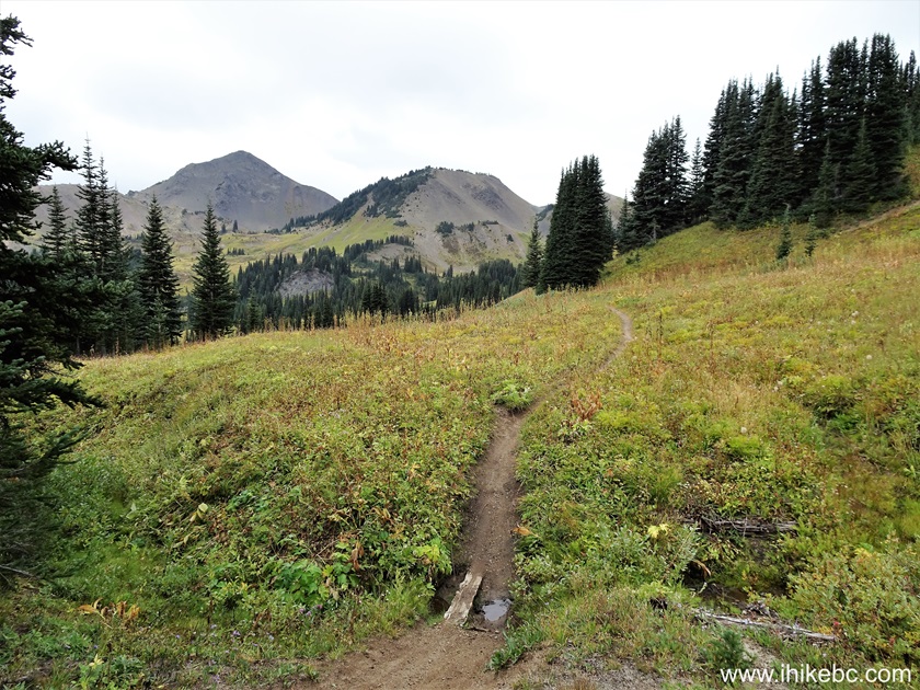
28-29. At 2.00 km, we have arrived to the beginning of Camel Pass Trail, which starts on the right side. Coordinates: N 50⁰57.923' W 122⁰51.152'. Elevation: 1,920 meters. High Trail continues to Windy Pass, which is 7 km further.
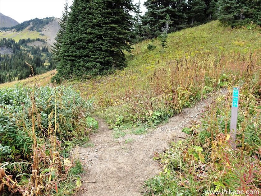
High Trail at Camel Pass Trail

Camel Pass Trail Trailhead in South Chilcotin Mountains Provincial Park
30. Camel Pass Trail starts.
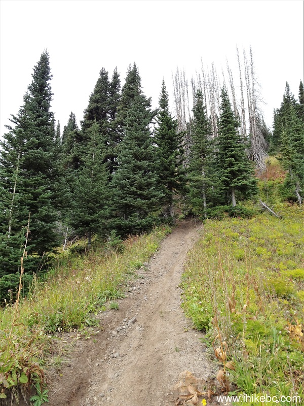
South Chilcotin Mountains Provincial Park - Camel Pass Trail
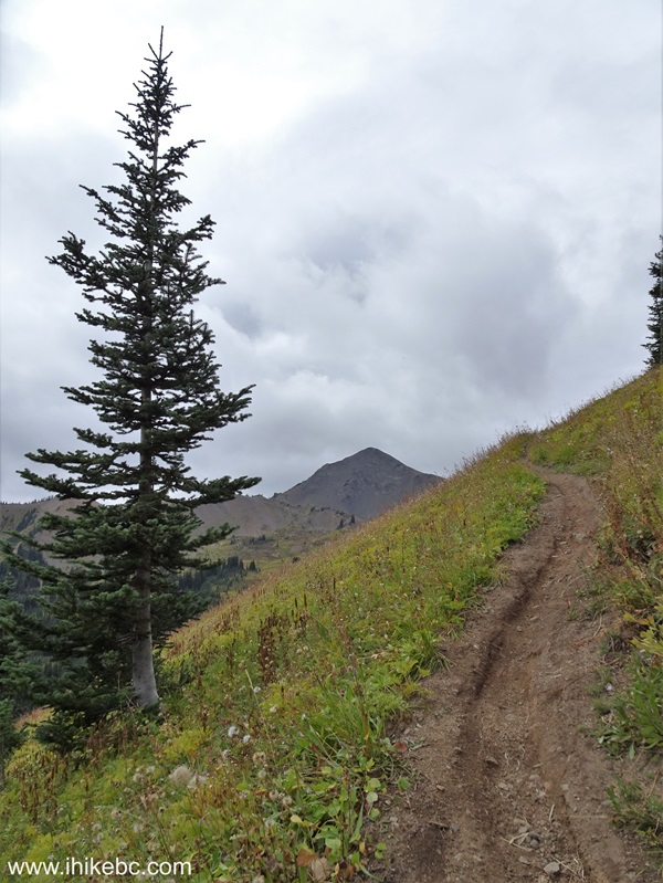
31. It is a steeper hike than High Trail. Looking left at 80 meters from the start.

Camel Pass Trail
32. 15 meters later.
Hiking Camel Pass Trail in South Chilcotin Mountains Provincial Park
33. At 200 meters of Camel Pass Trail, looking left.
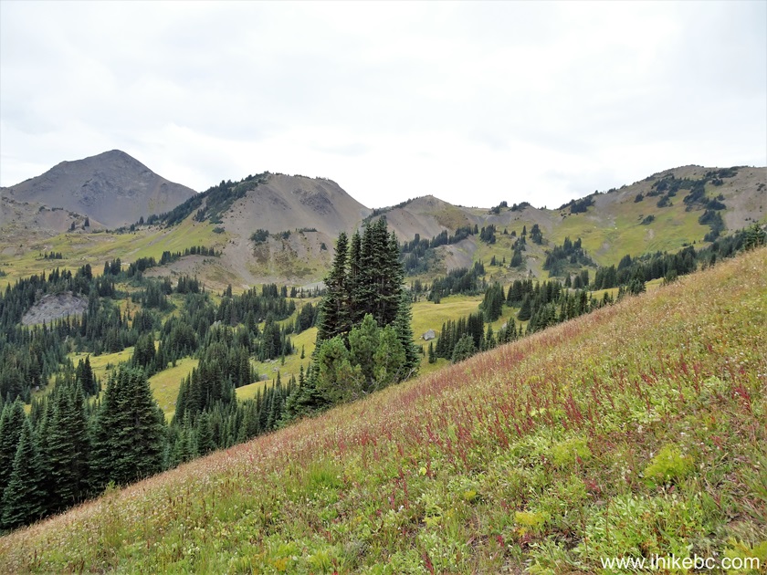
Camel Pass Trail Hike near Gold Bridge BC Canada
Our South Chilcotin Mountains Provincial Park Visit trip report Continues on Page 2.


|
 |
Other Trips:


![]()
![]()
![]()
ihikebc.com Trip 321 - South Chilcotin Mountains Provincial Park Visit
(near Gold Bridge, BC) Page 1 of 3