![]()
![]()
![]()

Trip 186 - May 29, 2020 (Friday)
Cutoff Butte Trail Hike
Near Vanderhoof BC
Trailhead Location:
Approximately 110
kilometers from the town of Vanderhoof via Highway 16 West, Bearhead
Road, Telegraph Road, Kenney Dam Road, Kluskus FSR, and 500 Rd
(Kluskus-Natalkuz FSR). Located at the 15.1 km of 500 Rd
(Kluskus-Natalkuz FSR).
Liked: Knewstubb Lake views.
Of Note: Numerous mosquitoes. The trail is steep closer to the end with loose rocks and dirt – hiking poles and boots are essential. Steep unbarricaded drop-offs closer to the end of the trail, with some trail erosion.
Northern BC Backroad Mapbook (3rd edition) Trailhead Coordinates: Page 9 (Fraser Lake) B7.
Related Website: Knewstubb Lake - Wikipedia.
Other Trips in Vanderhoof Area: Cheslatta Falls Trail Hike, Greer Creek Falls Trail Hike.
Follow @ihikebc Tweet
Cutoff Butte Trail is a short hike leading to fine views of Knewstubb
Lake. The higher you climb, the better the views, until you reach the
top of the short mountain (butte) and see the most panoramic view of the
lake below. What's interesting is that a time-beaten sign at the
trailhead says that the hike is 3 km long, and takes 1 hour. In fact,
it took us only 25 minutes and 1.2 km in distance to get to the top. As
the Backroad Mapbook software trail ribbon in our GPS ended there as
well, and there was no apparent way (or point) to proceed further, it
was clear that we, indeed, reached the end of the trail. The only
reasonable explanation for the discrepancy is that the trail used to be
longer, but a shorter trail was made after the sign was placed by the
trailhead.
Cutoff Butte Trail starts easy enough, but the last several hundred
meters are quite steep, and the surface is often loose. Also, there is
some trail erosion next to steep drop-offs, so watch out for that. There
was no sun during our hike, which would have likely made the views of
the lake even better. However, the heavy clouds, remote rain and
thunderstorm made for an interesting background.
There are several ways to get to Cutoff Butte trailhead. You can get
there via the end of Holy Cross FSR (then via Kenney Dam and 500
Rd, which begins at Kenney Dam), or via Kenney Dam Rd (which ends at
Kenney Dam and connects with 500 Rd there as well). But we proceeded to
this trail via Kluskus Forest Service Road right after hiking Greer
Creek Falls Trail, so
check out the previous trip report for directions on getting from
Highway 16 near Vanderhoof to Kluskus FSR.
All roads leading to Cutoff Butte Trail from Highway 16 are either dirt
of gravel, but are in very decent shape. Kluskus FSR could even qualify as a backroad highway - it's that wide and smooth. Speed limit of 70 km/h is
realistic.
1
. So, we continued on Kluskus FSR past Greer Creek Falls trailhead, which is located at 37.6 km mark of Kluskus (mileage markers are placed every kilometer there). The photo below is Kluskus FSR at about 62 km mark.
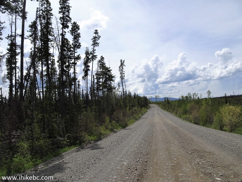
Kluskus Forest Service Road
2. Almost immediately after the 73 km sign on Kluskus FSR, and 34.8 km after Greer Creek Falls trailhead, turn right onto 500 Rd (also known as Kluskus-Natalkuz Forest Service Road). Coordinates: N 53⁰33.684’ W 124⁰34.295’. Elevation: 1,013 meters.
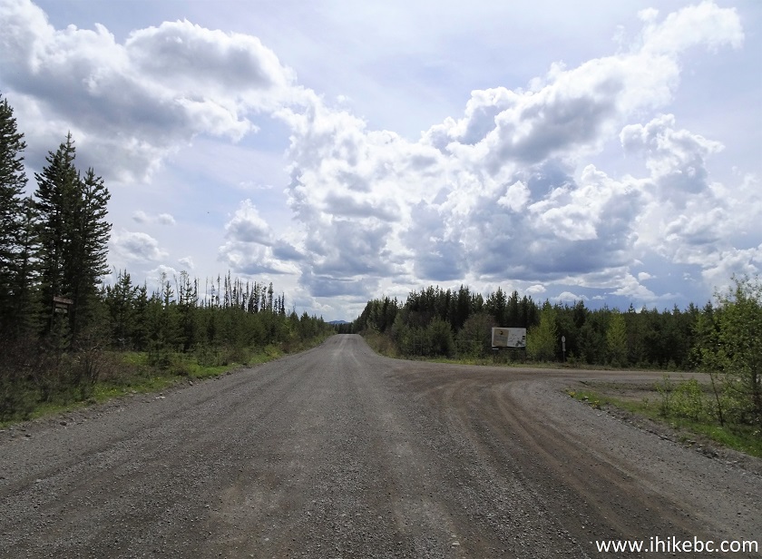
Kluskus FSR at Kluskus-Natalkuz FSR (500 Rd) near Vanderhoof BC
3. Now on 500 Rd (Kluskus-Natalkuz FSR).
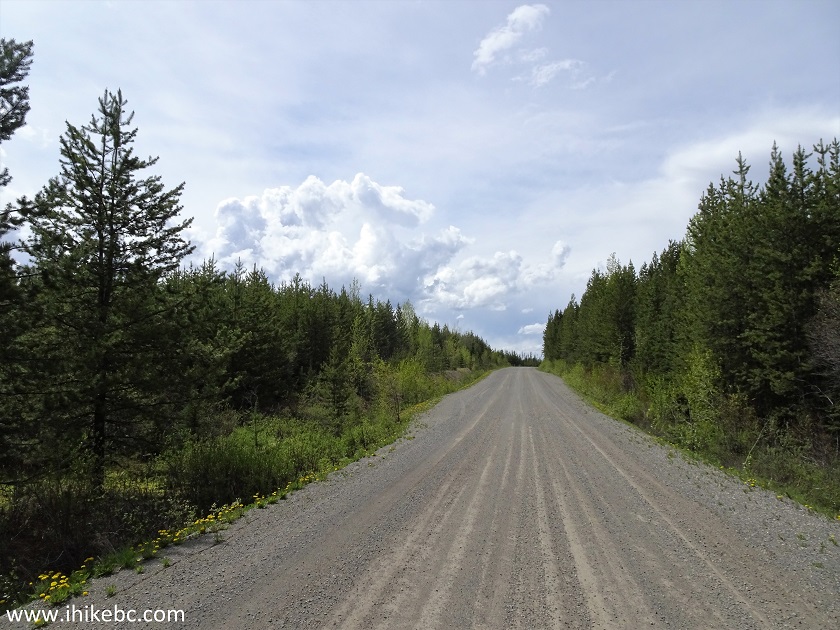
Kluskus-Natalkuz FSR (500 Rd)
4. The trailhead for Cutoff Butte Trail is at the 15.1 km mark of 500 Rd. Here we see a 15 km sign on the left side - the trailhead is 100 meters further, on the right side, where the curve is seen straight ahead.
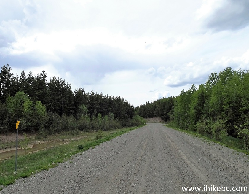
Kluskus-Natalkuz Forest Service Road (500 Road)
5. Here is that curve up close. The trail sign is seen on the right side.
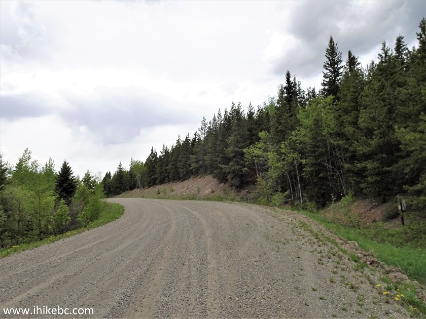
Kluskus-Natalkuz FSR at Cutoff Butte Trailhead
6. Cutoff Butte trailhead. Coordinates: N 53⁰34.378’ W 124⁰47.415’. Elevation: 940 meters. The trail begins on the right side of the photo, where it's a bit overgrown.
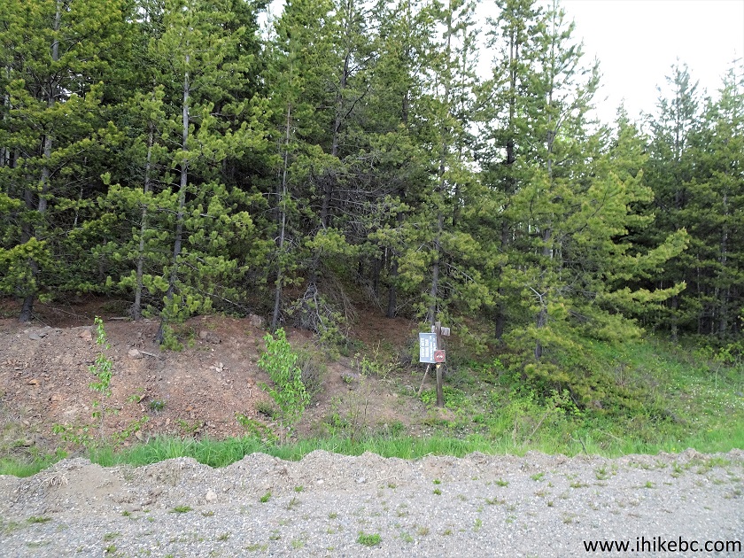
Cutoff Butte Trailhead
7. It can be difficult to tell that there is a trail for the first 50 meters or so, but then it becomes obvious.
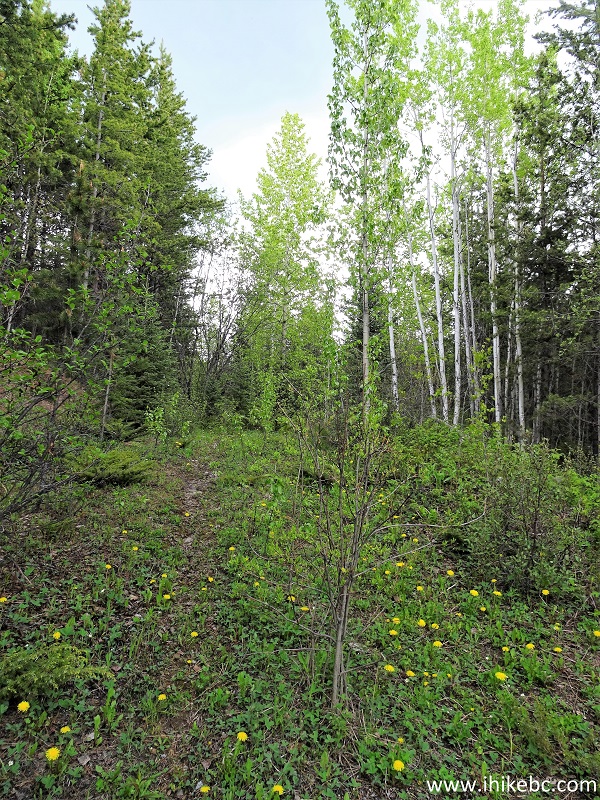
Cutoff Butte Trail - Vanderhoof Trail
8. The first half of the trail is inside a forest.
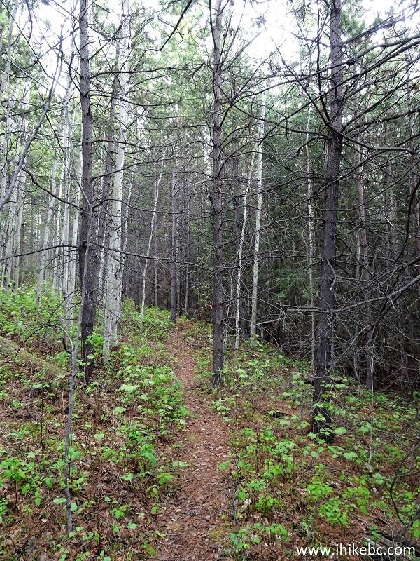
Cutoff Butte Trail - Trail on Vanderhoof Area
9. After about 700 meters, the trail emerges out of the forest, and turns into a rocky path.
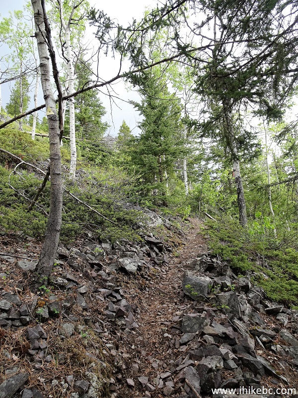
Vanderhoof Hike - Cutoff Butte Trail
10. Shortly, Cutoff Butte Trail becomes rather steep. The ground in many places is made of loose dirt and stones.
Cutoff Butte Trail - Hike in Vanderhoof Area
11. The first good view of Knewstubb Lake arrives at 0.8 km of the trail.
Knewstubb Lake Seen from Cutoff Butte Trail - Vanderhoof Hiking
12. The trail then goes through a short rock field.
Cutoff Butte Trail - Hiking in Vanderhoof Area
13. Another good lake view at 1.05 km mark.
Knewstubb Lake near Vanderhoof British Columbia Canada
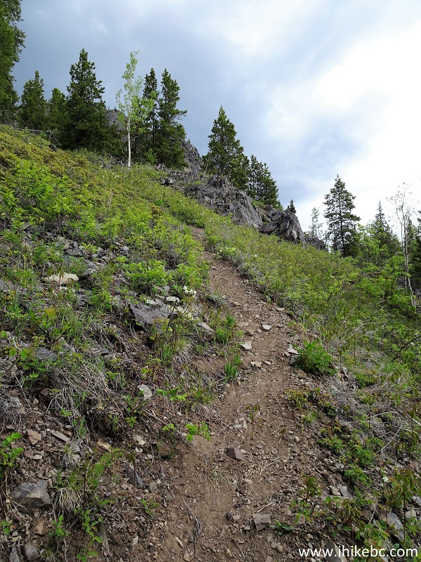
14. Approaching the base of the top of Cutoff Butte.
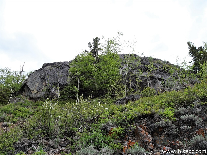
British Columbia Hiking - Cutoff Butte Trail
15. At the base of the top of the butte, the trail goes to the left. If the erosion gets to be too much, see if you can get around on the right side - we have not gone there, so can't tell if that's a viable option.
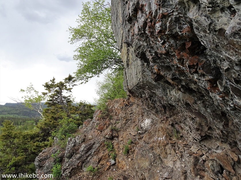
Cutoff Butte Trail
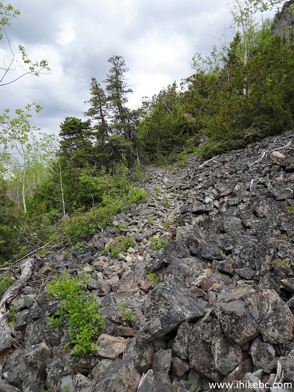
16. Just a bit further. Some erosion can be seen at the bottom of the photograph. There are very steep drop-offs there, so erosion presents a substantial obstacle.
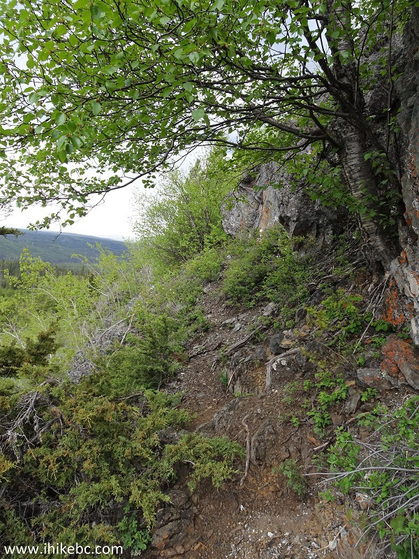
Cutoff Butte Trail near Vanderhoof BC Canada
17. Getting close to the end of the trail.

Trail on British Columbia - Cutoff Butte Trail near Vanderhoof
18. And we are there. It took all of 25 minutes and 1.2 km of hiking. The elevation here is 1,117 meters, which is 177 meters elevation gain from the start of the trail.
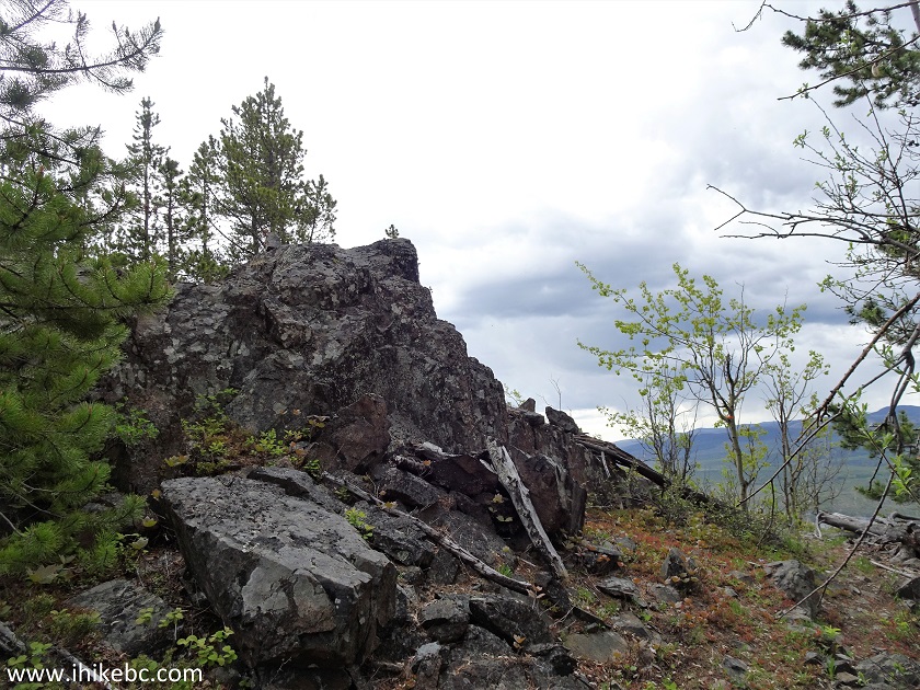
Cutoff Butte Hike
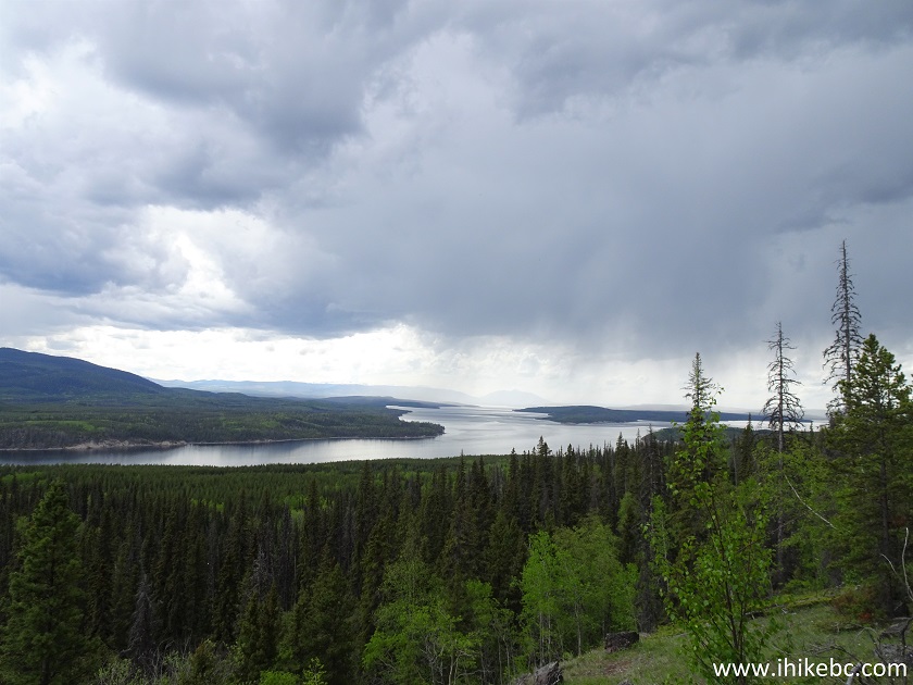
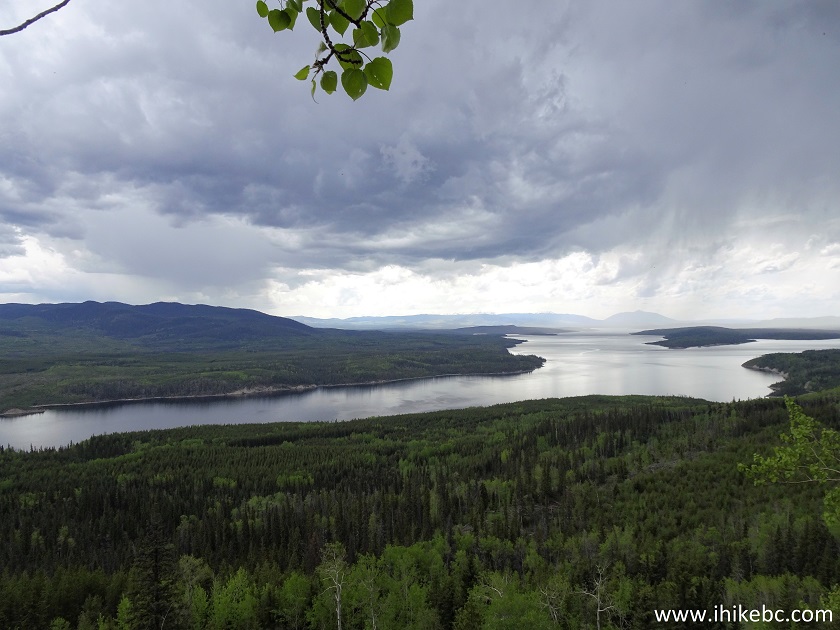
19. Knewstubb Lake view from the top of Cutoff Butte is panoramic and impressive.
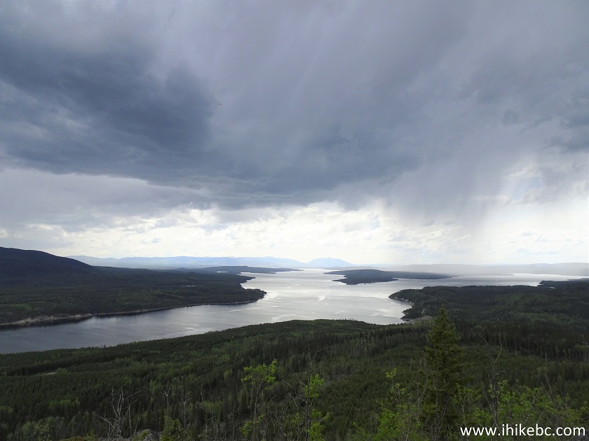
Knewstubb Lake
20. A zoomed view.
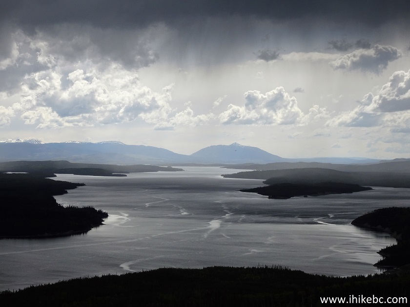
Knewstubb Lake British Columbia
Here is our video of Knewstubb Lake from the end of Cutoff Butte Trail.
More ihikebc videos are on our YouTube Channel.
21. And here is a view of Knewstubb Lake after we drove for 2 more kilometers on 500 Road after the hike. Some folks were camping in the area.

Cutoff Butte Trail has several serious challenges closer to the top, but leads to a fine lake view. Recommended.


|
 |
![]()
![]()
![]()
Follow @ihikebc Tweet
ihikebc.com Trip 186 - Cutoff Butte Trail Hike (near Vanderhoof BC)