![]()
![]()
![]()

Trip 320 - September 12, 2024 (Thursday)
Truax Forest Service Road Visit
Off Greyrock FSR
Near Gold Bridge, BC
Liked: Several fine views of Carpenter Lake. Good mountain views. Fairly good road conditions to 8.4 km (out of total 13.6 km).
Vancouver, Coast & Mountains Backroad Mapbook (2019 edition) Park Coordinates : Page 51
(Gold Bridge) D3.Other Forest Service Roads Trips: Chehalis (by Harrison Mills), Chilliwack Bench, Chilliwack Foley, Chilliwack Lake, Chuchinka-Colbourne (North of Prince George), Clear Creek (off Harrison East), Florence Lake (access to Stave Lake by Mission), Greyrock (near Gold Bridge), Harrison East, Harrison East Second Trip, Harrison West, Jones Lake (near Hope), Lost Creek (by Mission), Mamquam River (by Squamish), Nahatlatch (near Boston Bar), Parsnip West (by Mackenzie), Scuzzy (by Boston Bar), Shovel Creek (off Harrison East), Sowaqua Creek (by Hope), Squamish River Main, Squamish River Ashlu, Squamish River Ashlu Second Trip, Squamish River E-Main, Squamish River FSR Washout, Windfall Creek (by Tumbler Ridge).
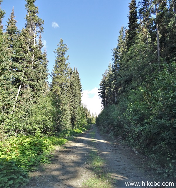
Follow @ihikebc TweetTruax Forest Service Road begins at the 10.9 km mark of Greyrock FSR (covered in the previous trip report). It is a good FSR, which should be suitable for regular clearance 2WD vehicles all the way to the 8.4 km mark, where there is a small parking area. We then hiked the rest of Truax FSR for 5.2 km, and had to cross two small creeks. Also, right after the parking area at the 8.4 km mark, the road becomes very narrow and brushed in, if not for long. However, your ride would likely get scratched.
There are also a few stretches of Truax FSR prior to the 8.4 km mark which are somewhat narrow and brushed in. Even though there is very little (if any) traffic that far from anything, should you meet an oncoming vehicle one of you might have to back up for quite a distance.
We saw in Backroads Mapbook that there is an old mine at the end of
Truax Forest Service Road, but found nothing of the kind. There is some
information on the Internet that, apparently, there is a faint trail
starting at the end of Truax FSR, but, from what it appears, there isn't
much left of the mine, and this route is good only for those who want to
do some challenging hiking in the area.
1
2. Here is the beginning of Truax Forest Service Road (on the right side) at the 10.9 km mark of Greyrock FSR, which itself starts in Gold Bridge, BC. Check out Greyrock FSR Trip Report for directions up to this point. This is the same photo as photo #20 of that trip report. Coordinates: N 50⁰53.461' W 122⁰42.500'. Elevation: 720 meters.
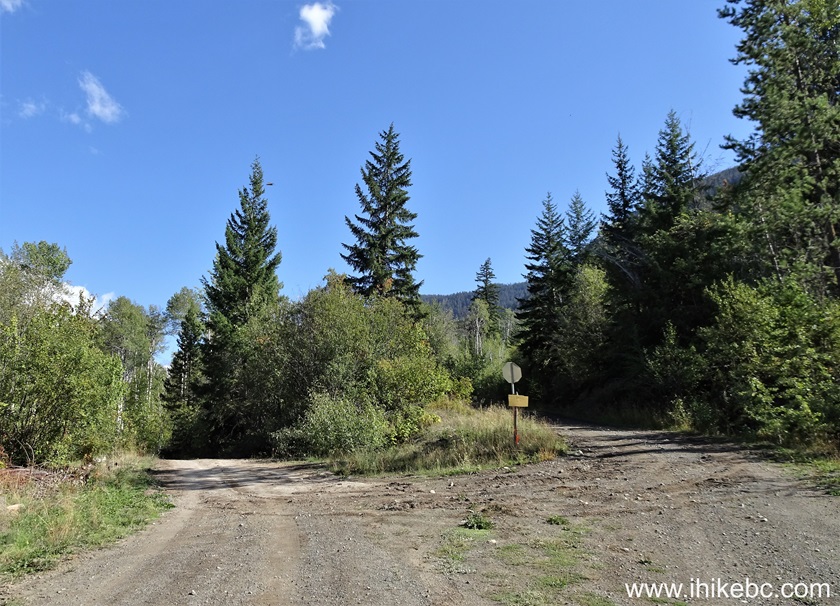
Truax FSR at Greyrock FSR near Gold Bridge BC Canada
3. Truax FSR right after the start.

Truax Forest Service Road
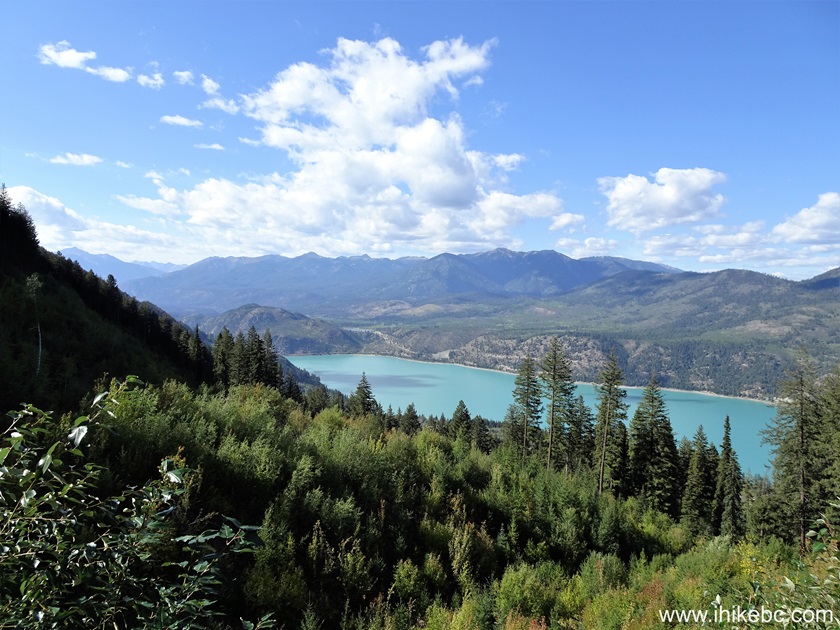
4. A fine view of Carpenter Lake at 1.4 km.

Carpenter Lake view off Truax FSR
5. Truax Forest Service Road at the 2.0 km mark. 2WD vehicles with regular clearance should be fine all the way to the parking area at 8.4 km.
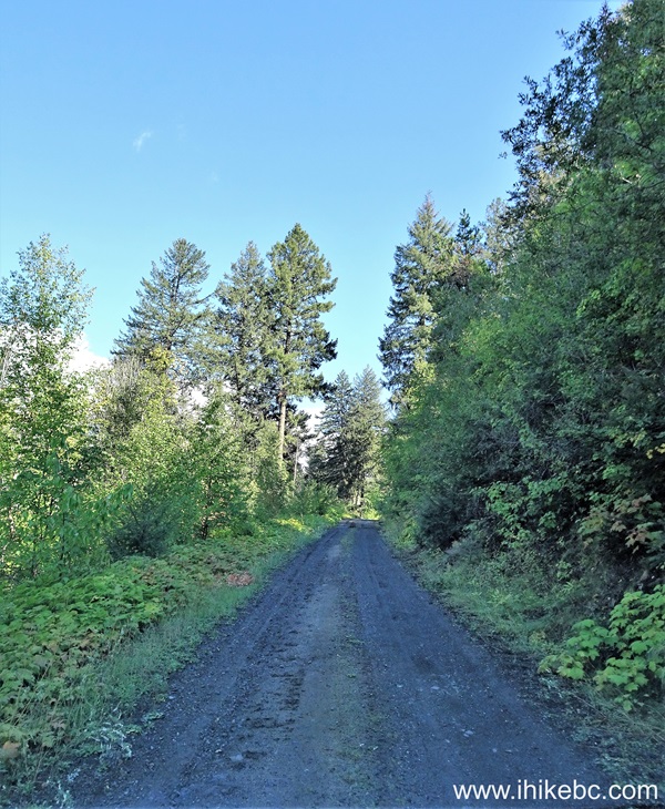
Truax FSR near Gold Bridge British Columbia Canada
6. There are two major splits, and you need to turn right both times. This one is shortly after 2.0 km.

Truax Forest Service Road - British Columbia - Canada
7. 2.5 km of Truax Forest Service Road.
Truax FSR
8-9. Another good view of Carpenter Lake at 2.7 km of Truax FSR. Left to right.
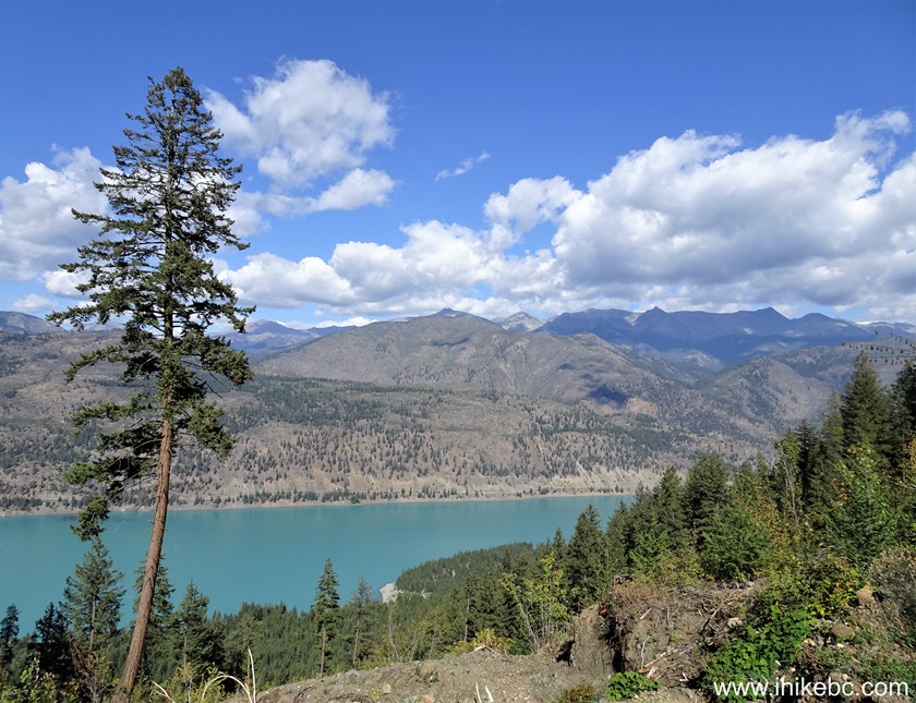
Carpenter Lake near Gold Bridge BC
10. One more at the 3.2 km mark of the FSR.
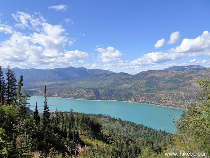
Carpenter Lake British Columbia
11. Truax Forest Service Road at the 5.2 km mark. There is another major split around this area - turn right again.
Truax Forest Service Road near Gold Bridge BC
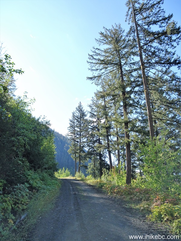
12. A very fine view at 7.3 km of the road.

Truax FSR British Columbia
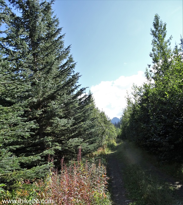
13. Just a bit further.

Truax Forest Service Road
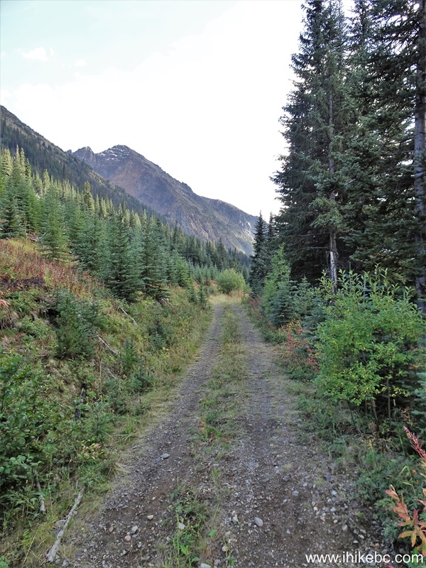
14. At around the 8.0 km mark Truax FSR becomes brushed in and quite narrow too. Should you meet oncoming traffic, one of you might have to back up for quite a bit.
Truax FSR in Gold Bridge BC area
15. Arriving to the parking area at 8.4 km mark of Truax Forest Service Road. Coordinates: N 50⁰51.250' W 122⁰41.407'. Elevation: 1,460 meters. The FSR continues on the right side. It is possible to keep driving, as it gets better shortly, but there is a very brushed-in and somewhat rough short stretch right after this parking area, and also several creek crossings further on. So, a 4x4 and willingness to get your ride scratched would be helpful going forward.
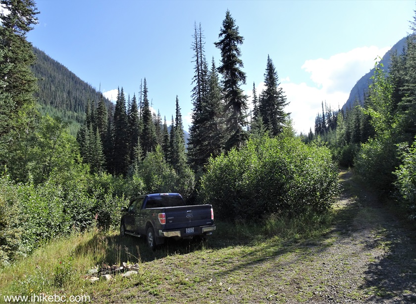
Truax FSR British Columbia
Here is our video of driving on Truax FSR to the parking area at 8.4 km.
More ihikebc videos are on our YouTube Channel.
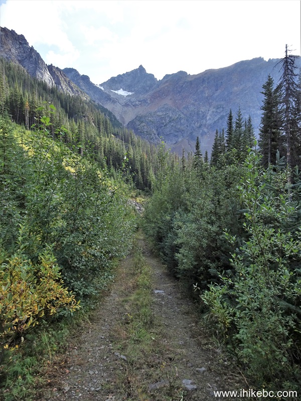
16. After the parking area, Truax FSR continues for 5.2 km, and we hiked it until the end. Here is the road at 35 meters after we parked. Brushed-in indeed.
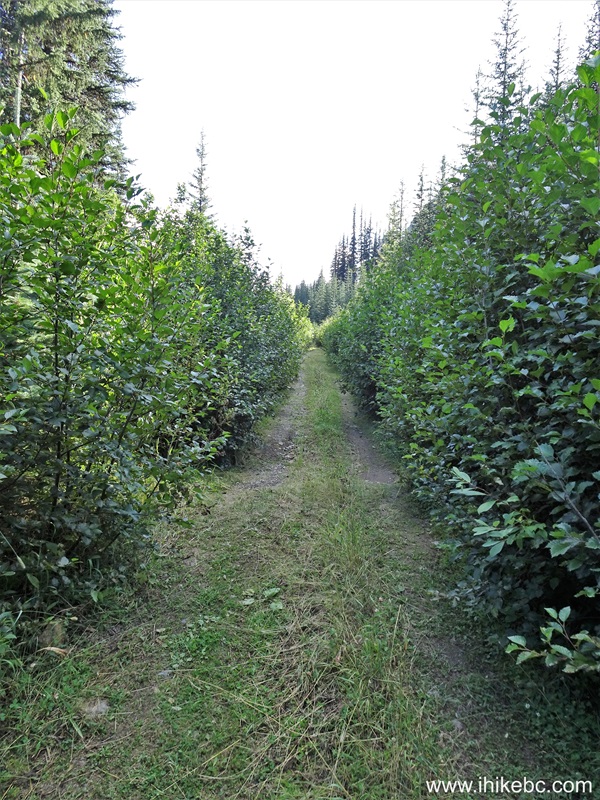
Truax Forest Service Road - British Columbia
17. Gets better at the 125 meter mark of the hike.
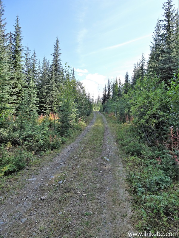
Truax FSR near Gold Bridge BC Canada
18. The first creek crossing arrives at the 400 meters of hiking on Truax FSR. We managed to stone-hop, but this was the end of the season, and there sure would be wider and deeper creek here earlier in the year.

Truax FSR Creek Crossing
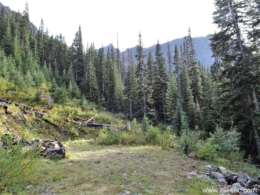
19. At 1.09 km of the hike.
Truax Forest Service Road
20. The second creek crossing at 1.50 km of the Truax Forest Service Road hike. Again, earlier in the season this could be a substantially deeper and wider creek.

Creek crossing on Truax Forest Service Road
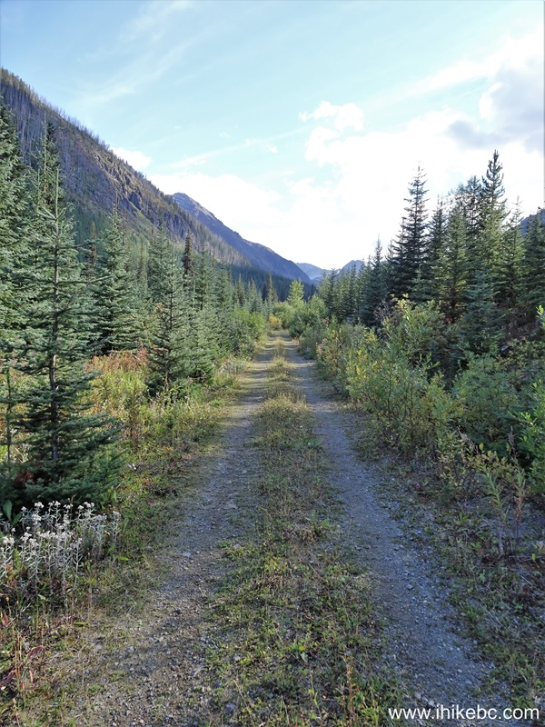
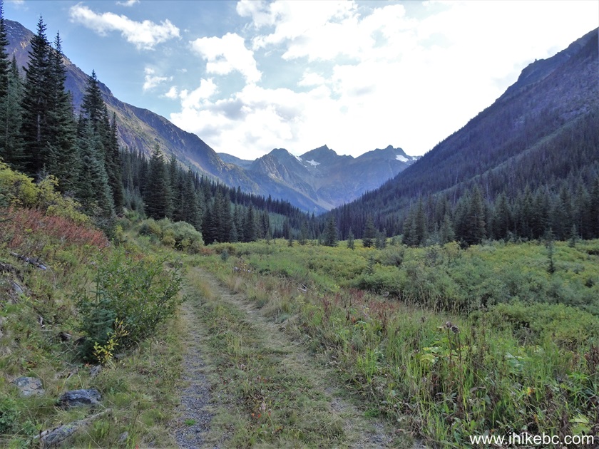
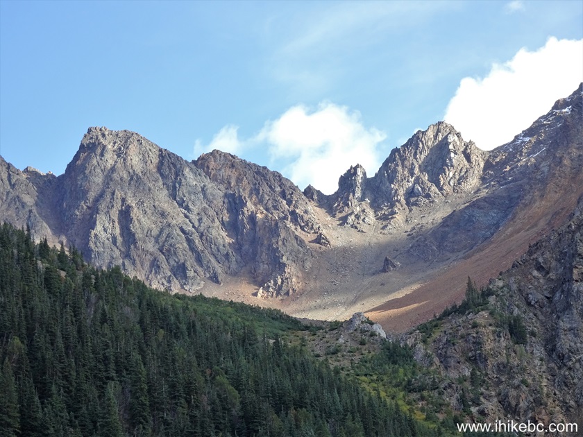
21. At 2.50 km, mountain views are starting to arrive in earnest.
Hiking on Truax Forest Service Road near Gold Bridge British Columbia
Canada
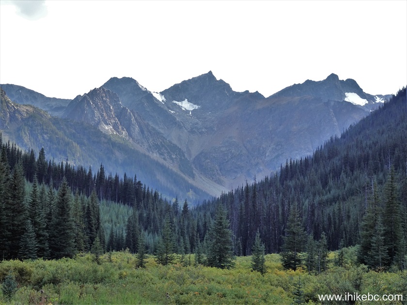
22. A very fine view at the 2.62 km of the Truax FSR hike.
Truax FSR Hike near Gold Bridge BC
23. A zoomed view.
British Columbia Mountain
24. Truax Forest Service Hike at 3.27 km.

Hiking on Truax Forest Service Road
25-26. A zoomed view of the mountain above. Left to right.
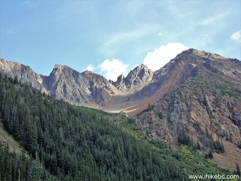
Mountain in British Columbia
27. Truax FSR at the 4.58 km of the hike.

Truax FSR by Goldbridge BC
28. Now at the 5.09 km mark.
Truax Forest Service Road - British Columbia - Canada
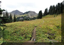
29. Arriving to the end of the hike at 5.2 km of Truax Forest Service Road (13.6 km from the start off Greyrock FSR). Coordinates: N 50⁰48.487' W 122⁰41.476'. Elevation: 1,740 meters. Apparently, there is a faint hiking trail going further for those wishing to climb nearby mountains and/or see the remnants of an old mine, but we stopped here.
End of Truax FSR
Truax Forest Service Road has several good views to make it a decent trip. Recommended.


|
 |
![]()
![]()
![]()
ihikebc.com Trip 320 - Truax Forest Service Road Visit
(near Gold Bridge, BC)