![]()
![]()
![]()

Trip 247 - May 19, 2022 (Thursday)
Bodega Ridge Trail Hike
Bodega Ridge Provincial Park
Galiano Island, British Columbia
Liked: Panoramic island views, a short and fairly easy trail with a few moderately difficult stretches, several arbutus trees, no bugs (a few at the parking lot), several fine forest scenes.
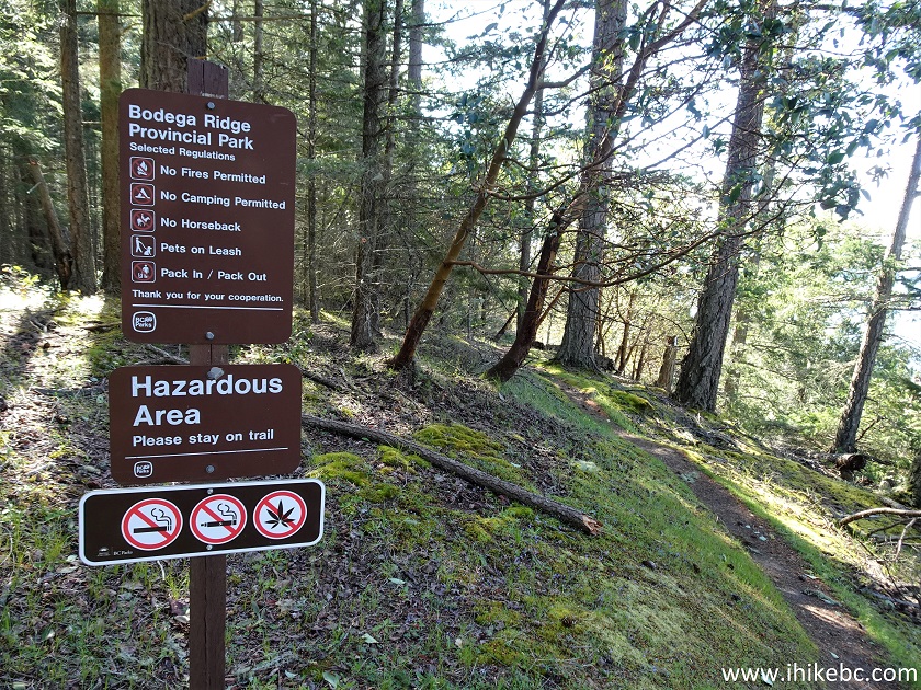
Of Note: No facilities. Steep unbarricaded drop-offs along the ridge, including three areas with the best views (otherwise, trees are substantially obstructing the views for most of the ridge walk). Uneven ground, rocks and roots – hiking poles and boots are recommended. Cottage Way has several narrow switchbacks – any vehicle larger than a full size pick-up may find it challenging getting through.Vancouver Island, Victoria & Gulf Islands Backroad Mapbook (9th edition) Bodega Ridge Trailhead Coordinates: Page 20 (Galiano Island) D2.
Related Website: Bodega Ridge Provincial Park - BC Parks Official Website.
Bodega Ridge Trail is a short and easy hike in Bodega Ridge Provincial Park located on Galiano Island (part of British Columbia Southern Gulf Islands). A ferry from Tsawwassen or Swartz Bay gets you to Galiano Island, and then it's 18.6 km to the trailhead. Final 1.7 km is via Cottage Way, which has several narrow switchbacks.
There are no facilities of any kind in Bodega Ridge Provincial Park, and the only sign is right at the trailhead. The views are mostly overgrown, but there are several spots with almost no obstruction. Just watch out for steep unbarricaded drop-offs along the entire ridge walk.
1. Here is a Google map with directions from Sturdies Bay Ferry Terminal to Bodega Ridge trailhead.
2. We are on Galiano Island's Porlier Pass Drive, heading to Bodega Ridge trailhead. Galiano Island roads have no shoulders and are often narrow and winding. Watch for pedestrians, cyclists, and deer.
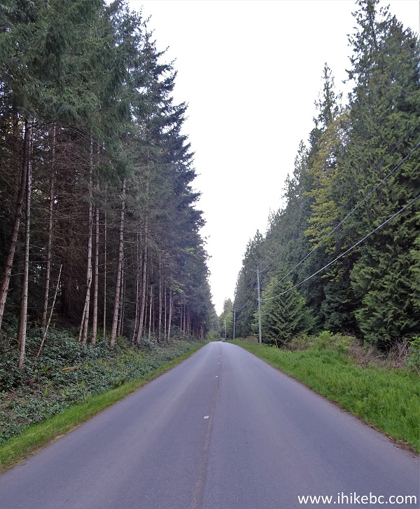
Porlier Pass Drive Galiano Island BC
3. Turning right from Porlier Pass Drive onto Cottage Way.
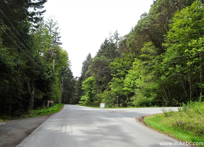
Porlier Pass Drive at Cottage Way -
Galiano Island - British Columbia
4. Here is Cottage Way 300 meters from Porlier Pass Drive. Cottage Way has several narrow switchbacks, and any vehicle larger than a full size pickup truck may find it challenging out there.
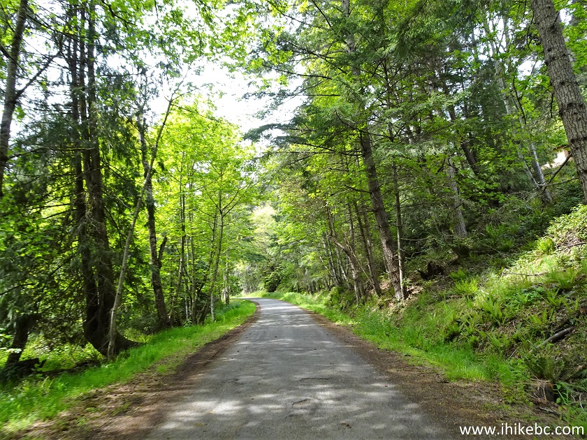
Cottage Way Galiano Island BC Canada
5. 1.7 km after Porlier Pass Drive, arriving at the end of Cottage Way, where a parking lot is located for Bodega Ridge trailhead. Coordinates: N 48°56.962’ W 123°30.726’ Elevation: 190 meters.
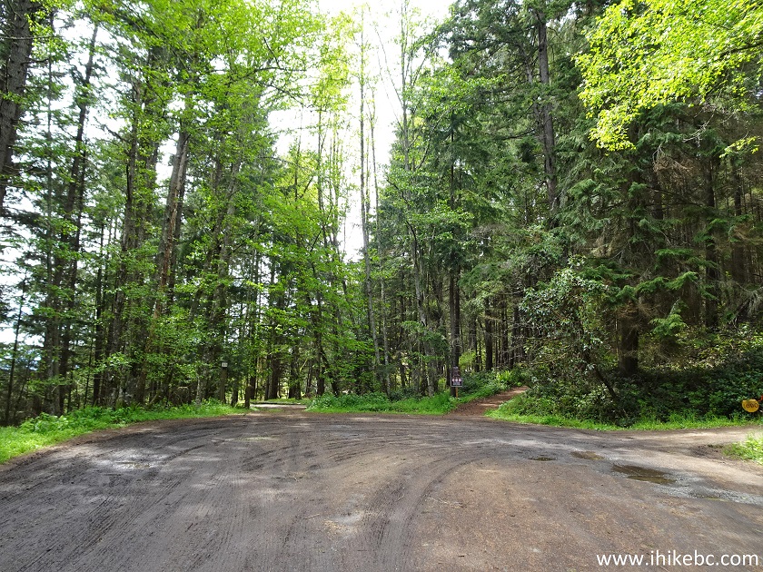
Bodega Ridge Trail Parking Lot
6. Here is the trailhead with a sign to Bodega Ridge Provincial Park. There are no other signs up to this point.
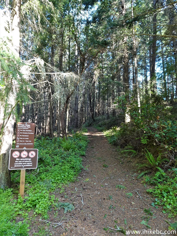
Bodega Ridge Trailhead
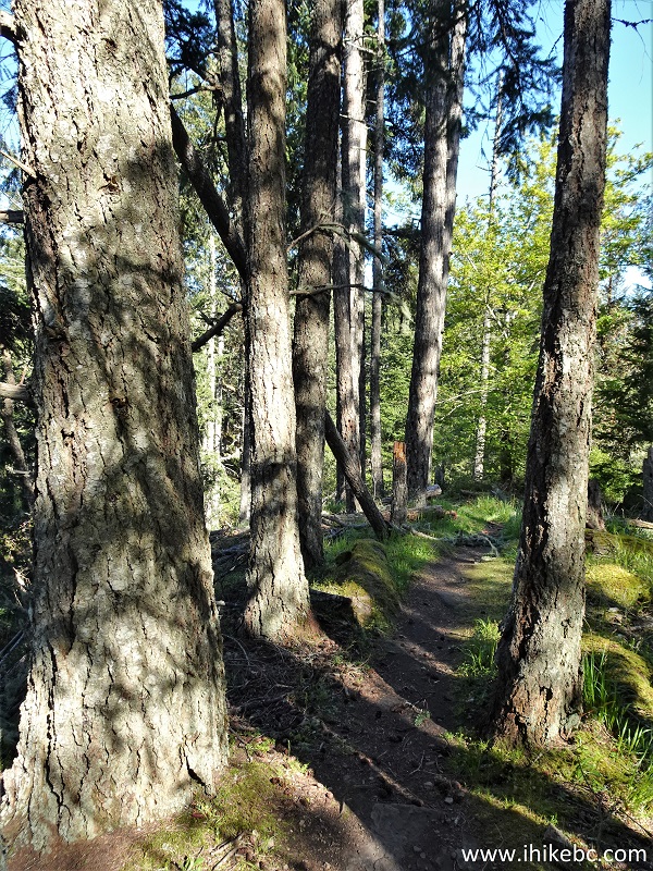
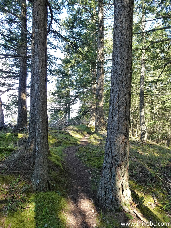
7. Bodega Ridge Trail is a short and easy hike, with several fine forest scenes. Here we are 290 meters from the trailhead (all distances are based on a GPS odometer and are approximate).
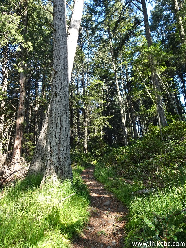
Galiano Island Hiking - Bodega Ridge Trail
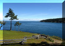
8-9. At 620 meters, there is a very short path to a bench with somewhat obstructed views.
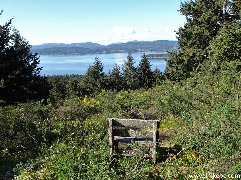
Bodega Ridge Provincial Park
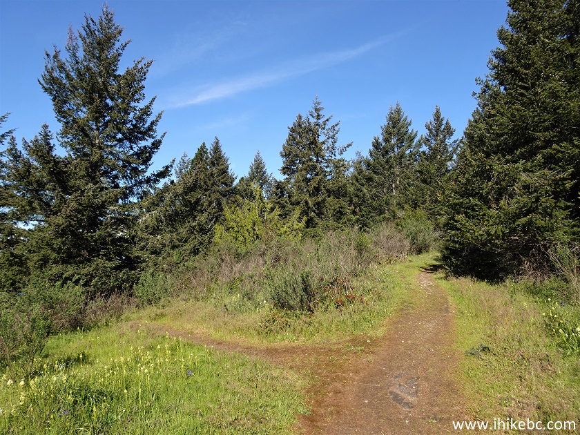
10. But the best views are ahead. Here we are at 1.0 km.
Hike on Galiano Island - Bodega Ridge Trail
11. It's a very pleasant path indeed. At 1.28 km.
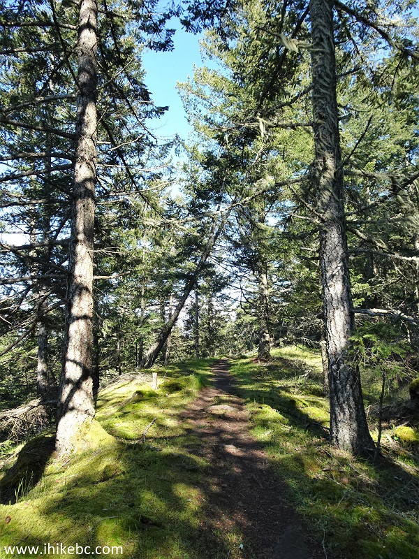
Bodega Ridge Hike
12. At 1.34 km, this warning sign signals the arrival of the ridge walk.
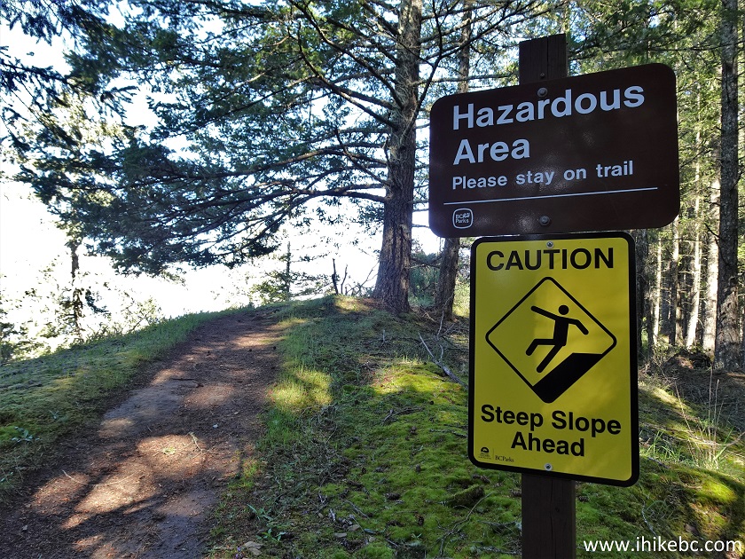
Bodega Ridge Provincial Park
Galiano Island BC Canada
13. Aside from fine views to the left (when unobstructed), another feature of this hike are several arbutus trees, such as the one seen on the right side below. Galiano Island has many of these fine trees, and their mostly barkless trunks, with colours from light brown to almost burgundy red (sometimes on the same tree), are very pleasant to look at.
Bodega Ridge Trail Hike Galiano Island BC
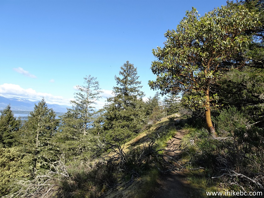
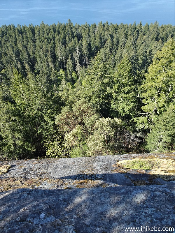
14. This is what the ridge walk mostly looks like. At 1.53 km here.
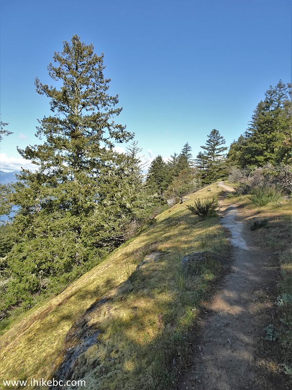
Hiking on Galiano Island in Bodega Ridge Provincial Park
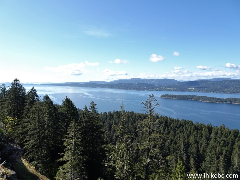
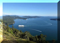
15. Unobstructed views arrive at 1.78 km. The closest thin stretch of land is Wallace Island, behind it is Salt Spring Island, and far away is Vancouver Island.
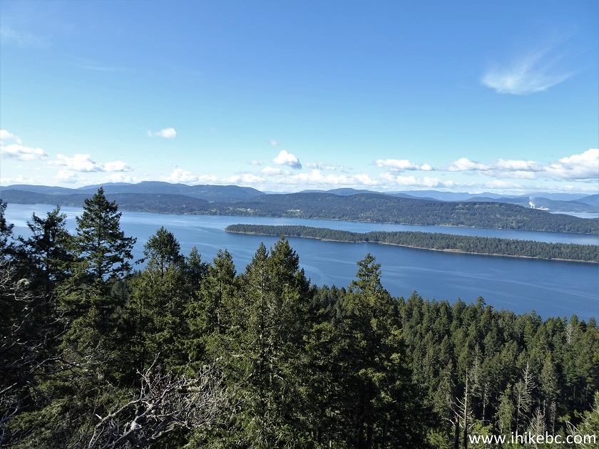
View from Bodega Ridge Trail British Columbia
16. A bit more to the right.
Wallace Island View from Bodega
Ridge on Galiano Island
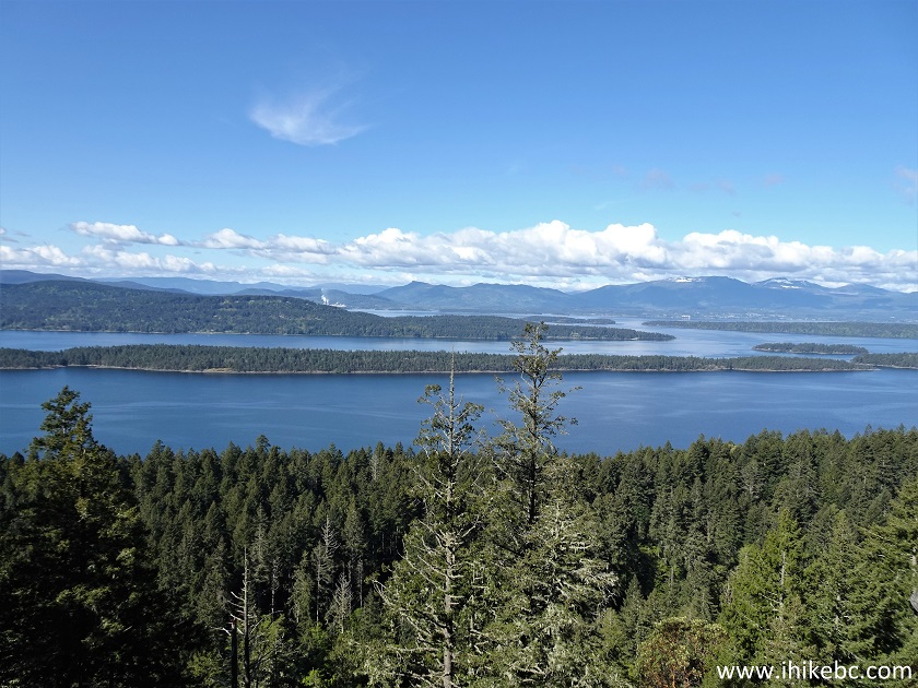
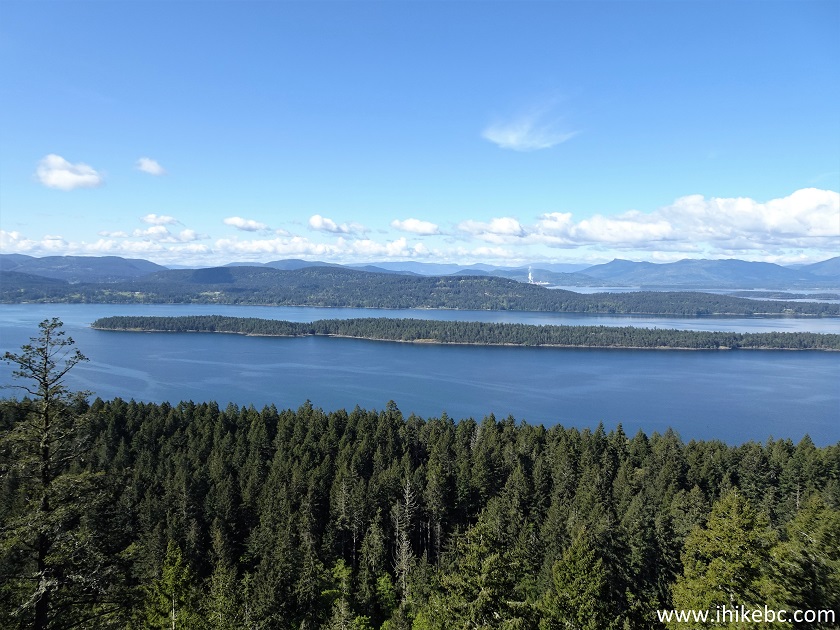
17. Yet more to the right we see Secretary Islands (yes, plural, there are a few) appearing on the right side, next to Wallace Island.
Secretary Islands British Columbia View from Galiano Island Bodega Ridge
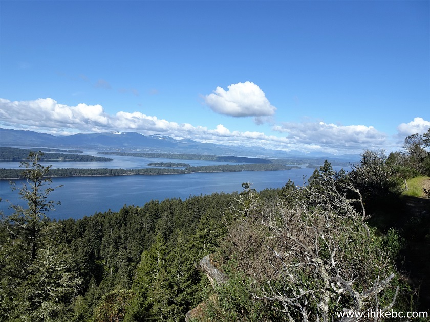
18. A panorama of it all. Looks good, but we did like the view from Mount Galiano better. It's more panoramic and you can see further away.
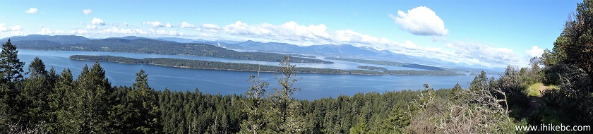
Panoramic View from Bodega Ridge on Galiano Island BC
19. Speaking of steep unbarricaded drop-offs...
Bodega Ridge Provincial Park British Columbia
20-22. At 1.84 km, there is another good unobstructed view. Left to right.
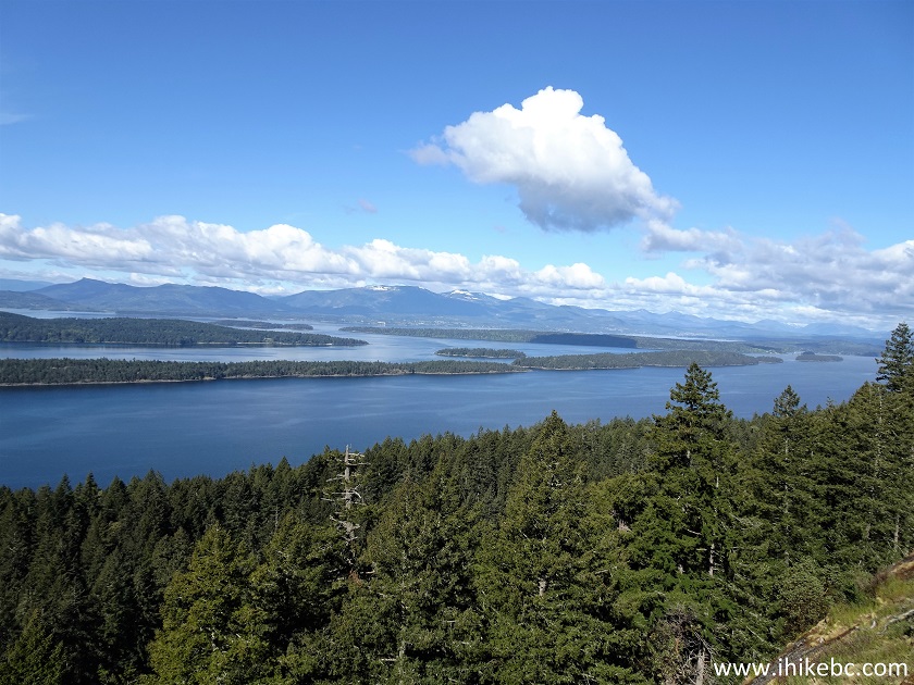
View from Bodega Ridge on Galiano Island
Here is our video of the views from this location.
More ihikebc videos are on our YouTube Channel.
23. Zooming in, we see several fine mountains on Vancouver Island.
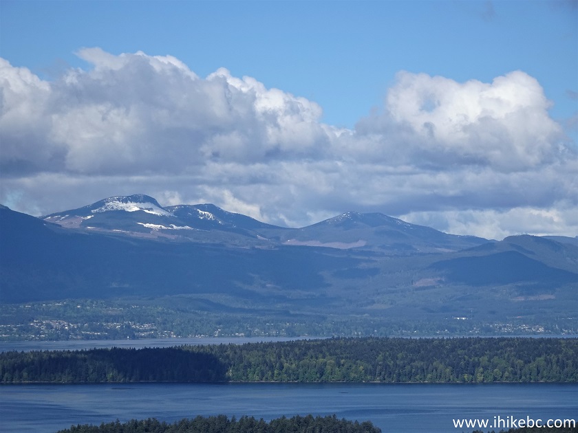
Vancouver Island zoomed view from
Galiano Island
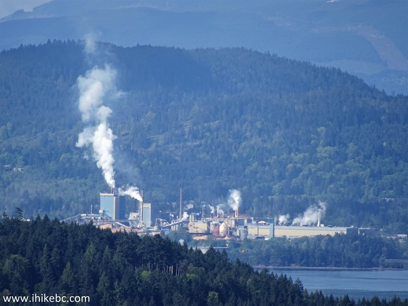
24. There is some smoke-emitting industry far away. You can see a bit of it in photos #16 and #22.
25. Continuing the ridge walk, here is another arbutus tree. At 1.86 km here.
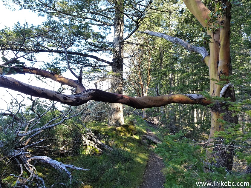
Arbutus Tree
26. Proceed a bit further...
Bodega Ridge Hike Galiano Island British Columbia Canada
27...and here is the end of Bodega Ridge Provincial Park, at 2.12 km from the parking lot. Coordinates: N 48°57.591’ W 123°32.094’. Elevation: 270 meters.
Bodega Ridge Provincial Park
The path continues past the sign and, apparently, it is possible to get all the way to Dionisio Point Provincial Park through some back roads, but we don't know the condition of that route. Bodega Ridge Trail is quite short and very easy, and leads to impressive views. Highly recommended.


|
 |
Other Trips on Galiano Island:
|
|
|
|
|
|
|
Other Trips:


![]()
![]()
![]()
ihikebc.com Trip 247 - Bodega Ridge Trail Hike (Galiano Island BC)