![]()
![]()
![]()

Trip 226 - July 29, 2021 (Thursday)
Buntzen Lake Trail Hike
Near Anmore, British Columbia, Canada
Liked: A mostly easy trail with little elevation change. Lake views. Numerous fine forest views. Suspension bridge. Floating bridge. Shade in the forest. No bugs.
Of Note: S
ome short hills. Rocks and roots. Uneven ground. Hiking poles and boots are recommended. Beware of park gate closure times (quite early).Vancouver, Coast & Mountains Backroad Mapbook (5th edition) Trailhead Coordinates: Page 12 (Pinecone Burke Provincial Park) A7.
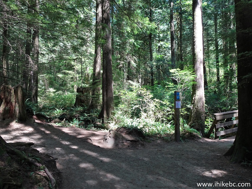
Buntzen Lake Trail goes around a very popular lake near the village of Anmore in Metro Vancouver. While most Buntzen Lake visitors are perfectly happy walking a few hundred meters from the three huge parking lots to the South Beach for their recreational adventure, some hardy souls brave a 4-km-long East side lake trail to the North beach, where the crowd is much smaller. And, for the hikers among us, crossing a suspension bridge and continuing along the West side of Buntzen Lake for over 5 kilometers completes the loop and brings us back to the parking lot.
We did the loop today, and it was a very fine hike. A few good views of Buntzen Lake, several fine forest scenes, plenty of shade, no bugs, very little elevation change - perfect conditions on a warm day. We have met dozens of fellow hikers, a few woodpeckers, and even a small snake. Crossing the suspension bridge was a neat experience as well.
Beware of a very early park gate closure time (8 PM even in the middle of Summer), lest you be stuck enjoying the beach overnight.
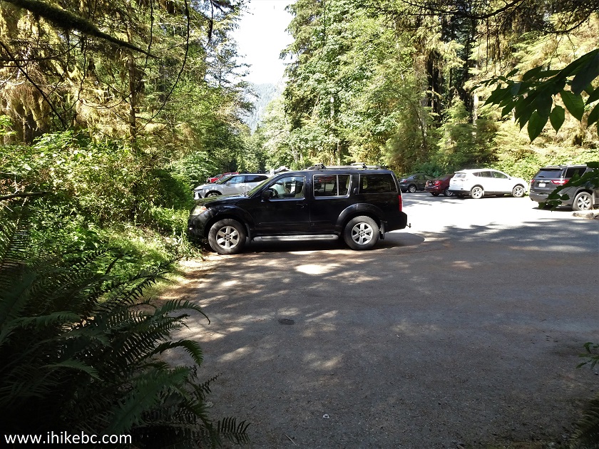
1. We are at the first Buntzen Lake parking lot after you enter the recreation area. For photo-directions on getting here from Vancouver, check out our Belcarra Regional Park and Lindsay Lake Loop trip reports.
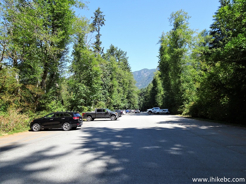
Buntzen Lake Recreation Area Parking Lot
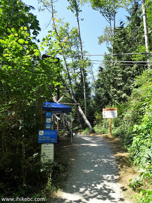
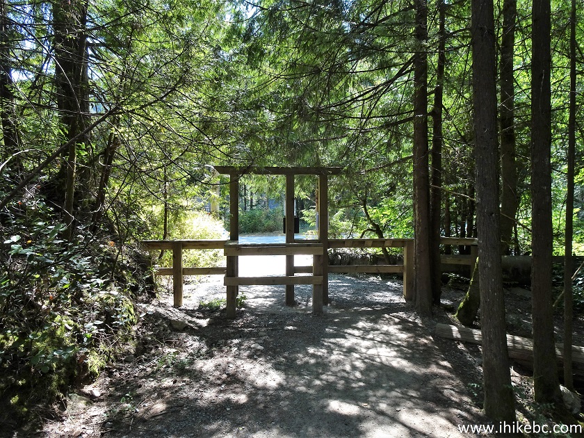
2. Buntzen Lake Loop starts on the East side of South Beach (far right, if facing the lake). The first parking lot is the closest to the beginning of the loop, but the last one is the closest to the end (though, all three lots are right next to each other). Here we are at the information board, with the trail beginning across the bridge on the right side (behind the board), and the gate leading back to the beach on the far left side of the photo below.
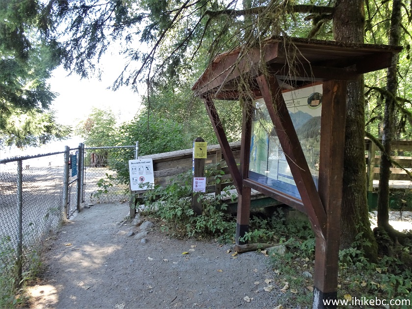
Buntzen Lake Trailhead
3. Here is that bridge marking the start of Buntzen Lake Trail. Coordinates:
N 49⁰20.410' W 122⁰51.308'. Elevation: 133 meters.
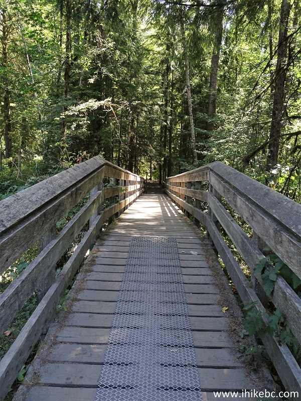
Bridge at the Start of Buntzen Lake Trail near Anmore BC Canada
4. And here is a trail map, posted on the information board. We have indicated as follows: red square - South beach and the trailhead; yellow square - North beach and the suspension bridge; blue square - floating bridge. Buntzen Lake Trail is marked #4 on the map. Of note is trail #6, which is a very picturesque (but much tougher) Diez Vistas Trail on the West side of Buntzen Lake. Diez Vistas Trail starts and ends off Buntzen Lake West trail.
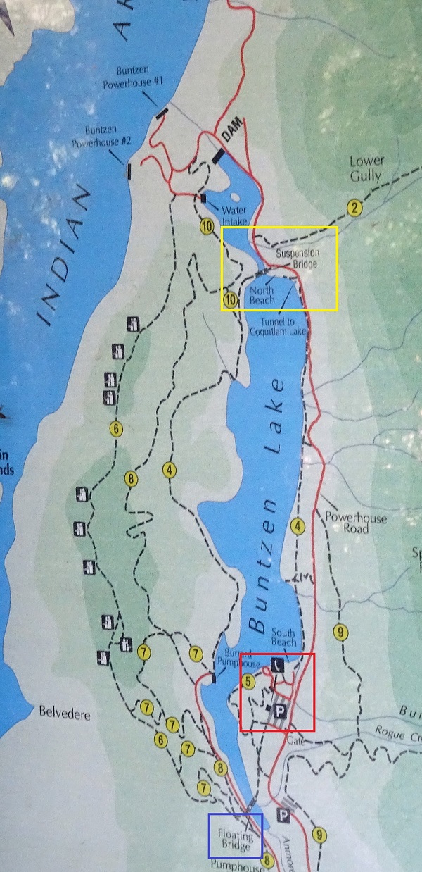
Buntzen Lake Trail Map
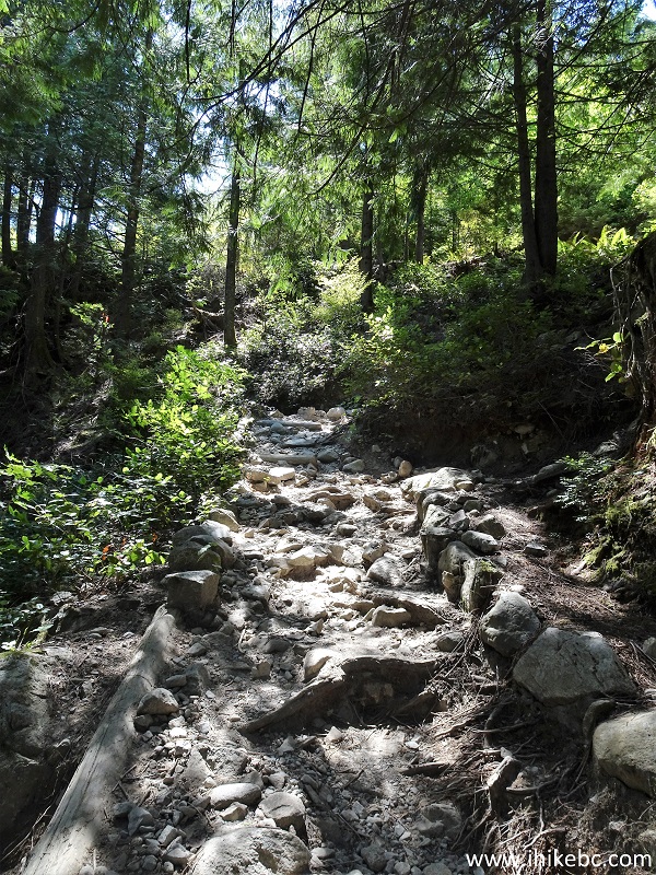
5. East side of Buntzen Lake Trail is shorter and easier than the west side. It's also closer to the lake. Here we are at 730 meters from the trailhead (all distances are based on a GPS odometer and are approximate).
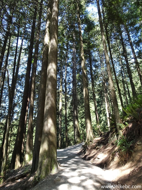
Buntzen Lake Trail East - Anmore Hike
6. At 780 meters, we are about to cross one of the numerous small bridges on Buntzen Lake Trail.
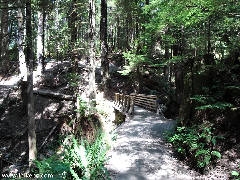
Buntzen Lake Trail in Anmore BC Area
7. At 830 meters, there is a split. Buntzen Lake Trail continues to the right. And, to the left, is a short trail to a lake viewpoint.
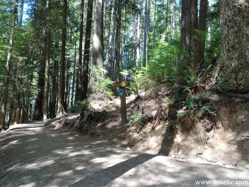
Buntzen Trail Lake East - Anmore Hiking
8. We proceeded to the viewpoint at first.
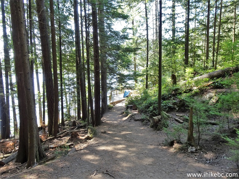
Trail in Anmore British Columbia Area - Buntzen Lake Trail
9. There is a garbage can there, an observation platform, and a neat lake view. Coordinates:
N 49⁰20.742' W 122⁰51.378'. Elevation: 126 meters.
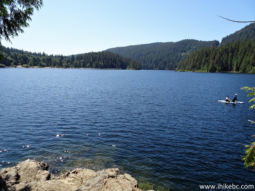
Buntzen Lake
10. A zoomed view of the main (South) beach from the viewpoint.
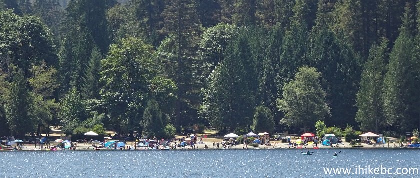
Buntzen Lake South Beach
11. Now continuing on Buntzen Lake Trail. About 90 meters from the viewpoint split, a right turn would lead to Powerhouse Road, which runs parallel to the east side of the trail all the way to the North Beach. By making a right turn, it's possible to go back to the parking lot via Powerhouse Road. We have noticed substantially fewer people on Buntzen Lake Trail past this point, so it appears many people do precisely this loop hike. There is another right turn to Powerhouse Road about 1.3 km from the viewpoint split.
Buntzen Lake Trail at Powerhouse Road Access Trail
12. And now a zoomed view of the North beach from approximately 2.2 km point past the viewpoint split (about 3 km from the trailhead). As you can see, it's much smaller and less crowded than the South beach. The suspension bridge is seen on the left side.
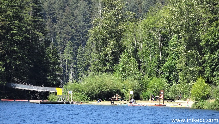
Buntzen Lake North Beach
13-14. About 2.5 km from the viewpoint split (3.3 km from the trailhead), Buntzen Lake Trail comes out of the woods and joins Powerhouse Road.

Buntzen Lake Trail at Powerhouse Road
15. Make a left turn, and re-enter the woods 30 meters later, right by those garbage cans.
Powerhouse Road at Buntzen Lake Trail
16. Back in the woods, with North Beach quickly approaching.
Buntzen Lake Trail Hike in Anmore BC Area
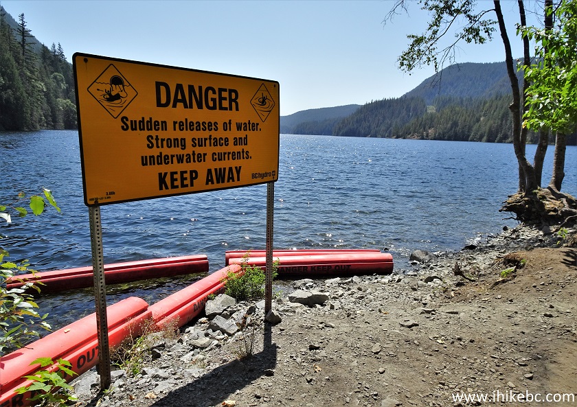
17. Finally, approximately 4 kilometers from the trailhead, we are at Buntzen Lake near the North Beach. Right here is a tunnel connecting Coquitlam and Buntzen reservoirs, so a warning message on a board asks to keep away. The beach is just a hundred meters further down the trail.
Buntzen Lake British Columbia
18-19. And here is the tunnel.

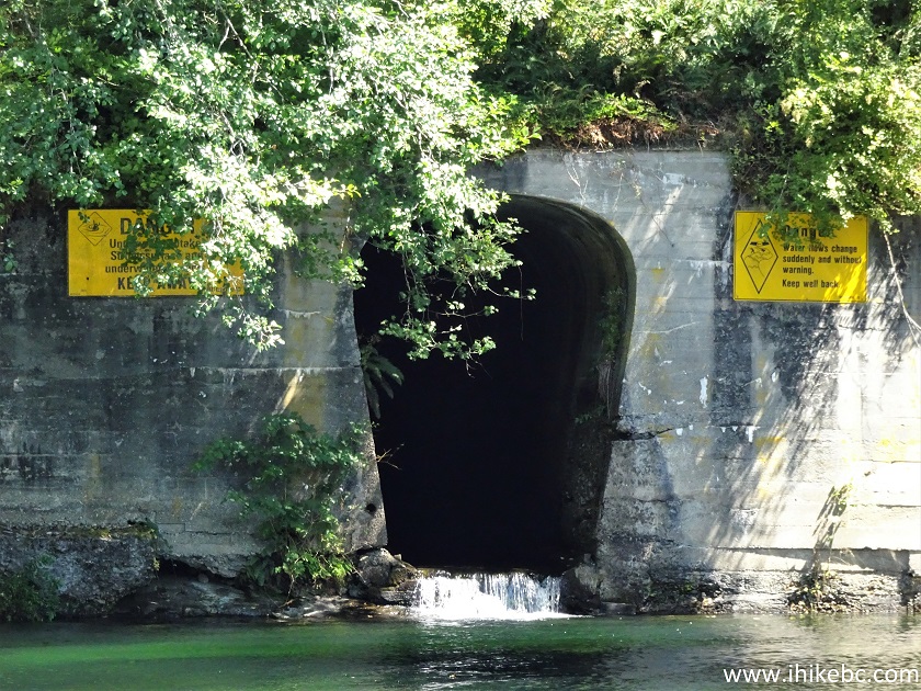
Tunnel Between Coquitlam Lake and Buntzen Lake
20. Now at the Buntzen Lake North Beach. No lifeguard here, very little sand, lots of grass and small stones. Coordinates:
N 49⁰21.898' W 122⁰51.366'. Elevation: 117 meters (16 meters elevation loss from the trailhead).
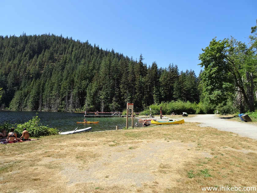
Buntzen Lake North Beach
21. Buntzen Lake with a dock.
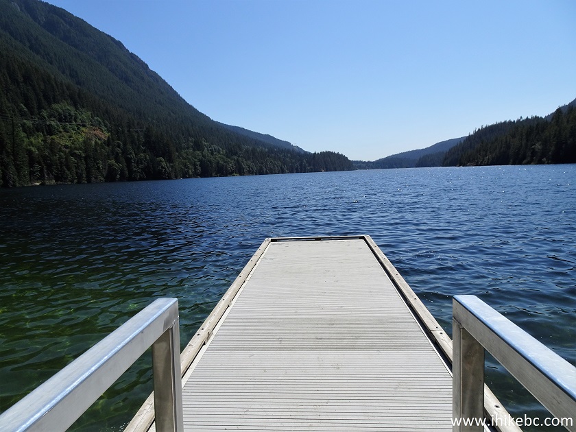
Buntzen Lake British Columbia Canada
22. Buntzen Lake without a dock.
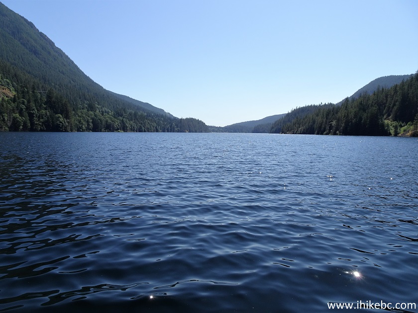
Buntzen Lake
23. Go past the beach and proceed to the West side of Buntzen Lake Trail.
Buntzen Lake Trail West Start - Trail in Anmore BC Area
24. Here is that suspension bridge. Apparently, it's in a rather rough shape, and only four people are allowed to be on the bridge at the same time. A staff member sits by the bridge all day long to ensure the safety of bridge users.
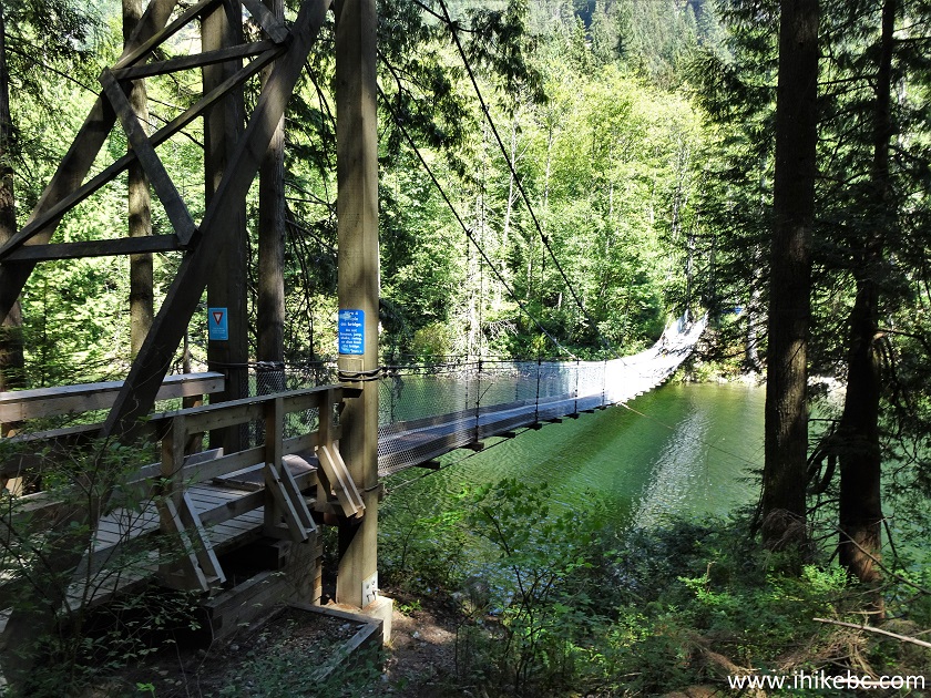
Buntzen Lake Trail Suspension Bridge
25. Buntzen Lake suspension bridge.
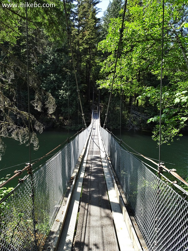
Suspension Bridge on Buntzen Lake Trail British Columbia Canada
Here is our video of crossing Buntzen Lake Suspension Bridge.
More ihikebc videos are on our YouTube Channel.
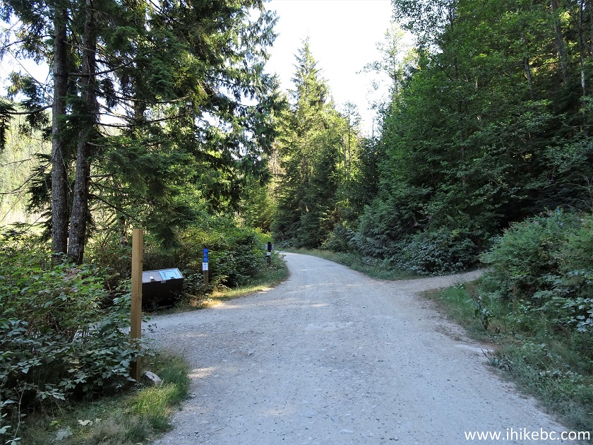
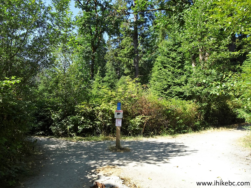
26. At 280 meters after the West side trailhead, a right turn signals the beginning (or the end, depending which way you are hiking) of Diez Vistas Trail. The other end is by the floating bridge seen in photo #30.
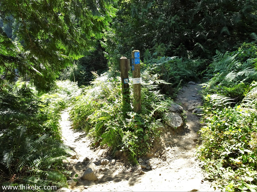
Buntzen Lake Trail West at Diaz Vistas Trailhead
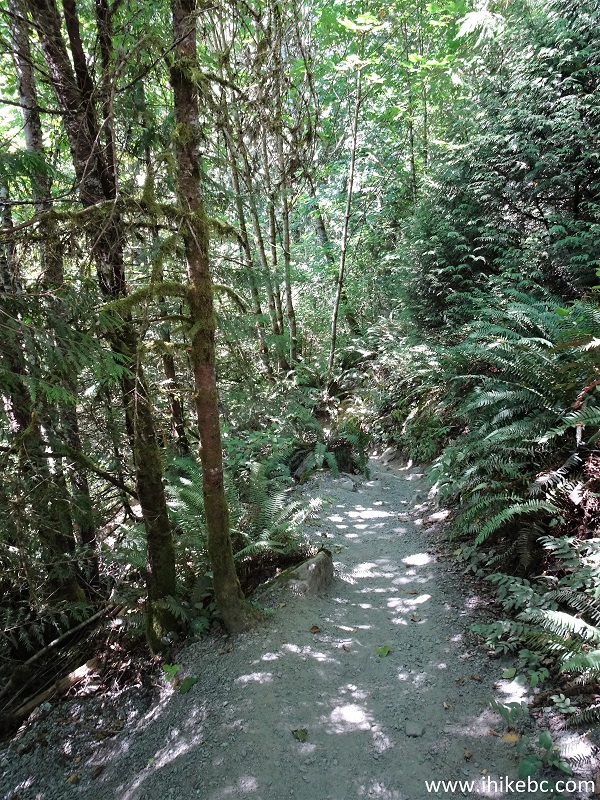
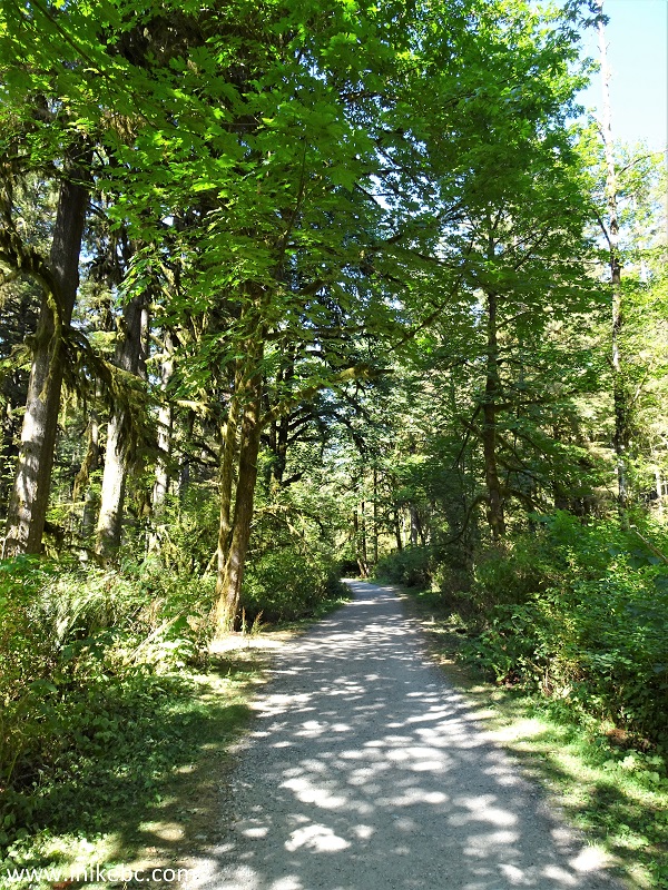
27. We proceeded to the left to stay on Buntzen Lake Trail. The West side of the trail is somewhat longer and rougher than the East side, and there are substantially fewer people here.
Hiking in Anmore BC Area - Buntzen Lake Trail
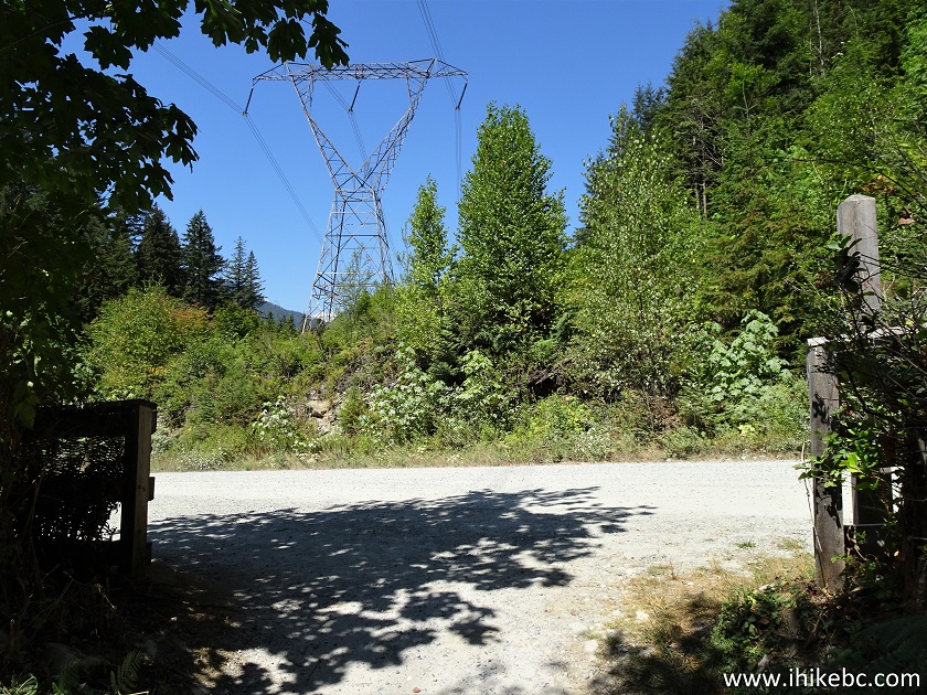
28. Having hiked for 3.9 km from the North Beach, we came out of the woods past this entrance gate.
Buntzen Lake Trail
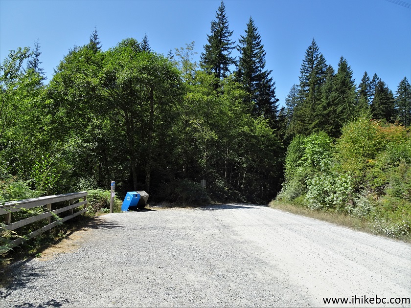
29. The road then comes closer to the lake and becomes very smooth.
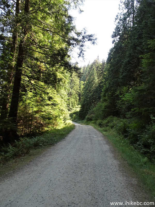
Buntzen Lake Hike
30. Approaching the floating bridge.
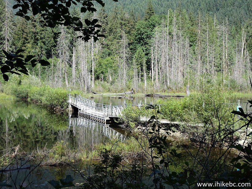
Floating Bridge on Buntzen Lake Trail
31. At 5.0 km from the North Beach, we are at a major intersection. Coordinates:
N 49⁰19.817' W 122⁰51.622'. Elevation: 117 meters. To the right is the other end of Diez Vistas Trail. Straight ahead is the park gate. And, to the left, is a floating bridge and the continuation of Buntzen Lake Trail.
Buntzen Lake Trail at Diez Vistas Trailhead
32. Crossing the floating bridge.
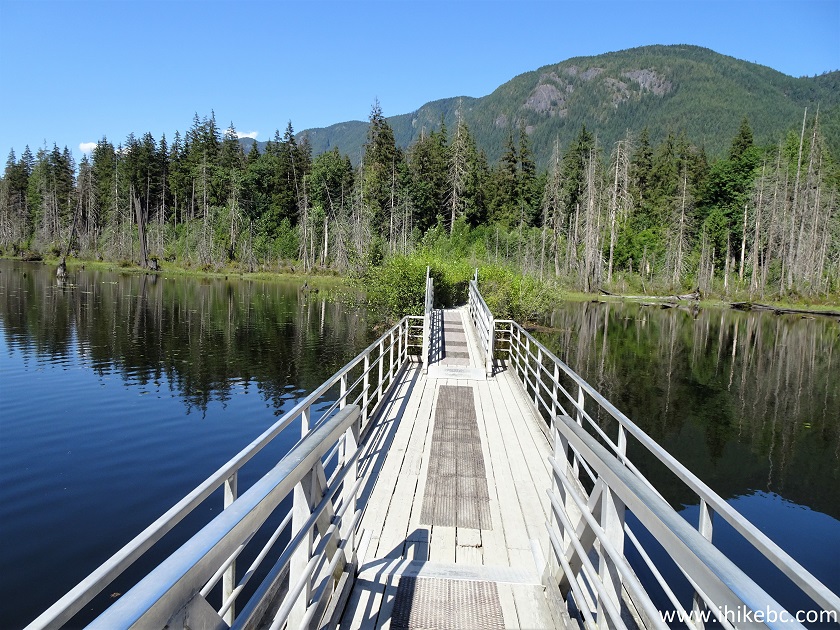
Buntzen Lake Trail Floating Bridge
33. After the floating bridge, there is another intersection. Make a left turn.
Buntzen Lake Trail British Columbia Canada
34. Approaching the parking lots.
Buntzen Lake Hike near Anmore BC Canada
35. And here we are, at the 3rd parking lot, 5.8 kilometers from the North Beach. Coordinates:
N 49⁰20.180' W 122⁰51.501'. Elevation: 127 meters.
Parking Lot for Buntzen Lake Recreation Area
Buntzen Lake Trail is a very pleasant, easy hike, with numerous fine views and access to the North Beach. Highly recommended.


|
 |
Other Trips:


![]()


![]()
![]()
![]()
ihikebc.com Trip 226 - Buntzen Lake Trail Hike (near Anmore BC)