![]()
![]()
![]()

Trip 052 - August 2, 2011 (Tuesday)
Mount Gardner Trail Hike
Bowen Island BC Canada
Page 2 of 2
Distance From Vancouver to the Trailhead: About 20 kilometers via Lions Gate Bridge to Horseshoe Bay Ferry Terminal. Then, take a 25 minute ferry ride to Bowen Island. After that, drive for 5 minutes to the trailhead on Mount Gardner Road.
Liked: Great panoramic views of Vancouver Island and mainland Metro Vancouver. Interesting forest.
Of note:
Numerous
intersecting and splitting paths with somewhat inadequate signage and
occasionally missing trail markings (as well as frequent wide-open
forest areas with no obvious path, and every now and then misleading
flagging tape) make it a difficult hike. It is easy to take a wrong turn
and walk for a long time before knowing it, so allow for at least 8
hours to get to the North Summit (best views) and back, unless you know
exactly how to get there. The path is mostly easy, but there are some
difficult forest stretches and several steep gravel road parts. Hiking
boots and poles are recommended.
Vancouver, Coast & Mountains Backroad Mapbook (2010 edition)
Coordinates: Page 10 (Gibsons)
F6-F7.
Related Website: Bowen Island Official Site.
Other Trips on Bowen Island: Dorman Point Trail Hike, Bowen Island Ferry Trip.
Follow @ihikebc Tweet
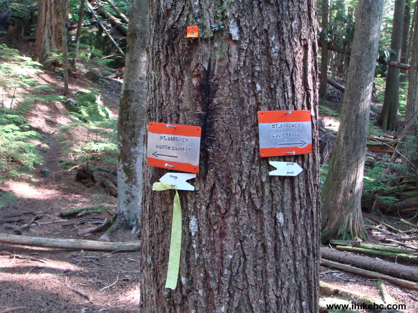
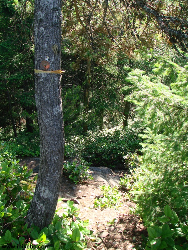
17. Less than twenty minutes after checking out the great views seen in photo #15, you would come to this tree with two small signs, one of which directs you to Mount Gardner North Summit. Thus, turn left.
Mount Gardner Hike
Bowen Island British Columbia Canada
18. And, right away, admire the remains of a fairly large animal, which, hopefully, died in peace.
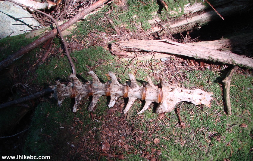
Photo of a Bone
Mount Gardner Bowen Island Province of BC Canada
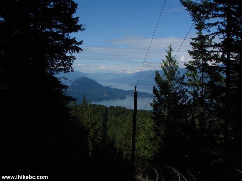
19. Five minutes later, the flagging tape disappears, and you get to see this view. Keep climbing - the North Summit is very close.
Mount Gardner Hike
Bowen Island British Columbia Canada
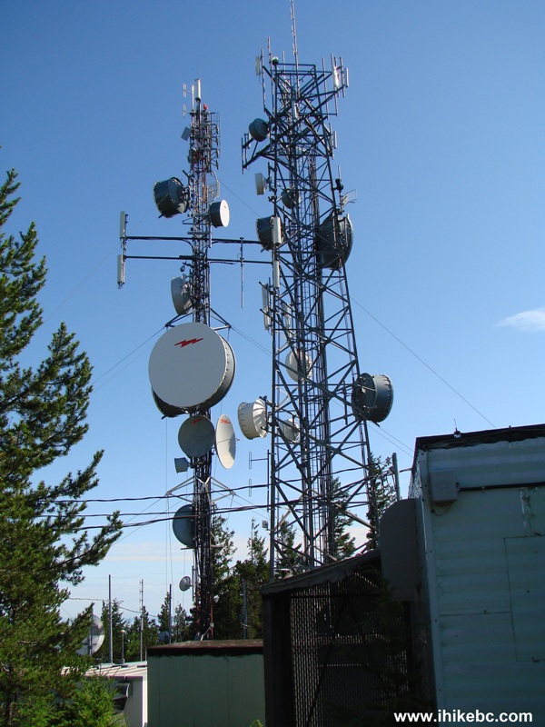
20. In about ten minutes, we are there! Here is the promised technological debris.
Antennas on Mount Gardner Bowen Island BC Canada
21. But, wait, there is more.
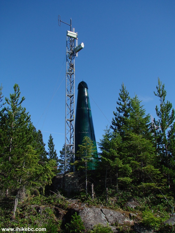
Antennas On Mount Gardner Bowen Island Canada
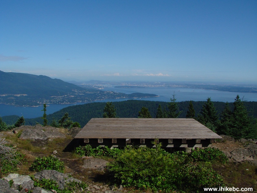
22. There are two helicopter pads at the North Summit, with the first one allowing to observe Metro Vancouver, and the other one facing Vancouver Island. They are also great for dropping down and taking a rest after an exhausting hike.
Helicopter Pad on Top of Mount Gardner BC Canada
23. Let's start with Metro Vancouver mainland, and go left to right.
View from North Summit of Mount Gardner British Columbia Canada
24. Those mountains up close. Big zoom.
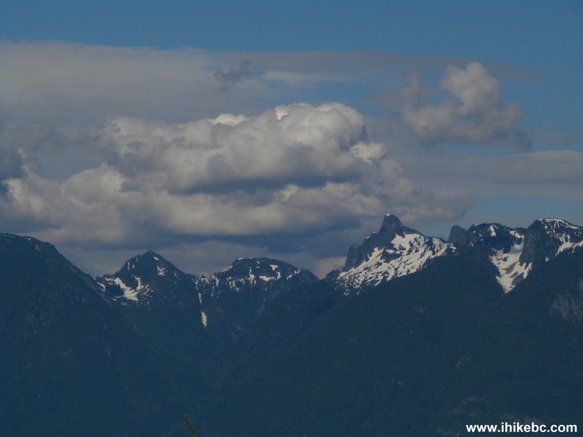
Mountains Seen from North Summit of Mount Gardner on Bowen Island BC
Canada
25. Slightly to the right now. Snug Cove (Bowen Island) is seen in the middle of the photo. No zoom.
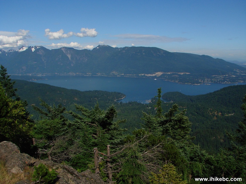
Snug Cove Seen from North Summit of Mount Gardner BC Canada
26. We zoomed in a bit later to check out Queen of Capilano ferry arriving to Bowen Island.
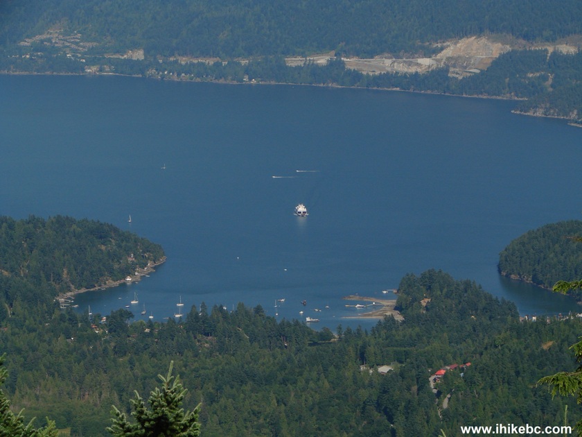
Queen of Capilano BC Ferry Seen From Mount Gardner Bowen Island BC Canada
127. A bit more to the right. That's West Vancouver far ahead. No zoom.
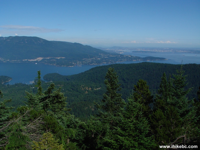
West Vancouver Seen from the North Summit of Mount Gardner BC Canada
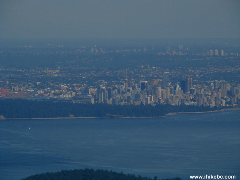
28. Using some zoom now. Same area. West Vancouver's Lighthouse Park is in the middle of the photo. Vancouver is seen far ahead.
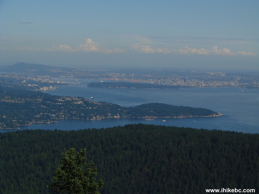
Lighthouse Park and the City of Vancouver Seen from Mount Gardner on
Bowen Island BC Canada
29. Yet more to the right and with a 12x zoom we see Lions Gate Bridge and a bit of Stanley Park on the right side.
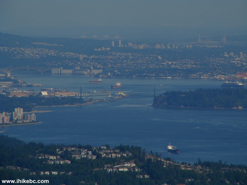
Lions Gate Bridge and Stanley Park seen from Mount Gardner Bowen Island British Columbia
Canada
30. Same zoom and even further to the right we see the rest of Stanley Park, as well as downtown Vancouver.
Stanley Park and Downtown Vancouver View from Mount Gardner Bowen Island BC
Here is our video of Metro Vancouver from the North Summit of Mt. Gardner:
More ihikebc videos are on our YouTube Channel.
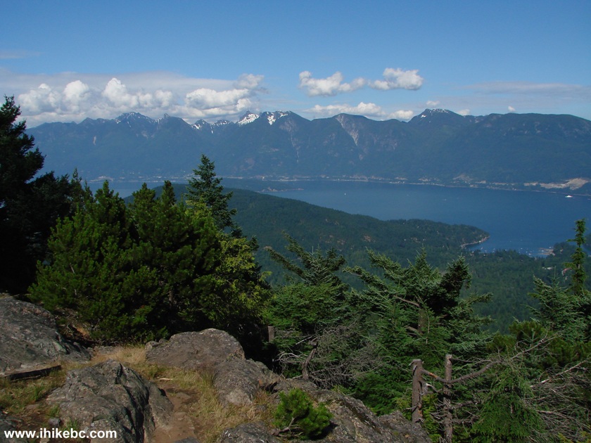
31. Now from the other helicopter pad and looking the other way we see Vancouver Island. No zoom.
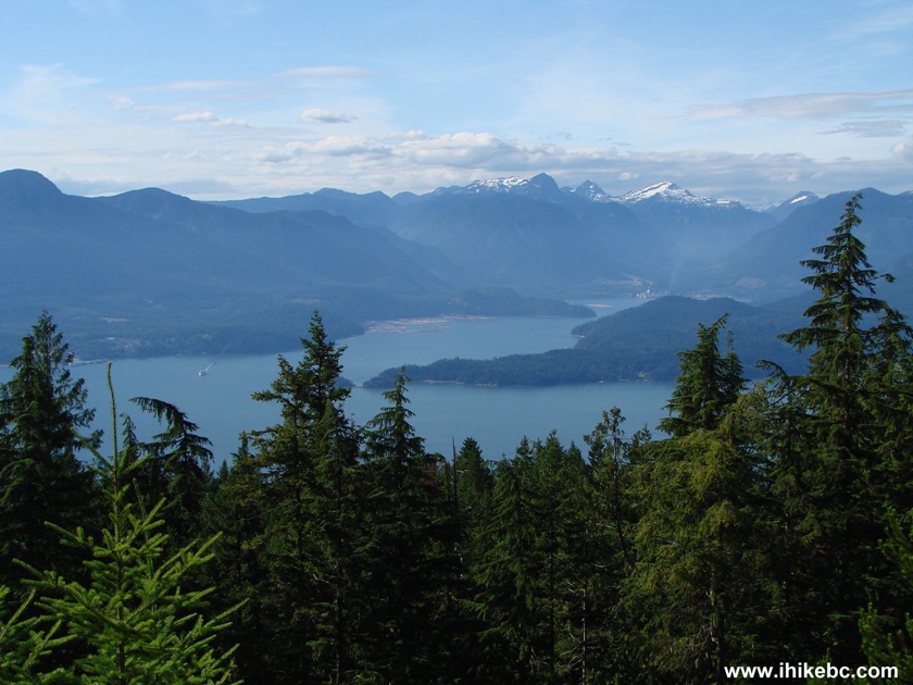
View of Vancouver Island from Mount Gardner BC Canada
32. When going back, you can either return the same way you came, or complete a loop by taking a trail located at the end of all those buildings on top of the mountain. Here is the beginning of that trail.
Mount Gardner Trail
Mount Gardner Trail: one of the hardest to navigate, but great views from the top of the North Summit.


|
 |
Other Trips:


![]()


![]()
![]()
![]()
Follow @ihikebc Tweet
ihikebc.com Trip 052 - Mount Gardner Trail Hike (Bowen Island, BC) Page 2 of 2