![]()
![]()
![]()

Trip 321 - September 13, 2024 (Friday)
South Chilcotin Mountains Provincial Park Visit
Near Gold Bridge, BC
Page 3 of 3
Liked: Numerous great mountain and valley views, shade in the forest on the access road, not terribly difficult trails, no bugs.
Vancouver, Coast & Mountains Backroad Mapbook (2019 edition) Park Coordinates : Page 51 (Gold Bridge) B1.
Related Website: South Chilcotin Mountains Provincial Park - BC Parks Official Website.
Follow @ihikebc TweetSouth Chilcotin Mountains Provincial Park is a huge remote park located near the settlement of Gold Bridge, closer to the end of BC Highway 40, which starts 90+ km earlier in Lillooet. There are numerous long trails in the park, and we hiked a small portion of those in the south-eastern corner. To see much more than that one would have to prepare to spend at least one night camping, while we did a day trip, which consisted of hiking a part of High Trail, then Camel Pass Trail, and, finally, Ridge-O-Rama trail to complete the loop.
There were panoramic mountain views everywhere, looking impressive even despite a cloudy day. With the sun out, it would be even more impressive. What was surprising were several motorcycle tracks along our entire route, even where it was rather dangerous. We later learned that this area is popular with mountain bikers, but those tracks were certainly from a motorcycle. So, watch out while hiking in this mountainous area, lest you be run over by a motorcycle! Please, note that only hikers, horse riders, and bicycle riders are allowed in the park.
There are several access point to South Chilcotin Mountains Provincial Park, and we used the one off Tyaughton Lake Road, which begins off BC Highway 40 about 12 kilometers East of Gold Bridge. There are no signs leading to the park, and several not-so-obvious turns, so check out our photo directions, as well as a video of the drive from Highway 40 to Cinnabar Mining Road, which leads to High Trail trailhead.
* All trail distances are based on a GPS odometer and are approximate.
60. Here we are at the 1.06 km mark of Ridge-O-Rama Trail. Completing the loop towards Cinnabar Mining Road.
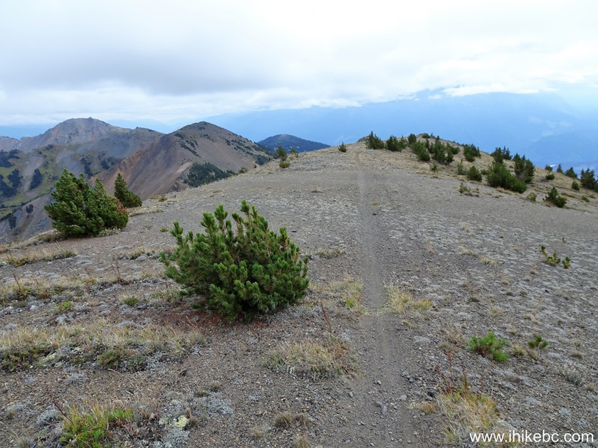
Ridge-O-Rama Trail - South Chilcotin Mountains Provincial Park - British
Columbia - Canada
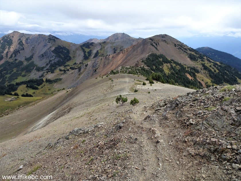
61. Looking right at 1.19 km.

Hiking in South Chilcotin Mountains Provincial Park
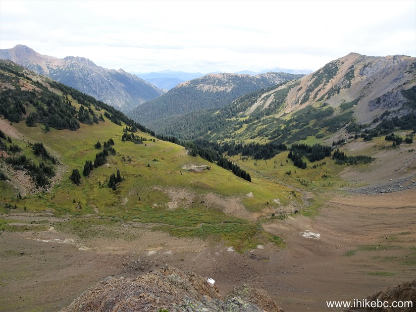
62. At 1.25 km with a slight zoom.

British Columbia Mountains in
South Chilcotin Mountains Provincial Park
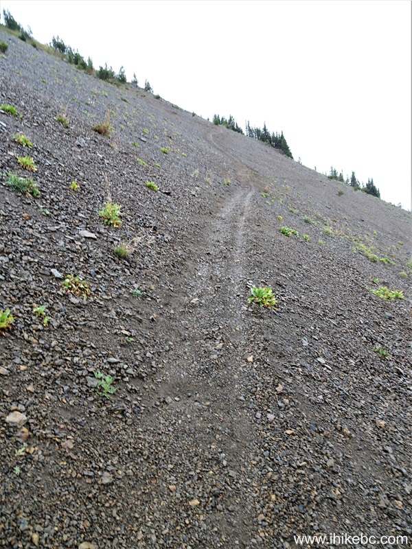
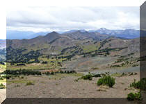
63. Looking back at 1.28 km of Ridge-O-Rama Trail. The wind finally stopped after we started descending.

British Columbia Hiking in
South Chilcotin Mountains Provincial Park - Ridge-O-Rama Trail
64. Looking forward from about the same spot.
Ridge-O-Rama Trail Hike near Gold Bridge BC Canada
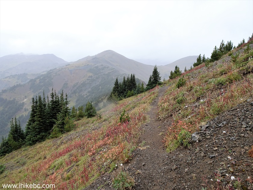
65. Looking left at the 1.70 km mark of Ridge-O-Rama Trail in South Chilcotin Mountains Provincial Park, British Columbia, Canada.
South Chilcotin Mountains Provincial Park British Columbia Canada
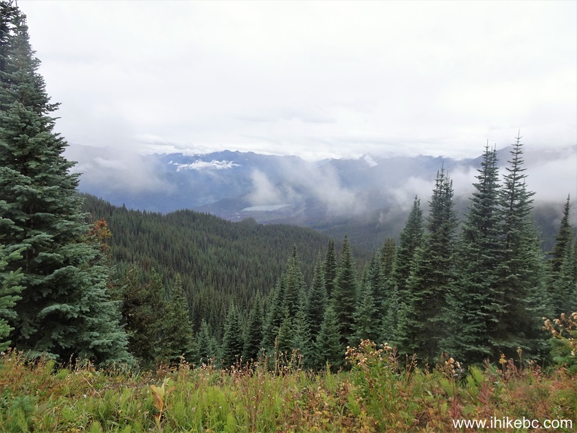
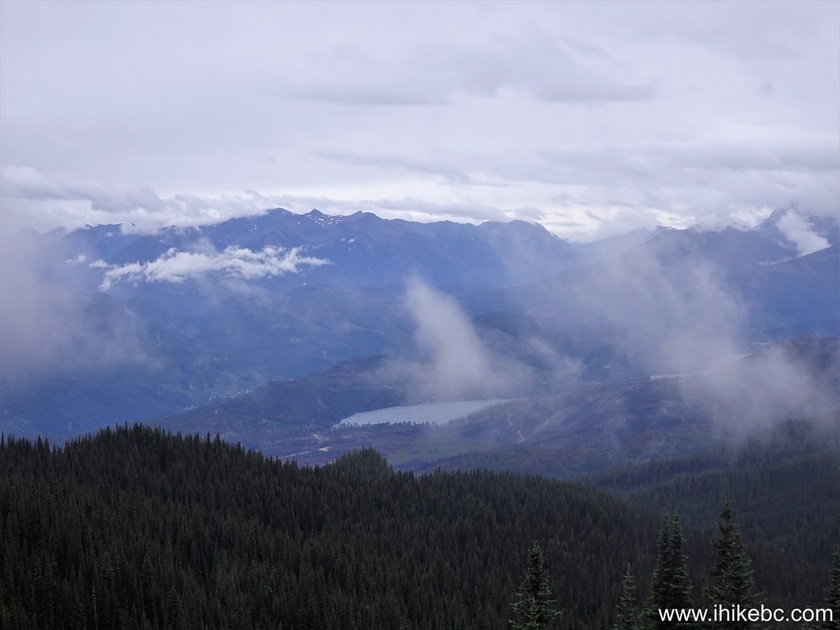
66-67. At 1.89 km, dark clouds are on the horizon. Plain and zoomed.

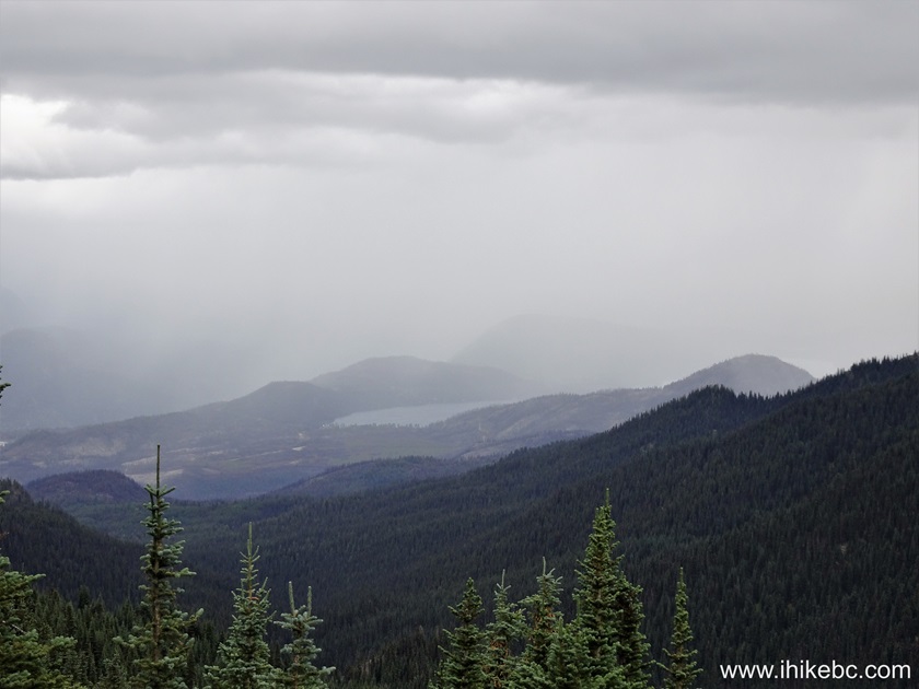
Cloudy weather in
South Chilcotin Mountains Provincial Park
68. And then we got hit by light rain. At 2.28 km here.
South Chilcotin Mountains Provincial Park near Gold Bridge BC
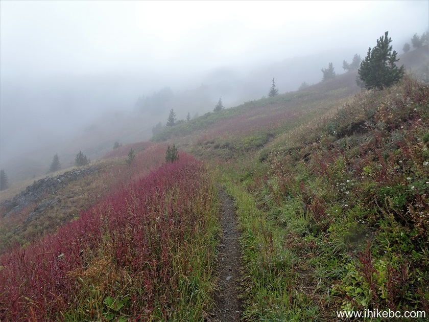
69. At 2.32 km, we are hiking though a neat stretch of colourful mountain plants.
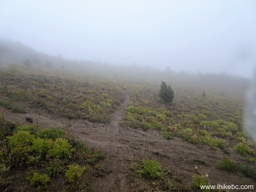
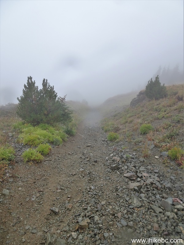
70. Quite foggy at 2.65 km of Ridge-O-Rama Trail. This is where a GPS proved to be very useful, as a path was, at times, hard to follow.

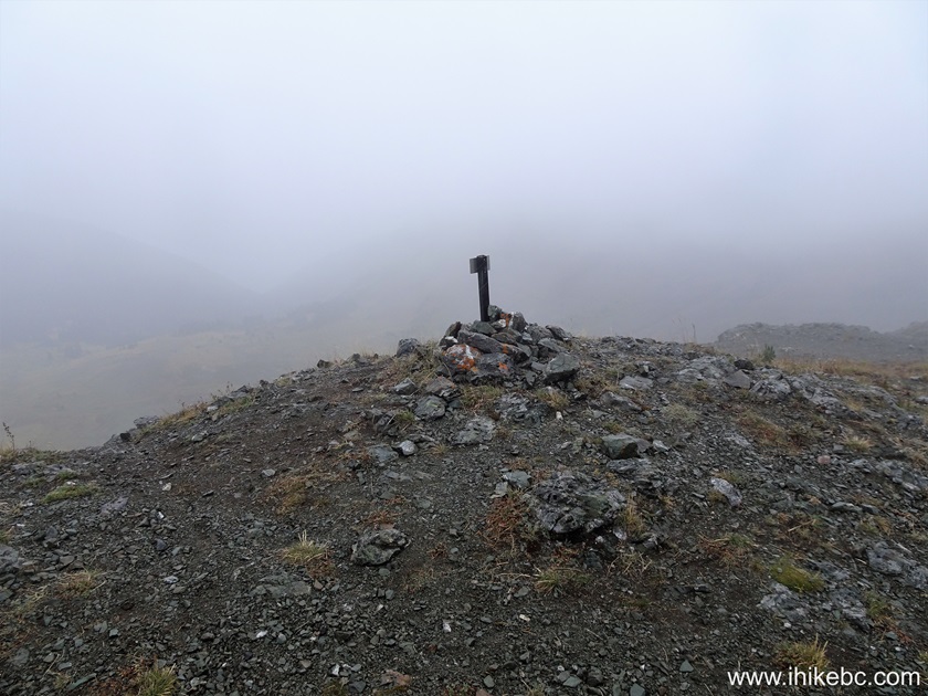
71. Just around here, at the 3.17 km mark, things got even more complicated due to heavy fog and several unmarked intersecting trails. Coordinates: N 50⁰57.964' W 122⁰49.516'. Elevation: 2,155 meters. The sign ahead indicates the park name.
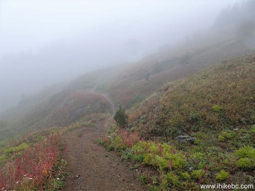
72. 50 meters after the sign, the trail is (sort of) still there.

73. Fortunately, 420 meters after the sign we ran into what is likely Cinnabar Mining Road, as we turned to the right and ended up at the intersection of Cinnabar Mining Road and High Trail trailhead (from where we started the loop) 2.1 kilometers later. As you can see, this is an absolutely unmarked intersection, and a GPS saved the day, since we knew we had to turn right to get to the start of the loop. Coordinates: N 50⁰57.808' W 122⁰49.306'. Elevation: 2,140 meters.
South Chilcotin Mountains Provincial Park inclement weather
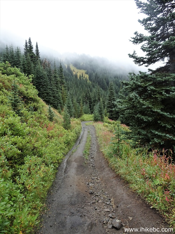
74. Cinnabar Mining Road 120 meters after the intersection.
75. At 320 meters, pretty plants galore.
76. 70 meters later.
South Chilcotin Mountains Provincial Park
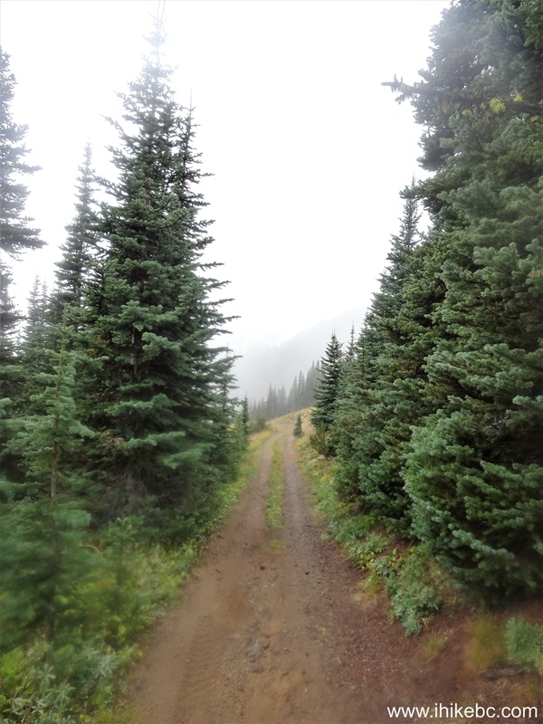
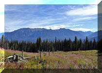
77. Briefly going through a stand of trees 920 meters from the intersection.
78. 440 meters later.

79-80. Looking at a lake far ahead on the left side. Plain and zoomed.
British Columbia, Canada
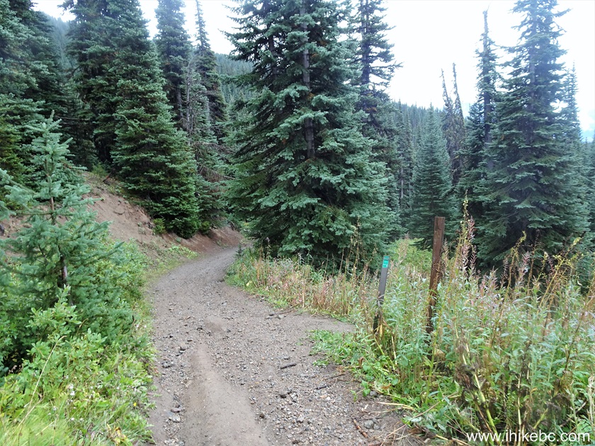
81. Close to two kilometers after the intersection, we are approaching the start of the loop.
South Chilcotin Mountains Provincial Park - Cinnabar Mining Road near
Gold Bridge BC
82. And, 2.17 km after the intersection, the loop hike is over. We started the High Trail on the right side. Straight ahead is 5.5 km of rough Cinnabar Mining Road back to the parking area. Of course, your high-clearance, short wheelbase 4x4 would be parked nearby. If we recall correctly, there is a good parking spot just downhill from here.
Cinnabar Mining Road at High Trail Trailhead in
South Chilcotin Mountains Provincial Park
Even though we hiked just a small part of South Chilcotin Mountains Provincial Park, there is no doubt that this is a great hiking destination. Highly recommended.


|
 |
Other Trips:


![]()
![]()
![]()
ihikebc.com Trip 321 - South Chilcotin Mountains Provincial Park Visit
(near Gold Bridge, BC) Page 3 of 3