![]()
![]()
![]()

Trip 306 - May 6, 2024 (Monday)
Coastline Trail Hike
Ruckle Provincial Park
Salt Spring Island, BC
Page 1 of 2
Liked: Several fine coastline/ocean views, fairly easy trail, shade in the forest, no bugs.
Of Note: Uneven ground, rocks and roots, several unbarricaded drop-offs, a few moderately steep sections – hiking poles and boots are recommended.
Vancouver Island, Victoria & Gulf Islands Backroad Mapbook (9th edition) Trailhead Coordinates: Page 11 (Duncan) G3.
Follow @ihikebc TweetCoastline Trail is a fairly easy hike of about 5.3 km one way along the coast of Salt Spring Island. You get to see pretty coves, passing BC ferries, and ocean vistas while walking through a forest from one viewpoint to another. Ruckle Provincial Park has a few other trails, which go into the depth of the park away from the coast, so there are more hiking opportunities. As well, there is a campground for campers among us.
The drive from Fulford Harbour ferry terminal (service to Swartz Bay on Vancouver Island) to Ruckle Provincial Park - Coastline Trail is just under 10 km-long one way, and is very easy. There is plenty of parking by the trailhead. Note that there are two other ferry terminals on Salt Spring Island, with service from other locations, so you will take a bit longer to get to the trailhead, if you arrive to this island via a different ferry terminal.
The trail starts about 70 meters from the parking lot and goes along Swanson Channel to Cusheon Cove. Keep making right turns at all the splits to stay close to the coast. There are trail maps with your current location at some junctions too.
* All hiking distances are based on a GPS odometer and are approximate.
0. Here are Google Map directions from Fulford Harbour to Ruckle Provincial Park.
1. We have disembarked from BC Ferry "Skeena Queen" at Fulford Harbour Terminal, drove for a few minutes on Ganges-Fulford Road, and are about to make a right turn onto Beaver Point Road.

Salt Spring Island Ganges-Fulford Road at Beaver Point Road
2. Entering Ruckle Provincial Park 8.6 km from Fulford Harbour Terminal.

Entrance to Ruckle Provincial Park on Salt Spring Island BC Canada
3. Passing by a working farm at 9.3 km.
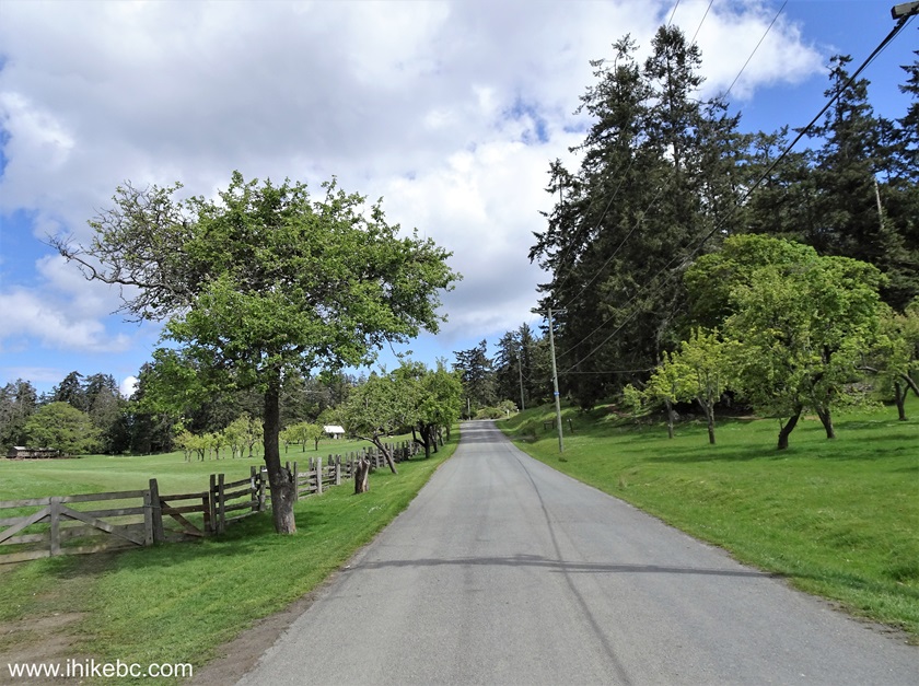
Salt Spring Island
4. A view on the left 100 meters later.
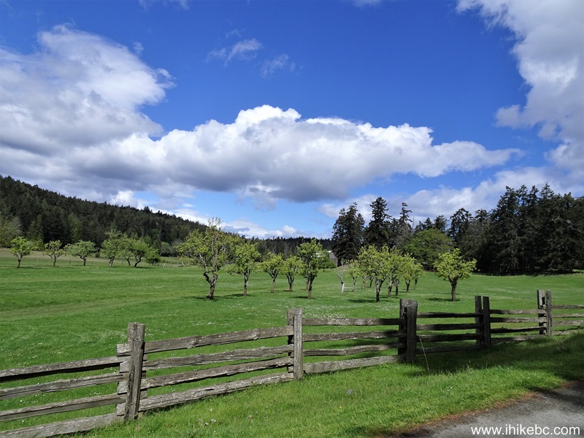
A farm on Salt Spring Island BC
5. At 9.7 km, there is a split, with access to Ruckle Provincial Park campground on the right side, and trailhead parking being straight ahead.

Ruckle Provincial Park
6. A hundred meters later, the road ends at the parking lot for Coastline Trail. Coordinates: N 48⁰46.435' W 123⁰22.318'. Elevation: 20 meters.
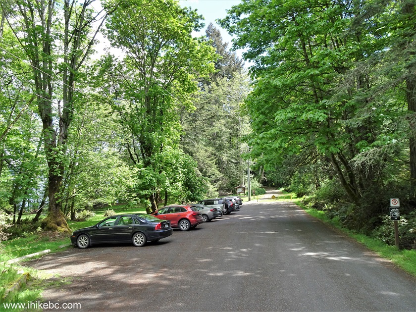
Parking lot for Coastline Trail in Ruckle Provincial Park on Salt Spring
Island BC
Here is our video of driving from Fulford Harbour ferry terminal to Ruckle Park.
More ihikebc videos are on our YouTube Channel.
7. An information board by the parking lot.

Ruckle Provincial Park Information Board
8-9. Information on the info board.
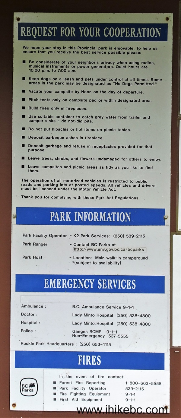
Ruckle Provincial Park Information
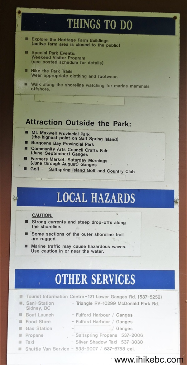
Things to do in Ruckle Provincial Park and Local Hazards
10. And here is a map of Ruckle Provincial Park. The red square indicates the parking lot / Coastline Trail trailhead, and the green square is where the trail ends 5.3 km later at Cusheon Cove. The trail itself can be seen following the coastline. Other park trails are shown as well.
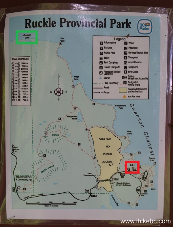
Ruckle Provincial Park map
11. Walking from the parking lot to the trailhead.

Ruckle Provincial Park - Salt Spring Island BC
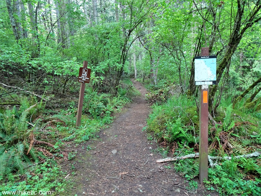
12. The trailhead for Coastline Trail is about 70 meters from the parking lot.
Hiking on Salt Spring Island - Coastline Trail - Ruckle Provincial Park
13. Canada - British Columbia - Salt Spring Island - Ruckus Provincial Park - Coastline Trail - 140 meter mark.
Salt Spring Island BC
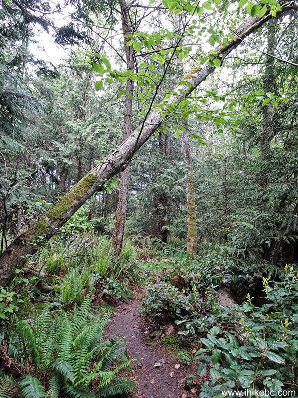
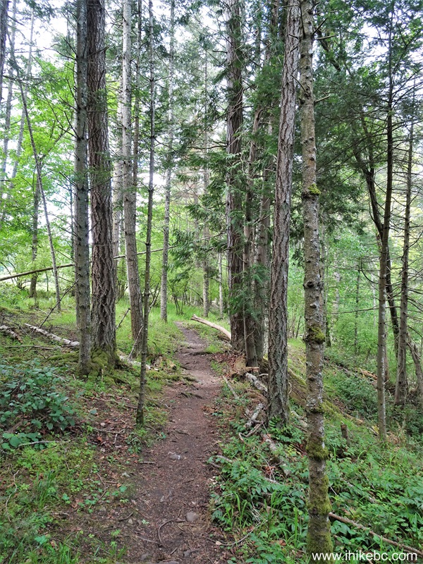
14. At 270 meters. You mostly hike through a forest with frequent clearings to see the views of the coast and of nearby islands.
Coastline Trail Hike on Salt Spring Island BC
15. At 300 meters from the trailhead.

Ruckle Provincial Park Hiking Coastline Trail
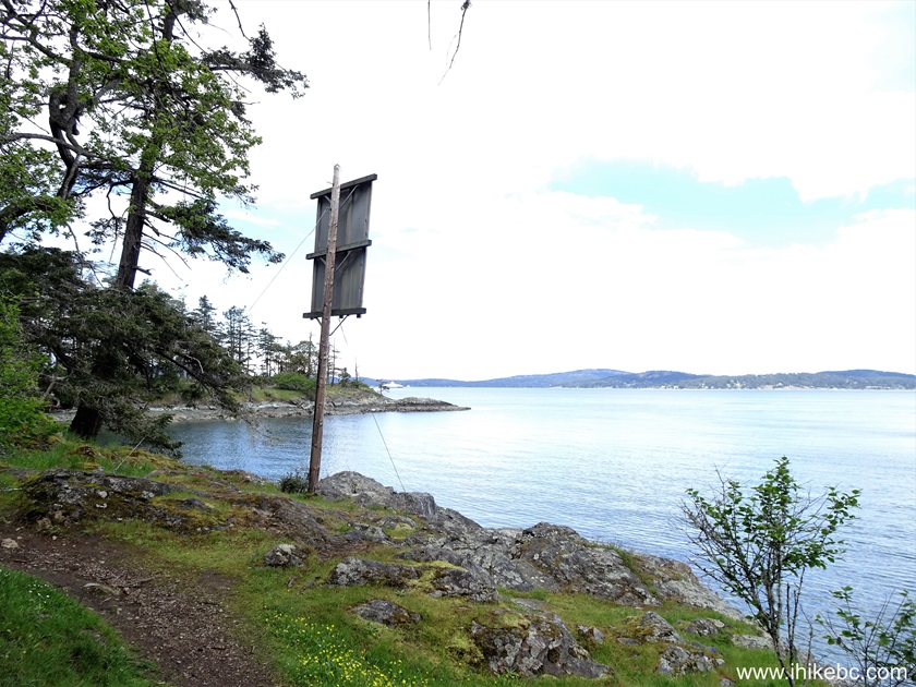
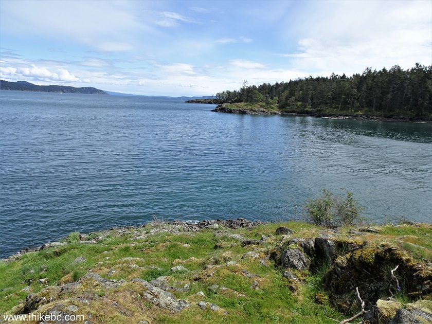
16. At 370 meters, a very fine view of Swanson Channel.
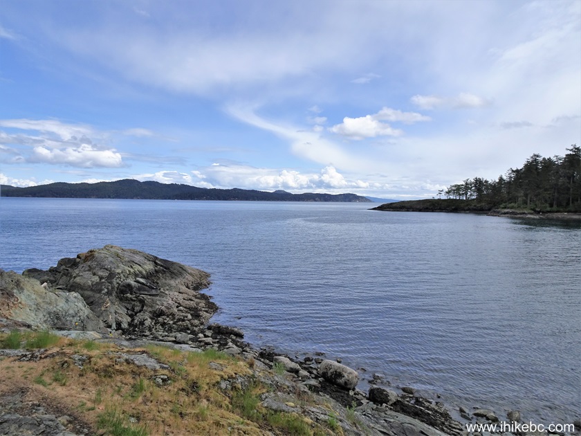
Swanson Channel by Salt Spring Island British Columbia
17. Hike a bit further...

Hike in Ruckle Provincial Park - Coastline Trail
18...and yet another good view arrives at the 420 meter mark of Coastline Trail.
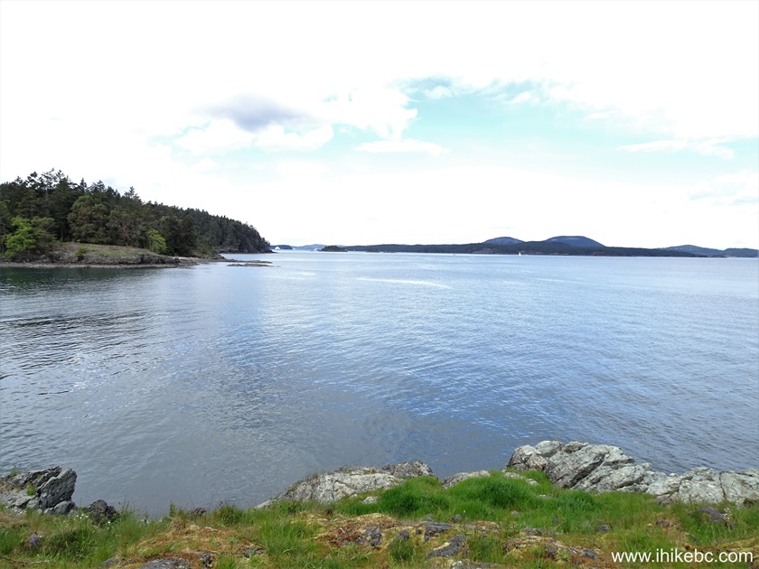
View from Coastline Trail on Salt Spring Island BC
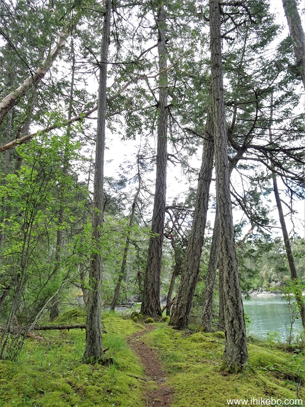
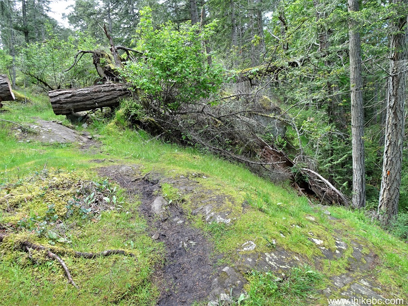
19. More forest hiking ensues.
British Columbia Hiking - Coastline Trail - Salt Spring Island
20. Another good view at 570 meters of the trail.
Salt Spring Island
21. At 670 meters, there is a substantial unmarked split. Keep right. Coordinates: N 48⁰46.612' W 123⁰22.449'. Elevation: 20 meters.
Coastline Trail in Ruckle Provincial Park Salt Spring Island British
Columbia
22. At 800 meters of Coastline Trail in Rucker Provincial Park on Salt Spring Island.
Hike in British Columbia in Ruckle Provincial Park - Coastline Trail
23. A small bridge 50 meters later. The trail continues on the left side after the bridge.

Salt Spring Island - Ruckle Provincial Park - Coastline Trail
24. But we turned right at first, and ended up at a cove 60 meters later.

Cove on Salt Spring Island
25. Continuing on Coastline Trail (to the left after the bridge in photo #23). At 960 meters here.

Coastline Trail on Salt Spring Island BC
26. Bear Cove arrives at 1.01 km from the trailhead.

Bear Cove Salt Spring Island BC Canada
27. 100 meters later.
Salt Spring Island BC
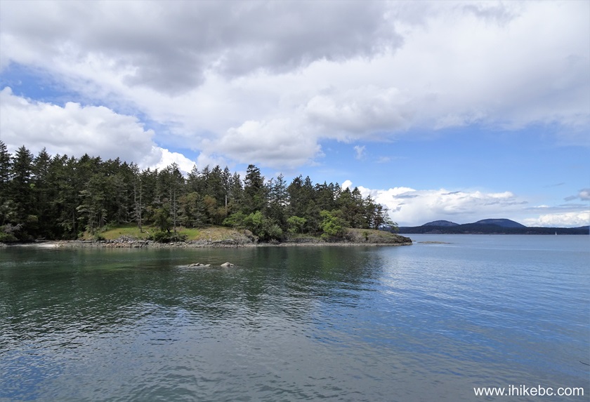
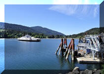
28. A fine view at 1.22 km of Coastline Trail.

View from Coastline Trail on Salt Spring Island BC Canada
Our Coastline Trail Hike trip report Continues on Page 2.


|
 |
Other Trips:


![]()
![]()
![]()
ihikebc.com Trip 306 - Coastline Trail Hike (Salt Spring Island, BC) -
Page 1 of 2