![]()
![]()
![]()

Trip 294 - August 30, 2023 (Wednesday)
Sidney Island Visit
Off Vancouver Island, BC
Page 2 of 3
Liked: Numerous fine shoreline views at the spit and the lagoon, many herons at the lagoon, shade in the forest, no bugs, interesting random mini-geysers at the spit (but see Of Note).
Of Note: Ferry service to Sidney Island (Sidney Spit) is seasonal, no fresh water on the island, noise from airplanes taking off from Victoria airport, from single engine aircraft, and from passing boats; random mini-geysers all over the place shooting up from the ground up to 1 meter high at the spit and occasionally hitting unsuspecting hikers, no shade at the spit. Lots of dirt and loose stones at the spit – hiking poles are recommended, and hiking boots are highly recommended (hiking boots are essential, if hiking through the mud by the lagoon).
Vancouver Island, Victoria & Gulf Islands Backroad Mapbook (9th edition) Town of Sidney Coordinates: Page 12 (Saturna Island) B6-B7.
Related Websites: Sidney Spit Ferry - Official Website, Sidney Spit Campground - Parks Canada.
Other Trips in Sidney BC Area: Town of Sidney Visit, Island View Beach Park visit.
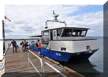
Follow @ihikebc TweetSidney Island is a camping and hiking destination located just east of Vancouver Island, across from the town of Sidney, BC. A small passengers-only (48 persons capacity) ferry Sallas takes 15 minutes and $25 per an adult round trip (online booking required both ways) to get from Port Sidney Marina in Sidney to Sidney Island, AKA Sidney Spit. The Spit is actually one part of the island's public access, and the other part is a 800 meter-long trail in the woods to a rustic campground, run by Parks Canada (reservations required).
About 1/3 of Sidney Island is open to the public, and the other 2/3 is fenced-off private property. There are buoys near the public dock where you can moor your boat for a daily fee, or you can also use the public dock itself. Fees for both the dock and the buoys apply after 3 PM.
There is no fresh water on Sidney Island, so bring your own. If you miss the last ferry, which leaves mid-afternoon, or do not have a booking and the last ferry is full, you would be stuck, so plan accordingly.
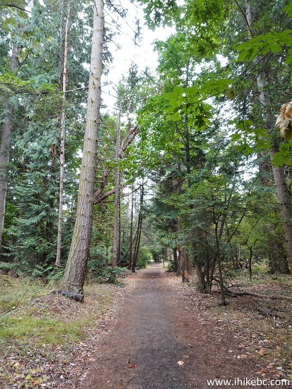
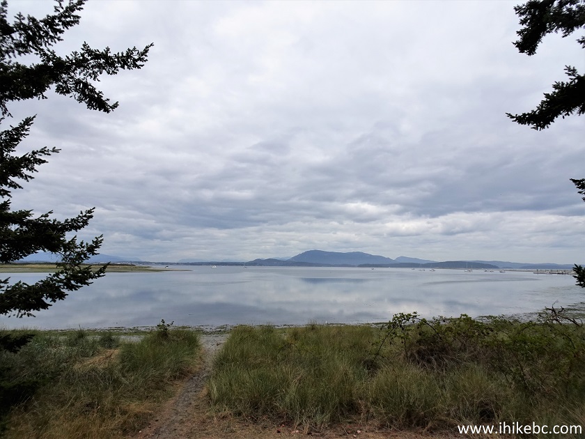
Hiking on The Spit is fun, as there many fine shoreline views, and the other fun part is guessing if you would get hit by the next burst from a mini-geyser which shoot up from the ground for up to 1 meter. We could not figure out what caused this phenomenon - living creatures or some underground water pressure issues, but this sure was unexpected and perplexing. The Spit is about 1.8 km long and is North (left) of the dock. The path to the campground is South (right) of the dock, and the nearest pit toilet is in that direction, about 150 meters away.
For the campers with a lot of belongings (water!) there are wheelbarrows near the dock which can be used to take your stuff for 800 meters to the campground. The path then goes beyond the campground and goes through the woods for about 1.6 km, hits the fence which indicates the end of public property, and then goes along the fence for another 300 meters or so until you reach the other side of the island, where you can hike for a few more kilometers to the Northern tip of the lagoon across from the public dock.
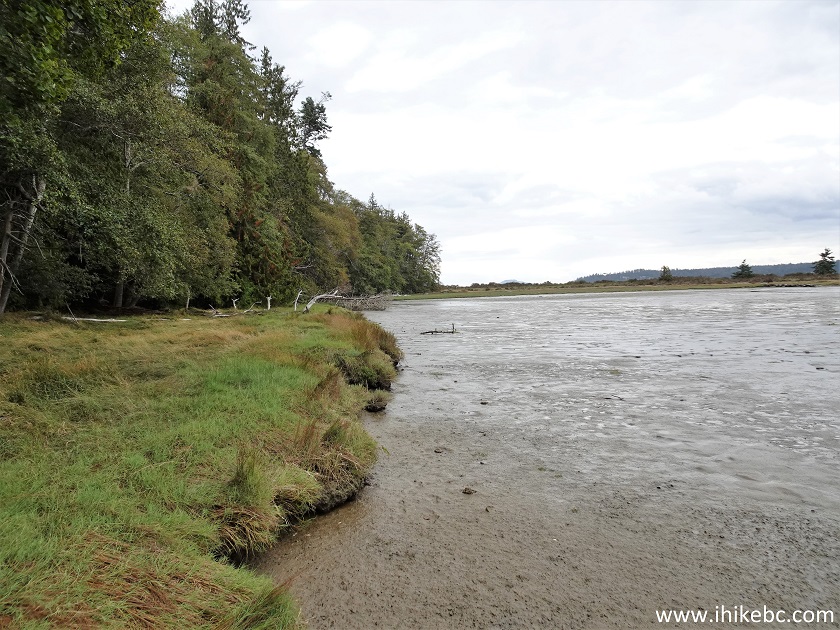
The trail in the woods actually runs along the lagoon, but you can't see it from the path. So, the only way to see interesting lagoon views is to hike on the lagoon itself, but it is quite muddy, so hiking boots would be essential there. Once you reach the southern end of the lagoon by a small Eagle Islet, the hike around the lagoon towards the northwestern tip of Sidney Island continues on the grassy shoreline, or you can cross over and hike along the beach - check out the attached map for a better understanding of the layout of the place.
* All hiking distances are based on a GPS odometer and are approximate.
35. We then completed the Spit hike by returning to the dock via the other side of the Spit. It's still a bit noisy due to airplanes taking off from Victoria International, and small planes and boats passing by, but a neat hike, nonetheless, due to all the fine natural views.
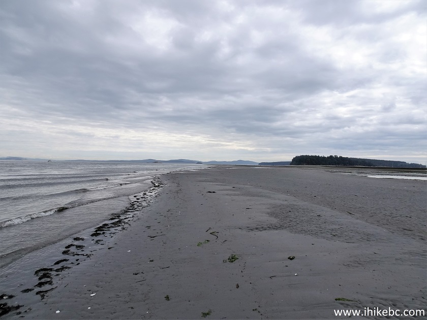
Sidney Spit
36. Returning to the dock.
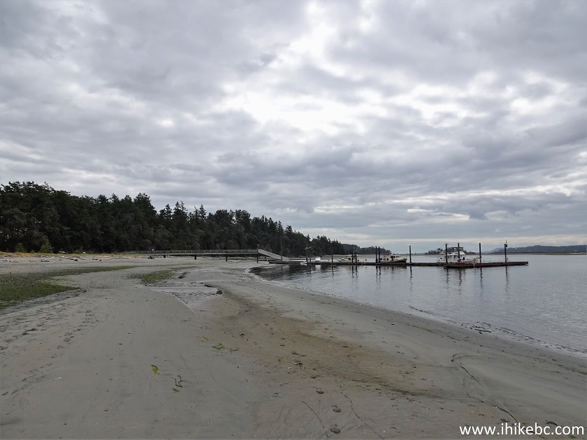
Sidney Island
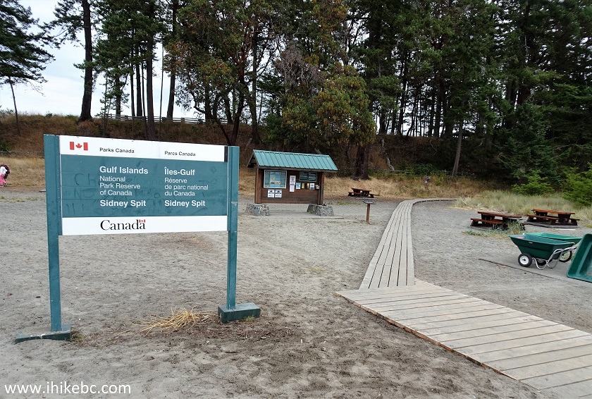
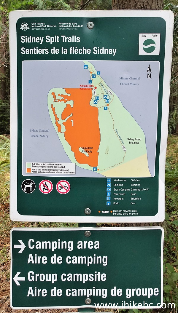
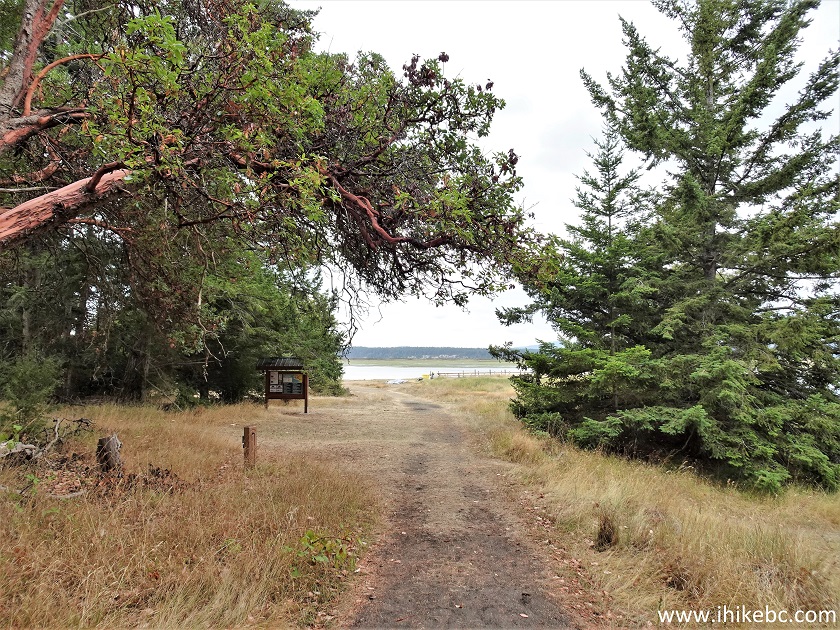
37. At the information stand again.
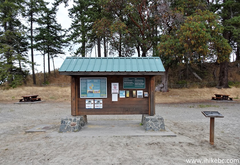
Sidney Island information stand
38. The map of the public portion of Sidney Island. We indicated the dock with a red square. To the left is Sidney Spit hike. To the right is a path to the campground (800 meters) and then a Lagoon Trail.
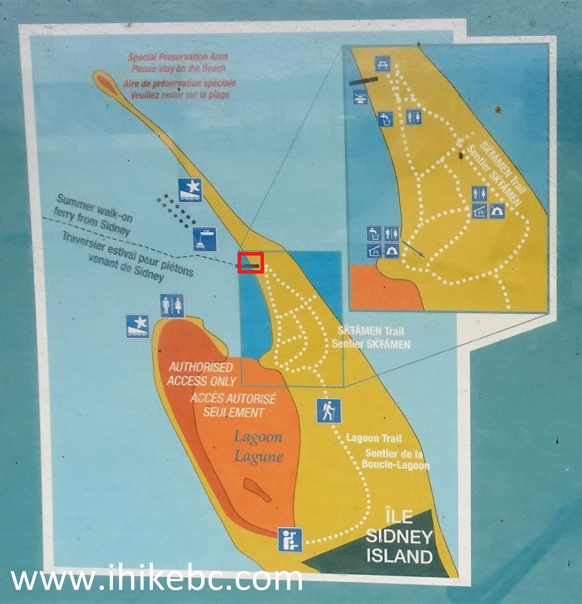
Sidney Island map
39. Let's go to the campground.
Gulf Islands National Park Reserve - Sidney Spit
40. 65 meters from the info stand.
Hiking on Sidney Island BC
41. At 150 meters, the pit toilets are to the left. There are more pit toilets at the campground. There are no garbage cans on Sidney Island, and no fresh water either.
Sidney Island hiking
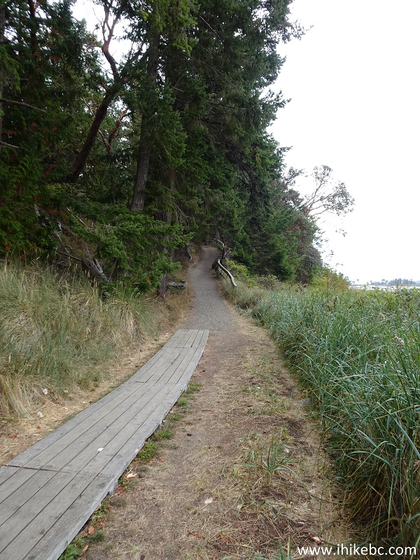
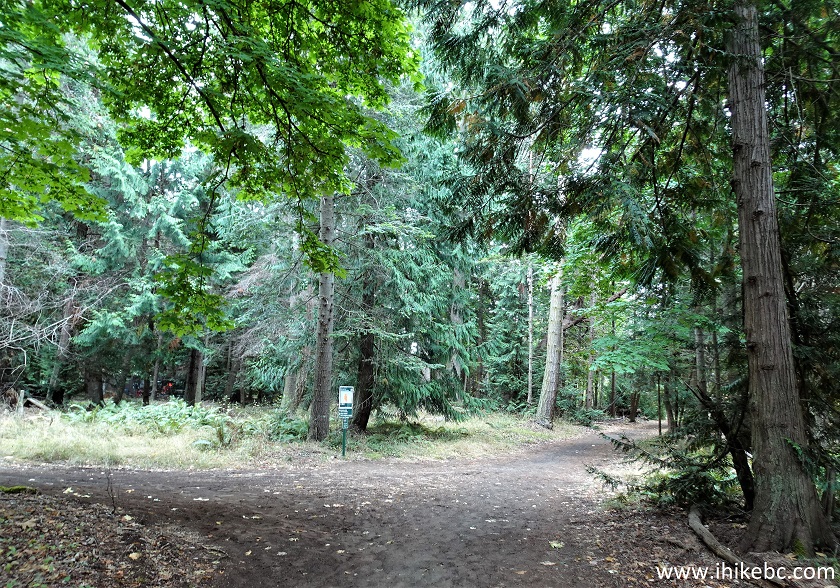
42. Sidney Island campground access trail at 170 meters from the dock. This trail is very easy.
Sidney Island path to the campground
43. At 310 meters there is a bench with a mostly obstructed view.
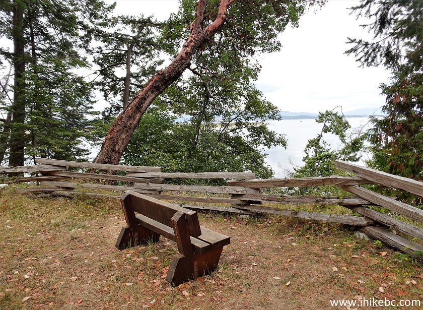
Bench on Sidney Island British Columbia Canada
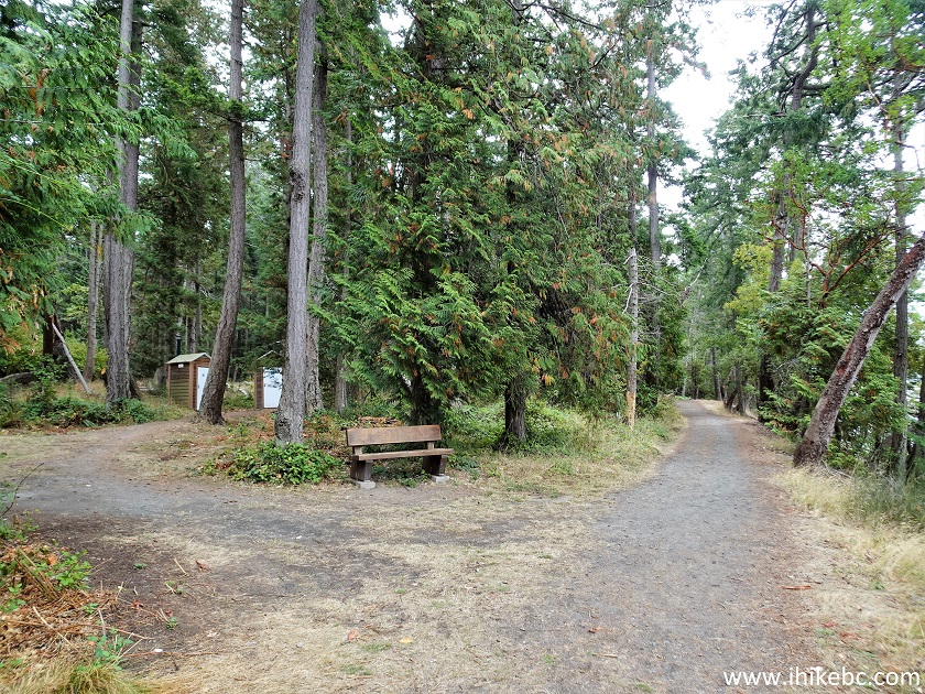
44-46. At 510 meters from the info stand there is a split. Group camping is to the left, and non-group camping is to the right.
Map of Sidney Spit Trails
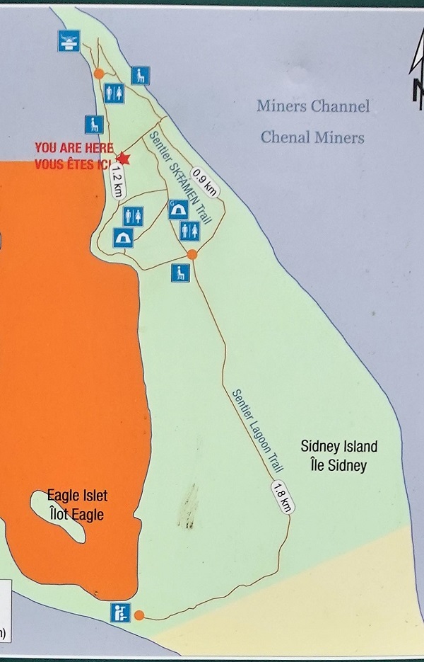
Sidney Island Lagoon Trail Map
47. We took the path to the right. At 515 meters.
Sidney Island Hiking British Columbia
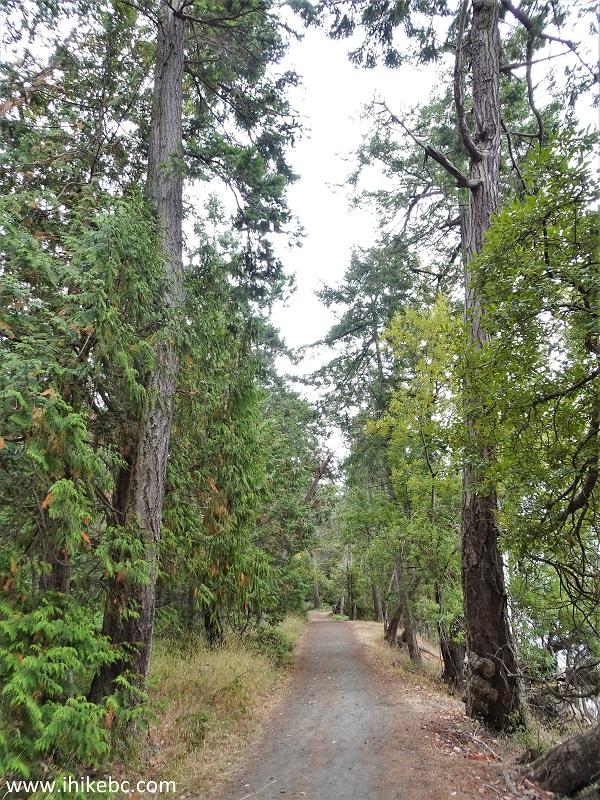
48. Approaching Sidney Island campground at 755 meters from the info stand.
British Columbia Sidney Island
49. Looking right.
View from Sidney Island BC
50. The map of Sidney Island campground.
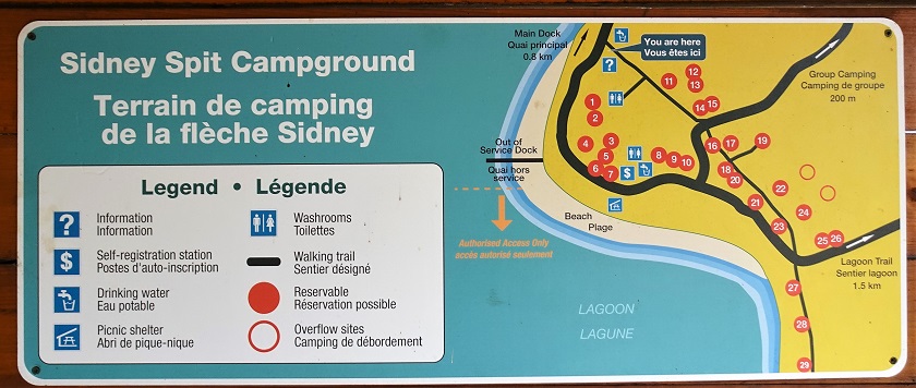
Sidney Island campground map
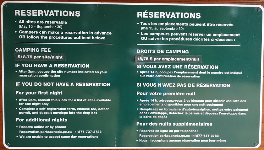
51. The rules of Sidney Island campground.
Sidney Island campground rules
52. One of the camping spots.
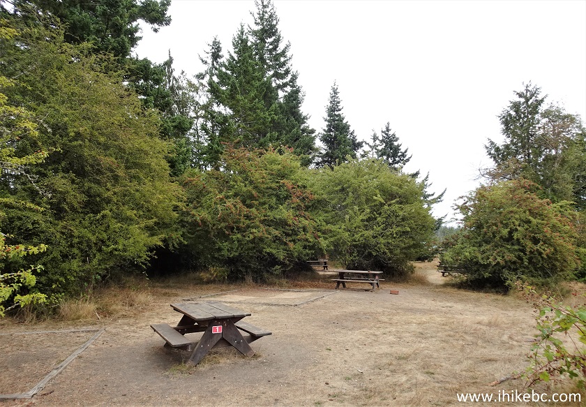
Sidney Island picnic tables
53. A lot of herons in the area. We saw at least four hanging out close to each other.
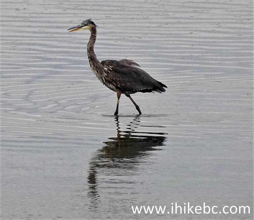
Heron
54. The path along the campground.
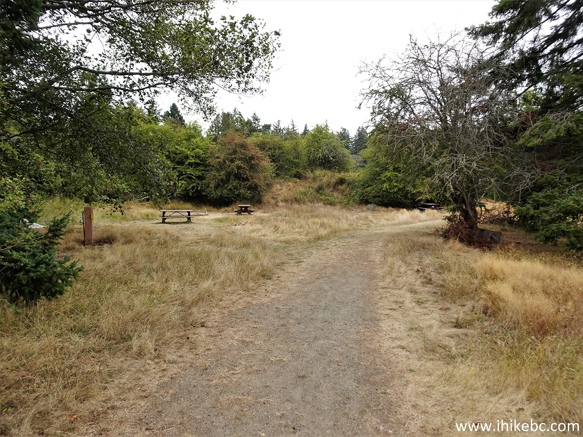
Path along Sidney Island campground
55. A campground gazebo.
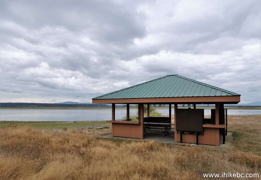
Sidney Island campground gazebo
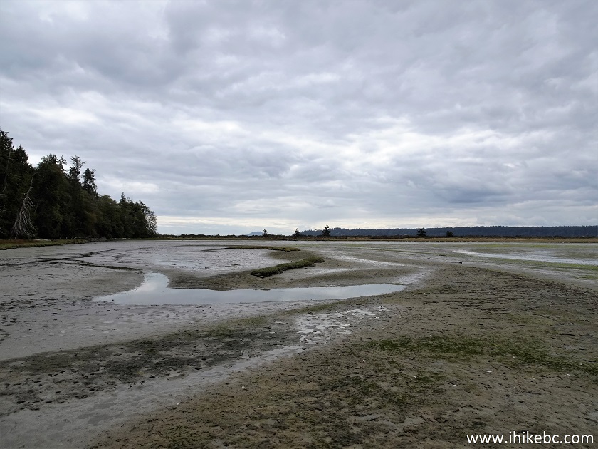
56. From here, the options are as follows - continue on the path past a few more camping spots while keeping the lagoon to your right, then hike through a forest, then make a right turn upon reaching a gate and a fence and hike along the fence towards the lagoon, then proceed on the opposite side of the lagoon on a route across and parallel to the campground path. Or, if you want to be closer to the herons, see the best views, and have proper boots, try hiking on the lagoon itself, though beware of mud. Here we are looking right while standing by the gazebo. This is the route we took on the side of all that water.
Sidney Island BC
57. At 140 meters from the gazebo.
Sidney Island British Columbia Canada
58. Looking back at 205 meters.
Hiking on Sidney Island BC
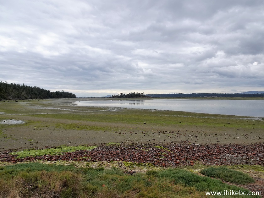
59. A neat view at the 1 km mark.
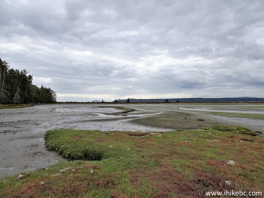
Sidney Island hiking
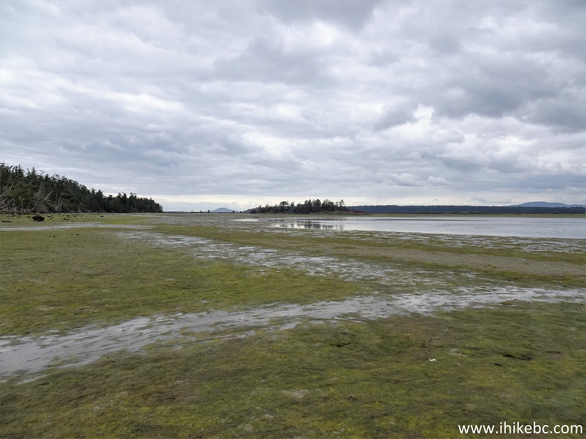
60. Looking back from the same spot.
Sidney Island hike
61. 20 meters later.
Hiking on Sidney Island in the province of British
Columbia
62. And Eagle Islet to the right.
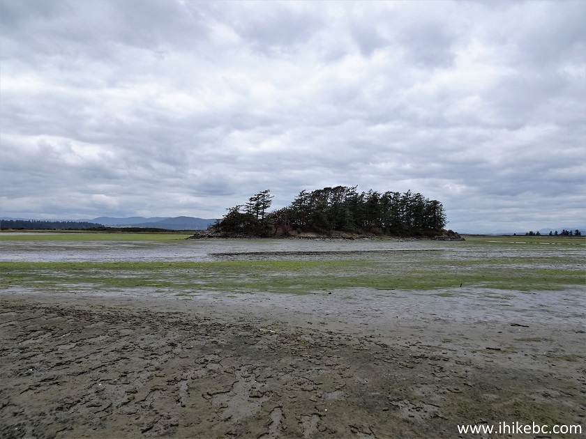
Eagle Islet
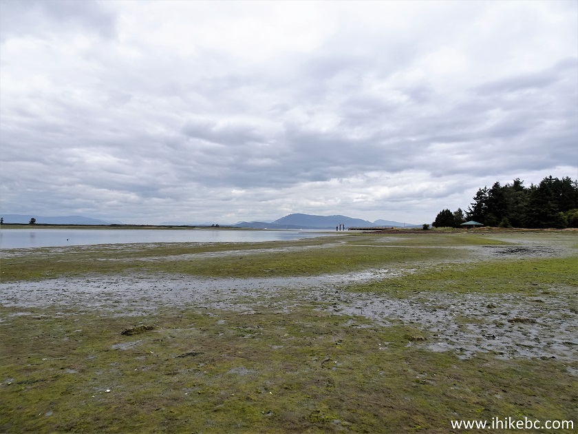
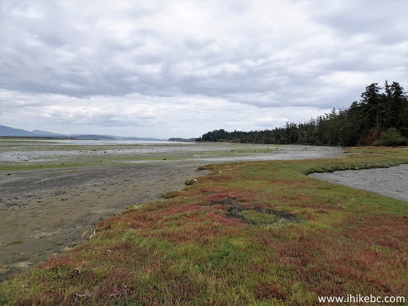
63. Now at 1.19 km from the gazebo.
Sidney Island off Vancouver Island BC
64. This is where mud got to be a bit of a challenge.
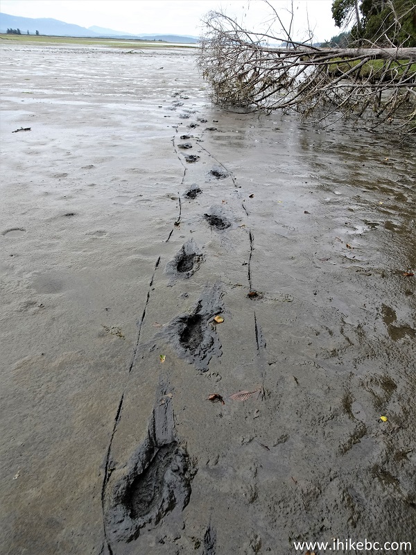
Mud on Sidney Island
Our Sidney Island Visit trip report Continues on Page 3.


|
 |
Other Trips:


![]()
![]()
![]()
ihikebc.com Trip 294 - Sidney Island Visit (Off Vancouver Island, BC) Page 2 of 3