![]()
![]()
![]()

Trip 268 - September 7, 2022 (Wednesday)
Smith River Falls Visit
Near Liard River BC
Of Note: 2.3 km-long access road is filled with potholes (regular clearance vehicles ok), parking lot may not be large enough for vehicles bigger than a full size pickup to turn around, several short steep stretches on the trail, hiking poles and boots are recommended.
Northern BC Backroad Mapbook (3rd edition) Coordinates: Page 89 (Coal River) D6.
Smith River Falls is a fine waterfall, more wide than tall, with an easy access off BC Highway 97 (Alaska Highway) 30 km North of Liard River and 345 km North of Fort Nelson. A gravel road full of potholes leads to a rather small parking lot 2.4 km from the highway. Any vehicle not larger than a full size pickup truck and with regular clearance should be able to get to the parking area and turn around.
The trail to Smith River Falls is rather steep, but has a very neat staircase, which takes care of much of that steepness. The trail is very short too, all of 300 meters one way, but, interestingly enough, the info board by the trailhead states that the round distance is 1.4 km, or 700 meters one way. Not sure what might have caused such a discrepancy.
Also, the toilet is still there, but it's boarded up pretty good. Finally, if you don't feel like hiking to the waterfall, a decent view of Smith River Falls can be had right from the parking lot.
*All trail distances are based on a GPS odometer and are approximate.
1. Here are Google Maps directions from Liard River, BC to Smith River Falls access road turnoff, located off BC Highway 97 (Alaska Hwy) about 30 km North of Liard River.
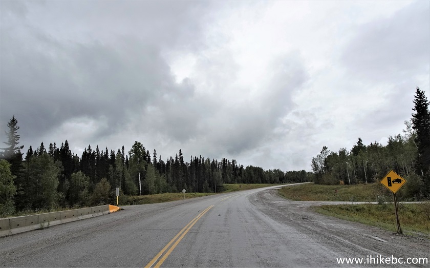
2. We are Northbound on BC Highway 97 (Alaska Hwy) approaching the turnoff to Smith River Falls access road.
BC Highway 97 (Alaska Hwy) North of Liard River BC
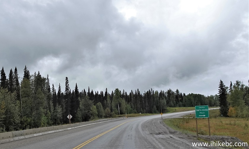
3. Here is the turnoff, 30 km North of Liard River, BC.
BC Highway 97 at Smith River Falls Access Road Turnoff
4. The access road to Smith River Falls is 2.4 km-long.

Smith River Falls Access Road near Liard British Columbia Canada
5. The access road features many potholes, with several being quite large.
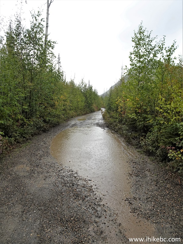
Potholes on Smith River Falls Access Road in Northern British Columbia
6. And here is Smith River Falls parking lot, 2.4 km from Highway 97. Coordinates: N 59°34.074’ W 126°27.721’. Elevation: 470 meters. Extra large vehicles may find turning around rather complicated, especially if other vehicles would already be parked here.
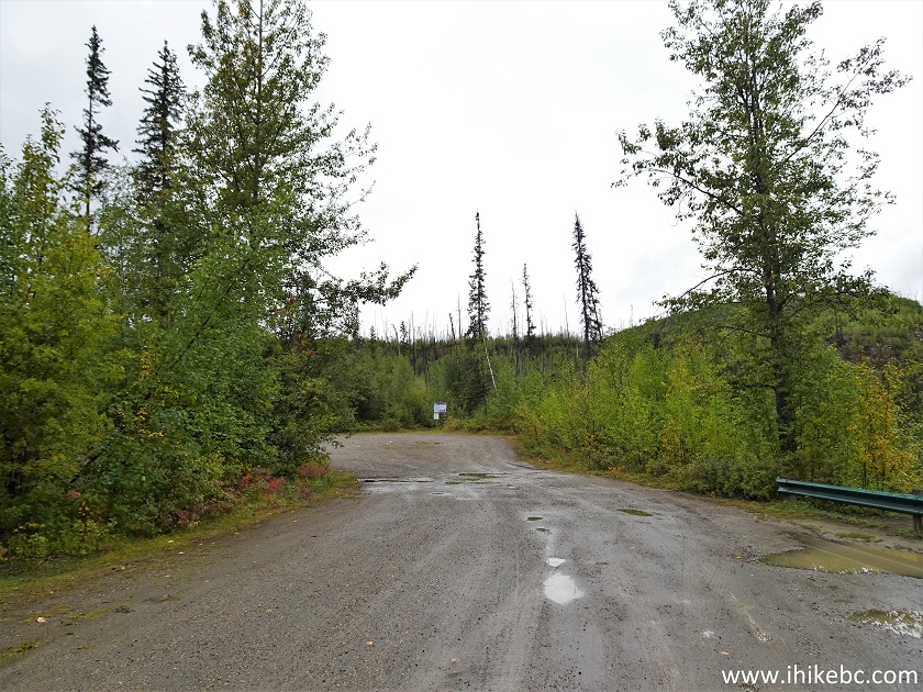
Smith River Falls Parking Lot
7. Smith River Falls can be observed right from the parking lot, where the railing is seen on the right side in the photo above.
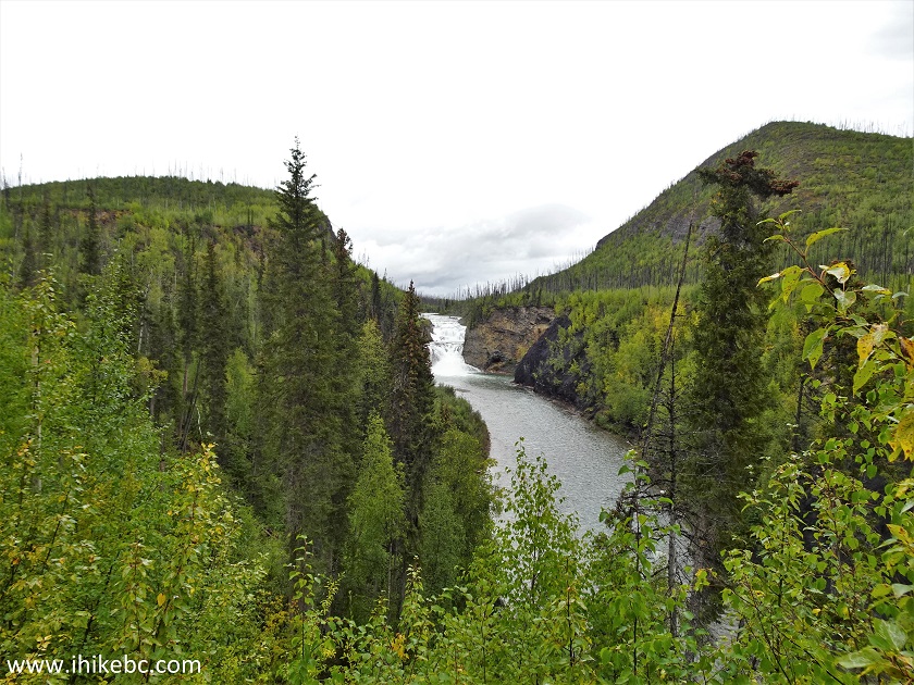
Smith River Falls in Northern British Columbia Canada
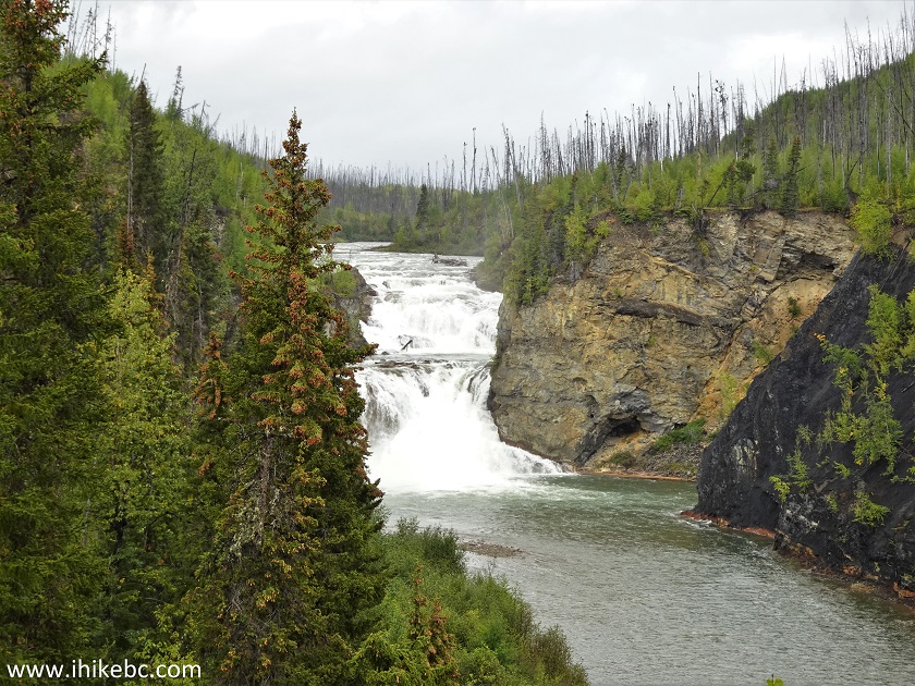
8-9. From the same spot with some and much zoom.
Smith River Falls

Smith River Waterfall
Here is our video of the views from this location.
10-13. An information board is located at the end of the parking lot, right by the trailhead.
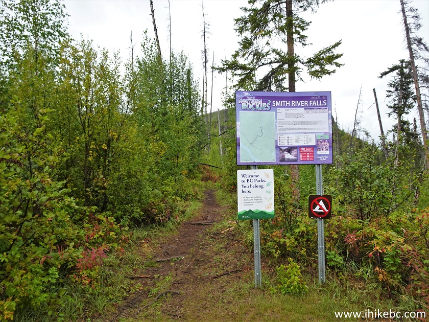
Smith River Falls Trailhead
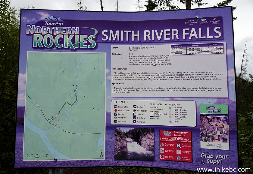
Smith River Falls Information Board
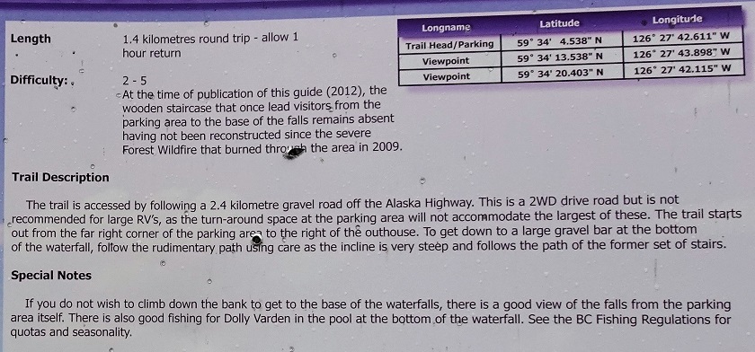
Smith River Falls Information
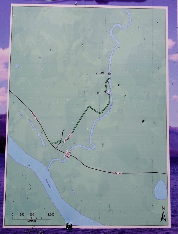
Smith River Falls Trail Map
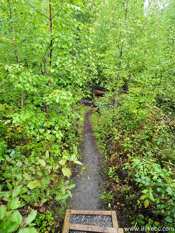
14. The short hike begins.
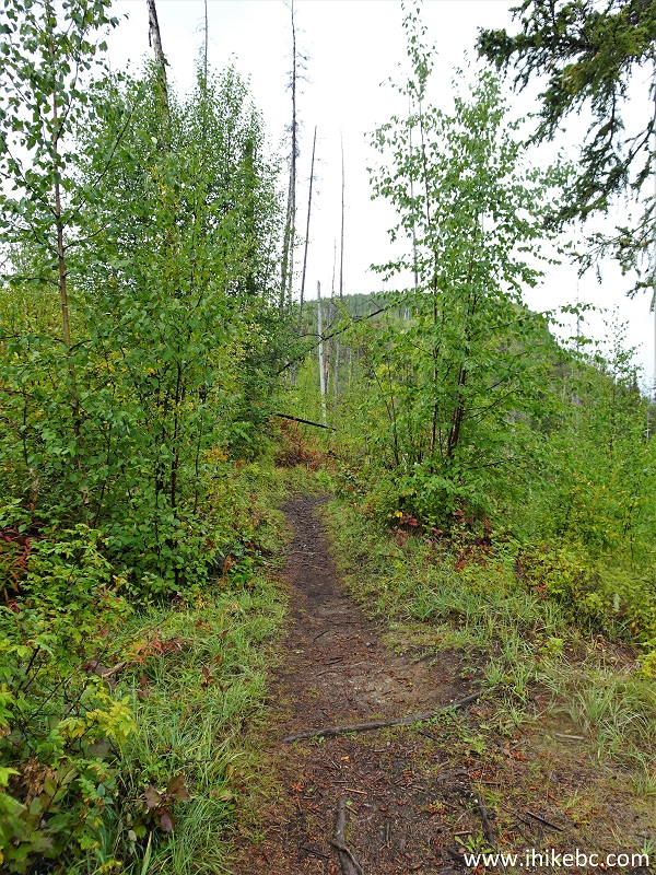
Liard River Hiking - Smith River Falls Trail
15. Just 20 meters later, there is a steep stretch referred to in the info board. Thankfully, a staircase has been placed in this location.
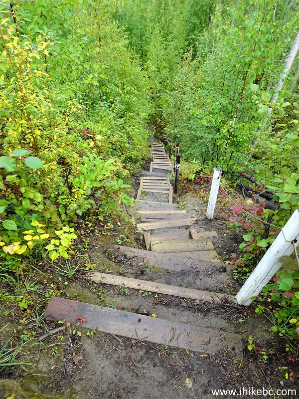
Smith River Falls Trail in Liard River BC Area
16. Another 20 meters, and we are at the bottom of the staircase.
Smith River Falls Hiking Trail in British Columbia Canada
17. Looking back up.
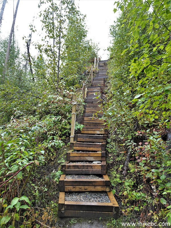
Smith River Falls Trail Staircase
18. Other than that, there is a small steep and slippery stretch, as seen on the way back.
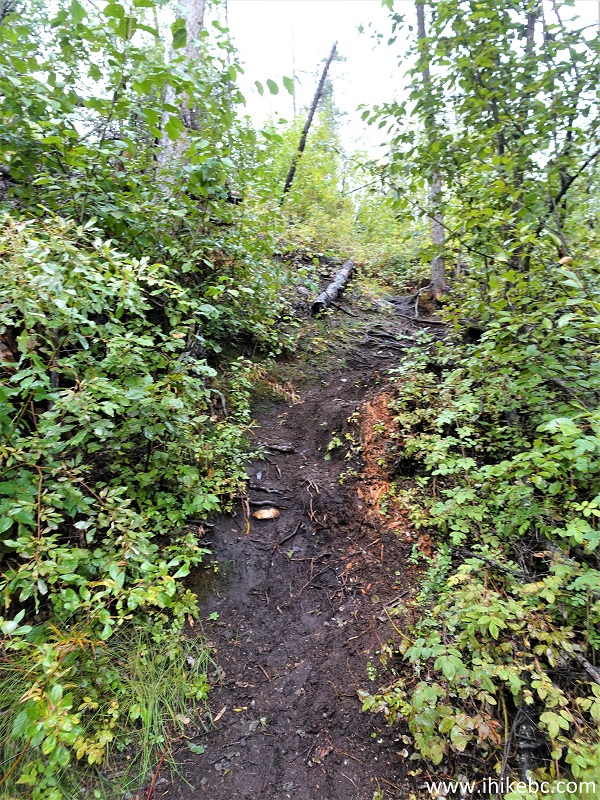
Smith River Falls Trail in British Columbia Canada
19. At 140 meters of the hike, we have reached Smith River.

Smith River Waterfall Hike in Northern British Columbia Canada
20. Looking back at 165 meters.
Smith River BC
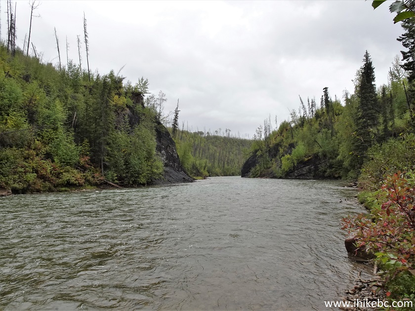
21. And, just 300 meters from the trailhead, we are at the end of the trail with Smith River Falls in front of us. Coordinates: N 59°34.201’ W 126°27.691’. Elevation: 457 meters. The river appeared too deep for wading, but, if one does not mind the swim, the waterfall is very close and appears to be quite approachable.
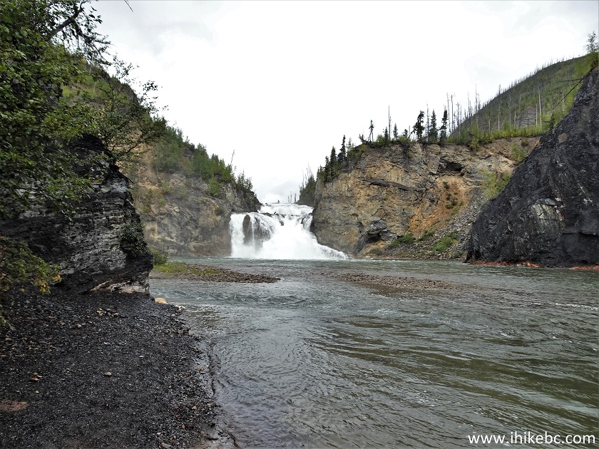
Smith River Waterfall British Columbia Canada
22. Now with a zoom.
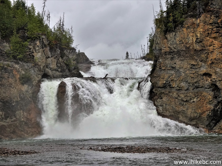
Smith River Falls
Here is our video of the views from this location.
More ihikebc videos are on our YouTube Channel.
23. Another natural attraction near Liard River are several herds of bison roaming by the highway.
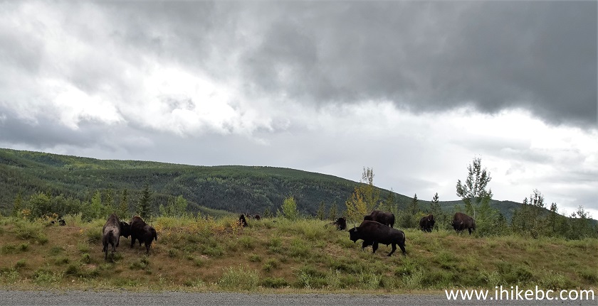
Bison
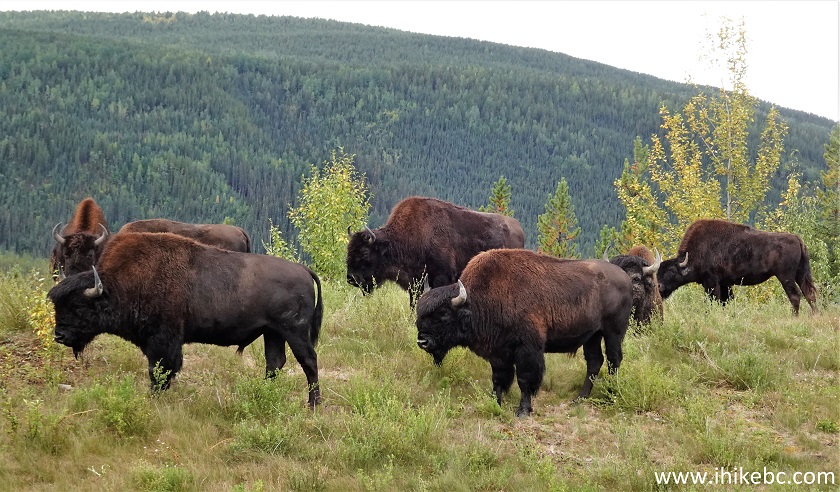
British Columbia Bison
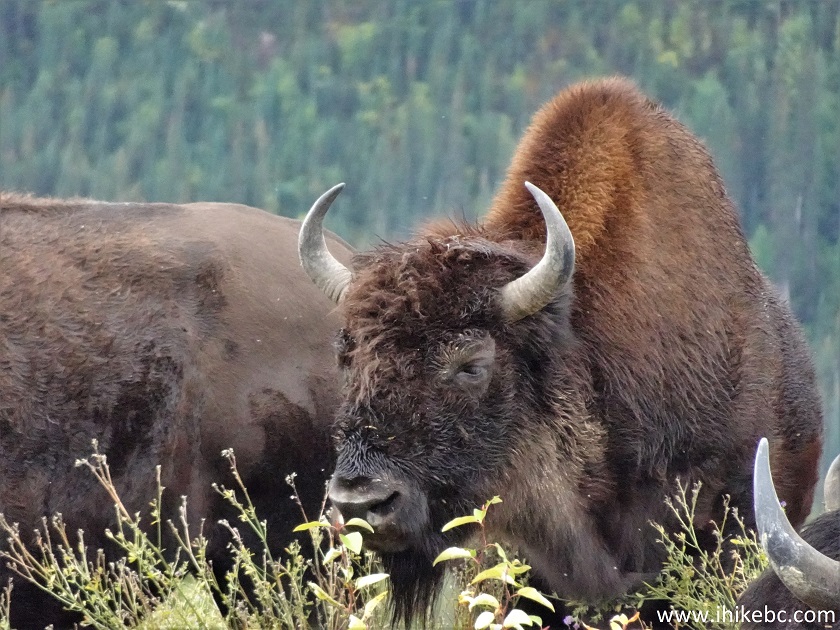
Canadian Bison
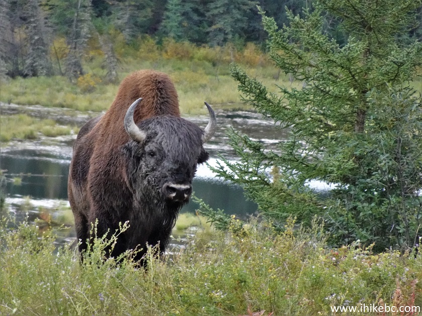
Bison in British Columbia Canada
Here is our video of the bison.
More ihikebc videos are on our YouTube Channel.
The path to Smith River Falls is quite short and fairly easy, and the waterfall is rather impressive. Highly recommended.


|
 |
Other Trips:


![]()
![]()
![]()
ihikebc.com Trip 268 - Smith River Falls Visit (Near Liard River BC)