![]()
![]()
![]()

Trip 169 - August 3, 2019 (Saturday)
Deception Falls Trail Hike
Wells Gray Provincial Park near
100 Mile House BC
Location: South-Central British Columbia, approximately 81 kilometers from 100 Mile House via Highway 97 (for 2 km), Canim-Hendrix Lake Road (for 34 km), Canim Lake South Road (for 25 km), Mahood Lake Road (for 15 km), and Mahood Lake Road North (for 5 km).
Liked: Deception Falls views, a fairly short and easy trail.
Of Note: Steep unbarricaded drop-offs at the best waterfall viewpoints. Hiking boots and poles are recommended. Some mosquitoes present. The trail is popular.
Cariboo Chilcotin Coast BC Backroad Mapbook (4th edition) Waterfall Location Coordinates: Page 19 (Interlakes Highway) E1.
Related Website: Wells Gray Provincial Park - BC Parks Official Website.
>>> British Columbia Waterfalls Visits.
Deception Falls Trail is located about five kilometers away from Mahood Lake Campground of Wells Gray Provincial Park. Once you reach the campground, a rather rough road leads to Deception Falls trailhead past Canim River trailhead (which leads to some badly collapsed old shacks), and Whale Lake trailhead (which leads to a fishing lake). Deception Falls, which is a part of Deception Creek, is a very impressive waterfall, though it certainly is overshadowed by the magnificence of Canim Falls, located less than fifteen kilometers away. Deception Falls Trail is also more difficult to get to, and more challenging to hike than Canim Falls Trail. That said, plenty of people hike to Deception Falls, and this trail is certainly quite popular.
1. We start with the photo of the entrance to Mahood Lake Campground. This is the same photograph as photo # 15 of that trip report, so check it out for directions on getting up to this point from BC Highway 97 near 100 Mile House. The campground itself is to the right, and to the left is Mahood Lake Road North, which leads to Canim River Trail, Whale Lake Trail, and Deception Falls Trail. See a dark-coloured sign to the left of the red sign in the middle of the photo?
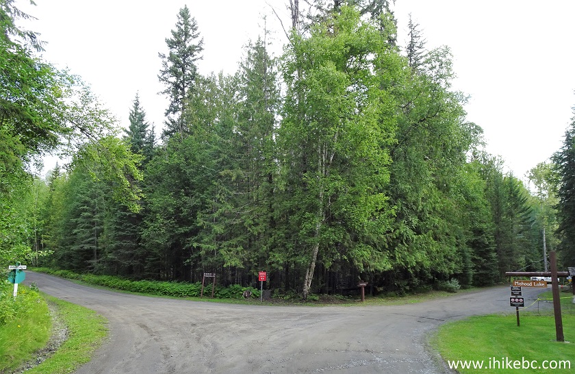
British Columbia Wells-Gray Provincial Park Mahood Lake Campground
Entrance
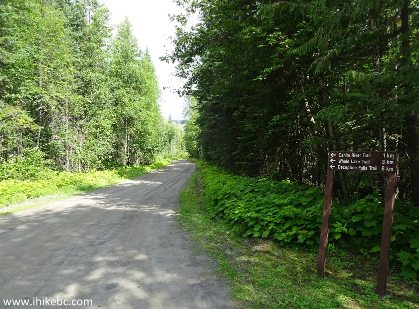
2. Here is that sign up close. Note, that the indicated distances are incorrect, especially to the last two trails. It's 700 meters from here to Canim River trailhead, 1.9 km to Whale Lake trailhead, and 4.9 km to Deception Falls trailhead.
Mahood Lake North Road Start
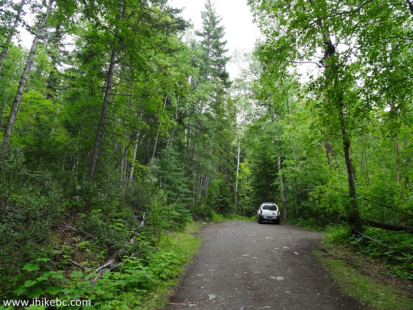
3. The roads from Highway 97 to Mahood Lake Campground are fairly decent, and can be tackled by just about any vehicle. However, Mahood Lake Road North is much rougher, and is suitable to high clearance vehicles only (2WD ok).
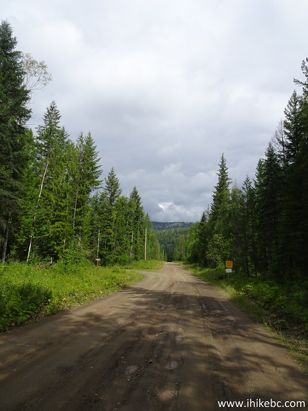
Mahood Lake Road North near 100 Mile House BC Canada
4. Canim River trailhead is on the left side, 700 meters after the start of Mahood Lake Road North. The sign says the trail is 500 meters long. We hiked for over a kilometer and saw nothing of interest. Wondering what's going on, we went back, and stumbled upon three badly collapsed and overgrown shacks, about 500 meters from the trailhead. Backroad Mapbook, indeed, states that the trail leads to "remains of an early homestead." Alas, the shacks are in such a bad shape that there is nothing to see. Thus, Canim River Trail could be considered as providing a way for the fishermen to access the river. That said, the trail kept going along the river, so who knows where it eventually leads.
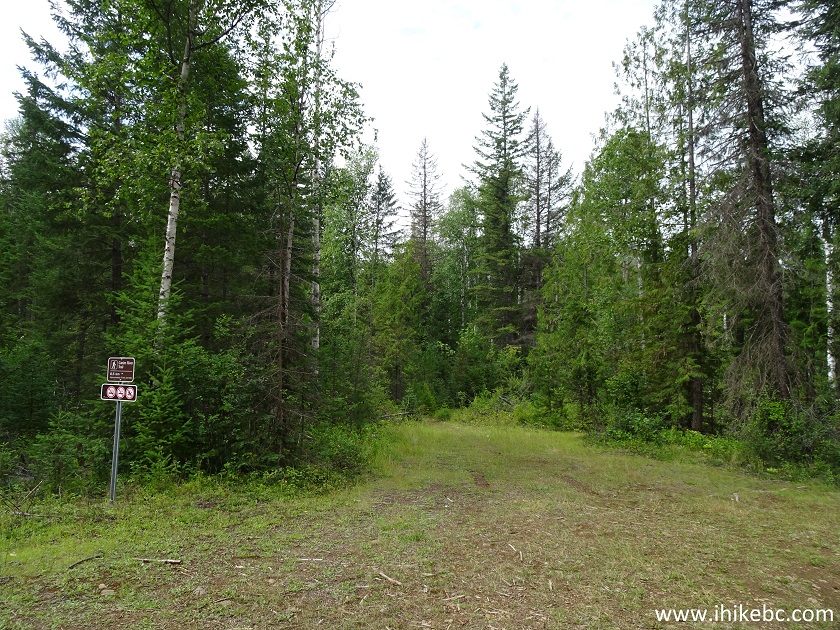
Canim River Trailhead off Mahood Lake Road North
5. Here is one of the busted shacks by Canim River Trail.
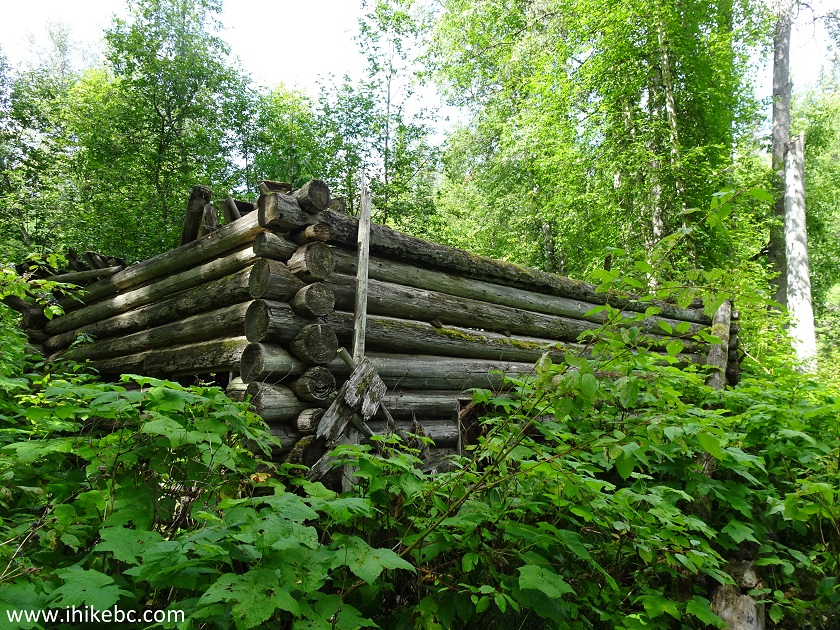
Busted Shack by Canim River Trail
6. Not much to see.

7. Moving on towards Deception Falls trailhead, Canim River bridge arrives at the 1.7 km mark.
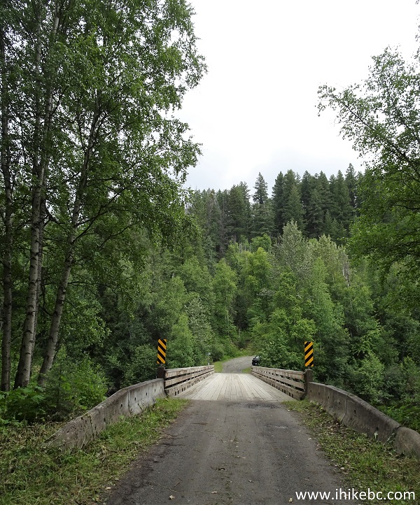
Canim River Bridge on Mahood Lake Road North
8. A view of Canim River from the bridge.
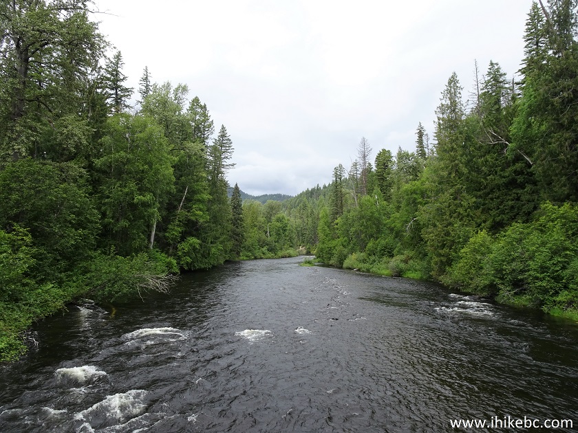
Canim River British Columbia Canada
9. Whale Lake trailhead to a fishing lake arrives on the left right after the bridge.
Whale Lake Trailhead by Mahood Lake Road North near 100 Mile House BC
10. Mahood Lake Road North splits at the 2.2 km mark. Stay to the right on the obvious main road.
Mahood Lake Road North
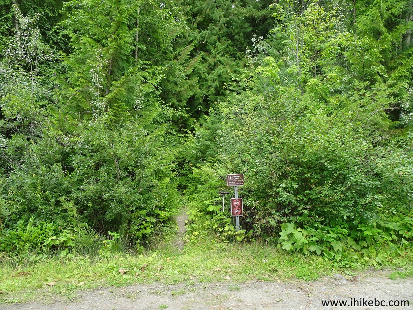
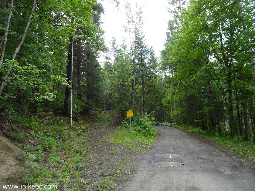
11. Deception Falls trailhead parking area is located at the 4.9 km mark.
Parking for Deception Falls trailhead on Mahood Lake Road North
12. Here is the trailhead, on the left side, like the rest of them. Coordinates: N 51⁰53.741' W 120⁰29.203'. Elevation: 651 meters.
Deception Falls trailhead - 100 Mile House Hike - Wells-Gray Provincial
Park Hike
13. Mahood Lake Road North continues for another 200 meters, and ends at the entrance to a private residence.
End of Mahood Lake Road North
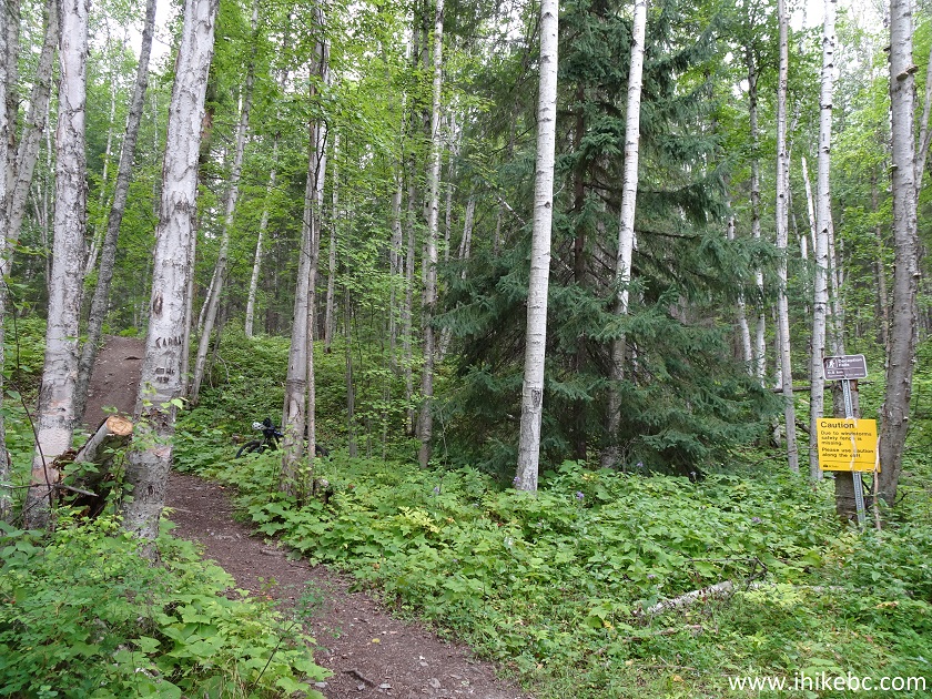
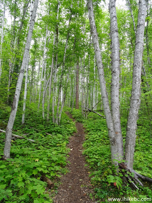
14. We returned to Deception Falls trailhead parking area, and started the hike. Within 30 meters, there is a split - keep going straight. All the trail distances are based on a GPS odometer and are approximate.
100 Mile House Hiking - Deception Falls Trail
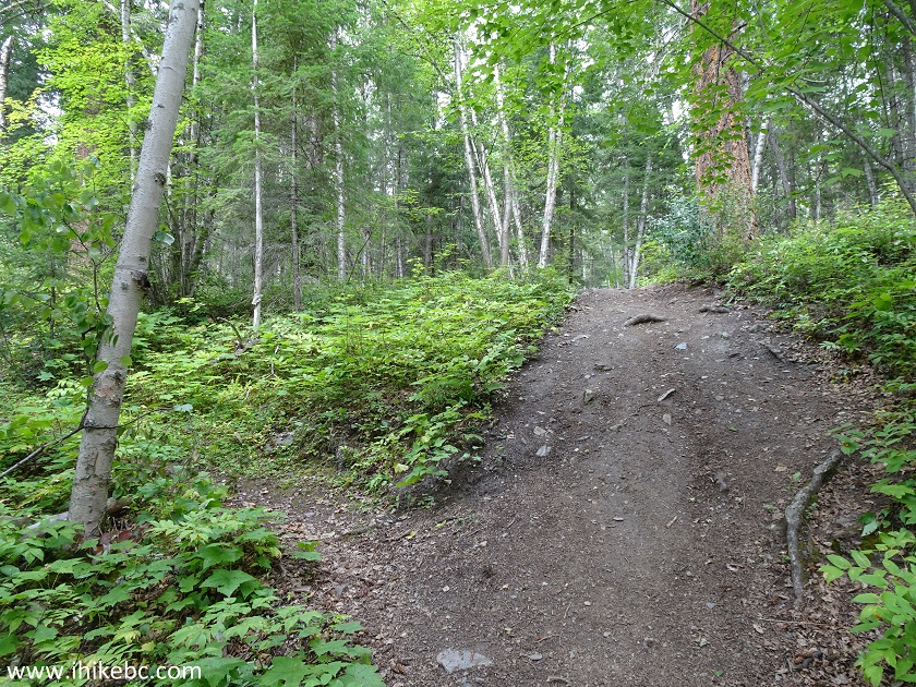
15. There is some elevation on this trail, but, overall, it's fairly easy.
Hiking in 100 Mile House Area - Deception Falls trail
16. Fenced-off observation area arrives 920 meters from the trailhead. Coordinates: N 51⁰54.164' W 120⁰29.141'. Elevation: 738 meters (87 meters elevation gain from the start of the trail).
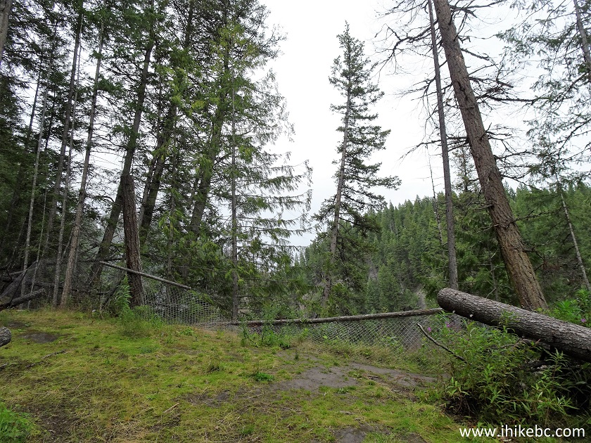
Deception Falls Observation Area Wells-Gray Provincial Park British
Columbia Canada
17. Deception Falls view from the observation area is substantially obstructed by trees.
Deception Falls Wells-Gray Provincial Park British Columbia
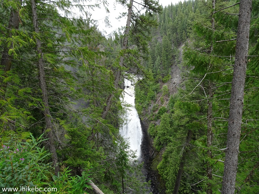
18. But, less than a hundred meters further, there are two access points to much better observation areas. Beware, though, as those viewpoints are not fenced-off, and the drop-offs are very steep. The path is also inclined towards the ravine. Here is the first such observation point.
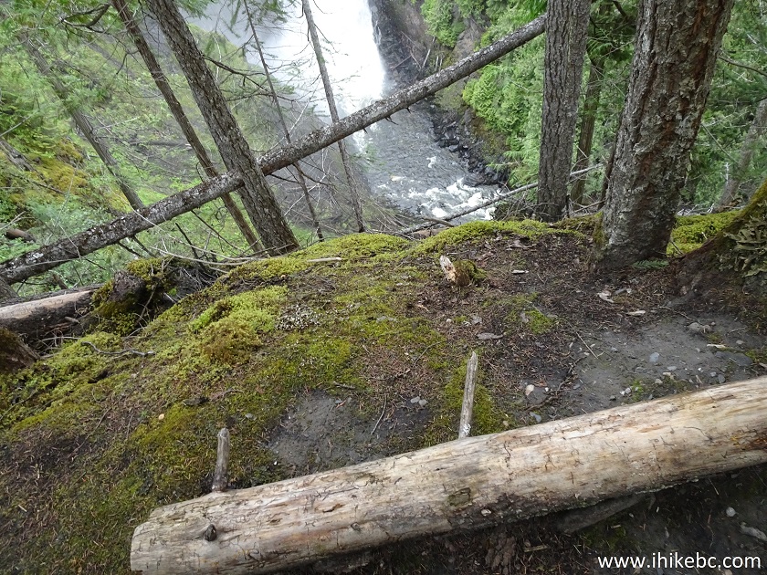
Wells-Gray Provincial Park British Columbia Canada
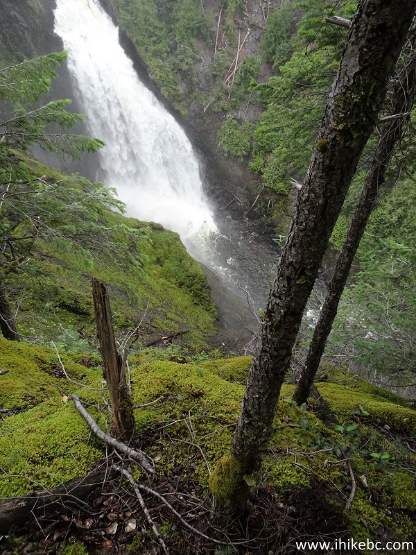
19. And Deception Falls is before you in all of its glory.
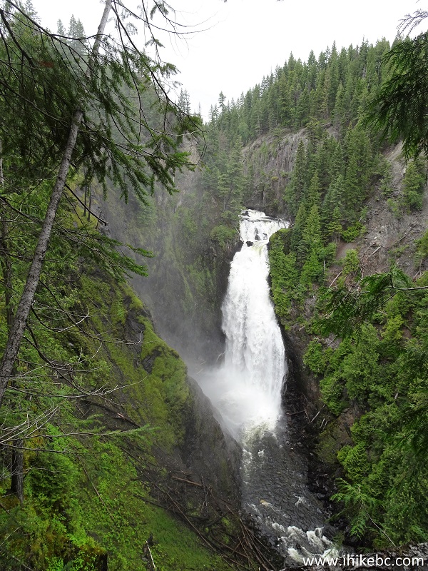
Deception Falls
20. The top of the waterfall with much zoom.
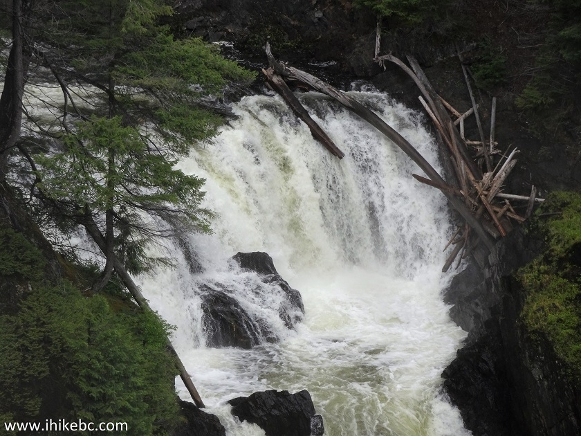
Deception Falls in Wells-Gray Provincial Park British Columbia Canada
21. A view of the gorge.
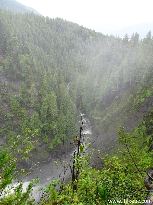
Deception Creek near 100 Mile House BC Canada
22. The path to the second good observation point.
Hiking in 100 Mile House Area - Deception Falls
23. A Deception Falls view from that area.
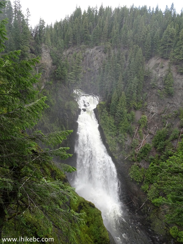
Deception Falls British Columbia
Here is our video of Deception Falls from the second good observation point.
More ihikebc videos are on our YouTube Channel.
While being overshadowed by the awesome nearby Canim Falls, Deception Falls is certainly a very impressive waterfall in its own right. Highly recommended.


|
 |
Other Trips in 100 Mile House BC Area:
|
|
|
|
Other Trips:


![]()


![]()
![]()
![]()
ihikebc.com Trip 169 - Deception Falls Trail Hike (Near 100 Mile House BC)