![]()
![]()
![]()

Trip 280 - June 6, 2023 (Tuesday)
Narvaez Bay Trail & Monarch Head Trail
Gulf Islands National Park Reserve
Saturna Island, BC
Liked: Shoreline views, fairly easy and short trails, loop trails, shade in the forest, no bugs.
Related Websites: BC Ferries Departures - Saturna Island, Gulf Islands National Park Reserve - Parks Canada.
Vancouver Island, Victoria & Gulf Islands Backroad Mapbook (9th edition) Trailhead Coordinates: Page 12 (Saturna Island) E3.
Other Trips on Saturna Island: Whale Trail / East Point Regional Park, Mount Warburton Pike Hike.
Follow @ihikebc TweetNarvaez Bay Trail and Monarch Head Trail are located on Saturna Island, and share a trailhead which is found at the end of Narvaez Bay Road, 8.2 km from Lyall Harbour Ferry Terminal with scheduled service to Victoria (Swartz Bay). There are only a few sailings each day, so plan accordingly lest you be stuck overnight on a small island with very limited services.
These two trails are quite short and easy, with the total round-trip hiking distance of 5 km or so, and are so interconnected that it could easily be considered as one trail. There are several loops and figure 8s you can do, and there are three major points of interests on this hike: Monarch Head viewpoint, Narvaez Bay camping area, and Echo Bay. Great views are plentiful at all three locations.
* all trail distances are based on a GPS odometer and are approximate.
1. Here is a Google Maps location of Narvaez Bay on
Saturna Island.
2. We are at Swartz Bay Ferry Terminal in Victoria, BC, getting ready to board BC Ferry "Queen of Cumberland".
Swartz Bay Ferry Terminal
Here is our video of boarding "Queen of Cumberland":
2. Good-bye, Swartz Bay.
Leaving Swartz Bay Ferry Terminal
Here is our video of departing from Swartz Bay:
3. Here is our ferry.
Queen of Cumberland
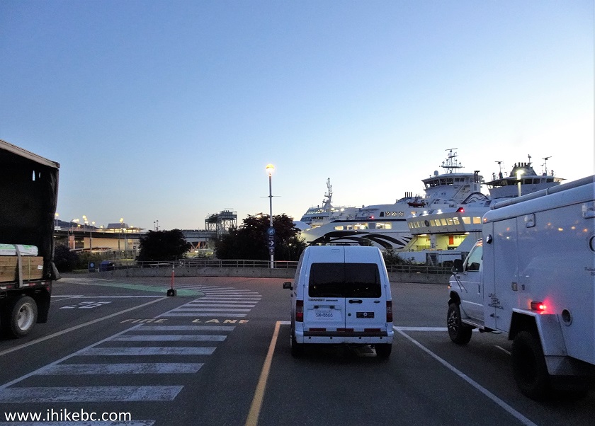
4. 5 AM departure on a weekday resulted in only 4 vehicles being present. Every other passenger seemed to have fallen asleep soon after boarding.
BC Ferry Queen of Cumberland Vehicle Loading Area
5. Just as empty inside.
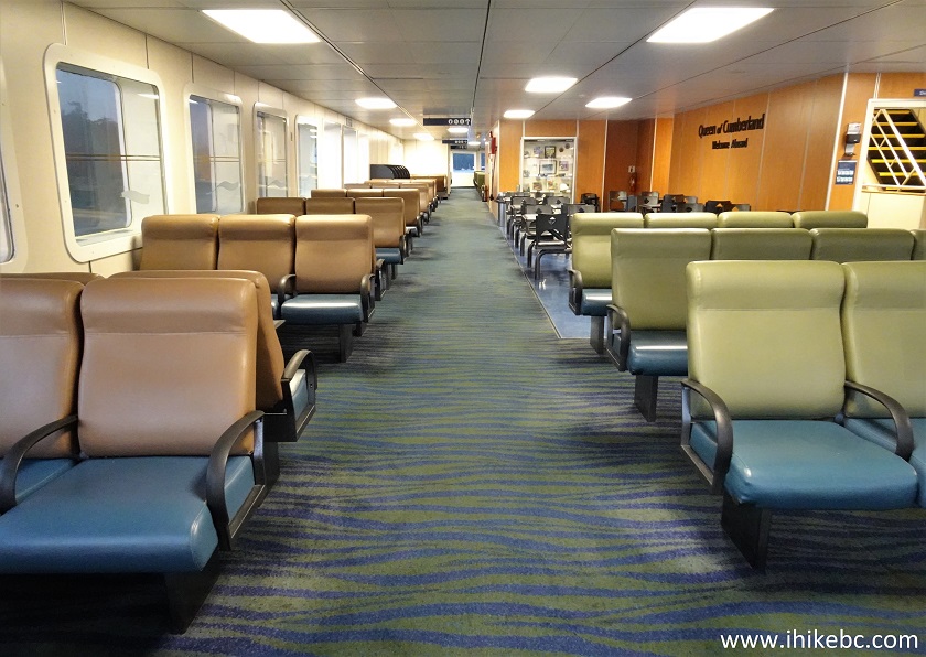
Queen of Cumberland Passenger Area
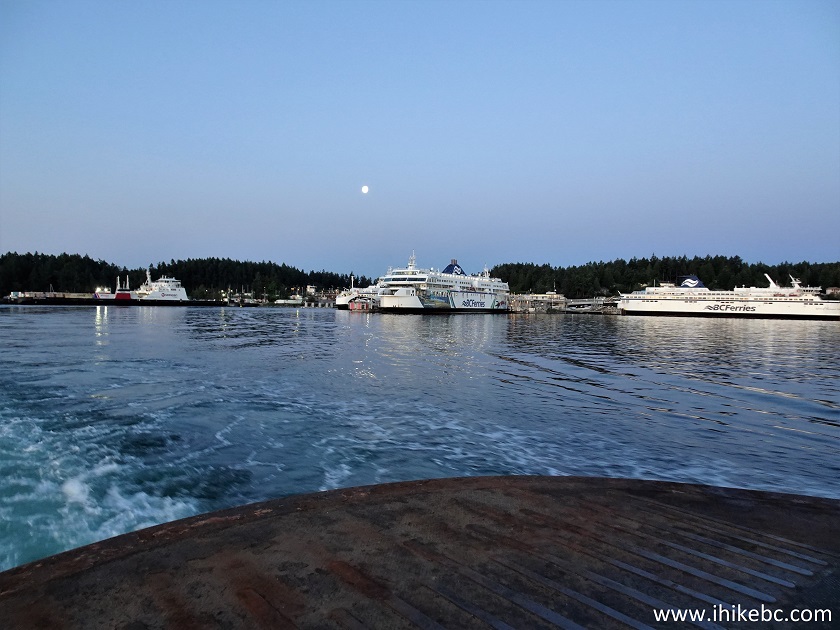
6-7. The sailing was direct and took 1 hour and 10 minutes. Other sailings include additional stops and even transfers, and will take longer. Approaching Saturna Island - Lyall Harbour Ferry Terminal.
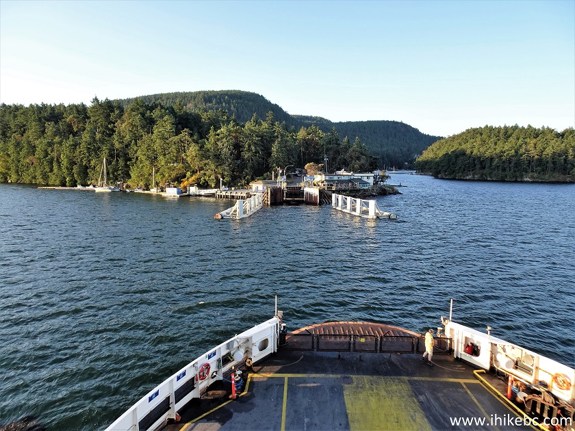
Approaching Saturna Island on BC Ferry Queen of Cumberland
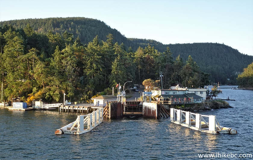
Lyall Harbour Ferry Terminal Saturna Island BC Canada
Here is our video of approaching Saturna Island:
8. Here is a map of Saturna Island posted by the terminal. We have indicated the terminal with a red square, and Narvaez Bay with a blue square. Start driving on East Point Road, and keep going straight 1.8 km later where there are a bunch of intersections by Saturna Island General Store - you will end up on Narvaez Bay Road, which will end 8.2 km from the terminal at the trailhead parking lot. The road is narrow and frequently winding, and is a bit rough in places, but should be ok for all 2WD vehicles with regular clearance.
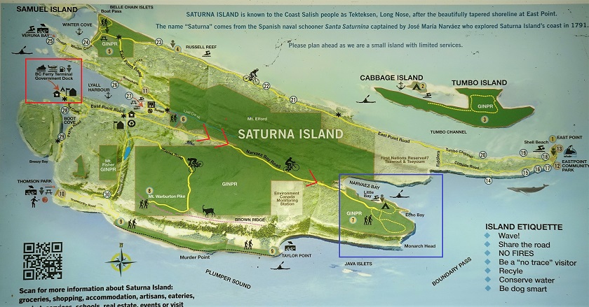
Map of Saturna Island
9. Narvaez Bay and Monarch Head trailhead parking lot, at the end of Narvaez Bay Road, 8.2 km from the ferry terminal. Coordinates: N 48⁰46.335' W 123⁰06.147'. Elevation: 70 meters. Overnight camping in vehicles is not permitted. There is a walk-in campsite at Narvaez Bay.
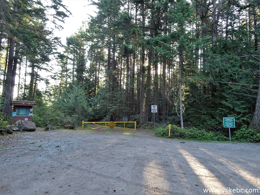
Narvaez Bay Parking Lot
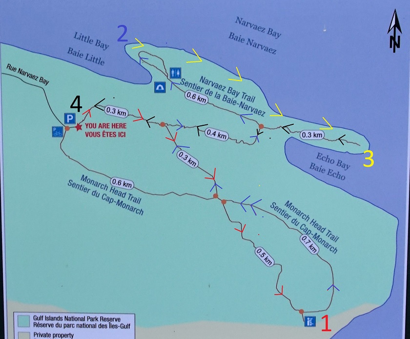
10. The map of the place. We have indicated with arrows our direction of travel. #4 is parking lot (trailhead). From there, red arrows to Monarch Head viewpoint (#1), then blue arrows to Narvaez Bay campsite (#2), then yellow arrows on a path along Narvaez Bay to Echo Bay (#3), then black arrows back to the parking lot (#4).
Narvaez Bay Trail Map
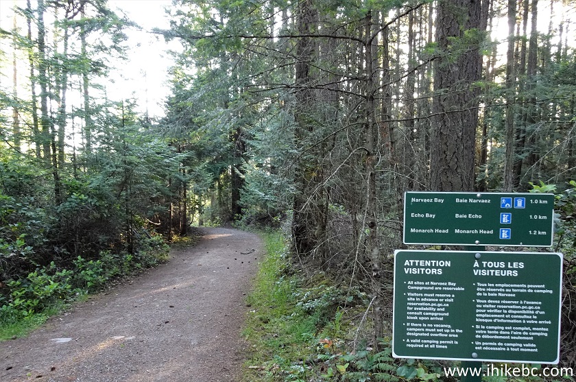
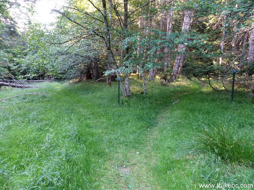
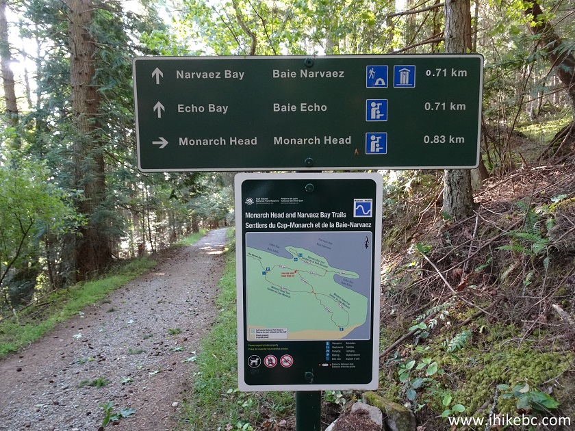
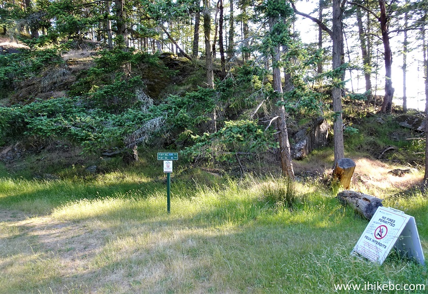
11. A sign at the trailhead indicates 1 km to Narvaez Bay, 1 km to Echo Bay, and 1.2 km to Monarch Head. For camping, a valid permit is required at all times.
Narvaez Bay Trail Hike on Saturna Island BC
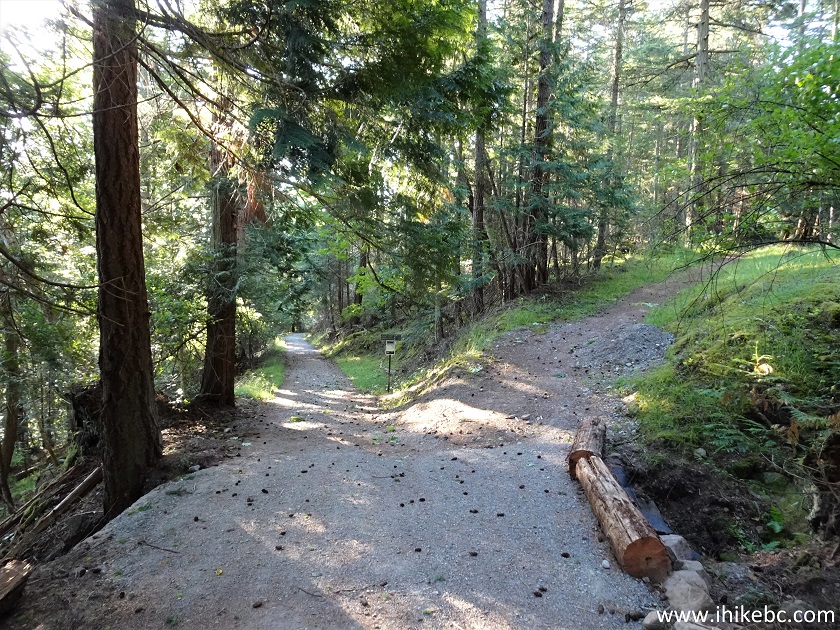
12. At 270 meters, there is a split - we took the right turn to Monarch Head.
Saturna Island Hiking
13. At 600 meters, Monarch Head loop begins - turned right once again.
Monarch Head Loop - Hike on Saturna Island
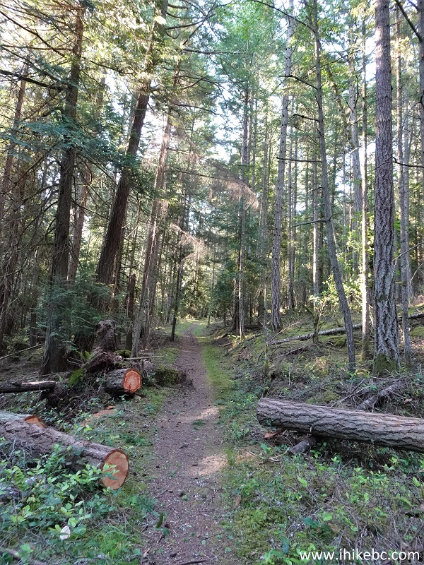
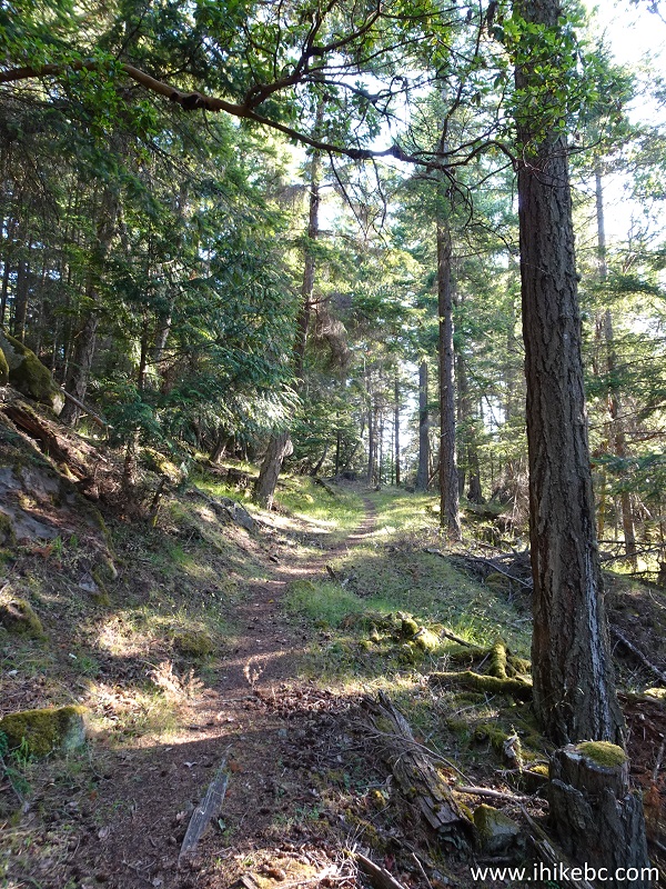
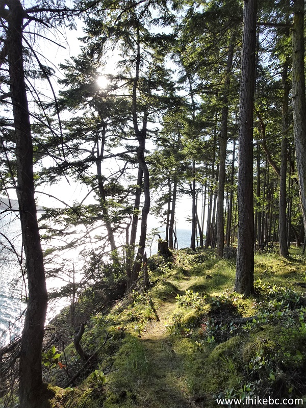
14. Monarch Head Trail at 700 meters from the parking lot. This entire hike is quite easy.
Hike on Saturna Island - Monarch Head Trail
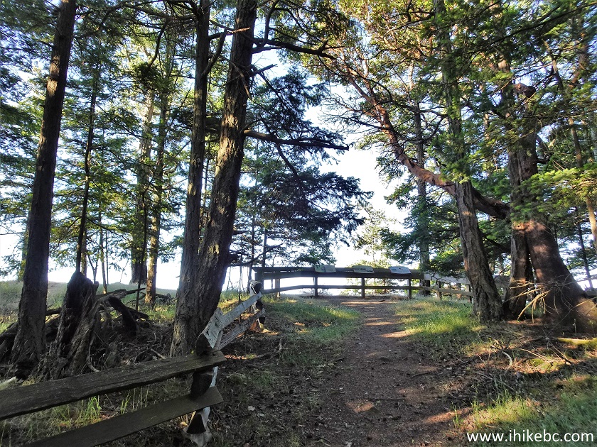
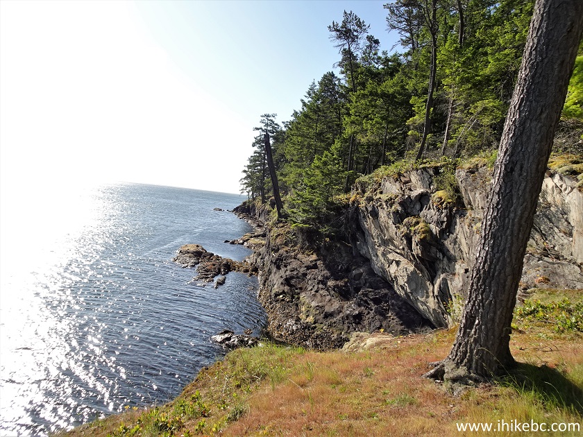
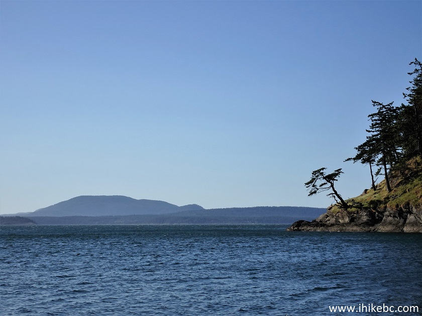
15. Approaching Monarch Head viewpoint at the 1.1 km mark. Coordinates: N 48⁰46.041 W 123⁰05.567'. Elevation: 105 meters. For the best view, you need to go beyond the fence - watch out for drop-offs.
Monarch Head Trail Saturna Island British Columbia Canada
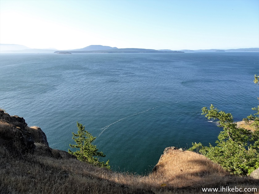
16. Swell.
View from Monarch Head Trail on Saturna Island BC
17. A bit to the right.
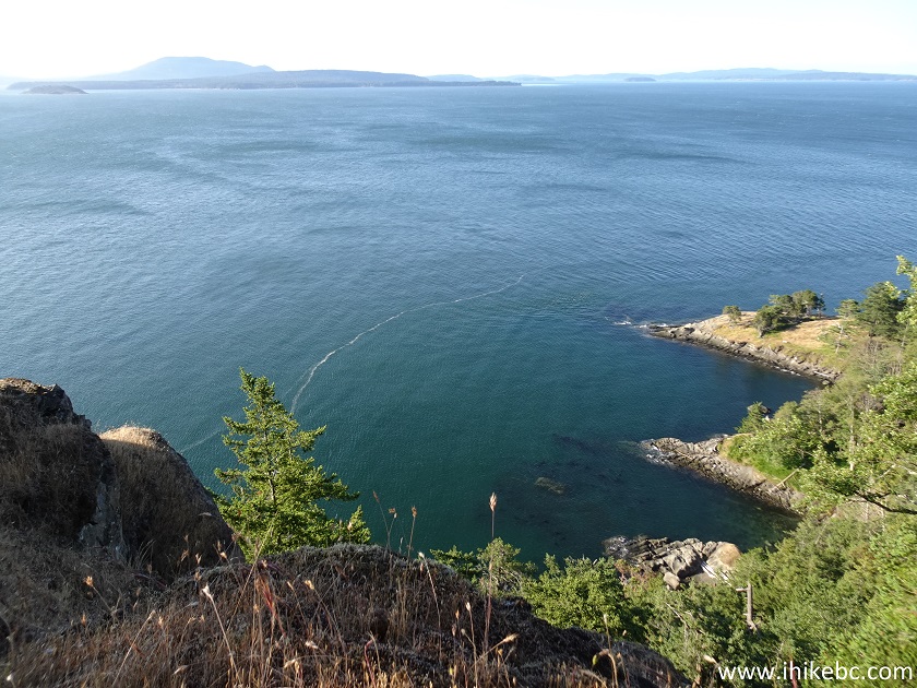
Saturna Island Monarch Head
Here is our video of the views from this location:
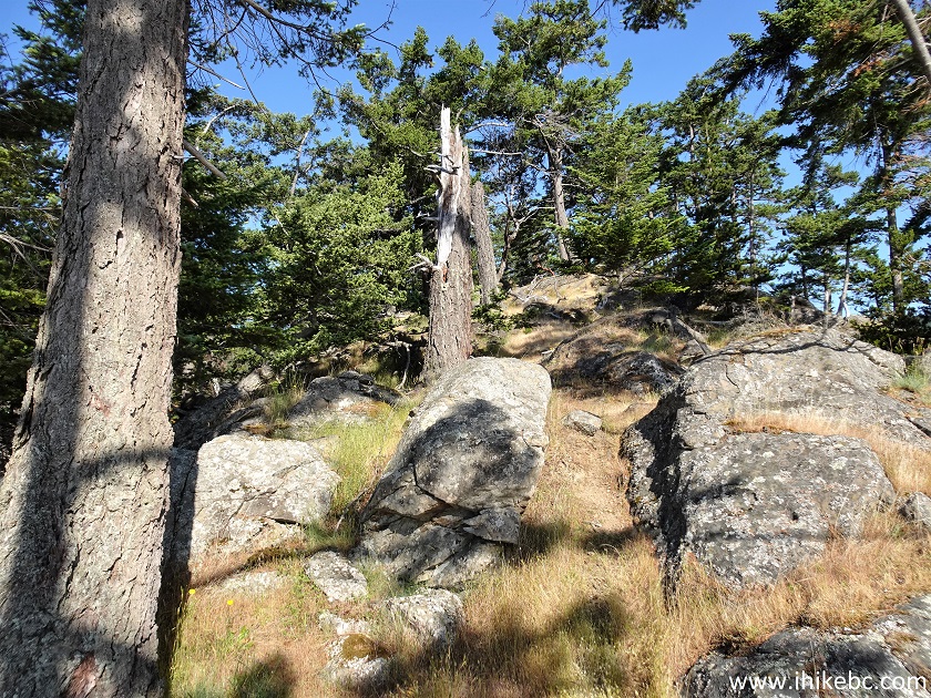
18. We then continued on the Monarch Head loop.
Monarch Head Trail
19. Returned to the intersection seen in photo #12. Made a right turn to proceed to Narvaez Bay and Echo Bay.
Hike on Saturna Island
20. At 280 meters after the intersection.
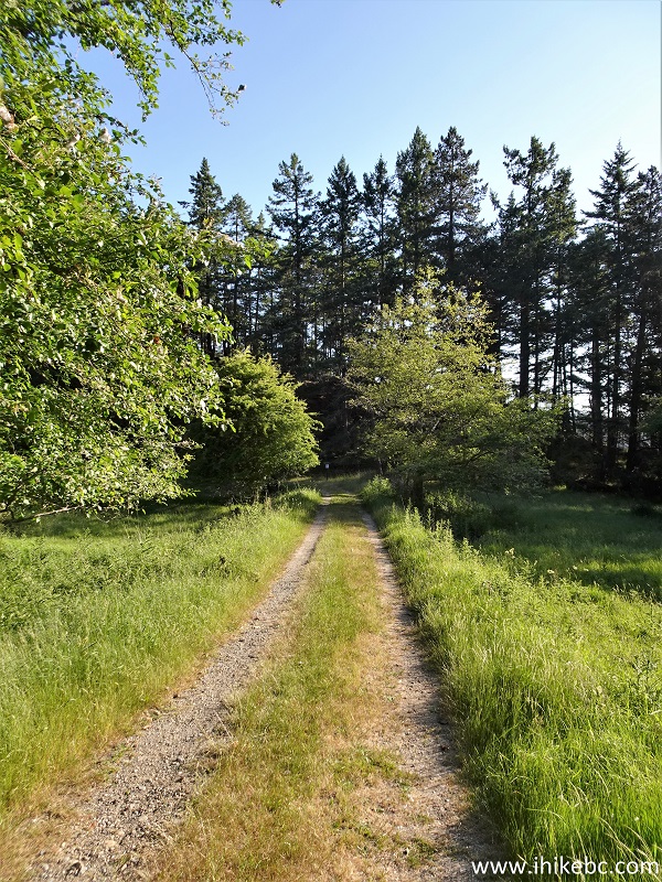
Narvaez Bay Trail
21. At 315 meters, we have reached Narvaez Bay Trail (to the left) split with Echo Bay Trail (to the right). Both trails are very short and easy from here, though the connecting trail along Narvaez Bay (yellow arrows on a map in photo #10) is somewhat rough, but has great views.
Saturna Island Hiking
22. We headed to Narvaez Bay first. Here is an overflow camping area 150 meters after the split.
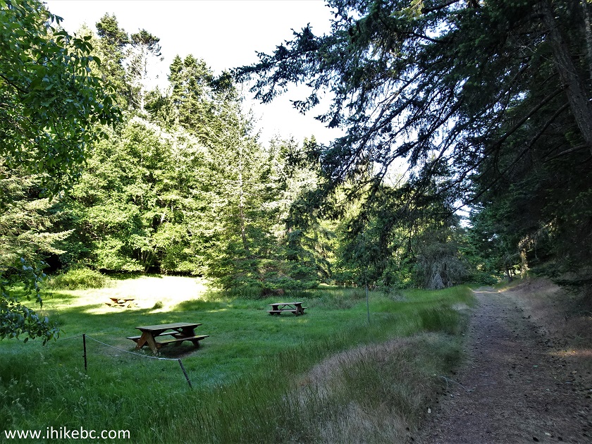
Narvaez Bay Hike
23. And here is the main camping area 200 meters further. Coordinates: N 48⁰46.468' W 123⁰05.966'. Elevation: 15 meters.
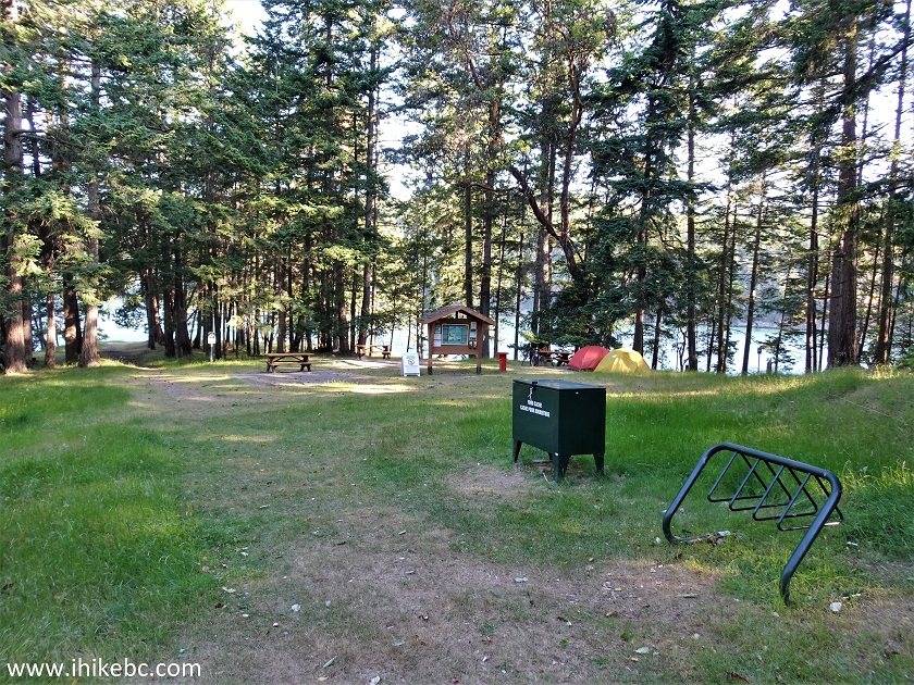
Saturna Island Camping Narvaez Bay
24. Just past the camping area is this spot where Narvaez Bay meets with Little Bay.
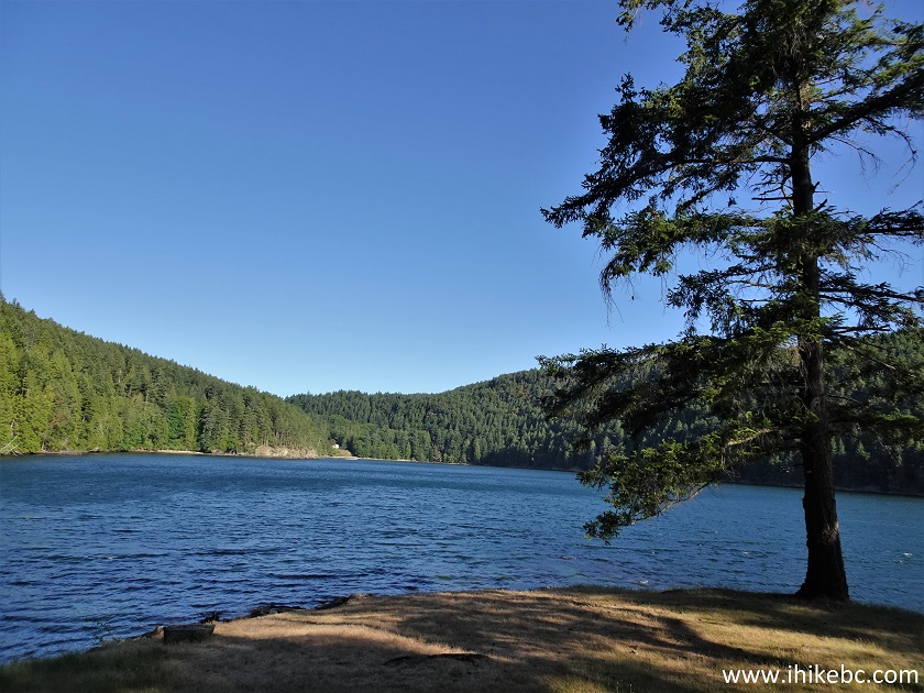
Little Bay Saturna Island BC
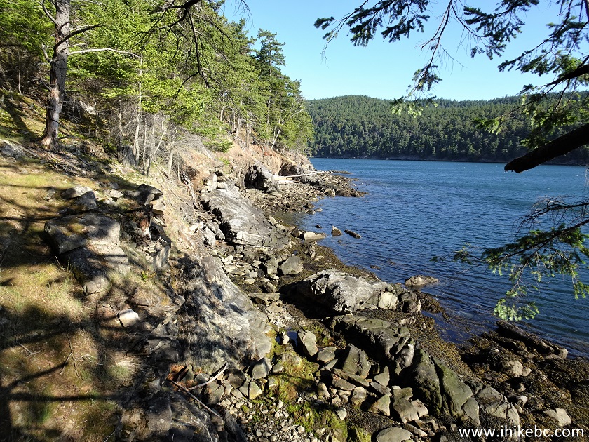
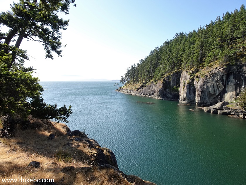
25. For great views, proceed along Narvaez Bay to Echo Bay, a distance of about 1 km. Hiking poles and boots are recommended for this stretch. Watch for drop-offs.
Hike on Saturna Island
26. At 150 meters from Narvaez Bay campground, looking forward.
Saturna Island BC Canada
27. At 500 meters, looking back.
Hiking on Saturna Island
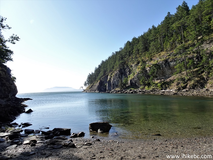
28-29. Now at Echo Bay, about 1 km from Narvaez Bay. Coordinates: N 48⁰46.329' W 123⁰05.433'. Elevation: 20 meters. Plain and zoomed.
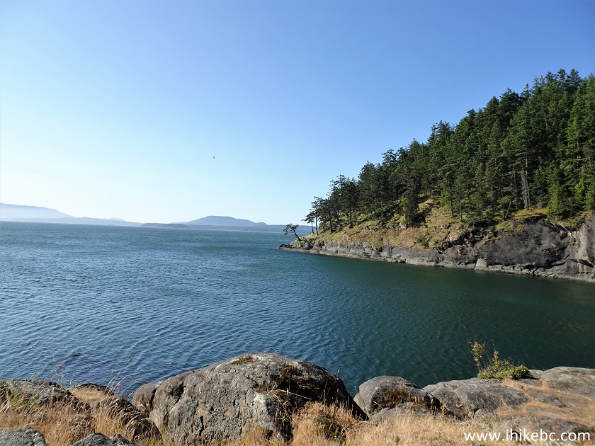
Echo Bay Saturna Island BC
Saturna Island Echo Bay
Here is our video of the views from this location:
More ihikebc videos are on our YouTube Channel.
30. Echo Bay has some interesting sandstone formations. Hiking poles and boots would be very helpful here, especially if the stones would be wet.
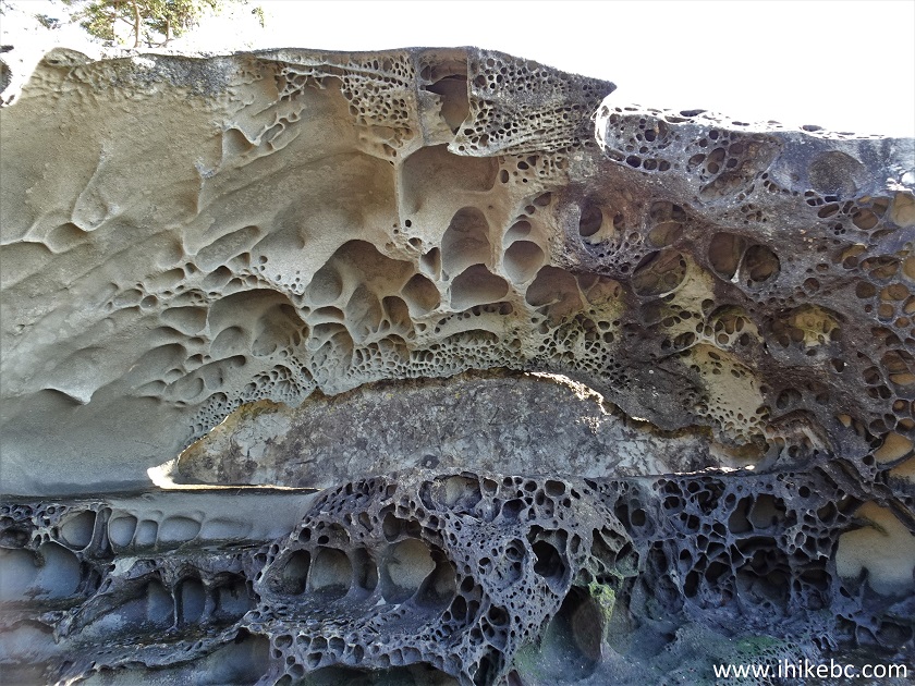
Saturna Island Sandstone
31. Heading back from Echo Bay on the "official" path now.
Hike on Saturna Island
32. A very fine view at 130 meters.
Echo Bay - Saturna Island - British Columbia - Canada
33. 50 meters later, the bay ends with a small beach.
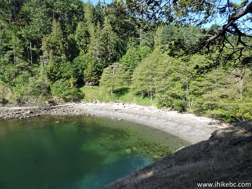
Saturna Island Echo Bay Beach
34. The view of Echo Bay from the beach.
Echo Bay Saturna Island BC
35. Echo Bay beach itself.
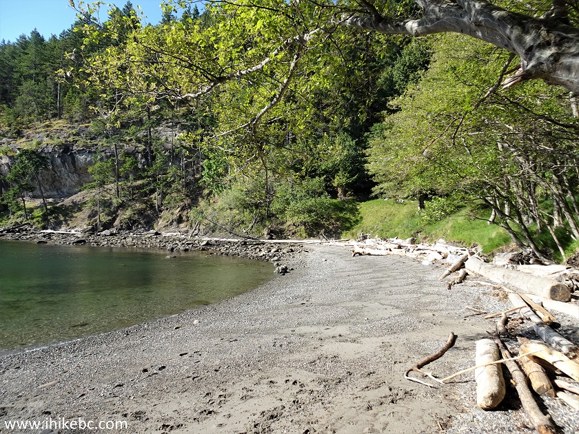
Saturna Island Echo Bay Beach
Monarch Head Trail and Narvaez Bay Trail, as well as the connecting trail to Echo Bay are all short and fairly easy, and lead to great views. Highly recommended.


|
 |
![]()
![]()
![]()
Other Trips:


![]()
![]()
![]()
Follow @ihikebc Tweet
ihikebc.com Trip 280 - Narvaez Bay Trail Hike & Monarch Head Trail Hike (Gulf Islands National Park Reserve - Saturna Island BC)