![]()
![]()
![]()

Trip 040 - May 19, 2011 (Thursday)
Bear Mountain Hike
Near Harrison Hot Springs BC Canada
Distance From Vancouver: About 140-145 km via Highway 1 East and Highway 9.
Liked: The view of Harrison Lake from viewpoint #1, and the panoramic view from viewpoint #2.
Of note: Rockwell Drive leading to the trailhead is a narrow and winding road (40 km/h speed limit in effect), numerous flies the first 1/3 of the hike, hard to follow the path after the first viewpoint, more than a meter of snow on the ground past the first viewpoint, badly overgrown path in some parts past the first viewpoint.
Vancouver, Coast & Mountains BC Backroad Mapbook (2nd edition) Coordinates: Page 14 (Harrison Lake) G7.
103 Hikes in Southwestern British Columbia (2008 edition): hike #60.
Related Website: Bear Mountain Hike by Tourism Harrison Hot Springs.
Follow @ihikebc Tweet
Bear Mountain proved to be an excellent first real hike of the season. The average grade was a benign 11.1%, as per "103 Hikes in Southwestern British Columbia" by Jack Bryceland, the length was around seven hours return, and the views were quite good. However, and that was a very interesting challenge, due to the deep snow, overgrown path, and flagging tape spaced too far, the hike after the first viewpoint became a matter of getting lost and then finding your way to much relief. If you want to avoid the snow, and still go past the first viewpoint, you would probably have to wait until August. We highly recommend using a map ("103 Hikes in Southwestern British Columbia" by Jack Bryceland has one), or a GPS unit with appropriate hiking software, as, otherwise, this trail would be very hard to follow past the first viewpoint.
1. To get to Bear Mountain trail you need to drive through the village of Harrison Hot Springs. If you are driving on Highway 1, take Exit 135 and follow directions to Highway 9 North. It would eventually lead you to Harrison Hot Springs, where Highway 9 becomes Hot Springs Road. One block before Hot Springs Road ends at Harrison Lake, it is crossed by Lillooet Avenue (Husky gas station on the left is another marker). You need to turn right onto Lillooet Avenue. Check your odometer - 5.1 kilometers later you would need to turn right to reach the Bear Mountain trailhead. In the photo below we are still on Hot Springs Road, and we would turn right at the stop sign seen straight ahead.
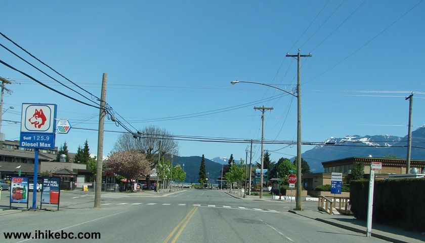
Hot Springs Road Harrison Hot Springs BC Canada
2. And this is Lillooet Avenue soon after we turned right from Hot Springs Road.
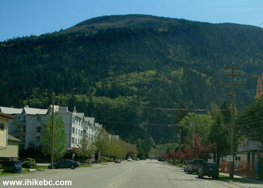
Lillooet Avenue Harrison Hot Springs Province of BC Canada
3. In a few minutes, Lillooet Avenue becomes Rockwell Drive, a fairly dangerous narrow and winding road, with a 40 km/h speed limit.
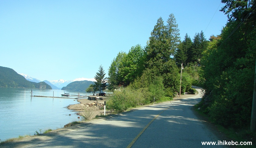
Rockwell Drive Harrison Hot Springs BC Canada
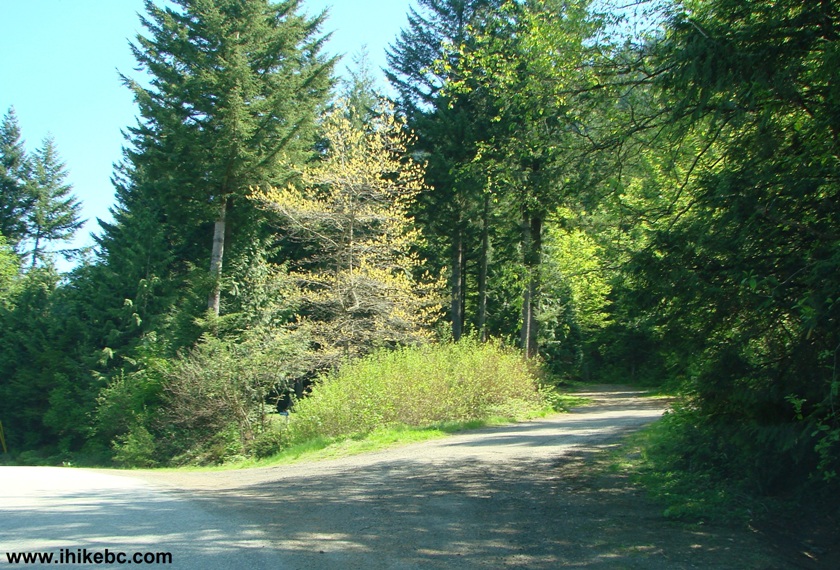
4. Just over five kilometers after turning onto Lillooet Avenue from Hot Springs Road, on the right side of Rockwell Drive you would see a dirt road. This is your destination. There is a residence on the side once you turn onto the dirt road. The address of the residence is 7050 Rockwell Drive - you would know you are in the right place if you see that number, but you would only see it after turning onto the dirt road - it cannot be seen from Rockwell Drive. Below is the beginning of the dirt road as seen from Rockwell Drive.
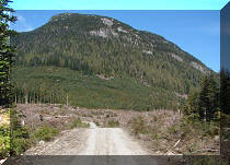
5. And, almost immediately, you see an open gate, and a sign put by a mining company prohibiting unauthorized access. The company is long gone. Disregard the sign, drive through the gate, and park at a dirt parking lot.
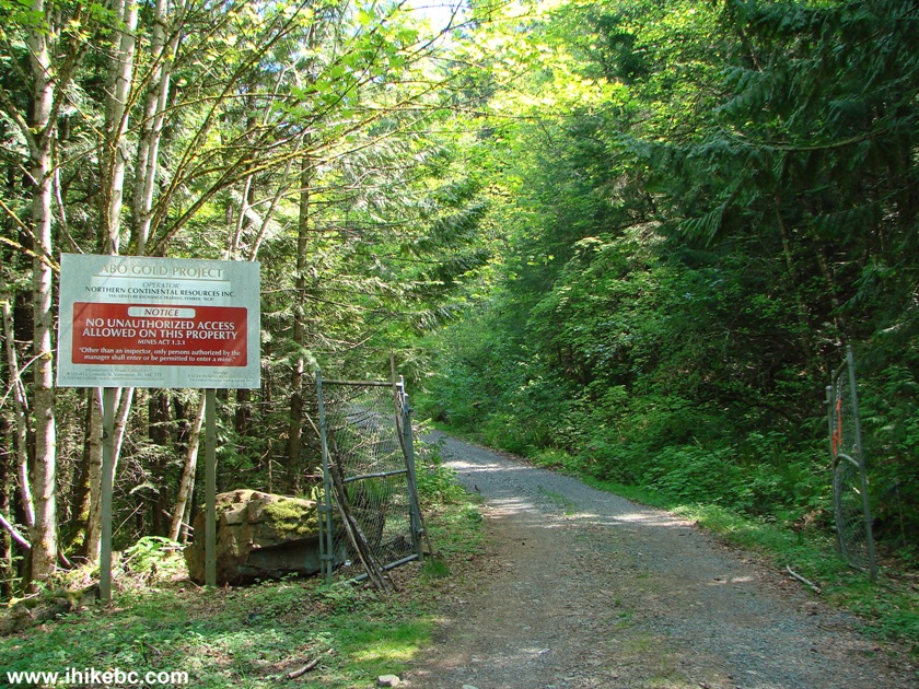
Bear Mountain Forest Service Road Start
6. Now it's time to start the hike up the Bear Mountain Forest Service Road. The grade is gentle, and the path is stony but not very treacherous.
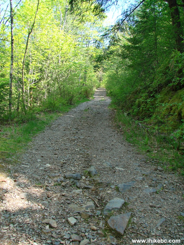
Hiking in Harrison Hot Springs Area -
Bear Mountain Hiking Trail
7. In about five minutes, you would reach a shack probably used by the mining company. It has now become a shooting target, and features numerous bullet holes.
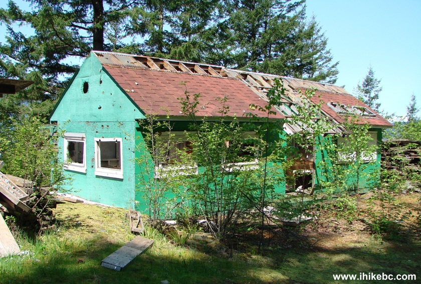
Bear Mountain Shack near Harrison Hot Springs
8. Inside the shack, the mess is simply spectacular.
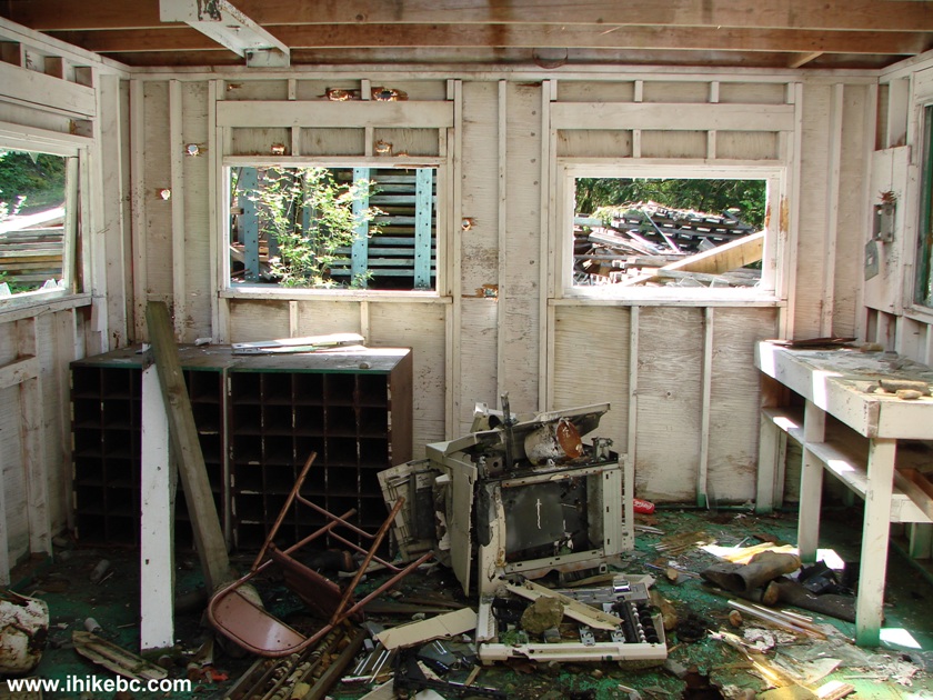
Busted Shack on Bear Mountain Trail near Harrison Hot Springs British
Columbia Canada
9. Right after the shack, the path splits in two - take the path on the right. After that and until the snow arrives, the path looks pretty much like this all the time.
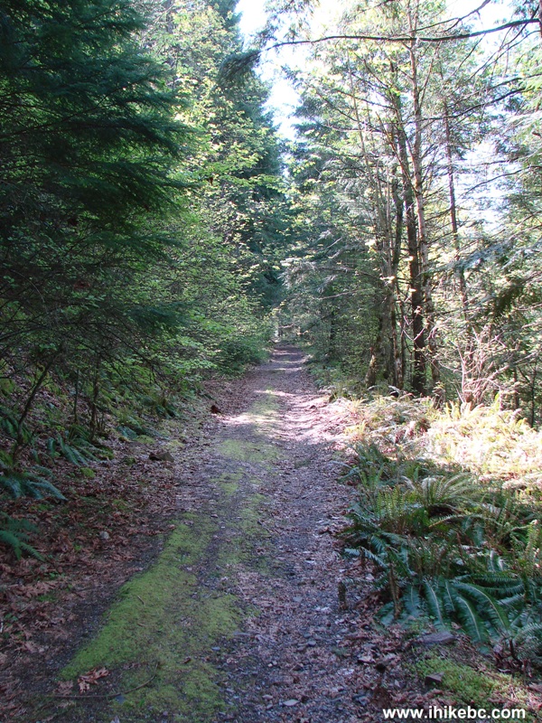
Bear Mountain Forest Service Road - Harrison Hot Springs Hiking BC Canada
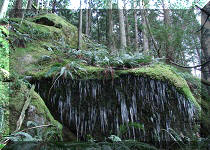
10. In 25 minutes after the shack, you get to see a small but pleasant waterfall on the side of the road.
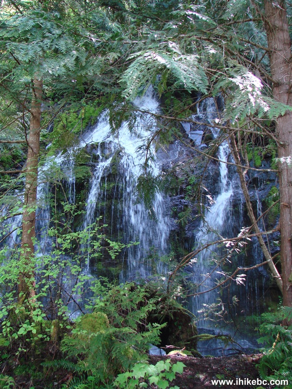
Photo of a Waterfall on Bear Mountain Trail - British Columbia Hiking
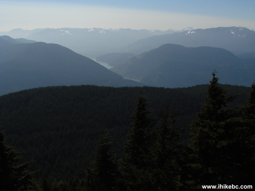
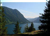
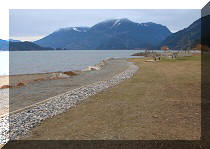
11. In about 1 hour and 40 minutes, you reach the first viewpoint and enjoy fantastic views of Harrison Lake.
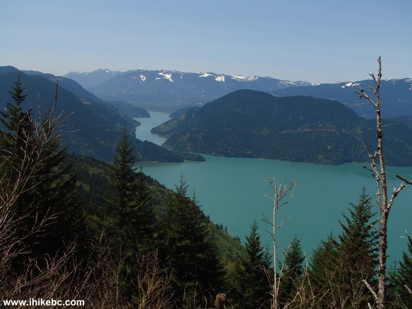
Harrison Lake from Bear Mountain Trail - Hiking in Harrison Hot Springs
Area
12. This is actually a good destination for the hike, unless you are prepared to battle the snow, unclear directions, and an occasionally overgrown trail.
Harrison Lake Photo as seen from Bear Mountain Trail - BC Hiking
Here is our video of Harrison Lake from this viewpoint:
13. If you do not mind some snow, it is possible to extend the hike.
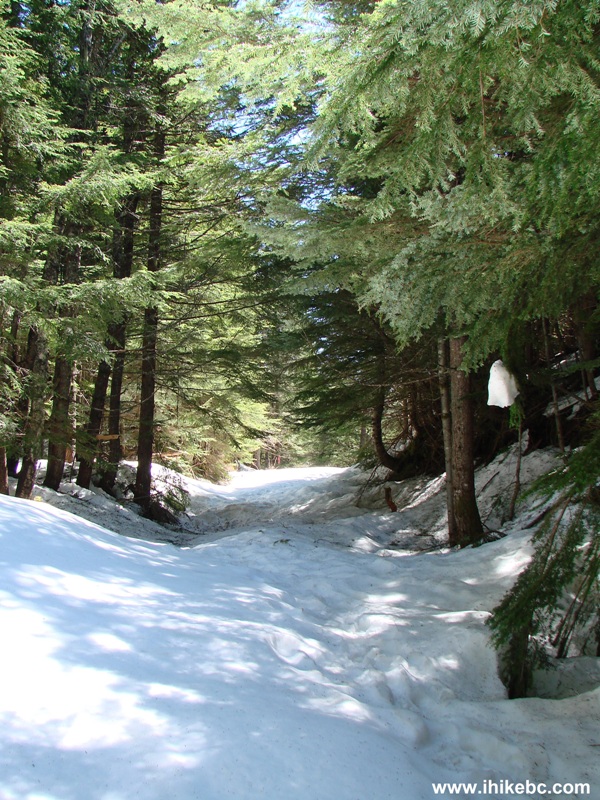
Snow on Bear Mountain Trail Near Harrison Hot Springs BC Canada
14. Yes, this IS the path.
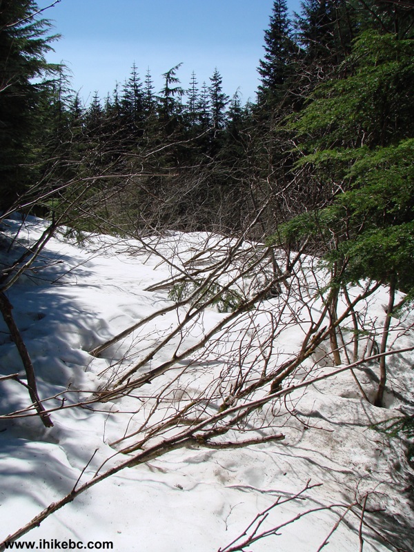
Overgrown Bear Mountain Trail by Harrison Hot Springs
15. And, finally, after getting lost time and again and wondering if you would ever find the end of this trail, a left turn brought us into some tall trees.
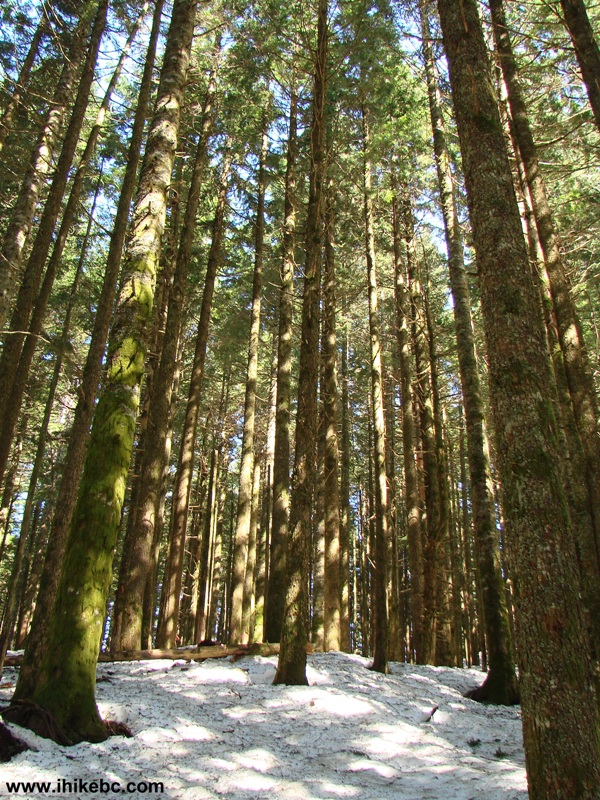
Bear Mountain Trail by Harrison Hot Springs Province of British Columbia
Canada
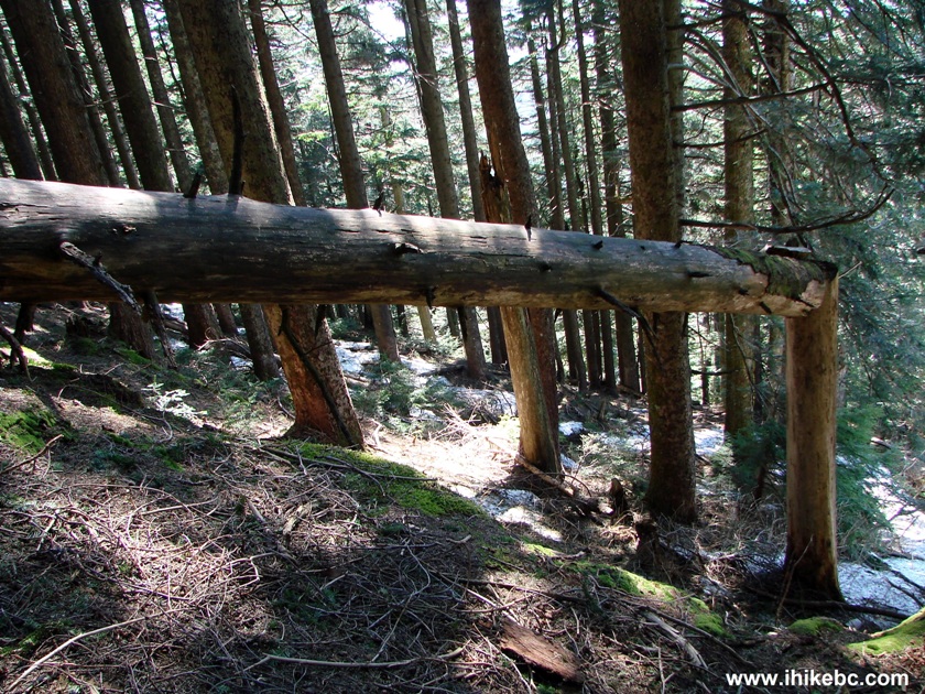
16. There are still plenty of twists and turns there, as well as too much space between the flagging tapes, but it is still easier to follow the path than before the left turn, and then you go up a small hill, and look around wondering if the view has been irreplaceably blocked by trees....We spent a while around this broken tree (you will find it for sure) thinking this is the end of the trail, but then we found another piece of flagging tape and went forward, and so....
Hiking in British Columbia - Bear Mountain by Harrison Hot Springs
17. Victory!
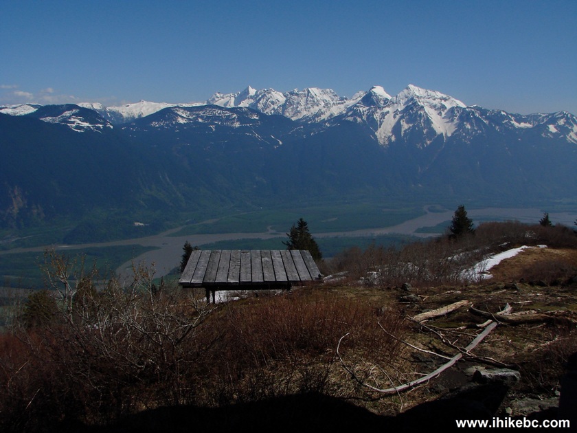
View from the end of Bear Mountain Trail - Harrison Hot Springs Hiking -
British Columbia Canada
18. "103 Hikes in Southwestern British Columbia" by Jack Bryceland explains that helicopters bring paragliders here, and then the paragliders try to land at the Harrison Hot Springs beach. This has to be a helicopter landing platform, because there was no other suitable helicopter landing area that we could see.
Bear Mountain Helicopter Pad - near Harrison Hot Springs BC Canada
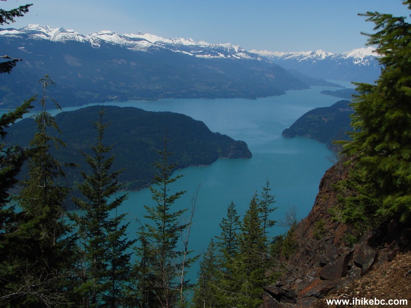
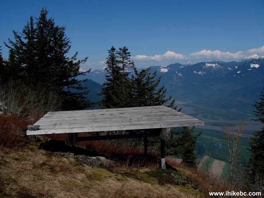
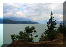
19. Viewpoint #2 is much more panoramic than viewpoint #1, but the views are not as impressive, especially if it is mostly hazy, like it was in our case.
Harrison River Seen from Bear Mountain Trail - British Columbia Hiking
20. There is also a weather station there. By the way, it took us nearly 5 hours to get to the end of the trail, and less than 2.5 hours to return.
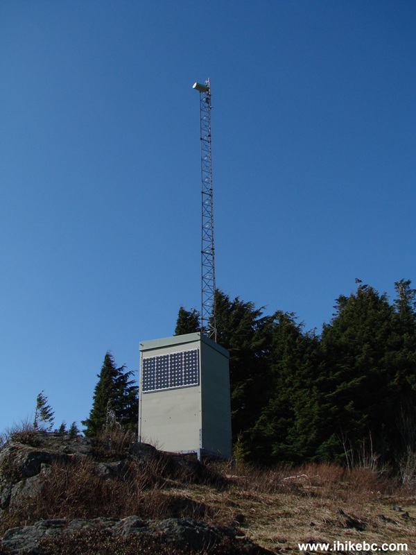
Weather Station on Top of Bear Mountain by Harrison Hot Springs BC
Canada
Here is our video of the views from the end of the trail:
More ihikebc videos are on our YouTube Channel.
This turned out to be one of the most memorable hikes due to all the snow, getting lost, and the numerous "here is the flagging tape again!" moments of joy. Hiking up to the first viewpoint and back is a good decision, unless you are willing to take chances with being lost and do not mind not finding the end of the trail. Beware of snow - your feet may fall through at a fast rate of speed and would stop only after the leg hits a trunk or a branch - not the best experience in the world, but it was all worth it.


|
 |
Other Trips in Harrison Hot Springs Area:
|
|
|
|
|
|
|
|
|
|
|
|


![]()
![]()
![]()
Follow @ihikebc Tweet
ihikebc.com Trip 040 - Bear Mountain Hike (near Harrison Hot Springs)