![]()
![]()
![]()

Trip 038 - May 12, 2011 (Thursday)
The Squamish Spit
Windsurfing and Kiteboarding
Area in Squamish BC Canada
Distance From Vancouver: 73 km: 66.5 km via Highway 1 West and Highway 99 (Sea-to-Sky) North to Industrial Way, then 3.0 km via Industrial Way and Queens Way to dirt road, then 3.5 km on dirt road to The Spit gate.
Liked: Natural views.
Of note: Very rough dirt road leading to The Spit. The Spit itself is quite narrow (about 8 meters), there is no guard rail, and the drop-offs are steep - be careful when driving and parking.
Related Website: Tourism Squamish.
Follow @ihikebc Tweet
The Squamish Spit is a long (about 700 meters) and narrow (about 8 meters) strip of land popular with windsurfers and kiteboarders, who use The Spit to park their vehicles and then play in the wind where Howe Sound and Squamish River meet. During our visit we did not see anyone on the water, probably because it was a Wednesday afternoon, and it was rather cold (around 14 degrees). However, the drive along a rough dirt road was still worth it due to the superb water and mountain views. If you can drive very slowly or do not mind the abuse your vehicle would take, it is worth the while to visit The Spit even if you do not windsurf or kiteboard, as the nature along the dirt road is quite attractive, the nearby mountains are impressive, and the birds are numerous.
1. Here is the map of the area, which we have marked as follows: 1 - Squamish Adventure Centre; 2 - Railway Heritage Park; 3 - The Spit. The arrow points to Queens Way. Disregard the yellow marker on the map - it is not related to this trip. This free map was provided by Squamish Adventure Centre.
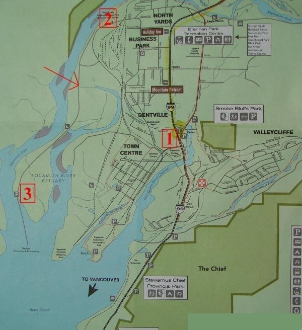
Squamish Area Map
2. The following several photographs show the directions to The Squamish Spit. We are driving in Squamish on Highway 99 North, just past the Cleveland Avenue / Loggers Lane intersection, with Squamish Adventure Centre (number 1 on the map above) seen ahead on the right side.
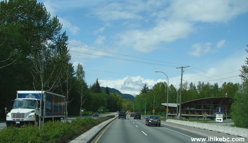
BC Highway 99 near Squamish Adventure Centre
3. Check your odometer and move to the left lane - a left turn onto Industrial Way is only 1.5 km past the Adventure Centre. The car barely seen in the bottom left corner is in the correct left turn lane. Industrial Way is seen on the left. And we missed the turn and had to drive back.
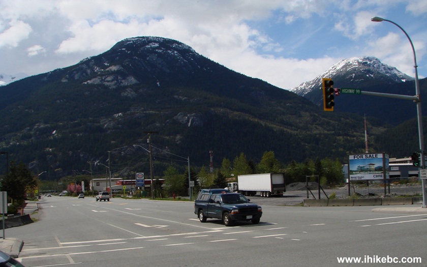
Photo of Highway 99 at Industrial Way in Squamish BC Canada
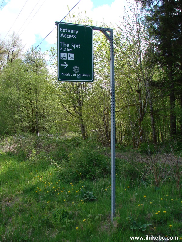
4. Industrial Way is very short here, and, within a minute, you are at a T-junction with Queens Way. Turn to the right. The sign is directing you to Windsurfing, among other things.
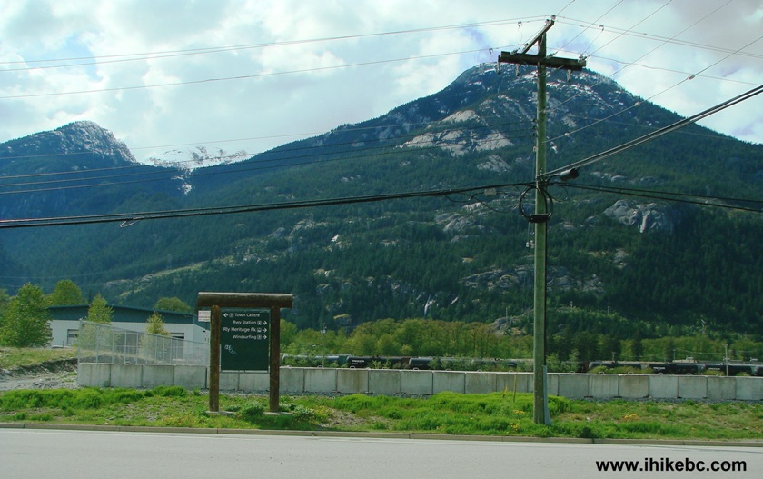
Industrial Way at Queens Way in the Town of Squamish BC Canada
5. Railway Heritage Park (Number 2 on the map above) is on the right side two kilometers after you turn onto Industrial Way from Highway 99. We visited Railway Heritage Park in April of 2010, and it is a worthwhile attraction.
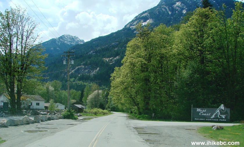
Squamish Railway Heritage Park Entrance
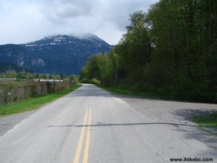
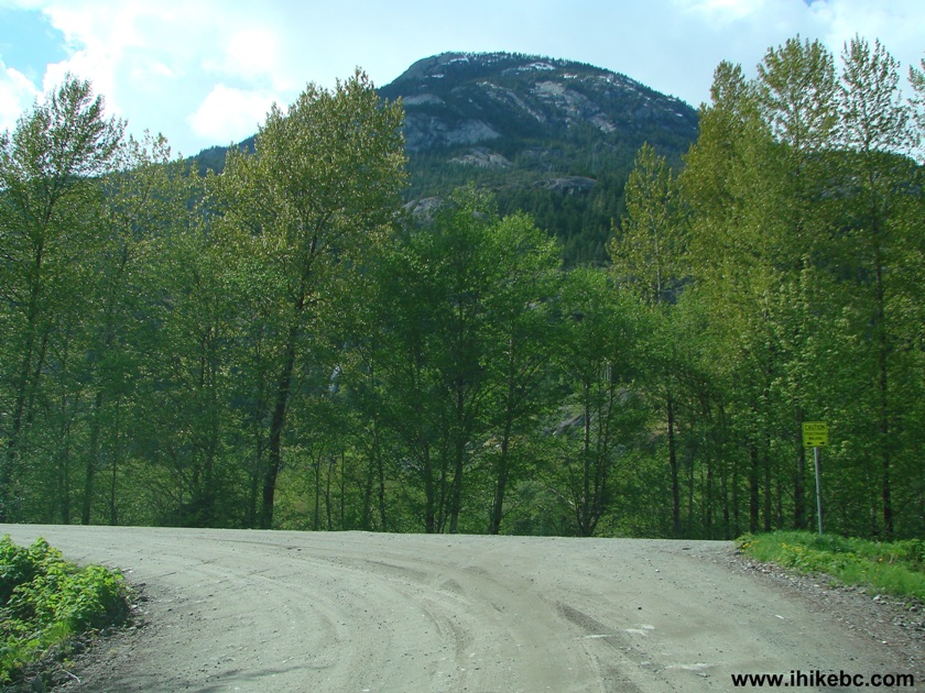
6. One kilometer later, a sign is directing you to turn onto a dirt road to reach The Spit.
Sign directing to the Squamish Spit near Squamish BC Canada
7. The turnoff right after the sign.
The turnoff to Squamish Spit
8. The beginning of the dirt road, which has numerous potholes.
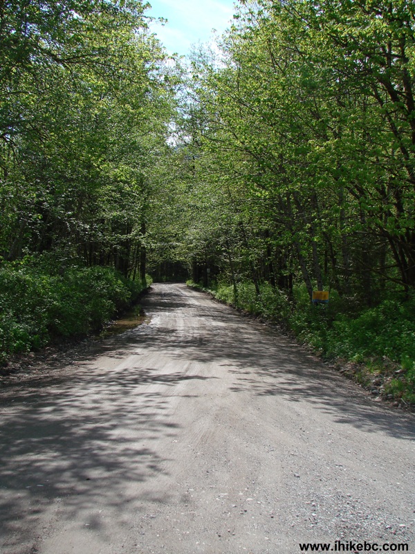
The Road to Squamish Spit by Squamish British Columbia
9. Within a minute, you get to another T-junction. Turn left here.
Driving to Squamish Spit
10. And then it's just driving straight, admiring the nature, and testing your vehicle's suspension.
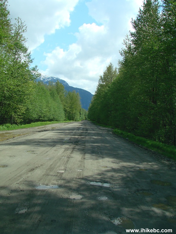
Photo of a Dirt Road Leading to The Squamish Spit
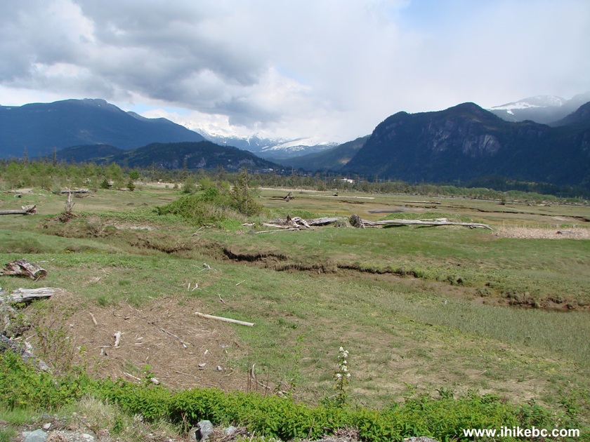
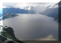
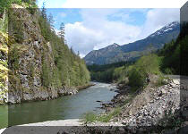
11. The views to the left are simply grand. The Stawamus Chief dominates the skyline.
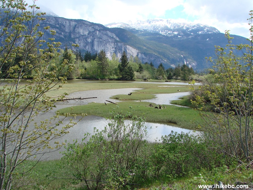
Stawamus Chief and Squamish River Estuary seen from the dirt road leading to the Squamish Spit
12. After 3.5 km of the dirt road, you reach The Spit's gate.
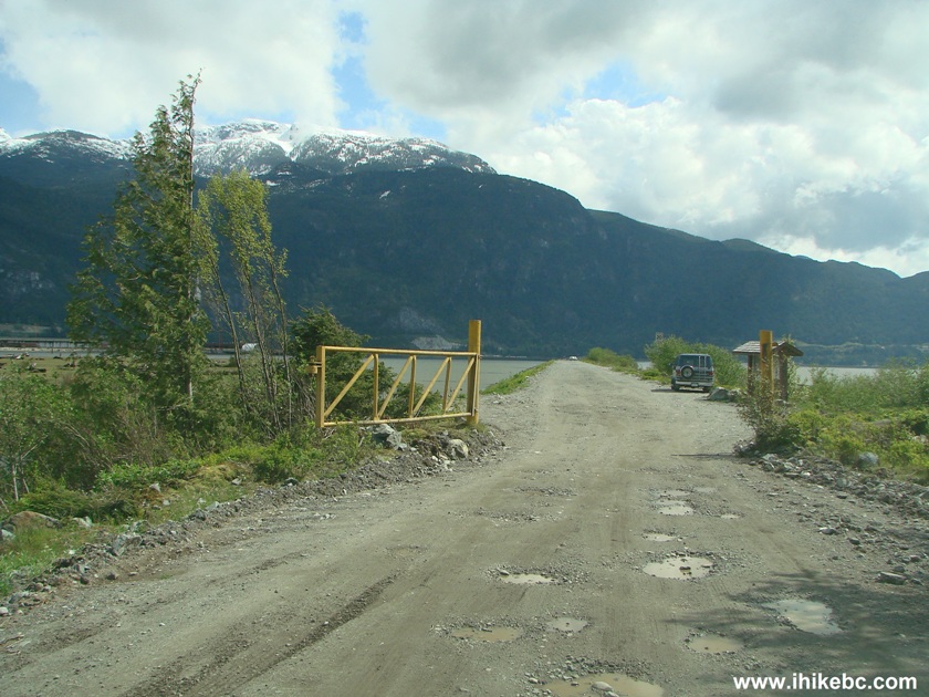
The Squamish Spit Entrance
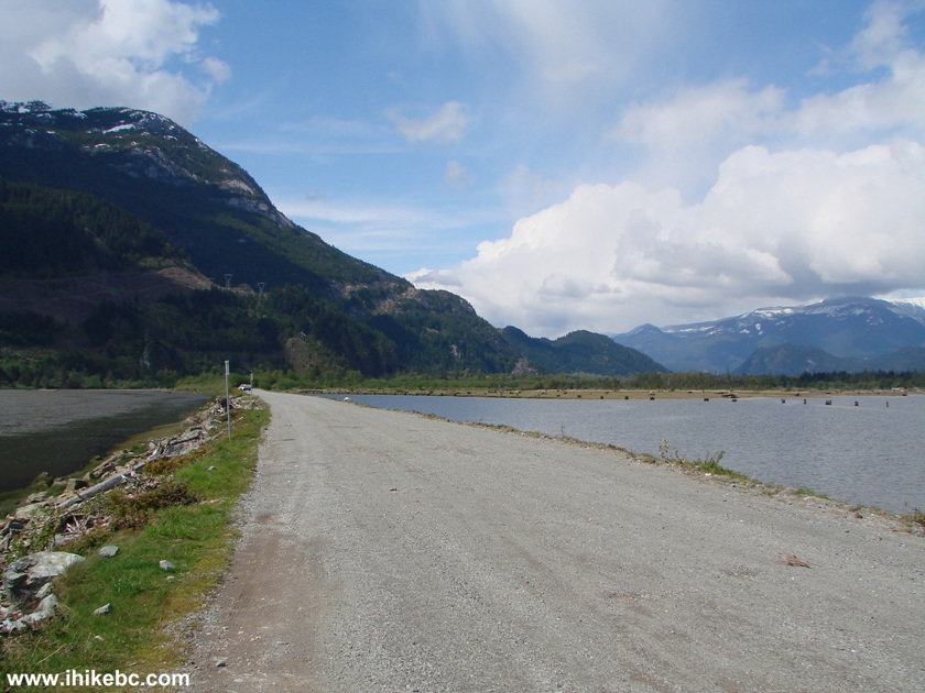
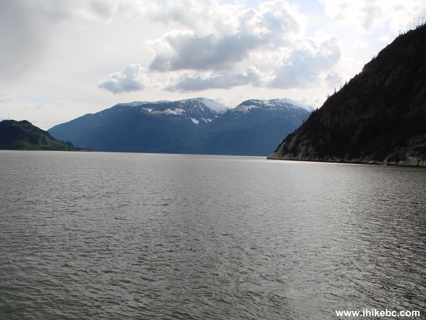
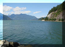
13. The views from The Spit are superb, especially on the left (East) side. You can even see Shannon Falls in the distance (check out the video below).
View from the Squamish Spit
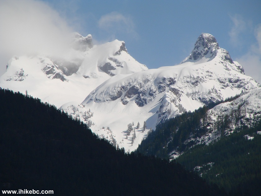
14. Using a substantial zoom makes it easier to see these impressive mountain peaks.
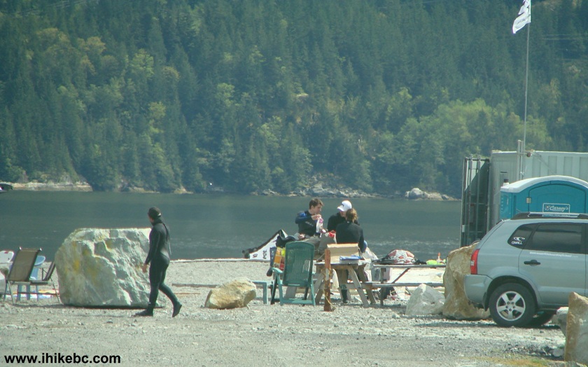
15. Closer to the end of The Spit, several people in watertight clothing were hanging out. But it appeared that they have finished their water-related activities for the day. A toilet cabin is seen on the right. This is also a vehicle turnaround area.
Picture of People at the Squamish Spit
16. Looking back from near the end of The Spit.
The Squamish Spit near the town of Squamish BC Canada
17. Just beyond where the people are seen in photo #15, there were many interesting items placed on the ground.
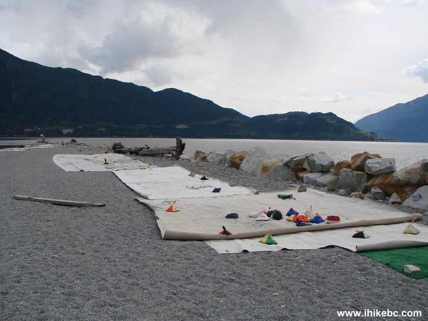
The Squamish Spit
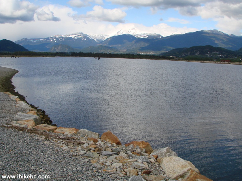
18. Looking to the right. Not bad at all.
View of Howe Sound from The Squamish Spit near Squamish British Columbia
Canada
19. And now to the left.
Here is our video of The Squamish Spit. The large waterfall seen in the video is Shannon Falls.
More ihikebc videos are on our YouTube Channel.
The Squamish Spit is certainly a good place to visit for windsurfers and photographers alike.


|
 |
Other Trips in Squamish Area:
|
|
|
|
|
|
|
|
|
|
|
|
|
|
|
|
|
|
|
|
|
|
|


![]()
![]()
![]()
ihikebc.com Trip 038 - The Squamish Spit