![]()
![]()
![]()

Trip 081 - May 29-30, 2015 (Friday-Saturday)
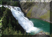
Sikanni Chief Falls
Off Alaska Highway (BC Highway 97)
Page 1 of 2
Location: Northeastern British Columbia,
16th kilometer of Mile 171 (Grassy) Road off Alaska
Highway (BC Highway 97), approximately midway between Fort St. John and Fort Nelson.
Liked: The waterfall, layered rock by the waterfall, meeting moose on Mile 171 Road, fairly good road conditions on Mile 171 Road (but also see "of note").
June 2016 Update: Mile 171 Road is now very rutted and potholed, though still quite passable in a high-clearance 2WD vehicle.
Of note: Remote area, no cell phone signal, steep cliffs at the waterfall viewing area, Mile 171 Road could be impassable in 2wd and/or low-clearance vehicles, unless it's dry. Also, there are no signs on Alaska Highway directing you to Sikanni Chief Falls, so you need to know exactly where to turn off the highway.
Northern BC Backroad Mapbook (3rd edition) Waterfall Coordinates: Page 73 (Pink Mountain) B6.
Related Website: Sikanni Chief Falls Protected Area - BC Parks.
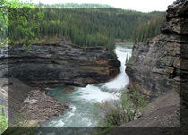
Related Trip: Sikanni River Trail Hike.
>>> British Columbia Waterfalls Visits.
Follow @ihikebc Tweet
This turned out to be an interesting visit from the get go, as we spent over an hour looking for the right road to take to the Falls. Finally, Mile 171 Road turned out to be the correct one. Here is how it all went down:
1. We drove North on Alaska Highway past Fort St. John to get to Sikanni Chief Falls. Alaska Highway in this part of British Columbia is mostly featureless, and usually looks something like this.
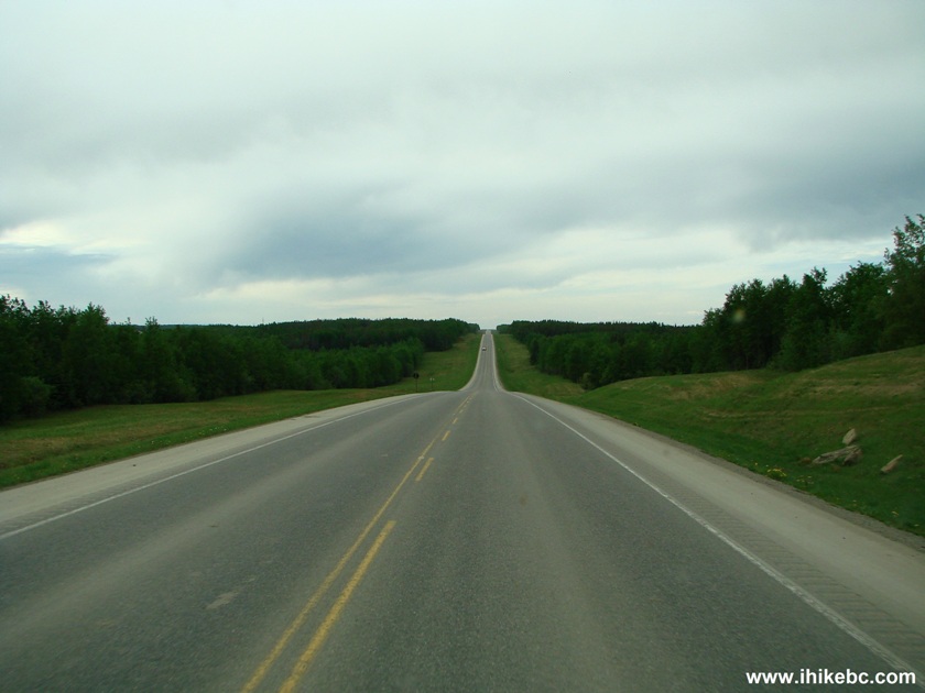
Alaska Highway British Columbia Canada
2. Mile 171 Road is located between the communities of Sikanni Chief (to the South) and Buckinghorse River (to the North). After Sikanni Chief (there is an RV park there, or something like that) look for a small green sign for Mason Creek, seen in the photo below.
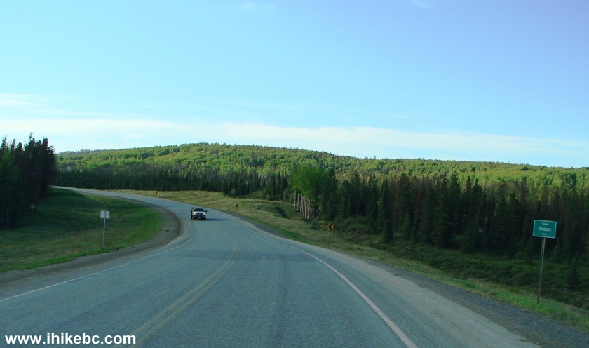
Alaska Highway Near Mile 171 Road BC Canada
3. Mile 171 Road would be on the left side very shortly. Here it is. Take note of a large white sign by the road. Coordinates: N 57⁰19.701' W 122⁰49.240'.
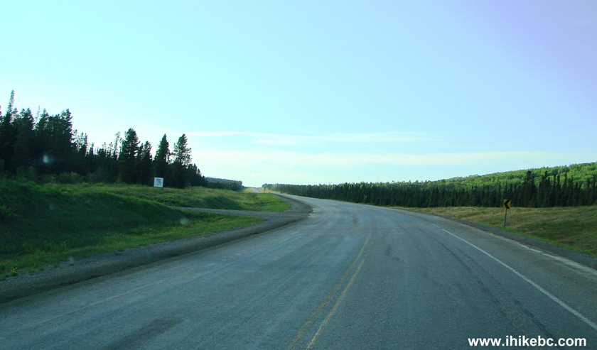
Alaska Highway at Mile 171 (Grassy) Road British Columbia Canada
4. The sign says "Sikanni River Ranch Mile 171". That's a good clue that Mile 171 Road starts here.
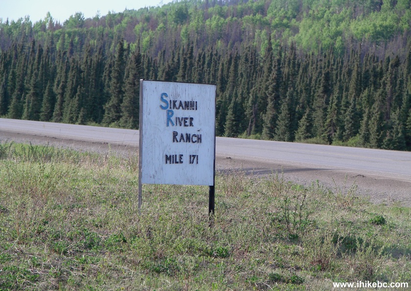
Sikanni River Ranch Sign at Alaska Highway BC Canada
5. Upon turning onto Mile 171 Road, another sign states that this is also known as "Grassy Road," the primary user being Canadian Natural Resources (phone #250-785-3085). In emergency, call 1-888-878-3700, and, if you have a radio which can broadcast on the frequency of 150.815 MHz, it's a good idea to call your locations as you drive up and down this road.
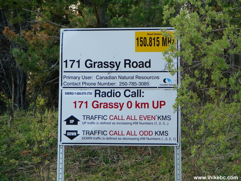
Grassy (Mile 171) Road Information Sign
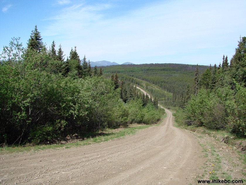
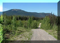
6. The road was in a very good shape.
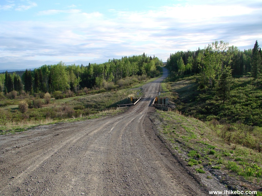
Mile 171 (Grassy) Road BC Canada
7. Alas, between km 4 and 5, there was this one still wet and muddy spot, which we did not dare crossing in our high-clearance 2WD vehicle. We ended up camping overnight on the side of the road.
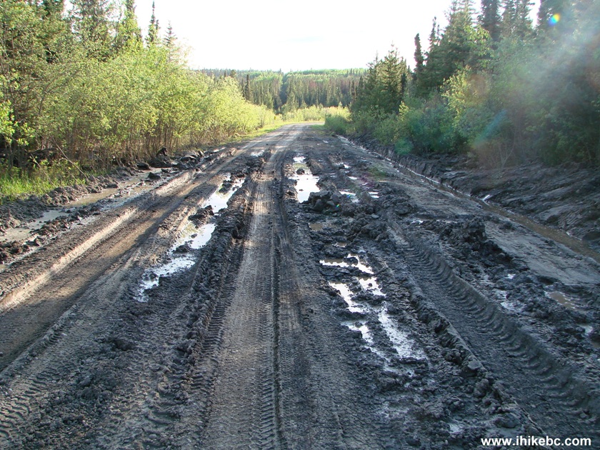
Messy Road Mile 171 (Grassy) Road British Columbia Canada
8. The next day, we decided to bike to our destination. It was sunny and rather warm.
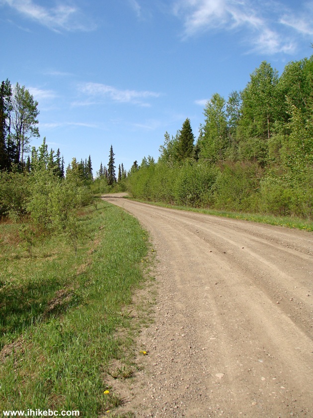
Photo of Grassy Road (Mile 171) British Columbia Canada
9. Mile 171 (Grassy) Road is not very picturesque, mostly going through a forest. There are a lot of hills, so cyclists are going to get a good workout. Beware, though, as the gravel surface is quite slippery, and there are many grooves on the roadway, which make things even more complicated. Going fast is very tempting, especially on a downhill like the one pictured below (located between km 8 and 9), but we had to constantly slow down on this road.
Downhill on Mile 171 Road off Alaska Highway
10. Aside from saving gas money and exercising your legs, another great advantage of biking on Mile 171 Road is that you are more likely to spot moose, who would hear a car much sooner than a bicycle. These two juveniles were very alert and shy, so it took a 12x zoom and much cropping to make them appear close in the photo below. In reality, they were about 150 meters away, and ran into the woods before we could get any closer. Another, much larger moose, ran away on our way back before we could take a photo.
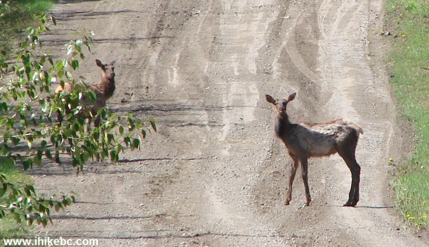
Moose on Mile 171 Road British Columbia Canada
11. There is a three-road split between km 14 and 15. The road to the right goes for a short bit to a small industrial installation (if we recall correctly). The road in the middle leads to Sikanni River Ranch and to the Sikanni River Trail. And the road to the left will get you to...
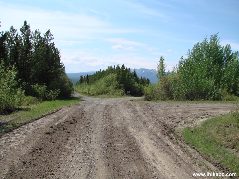
Road Split Mile 171 Road
12. ...Sikanni Chief Falls.
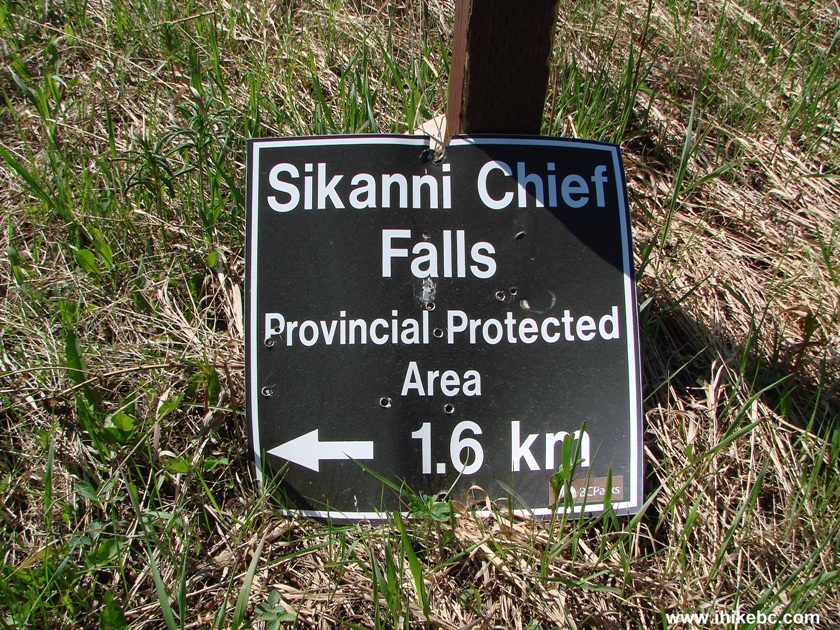
Sign to Sikanni Chief Falls Provincial Protected Area
13. In a few minutes, the road all but ends at a huge open area.
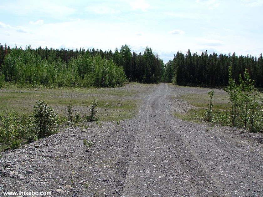
Large Open Area Near Sikanni Chief Falls Trailhead
14. Just beyond that, there is a much smaller parking lot of sorts by the Sikanni Chief Falls trailhead. There is a pit toilet there too. Coordinates: N 57⁰15.686' W 122⁰58.893'. Elevation: 985 meters.
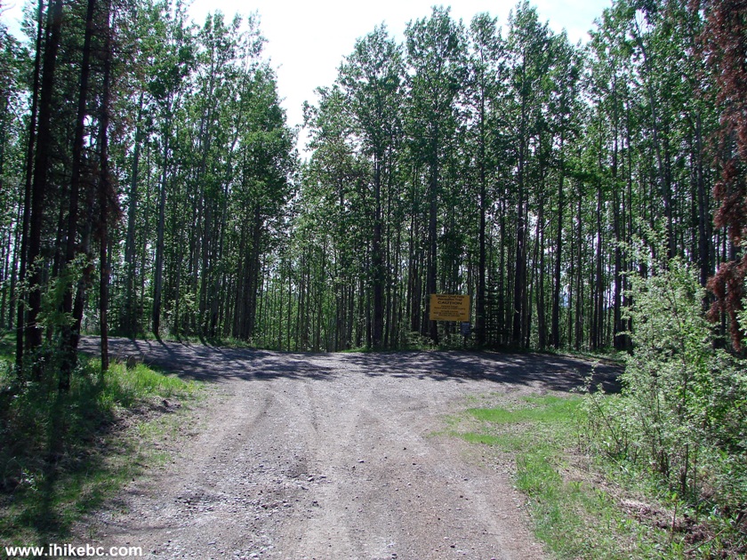
Parking Area by Sikanni Chief Falls Trailhead BC Canada
15. A warning message.
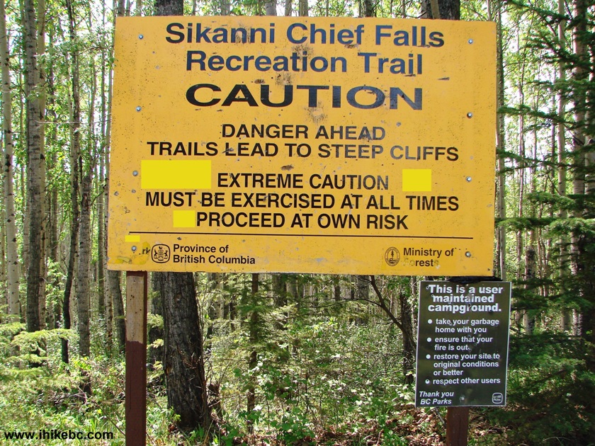
Sikanni Chief Falls Recreation Trail Warning Message
16. It is possible to keep biking, though there are way too many roots on the path that follows, and, besides, the path is quite short. Also, this steep stretch right after the sign would make pushing a bike up on your way back fairly difficult.
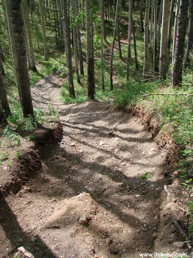
Sikanni Chief Falls Trail British Columbia Canada
Our Sikanni Chief Falls Trip Report Continues On Page 2.


|
 |
Other Trips off Alaska Highway / BC Hwy 97:
|
|
|
|
|
|
|


![]()
![]()
![]()
Follow @ihikebc Tweet
ihikebc.com Trip 081 - Sikanni Chief Falls Visit (Off Alaska Highway / BC Hwy 97) Page 1 of 2