![]()
![]()
![]()

Trip 281 - June 6, 2023 (Tuesday)
Mount Warburton Pike Hike
Saturna Island, BC
Liked: A very fine short ridge hike with excellent island views. Meeting a herd of wild goats.
Related Website: BC Ferries Departures - Saturna Island.
Vancouver Island, Victoria & Gulf Islands Backroad Mapbook (9th edition) Trailhead Coordinates: Page 12 (Saturna Island) D3.
Other Trips on Saturna Island: Whale Trail / East Point Regional Park, Narvaez Bay Trail & Monarch Head Trail Hike.
Follow @ihikebc TweetMount Warburton Pike is located on Saturna Island, one of British Columbia's Gulf Islands. While Saturna Island is much closer to the Lower Mainland than to Vancouver Island, there is no direct ferry sailing from either Tsawwassen or Horseshoe Bay, so departing from Victoria's Swartz Bay or transferring on one of the other Gulf Islands is required. There are only a few sailings each day, so plan accordingly lest you be stuck overnight on a small island with very limited services.
Charles Kahn in his book "Hiking the Gulf Islands of British Columbia" gave this hike a top rating of 5 stars and called it "one of the finest hikes on Gulf Islands". And the views were certainly good to make it a very worthwhile outing. As a bonus, we have met a herd of wild goats during the hike.
There is a parking lot at the end of Staples Road, and then you just walk along Brown Ridge as far as you can (we went for about 800 meters one way) and check out the views of the ocean and nearby islands, mostly Pender Island located right across from Saturna Island. A steep descent is required to get to the best views, though the view from the parking lot is quite good too, if you don't feel like tackling the challenging terrain.
* all trail distances are based on a GPS odometer and are highly approximate.
1. Here is a Google Maps location of Mount Warburton Pike on
Saturna Island.
2. In this map of Saturna Island, posted by the ferry terminal, we have indicated as follows: red square - ferry terminal, blue square - Mount Warburton Pike, green square - Narvaez Bay (subject of our previous trip report), yellow square - intersection of Narvaez Bay Road and Harris Road, right by Saturna General Store.
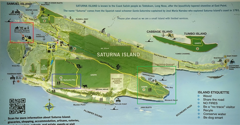
Map of Saturna Island
3. We are now on Narvaez Bay Road, coming from Narvaez Bay. The ferry terminal is 1.8 km straight ahead (via East Point Road), but we are making a left turn onto Harris Road.
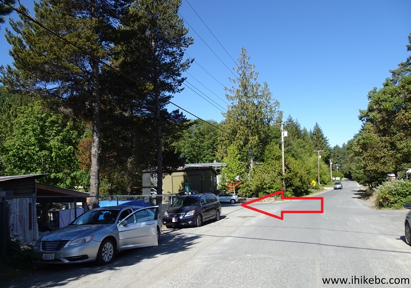
Narvaez Bay Road Saturna Island BC Canada
4. Harris Road after the turn.
Saturna Island Harris Road
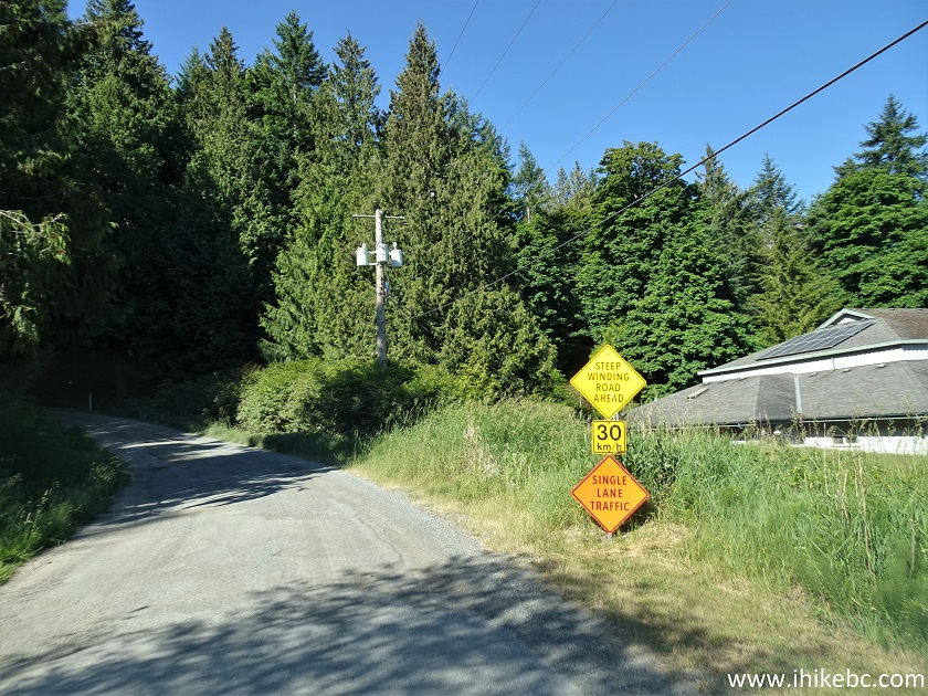
5. 700 meters after turning onto Harris Road, make a left turn onto Staples Road.
Harris Road at Staples Road Saturna Island British Columbia Canada
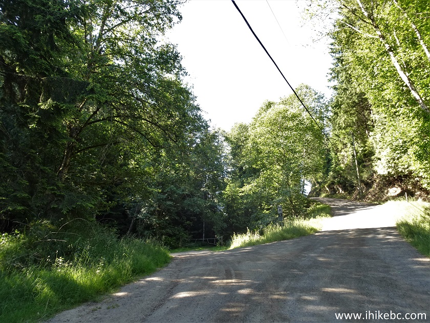
6. Just like Harris Road, Staples Road is narrow and frequently winding. Watch for deer, pedestrians, cyclists, other vehicles.
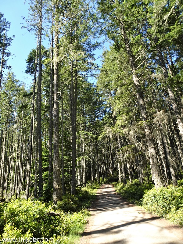
Staples Road - Saturna Island - British Columbia - Canada
7. Arriving to Mount Warburton Pike overflow parking lot, 4.8 km from Narvaez Bay Road / Harris Road intersection, and 6.6 km from Lyall Harbour BC Ferries Terminal.
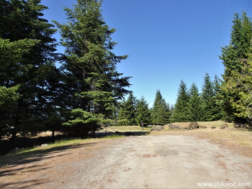
Mount Warburton Pike Overflow Parking Lot
8. The main parking lot is just around the corner. Coordinates: N 48⁰46.452' W 123⁰10.260'. Elevation: 395 meters.
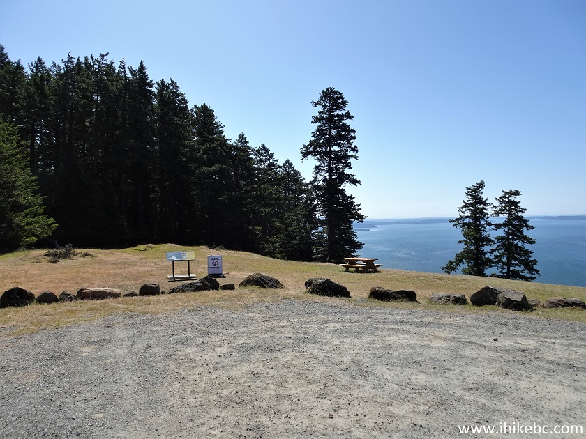
Mount Warburton Pike Parking Lot
Here is our video of driving from Harris Rd to the parking lot:
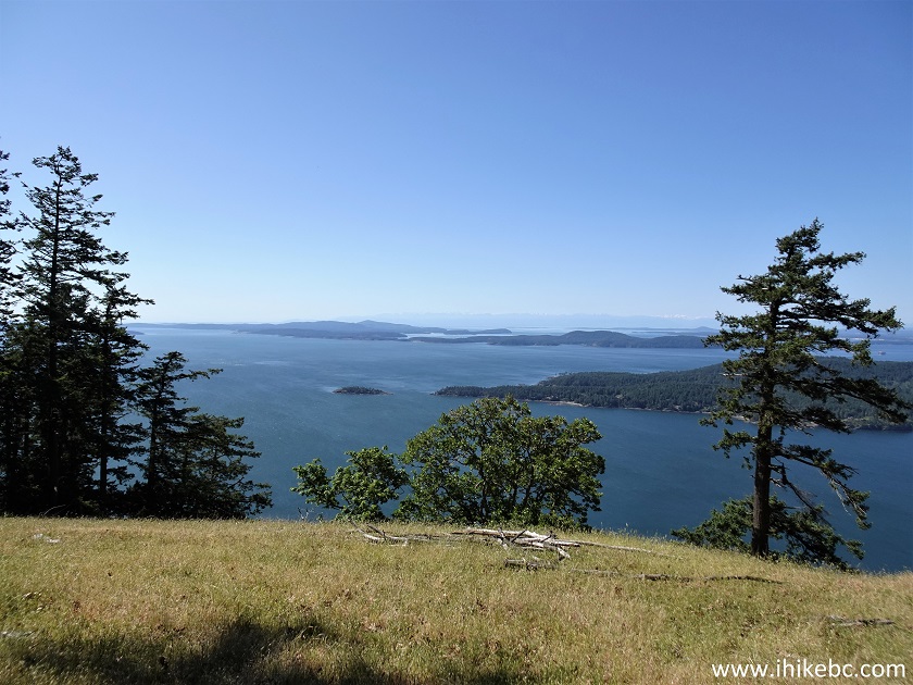
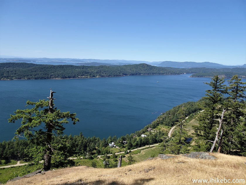
9. A fine view from the lot. That's South Pender Island peeking from the right side, and Blunden Islet just to the left of it.
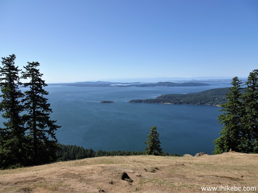
View from Saturna Island BC
10. Going a bit forward allows for even a better view.
View from Mount Warburton Pike
Here is our video of the views from this location:
11. If you decide to hike Brown Ridge, make a right turn, find a path which makes sense and keeps you out of the trees, and get ready for a steep, if short, descent at some point. Here we are at 200 meters from the parking lot.
Brown Ridge - Mount Warburton Pike - Saturna Island - British Columbia -
Canada
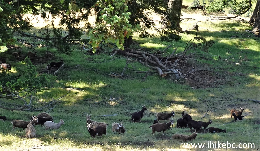
12. As we started to head along the ridge, a herd of about 20 wild goats appeared nearby.
Saturna Island Hiking - Mount Warburton Pike
13. Here they are.
Saturna Island Goats
14-16. These goats were curious and shy at the same time. Much zoom used.
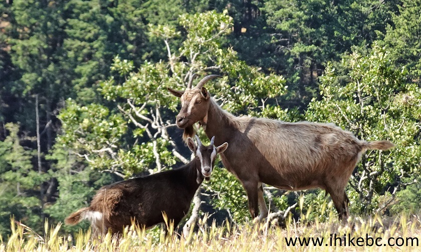
Feral Goats on Saturna Island
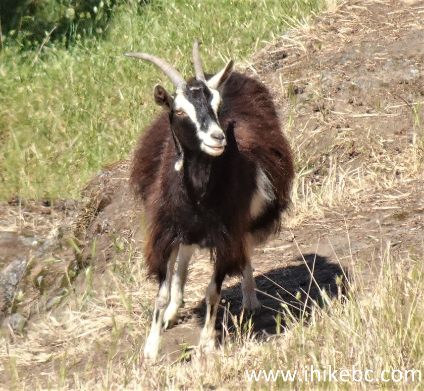
Saturna Island Goat
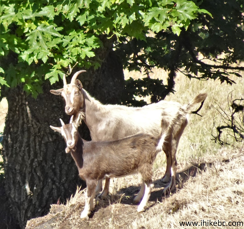
British Columbia Wild Goats on Saturna Island
Here is our video of the goats:
17. At about 500 meters from the parking lot, here is that steep descent.
Mount Warburton Pike Hike on Saturna Island BC Canada
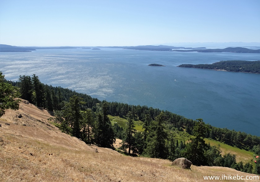
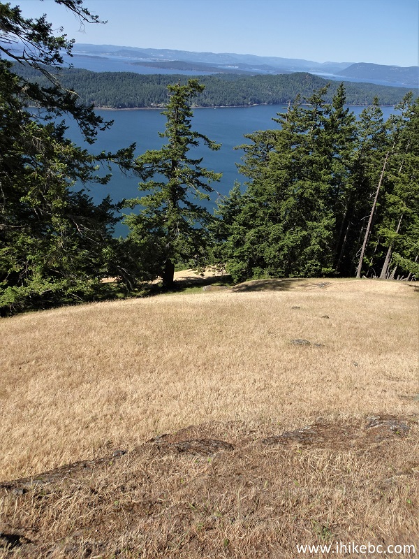
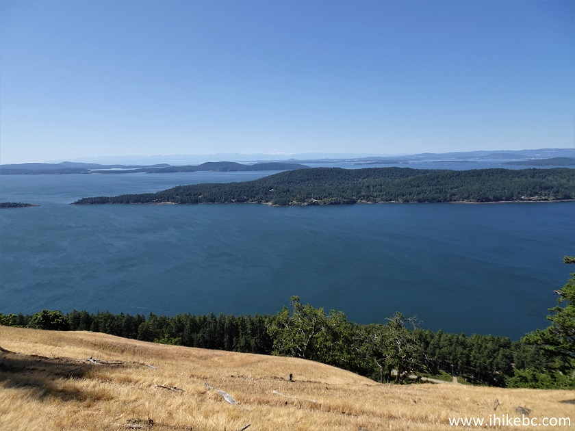
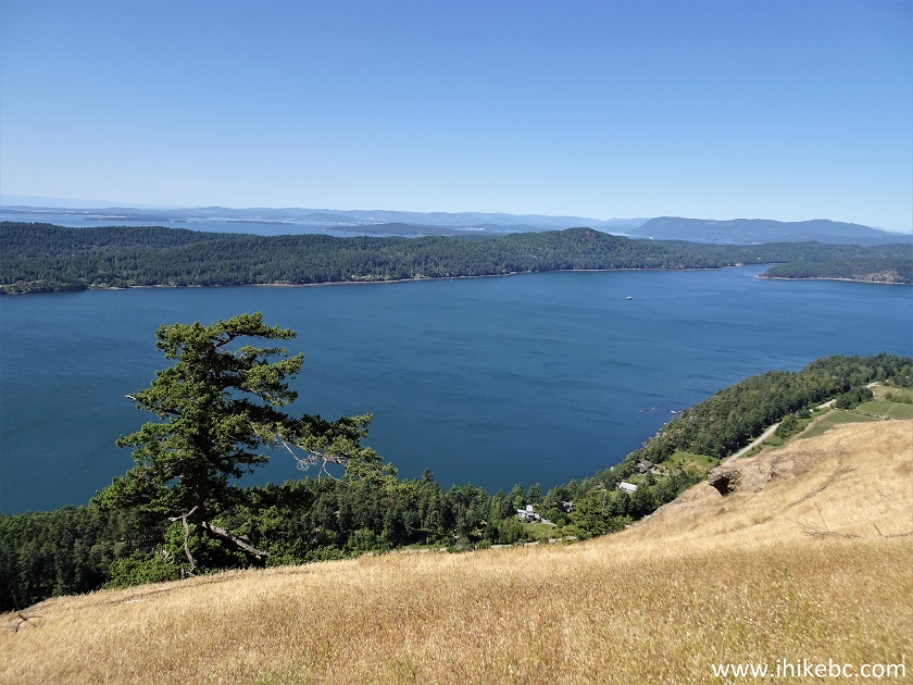
18-21. Once you have cleared the tree line, the views are very fine indeed. Left to right, then a panorama. It's much more impressive with your own eyes, as the camera can't quite capture the width and the depth of this view. South Pender Island is in the foreground.
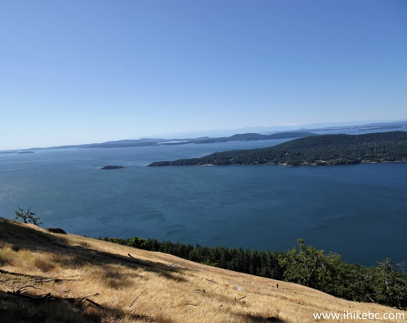
View from Saturna Island
Pender Island View from Saturna Island
Mount Warburton Pike Saturna Island BC
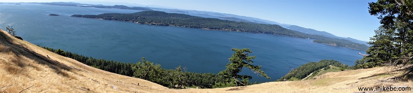
Saturna Island - Mount Warburton Pike
Here is our video of the views from approximately this location:
More ihikebc videos are on our YouTube Channel.
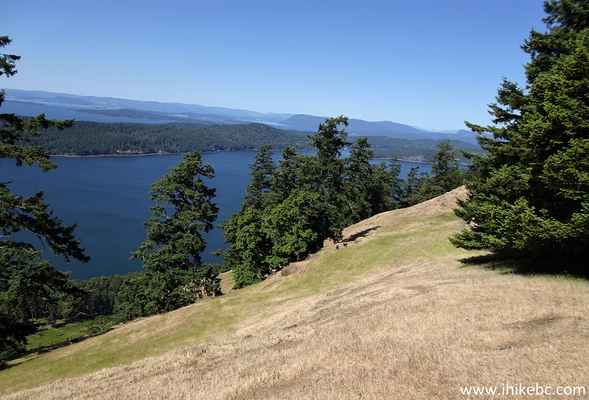
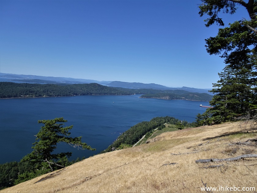
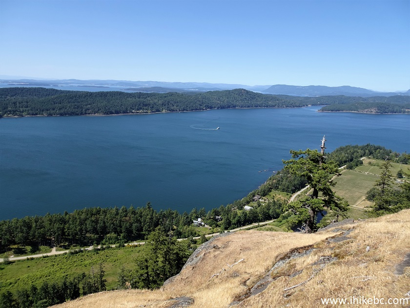
22. One more.
Pender Island view from Mount Warburton Pike on Saturna Island BC
23. And that's approximately where we stopped, about 800 meters from the parking lot. It may or may not be possible to go further. Approximate Coordinates: N 48⁰46.479' W 123⁰10.873'. Elevation: 260 meters (135 meters elevation loss from the parking lot).
Saturna Island BC - Mount Warburton Pike
24. Another fine view on the way back.
Mount Warburton Pike Hike
The views from the Brown Ridge of Mount Warburton Pike are certainly impressive, especially considering the rather short hiking distance involved. Meeting the goats was a pleasant bonus. Highly recommended.


|
 |
![]()
![]()
![]()
Other Trips:


![]()
![]()
![]()
Follow @ihikebc Tweet
ihikebc.com Trip 281 - Mount Warburton Pike Hike (Saturna Island BC)