![]()
![]()
![]()

Trip 225 - July 15, 2021 (Thursday)
Cold Creek Falls Trail Hike
Port Alberni, British Columbia, Canada
Liked:
The waterfall, a fairly short and easy trail, shade in the forest, no bugs.Of Note: Numerous intersecting trails, only one trail sign (by the bridge), a few moderately challenging sections, uneven ground, rocks and roots, hiking poles and boots are recommended.
Vancouver Island Backroad Mapbook (9th edition) Trailhead Coordinates: Page 17 (Port Alberni) B1.
Other Trips in Port Alberni Area: City of Port Alberni Visit, Jack's Peak Trail.
Cold Creek Falls Trail is located in a small city of Port Alberni on Central Vancouver Island. There are several trailheads at various parts of the city, but they all eventually lead to a small bridge, where a side trail leads to the waterfall. Cold Creek Falls is a small waterfall, but quite pleasant to look at. Also, the trail itself is through a fine forest. There are a few small hills here and there, but it's an easy trail, all things considered. We hiked from the Milligan Road trailhead today, and it appears to be the shortest way (under 1 km) to get to the waterfall. Another trailhead that we know of is located at the intersection of Maebelle Road and Mozart Road.
1. We are in Port Alberni, Westbound on Johnston Road (BC Highway 4), approaching Cherry Creek Road.
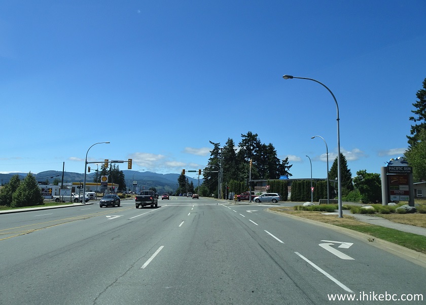
Port Alberni Johnston Road (BC Highway 4) Approaching Cherry Creek Road
2. Making a right turn from Highway 4 (Johnston Road) onto Cherry Creek Road. Zero your odometer here.
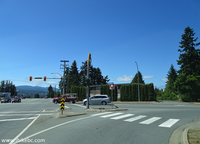
Johnston Road at Cherry Creek Road Port Alberni BC Canada
3. Cherry Creek Road 900 meters from Johnston Road.
Cherry Creek Road Port Alberni BC
4. At 2.1 km, make a right turn onto Milligan Road.
Cherry Creek Road at Milligan Road Port Alberni British Columbia
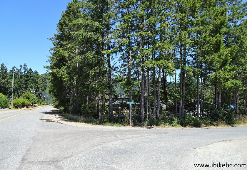
5. Just 200 meters later, make a left turn to stay on Milligan Road (Margot Road would be to the right).
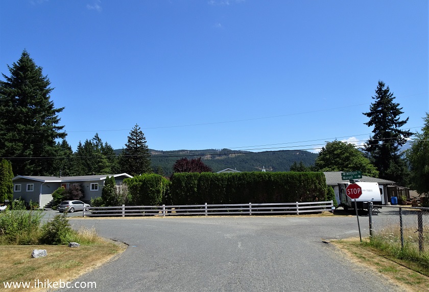
Milligan Road at Margot Road Port Alberni BC Canada
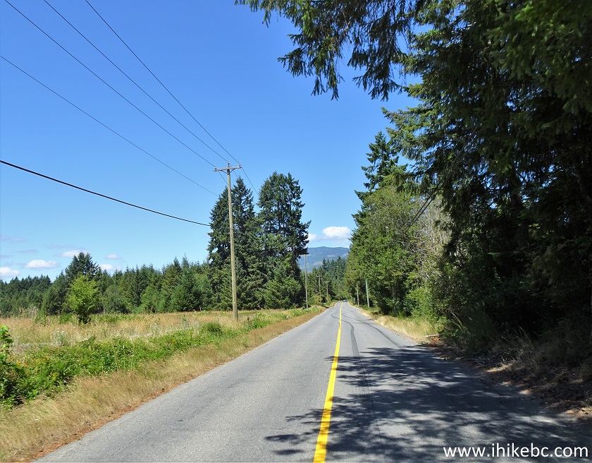
6. Continuing on Milligan Road.
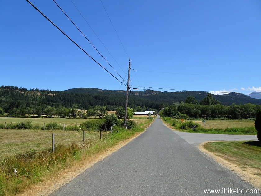
Vancouver Island - Port Alberni BC - Milligan Road
7. 3.5 km after turning from Highway 4 (Johnston Rd) onto Cherry Creek Road, we arrived at the end of Milligan Road near Alberni Valley Cold Creek Motor Park. Plenty of space to leave your vehicle. Coordinates:
N 49⁰17.131' W 124⁰46.217'. Elevation: 89 meters.
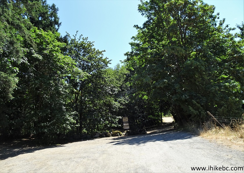
Milligan Road by Alberni Valley Cold Creek Motor Park
8. The trailhead for Cold Creek Falls is just to the left.
Cold Creek Falls Trailhead - Hiking in Port Alberni
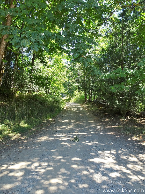
9. 90 meters later, a gate prevents all vehicular access. All distances from this point on are based on a GPS odometer and are approximate.
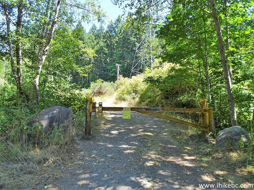
Cold Creek Falls Trail Hike in Port Alberni BC Canada
10. Cold Creek Falls Trail 150 meters from Milligan Road trailhead.
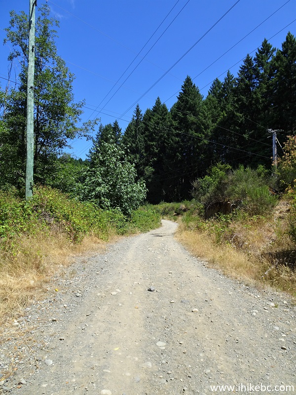
Cold Creek Falls Trail in Port Alberni British Columbia
11. At 240 meters, a power line tower stands next to a split with four paths.
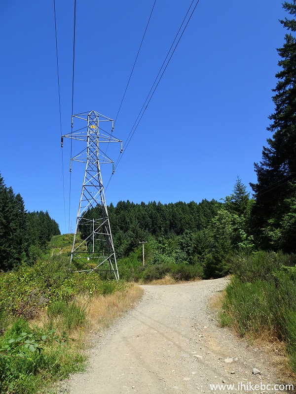
Port Alberni Hike - Cold Creek Falls Trail
12. Take the path on the very right.
Port Alberni Trail - Cold Creek Falls Hike
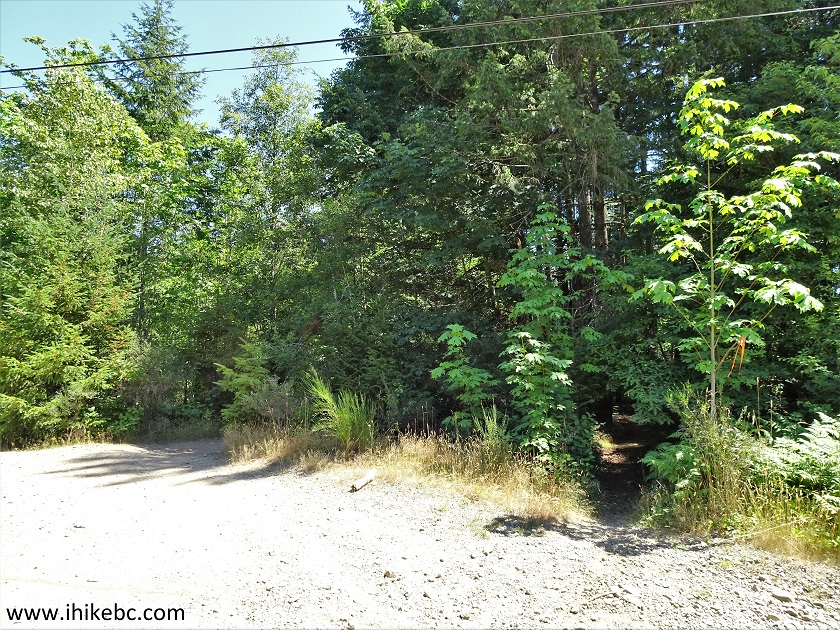
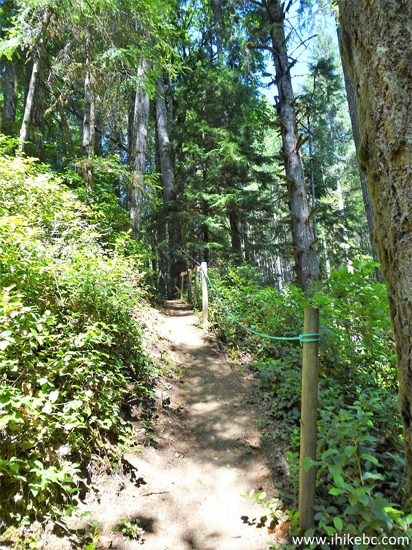
13. Now hiking in the forest, 350 meters from the trailhead.
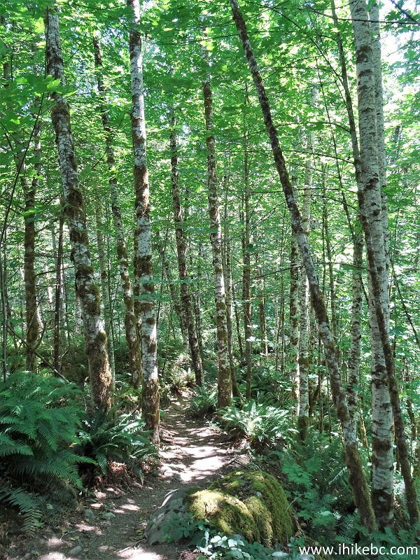
Port Alberni Hike - Cold Creek Falls Trail
14. At 450 meters, there is this bridge. Coordinates:
N 49⁰17.161' W 124⁰46.032'. Elevation: 108 meters. The trail to the waterfall is on the left side before the bridge. There is also a sign there, but you don't see it when walking in this direction, so we went past it. There is a small hill right after the bridge. Once you climb the hill, the Motor Park is on the right, and the trail continues for much longer straight ahead en route to other Cold Creek Falls trailhead(s).
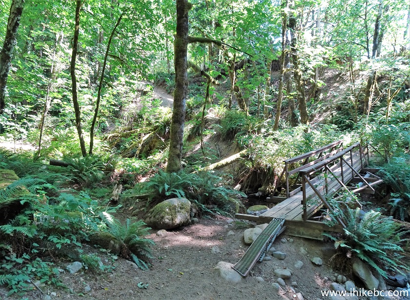
Cold Creek Falls Trail - Hiking in Port Alberni British Columbia Canada
15. Looking left.
Cold Creek Falls Trail on Vancouver Island BC
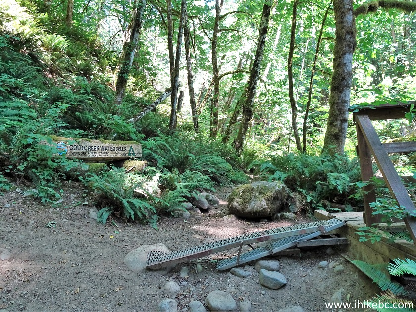
16. Here is that one and only sign.
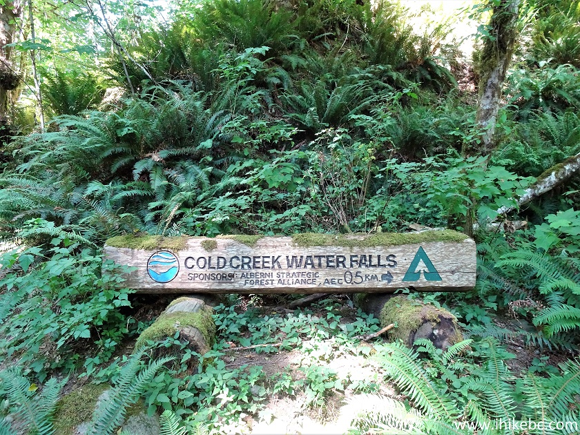
Cold Creek Waterfalls Sign
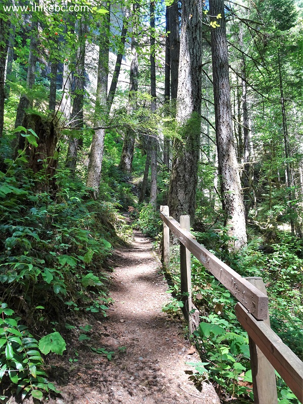
17. The start of the path by the bridge. It's 360 meters from here to the waterfall.
British Columbia Hiking - Cold Creek Falls Trail in Port Alberni
18. At 640 meters from the trailhead.
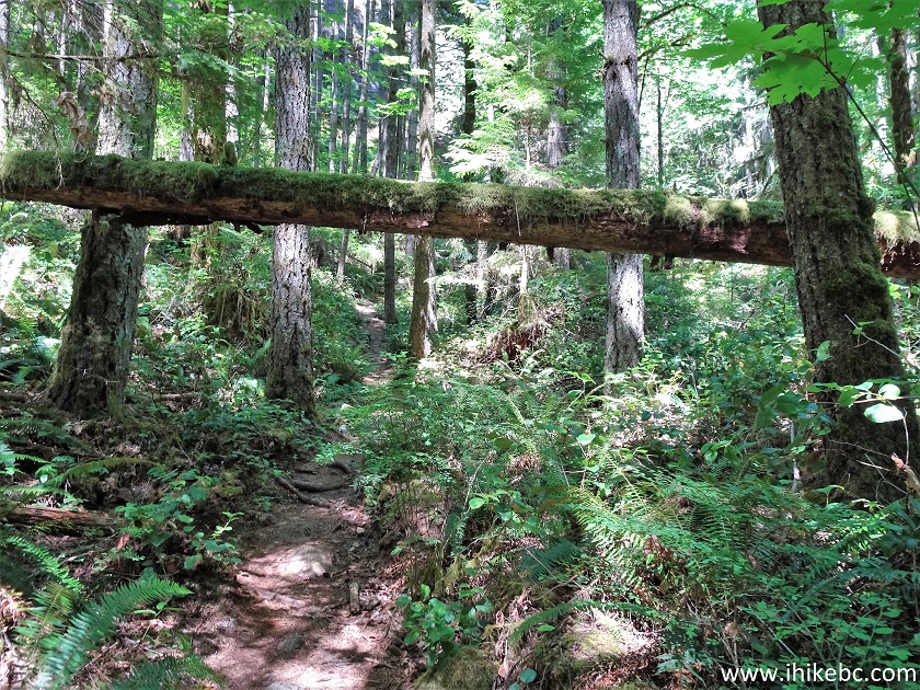
Cold Creek Falls Trail - Hiking in British Columbia
19. 80 meters later, a small staircase helps with some elevation gain.
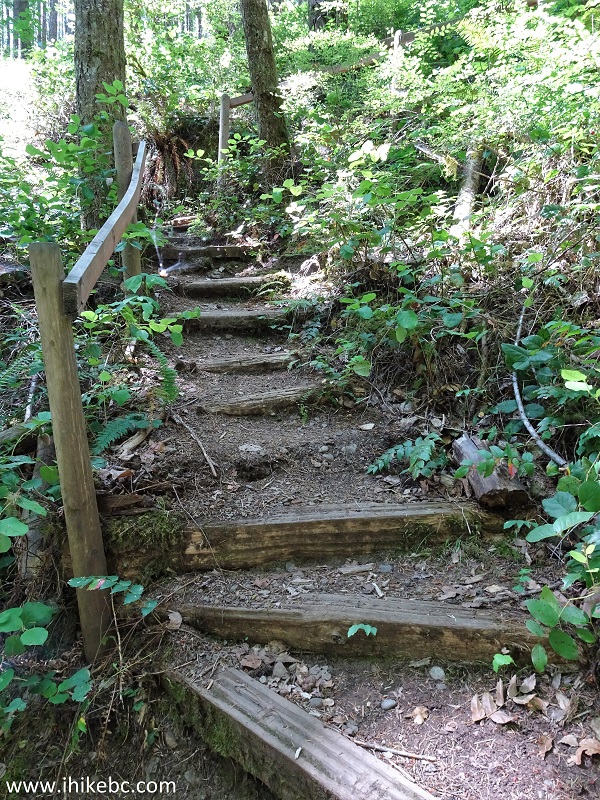
Cold Creek Falls Trail
20. Now at 750 meters, approaching the waterfall.
Trail in British Columbia - Cold Creek Falls Trail
21. And here it is, in the distance, 810 meters from the trailhead.
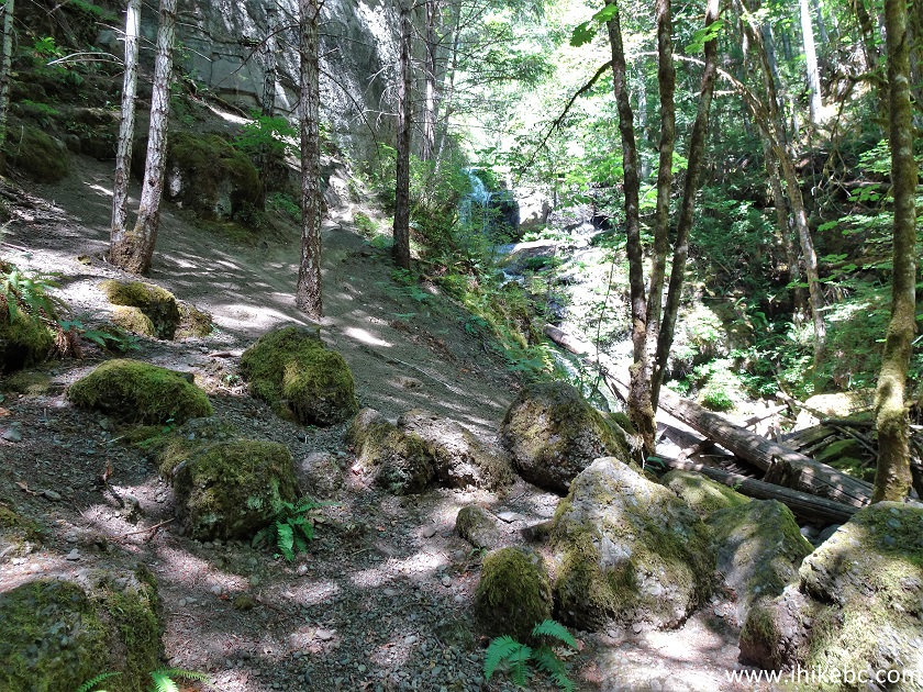
Cold Creek Falls Hike
22. Cold Creek Falls. Coordinates:
N 49⁰17.254' W 124⁰45.845'. Elevation: 100 meters.
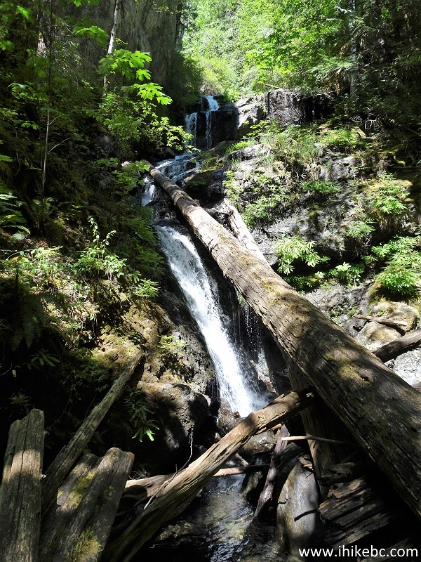
Cold Creek Falls Port Alberni BC Canada
23. A neat small waterfall.
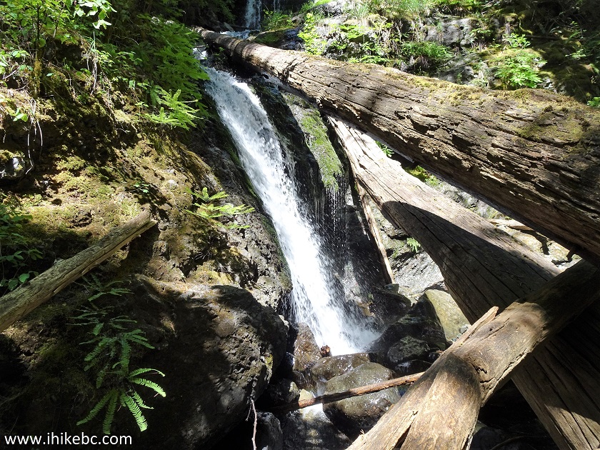
Cold Creek Falls
Here is our video of Cold Creek Falls.
More ihikebc videos are on our YouTube Channel.
A pleasant short path in a pleasant lush forest leads to a pleasant small waterfall. Highly recommended.


|
 |
![]()
![]()
![]()
ihikebc.com Trip 225 - Cold Creek Falls Trail Hike (in Port Alberni BC)