![]()
![]()
![]()

Trip 048 - July 6, 2011 (Wednesday)
Statlu Lake Trail Hike
To Second Waterfall (Brotherhood Trail Split)
Distance From Vancouver:
152-172 km, depending on if you take Highway 1 East -
Highway 11 North - Highway 7 East route, or drive straight on Highway 7
East from Vancouver (Broadway turns into Lougheed Highway in Burnaby and
goes on from there). Once you are at the split of Highway 7 and 11 in
Mission, drive further East on Highway 7 for 32 km to Morris Valley Road
and turn left. Then drive for 16 km to
Harrison West
Forest Service Road. Then for 29.2 km to Chehalis-Mystery FSR
and turn left. Then for 8.3 km until the T-junction, where you can park
and take the road on the right to the trail.
Liked: Beautiful lake, waterfalls.
Of note: Remote wilderness area with few, if any, people around, and no cell phone coverage. The trail is hard to find. The trail is marked sporadically and could be hard to follow. Two narrow log bridges and two tricky rockslides to be crossed (avoid this trail if the rocks are wet or snow-covered). The trail is moderately challenging with some steep sections. Some parts of the trail are substantially overgrown and scratches are imminent without long pants and a long-sleeved shirt. Hiking poles and boots are essential.
Vancouver, Coast & Mountains Backroad Mapbook (2010 edition) Coordinates: Page 14 (Harrison Lake) B4.
103 Hikes in Southwestern British Columbia (2008 edition): hike #58.
Related Website: Chilliwack District FSR Conditions.
>>> British Columbia Waterfalls Visits.
Follow @ihikebc Tweet
Statlu Lake trail is one of those beautiful remote trails that few people hike due to the difficulty of getting to the trail, difficulty locating the trail, and difficulty hiking the trail. We probably would not have found it, were it not for a fellow camper/hiker whom we encountered camping in his hatchback at the T-junction described below. He told us how to get to the Statlu Lake trailhead, and we were able to eventually find it the next day, despite getting lost a few times.
We tried to use directions described in "103 Hikes in Southwestern British Columbia," but those directions advise taking Chehalis FSR, where a huge rockslide blocked access likely forever. Thus, it is now necessary to come from the opposite direction, by taking Harrison West FSR, and then turning onto Chehalis-Mystery FSR. We also could not quite figure out the map of this area contained in the "Backroad Mapbook," though our map-reading skills could be better.
Getting to the trail is, actually, fairly uncomplicated, but only if you know exactly where you are going. In any case, it is a long trip from Vancouver for sure. It might be better to get to Chehalis-Mystery FSR in the evening, camp overnight, and then hike in the morning, especially because this could be a very long hike. There is a good flat camping spot on the left side of Chehalis-Mystery about 7.2 km after the split with Harrison West FSR. To get a better picture of how to get to Harrison West FSR, check out our Weaver Trail trip report.
1. We have just driven 29.2 km on Harrison West Forest Service Road and turned left onto Chehalis-Mystery FSR.
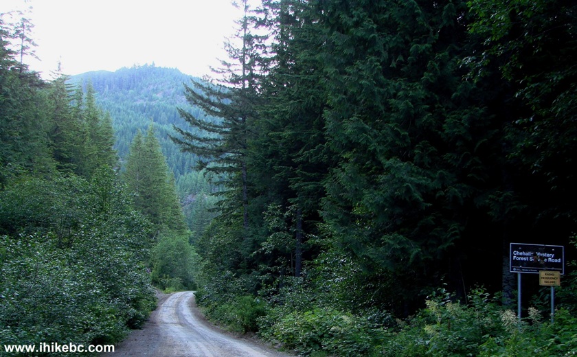
Chehalis-Mystery FSR Province of British Columbia Canada
2. After driving for 8.3 km, you come to a T-junction right after a long steep descent. If you turn left, your progress would be blocked in about 100 meters by this mound. There is enough space to turn around here.
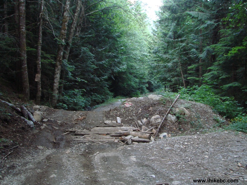
3. And on the right side of the T-junction is the way to Statlu Lake trailhead. You may try to drive in, if you have a 4x4, but that would save 10 minutes at most.
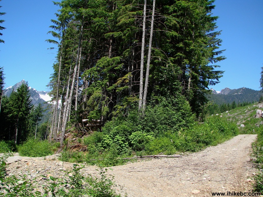
4. Soon, you reach a split, where you need to turn left.
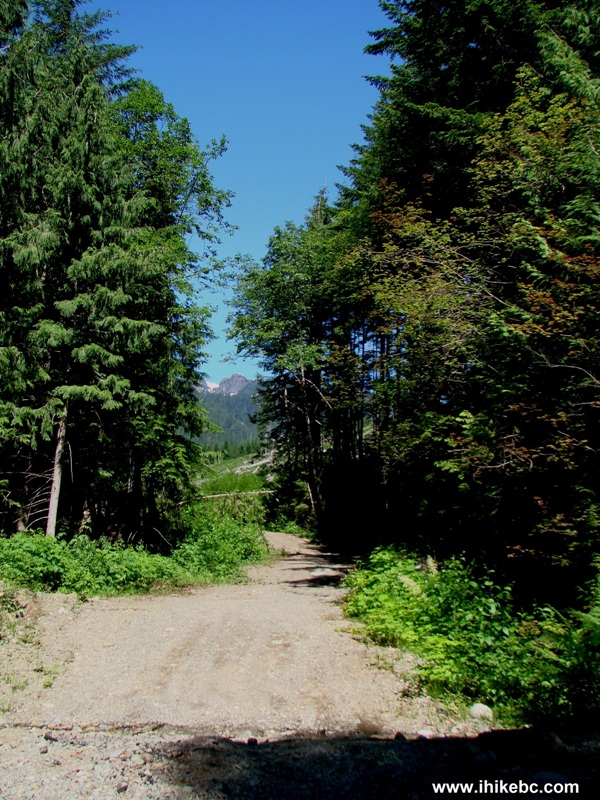
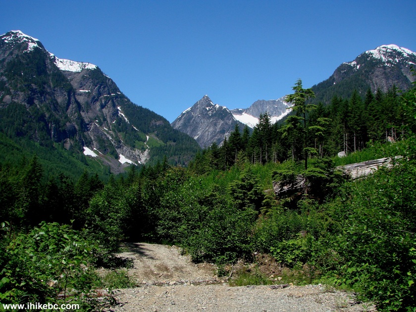
5. But, if you have time to spare, you may want to turn right, where the road goes up and leads to this great view within 10-15 minutes.
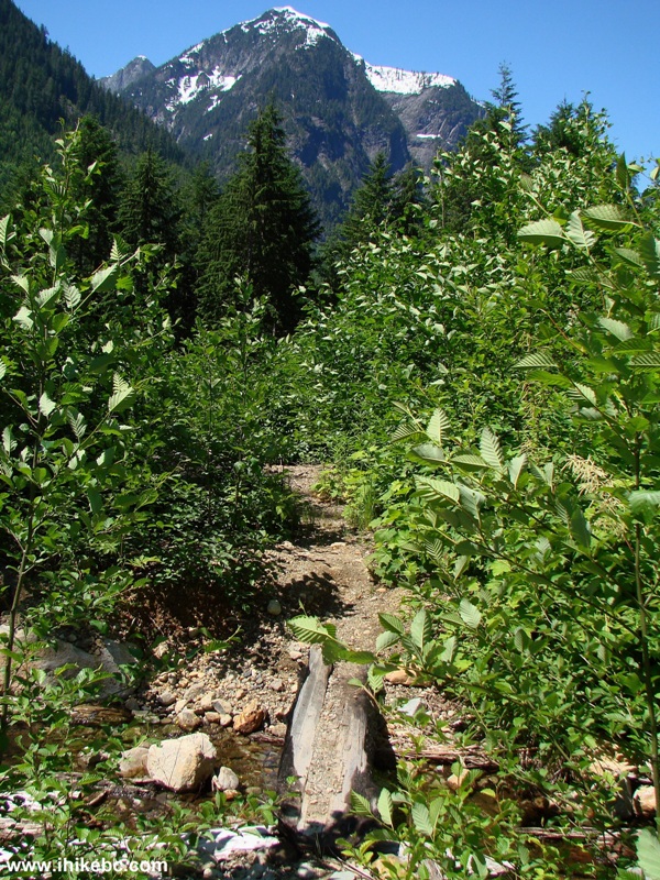
6. If you turn left at the junction seen in photo #4, soon you come to this tiny log "bridge", after which there is a stand of small trees and plants and no trail in sight. Cross the bridge and walk forward. The trail is a minute away. There are no information boards or pieces of paper or even flagging tape to show the start of the trail, but the path is quite obvious once you go past this stretch of your hike.
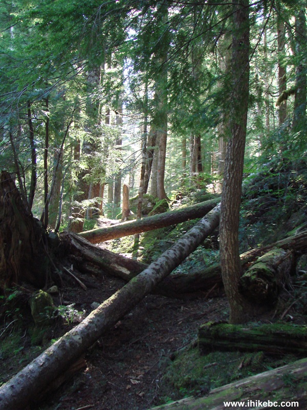
7. Then, you walk through a forest along a fairly easy path, and reach a sturdy log bridge.
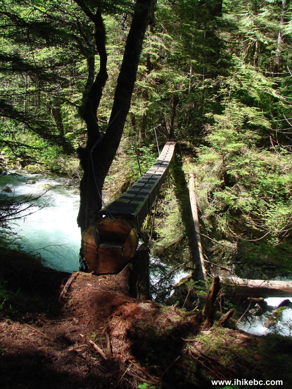
Statlu Lake Trail Log Bridge Photo BC Canada
8. Half an hour later, you get to the second bridge. Get ready to turn right very soon after crossing this bridge.
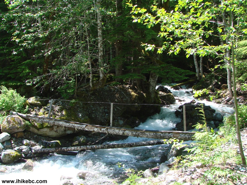
Statlu Lake Hiking Trail in British Columbia Canada
9. After crossing the second bridge, look for a not-very-obvious path on the right side of the trail. Currently, there is an cairn/inukshuk there to guide you. Turn right immediately after the cairn, to which a red arrow is pointing in the photo below.
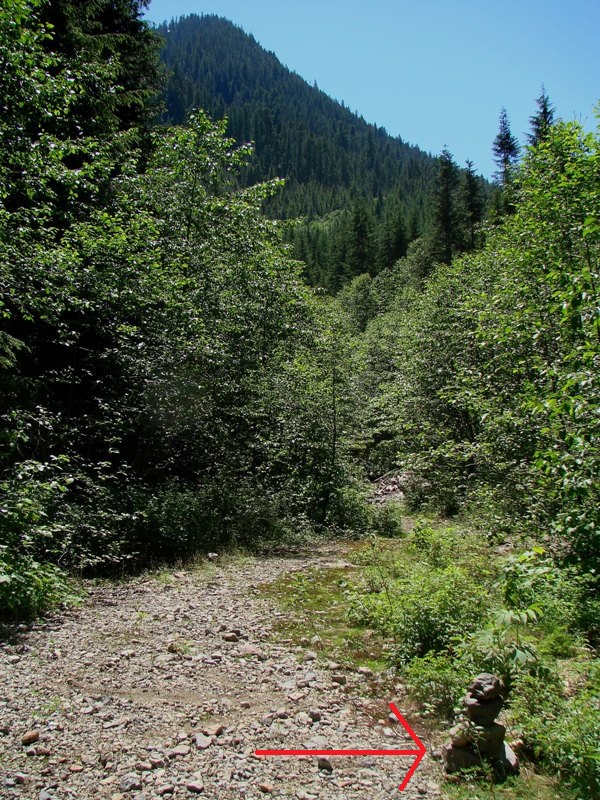
10. If you have reached a deteriorating bridge, you have gone too far, and missed the right turn about a minute earlier. This is the view of the Statlu Lake Trail immediately after making that right turn.
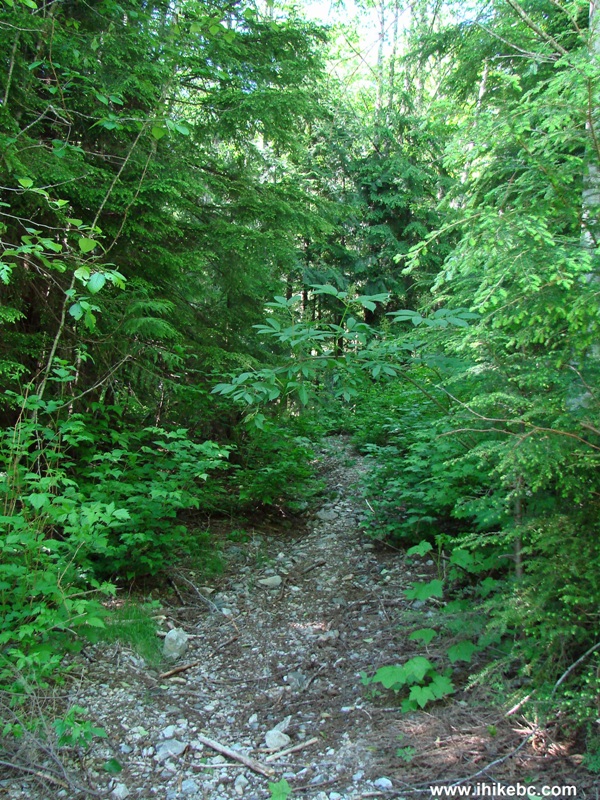
Photo of Statlu Lake Trail BC Canada
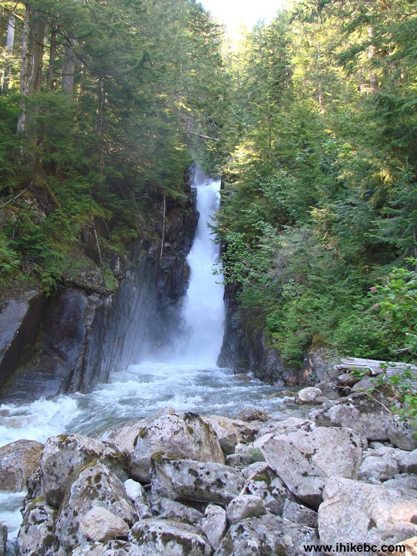
11. Now the hard part begins, as the trail gets quite steep. But the reward awaits 25 minutes later, as you reach two waterfalls in one place. The first waterfall is very small, but can be easily seen and approached.
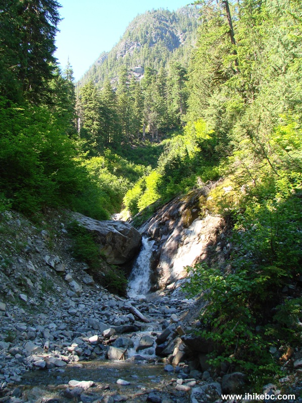
12. The second waterfall is enormous, but, to see even as much as you can see in the photo below, you need to descend down a steep hill. It is very tempting to go further to get an even better look, but there is a very steep drop-off there, partially hidden by trees and debris. WARNING: this is a VERY dangerous area. Several people died at this very spot. It would be prudent not to go down that steep hill at all in wet conditions. It would also be a good idea to stop before the steep drop-off even in perfectly dry conditions, and be satisfied with observing as much as can be seen in the photo below.
Statlu Lake Trail Waterfall Province of BC Canada
Here is our video of this waterfall:
13. The path continues between the two waterfalls, and there is a rope there to assist you through a very steep part of the trail. This rope is a lifesaver on the way down, but even going up it can be very helpful. After you re-enter the forest, you start walking along Statlu Lake (the huge waterfall actually comes from the lake).
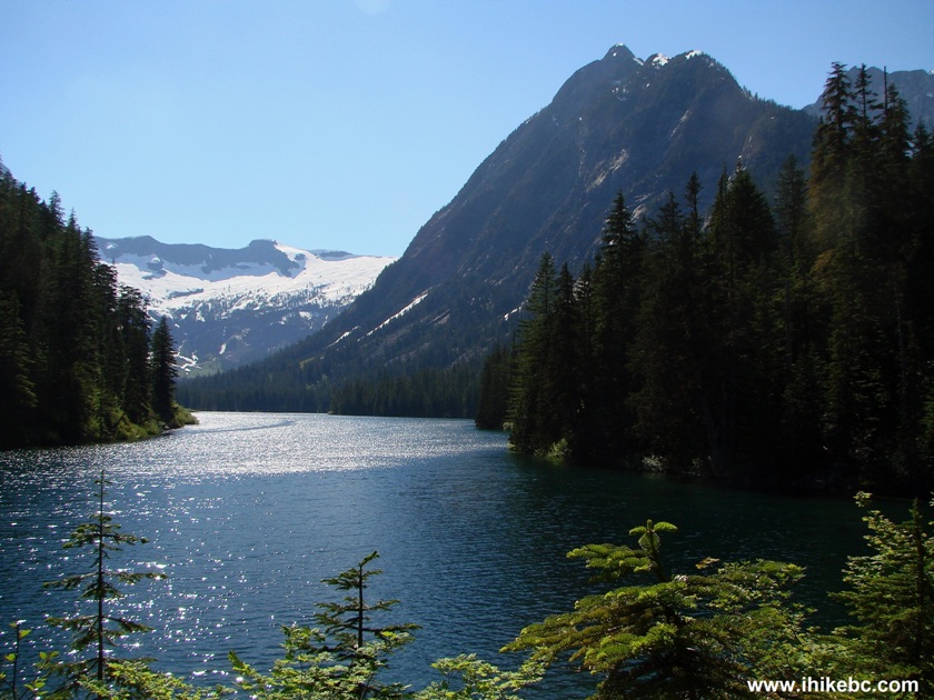
Statlu Lake British Columbia Canada
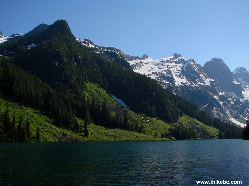
14. Observing the beautiful lake makes it easier to tackle such a difficult trail. There are two rock fields to cross. And they look good too, especially the first one.
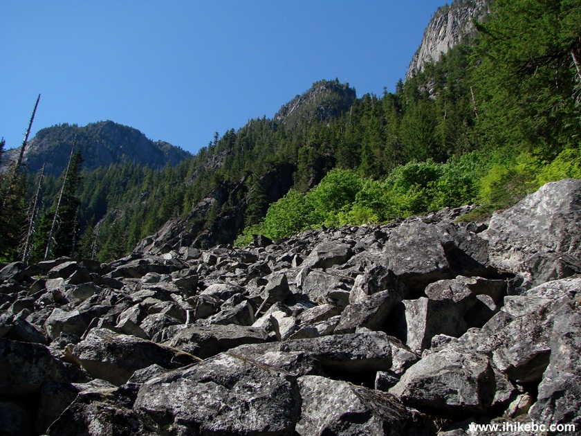
Statlu Lake Trail View BC Canada
15. But the difficult part is that the path goes on these rocks right by the edge of the lake. If the stones are wet, this could be quite dangerous. You may want to avoid this trail altogether in wet and, especially, snowy conditions. Yes, those stones IS the path in the photo below, and you can even see some flagging tape there.
Statlu Lake Trail Picture
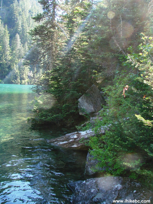
16. Beautiful Statlu Lake.
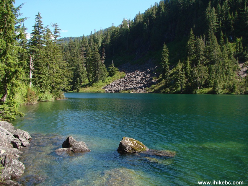
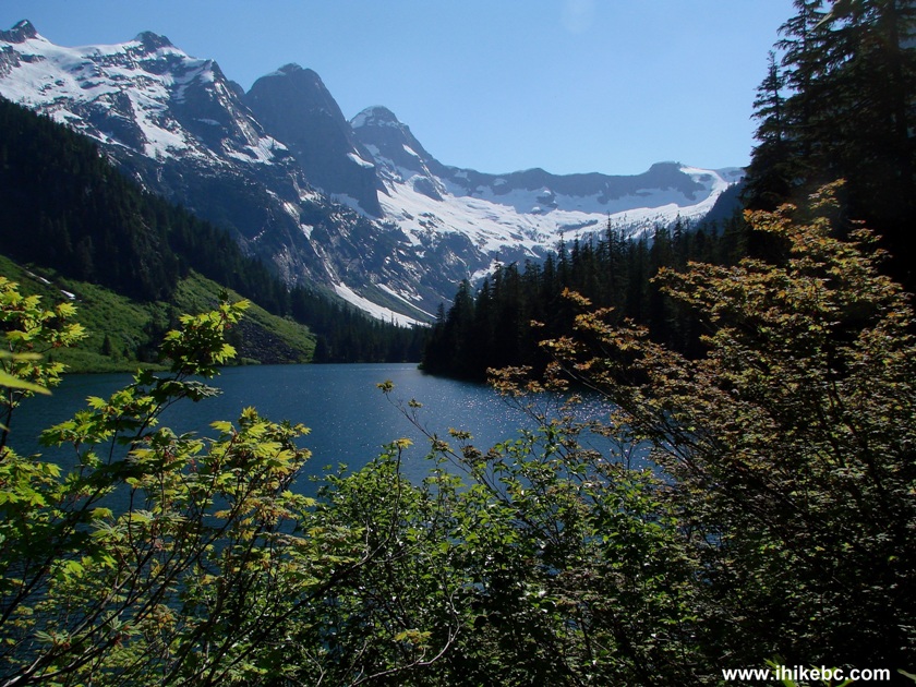
Mountains By Statlu Lake British Columbia Canada
17. The views are great indeed. But not too many people come to enjoy them, so the trail is badly overgrown in some places, and, unless you have long pants and a long-sleeved shirt, you would be scratched all over.
Statlu Lake
18. After you cross the two rockslides and the overgrown parts of the trail, you walk in a forest for a bit before reaching the second large waterfall, about one hour and thirty minutes after the first major one.
Statlu Lake Hiking Trail Province of BC Canada
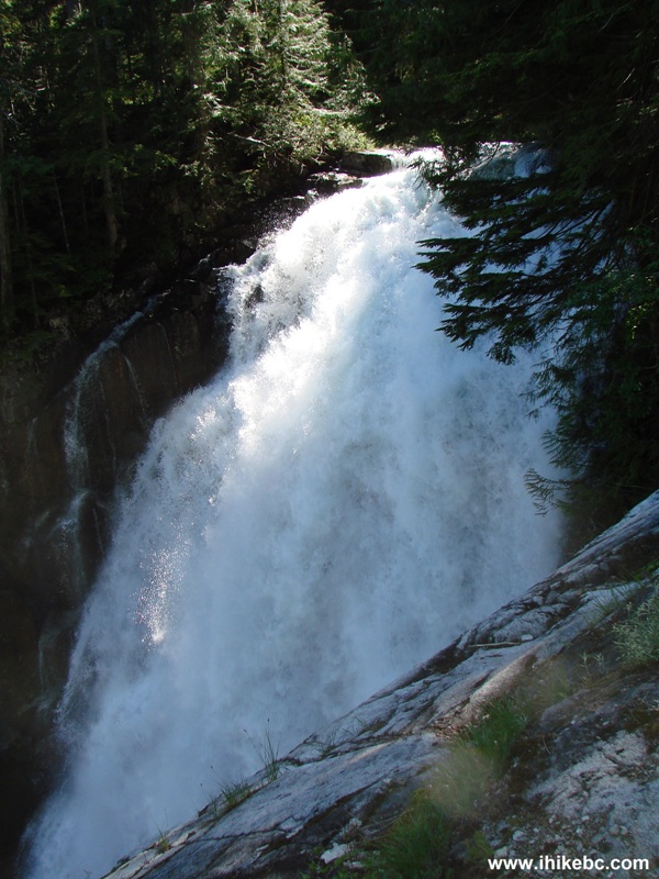
19. And here is that second large waterfall.
Statlu Lake Trail Second Large Waterfall
Here is our video of this waterfall:
More ihikebc videos are on our YouTube Channel.
20. The second waterfall is an important marker, because this is where the trail splits. Just before the waterfall a tough Brotherhood Trail leads to the second (smaller) lake. And going straight would lead you to the end of Statlu Lake. But, for us, the second waterfall was the final destination, as it was getting late. It was nice to discover a weather-beaten 22-year-old memorial plaque at the beginning of Brotherhood Trail.
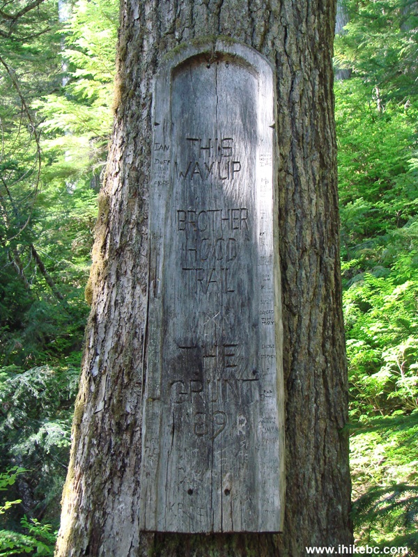
Brotherhood Trail Plaque BC Canada
Statlu Lake Trail is a long way from Vancouver, and is a challenge to hike. But the views are great, and chances are high that this trail would be all yours, especially on a weekday. It would take about 3 hours to hike to the second major waterfall, and substantially longer, if you would continue further on.


|
 |
![]()
![]()
![]()
Follow @ihikebc Tweet
ihikebc.com Trip 048 - Statlu Lake Trail Hike