![]()
![]()
![]()

Trip 282 - June 6, 2023 (Tuesday)
Whale Trail Hike
East Point Regional Park
Saturna Island, BC
Liked: A great combination of green and yellow grass, blue sky and ocean, and white-and-red Heritage Lighthouse. Wonderful wave-like sandstone formations. Remote view of Mount Baker. A short and easy loop trail.
Of Note: Saturna Island is quite small and has limited services. No shade in most of the park. Strong wind in some parts of the park. Hiking poles and boots are recommended for shoreline exploration.
Related Website: BC Ferries Departures - Saturna Island.
Vancouver Island, Victoria & Gulf Islands Backroad Mapbook (9th edition) Trailhead Coordinates: Page 12 (Saturna Island) F3.
Other Trips on Saturna Island: Mount Warburton Pike Hike, Narvaez Bay Trail & Monarch Head Trail Hike.
Follow @ihikebc TweetWhale Trail in East Point Regional Park is located on Saturna Island, one of British Columbia's Gulf Islands. While Saturna Island is much closer to the Lower Mainland than to Vancouver Island, there is no direct ferry sailing from either Tsawwassen or Horseshoe Bay, so departing from Victoria's Swartz Bay or transferring on one of the other Gulf Islands is required. There are only a few sailings each day, so plan accordingly lest you be stuck overnight on a small island with very limited services.
East Point Road and Tumbo Channel Road are paved and are in good shape. Whale Trail can be done in a loop, which is about 800 meters long. If you enjoy a matching combination of natural colours and/or cool sandstone formations, East Point Regional Park will not disappoint, especially on a sunny day.
Also, it appears whales sometimes pass in the waters by the park (hence the trail name), so that would certainly add to the great experience of visiting this place.
Finally, Winter Cove is located relatively close to East Point Regional Park, and two photos and a video at the end of this trip report show the best views from that hike.
* all trail distances are based on a GPS odometer and are highly approximate.
1. Here is a Google Maps location of East Point Regional Park on Saturna Island.
2. Here is a map of Saturna Island posted by the ferry terminal. We have indicated as follows: red square - Lyall Harbour Ferry Terminal, small white square - T-Junction where a left turn leads to Winter Cove (yellow square) in 600 meters, and a right turn leads to East Point Regional Park / Whale Trail (blue square) in 10.9 km.
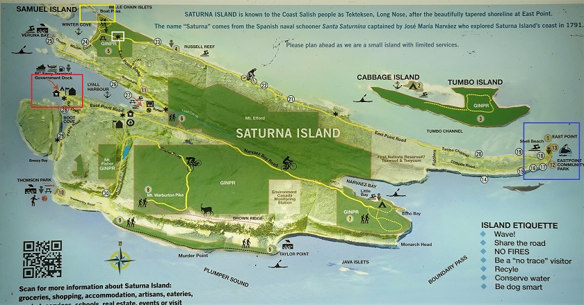
Map of Saturna Island BC
3. Here we are at that T-Junction (white square) mentioned above.
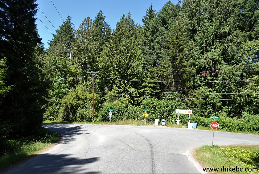
East Point Road Saturna Island British Columbia
4. Having made the right turn, we are still on East Point Road.
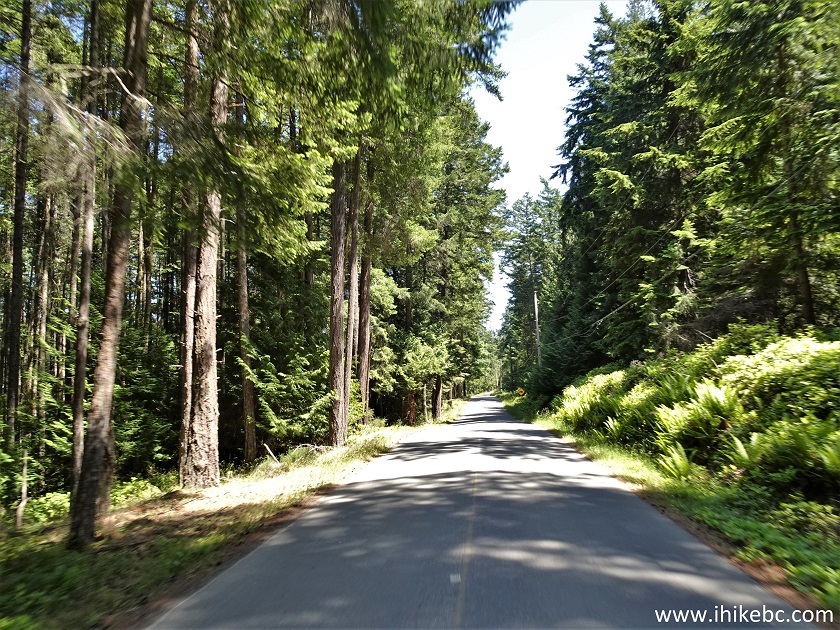
Saturna Island East Point Road
5. Arriving to East Point Regional Park, 16 km from Lyall Harbour Ferry Terminal. Coordinates: N 48⁰46.980' W 123⁰02.807'. Elevation: 30 meters.
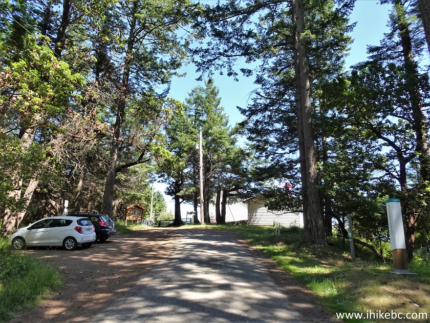
East Point Road at East Point Regional Park Saturna
Island BC Canada
Here is our video of driving on Saturna Island to East Point Regional Park:
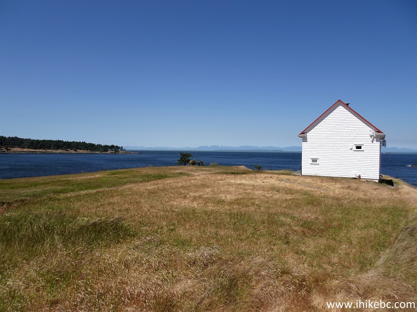
6. Whale Trail entrance. You can do the reverse loop by going to the left of the building seen in the photo above. A pit toilet is also located along the path to the left of that building.
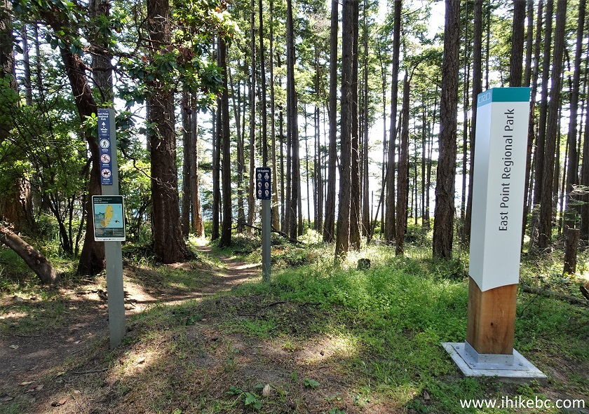
East Point Regional Park - Whale Trail Trailhead
7. Whale Trail map.
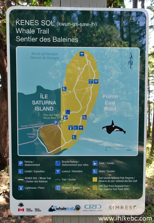
Whale Trail Map
8. Go through the woods for 80 meters, and then the beauty begins.
Saturna Island Hiking Whale Trail
9. Make a left turn. Very pleasant and peaceful.
Whale Trail
10. At 155 meters, a staircase leads to an observation platform next to a tower.
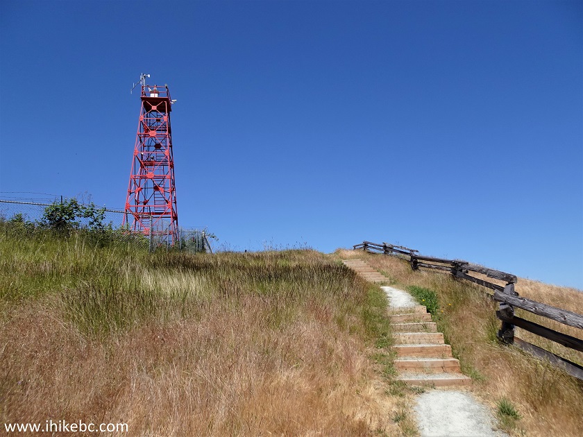
Whale Trail on Saturna Island BC
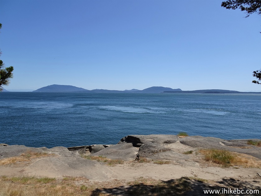
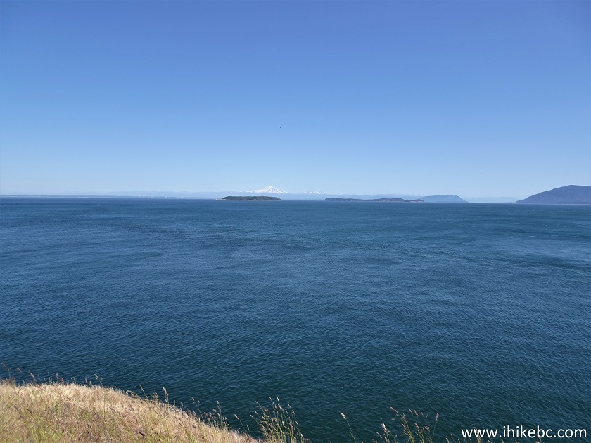
11. Having climbed up, a look back.
Saturna Island
12. Here is the tower.
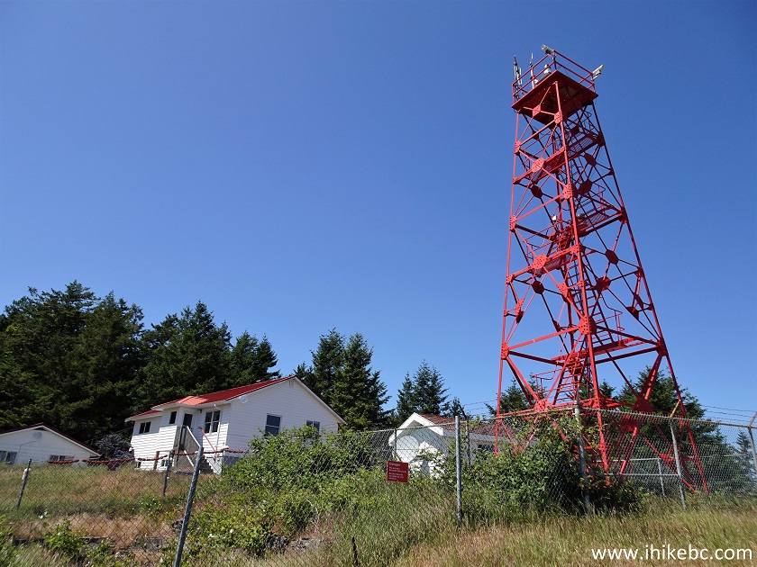
East Point Regional Park - Saturna Island BC
13. And here is the observation platform.
Saturna Island East Point Regional Park
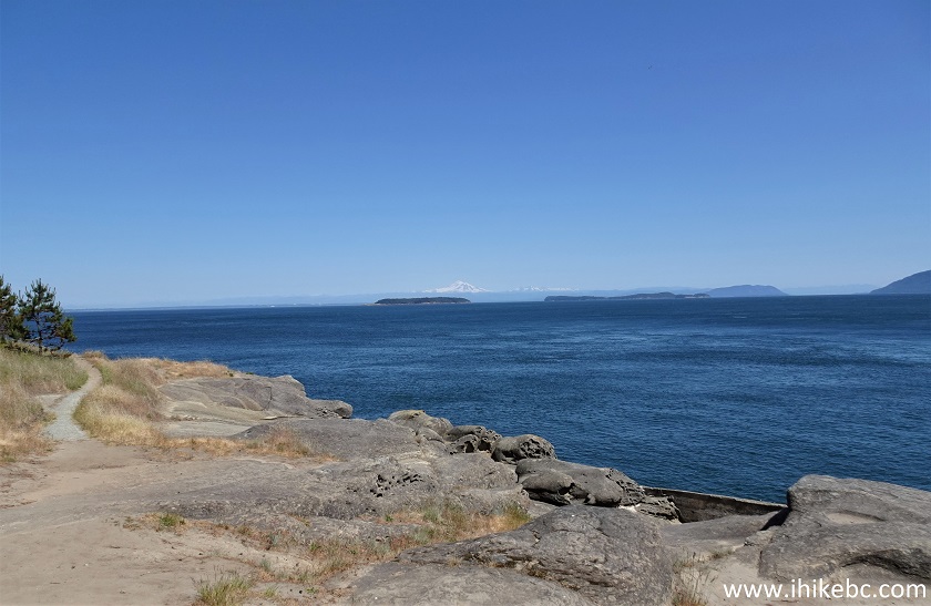
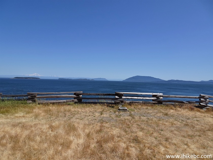
14-15. Mount Baker in the distance. Plain and zoomed.
Mount Washington View from Saturna Island
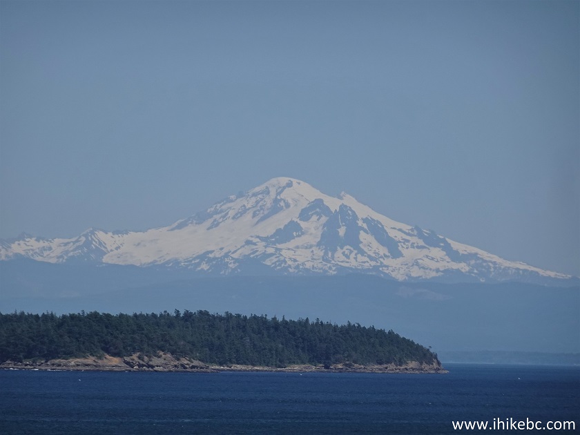
Mount Washington
Here is our video of the views from this location.
Note: the mountain in the video is incorrectly labelled as Mount Washington. It's Mount Baker (in Washington State).
16. Descend down the stairs...
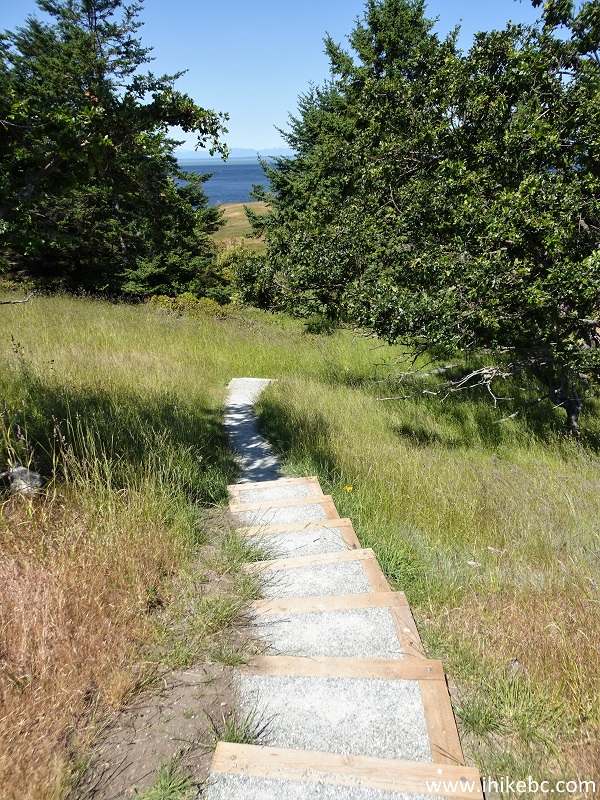
East Point Regional Park
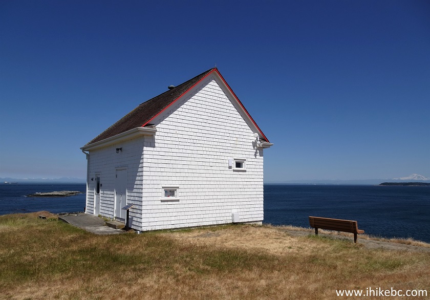
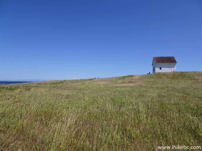
17...and here comes the Heritage Lighthouse.
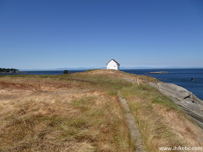
Saturna Island
18. Getting closer.
Heritage Lighthouse Saturna Island BC
19. Looking left.
Saturna Island British Columbia Canada
20. Apparently, the lighthouse occasionally gets opened for visitors.
Saturna Island Heritage Lighthouse
21. The view just past the lighthouse.
British Columbia Saturna Island
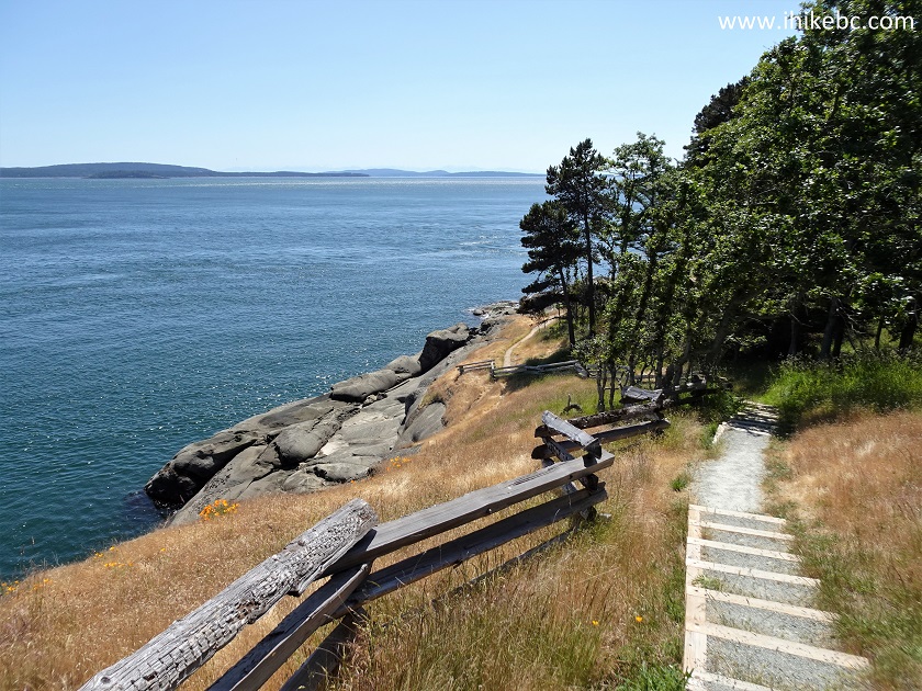
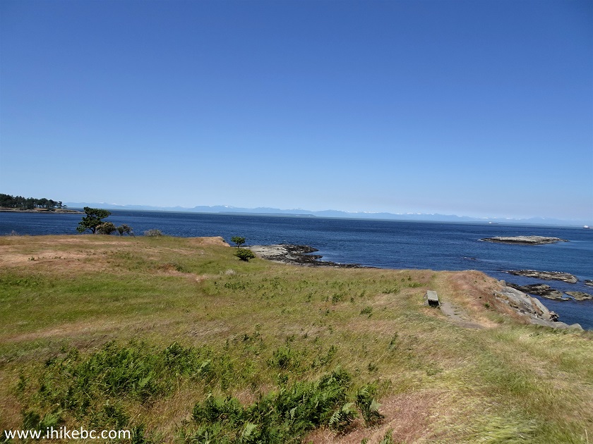
22. Looking back at about 370 meters from the trailhead. Simply splendid.
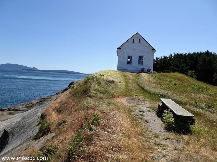
East Point Regional Park
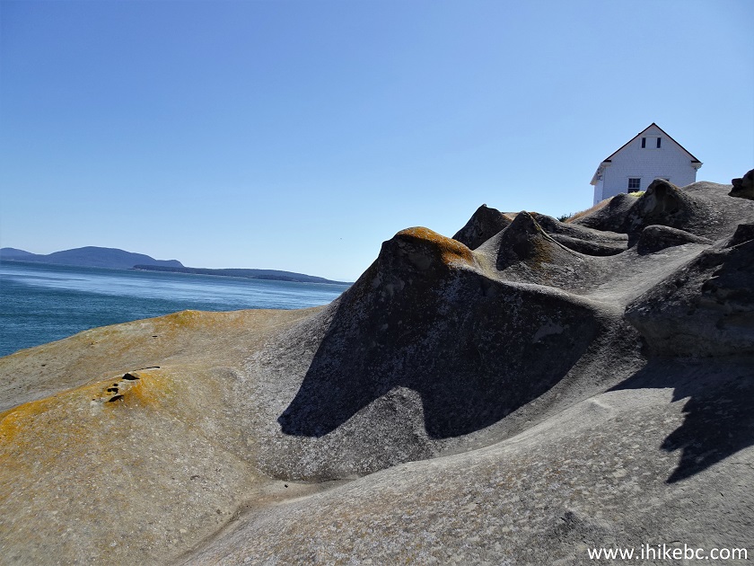
23. And, a bit further and just to the left, are these neat wave-like sandstone formations.
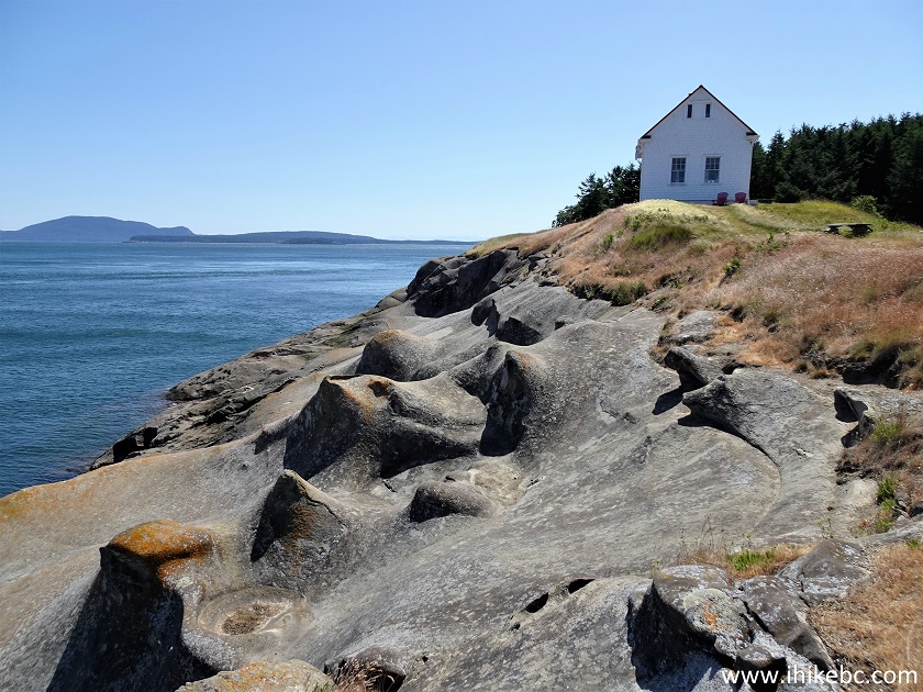
Saturna Island East Point Regional Park Whale Trail
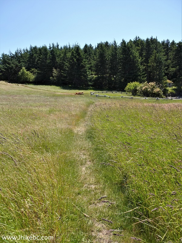
24. Proceeding on Whale Trail loop. At 410 meters now.
Whale Trail Saturna Island BC
25. Looking back once again.
East Point Regional Park British Columbia Canada
26. Looking from the side.
Heritage
Lighthouse on Saturna Island
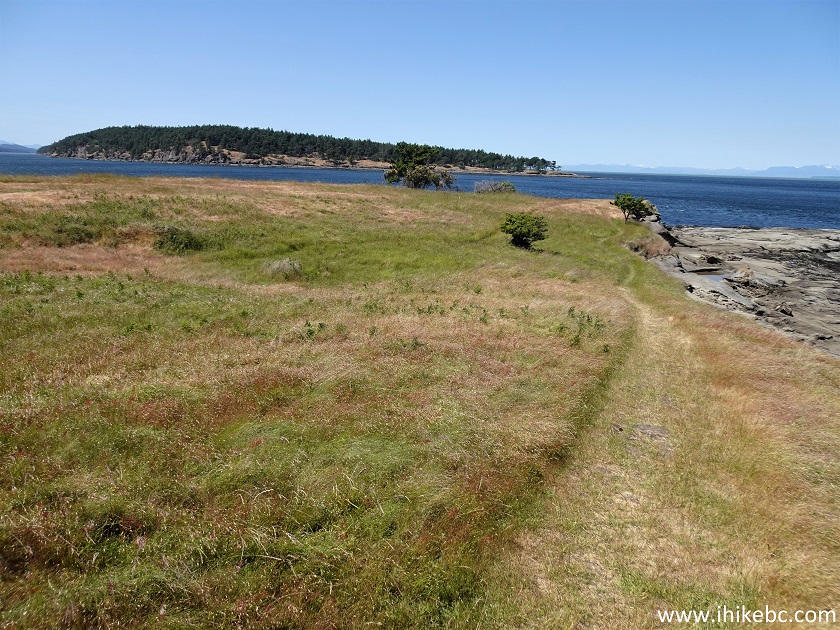
27. We continued on Whale Trail for a bit longer. The loop ends shortly
at a beach (to the right in the photo below - just out of the view), and
you can then return to the parking lot by completing the loop right
there (you would walk by a pit toilet mentioned at the beginning), or
turn around and explore the shoreline by paralleling the path you took
originally to get to the lighthouse, which is what we did.
Saturna Island Hiking - Whale Trail
28. Here is the beach.
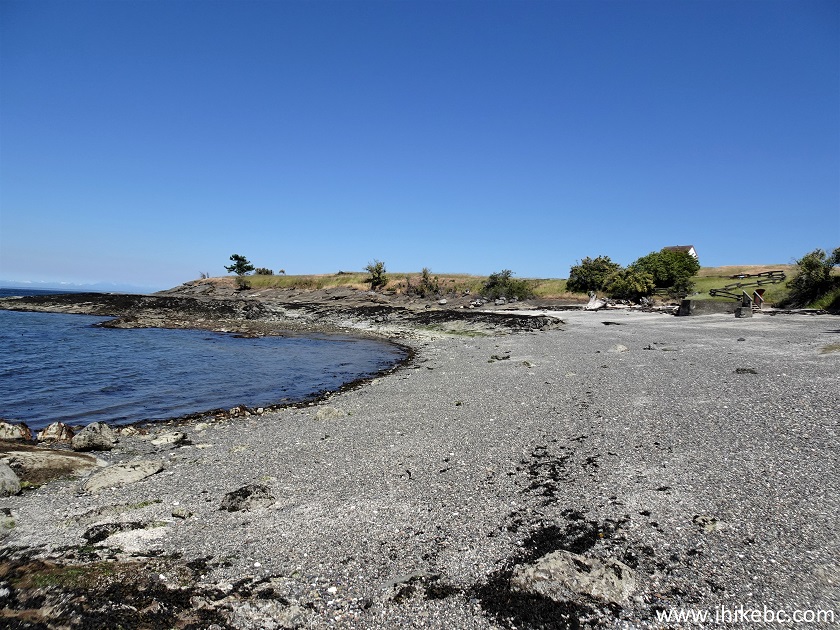
East Point Regional Park Beach
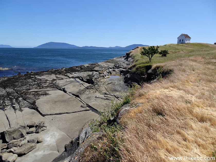
29. And here we are going back by paralleling the original path.
Saturna Island
30. It's a slightly more challenging hike than the path above it, so hiking poles and boots are recommended here.
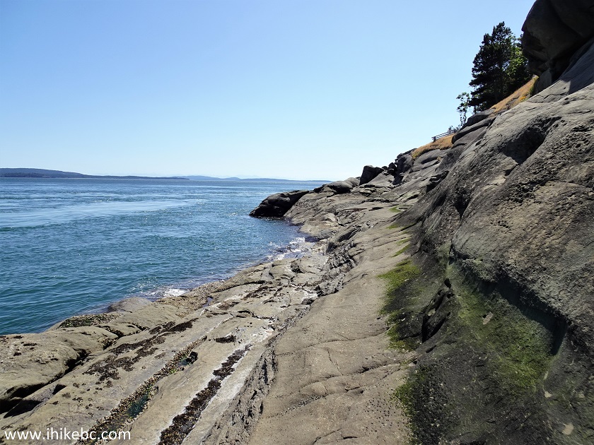
East Point Regional Park - Saturna Island - Province
of British Columbia
31-32. An oystercatcher was hanging out in the area.
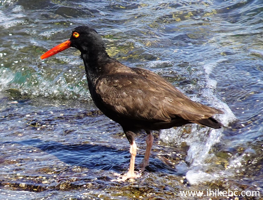
Oystercatcher
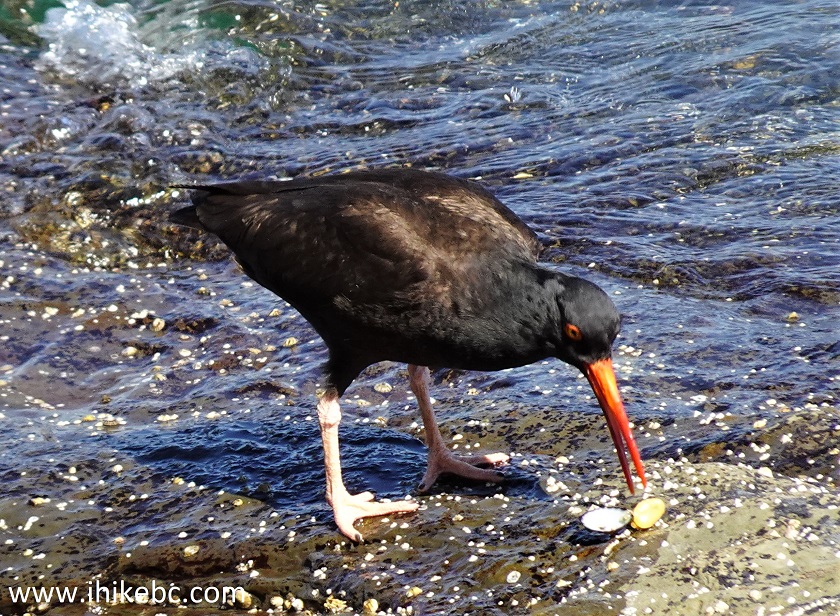
British Columbia Black Oystercatcher
Here is our video of the oystercatcher:
33. Another look at that tower. We then returned to the parking lot the same way we came.
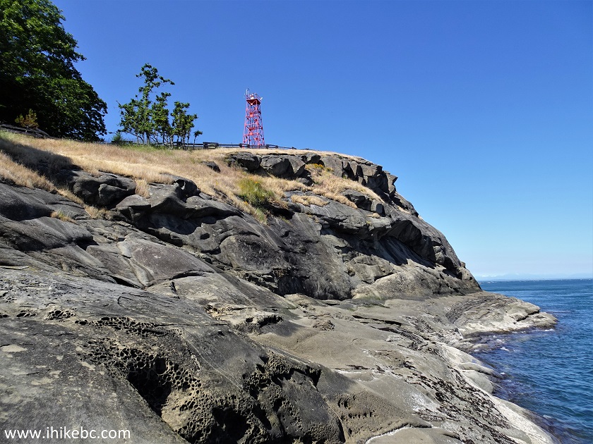
Saturna Island Canada
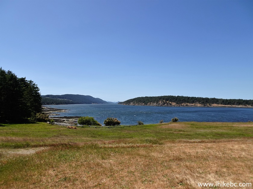
34-35. And now two photos and a video from the Winter Cove hike, which you can do by turning left at the intersection seen in photo #3. After about 700 meters of easy hiking you would get to this point where Saturna Island (almost) meets Samuel Island, with rushing water in-between. It's called "boat passage", but not sure if any boats can actually pass here. Perhaps, during high tide?
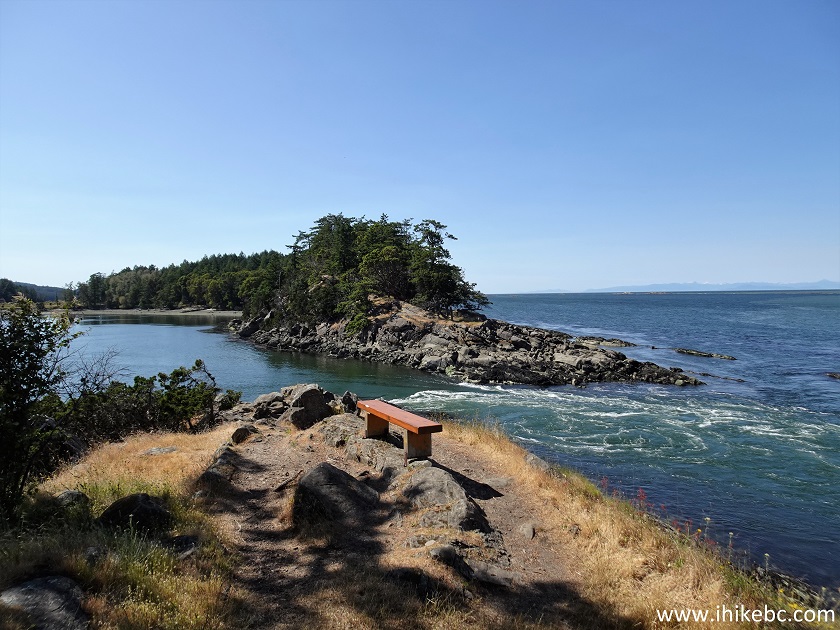
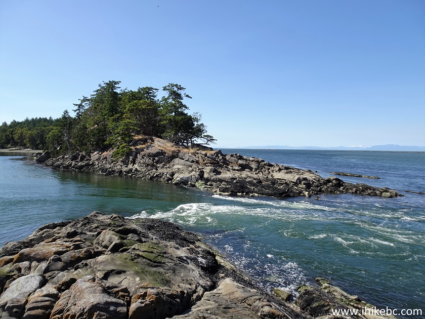
Saturna Island Winter Cove Boat Passage
Here is our video of the views from this location:
More ihikebc videos are on our YouTube Channel.
East Point Regional Park (Whale Trail) is a very fine
place to visit. Highly recommended.


|
 |
![]()
![]()
![]()
Follow @ihikebc Tweet
ihikebc.com Trip 282 - Whale Trail Hike (East Point Regional Park - Saturna Island BC)