![]()
![]()
![]()

Trip 191 - June 30, 2020 (Tuesday)
Silver King Basin Trail Hike
Babine Mountains Provincial Park
Near Smithers BC
Trailhead Location: In Babine Mountains Provincial Park, near the town of Smithers, which is approximately 370 kilometers West of Prince George via Highway 16.
Liked: Mountain views, Driftwood Creek views, Joe L'Orsa cabin, the ability to bike on the trail.
Of Note: Limited parking by the trailhead, some mosquitoes, the trail is popular, uneven ground - hiking poles and boots and recommended, horses allowed on the trail - watch for manure, bike ride is very rough on the way down for most of the trail.
Northern BC Backroad Mapbook (3rd edition) Trailhead Coordinates: Page 36 (Smithers) C4.
Related Website: Babine Mountains Provincial Park - BC Parks official website.
Other Trips in Babine Mountains Provincial Park: Harvey Mountain Trail Hike, Hyland Pass Trail Hike.
Silver King Basin Trail proves that the accolades received by the Babine Mountains Provincial Park are all well-deserved. Two years ago we hiked Harvey Mountain Trail in this very park, and, while the views were good, we expected something more. This something more arrived today, when we saw a "basin" surrounded by mountains at the end of a fairly long (over 8 km) trail. Even though low-hanging clouds and the lack of sunshine made for a less than ideal picture, the views of the surrounding mountains were quite impressive. And the Hyland Pass Trail (the subject of the following trip report), which begins at the end of Silver King Trail, impressed even more.
A bonus for Silver King Basin Trail is the ability to bike, as this whole trail is an old industrial road, which used to lead to a mine, which remnants (a few small mining rail cars and a short busted rail track) can still be found at the end of the trail. Alas, while the first three kilometers are fairly smooth and with little elevation, the last five are steeper and are full of large stones sticking out of the ground, making for a bone-jarring downhill ride. Besides, dozens of cross ditches complicate the matter even further. That said, using the bicycle would definitely save a few hours of time, which is especially helpful since there is very little to see on this trail until the very end.
Another bonus is the ability to make it a giant loop hike: Silver King Basin Trail - Hyland Pass Trail - Cronin Creek Trail. And then either Eagle Pass Trail - McCabe Trail to the parking lot, or Cronin Creek Trail all the way to Babine Lake Road, which connects with Old Babine Road, and then the same way to the parking lot as when you arrived to the park. Of course, a car shuttle would make things even easier in the latter case. We have not tried any of the loops, so don't know the road or trail conditions beyond Hyland Pass Trail.
Access to Babine Mountains Provincial Park is straightforward - take Old Babine Road, which starts off Highway 16 just East of Smithers. At 4.7 km, turn left onto McCabe Road, at 8.3 km make a left turn onto Telkwa High Road, and at 8.5 km turn right onto Driftwood Road. Then, 15.2 km after leaving Highway 16, you would be entering Babine Mountains Provincial Park. Drive until the very end of the park access road, which is 4.4 km long (the total distance from Highway 16 to the end of the park access road is 19.6 km). There, you would find a smallish parking lot for 3 trails: Silver King Basin, McCabe and Fletcher-Gardiner.
Just as two years ago, we have not seen a single sign indicating the way to Babine Mountains Provincial Park, until the entrance at 15.2 km past Highway 16. There are plenty of signs, however, to a much smaller Driftwood Canyon Provincial Park, located nearby - so, follow those signs, go past Driftwood Canyon Park located on Driftwood Road, and you would end up in Babine Mountains Provincial Park in a few kilometers.
1. We are 15.2 km past BC Highway 16, entering Babine Mountains Provincial Park. For photo-directions on getting up to this point from Highway 16, check out Malkow Lookout Hike trip report, and Harvey Mountain Hike trip report.
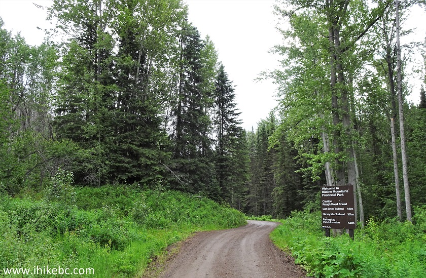
Babine Mountains Provincial Park Entrance
2. Now at the end of the park access road, 19.6 km from Highway 16.
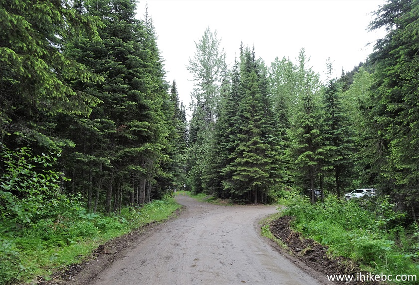
Babine Mountains Provincial Park Access Road
3. A parking lot for three nearby trails. Coordinates: N 54⁰52.452’ W 126⁰58.282’. Elevation: 977 meters.
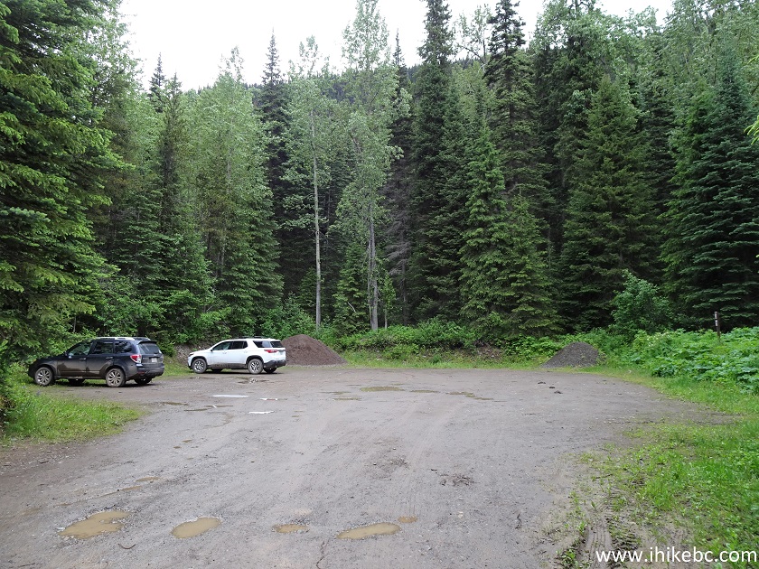
Silver King Basin Trailhead Parking Lot
4. Here is a map of Babine Mountains Provincial Park, posted by the parking lot. We have indicated as follows: blue arrow - parking lot, red arrow - Silver King Basin Trail (Fletcher-Gardiner Trail is to the left, and McCabe Trail is below), green arrow - end of Silver King Basin Trail and Joe L'Orsa cabin (as well as the beginning of Hyland Pass Trail, covered in the next trip report).
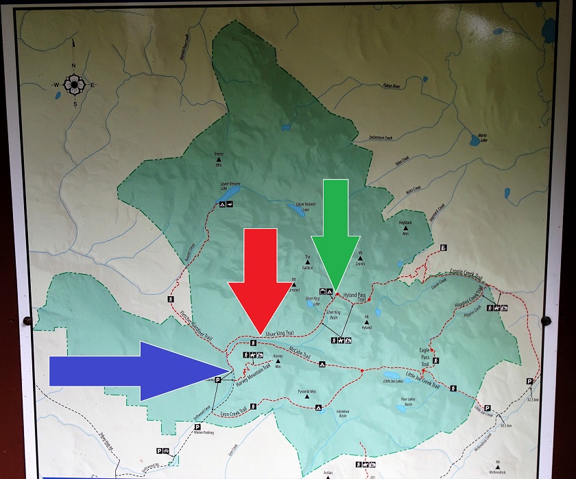
Babine Mountains Provincial Park Map
5. Here is the trailhead for Silver King Basin, McCabe, and Fletcher-Gardiner trails.
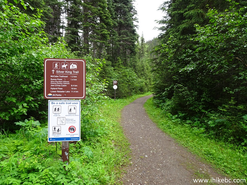
Silver King Basin, McCabe and Fletcher-Gardiner Trailhead
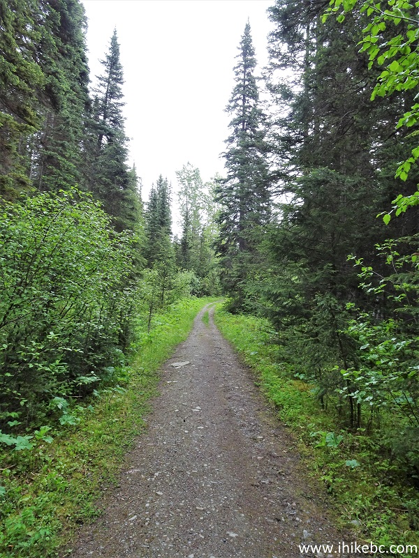
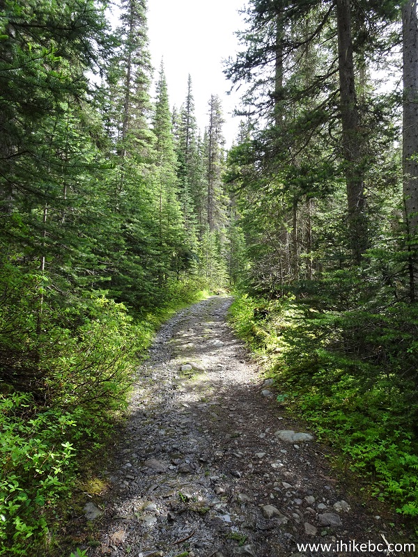
6. It's an old industrial road, good for easy uphill biking for the first 3 kilometers or so.
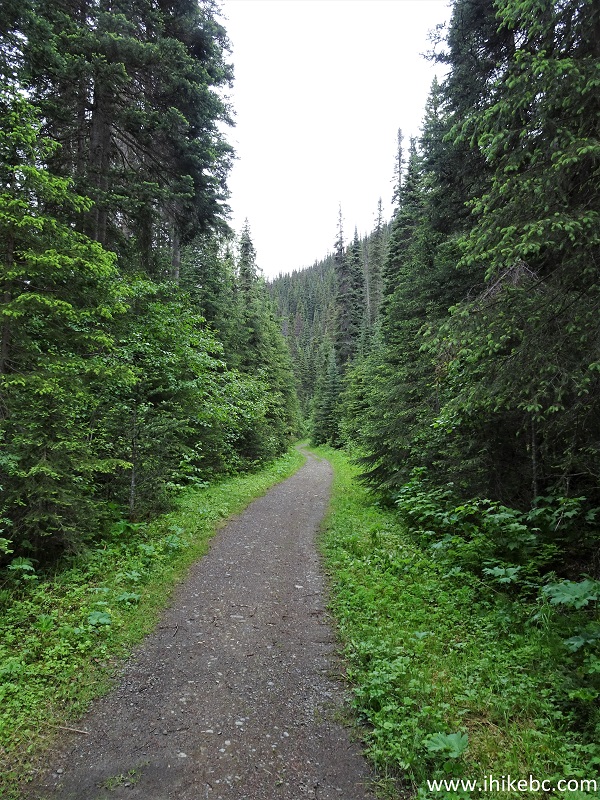
Smithers Trail - Silver King Basin Trail
7. At 1.3 km, McCabe trail goes its own way on the right side.
Trail in Smithers Area - Silver King Basin Trail
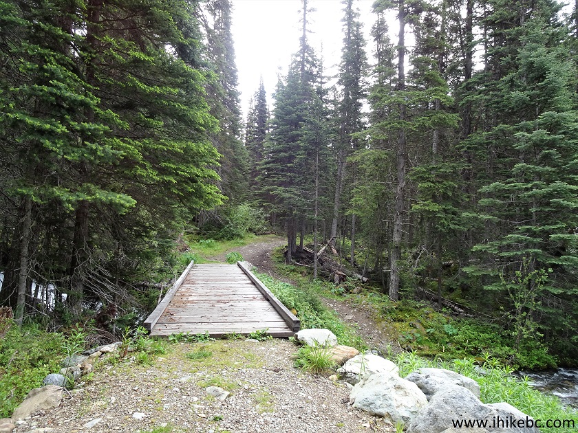
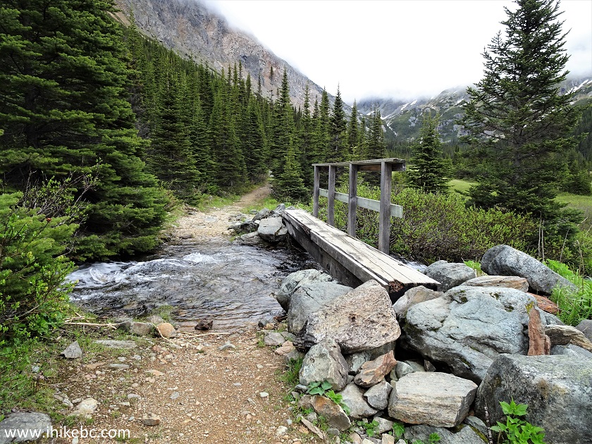
8. Very shortly, there is a bridge across Driftwood Creek.
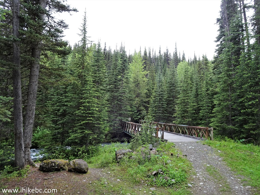
Silver King Basin Trail - Smithers Hiking
9. A Driftwood Creek view from the bridge. Up until this point, the creek flows by the trail, with several access point to check it out even closer.
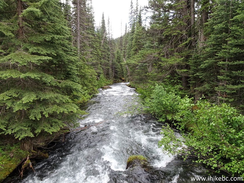
Driftwood Creek in Babine Mountains Provincial Park
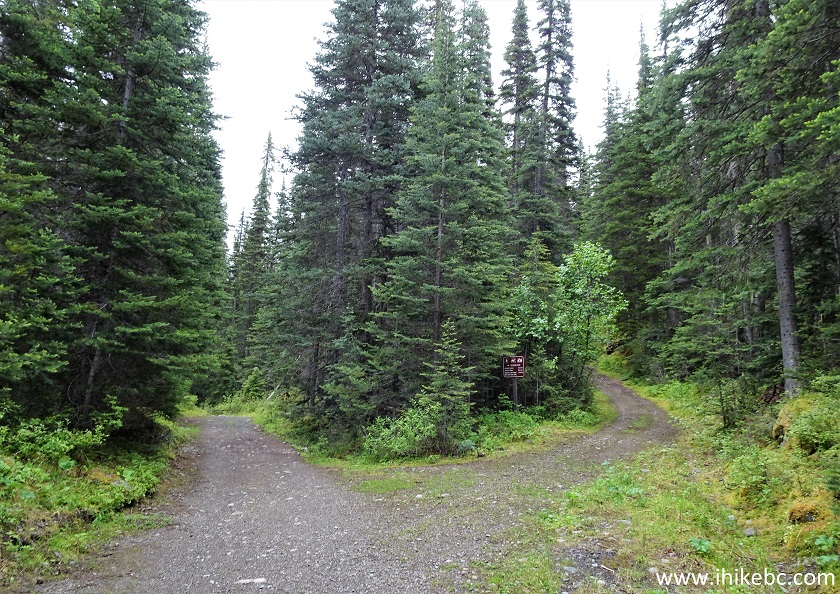
10. Right after the bridge, about 1.4 km from the start, another split. Fletcher-Gardiner Trail continues on the left side, and Silver King Basin on the right.
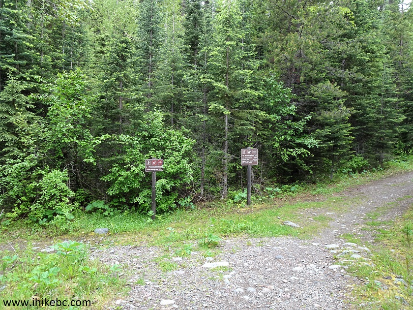
Silver King Basin Trail Split with Fletcher-Gardiner Trail
11. The remaining distances from this location.
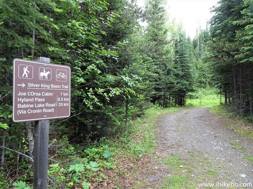
Silver King Basin Trail - Hiking in Smithers Area
12. The trail is still smooth here, if not for much longer.
Smithers Hike - Silver King Basin Trail
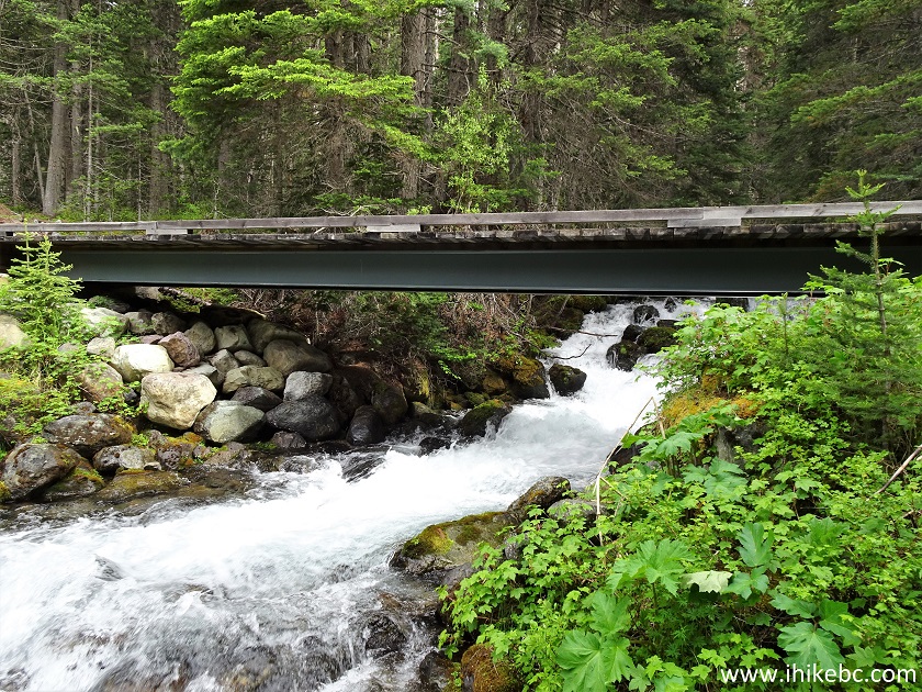
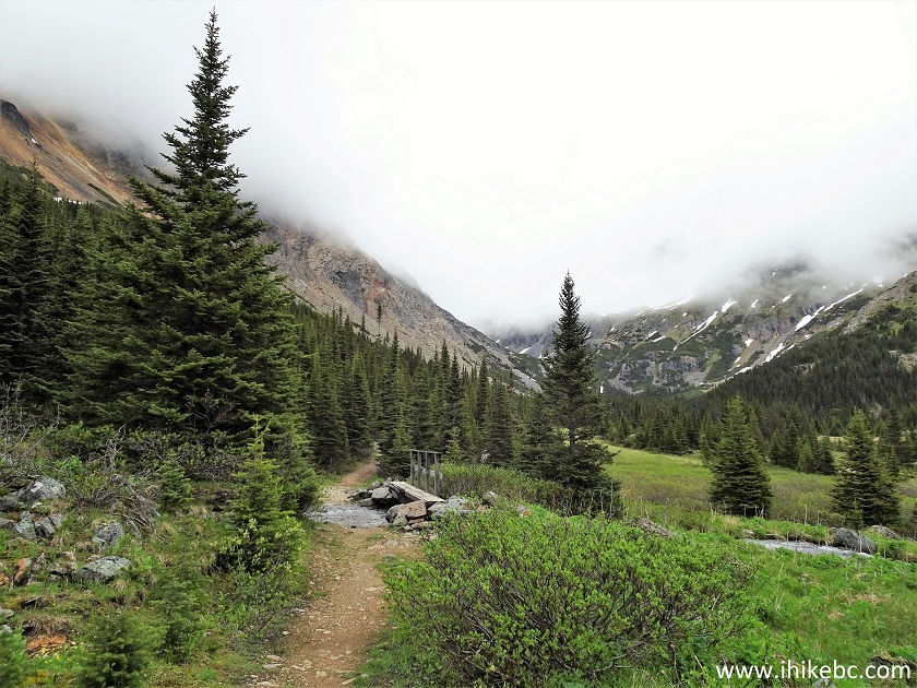
13. There are good mileage markers on Silver King Basin Trail, and, after the 3 km mark, this bridge above Driftwood Creek signals the end of the creek flowing by the trail, and the arrival of the tougher, steeper and more stone- and ditch-infested part of the hike.
Silver King Basin Trail - Hike in Smithers Area
14. Bye for now, Driftwood Creek.
Babine Mountains Provincial Park - Driftwood Creek
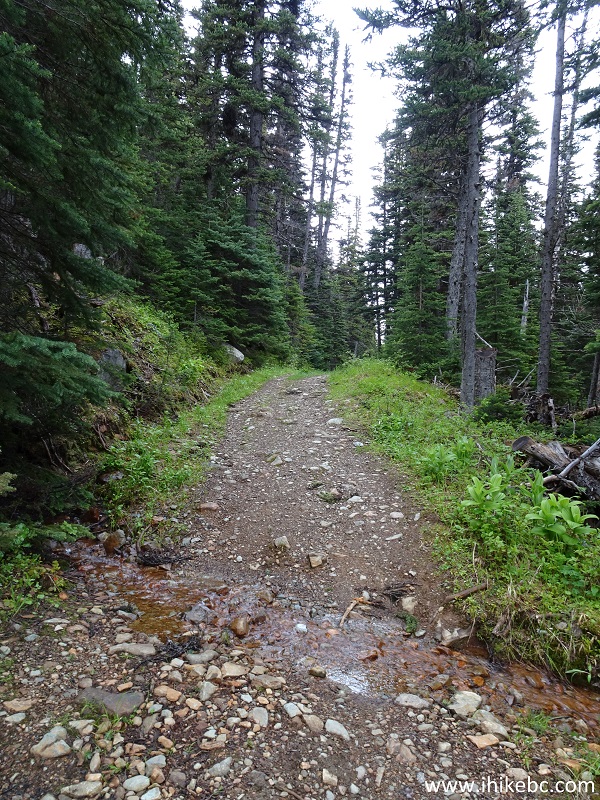
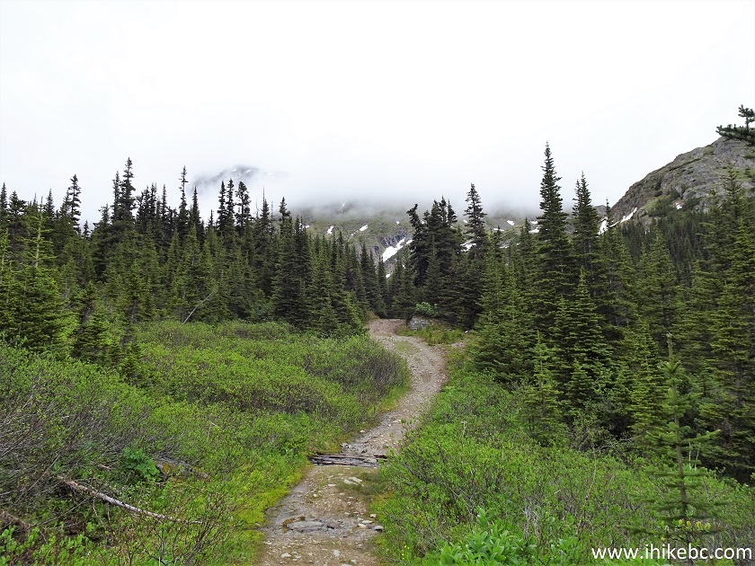
15. Here comes the rougher part of the trail. It's not terribly steep, but all the stones and cross-ditches make downhill biking a rather taxing affair.
Silver King Basin Trail
16. There are dozens of these ditches on Silver King Basin trail, and they are narrow and deep enough that slowing down is required in order to cross them safely.
British Columbia Hiking - Silver King Basin Trail
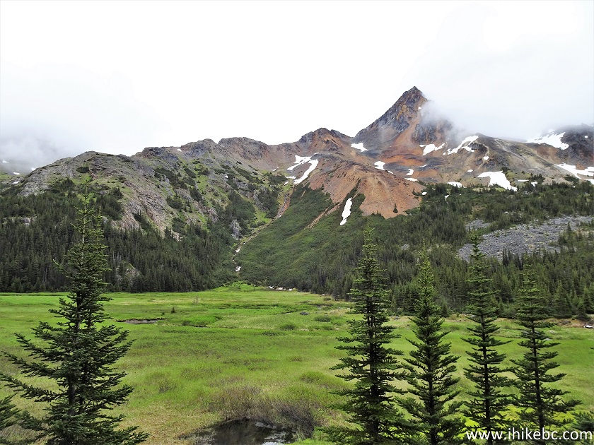
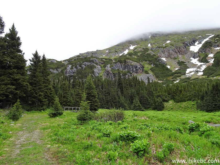
17. Just over 7 kilometers of hiking and biking in a mostly featureless forest leads to great mountain views. Even with the low hanging clouds the views were quite impressive.
Silver King Basin Trail - Hike in British Columbia
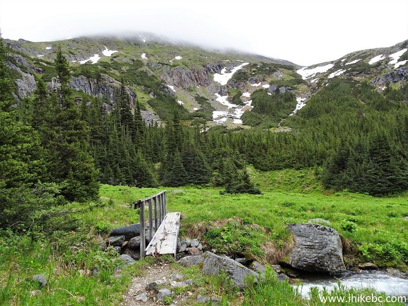
18. There are two short narrow bridges on this trail, the first arriving soon after you enter the basin. If you have a bicycle, going backwards while holding the bridge's handrail and dragging the bike might be the easiest way to cross such a bridge.
Babine Mountains Provincial Park near Smithers British Columbia
19. Hello, Babine Mountains - just before the 8 km mark.
Silver King Basin in Babine Mountains Provincial Park
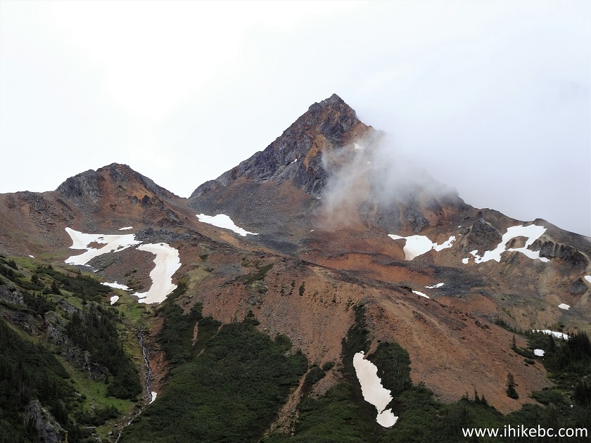
20. Zooming in.
Babine Mountains Provincial Park British Columbia Canada
21...a few hundred meters further...
Silver King Basin Trail - Smithers Hike
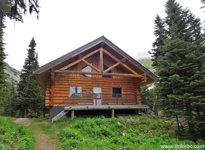
22...and here is Joe L'Orsa cabin, at 8.4 km after the start of the hike by the parking lot. Coordinates: N 54’54.635 W 126⁰53.171’. Elevation: 1,457 meters. It was locked due to the pandemic. We peeked inside, and it looked quite impressive. An overnight fee is applicable, and BC Parks website indicates it can hold 15-20 people (look under "Facilities Available in the Park").
Joe L'Orsa Cabin
23. Thanks, Joe!
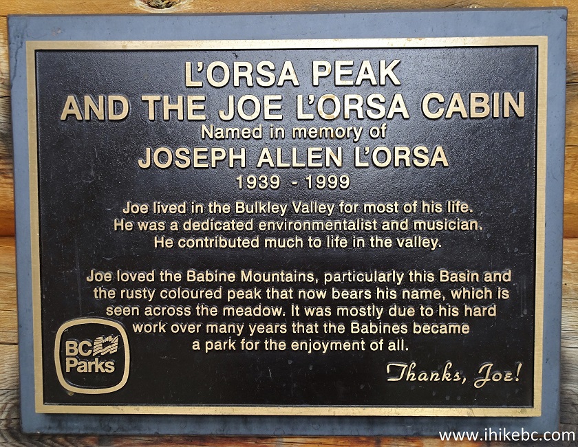
Joe L'Orsa Memorial Plaque
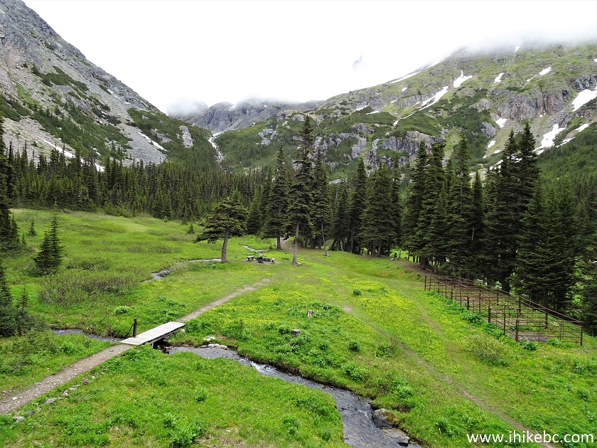
24. The camping area behind the cabin is quite large. The path is the continuation of the trail, which ends about 300 meters later by the remnants of Silver King Basin mine. See the footbridge in the photo below?
Babine Mountains Provincial Park
25. Someone is a genius...
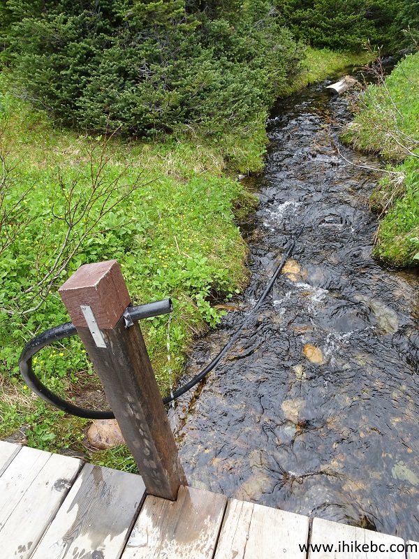
Makeshift Water Faucet by Joe L'Orsa Cabin
26. Looking back at the cabin from the camping area.
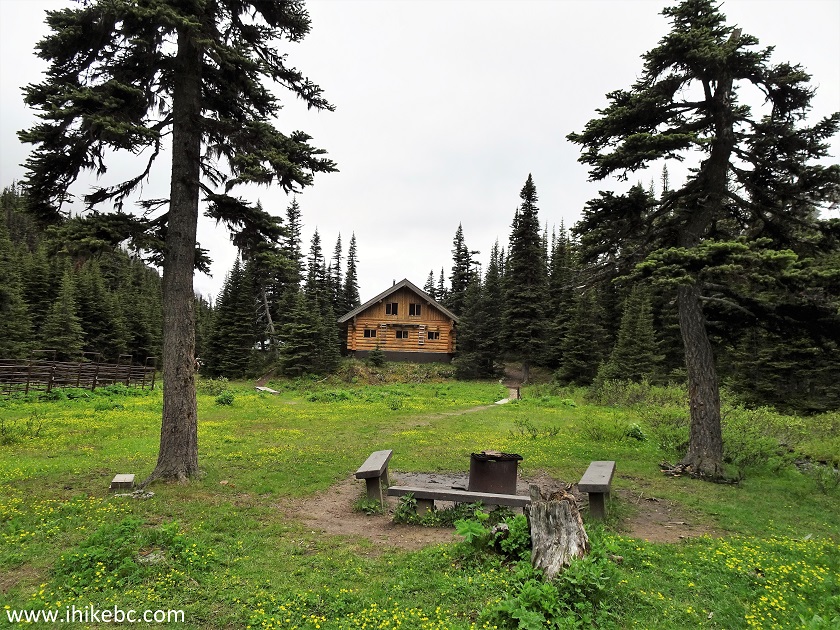
Silver King Basin Camping Area
27. If you look on the right side in photo #24, there are some fenced-off plots there. At first, we thought those were vegetable gardens, and fencing was used to keep animals away. Turns out, those are horse pens, and two ladies on horses arrived shortly and put their horses inside. While it was cool to see horses up close, watch out for manure on the trail when hiking, and, especially, biking downhill.
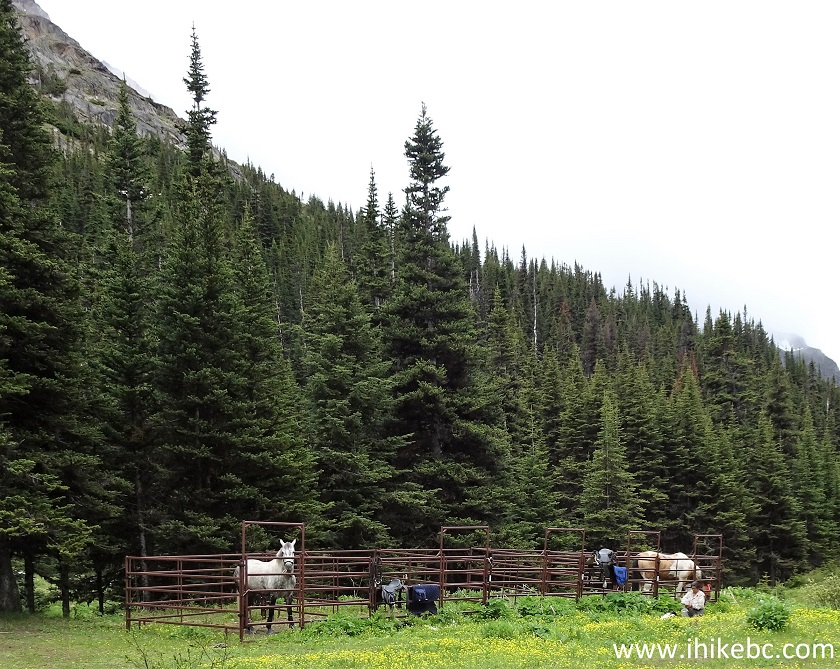
Silver King Basin Horse Pens Area
28. Silver King Basin Trail continues for a few hundred meters past the camping area.
Silver King Basin Trail - Hiking in Smithers Area
29. Another narrow bridge on the trail.
Hiking in Babine Mountains Provincial Park British Columbia
30. Hello again, Driftwood Creek.
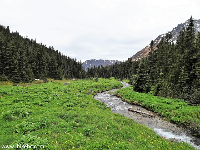
Babine Mountains Provincial Park
31. Soon after the bridge, Silver King Basin Trail ends at the remnants of Silver King Basin mine. Hyland Pass Trail starts to the right of the information stand. Coordinates: N 54⁰54.809’ W 126⁰53.007’. Elevation: 1,501 meters (524 meters elevation gain from the start of the trail by the parking lot).
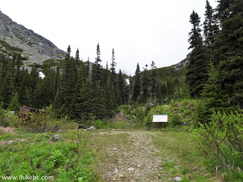
End of Silver King Basin Trail in Babine Mountains Provincial Park
32. Here is what happened here.
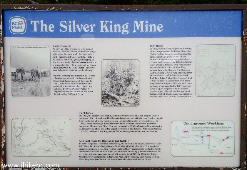
Silver King Mine Information Board
33. There is a short busted rail track, and a few small mining cars to serve as a reminder of years gone by.
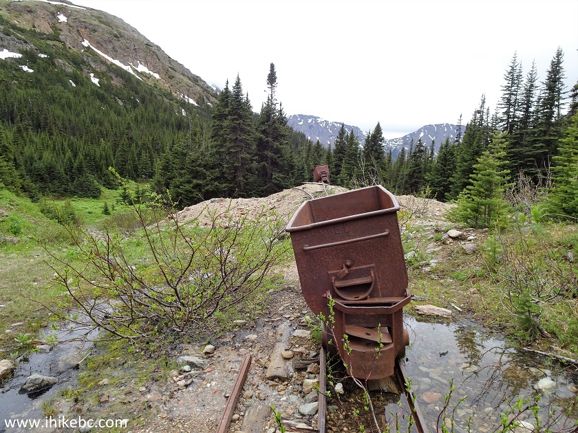
Remnants of Silver King Mine in Babine Mountains Provincial Park
Silver King Basin Trail is relatively easy, and leads to a cool cabin and impressive mountain views. Highly recommended.


|
 |
Other Trips in Smithers BC Area:
|
|
|
|
|
|
|
|
|
|
|
|
|
Fletcher-Gardiner Trail  |


![]()
![]()
![]()
ihikebc.com Trip 191 -
Silver King Basin Trail Hike (near Smithers BC)