![]()
![]()
![]()

Trip 275 - April 27, 2023 (Thursday)
Dorman Point Trail Hike
Crippen Regional Park
Bowen Island BC
Of Note: The trail is popular. Parking by the ferry terminal could be an issue. Constant noise from the island activities. The trail is moderately challenging in some places. Hiking poles and boots are recommended.
Vancouver, Coast & Mountains Backroad Mapbook (2019 edition) Trail Coordinates: Page 10 (Gibsons) F6.
Related Website: Crippen Regional Park - Metro Vancouver Official Website.
Other Trips on Bowen Island: Mount Gardner Trail Hike, Bowen Island Ferry Trip.
Follow @ihikebc Tweet
Dorman Point Trail is a very short (1.4 km one way) hike located in Crippen Regional Park on Bowen Island, a 20 minute ferry ride from Horseshoe Bay Ferry Terminal in West Vancouver. The trail starts off a boardwalk by a marina which is about 100 meters from the ferry terminal. Parking is very tight in that area, due to the combination of a ferry terminal and a commercial area of Bowen Island. Busy Summer weekends do not look promising, so try to walk or bike onto the ferry, if you are interested in hiking this trail in busy times. Or, drive to Robinson Road parking lot, which would reduce your hike to all of 400 meters one way.
During our visit, there was a loud pressure washing operation at the marina, as well as constant hammering from a construction site by the trail. Also, ferry onboard announcements could be heard during the hike. For your troubles, you get to see a decent ocean/Bowen Island/small nearby island/Whytecliff Park (West Vancouver) view.
*all trail distances are based on a GPS odometer and are approximate.
1. Here is a Google Maps location of Dorman Point on
Bowen Island.
2. We are on Bowen Island Trunk Road at Cardena Road (transit buses terminate here), with Snug Cove Ferry Terminal about 100 meters behind us.
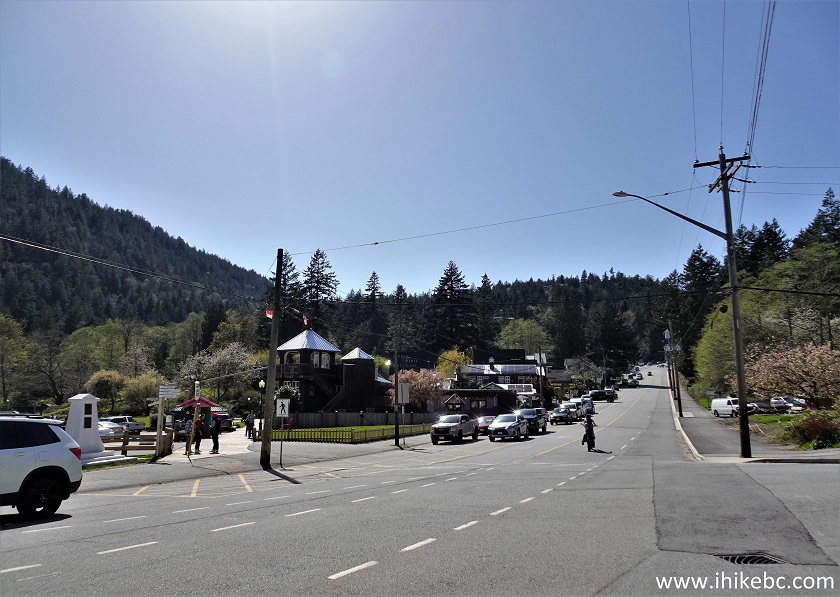
Bowen Island Trunk Road
3. Make a left turn at the above location and start walking on a boardwalk. This could be counted as the trailhead for Dorman Point Trail (not much of a difference from the apparent real trailhead 250 meters further). Coordinates: N 49°22.774’ W 123°20.007’ Elevation: 15 meters.
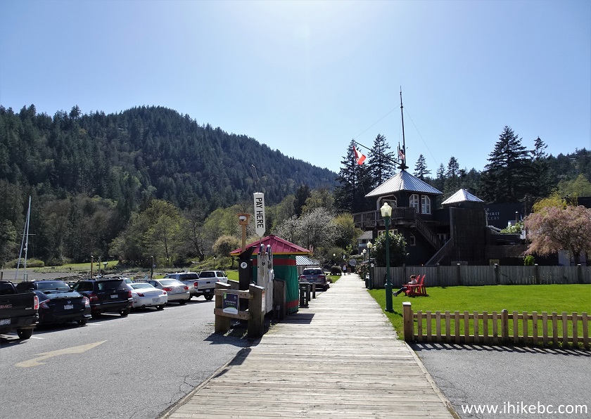
Bowen Island BC
4. At 65 meters, we are passing by Union Steamship Company Marina office and an eatery (looking back).
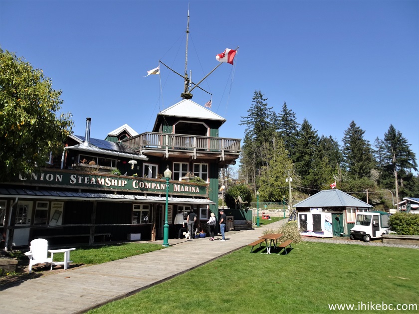
Union Steamship Company Marina Office - Bowen Island
BC
5. Now at 85 meters. Stay on the boardwalk. A large green space is on the left.
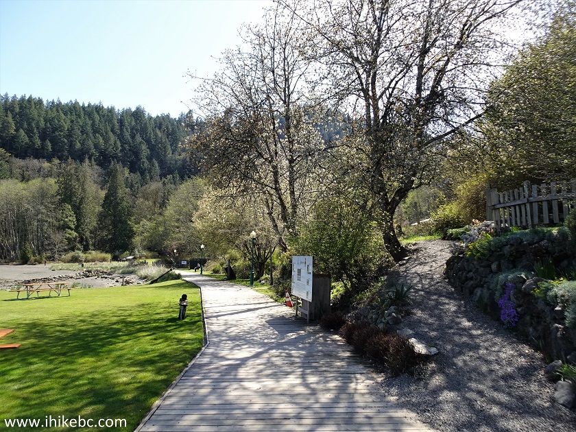
Bowen Island - British Columbia - Canada
6. At 165 meters, we are entering Crippen Regional Park.

Crippen Regional Park Bowen Island BC Canada
7. Looking left, there is this fine marina view.
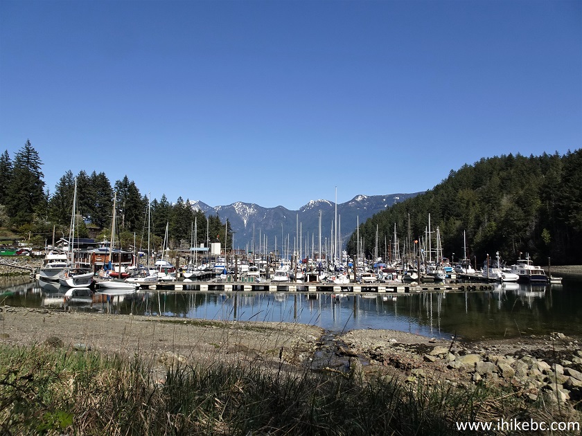
Bowen Island - Union Steamship Company Marina
8. Across a small bridge there is a huge Snug Cove picnic area, as well as an outhouse (not too far).
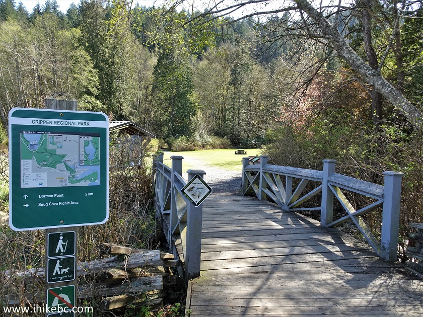
Crippen Regional Park
9. The map of Crippen Regional Park.
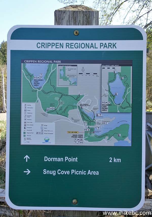
Map of Crippen Regional Park
10. Proceed past that huge picnic area. This is the right trail to burn a few calories before or after the picnic.
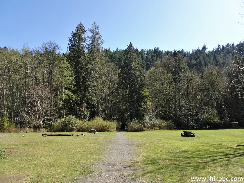
Bowen Island Crippen Regional Park Picnic Area
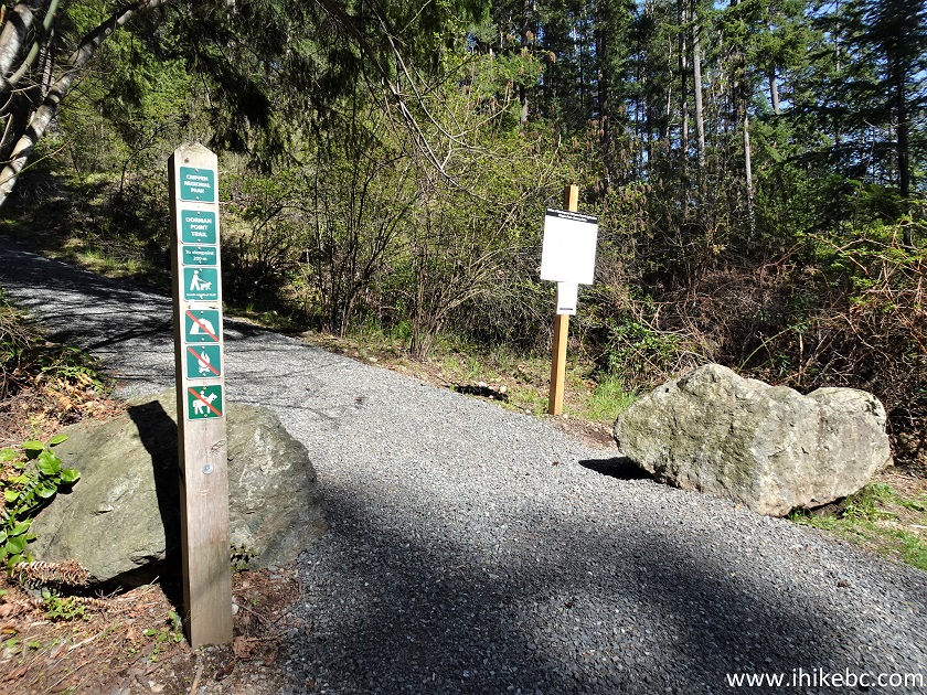
11. At 250 meters from Bowen Island Trunk Road, enter into the forest. This might be the official start of Dorman Point Trail. Leave your bike, tent, and horse at home.
Dorman Point Trailhead - Bowen Island British
Columbia
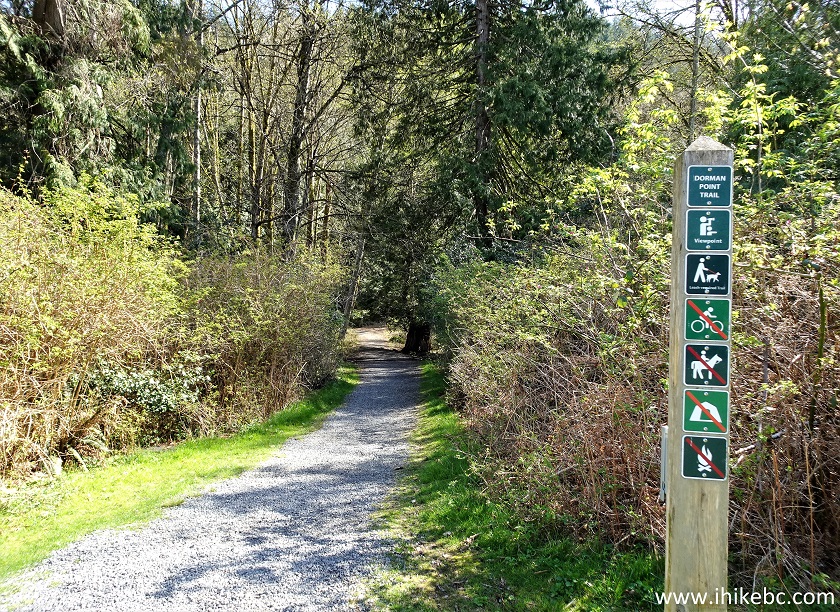
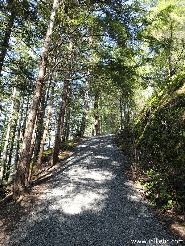
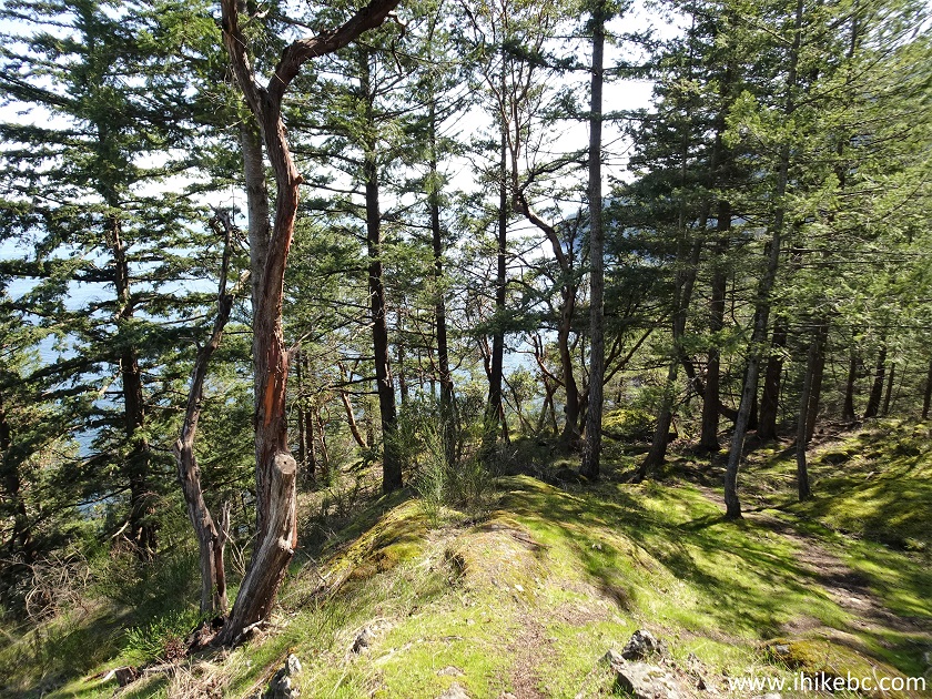
12. Dorman Point Trail in Crippen Regional Park on Bowen Island, British Columbia, Canada, at 810 meters. This is a fairly easy trail with some moderately challenging stretches.
Bowen Island Hiking - Dorman Point Trail
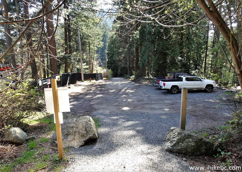
13. At 1.00 km from the trailhead at Bowen Island Trunk Road there is Robinson Road parking lot.
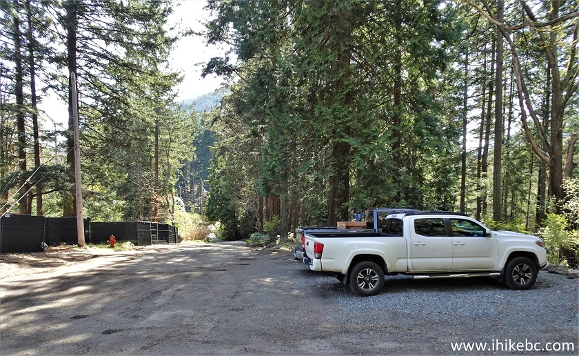
Robinson Road Parking for Dorman Point Trail on Bowen
Island BC
14. Make a left turn to continue the hike (only 400 meters more from here).
Dorman Point Trail on Bowen Island BC Canada
15. Looking back at Robinson Road after making the left turn.
Robinson Road at Dorman Point Trail in Crippen
Regional Park on Bowen Island BC
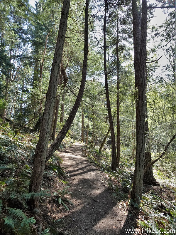
16. The final climb. At 1.08 km now.
Dorman Point Trail
17. At 1.16 km, we are almost there. The GPS trail ribbon showed there was a bit of a trail on the left too, but a sign prohibited going there.
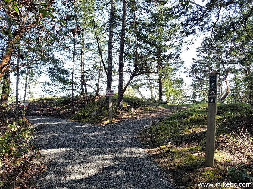
Bowen Island Trail - Dorman Point Trail - Crippen
Regional Park
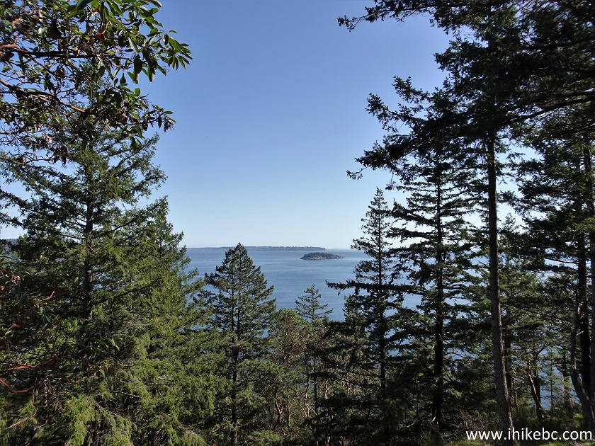
18. So, we turned right, and here is an obstructed view at 1.20 km of the trail.
Dorman Point Hike on Bowen Island BC
19. A nice bench, though.
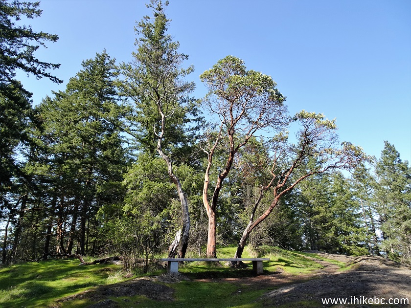
Dorman Point Trail Bench
20-21. A plain and zoomed views of a small island, as seen from the above location.
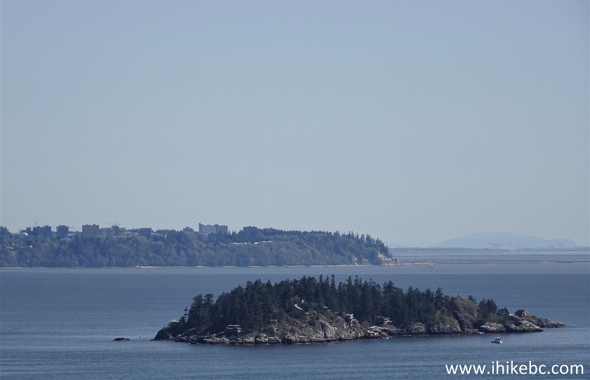
Zoomed view from Dorman Point Trail on Bowen Island
British Columbia
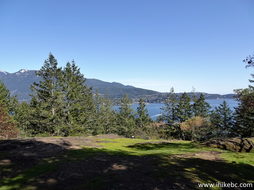
22. To see the best view, proceed a few hundreds meters more on the right side.
Hike on Bowen Island - Dorman Point Trail
23. Much better.
Coordinates: N 49°22.633’ W 123°19.557’ Elevation: 85 meters (70 meters elevation gain from Bowen Island Trunk Road, for about a 5% average trail grade).
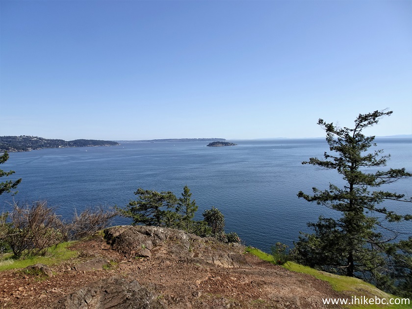
View from Dorman Point Trail on Bowen Island BC
Here is our video of the views from this location.
More ihikebc videos are on our YouTube Channel.
Dorman Point Trail on Bowen Island is quite short, if a bit steep in places, and leads to a decent view. Recommended.


|
 |
![]()
![]()
![]()
Follow @ihikebc Tweet
ihikebc.com Trip 275 - Dorman Point Trail Hike (Bowen Island BC).