![]()
![]()
![]()

Trip 066 - August 12, 2014 (Tuesday)
Squamish River FSR Ashlu Main
Second Trip
Distance From Vancouver:
About 108 km - 65 km via Highway 1 West and Highway 99 (Sea-to-Sky) North to Squamish Adventure
Centre, then keep driving straight on Highway 99 and turn left onto
Squamish Valley Road 9.6 km later, then drive for 23 km to Squamish
River FSR, and turn left onto Ashlu Main 1.2 km after that. Drive for
another 6.7 kilometers until a split - take the road on the right. Less
than two kilometers later you would reach Ashlu Dam view (in photo #1),
which would be the end of 2WD road.
Liked: The great view at the end. The road is in a fairly decent shape too.
Of note: Remote wilderness area. No cell phone signal. Grizzly bears in the vicinity. Creek crossing required. There isn't much to see until you reach the end of the hike.
Vancouver, Coast & Mountains Backroad Mapbook (2010 edition) Coordinates for the Beginning of the FSR: Page 21 (Phantom Lake) G2.
Related Website: Squamish District FSR Conditions.
Previous Trip: Squamish River FSR - Ashlu Main and A-600.
Nearby FSR Trips: Squamish River Main, Squamish River Ashlu, Squamish River E-Main, Squamish River FSR Washout.
Other Forest Service Roads Trips: Chehalis (by Harrison Mills), Chilliwack Bench, Chilliwack Foley, Chilliwack Lake, Chuchinka-Colbourne (North of Prince George), Clear Creek (off Harrison East), Florence Lake (access to Stave Lake by Mission), Harrison East, Harrison East Second Trip, Harrison West, Jones Lake (near Hope), Lost Creek (by Mission), Mamquam River (by Squamish), Nahatlatch (near Boston Bar), Parsnip West (by Mackenzie), Scuzzy (by Boston Bar), Shovel Creek (off Harrison East), Sowaqua Creek (by Hope), Windfall Creek (by Tumbler Ridge).
Follow @ihikebc TweetWe have already hiked Ashlu Main FSR just over three years ago. Check out that trip report for detailed directions to the Ashlu Dam view, which would be the beginning of this hike. So, this year we decided to go further because three years ago someone told us there was a great view on that road, which we did not see the last time due to not hiking far enough. It is possible to drive on this part of Ashlu Main all the way to the dilapidated bridge close to the final destination of our hike, though check out photo #3.
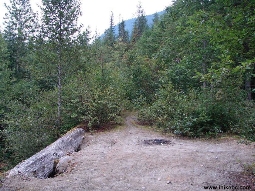
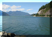
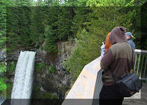
1. A photo from 2011 shows Ashlu Dam View, the beginning of our hike. Coordinates: N 49⁰56.147' W 123⁰22.716'. This is by far the best view of the hike until...well, stay tuned :)
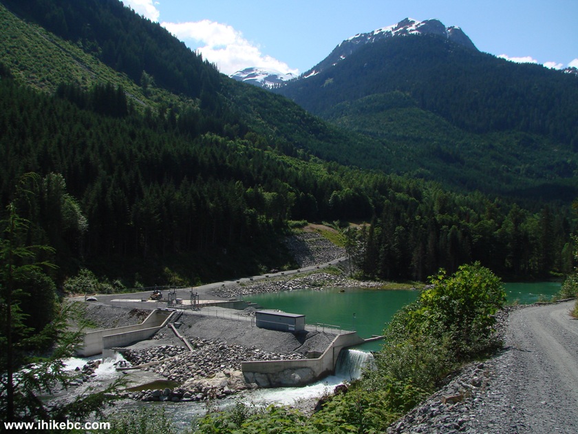
Ashlu River Dam Squamish River FSR Ashlu-Main British Columbia Canada
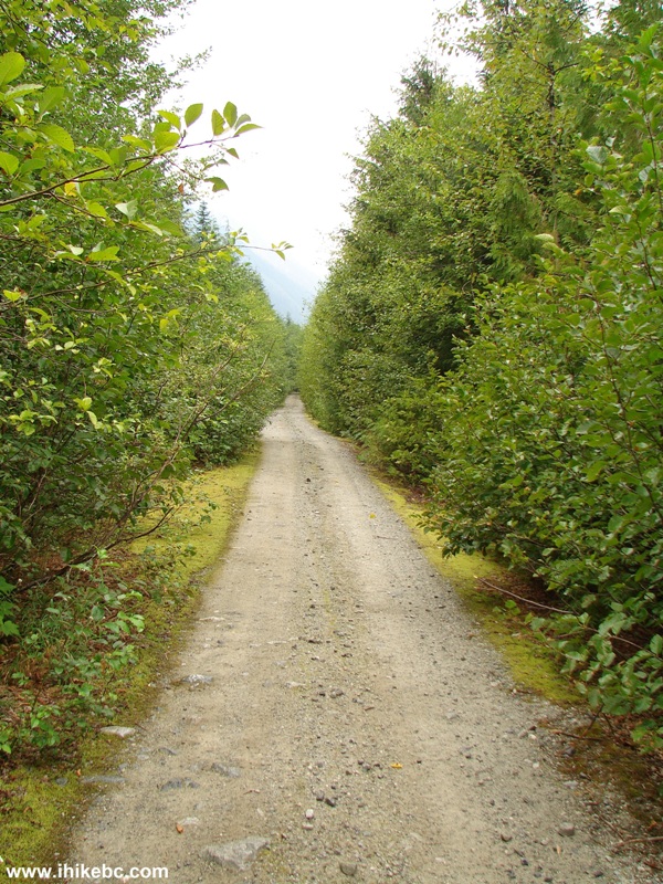
2. It's fairly easy to hike on this road - the surface is sturdy, and the road is wide. There are many uphill stretches, but they are not too steep. Biking on this road should be quite good as well.
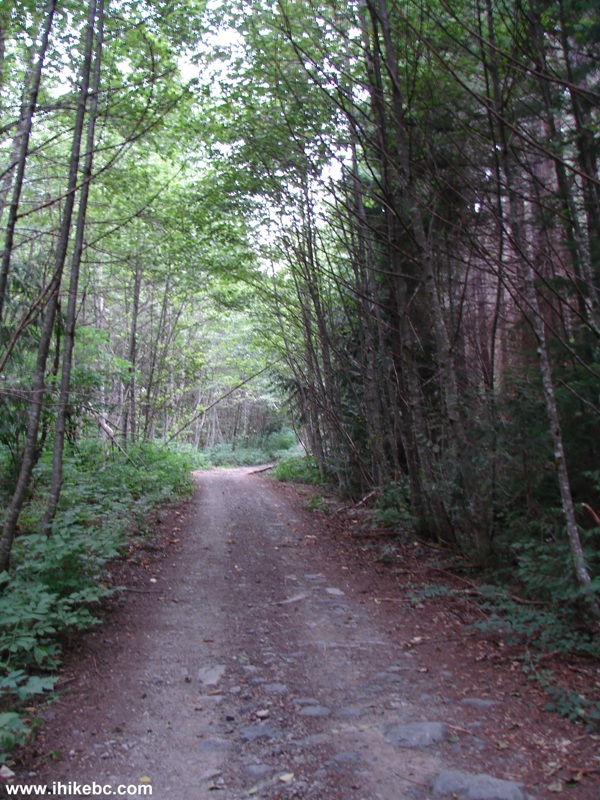
Squamish River A-Main FSR BC Canada
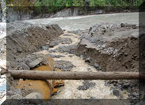
3. Half an hour into the hike, your main challenge awaits - a creek just wide and deep enough to make it impossible to cross without getting your feet wet. We took off the boots and then dried the feet on the other side. But check out the sign on the right side - it says: "The Ashlu Forest Service Road is closed beyond this point to all motorized vehicles between April 1 and June 15 to reduce disturbance to grizzly bears."
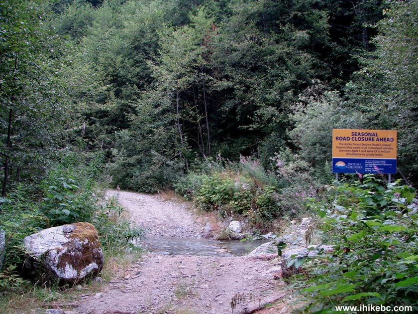
Creek Crossing Squamish River Ashlu-Main Forest Service Road
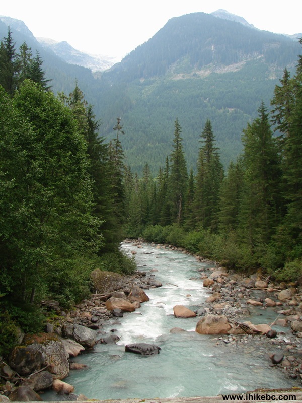
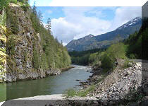
4. Nice river view a bit further down the road. A slight zoom used.
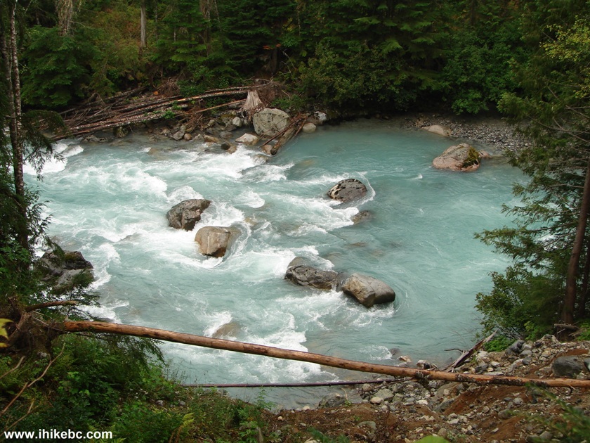
River View Squamish River Ashlu-Main FSR BC Canada
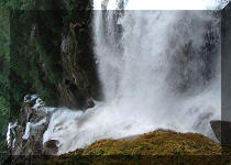
5. Fifteen minutes later, a small but powerful waterfall appears on your right.
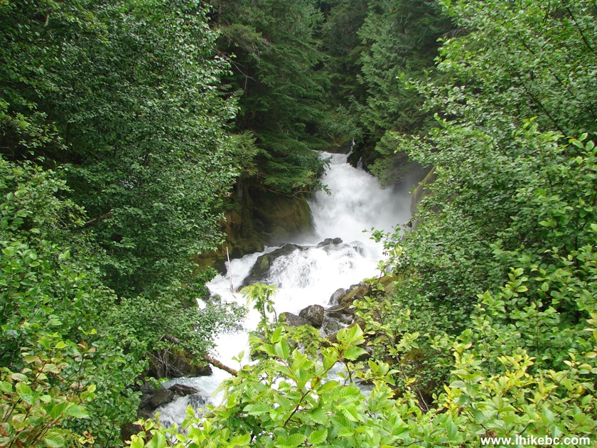
Waterfall Squamish River A-Main Forest Service Road
6. A closer look at the waterfall.
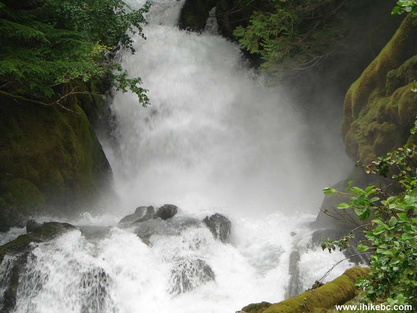
Photo of a Waterfall Squamish River A-Main FSR British Columbia
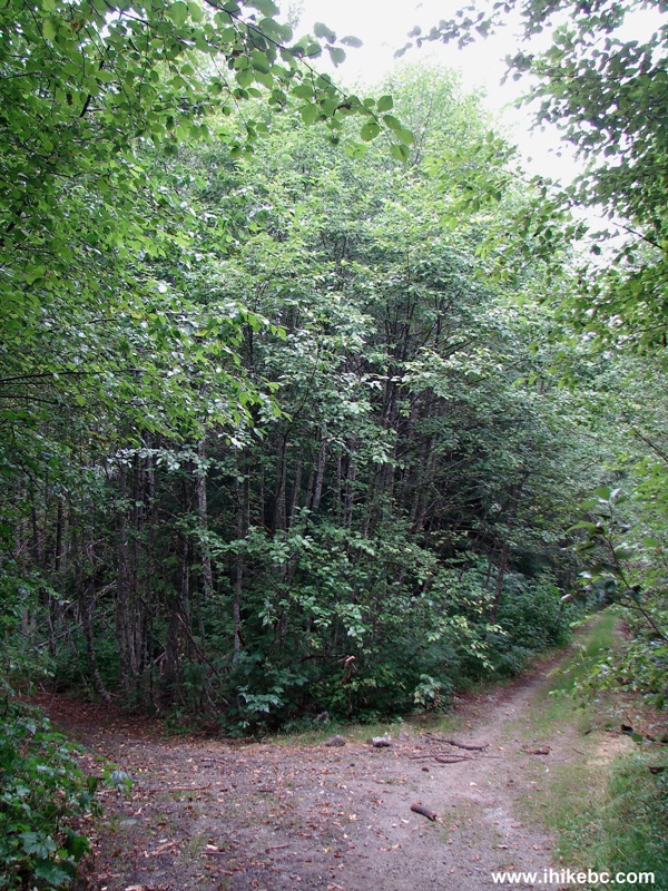
7. Continuing on Squamish River Ashlu Main FSR.
Squamish River A-Main FSR BC Canada
8. Forty-five minutes after the waterfall, you would reach this split, where straight ahead is A-1000 road, and, to the left, is Ashlu Main. Coordinates: N 49⁰58.672' W 123⁰29.374'. We turned left, just like three years ago.
A-Main Split with A-1000 Squamish River Forest Service Road
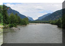
9. And, shortly thereafter, this old bridge offers good river views.
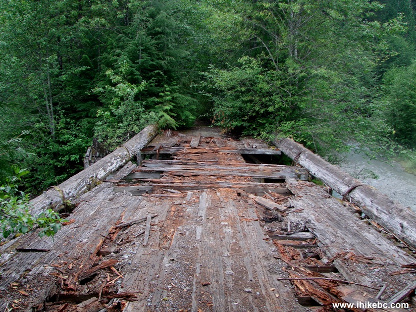
Dilapidated Bridge Squamish River Ashlu-Main FSR BC Canada
10. This bridge looked slightly better three years ago, but still feels sturdy enough for crossing on foot.
Picture of an Old Bridge Squamish River A-Main Forest Service Road
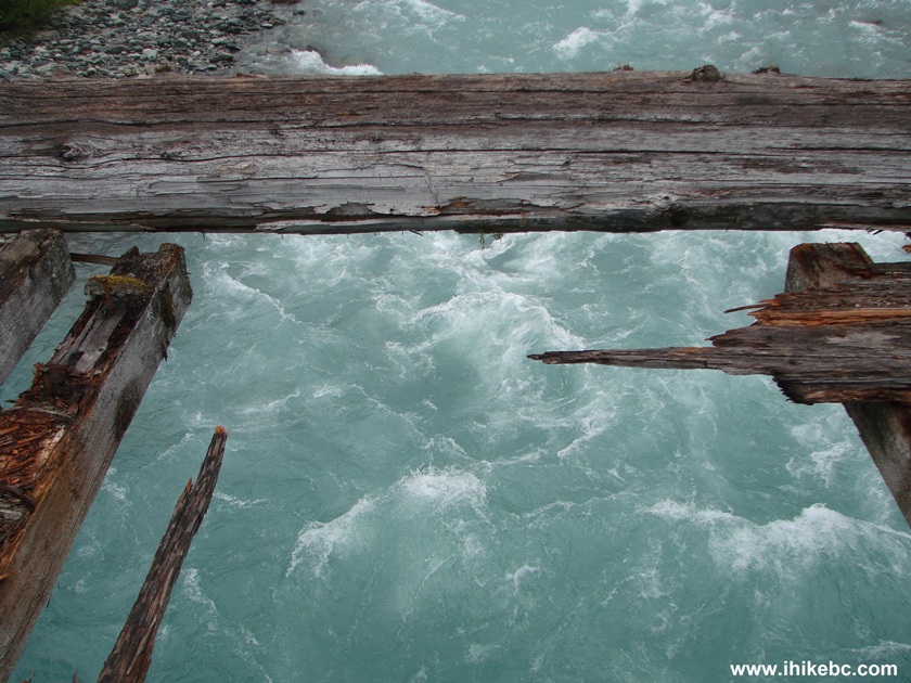
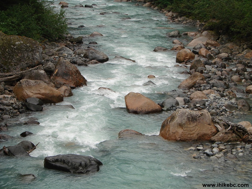
11. River view from the bridge.
River View Squamish River A-Main FSR BC Canada
Here is our video of the views from this location:
12. Moving on.
Squamish River A-Main Forest Service Road British Columbia Canada
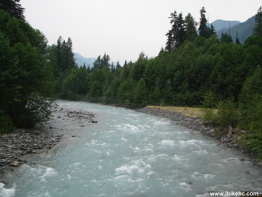
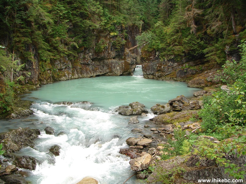
13. Three years ago we turned around at the bridge seen in the photos above. Today, we went ten minutes further and saw this.
Squamish River A-Main FSR River View
14. A closer look.
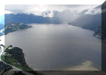
15. But the main attraction is on the other side.
Beautiful Gorge Squamish River A-Main FSR BC Canada
16. Zooming in.
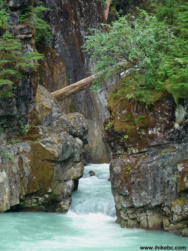
Photo of a Gorge Squamish River A-Main Forest Service Road
Here is our video of the gorge and the surrounding area:
More ihikebc videos are on our YouTube Channel
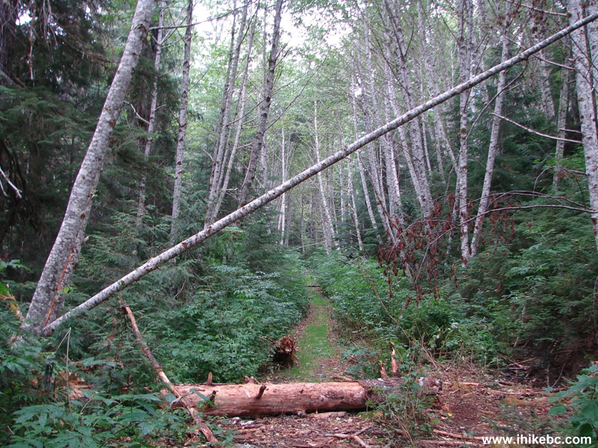
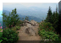
17. And here is the continuation of Ashlu Main. It is badly overgrown beyond this point, so we headed back.
Squamish River Ashlu-Main FSR BC Canada
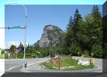
18. Driving back to Vancouver on Highway 99 Sea-to-Sky. Passing through Squamish, with Stawamus Chief (a great hike) in front of us.
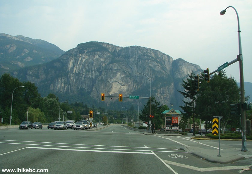
Stawamus Chief Seen from Highway 99 South in Squamish BC Canada
Ashlu Main is a good hike, which leads to a great view. The round-trip hike time would be around five hours.


|
 |
Other Trips in Squamish Area:
|
|
|
|
|
|
|
|
|
|
|
|
|
|
|
|
|
|
|
|
|
|
|


![]()
![]()
![]()