![]()
![]()
![]()

Trip 095 - September 22, 2015 (Tuesday)
Callaghan Lake Provincial Park Visit
Near Whistler BC
Distance From Vancouver: Approximately 127 kilometers: about 110 kilometers via Highway 1 West and Highway 99 Sea-to-Sky to Callaghan Valley Road, then about 8 kilometers to Callaghan Creek Forest Service Road, and then close to 9 kilometers to Callaghan Lake.
Liked: Several great lake views.
Of note: Rough access road (suitable for
high-clearance vehicles only), very few spots in the campground by the
lake, no developed trails in the park, hiking around the lake is a bona
fide obstacle course. For hiking around the lake, hiking poles, hiking
boots, rain pants and a windbreaker or a rain coat are essential, while
safety glasses are recommended. Hiking around the lake is for
experienced hikers only, due to numerous opportunities to get hurt.
Vancouver, Coast & Mountains Backroad Mapbook (2010 edition)
Coordinates
for Callaghan Lake:
Page 29 (Whistler) B3.
Related Website: Callaghan Lake Provincial Park - BC Parks.
Callaghan Lake Provincial Park is located near Whistler. There are no developed trails in that park, so today we did something for the first time - hiked without a trail through all the obstacles. There were some great views to be had, but this also proved to be a good way to fall a lot of times and get hurt. We took pictures over two days, hence the lighting difference here and there.
1. To get to Callaghan Lake Provincial Park from Vancouver, take Highway 1 West, and then Highway 99 (Sea-to-Sky) and drive past Squamish towards Whistler. Here we are on Highway 99 North approaching a left turn onto Callaghan Valley Road, located several kilometers South of Whistler.
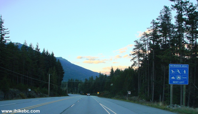
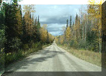
BC Highway 99 Sea-to-Sky Near Whistler
2. In the left turn lane now. Coordinates for the beginning of Callaghan Valley Road: N 50⁰03.687' W 123⁰06.505'.
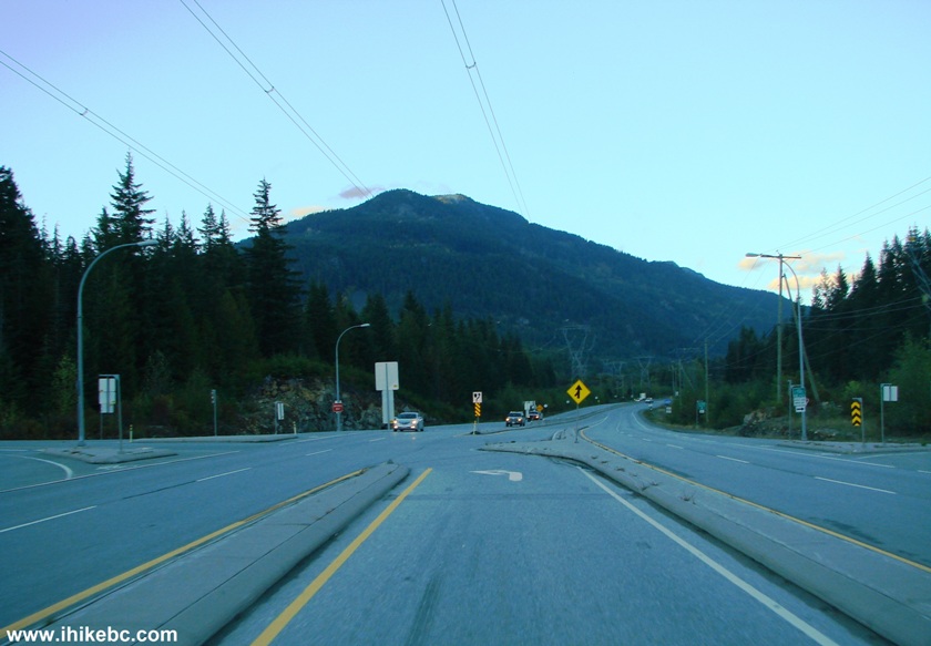
Highway 99 Sea-to-Sky by Callaghan Valley Road
3. After turning onto Callaghan Valley Road, turn left onto Callaghan Creek Foster Service Road about 9 kilometers later. But, before you get there, a great bonus (or a destination on its own) awaits - Alexander Falls. The turnoff to Alexander Falls is 300 meters before the start of Callaghan Creek FSR. Here is that turnoff to Alexander Falls.
Callaghan Valley Road by Alexander Falls Turnoff
4. After the left turn, the parking area is just a hundred meters later. The waterfall observation platform is to the right of where the cars are parked in the photo below.
Alexander Falls Parking Area
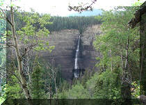
5. Alexander Falls. A slight zoom used.
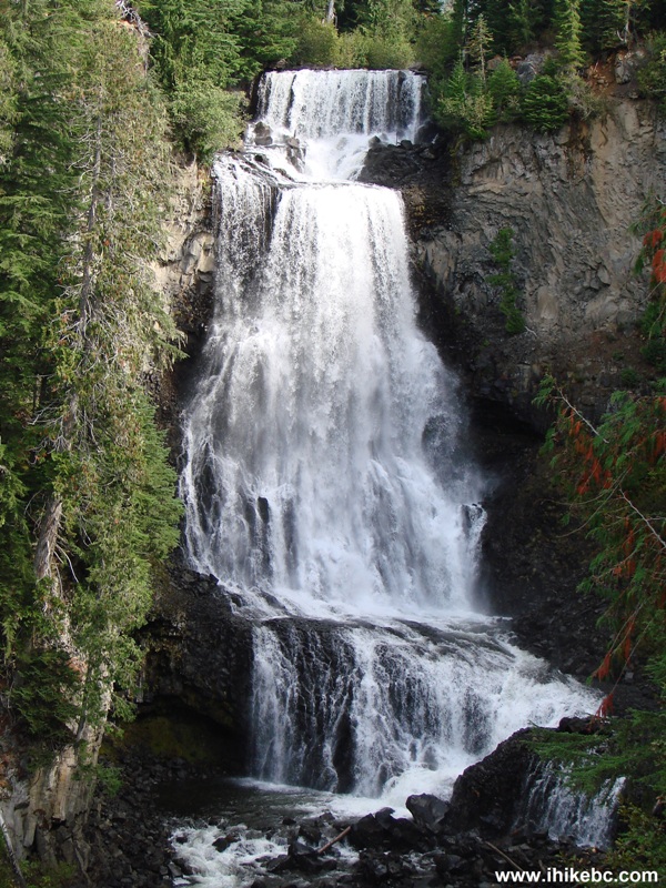
Alexander Falls BC Canada
Here is Our Video of Alexander Falls:
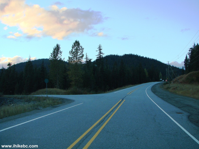
6. As mentioned above, the left turn onto Callaghan Creek Forest Service Road is 300 meters past the turnoff to Alexander Falls. If you were to keep driving past that left turn, you would get to all the things indicated by the right arrow on the information stand pictured below. These activities can be had at the Whistler Olympic Park.
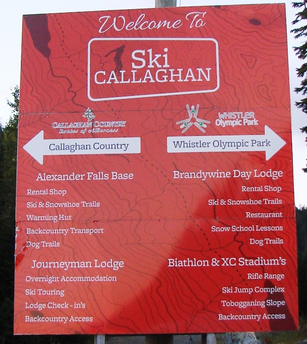
Callaghan Valley Activities Sign
7. And just to the left of this big red sign is the start of Callaghan Creek Forest Service Road. Coordinates: N 50⁰08.163' W 123⁰07.639'.
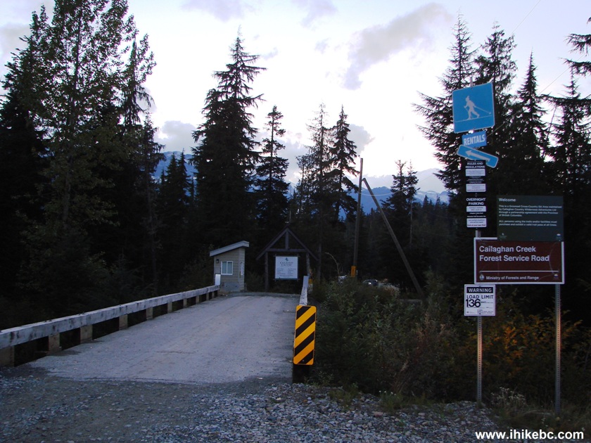
Start of Callaghan Creek Forest Service Road
8. Very soon after the start of Callaghan Creek FSR, there is a split. To the left is a rough road to Callaghan Lake Provincial Park. To the right is, according to a sign, another road to Whistler Olympic Park.
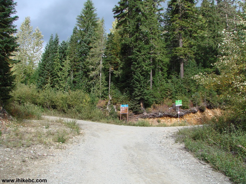
Callaghan Creek FSR near Whistler BC
9. We took the road on the left, and it was full of large potholes, as well as a few treacherous cross-ditches. Low clearance vehicles would likely get damaged.
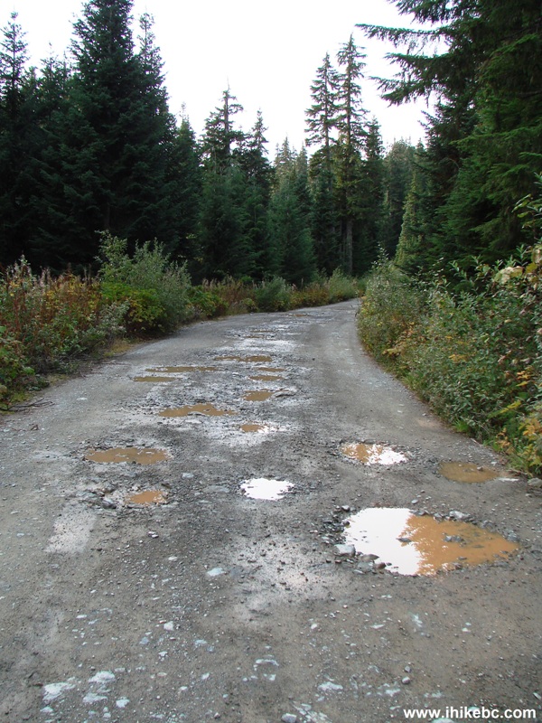
Callaghan Creek Forest Service Road
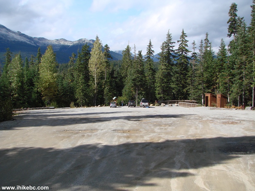
10. About 9 kilometers after the start of Callaghan Creek FSR, the road ends at a campground by Callaghan Lake. Coordinates: N 50⁰11.508' W 123⁰10.982'. The campground has four or five camping spots. Despite a fairly cold day, and despite that being a weekday, there were two parties camping by the lake early in the morning, with more people showing up later in the day. What happens here on weekends, especially in the Summer, is anyone's guess.
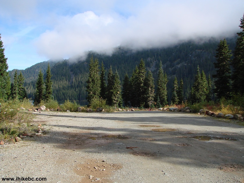
Callaghan Lake
Camping Area by Whistler BC Canada
11. There is a rough car-top boat launch available, according to the BC Parks Website.
Callaghan Lake Boat Launch
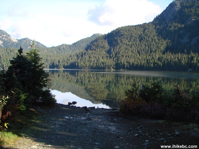
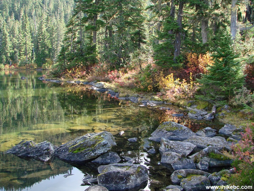
12. View of Callaghan Lake from the boat launch.
Callaghan Lake British Columbia Canada
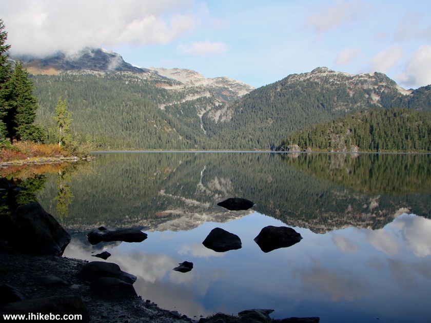
13. Take a short path on the left side...
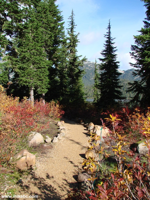
Callaghan Lake Provincial Park
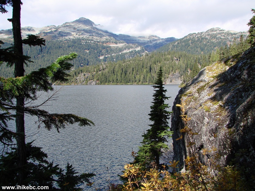
14. ...and check out this view.
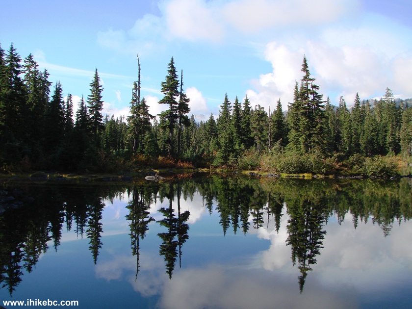
Photo of Callaghan Lake Provincial Park British Columbia Canada
15. We decided to hike counter-clockwise around the lake to reach what looked like a waterfall on the other side. Our painful hike begins.
Callaghan Lake Provincial Park BC Canada
16. At first, it was actually quite good, as there were large stones along the shore, making it easy to get around the lake by hopping from one stone to another. The waterfall we tried to reach is seen across the lake.
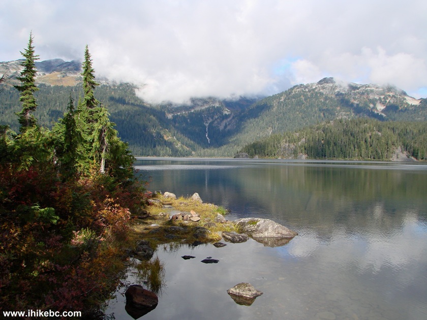
Callaghan Lake BC Canada
Here is Our Video of Callaghan Lake From This Spot:
17. Looking forward now.
Hiking Around Callaghan Lake
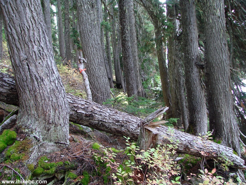
18. Alas, the stones ended soon, and we had to start tackling the plants.
Callaghan Lake Provincial Park BC Canada
19. Young trees were our next challenge. Safety glasses would have been very helpful, with numerous branches trying to scratch the eyes. Rain pants and a windbreaker proved indispensable during this hike.
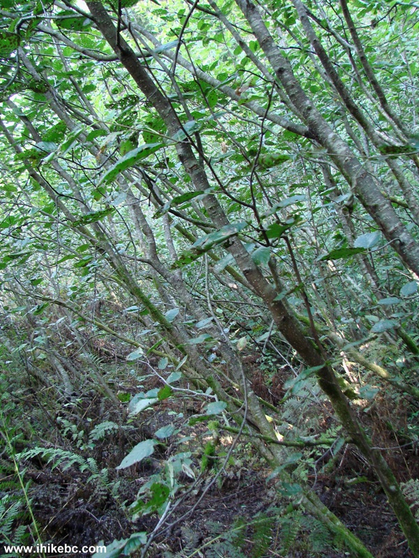
Hike Around Callaghan Lake British Columbia Canada
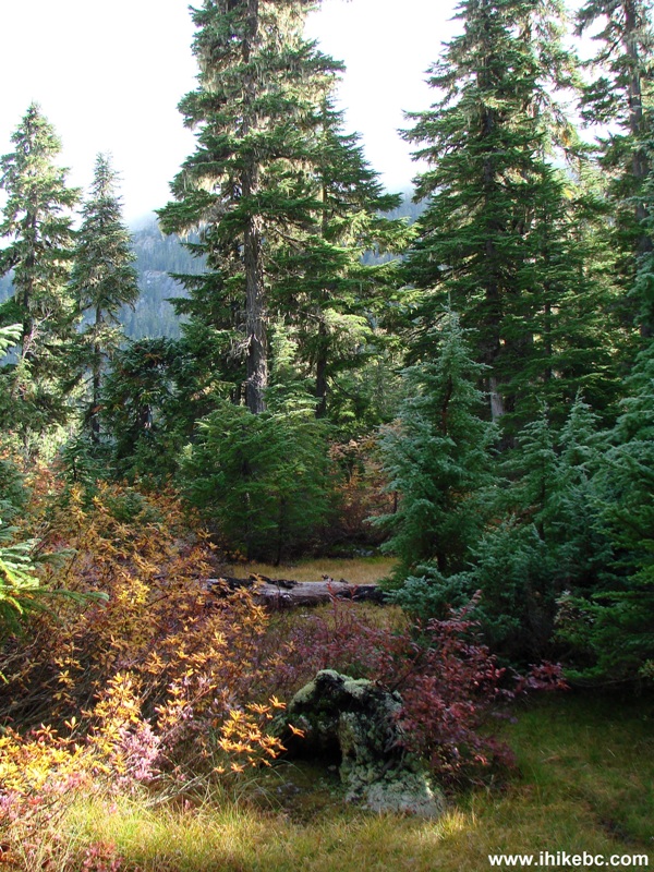
20. There was also a mini-swamp there, followed by a relatively easy stretch pictured below.
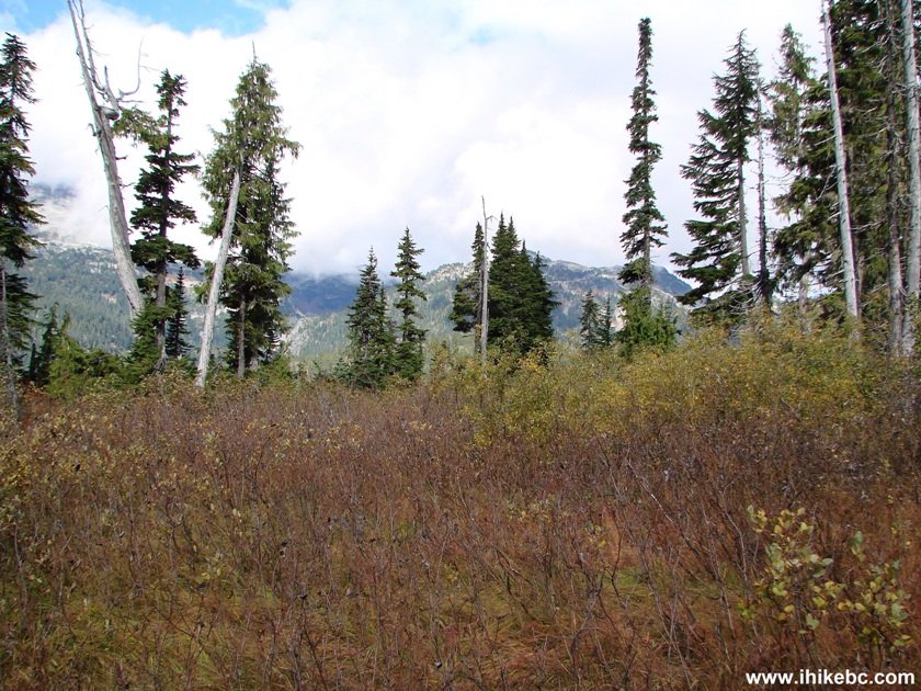
Callaghan Lake Provincial Park BC Canada
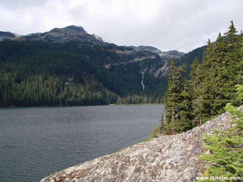
21. About an hour into the hike, we have reached a large stone. You can see a small part of it on the right side of the photo below. This is where we should have stopped, in hindsight, as the views hardly got any better, and the terrain became even tougher.
Callaghan Lake BC Canada
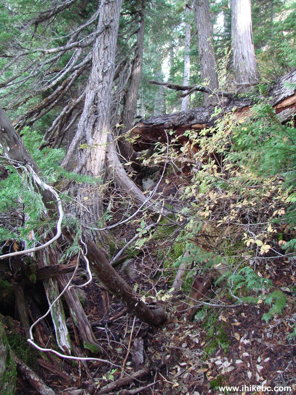
22. But, we kept going, and reached this rockfall.
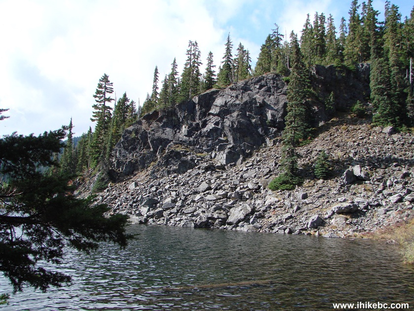
Callaghan Lake Rockfall
23. Walking across the rockfall.
Callaghan Lake BC Canada
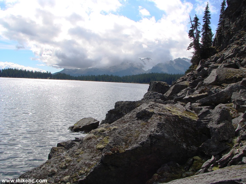
24. Here is a good view.
Hiking Around Callaghan Lake BC Canada
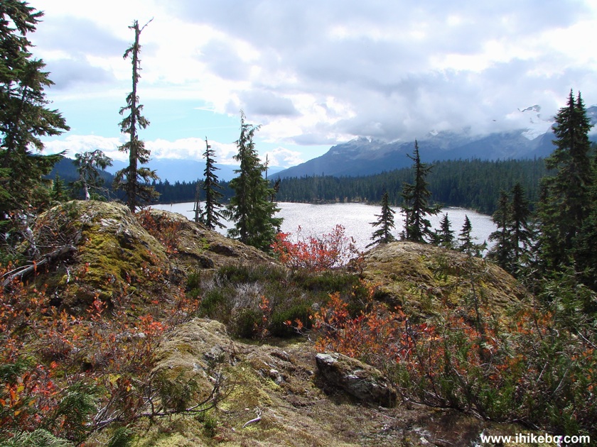
25. Our waterfall was getting closer, but not fast enough.
Hiking Around Callaghan Lake British Columbia Canada
26. After three exhausting hours of numerous falls, it was time to stop right here, at least an hour away from the waterfall. Tied up a piece of a flagging tape there to commemorate the occasion. Coordinates: N 50⁰12.196' W 123⁰11.466'.
Callaghan Lake Provincial Park
Here is Our Video of The Area at the End of Our Hike:
More ihikebc videos are on our YouTube Channel.
27. Got this neat creek view on the way back.
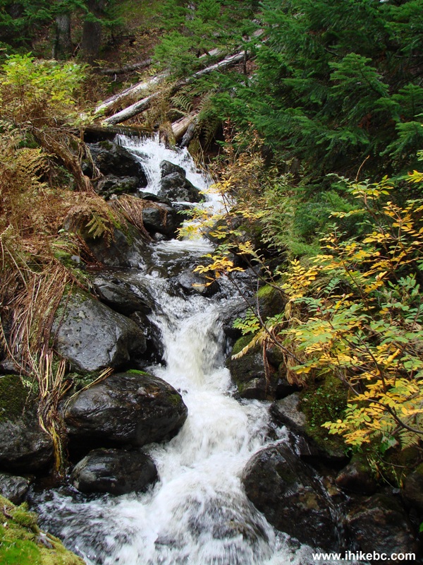
Callaghan Provincial Park British Columbia
Despite a few good views, hiking around Callaghan Lake is hard to recommend. Camping, fishing or boating could be a different story.


|
 |
![]()
![]()
![]()
ihikebc.com Trip 095 - Callaghan Lake Provincial Park Visit (near Whistler BC)