![]()
![]()
![]()

Trip 271 - September 12, 2022 (Monday)
Kitwanga Mountain Trail Hike
AKA Bernadine Mountain Trail Hike
Near Kitwanga BC (Hwy 16 @ Hwy 37 area)
Page 2 of 2
Liked: Mountain views (especially Seven Sisters mountain range), panoramic Skeena River valley views, volcanic rock views, colourful mountain plants, shade in the forest, few bugs.
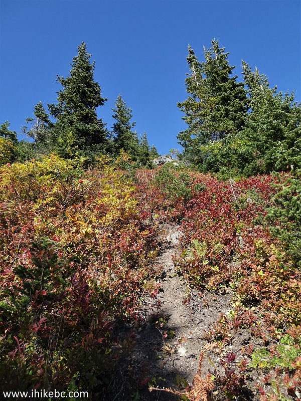
Of Note: Trailhead access road (off Cedarvale-Kitwanga Rd AKA 3rd Ave) is suitable for high-clearance 4x4 vehicles only due to large deep puddles (otherwise, extra 5.4 km round-trip hiking is in order). Remote traffic noise for most of the trail. A very steep trail in sub-alpine area (past the first viewpoint), which is suitable for experienced well-equipped hikers only. Hiking poles and boots are essential. The trail is a bit brushed-in for about a kilometer before the first viewpoint.
Northern BC Backroad Mapbook (3rd edition) Approximate Trailhead Coordinates: Page 34 (Kitwanga) F1.
Kitwanga Mountain Trail (also known as Bernadine Mountain Trail) is found in Kitwanga Mountain Provincial Park near a Native settlement of Kitwanga, which is located in Western British Columbia off Highway 37 near its intersection with Highway 16. The said intersection is about halfway between the town of Terrace (100 km to the West), and the town of Smithers (116 km to the East).
Kitwanga Mountain Trail starts off a 2.7 km-long access road, which branches off Cedarvale-Kitwanga Road about 4.7 km from Highway 37. Cedarvale-Kitwanga Road is suitable for all vehicles, but the access road is rather rough and has very deep and long puddles. So, unless you have a high clearance 4x4 vehicle, getting to the trailhead would add an additional 5.4 km to the hike.
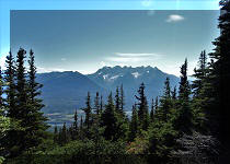
The trail itself goes through the woods, and then breaks into sub-alpine with absolutely gorgeous views of the Skeena River valley and Seven Sisters mountain range. Past the first viewpoint, the trail is suitable for experienced, well-equipped hikers only, as it is very steep out there. Up to the first viewpoint, which is located about 3.3 km from the trailhead, the trail is moderately difficult with several short steep stretches, and should be ok for any hiker in a decent physical shape.
Past the first viewpoint, Kitwanga Mountain Trail becomes more of a route, but the direction of travel is very obvious - West along the Skeena River valley. The views are very panoramic and impressive. For the best experience, head out as early as you can or on a cloudy day, as later in the afternoon the sun starts shining in the eyes when you are looking Southwest at the Seven Sisters, which is the main attraction of the hike.
Today, we traveled for about 1.4 km past the first viewpoint, for a total of 9.4 km round trip (plus 5.4 km of access road round-trip, for a grand total of almost 15 km). It appeared that it was possible to hike at least a bit further past the point where we stopped.
*All trail distances are based on a GPS odometer and are approximate.
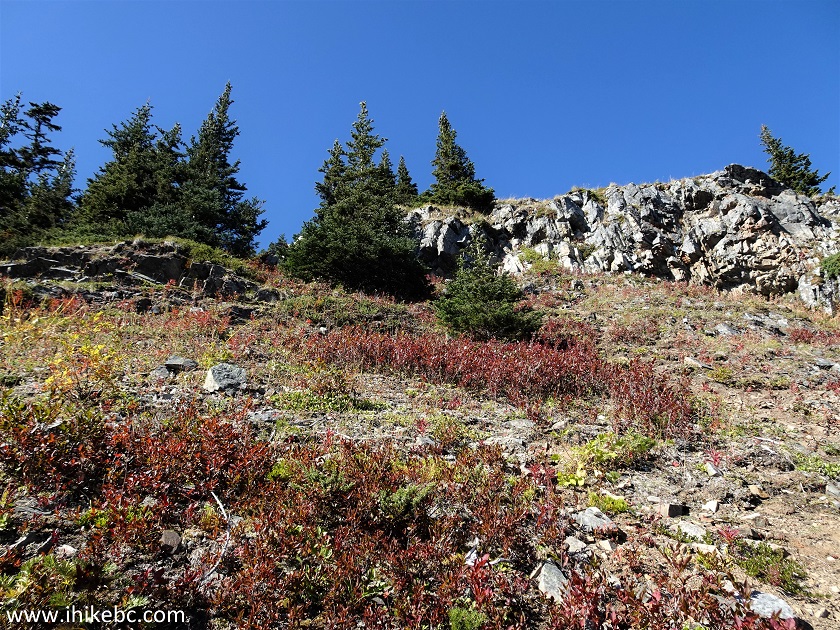
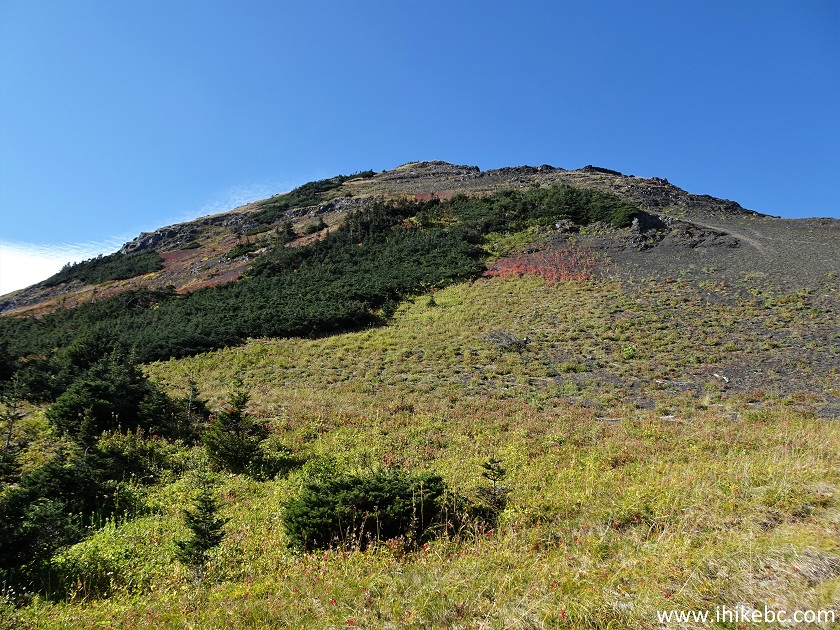
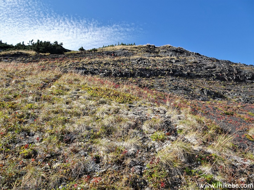
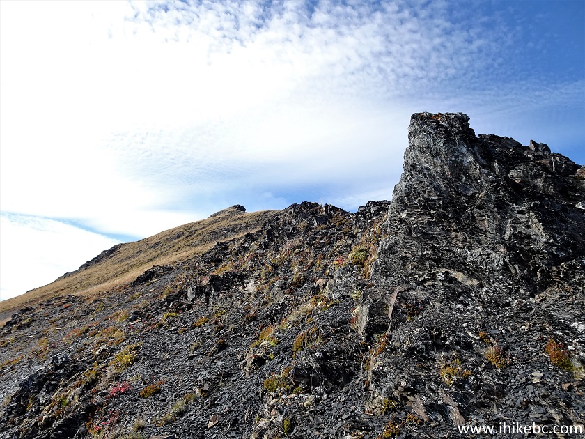
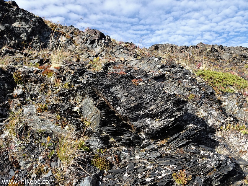
35. At the 3.53 km mark, we are out of the woods and are facing this wall of stone.
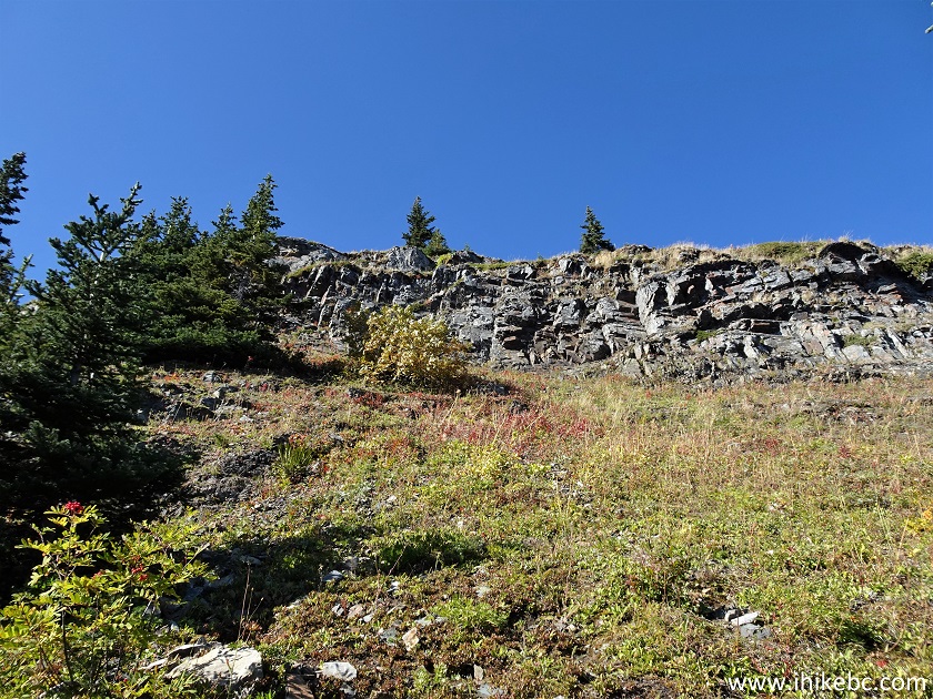
Bernadine Mountain Trail - Kitwanga Mountain Trail
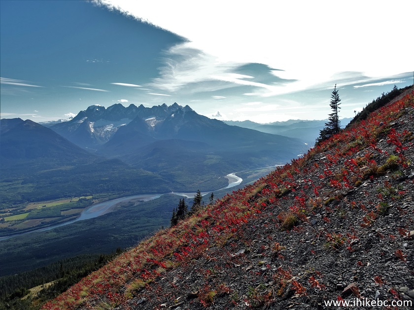
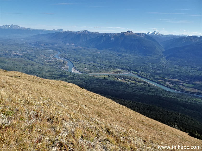
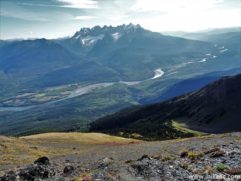
36. Looking back is a panoramic view of Skeena River Valley.
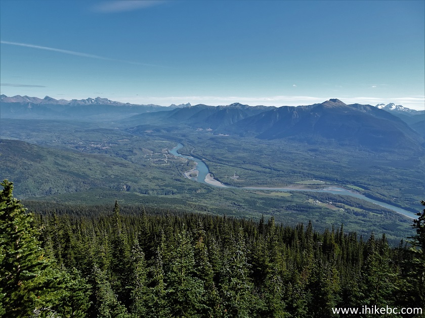
Skeena River Valley View from Kitwanga Mountain
37-38. Climb up the wall of stone.
British Columbia Hiking - Kitwanga Mountain Trail
Hike in British Columbia - Bernadine Mountain Trail
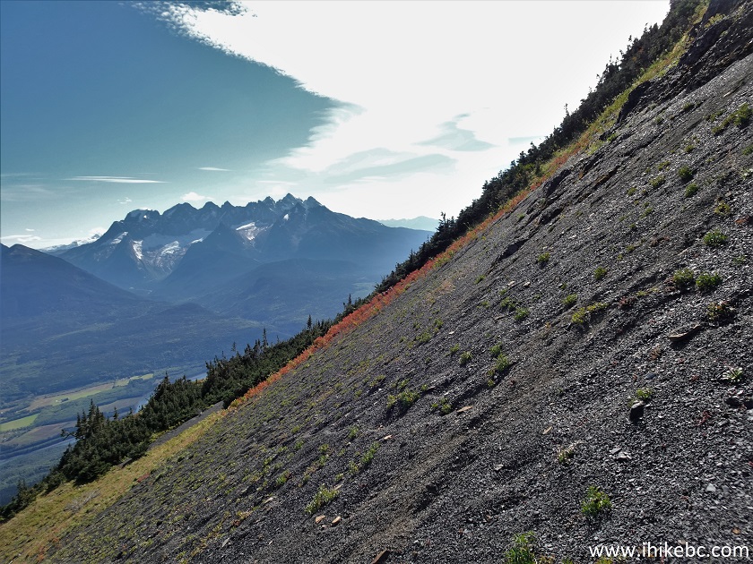
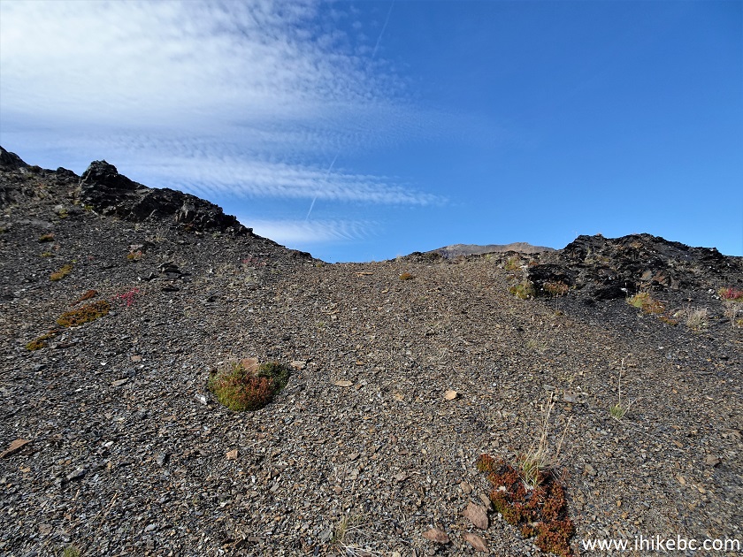
39. And, at 3.70 km, here comes the most difficult part of the hike - a tremendously steep climb up loose dirt (the right side of the photo below). While hiking up loose dirt is very exhausting, it really helps on the way back, serving as a natural brake during the descent.
Kitwanga Mountain
40. Steep. Looking left.
Steep Kitwanga Mountain
41. Looking back.
Hike in Kitwanga BC Area - Kitwanga (Bernadine) Mountain Trail
42. Having conquered the climb, which is about 300 meters long, your reward is a fine view of mountain plants.
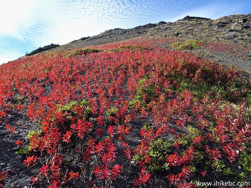
Blooming Mountain Plants British Columbia
43. Looking left from the mountain plants area.
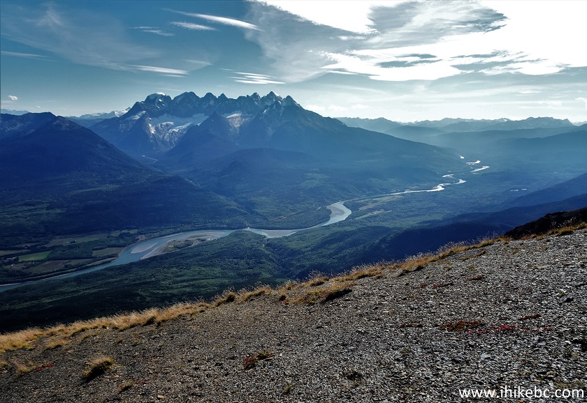
Seven Sisters View from Kitwanga Mountain
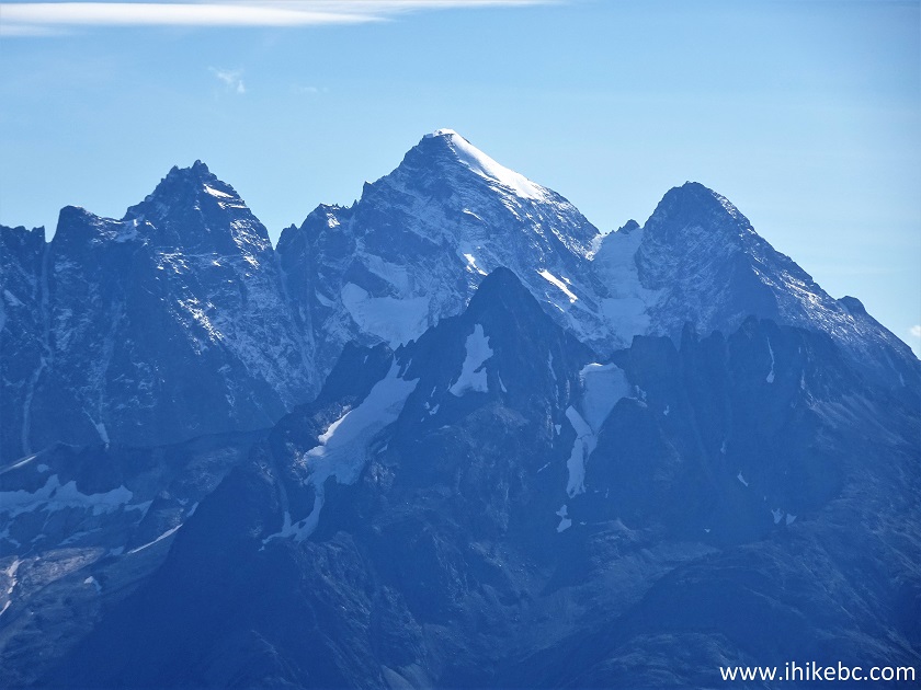
44. Seven Sisters with some zoom.
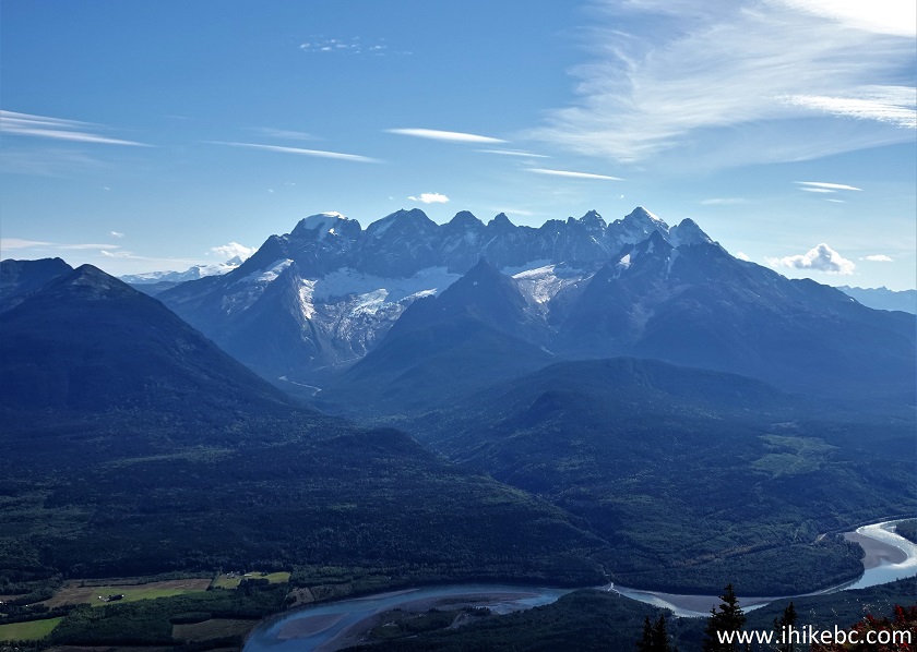
Seven Sisters British Columbia
45. Going forward (West) is still a bit steep, but not nearly as much.
Hike in Kitwanga BC Area - Kitwanga Mountain Route
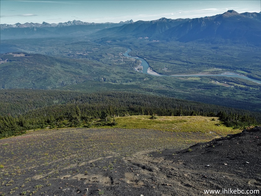
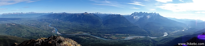
46-49. At 4.28 km, a panoramic view of Skeena River Valley from East to West.
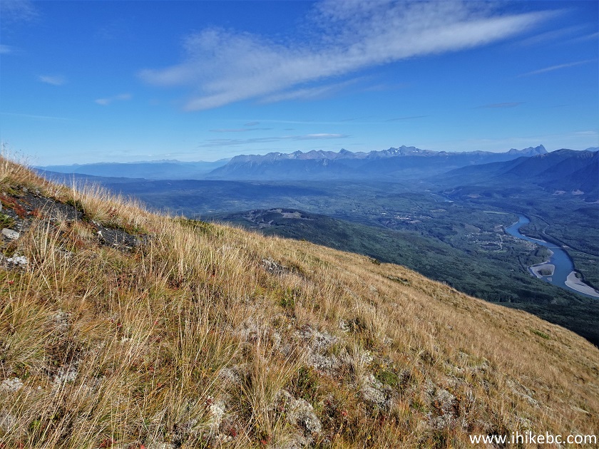
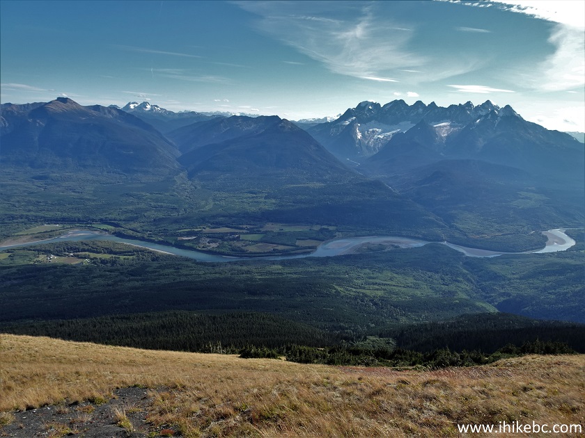
Skeena River Valley View from
Kitwanga Mountain British Columbia
Here is our video of the
views from approximately this point.
50. By 4.34 km, volcanic rock is all around.
Volcanic Rock Kitwanga Mountain BC
51. Here it is up close.
Volcanic Rock British Columbia Canada
52. Hike up this saddle...
British Columbia Hiking - Kitwanga Mountain Route
53...and here is a view on the other side at about the 4.45 km mark.
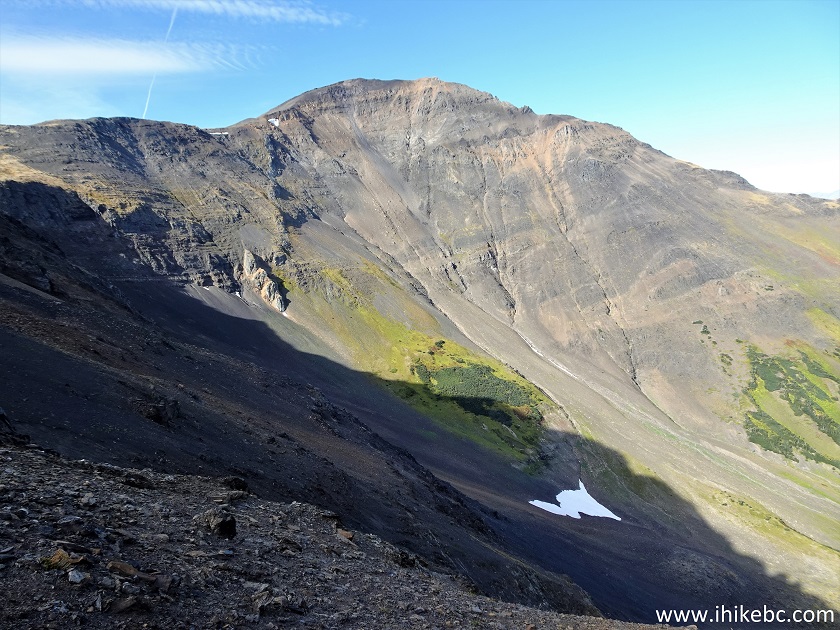
Kitwanga Mountain Hike in Canada
54. Looking back.
Hike in Kitwanga BC Area - Kitwanga (Bernadine) Mountain
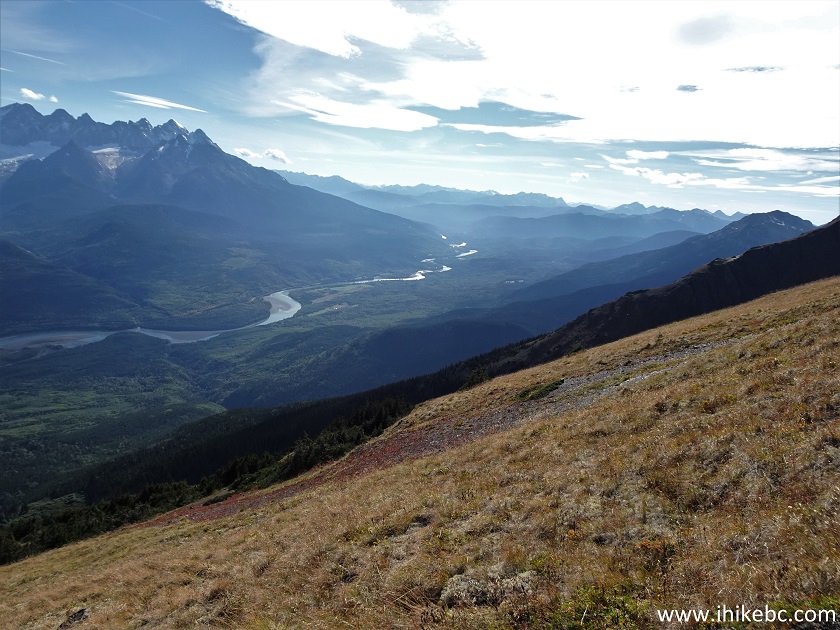
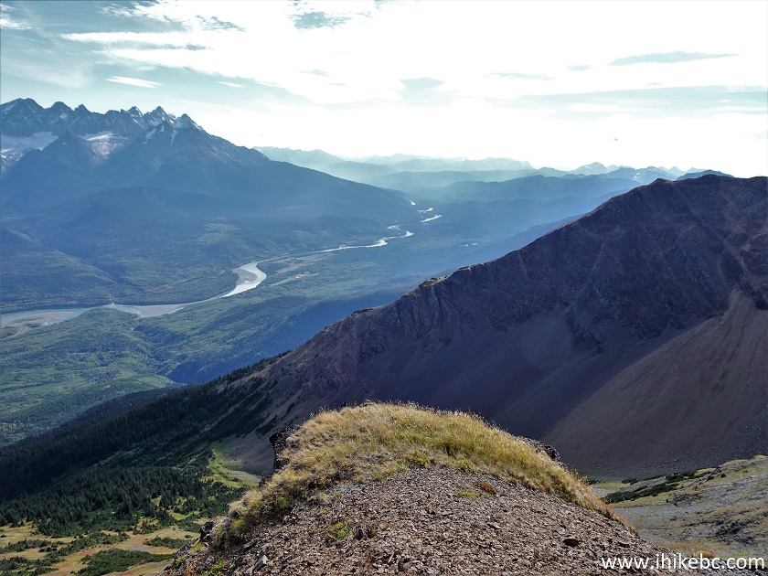
55. Looking West.
Seven Sisters and Skeena River Valley View from Kitwanga Mountain
56. We then proceeded towards the ridge seen ahead.
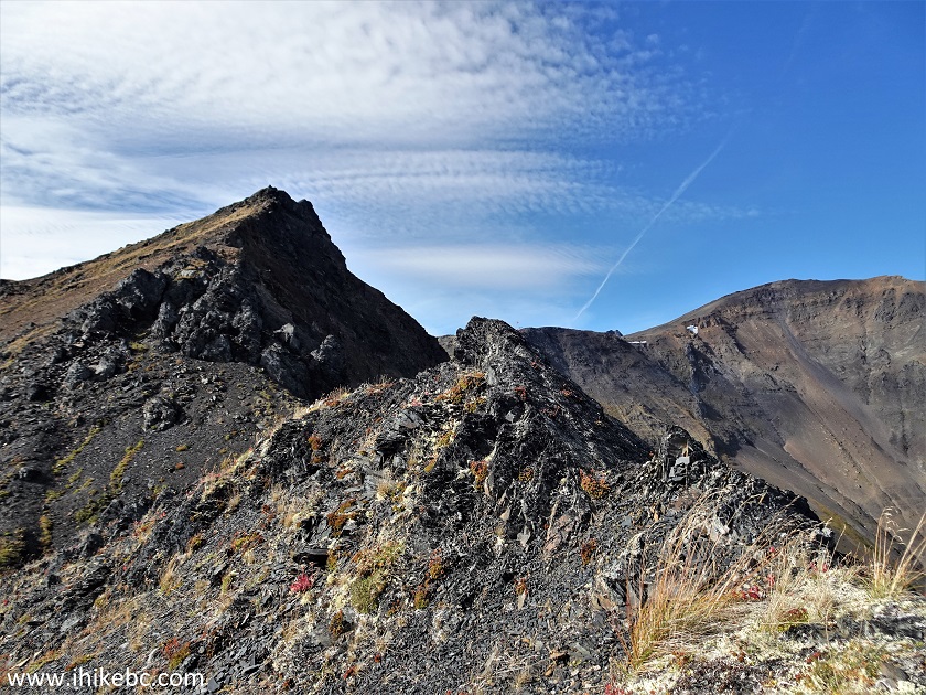
Kitwanga Mountain
57. Here it is.
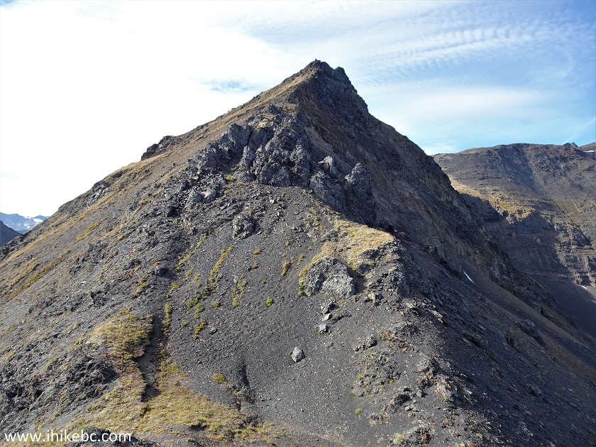
Bernadine Mountain British Columbia
58. Looking back from the ridge.
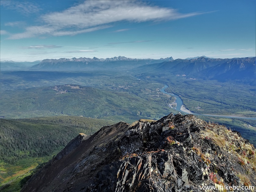
Skeena River Valley View from Bernadine Mountain
59. With zoom, we see Kitwanga BC on the left side.
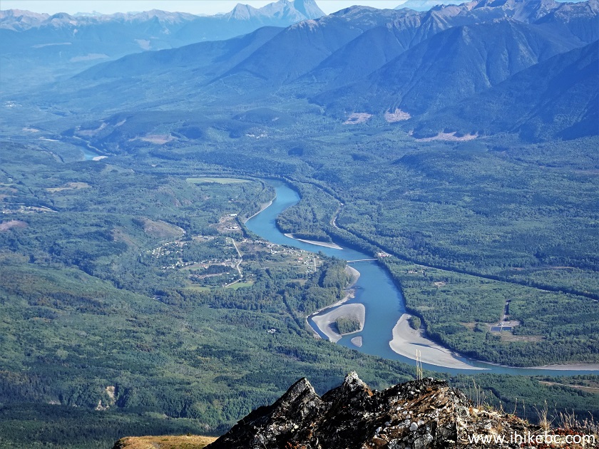
Kitwanga BC View from Kitwanga Mountain
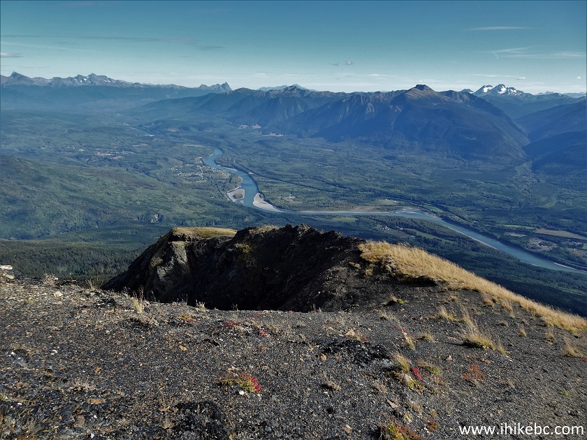
60. The bridge in the middle is the same one we crossed to get to the trailhead. It is located on Highway 37 just North of the junction with Highway 16. Petro Canada's red roof is seen on the right side.
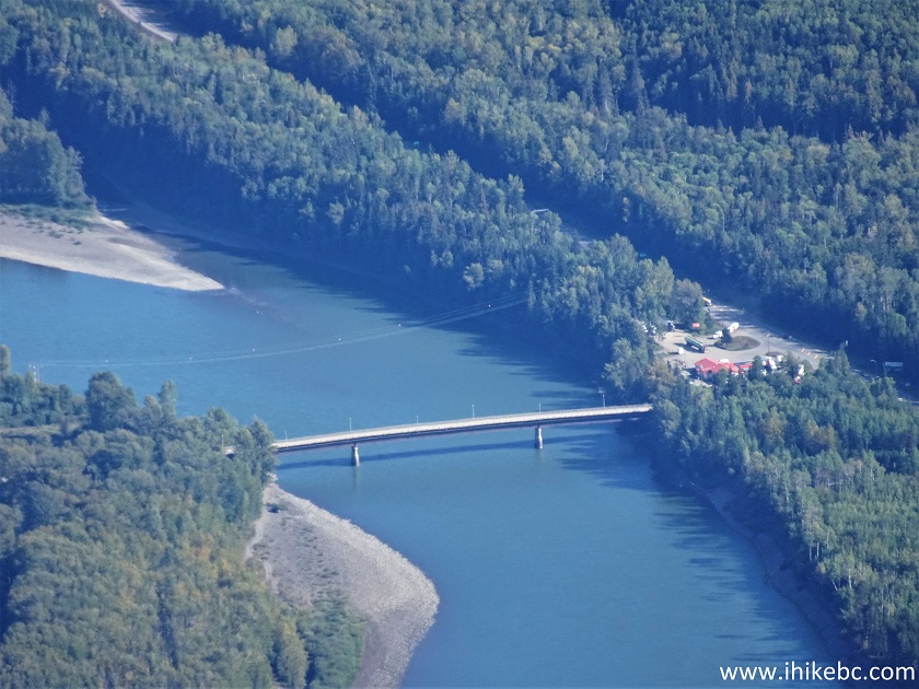
Bridge Across Skeena River View from
Kitwanga Mountain
Here is our video of the
views from approximately this point.
More ihikebc videos are on our YouTube Channel.
61-64. Zoomed views of Seven Sisters and its peaks.

Seven Sisters Mountain Range British Columbia
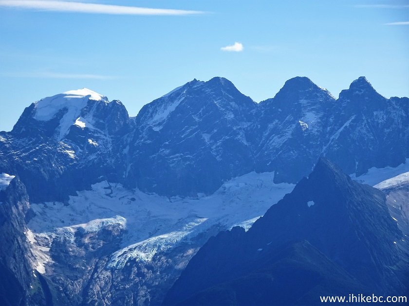
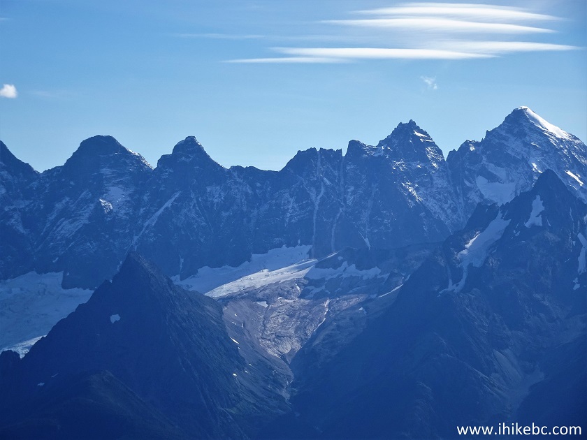
Seven Sisters Peaks
65. A panorama of the place.
Skeena River Valley Panorama
66. We then descended from the ridge...
Hike in British Columbia on Kitwanga Mountain
67...and found a neat flat grassy spot (foreground) about 4.75 km from the trailhead, perfect for a break. Coordinates: N 55°07.700’ W 128°11.145’. Elevation: 1,755 meters. The average grade from the first viewpoint is about 31%. We then headed back.
Kitwanga Mountain Hiking
It is certainly possible to hike further from this location, though we don't know how far. Kitwanga Mountain Trail, while quite difficult in a few places, features very impressive views. Highly recommended.


|
 |
![]()
![]()
![]()
ihikebc.com Trip 271 - Kitwanga Mountain Trail Hike (Near Kitwanga BC) Page 2 of 2