![]()
![]()
![]()

Trip 069 - August 26, 2014 (Tuesday)
Chilliwack Foley Forest Service Road
Near Chilliwack, BC
Distance From Vancouver (Grandview Hwy Entrance to
Hwy 1 East):
About 128 km: 93.5 km from Grandview Hwy entrance to Hwy 1 East to Exit
123 (Prest Road) - turn right (South), then 5 km on Prest Rd and turn
left on Bailey Rd, then 700 meters later at a split stay right on
Elk View Road.
Continue on Elk View Road until it ends ten kilometers later, and
Chilliwack Bench Forest Service Road begins. Then, 18.7 kilometers
later, Chilliwack Foley FSR appears ahead. On the right side would be a
2-km spur to Chilliwack Lake Road, so you can reach Chilliwack Foley FSR
through Chilliwack Lake Road too.
Liked: The granite wall, the waterfall, several mountain views, Foley Lake.
Of note:
Contrary to
Chilliwack Bench FSR, Chilliwack Foley is a rough road, though still
passable in a 2WD vehicle (in dry conditions, anyway) all the way to
Foley Lake. There was too much garbage at Foley Lake, which is fairly
popular.
Vancouver, Coast & Mountains Backroad Mapbook (2010 edition)
Coordinates
to the Beginning of the FSR: Page 5
(Chilliwack Lake) C5.
Other Trips in
Chilliwack Area:
Flora Lake Trail,
Williams Ridge Trail,
Mount Thom Lookout
Loop Trail, Vedder Rotary Loop
Trail,
Teapot Hill Trail Hike, Chilliwack Dyke Trail,
Greendrop Lake Trail, Mount Cheam Peak
Trail, Ling Lake Trail Hike (off
Chilliwack Foley FSR), Chilliwack
Bench FSR, Elk-Thurston Trail,
Slesse Memorial Trail, Downtown Chilliwack BC
Visit, Chilliwack
Lake FSR, Radium Lake Trail,
Chilliwack Lake
Provincial Park, Minter Gardens,
Town of Agassiz BC,
Bridal Veil Falls Provincial
Park. Other Forest Service Roads Trips:
Chehalis
Follow @ihikebc Tweet
Chilliwack Foley Forest Service Road leads to Foley Lake, as well as Ling Lake Trail. It has some nice views, but will slow you down to crawl in some places due to potholes and general rough state of the road.
If you zero your trip odometer at the 3-way intersection seen
in photo #1, here are the approximate distances to various attractions
along the way:
| KM | Feature | Side |
| 1.1 | Granite Wall & Waterfall | L |
| 2.3 | Foley Creek Crossing | S |
| 2.4 | Small Camping Area | L |
| 2.5 | Airplane Creek FSR - Baby Munday Trailhead | L |
| 3.9 | Large parking Area | R |
| 4.1 | Foley Lake begins | L |
1. This area is slightly complicated as far as which FSR is where. Chilliwack Bench, Chilliwack Foley, and Chilliwack Chipmunk Forest Service Roads all begin and end nearby. But, as far as we understood it, at this particular spot Chilliwack Chipmunk meets Chilliwack Foley. So, in the photo below we are at a 3-way intersection and are facing South. There is nothing but trees and shrubs behind us (North) - no road there of any kind. Straight ahead (South) is Chilliwack Foley FSR (2 km later it ends at Chilliwack Lake Road, which goes from Chilliwack to Chilliwack Lake Provincial Park and Chilliwack Lake FSR). To the left (East) is also Chilliwack Foley, and it is this particular stretch of the road that we cover in the trip report below. And, to the right (West), is Chilliwack Chipmunk, which 1.9 km later meets with Chilliwack Bench, covered in our previous trip report.
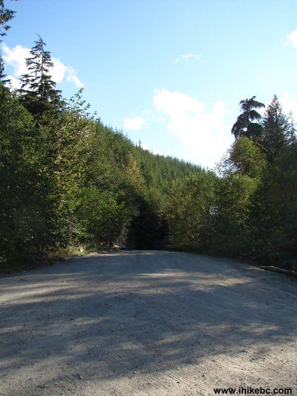
Chilliwack Foley FSR Intersection with Chilliwack Chipmunk FSR
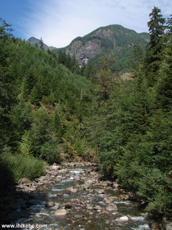
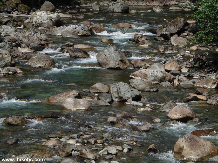
2. Chilliwack Foley going East is quite rough, with lots of potholes. But, there are some good views too, such as this river view.
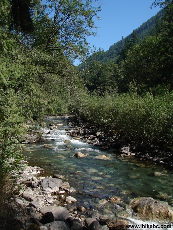
Creek by Chilliwack Foley Forest Service Road BC Canada
3. Also, 1.1 kilometers after the 3-way intersection seen in photo #1, there is an ordinary left turn not promising much, until you walk for half a minute and see this large granite wall.
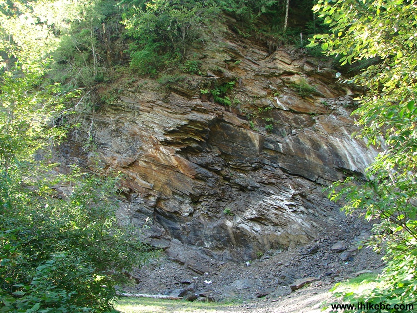
Granite Wall off Chilliwack Foley FSR BC Canada
4. The left side of the wall.
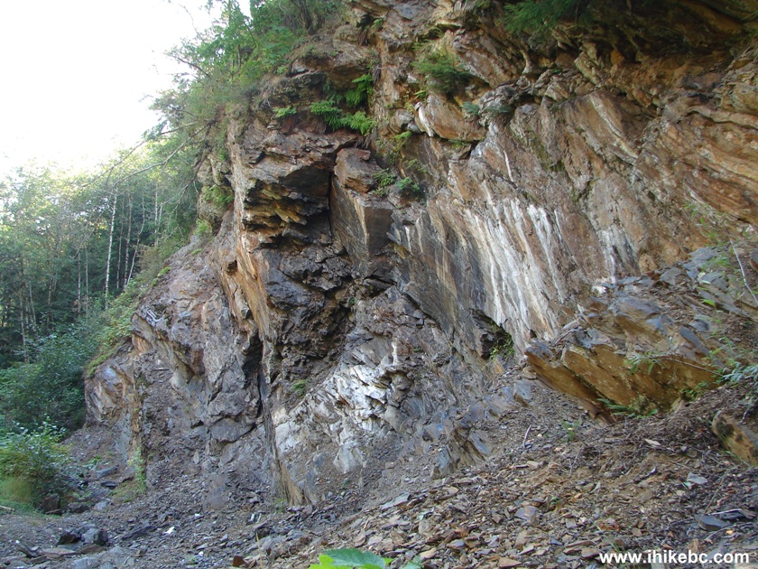
Photo of a Granite Wall Near Chilliwack Foley Forest Service Road BC
Canada
5. To the right of the wall, behind some bushes, there is a neat waterfall.
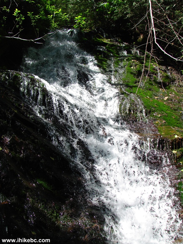
Waterfall Near Chilliwack Foley FSR BC Canada
Here is our video of the waterfall and the granite wall:
More ihikebc videos are on our YouTube Channel.
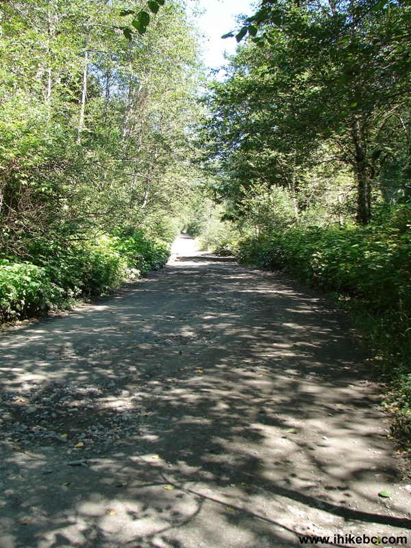
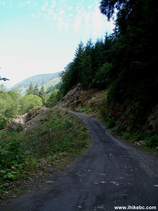
6. Chilliwack Foley is a rough road with many potholes, though it's still possible to make it to Foley Lake in a high clearance 2WD.
Chilliwack Foley FSR BC Canada
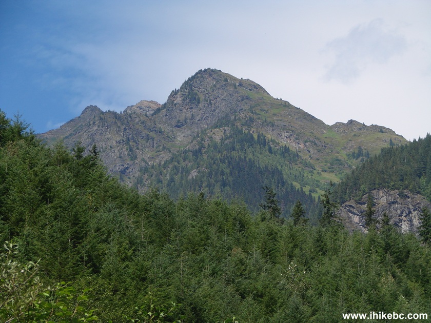
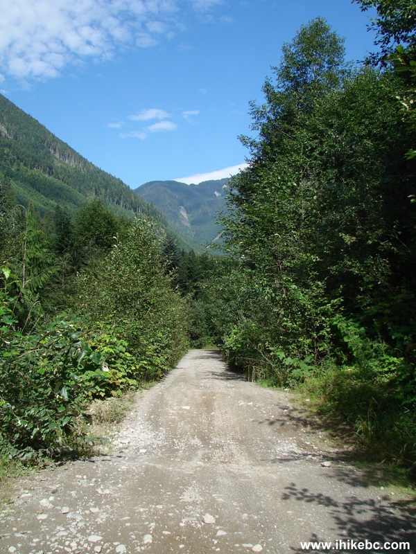
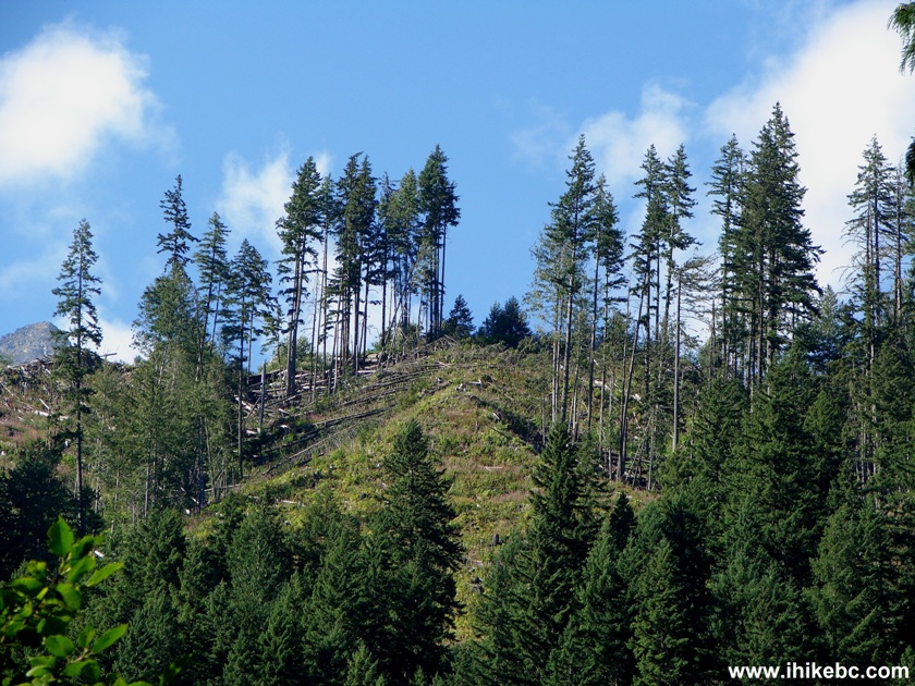
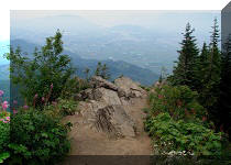
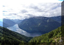
7. Going slow allows better appreciation of the mountain views along the road.
Mountain View Chilliwack Foley Forest Service Road BC Canada
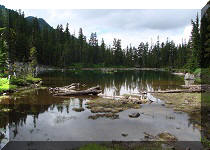
8. Crossing Foley Creek.
Foley Creek Chilliwack Foley FSR BC Canada
9. A closer look.
Picture of Foley Creek Chilliwack Foley Forest Service Road BC Canada
10. The last steep stretch before the lake.
Chilliwack Foley FSR BC Canada
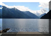
11. Foley Lake. Pretty. Popular. Lots of garbage on the shore.
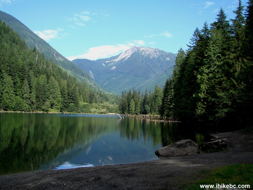
Foley Lake BC Canada
12. Zooming in.
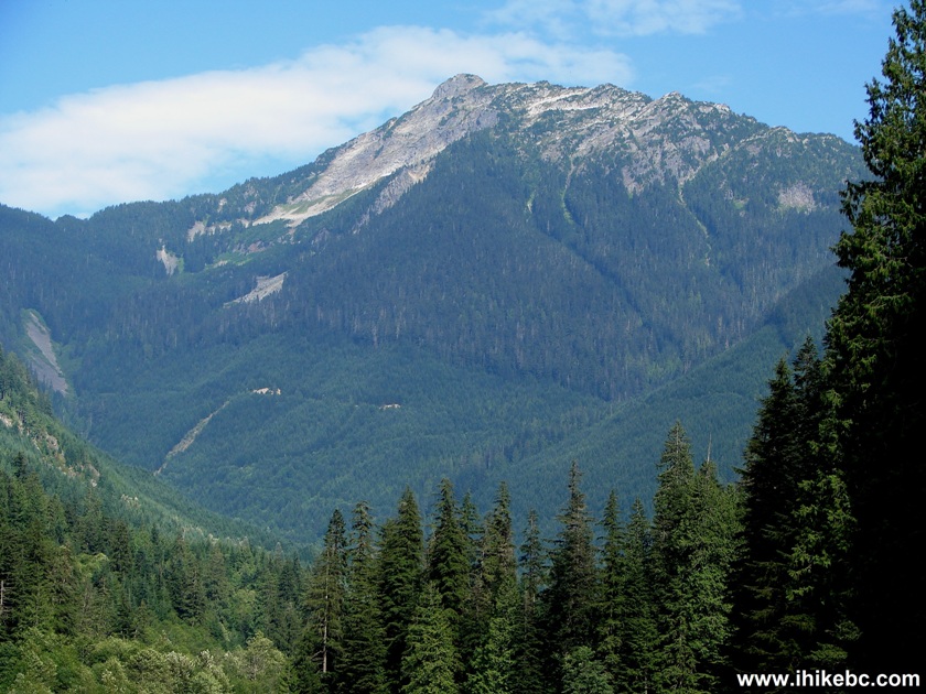
Photo of a Mountain by Foley Lake British Columbia Canada
13. Looking to the left.
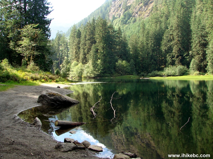
Foley Lake British Columbia Canada
14. A log sticking out of the lake.
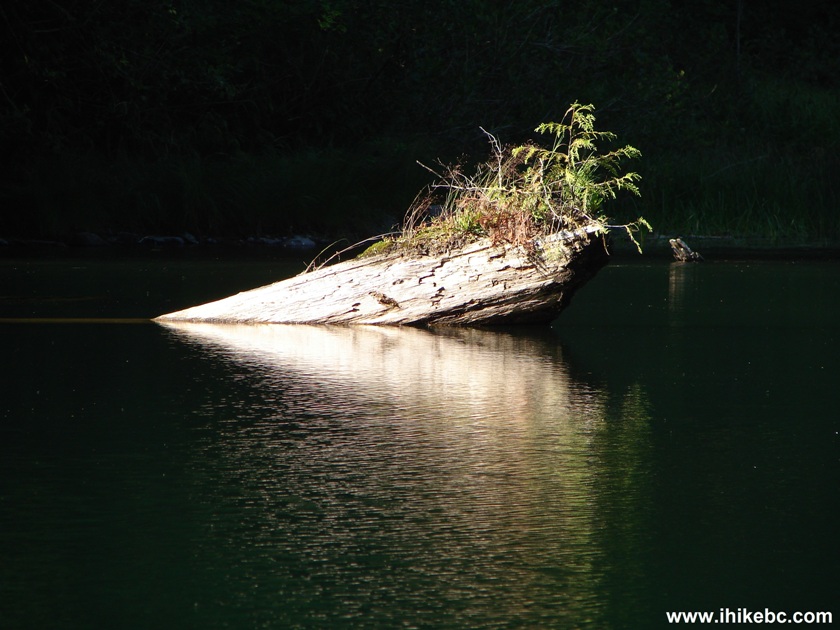
Log Sticking Out of Foley Lake BC Canada
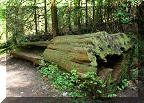
15. Another log - resembles some animal.
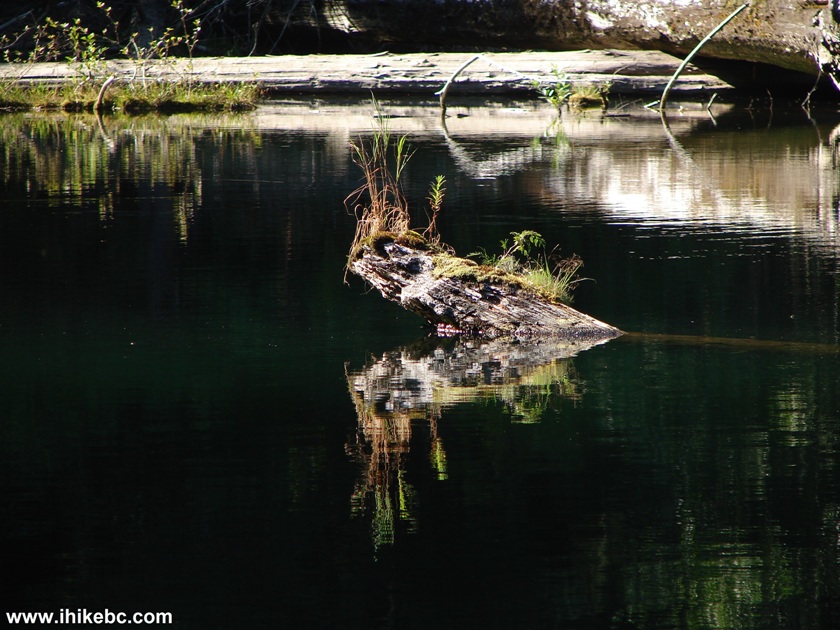
Foley Lake Province of British Columbia Canada
16. Then, we continued on Chilliwack Foley FSR. Still near the lake there is a split where the main FSR is on the right (and a sign states "Ling Lake Trail"), while on the left side there is a spur road which goes for a bit longer. We will explore the "Ling Lake Trail" part in the next trip report. For the time being, we took the road on the left.
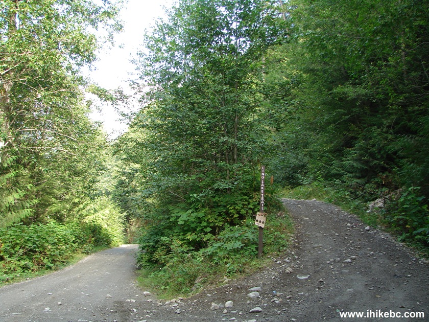
Chilliwack Foley FSR BC Canada
17. We didn't go too far, but went far enough to find a few cross-ditches. So, a 4WD can make it, but a 2WD better not go any further than the split seen in the photo above. This particular cross-ditch doesn't look too bad, but it does get worse further down the road.
Chilliwack Foley Forest Service Road BC Canada
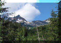
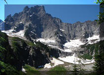
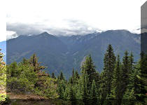
18. Later on, you get to see this mountain.
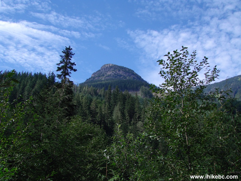
Mountain View Chilliwack Foley FSR BC Canada
19. A closer look.
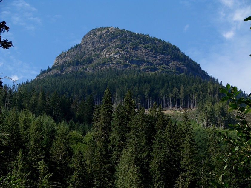
Mountain View off Chilliwack Foley Forest Service Road BC Canada
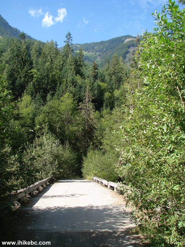
20. Then, we reached this bridge about fifteen minutes after the road split, and went back shortly thereafter. The road does continue for a bit longer, according to the Backroad Mapbook.
Chilliwack Foley FSR BC Canada
21. Another good view to wrap up our trip report.
View off Chilliwack Foley FSR British Columbia Canada
Chilliwack Foley Forest Service Road is rough, but
leads to several good views and, also, to Foley Lake. We will continue
further on this road in our next trip report, by taking the right turn
en route to look for the elusive Ling Lake Trail.
Other Trips in
Chilliwack BC Area:


Greendrop Lake Trail


Teapot Hill Trail
Vedder Rotary Trail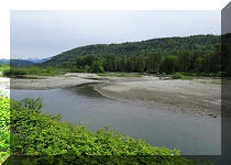
Mount Thom
Trail
Flora Lake Trail
![]()
![]()
![]()
ihikebc.com Trip 069 - Chilliwack Foley Forest Service Road Trip (Near Chilliwack BC)