![]()
![]()
![]()

Trip 207 - May 11, 2021 (Tuesday)
Nahatlatch Forest Service Road
Near Boston Bar BC
To km 42 (creek eroding the road, still passable in a 4x4)
Liked: Several fine lake and mountain views, access to a waterfall trail, availability of many camping sites by Nahatlatch River (for a fee).
Of Note: Industrial traffic is present, clouds of dust are raised by passing vehicles (camping sites would be affected), the road is narrow by Nahatlatch Lake - backing up may be required, numerous deer on the road.
Vancouver, Coast & Mountains Backroad Mapbook (5th edition) FSR Coordinates: Page 26 (Boston Bar) D1, Page 36 (Lytton) D7-C7-B7-A7, Map 35 (Stein River) G7, Page 25 (Nahatlatch Lake) G1-F1-E1-E2-D2-C2-B3-A2, Page 24 (Skookumchuck) G1-F1, Map 34 (Lillooet Lake) G7-F7.
Related Website: District of Chilliwack FSR conditions.
Nearby FSR Trip: Scuzzy FSR Hike.
Other Forest Service Roads Trips: Chehalis (by Harrison Mills), Chilliwack Bench, Chilliwack Foley, Chilliwack Lake, Chuchinka-Colbourne (North of Prince George), Clear Creek (off Harrison East), Florence Lake (access to Stave Lake by Mission), Harrison East, Harrison East Second Trip, Harrison West, Jones Lake (by Hope), Lost Creek (by Mission), Mamquam River (by Squamish), Parsnip West (near Mackenzie), Scuzzy (by Boston Bar), Shovel Creek (off Harrison East), Sowaqua Creek (by Hope), Squamish River Main, Squamish River Ashlu, Squamish River E-Main, Squamish River FSR Washout, Windfall Creek (by Tumbler Ridge).
Nahatlatch Forest Service Road (formerly Nahatlatch River FSR) starts at the end of Chaumox Road, approximately 12 kilometers from Highway 1 turnoff in Boston Bar. It is a fine road, leading to numerous fee-based recreation sites, several picturesque lakes, and a hike to a neat waterfall. There are good mountain views along the way too. Also, this FSR goes through Nahatlatch Provincial Park, from where whitewater rafting trips start their wild ride down Nahatlatch River.
There are numerous private residences on both sides of the road, and the first large free camping spot is by Mehatl Falls trailhead, at 40.3 km of Nahatlatch FSR, good for 20-25 vehicles.
The road surface is gravel all the way, and it is smooth enough up to Nahatlatch Provincial Park, so it is possible to maintain the speed of 60-70 km/h. After the park, the road is somewhat rougher, and 30-40 km/h speed is more realistic. Good tires are a must, but, as far as clearance, all but low clearance vehicles should be able to make it to at least the Mehatl Falls trailhead at km 41.3.
Also, watch out for industrial traffic, especially on a narrow stretch along Nahatlatch Lake. A truck with a trailer would have a hard time backing up there, so it might be a good idea to have a second (scout) car go through the narrow part of the Nahatlatch FSR first, and then radio the truck with the trailer if there are any incoming vehicles.
Today, we have made it to the 42.6 km of the road, according to our odometer (about 41.9 km, according to mileage markers). The was a small creek, about 10 meters wide, crossing the FSR and eroding the road surface. We probably would have made it easily through this obstacle in our 2WD medium/high clearance vehicle, but the first five meters of the creek's bottom were sand, and it sure did not look like an appealing option to be stuck in that sand in the middle of a flowing creek, while blocking Nahatlatch FSR to boot.
The mileage markers placed every kilometer of the FSR were in sync with the odometer for the first 12 km, and then started to be too late, ending up being about 700 meters too late by the time we stopped at the 42.6 km mark. According to the Backroad Mapbook, there were still about 20 kilometers of Nahatlatch FSR remaining after that spot.
Zero your odometer at the beginning of Nahatlatch FSR, if you want to follow our odometer mileage markers in the table below. All recreation sites are located by Nahatlatch River, and have pit toilets, but no garbage bins. Dust from passing vehicles may reach those staying at the recreation sites.
| KM | Feature | Side |
| 0.0 - 5.8 | Chaumox Indian Reserve. No turns, no trespassing | All |
| 4.7 | Bridge | Straight (S) |
| 6.0 | Keefers FSR | Right (R) |
| 6.1 | Road to Wilderness Ranch | R |
| 7.5 | Nahatlatch River appears by FSR | Left (L) |
| 7.7 | Apocynum Recreation Site | L |
| 8.1 | FSR | R |
| 8.4 | Pond | R |
| 9.3 | Fir Flat Recreation Site | L |
| 14.9 | Bridge | S |
| 14.9 | FSR | R |
| 15.0 | Log Creek Recreation Site | L |
| 15.4 | Kookipi FSR (connect with Harrison East FSR via Shovel Creek FSR, if open) | L |
| 15.8 | Nahatlatch Provincial Park Entrance | S |
| 15.8 | Frances Lake (boat launch & whitewater rafting) | L |
| 18.1 | Hannah Lake boat launch | L |
| 18.9 | FSR | R |
| 23.0 | Nahatlatch Lake boat launch | L |
| 25.6 | Bridge | S |
| 25.7 | Squakum Campground (Nahatlatch Provincial Park) | L |
| 30.0 | Waterfall | R |
| 35.0 | Bridge | S |
| 40.3 | Mehatl Falls trailhead | R |
| 40.3 | A large free camping area | R |
| 40.4 | Bridge | S |
| 40.6 | Road | L |
| 42.6 | Creek eroding the road (still passable in a 4x4) | S |
1. We are Eastbound on Highway 1 in Boston Bar, approaching a left turn to Boston Bar Station Road. A community of North Bend is also located in that direction. Here is your last chance to fuel up - at either Esso or Fas Gas.
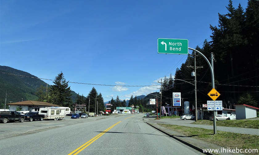
Boston Bar BC
2. Making a left turn onto Boston Bar Station Road, just before Fas Gas.
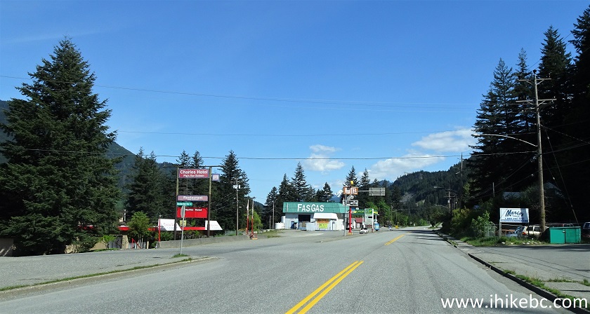
Highway 1 at Boston Bar Station Road
3. Boston Bar Station Road.
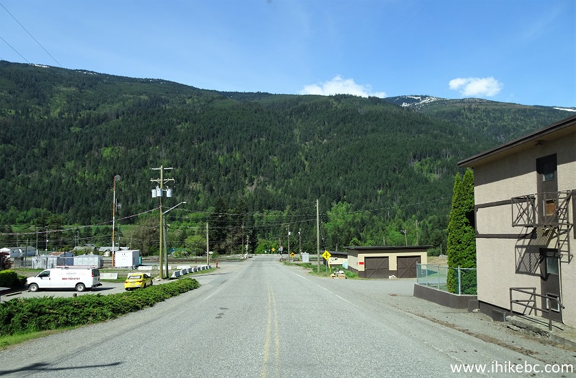
Boston Bar Station Road
4. After several hundred meters, cross the rail tracks and make a right turn.
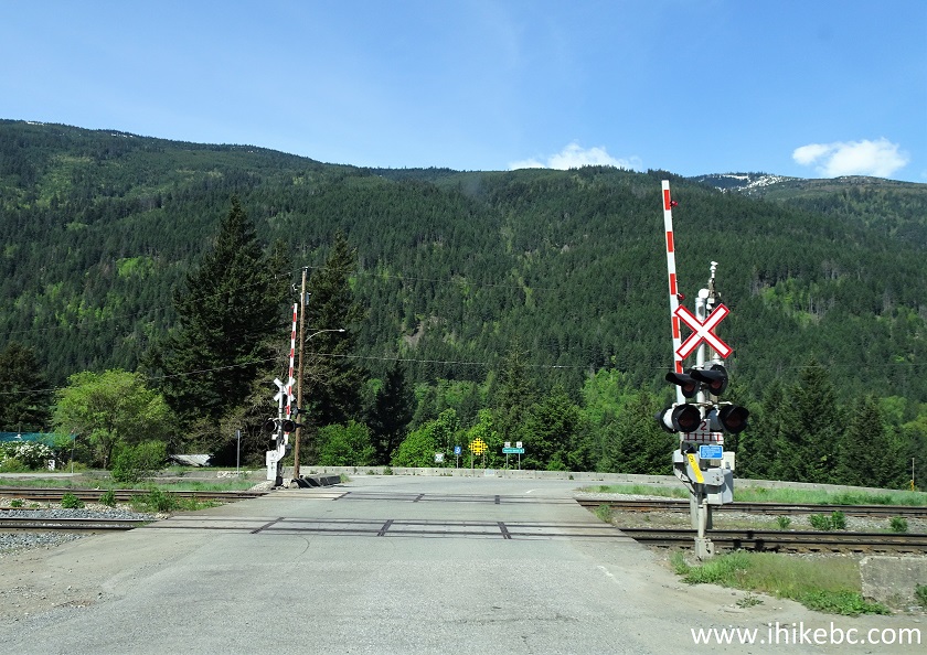
Railway tracks across Boston Bar Station Road
5. This is now Chaumox Road.
Chaumox Road North Bend British Columbia Canada
6. One kilometer after Highway 1 turnoff, Chaumox Road crosses Cog Harrington Bridge across Fraser River.
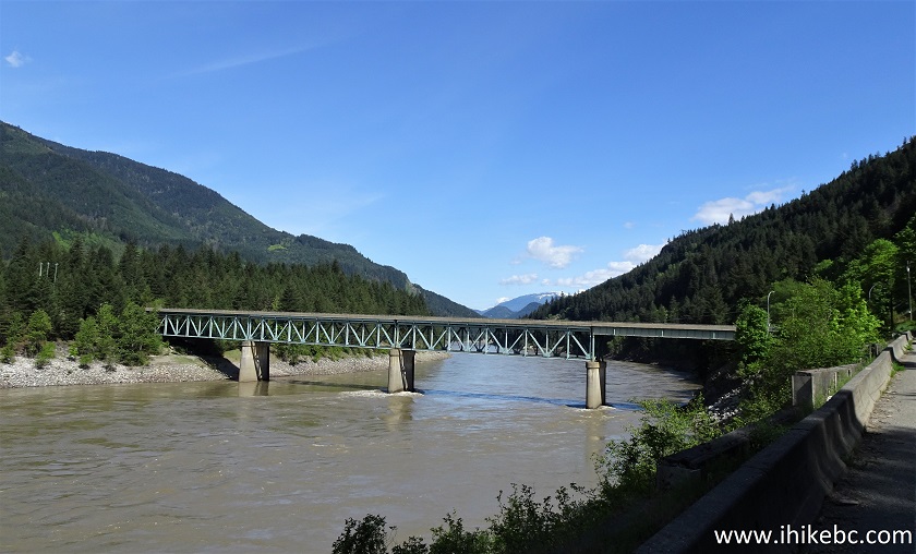
Chaumox Road by Cog Harrington Bridge Across Fraser
River
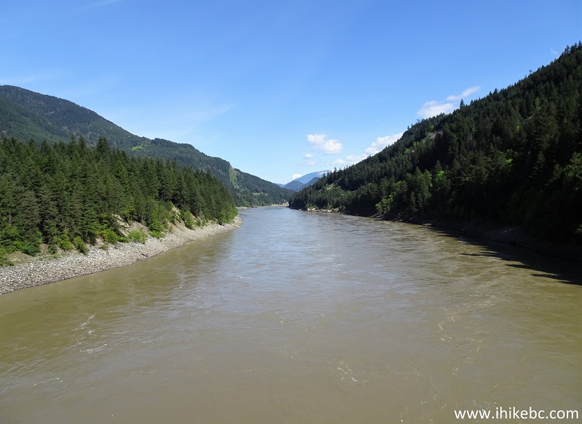
7. The bridge was built in 1986.
Cog Harrington Bridge
8. Fraser River seen from Cog Harrington Bridge.
Fraser River North Bend BC
9. Cross another set of rail tracks shortly after the bridge. Keep straight.
Chaumox Road North Bend British Columbia Canada
10. Chaumox Road is a rather scenic drive. Here it is 3.2 km from Highway 1.
Chaumox Road
11. Now at 8.3 km.
Chaumox Road
12. At 8.8 km gravel replaces asphalt, but it's still a fairly smooth road.
Chaumox Road to Nahatlatch FSR
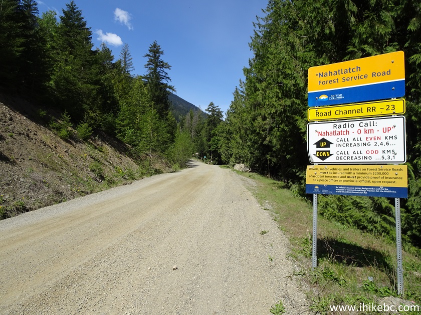
1
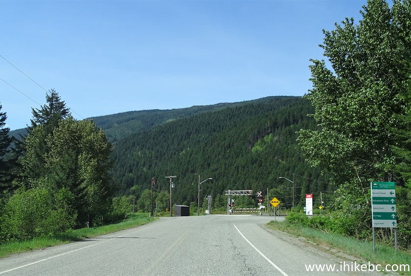
3. Just under 12 kilometers from Highway 1, Chaumox Road ends, and Nahatlatch Forest Service Road begins. Coordinates: N 49⁰57.010' W 121⁰29.290'. Elevation: 184 meters. If you have a radio, monitor channel RR-23 for industrial traffic. And, if you want to follow the table of the points of interest above, zero your odometer at the 0 km marker about 30 meters before the sign seen below.
Nahatlatch FSR Start
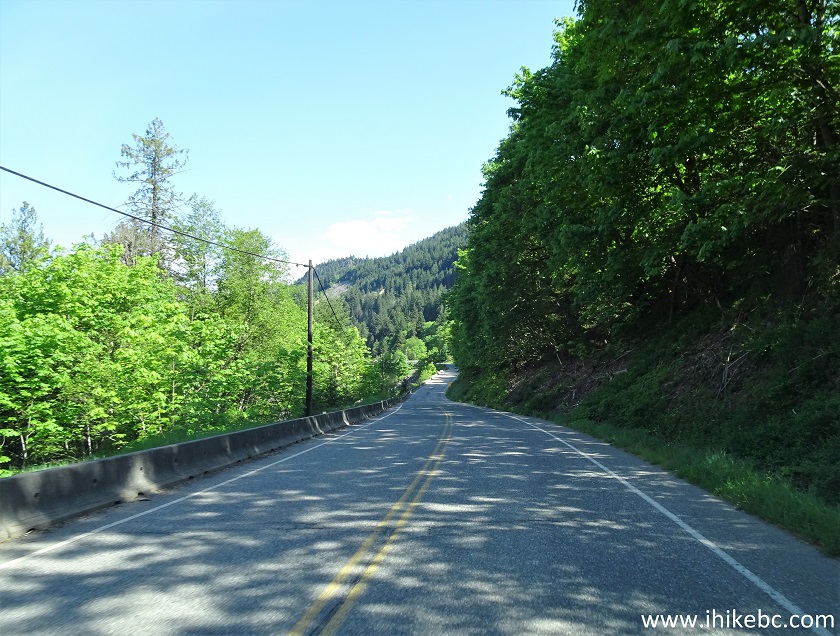
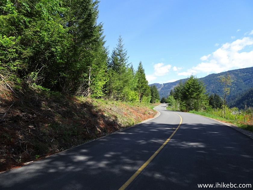
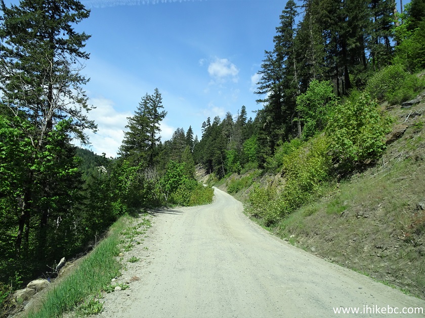
14. Until about Nahatlatch Provincial Park nearly 16 kilometers later, Nahatlatch FSR is quite wide and rather smooth by FSR standards. It is possible to maintain the speed of 60-70 km/h.
Nahatlatch Forest Service Road
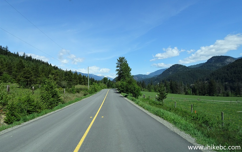
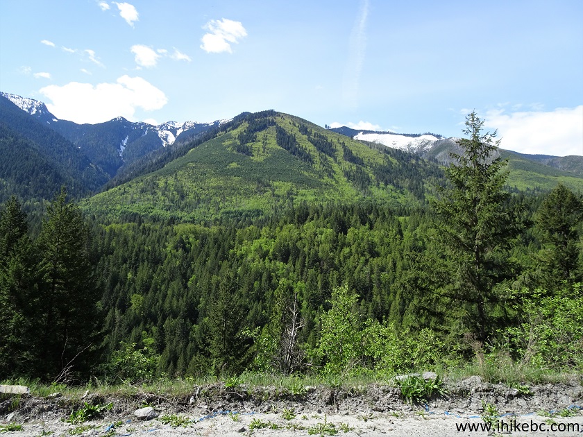
15. A fine mountain view on the left side at 6.2 km of the FSR.
Mountain View from Nahatlatch FSR
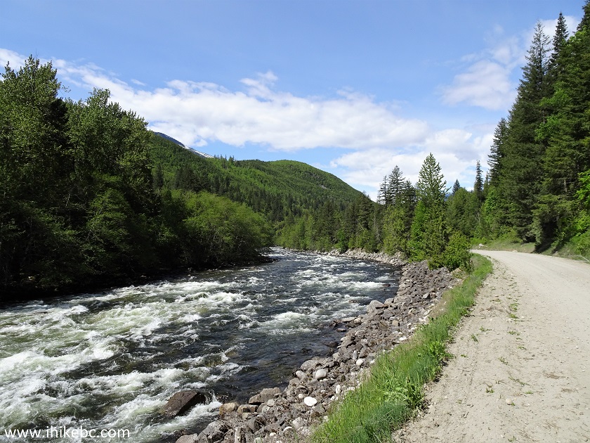
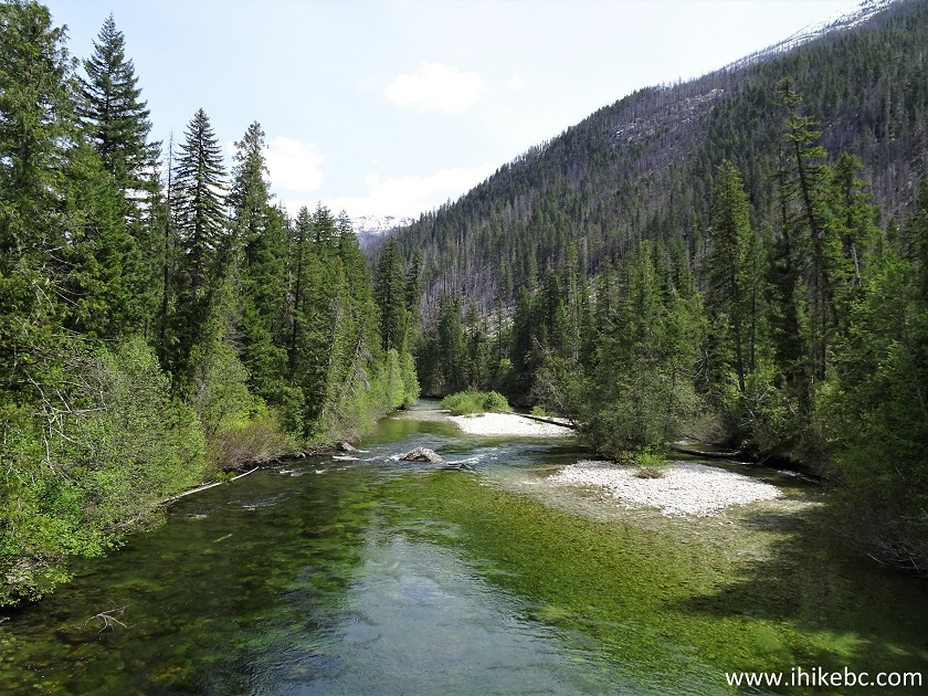
16. Nahatlatch River appears by the side of Nahatlatch FSR at about the 7.5 km mark, and keeps running alongside the road, interrupted only by the lakes.
Nahatlatch River
17. There are three recreation sites on Nahatlatch Forest Service Road, all fee-based, and all subject to suffering from clouds of dust raised by passing vehicles. Thus, try to get a spot as far away from the road as possible. This is Fir Flat Recreation Site, at 9.3 km of the FSR.
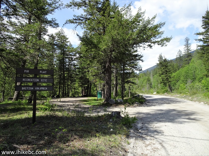
Fir Flat Recreation Site by Nahatlatch FSR
18. There are pit toilets at these recreation sites, but no garbage bins. All three sites are located by Nahatlatch River.
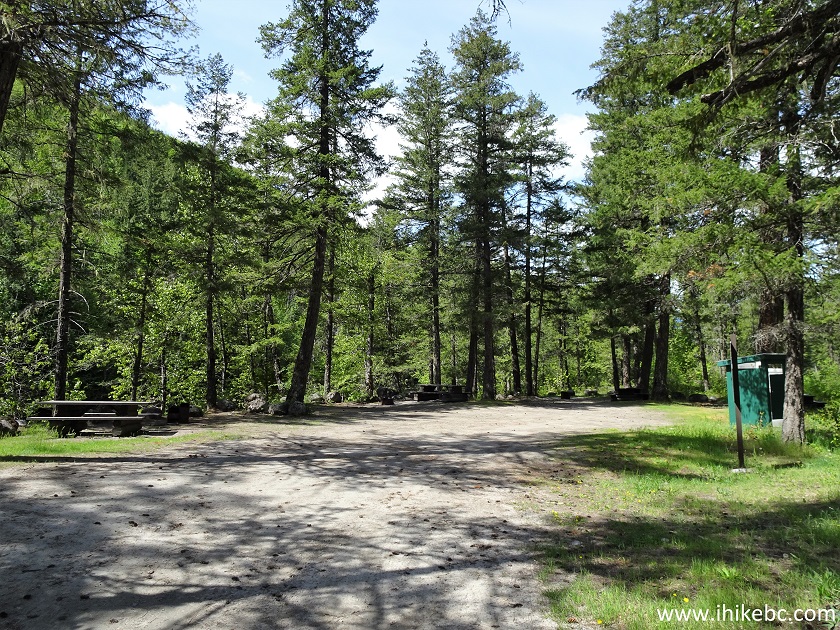
Fir Flat Recreation Site
19. The rules to live by at Fir Flat Recreation Site, which are likely the same for all of them.
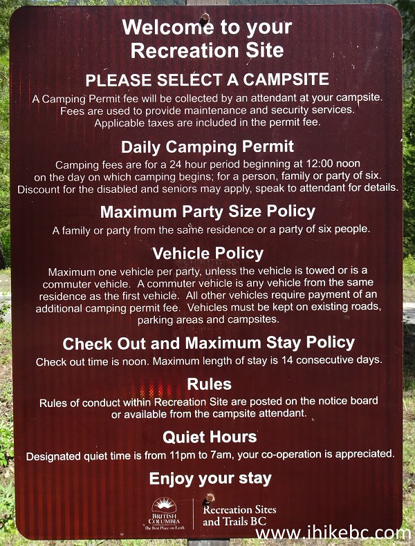
Fir Flat Recreation Site Rules
20. Nahatlatch Provincial Park arrives at 15.8 km of Nahatlatch FSR.
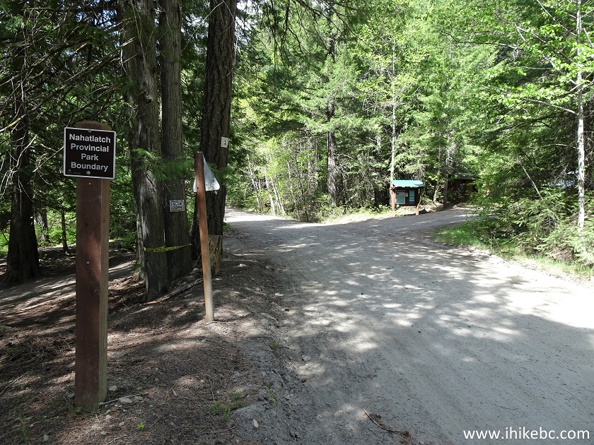
Nahatlatch Provincial Park Entrance
21. Just past the park sign, on the left side, there is a boat launch for Frances Lake. Also, whitewater rafting is a popular activity on Nahatlatch River, and we spotted a group of adventurers just before the beginning of their downriver ride.
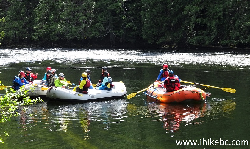
Whitewater Rafters on Frances Lake
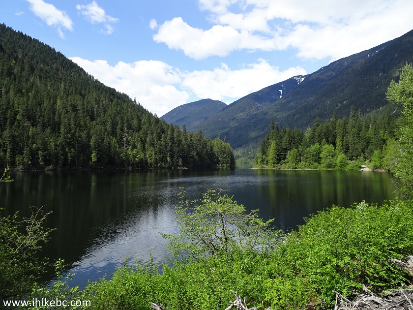
22. Hannah Lake is next, and here it is at 17.8 km of Nahatlatch Forest Service Road.
Hannah Lake British Columbia Canada
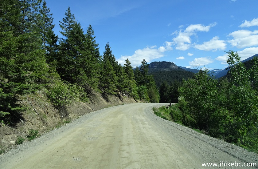
23. Nahatlatch FSR becomes rougher after Nahatlatch Provincial Park entrance, and the realistic speed drops to 30-40 km/h.
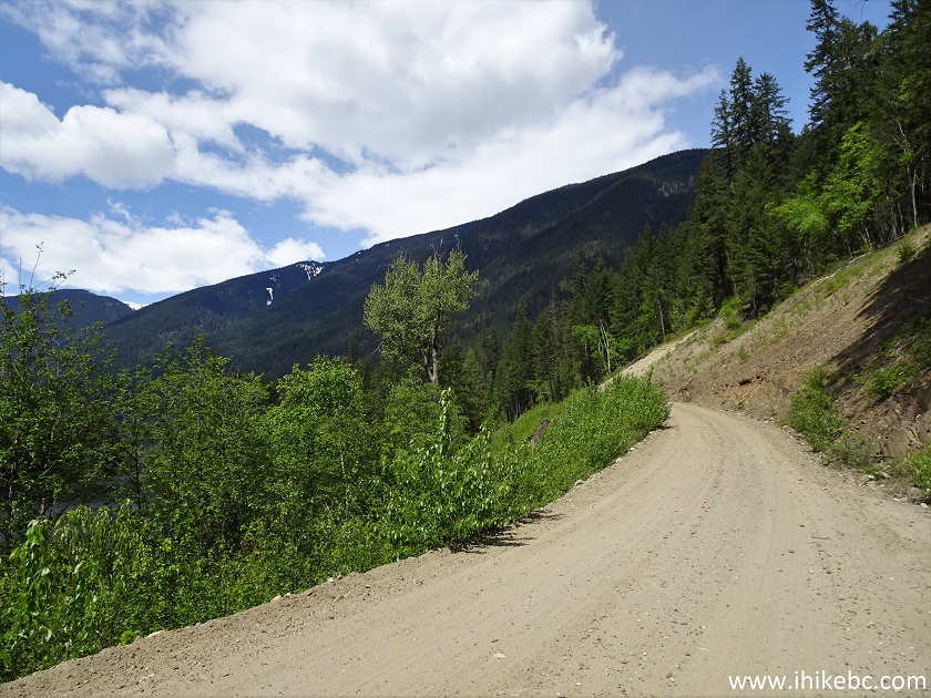
Nahatlatch Forest Service Road
24. Another shot of Hannah Lake, this time at 19.3 km of the road.
Hannah Lake
25. Nahatlatch Lake is next. This is where Nahatlatch FSR becomes quite narrow, and it might be necessary to back up, if one were to meet a particularly wide vehicle. This is at 21.9 km of the road.
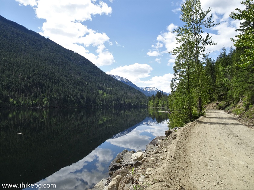
Nahatlatch Lake
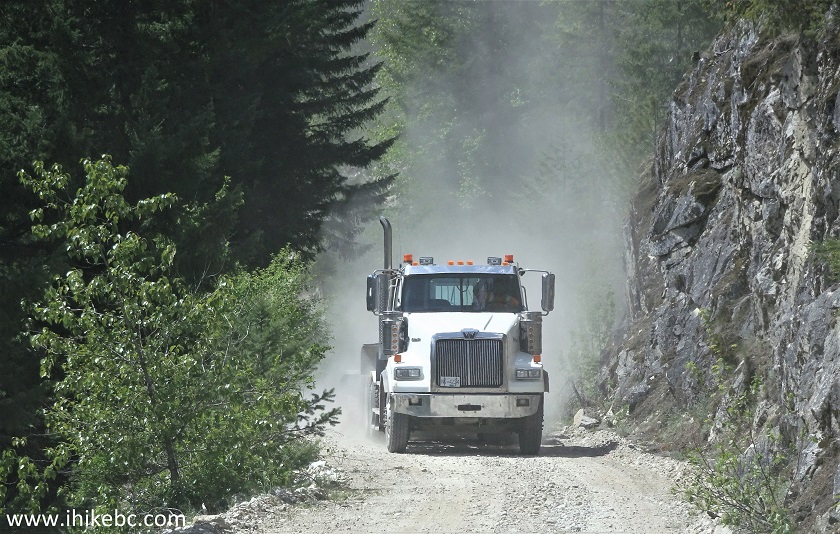
26. Speaking of particularly wide vehicles, we have met this tractor/trailer combination exactly at the spot where we had to back up for about 50 meters to let it through. We are at 29.7 km of Nahatlatch FSR here. The driver of a pickup with a trailer would have an interesting time meeting one of these guys here.
Industrial Traffic on Nahatlatch FSR
27-28. Another hazard on Nahatlatch Forest Service Road is an overabundance of deer, who are very fond of hanging out on the road, oblivious to approaching traffic until the last 50-60 meters or so. Here is one such fella.
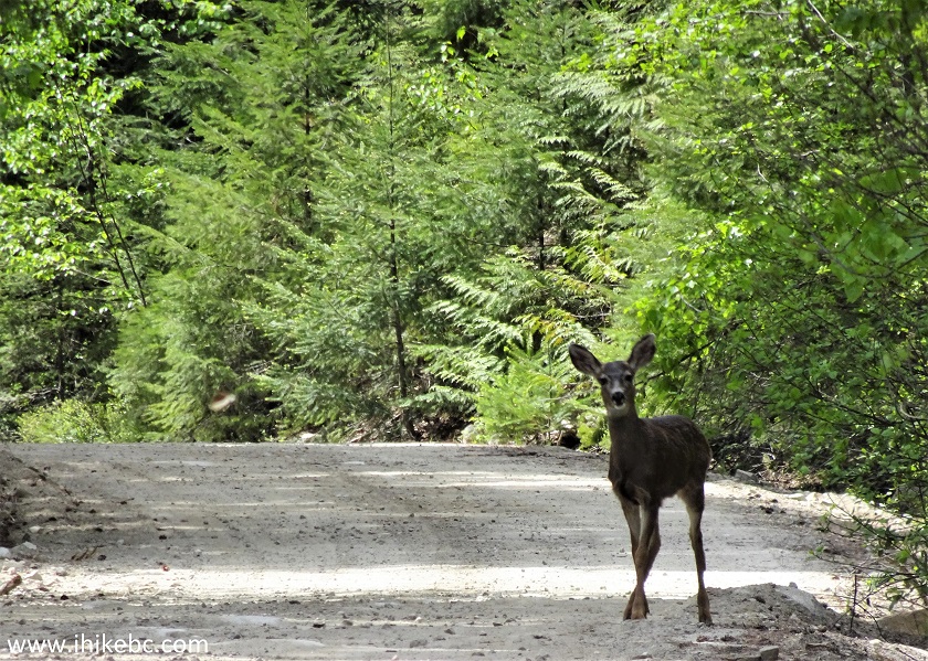
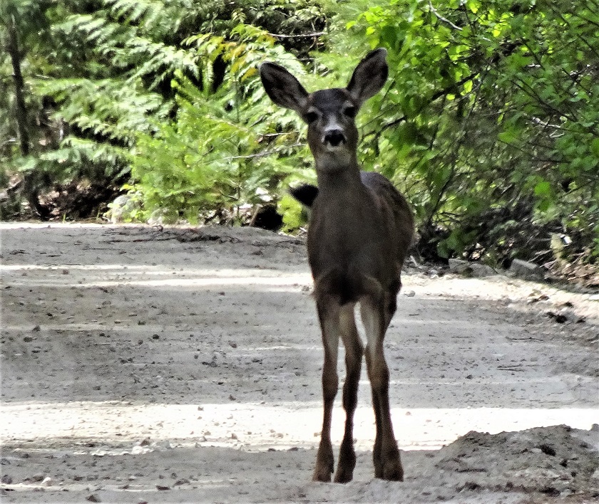
Deer on Nahatlatch FSR
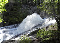
29. A small but picturesque waterfall arrives at 30.0 km of the FSR.
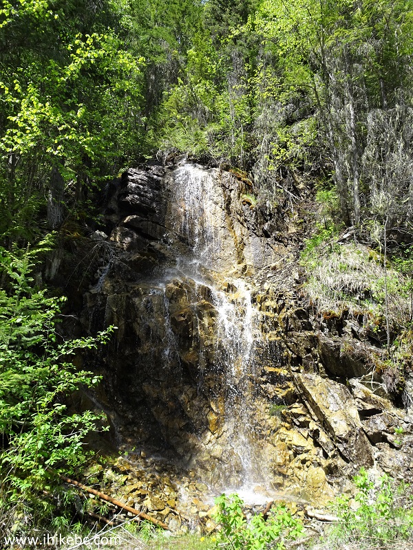
Waterfall by Nahatlatch Forest Service Road
Here is our video of the waterfall and Nahatlatch FSR.
More ihikebc videos are on our YouTube Channel.
30. Then, at 40.3 km, the first free large parking lot is located right by the Mehatl Falls trailhead. We will cover this trail in the following trip report.
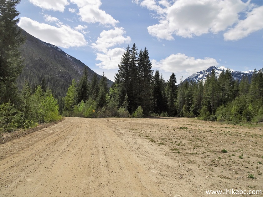
Mehatl Falls Trail Parking Lot
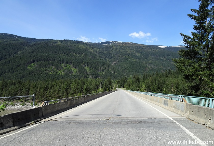
31. Right after the parking lot there is a gate, followed by a bridge. If we understand what we have read on the Internet correctly, a rough road to the left immediately after the bridge leads to Grizzly Falls, but we have not gone there.
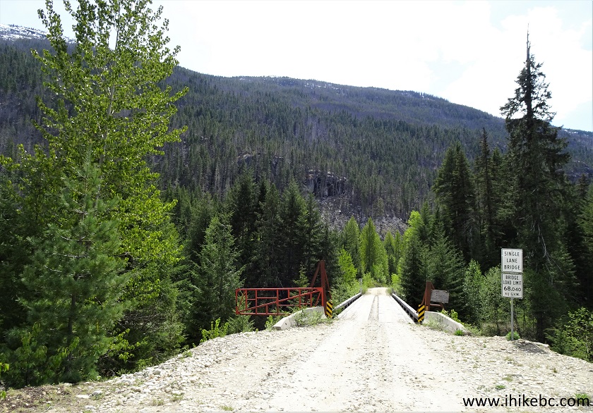
Nahatlatch Forest Service Road near Boston Bar
British Columbia Canada
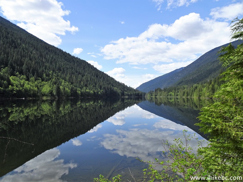
32. A neat view from the bridge.
View from a bridge on Nahatlatch FSR
33. Then, the road is slightly overgrown for several hundred meters.
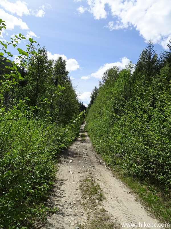
Nahatlatch FSR
34. And, at 46.2 km, we have met our match, as a creek flowing across Nahatlatch FSR is actively eroding the road surface. Coordinates: N 49⁰55.593' W 121⁰57.426'. Elevation: 361 meters.
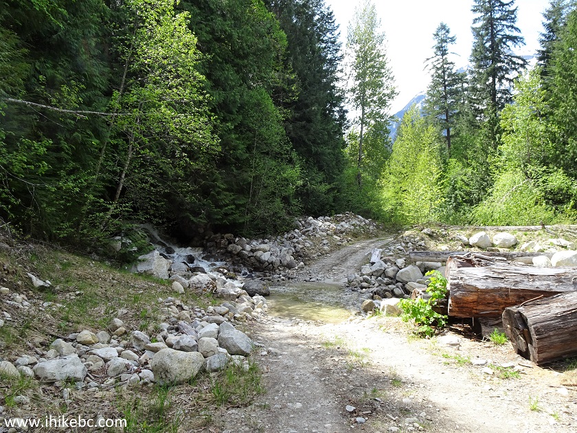
Creek Flowing Across Nahatlatch FSR
35. The creek was about 10 meters wide, and not very deep. We probably could have easily gotten through in our medium/high clearance 2WD vehicle, but the first five meters or so looked like soft sand, and the possibility of getting stuck in the middle of the creek and blocking the road was not appealing in the slightest. So, we called it a trip at this point, and went hiking to Mehatl Falls. The FSR apparently continues for another 20 kilometers or thereabouts.
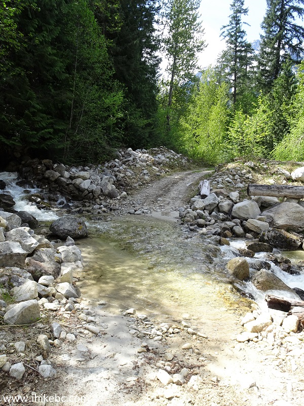
Creek Eroding Nahatlatch Forest Service Road
Nahatlatch Forest Service Road is an interesting drive, leading to good views, several recreation sites, and a good hike to a fine waterfall.


|
 |
![]()
![]()
![]()
ihikebc.com Trip 207 - Nahatlatch Forest Service Road (Near Boston Bar BC)