![]()
![]()
![]()

Trip 269 - September 9, 2022 (Friday)
Ore Mountain Hike
Near Stewart BC
Page 2 of 2
Liked: Pond view, mountain views, shade in the forest, no bugs.
Of Note: A semi-dangerous trail to the pond, then a very steep and dangerous climb to the sub-alpine, then a fairly easy alpine area. A small creek crossing on slippery logs is required. Hiking poles and boots are essential. A part of the trail is overgrown with stinging/scratching plants - long pants and a long-sleeve shirt are essential.
Northern BC Backroad Mapbook (3rd edition) Coordinates: Page 61 (Stewart) A5.
Another Trip in Stewart BC Area: Sluice Box Trail Hike.
The town of Stewart is a small settlement in the West of British Columbia, very far from any major town. A long and mostly featureless Highway 37 goes North-South from near the Yukon border to Highway 16 by Kitwanga, located between Terrace to the West and Smithers to the East. Mezadin Junction, found 150 km North of Kitwanga, is where a very picturesque Highway 37A starts off Highway 37, goes past several glaciers (including Bear Glacier) and reaches Stewart in about 60 kilometers.
Ore Mountain Trail is about 13.5 kilometers East of Stewart. It starts near Clements Lake Recreation Site, reaches a fine pond 4.25 km later, and then a very steep trail leads to an impressive sub-alpine area with quite extensive hiking opportunities.
*All trail distances are based on a GPS odometer and are approximate.
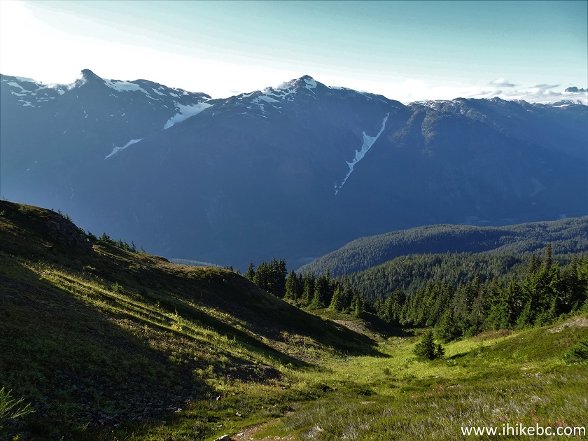
36-37. On the positive side, the first good mountain view appears on the right side. Plain and zoomed.
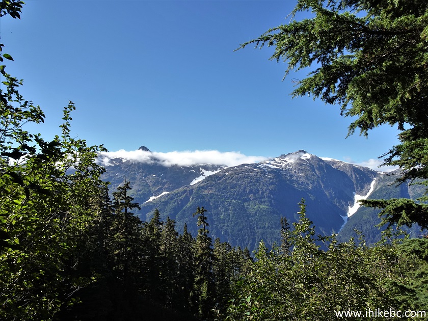
Ore Mountain Trail View British Columbia Canada
British Columbia Mountain
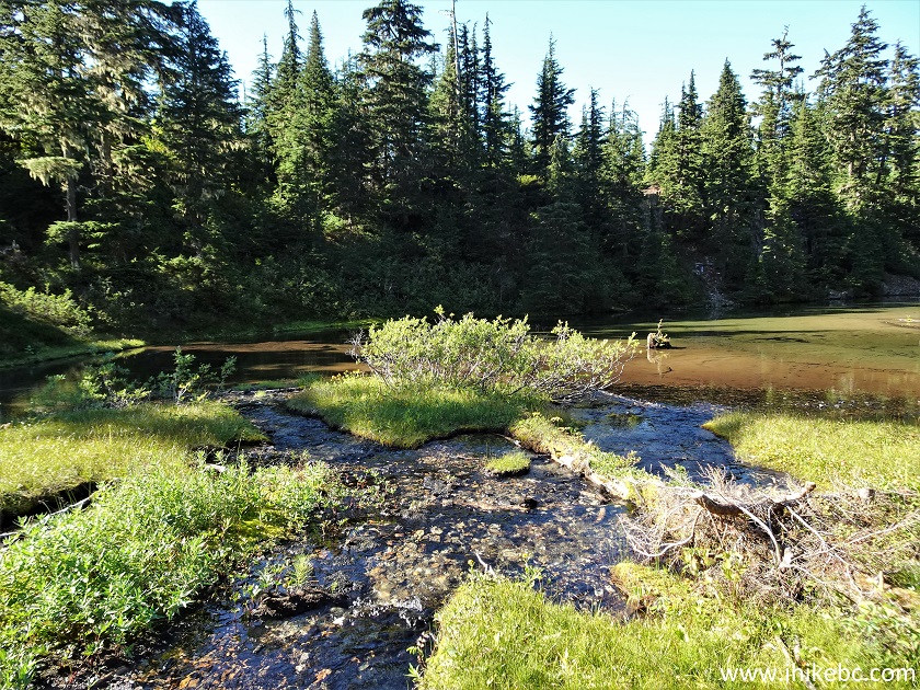
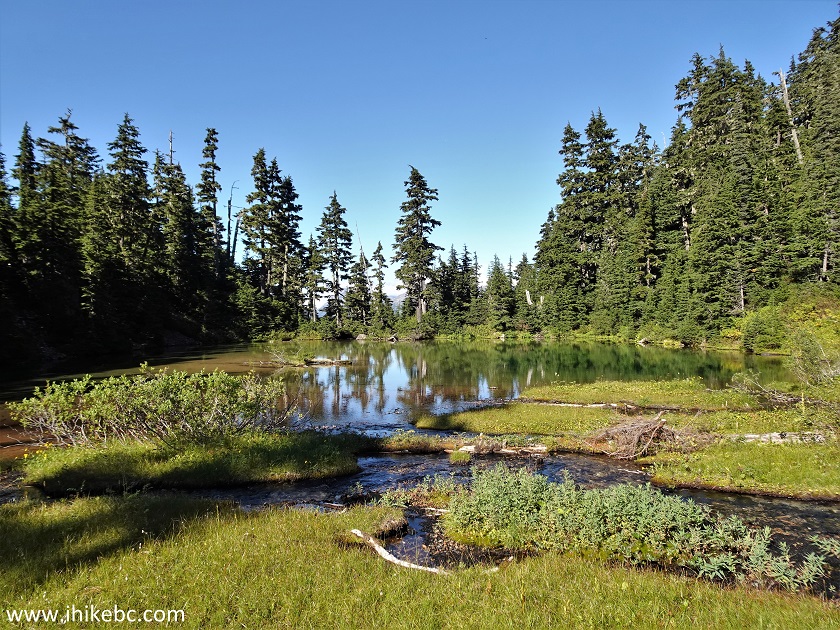
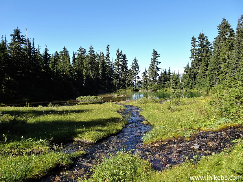
38. At 4.25 km, the dangerous part of the trail is behind us, and we are approaching the pond.
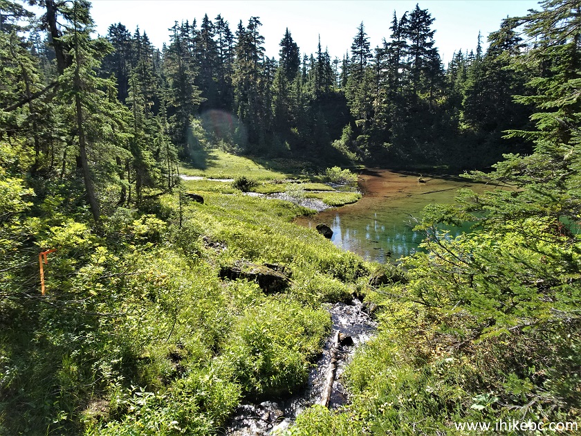
Ore Mountain Trail Pond
39. Here it is. A fine pond indeed. The trail ribbon in our Backroad Mapbook software-equipped GPS ended here as well. Coordinates: N 56°02.707’ W 129°52.453’. Elevation: 1,025 meters.
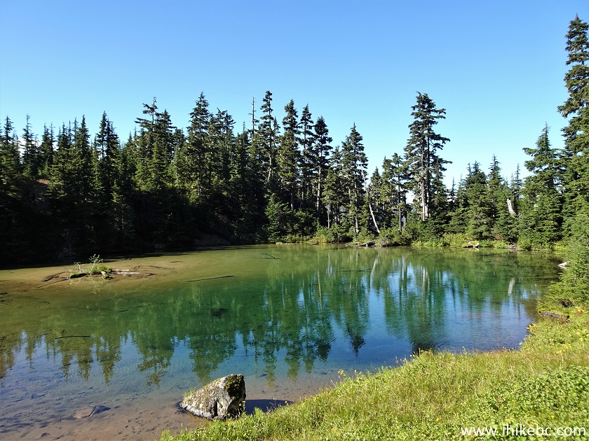
Hiking in Stewart BC Area - Ore Mountain - Pond View
40. This would be a good final destination for those hikers unwilling or unable to tackle an extremely steep and very slippery terrain en route to sub-alpine.
Ore Mountain Trail Pond in Stewart British Columbia Canada Area
41. Several brooks flow into the pond.
British Columbia
42. It's a very pleasant, serene location.
Hiking in British Columbia Ore
Mountain near Stewart
Here is our video of the views from this location.
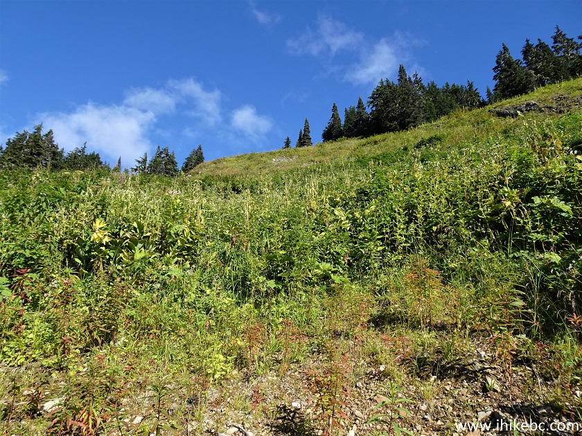
43. If you are a properly equipped and experienced hiker, the terrain just to the left of where the trail to the pond ends is going to be a very good challenge. It's not only steep, but covered in very slippery vegetation, so it's going to be a struggle to get up there.
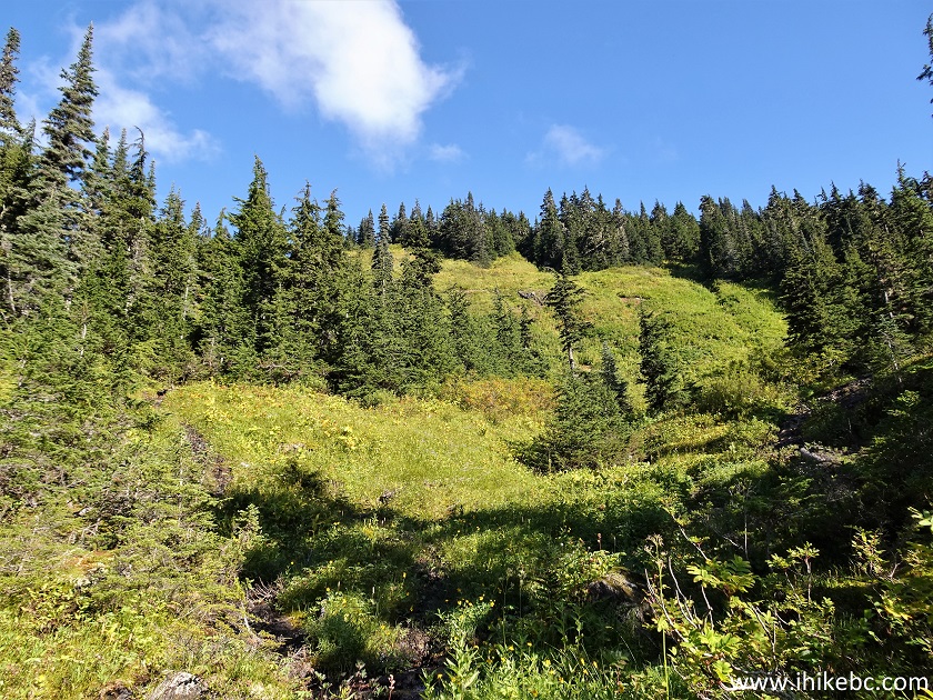
Ore Mountain Route Hike British Columbia Canada
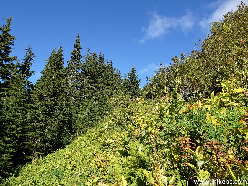
44. We actually went in the middle of that climb, as the path was nowhere to be found, but it would be a bit easier to keep closer to the trees on the left side, seen in the photo below.
Ore Mountain Route
45-47. Looking back at the pond and the mountain in the background.
Ore Mountain Route Hike near Stewart BC Canada
British Columbia
Canada
46. The very tough climb is about 300 meters long, and then it gets better.
Hiking Ore Mountain in British Columbia
47. Right by the trees there is a path of sorts closer to the top, but it is obvious that this trail does not see many hikers.
British Columbia Hiking - Ore Mountain Route
48. Finally, we are through the vegetation, and the sub-alpine is on the horizon.
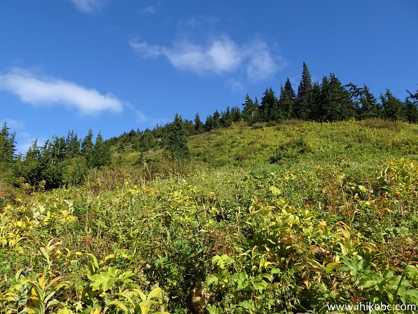
Ore Mountain
49. It is still steep here, but nothing compared to the brutal climb after the pond.
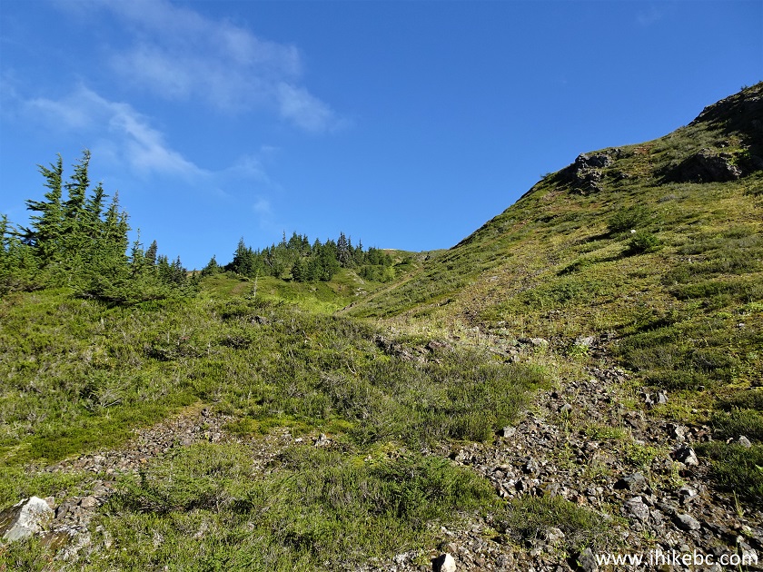
Hike in British Columbia - Ore Mountain Route
50. Looking back at where we came from. 720 meters from the pond.
Hiking in Stewart BC Area - Ore Mountain Route
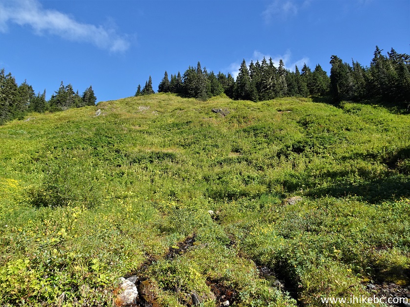
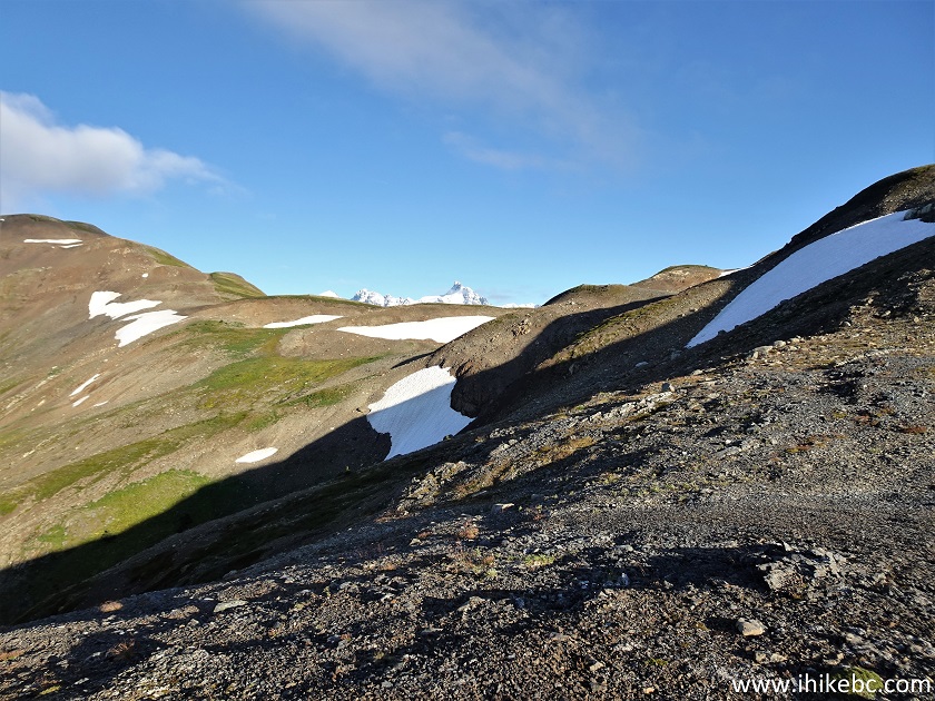
51. The sub-alpine here is quite vast, so we decided to turn left and keep going.
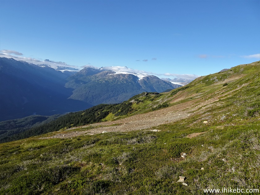
Ore Mountain Hike
52. Pleasant colours all around.
Ore Mountain Route British Columbia
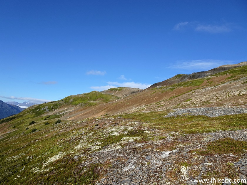
53. Looking left at 1.35 km from the pond.
Ore Mountain near Stewart BC
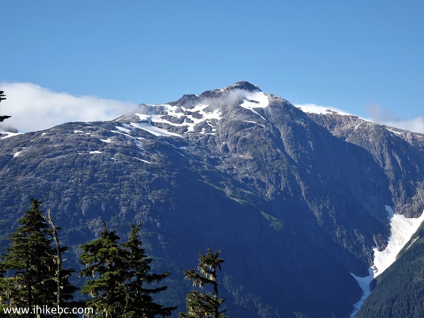
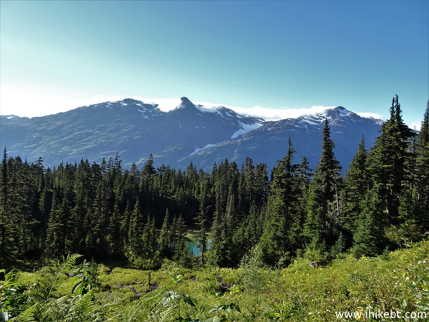
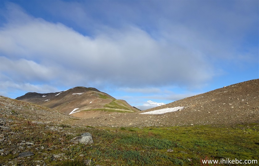
54-55. A 1.85 km, here is this very fine mountain. Plain and slightly zoomed.
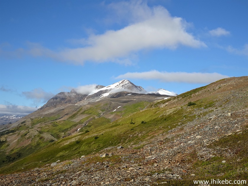
Hike in Canada - Ore Mountain Route
Ore Mountain Route Hike in Canada -
British Columbia
Here is our video of the views from approximately this location.
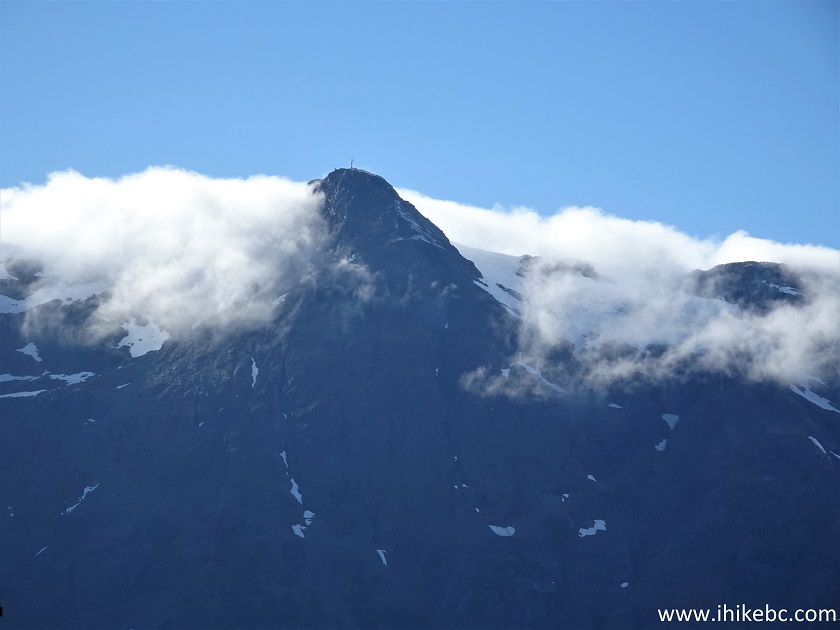
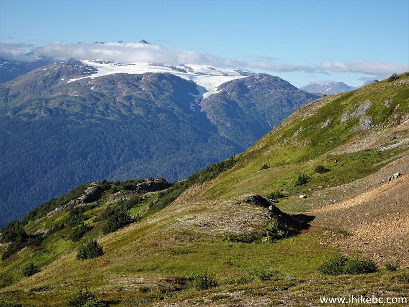
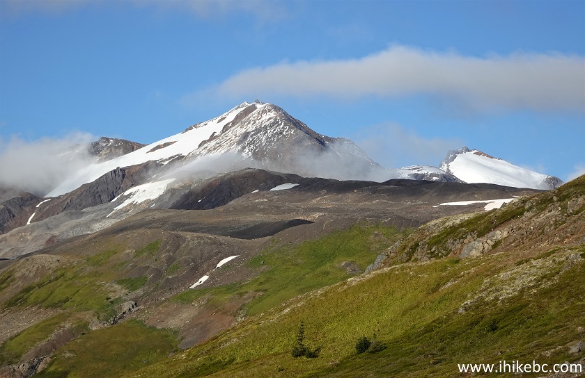
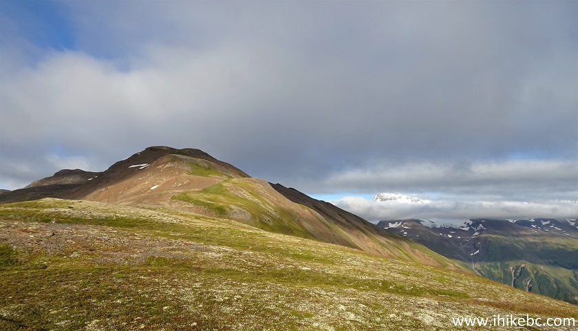
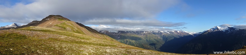
55-56. We then went just a bit forward, and found this beauty lurking on the right side.
British Columbia Hiking
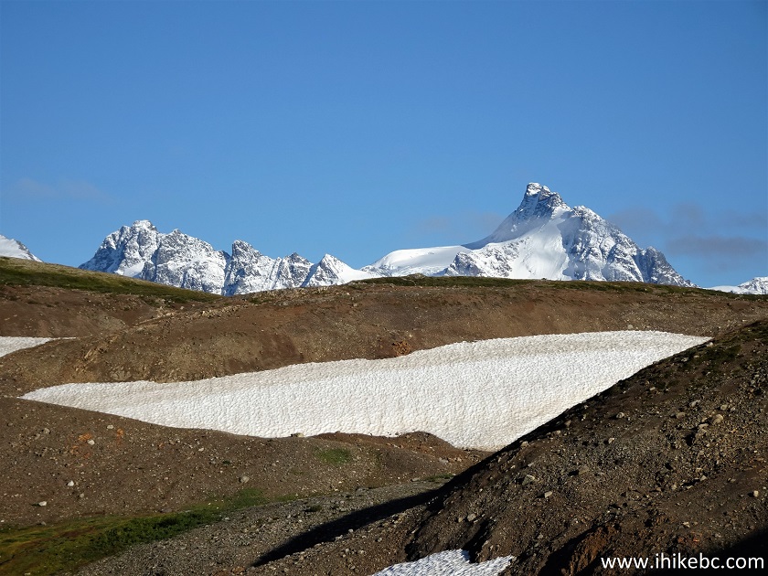
57. We headed towards that glacier as fast as we could, especially with the daylight running out.
Hike in Stewart BC Area - Ore Mountain Route
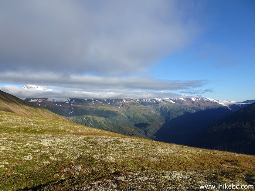
58. Alas, clouds showed up before we could arrive to get the full view of that glacier, seen here on the right side. This is where we ended our hike, about 2.36 km from the pond. Coordinates: N 56°02.879’ W 129°50.695’. Elevation: 1,520 meters.
Ore Mountain British Columbia
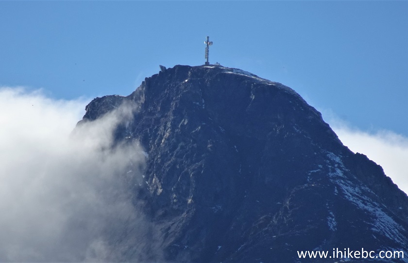
59. A bit more to the right.
British Columbia Hiking
60. And here are two panoramas of this place.
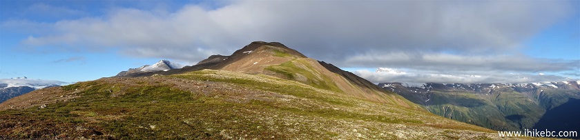
Hike in Canada
Here is our video of the views from this location.
More ihikebc videos are on our YouTube Channel.
We then headed back, and ended up walking in complete darkness at the end of the hike, helped only by a flashlight in our GPS. It is obvious that there is (much) more to be seen here, so leave early and enjoy! Highly recommended.


|
 |
![]()
![]()
![]()
ihikebc.com Trip 269 - Ore Mountain Hike (Near Stewart BC) Page 2 of 2