![]()
![]()
![]()

Trip 053 - August 3, 2011 (Wednesday)
Squamish River FSR - Ashlu Main & A-600
Page 2 of 2
Distance From Vancouver to the Beginning of Ashlu Main
FSR:
About 99 km - 65 km via Highway 99 (Sea-to-Sky) North to
Squamish Adventure Centre, then keep driving straight on Highway 99 and
turn left onto Squamish Valley Road 9.6 km later, then drive for 23 km
to Squamish River FSR, and turn left onto Ashlu Main 1.2 km after that.
Liked: Decent road surface until the end of 2WD road for both Ashlu Main and A-600 branch road, several good natural views, dam view (Ashlu Main), shadow in the forest while walking on both Ashlu Main and A-600.
Of note: Not too many mosquitoes but numerous annoying flies, very few views while walking on Ashlu Main for several hours past the dam (where the 2WD road ends).
Vancouver, Coast & Mountains Backroad Mapbook (2010 edition) Coordinates for the Beginning of the FSR: Page 21 (Phantom Lake) G2.
Related Website: Squamish District FSR Conditions.
Subsequent Trip: Squamish River FSR Ashlu Main Second Trip.
Nearby FSR Trips: Squamish River Main, Squamish River Ashlu, Squamish River E-Main, Squamish River FSR Washout.
Other Forest Service Roads Trips: Chehalis (by Harrison Mills), Chilliwack Bench, Chilliwack Foley, Chilliwack Lake, Chuchinka-Colbourne (North of Prince George), Clear Creek (off Harrison East), Florence Lake (access to Stave Lake by Mission), Harrison East, Harrison East Second Trip, Harrison West, Jones Lake (near Hope), Lost Creek (by Mission), Mamquam River (by Squamish), Nahatlatch (near Boston Bar), Parsnip West (by Mackenzie), Scuzzy (by Boston Bar), Shovel Creek (off Harrison East), Sowaqua Creek (by Hope), Windfall Creek (by Tumbler Ridge).
Follow @ihikebc Tweet
19. At the 4.0 km mark, there is a good view of Ashlu River.
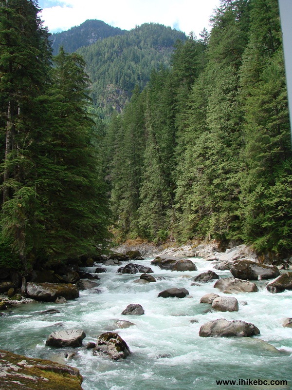
Ashlu River near Squamish BC Canada
20. Also at this spot, there is this very interesting device to warn kayakers of rapidly rising waters due to the discharge from a dam upstream.
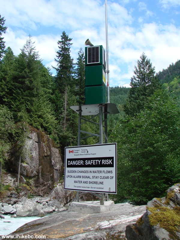
Kayaker Warning Device Ashlu Main FSR British Columbia Canada
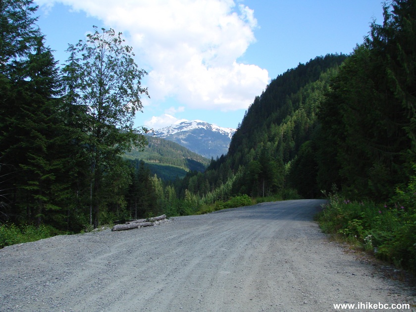
21. At 6.7 km, there is an unmarked road split. To the right is Ashlu Main. To the left/straight is A-600 branch road. We went straight/left here to explore A-600.
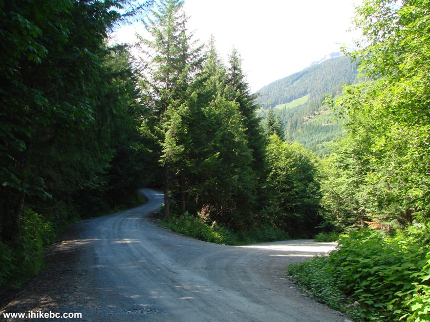
Ashlu Main and A-600 FSR Split Squamish River FSR Province of BC Canada
22. A-600 2WD road ends at 8.8 km. The road narrows and becomes very rough. There is a turnoff to the dam there too, and the dam itself is easy to see, but the best view is from Ashlu Main. Here is the narrowing of A-600.
A-600 Squamish Forest Service Road
23. Looking the other way. Straight ahead is where we drove from, and to the left is the turnoff to the dam.
A-600 FSR by Squamish British Columbia Canada
24. And so we parked right here and started walking down the narrow part of A-600. In about ten minutes, this busted tractor would stop everything except bicycles and walkers.
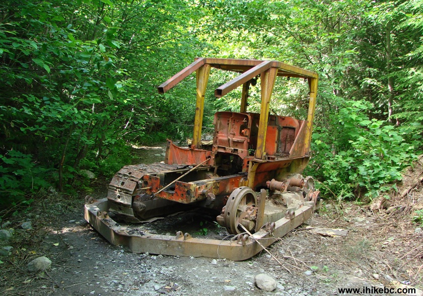
Busted Tractor on A-600 Road near Squamish British Columbia Canada
25. And, about ten minutes later, A-600 ends where several badly trashed buildings are standing in a picturesque setting.
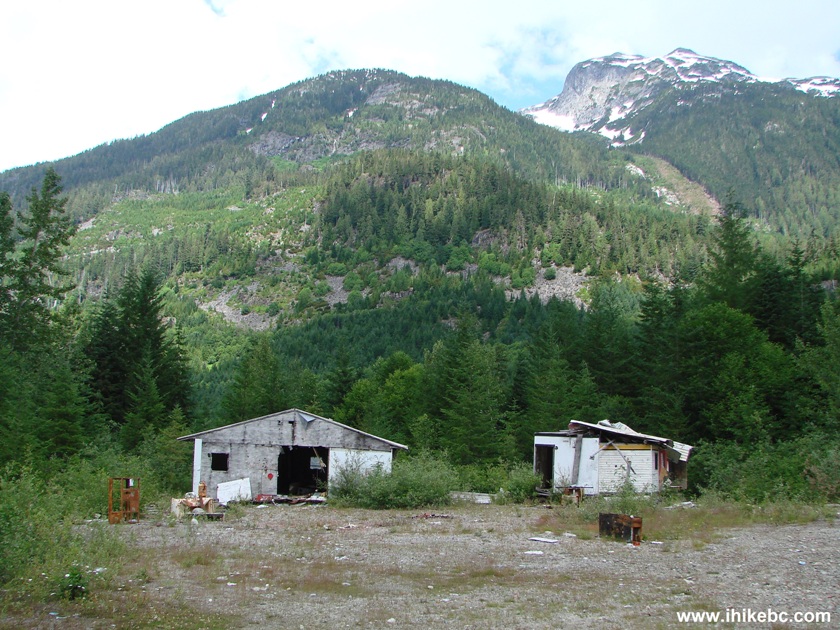
A-600 FSR end near Squamish BC
26. According to Backroad Mapbook, Osprey Mines used to be located in this area. We did not find any mines here.
Busted buildings at the end of A-600 Forest Service Road near Squamish
BC
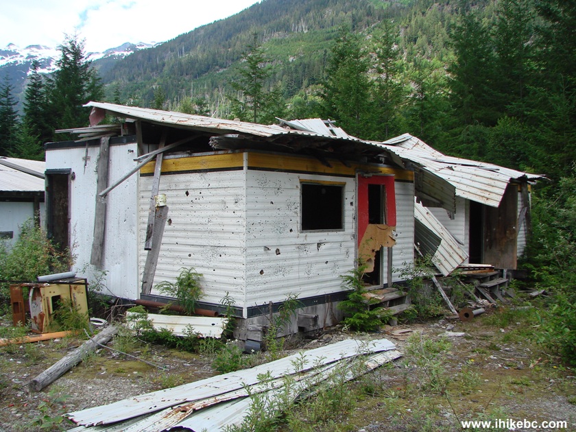
27. But sure found lots of bullet holes.
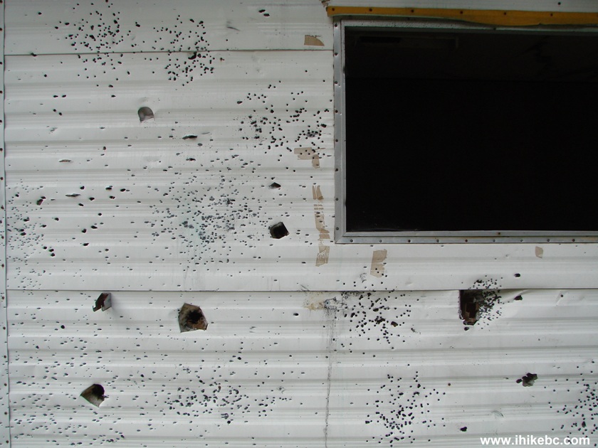
Bullet-ridden building at the end of A-600 FSR near Squamish BC
28. No more dining in here.
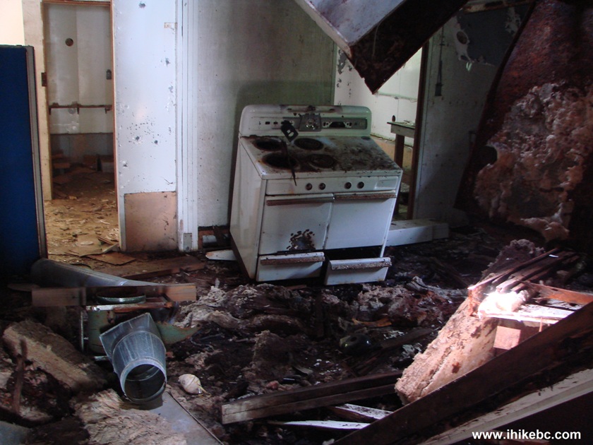
Inside a busted building at the end of A-600 Forest Service Road by
Squamish British Columbia
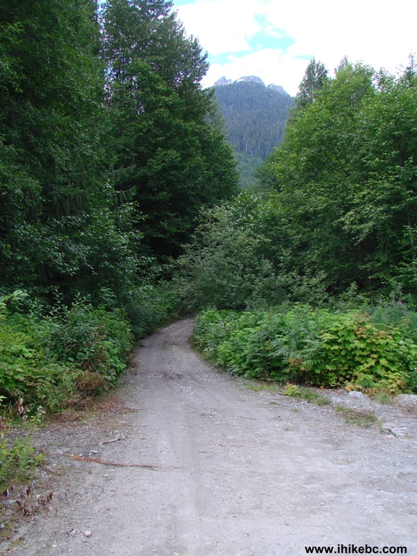
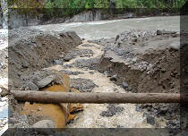
29. After visiting A-600, we returned to the road split seen in photo #22, and turned onto Ashlu Main. Very soon we encountered a mini quarry by the roadside.
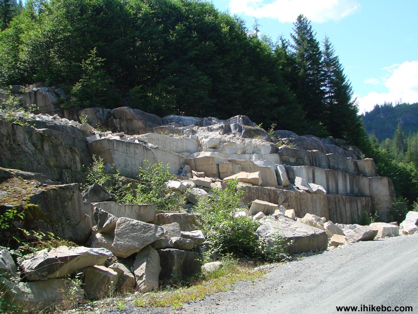
Stone Quarry Ashlu Main FSR near Squamish British Columbia Canada
30. Nice stones.
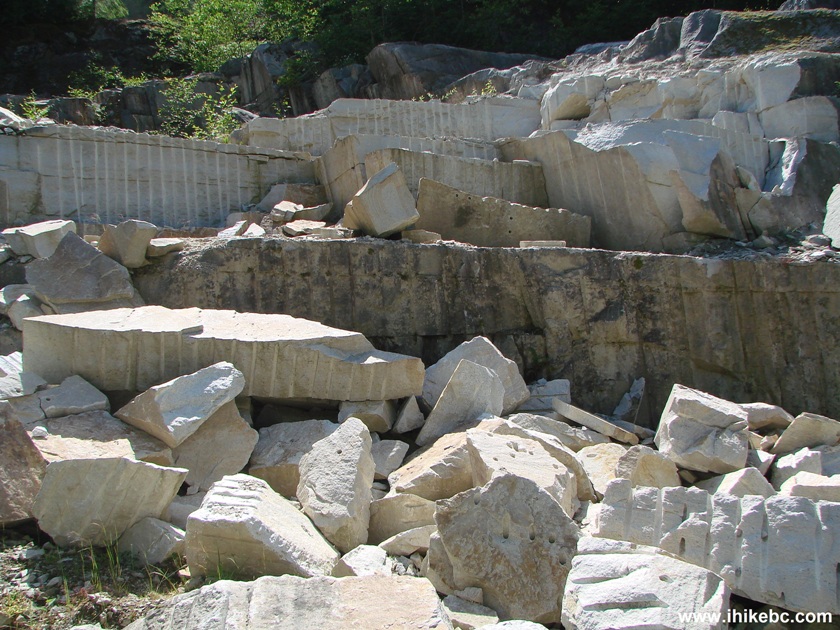
Stones on the side of Ashlu Main Forest Service Road by Squamish BC
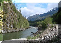
31. A few minutes later, we are crossing a small river. Good views from the bridge.
River view from Ashlu Main Forest Service Road near Squamish BC Canada
32. Less than 2 km after the split with A-600, Ashlu Main 2WD road ends with a view of a dam. On the other side of the river you see a road which very shortly comes to a point seen in photo #24.
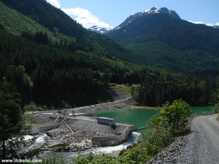
Ashlu FSR Dam near Squamish Province of British Columbia Canada
33. And so we parked right here, and started walking on Ashlu Main. The road became narrow and rough in several areas, though mostly it was in decent shape, probably because very few people drive here.
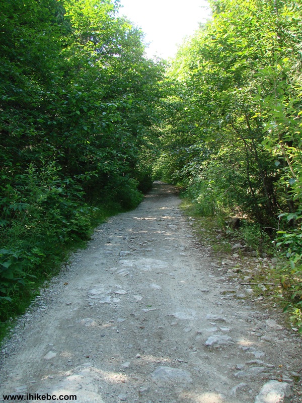
Squamish River Forest Service Road - Ashlu Main - BC Canada
34. It is a pleasant walk on a hot day due to all the shade. The only problem - you do not see much. Just the trees. A bicycle or an ATV would be very good here.
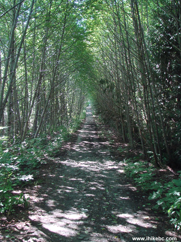
Ashlu FSR by Squamish BC
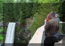
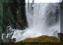
35. The first decent view comes more than an hour into the walk - there is a small bridge and a fairly impressive waterfall there. Be very careful when checking out the creek on the other side of the bridge - the small log serving to keep you from falling into that fast flowing stone-filled creek could be slippery from the waterfall's moisture, and, if you decide to step on that log to get a better photo of the creek below, it might not end up well.
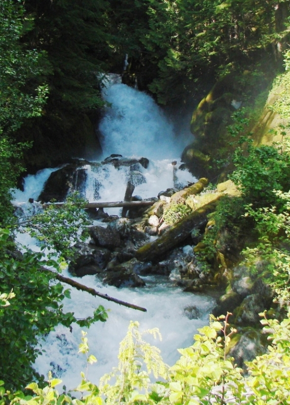
Waterfall off Ashlu Main FSR Province of British Columbia Canada
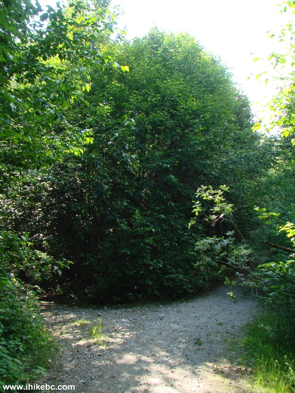
36. And then we hiked for another 45 minutes with just glimpses of mountains here and there, but not much else. The reason for such persistent walking was because a guy we encountered on A-600 earlier in the day said that some days ago he drove an ATV on Ashlu Main all the way to a washed out bridge, and saw some decent views. However, it was getting late in the day, and it was time to have a break and head back. Just when we were going to return while seen nothing impressive, there was a split on the road. As the river was heard on the left, this is where we turned.
Ashlu Main FSR
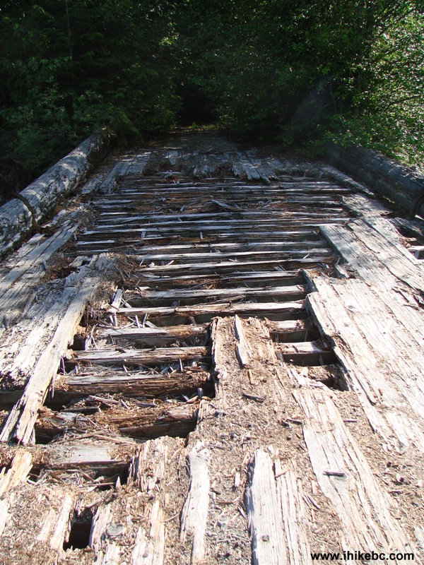
37. Several minutes later, we encountered a badly worn-out bridge.
Worn-out bridge by Ashlu Main FSR
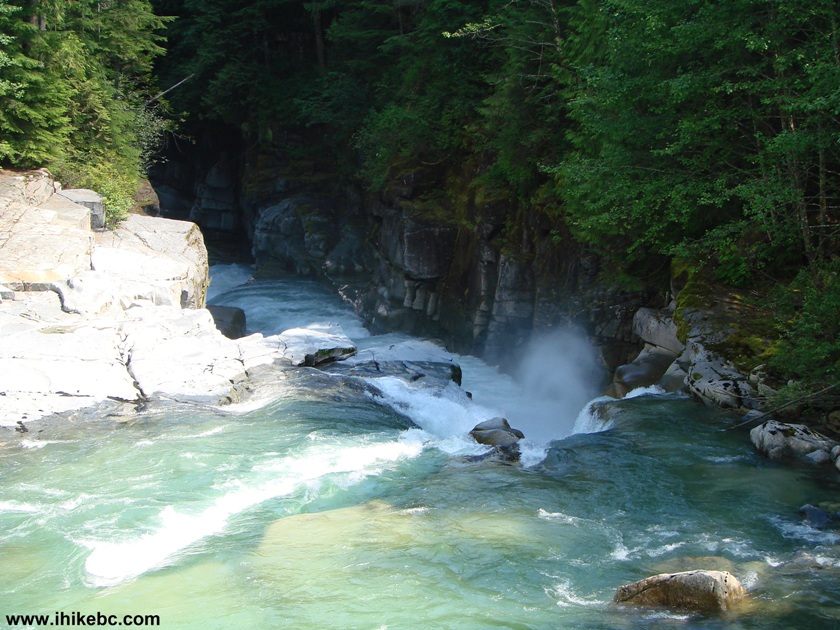
38. The worst part about having a meal break on this bridge were the flies, which decided to have us as THEIR meal break. The best part was this view, which made the whole walking trip (somewhat) worthwhile.

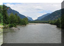
In conclusion, Ashlu Main is not the most impressive of all the other major Squamish River FSRs, but it is a fairly smooth road, it has its attractions, and having a free campsite by Squamish River does not hurt either.
2014 Update:
check out what we've
discovered during our
Second
Ashlu Main Trip.


Other Trips in Squamish Area:


![]()
![]()
![]()
Follow @ihikebc Tweet
ihikebc.com Trip 053 - Squamish River FSR Ashlu Main Page 2 of 2