![]()
![]()
![]()

Trip 109 - June 30, 2016 (Thursday)
Monkman Falls Hike
Via Monkman Pass Memorial Trail
Monkman Provincial Park by Tumbler Ridge BC
Page 2 of 2
Trailhead Location:
Northeastern British Columbia, approximately 64 kilometers Southeast of Tumbler Ridge.
Liked: Monkman Falls, several fine mountain views, suspension bridge, lots of shade.
Of note: Remote wilderness area, the trail is overgrown in many places, some trail erosion by the river, numerous fallen trees, mosquitoes and bugs, hiking poles and boots are recommended.
Northern BC Backroad Mapbook (3rd edition) Trailhead Coordinates: Page 44 (Tumbler Ridge) B7.
Related Website: Monkman Provincial Park - BC Parks.
Other Trips off Murray River FSR: Nesbitt's Knee Falls, Stone Corral Trail Hike, Barbour Falls Trail Hike, Kinuseo Falls.
>>> British Columbia Waterfalls Visits.
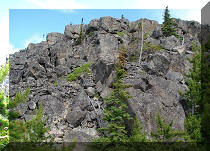
24. One of the most overgrown parts of the trail arrives shortly.
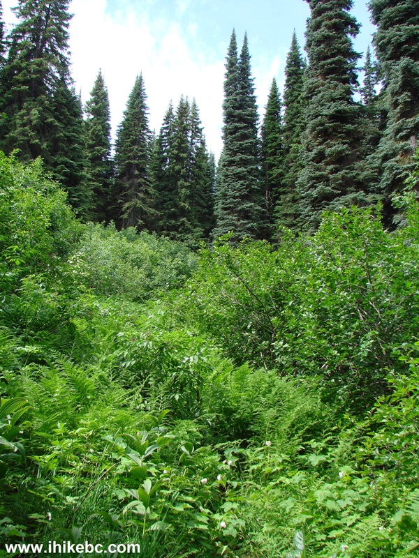
Monkman Pass Memorial Trail British Columbia Canada
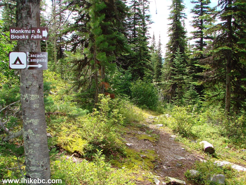
25. Things start to get interesting between km 18 and 19, as the turnoff seen in the photo below allows to visit several waterfalls by completing a loop, though a sign says that the recommended direction is straight, since turning right would lead to a steep part of the trail.
Monkman Pass Memorial Trail
26. Here is that sign.

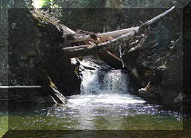
27. Thus, we went straight and went over this picturesque creek crossing.
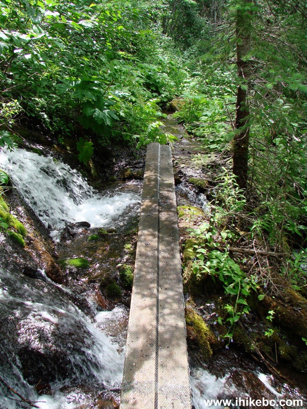
Creek Crossing Monkman Pass Trail
28. Soon after the creek crossing, there is an option of exploring several waterfalls and getting to Cascades campsite by turning right, or continuing on to Monkman Lake by going straight.
Monkman Provincial Park British Columbia Canada
29. Being short of time, we abandoned the goal of reaching Monkman Lake, turned right, and good views started appearing in abundance.
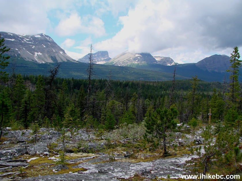
Tumbler Ridge Hiking near Monkman Falls
30. Zooming in.

31. It takes 10-15 minutes from the turnoff to get to Monkman Falls, though this signpost is confusing, as we have reached the viewpoint by going more to the right than the arrow indicates. Perhaps, there is another viewpoint there, or a way to get to the bottom of the Falls? We did not have time to find out.

32. Going more to the right than the arrow indicated.

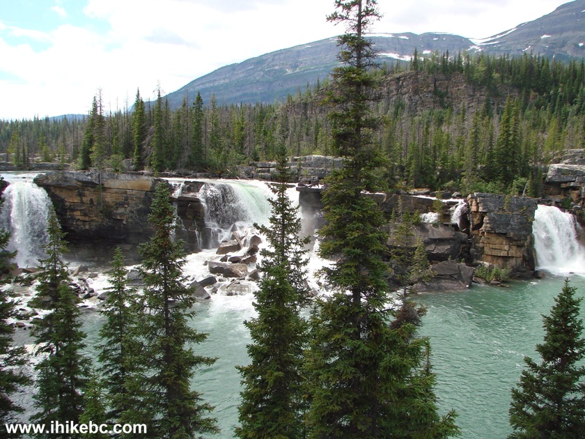
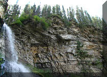
33. Here it is - three waterfalls in one place - very impressive. Made this entire trip worth the exhaustion and the busted bicycle wheel. The trees are starting to get in the way, but it's probably possible to get to the bottom of the cliff for an unobstructed view. Coordinates: N 54⁰38.195' W 121⁰09.462'. Elevation: 1,084 meters.
Monkman Falls British Columbia Canada
34. The left waterfall.
Monkman Falls - left waterfall
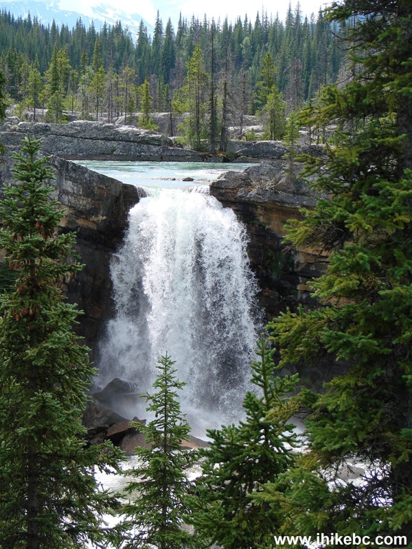
35. The middle waterfall.

Monkman Falls - middle waterfall
36. The right waterfall.
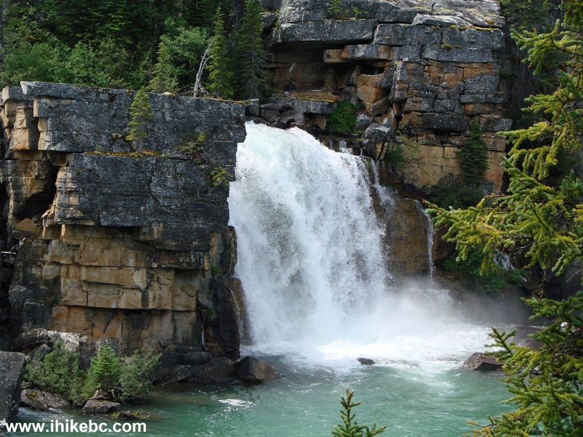
Monkman Falls - right waterfall
Here is our video of Monkman Falls:
More ihikebc videos are on our YouTube Channel.
37. Mountains in the background to the right.

38. Looking good.

39. Not bad either.

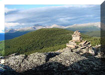
40. And this is a mountain view from that ridge at around the 9-10 km mark, once the sun came out on the way back.
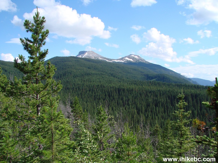
View from Monkman Pass Memorial Trail British Columbia Canada
41. Also on the way back we met this mama grouse...
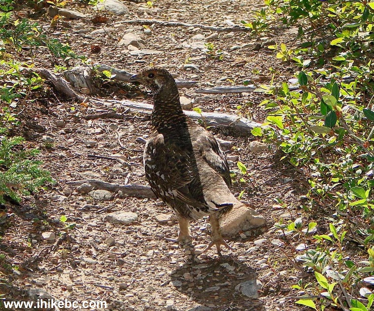
Adult Female Grouse
42...and four of her chicks, with this one being the most curious.

Grouse chick
It took about 6 hours and 40 minutes each way, and around 40 minutes at the waterfall, for a total trip time of nearly 14 hours. Monkman Falls Hike deserves a place in the top 3 of the most exhausting ever (along with the leader - Christina Falls Hike, and Mount Outram Hike). There are many great views out there which we did not get to see because there was no time. To take full advantage of this area, you would definitely need to have an overnight trip.


|
 |
Other Trips in Tumbler Ridge BC Area:
|
|
|
|
|
|
|
|
|
|
|
|
|
|
|
|
|
Bergeron
Cliffs Hike
|
|
Windfall Lake Trail  |
|
Cowmoose Mtn Trail
|
|
Bootski Lake Trail  |
|
Murray Canyon
Overlook
|
|
Quality Canyon Trail  |


![]()
![]()
![]()
ihikebc.com Trip 109 - Monkman Falls Trail Hike (near Tumbler Ridge BC) Page 2 of 2