![]()
![]()
![]()

Trip 083 - June 4-6, 2015 (Thursday - Saturday)
Pinnacle Peak Route Hike
Near Tumbler Ridge BC
Page 2 of 2
Location: Northeastern British Columbia. The trailhead is located
off Windfall Creek Forest Service Road, which begins off Bullmoose Mine
Road, which, in turn, starts off BC Highway 29, approximately 20
kilometers North of Tumbler Ridge.
Liked: Mountain views, meeting a ptarmigan, relatively easy access to the trailhead.
Of note: Remote wilderness area, no cell phone signal, no shade in the second half of the route, strong wind on the exposed ridge, several short stretches are very steep, hiking boots and poles are essential. This trail is for experienced hikers only. Not recommended, unless the ground is completely dry, and the snow is gone.
Northern BC Backroad Mapbook (3rd edition) Coordinates: Page 43 (Mount Crum) E4.
Other Trips Off Bullmoose Mine Road: Cowmoose Mountain Trail Hike, Windfall Lake Trail Hike, Holzworth Meadows Hiking Route.
Follow @ihikebc Tweet
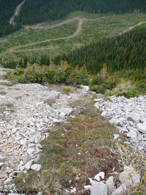
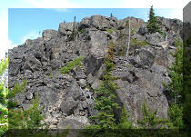
17. Another steep stretch follows shortly.
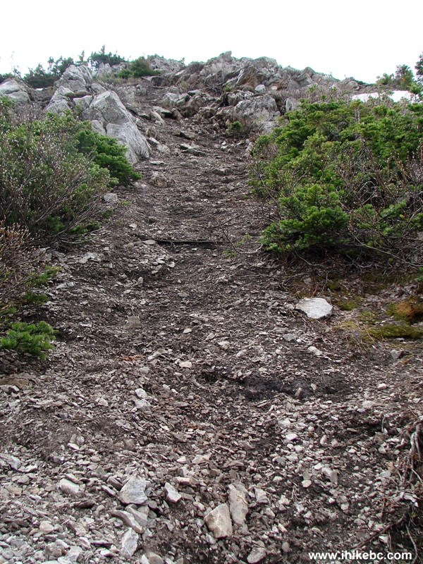
Pinnacle Peak Route - Tumbler Ridge Hiking British Columbia Canada
18. A mountain view on the right side.
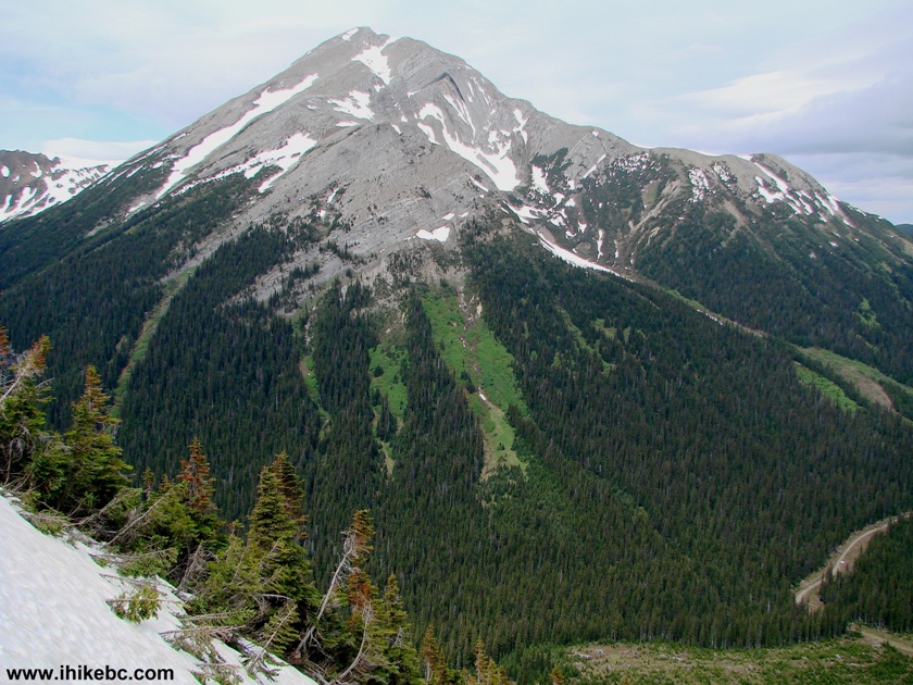
Mountain View From Pinnacle Peak Route British Columbia Canada
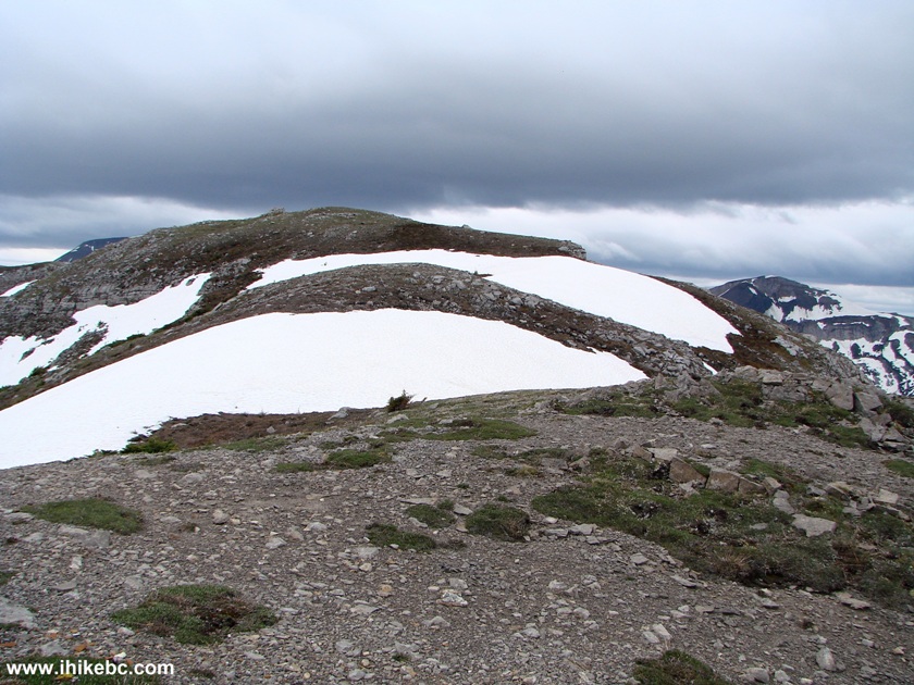
19. The really steep stretch, however tricky, is fairly short. Then, the surface gets substantially flatter.
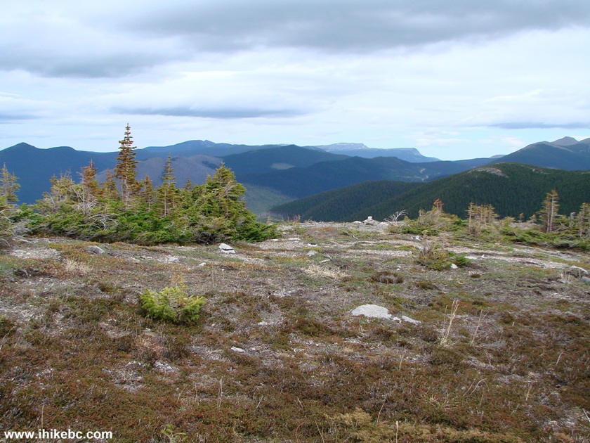
View From Pinnacle Peak Route - Hiking in Tumbler Ridge area BC Canada
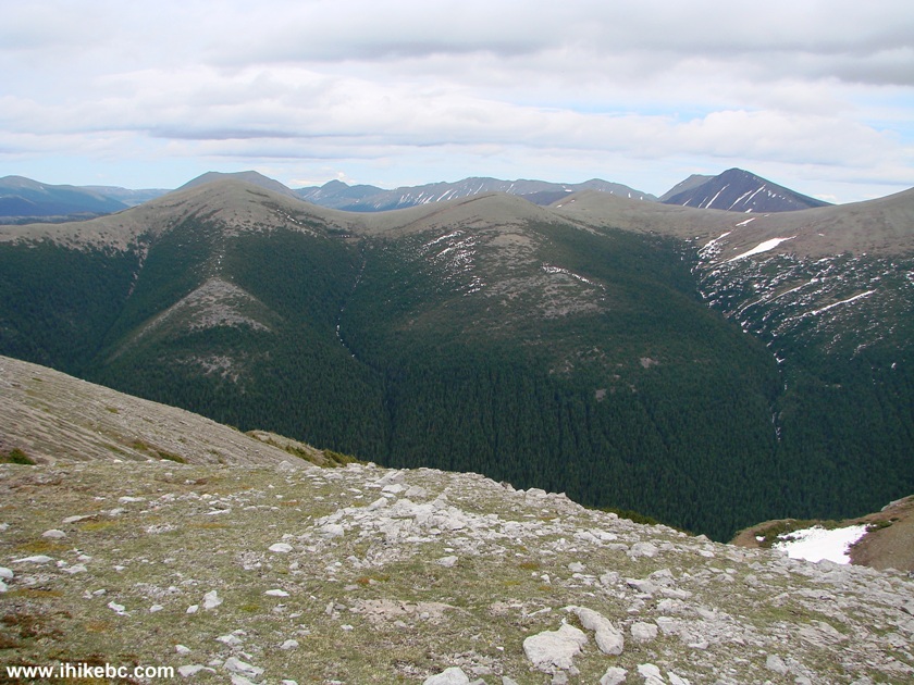
20. And the views get substantially better.
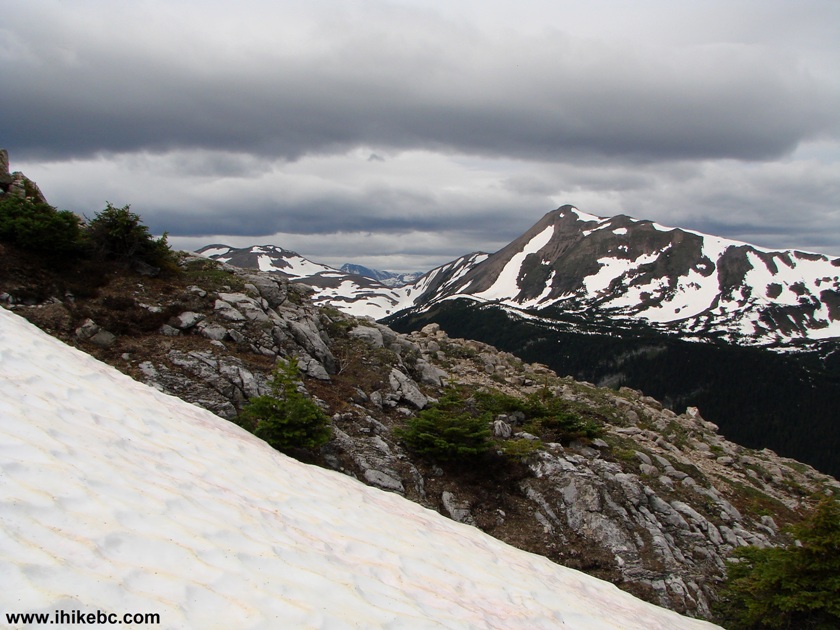
Mountain View Pinnacle Peak Route Province of British Columbia Canada
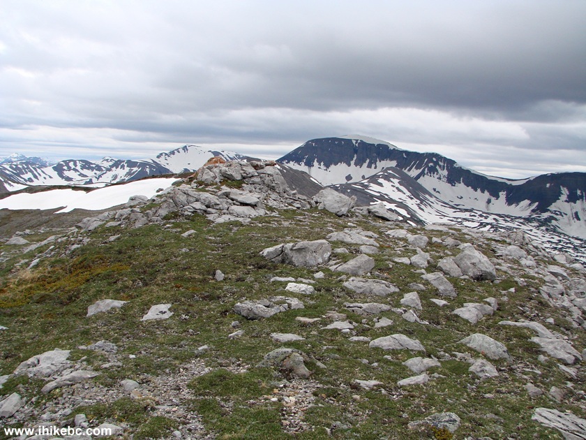
21. You get to the top of this hill, and...
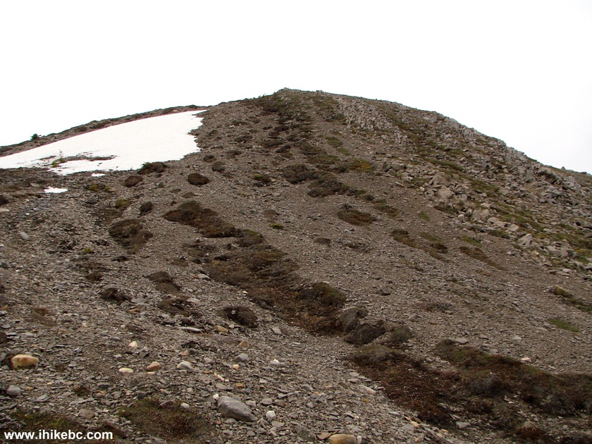
Photo of Pinnacle Peak Route - Hiking in British Columbia Canada
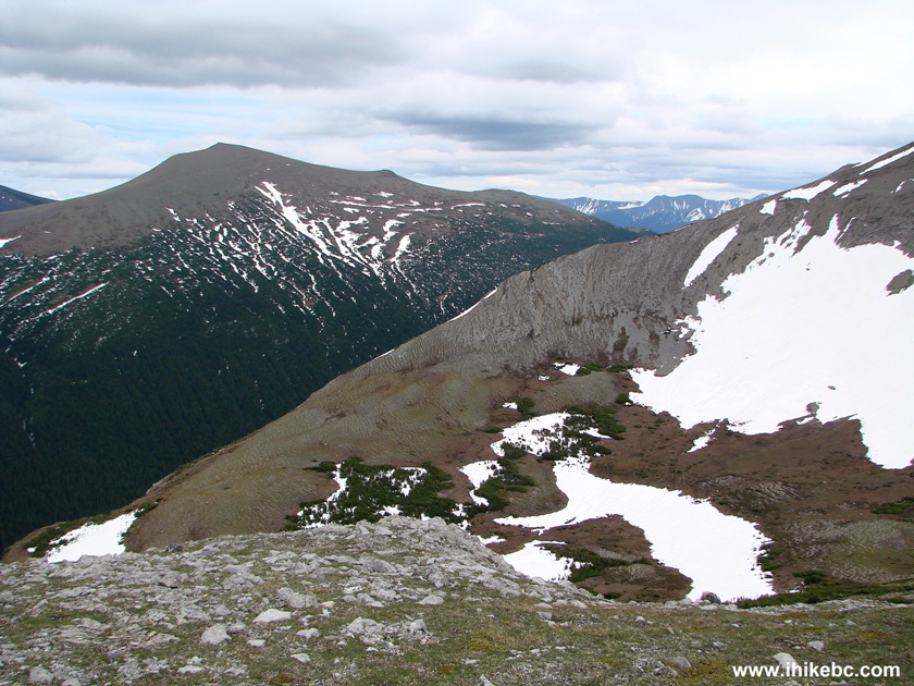
22. ...the alpine area opens up in front of you. See a barely noticeable bump on top of the last visible hill far ahead?
Hike in Tumbler Ridge Area -
Pinnacle Peak Route British Columbia Canada
23. Here is that bump up close. It took about 2.5 hours from the start to get here, and this could be a very good end to the hike, if you do not feel like going all the way to Pinnacle Peak.
The Notch - Pinnacle Peak Route - British Columbia Canada Hiking
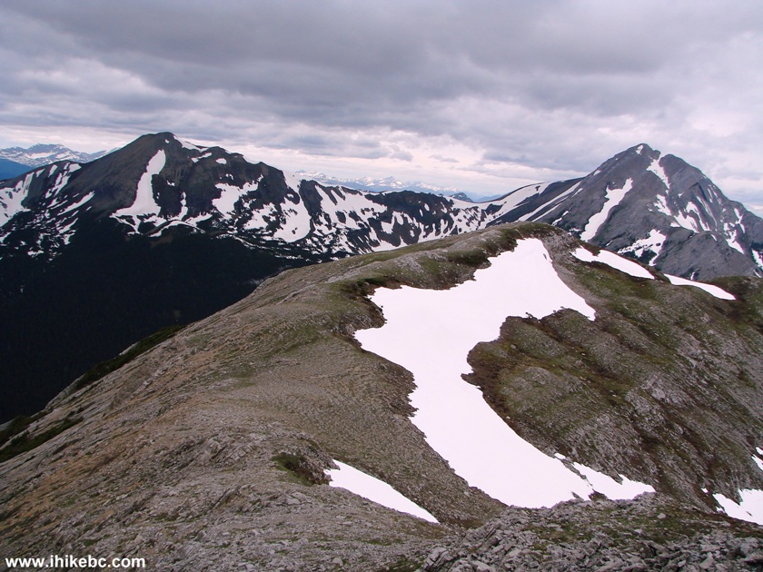
24. The views from the bump area are impressive.
View From Pinnacle Peak Notch BC Canada
25. One more.
View From Pinnacle Peak Hiking Route BC Canada
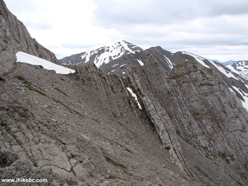
26. And this is the view of Pinnacle Peak from the bump. Do note that, once you are on the ridge, the wind could be very strong.
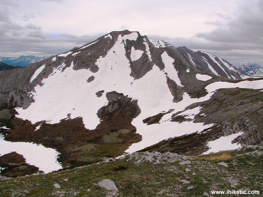
Pinnacle Peak Near Tumbler Ridge British Columbia Canada
Here is our video of the surrounding area viewed from the bump:
More ihikebc videos are on our YouTube Channel.
27. We decided to go a bit further towards Pinnacle Peak, and had to do minor climbing.
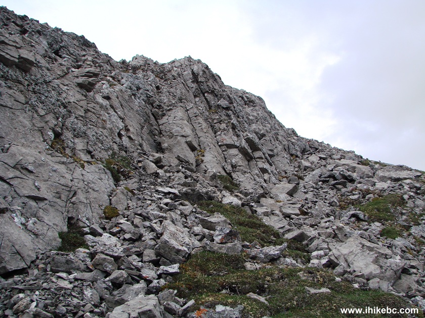
Tumbler Ridge Hiking -
En Route to Pinnacle Peak BC Canada
28. This ptarmigan was hanging out in the area. The only reason we noticed this bird was because it moved - otherwise, it was blending into its environment really well.
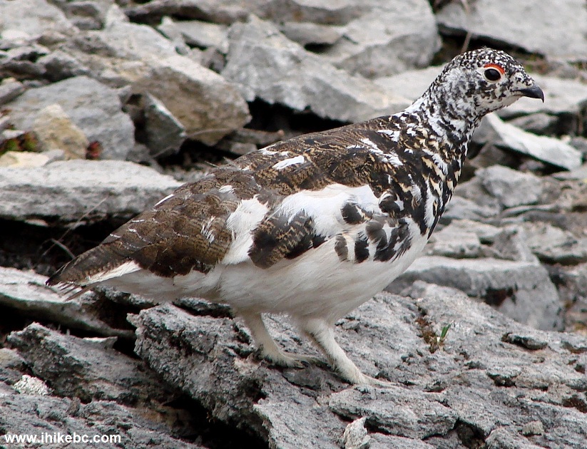
Ptarmigan Near Pinnacle Peak
Northeastern British Columbia Canada
29. The views did not get any better after the bump, and going further required more climbing than was desirable, so we stopped our forward progress at about this point, approximately forty-five minutes after leaving the bump. Approximate coordinates of our final destination: N 55⁰00.442' W 121'36.622'. Approximate elevation: 1,830 meters. It is, however, quite possible to go much further, and, apparently, connect with Windfall Lake Route.
Views From Pinnacle Peak Route British Columbia
30. Looking back at the wind-exposed ridge.
Ridge of the Pinnacle Peak Route Near Tumbler Ridge BC Canada
31. And the main challenge of this hike arrived when it was time to go down all those steep stretches. We squatted on the right leg, stuck the left leg forward, and slid down, using the hiking poles for balancing and braking. It wasn't pretty, but it worked. Stones and dirt hurled down in abundance, though, so be careful, if there is someone below you when you go through these steep stretches either on your way up or, especially, down.
Steep Stretch of Pinnacle Peak Route BC Canada
If it were not for those steep stretches, Pinnacle Peak Route would have come recommended. As is, it should really only be attempted by experienced and well-equipped hikers, preferably when the snow is gone and the ground is completely dry. A safer alternative in this area is Holzworth Meadows Route.


|
 |
Other Trips in Tumbler Ridge BC Area:
|
|
|
|
|
|
|
|
|
|
|
|
|
|
|
|
|
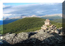
Monkman
Falls Hike
|
|
Windfall Lake Trail  |
|
Cowmoose Mtn Trail
|
|
Bootski Lake Trail  |
|
Murray Canyon
Overlook
|
|
Quality Canyon Trail  |


![]()
![]()
![]()
Follow @ihikebc Tweet
ihikebc.com Trip 083 - Pinnacle Peak Route Hike (near Tumbler Ridge BC) Page 2 of 2