Trip 015 - March 17, 2010 (Wednesday)
Horseshoe Bay Visit
West Vancouver BC Canada
Liked:
Of note:
Distance From Vancouver:
Approximately 35 minutes via Highway 1 West. Or
about an hour via West Vancouver's Marine Drive.
Vancouver, Coast & Mountains Backroad Mapbook (2010 edition)
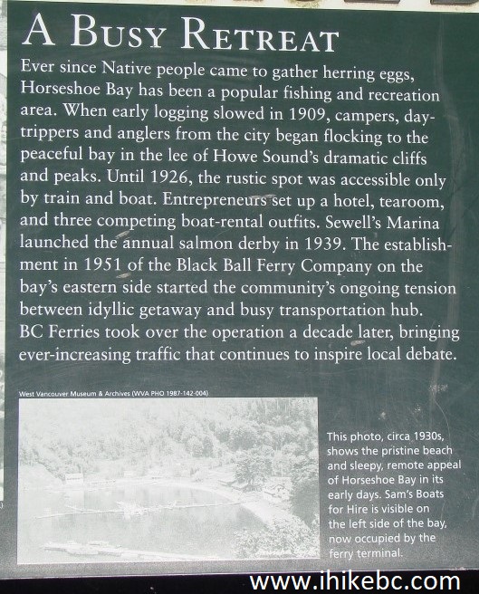
Coordinates:
Page 11 (North Vancouver) A7.
Related Website: Other BC Cities, Towns and
Locations We Have Visited:
Agassiz,
Bella Coola,
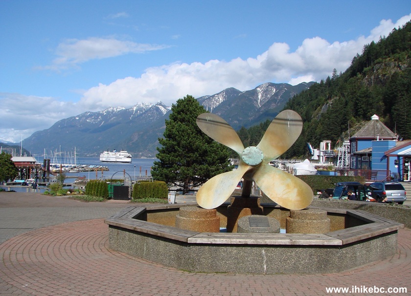
Bralorne,
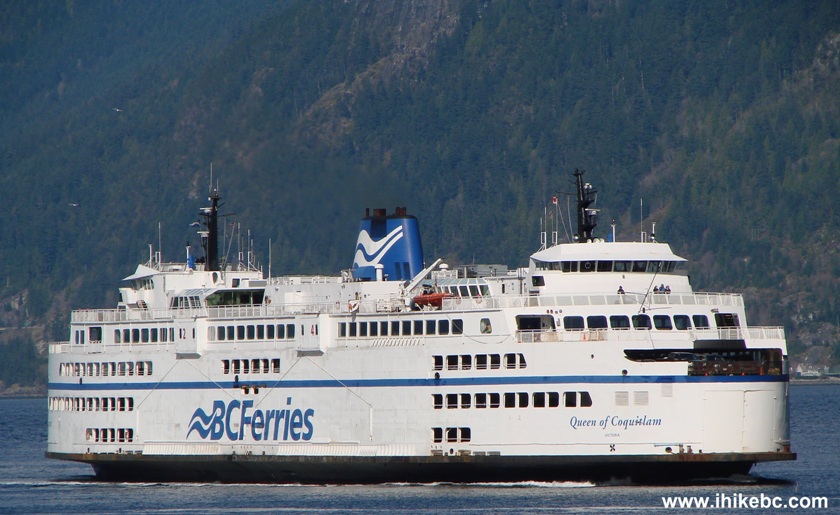
Chilliwack,
Fort Nelson,
Gibsons,
Gold Bridge,
Harrison Hot Springs,
Hope,
Merritt,
Mission,
Nanaimo
(Old City Square),
Port Alberni,
Prince George,
Prince Rupert,
Smithers,
Squamish,
Telkwa,
Tofino,
Tumbler Ridge,
Vancouver
(Seawall),
Vancouver (Stanley Park),
West Vancouver
(Ambleside Park).
Follow @ihikebc Tweet
The Village of Horseshoe Bay, which is a part of West Vancouver, is located at the Western end of Highway 1, where it splits with Highway 99, which then proceeds to Squamish, Whistler and Pemberton. The village is quite nice, but today we walked near the bay itself, where a ferry terminal is located with ferries sailing to Nanaimo and Bowen Island, among other destinations.
The last 10 minutes or so of the drive on Highway 1 is a treat for your eyes. But the bay looks simply spectacular in good weather. The parking is free for 2 hours, though it is fairly limited, and will be hard to find during the busy season. There is pay parking too, but considering the price ($14 flat rate for 24 hours), it might be too steep for day trippers, and would be more suitable for foot passengers unwilling to pay BC Ferries' car rates.
Hint: free three hour parking is allowed along the road
leading from the bay to Whytecliff Park (the same road which allows to
reach Marine Drive in West Vancouver). You can reach this road by simply
turning left from Bay Street, which runs along the bay.
1. We are Westbound on Highway 1, about to take Exit 3 to get to
Horseshoe Bay.
Highway 1 British Columbia Canada
2. Once you take Exit 3, the signs then direct drivers to the leftmost
lane, if they wish to go to Horseshoe Bay village. The lane is separated
from the ferry-bound lanes by a concrete barrier.
Approaching Horseshoe Bay
3. At some point, the ferry-bound lanes get behind a fence.
Photo of Horseshoe Bay British Columbia Canada
4. In about five minutes after splitting with ferry-bound traffic, we
arrived to the end of the highway, ready to turn left and enter
Horseshoe Bay village.
Entering Horseshoe Bay village British Columbia Canada
5. We are in the village now. BC Ferries building is seen on the right
side. Ferry foot passengers should be dropped off by this building.
Horseshoe Bay Village BC Canada
6. At the end of the road, the choices are to turn right towards Highway
1 East and Highway 99 (Sea-to-Sky), or turn left. The bay is straight
ahead.
Horseshoe Bay Village
7. We turned left onto Bay Street and took advantage of two hours free
parking. The non-resident parking is allowed between 7 AM - Midnight
only. There are a bunch of shops and eateries on the left side of Bay
Street, as well as on several adjacent streets.
Bay Street Horseshoe Bay Village British Columbia Canada
8. First good look at the bay. Very nice indeed.
Horseshoe Bay
9. An information stand explains the history of Horseshoe Bay. The photo
on the left is from the 1970 salmon derby. The photo on the right shows
the horseshoe shape of the bay in 1960. The small photo in the middle
shows a few shacks around the bay in 1930s to emphasize the quiet appeal
of the bay back in those days.
Horseshoe Bay History
10. The Lookout Tourist Information - Coffee House - Gift shop was
closed until the busy season.
The Lookout Store Horseshoe Bay British Columbia Canada
11. But the murals on The Lookout are available year-round.
The Lookout store mural Horseshoe Bay BC Canada
12-13. In the meanwhile, Queen of Capilano
departed to Bowen Island.
Queen of Capilano Ferry in Horseshoe Bay
Queen of Capilano Ferry
14. Horseshoe Bay Park runs along the street where we parked our
vehicle.
Horseshoe Bay Park British Columbia Canada
15. This propeller once propelled a tug named "Samarinda." Five thousand pounds of solid bronze on display.
Propeller Display in Horseshoe Bay BC Canada
16. BC Ferry Queen of Coquitlam arriving to Horseshoe Bay.
Queen of Coquitlam BC Ferry
17. View of the bay.
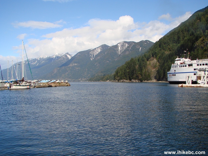
Photo of Horseshoe Bay
Horseshoe Bay is a great place to visit, even if you don't plan on taking a
ferry.
Other Trips in West Vancouver Area:
ihikebc.com Trip 015 - Village
of Horseshoe Bay
Visit
(West Vancouver BC)


Follow @ihikebc
Tweet
![]()
