![]()
![]()
![]()

Trip 150 - September 4, 2018 (Tuesday)
Sowaqua Creek Forest Service Road Trip
By BC Highway 5 (Coquihalla) near Hope
Page 2 of 2
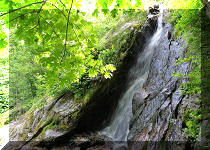
Liked: Mountain views, two small waterfalls, fine natural views, fairly good road condition, no bugs.
Of Note: The road is frequently narrow and winding, the road is subject to slides, steep unbarricaded drop-offs, logging truck traffic possible, high-clearance vehicle is required (2WD ok), there are numerous small sharp stones - good tires and a spare are essential.
Vancouver, Coast & Mountains BC Backroad Mapbook (2nd edition) Coordinates: Page 16 (Coquihalla Summit) B5-C5-D6-E7 and Page 6 (Skagit Valley) E1.
Other Trips in Hope BC Area: Thacker Mountain Trail, Flat Iron Peak Trail, Needle Peak Trail, Sowerby Creek FSR Hike, Dog Mountain Trail, Jones Lake FSR Trip to Jones Lake, Yak Peak Trail, HBC Heritage Trail, Zoa Peak Trail, Skagit River Trail, Skyline II Trail Hike, Silver Skagit Road, Mount Outram Trail, Othello Tunnels, Eaton Lake Trail, Mount Hope Lookout Trail, Town of Hope BC.
Other Forest Service Roads Trips: Chehalis (by Harrison Mills), Chilliwack Bench, Chilliwack Foley, Chilliwack Lake, Chuchinka-Colbourne (North of Prince George), Clear Creek (off Harrison East), Florence Lake (access to Stave Lake by Mission), Harrison East, Harrison East Second Trip, Harrison West, Jones Lake (near Hope), Lost Creek (by Mission), Mamquam River (by Squamish), Nahatlatch (near Boston Bar), Parsnip West (by Mackenzie), Scuzzy (by Boston Bar), Shovel Creek (off Harrison East), Squamish River Main, Squamish River Ashlu, Squamish River E-Main, Squamish River FSR Washout, Windfall Creek (by Tumbler Ridge).
Sowaqua Creek Forest Service Road is located by Exit 192 of BC Highway 5 (Coquihalla), about 20 kilometers North of Hope. It's not very long (not much longer than 30 km), and features several very fine mountain and natural views, as well as two small waterfalls. It is also possible to access HBC Brigade Heritage Trail (which starts and ends elsewhere) from this road, which is very convenient, if you wish to hike only a portion of this very long trail, or want to cut your hike short. There is also a recreation site with a pit toilet (but no garbage bin) very close to the HBC Brigade Trail. We did not encounter any logging trucks over the two days we spent on Sowaqua Creek FSR, but the signs of an extensive logging activity are certainly there. Also, there was an excavator working on building a side road, so logging trucks may be visiting Sowaqua Creek FSR again in the very near future. The condition of the road is fair, if somewhat rough, and a 2WD vehicle with high clearance can make it very close to the end of the FSR as of the time of writing (deep cross-ditches would stop most vehicles from going any further). Note, that there are numerous loose sharp stones on this road, which would easily puncture tires not suitable for this terrain. Also, there are several potential areas of slides along this FSR, so be prepared to be cut-off from getting back, and reconsider visiting during or after a heavy rainfall. Finally, frequent potholes, as well as narrow and winding road conditions, would limit reasonable speed to 20-30 km/h throughout the entire Sowaqua Creek FSR.
Zero your odometer at the beginning of Sowaqua Creek FSR, if you want to follow the points of interest in the table below.
| KM | Feature | Side |
| 0.2 | Split (stay left) | Straight (S) |
| 7.0 | Forest Service Road (FSR) | Left (L) |
| 7.7 | Waterfall 1 | L |
| 8.2 | Waterfall 2 | L |
| 10.5 | Road into the woods | L |
| 11.9 | Mountain view | R |
| 13.5 | FSR | L |
| 14.1 | Road | L |
| 14.8 | Valley View (Manson Ridge View) | Right (R) |
| 16.1 | Road | L |
| 16.4 | Split (HBC Trail/Davis Mtn - L. Manson Ridge - R) | S |
| 17.2 | Mountain View | R |
| 17.8 | Road | R? |
| 18.8 | Road | R |
| 19.4 | HBC Brigade (1849) Heritage Trail | L/R |
| 19.5 | Sowaqua Creek/HBC Trail Recreation Site (pit toilet) | R |
| 22.3 | Hole on the road | L |
| 25.7 | Road | R |
| 27.1 | Main Sowaqua FSR Split | L/R |
| 28.6 | (if taking the road on the right - stopped) | S |
| 27.8 | (if taking the road on the left - one more split) | S |
| 28.4 | (if taking the road on the left after the 27.8 split - stopped) | S |
22. HBC (1849) Heritage Trail (HBC Brigade Trail in the Backroad Mapbook) arrives at the 19.4 km mark. The start and end of this trail is elsewhere, so you can hike in both directions from here.
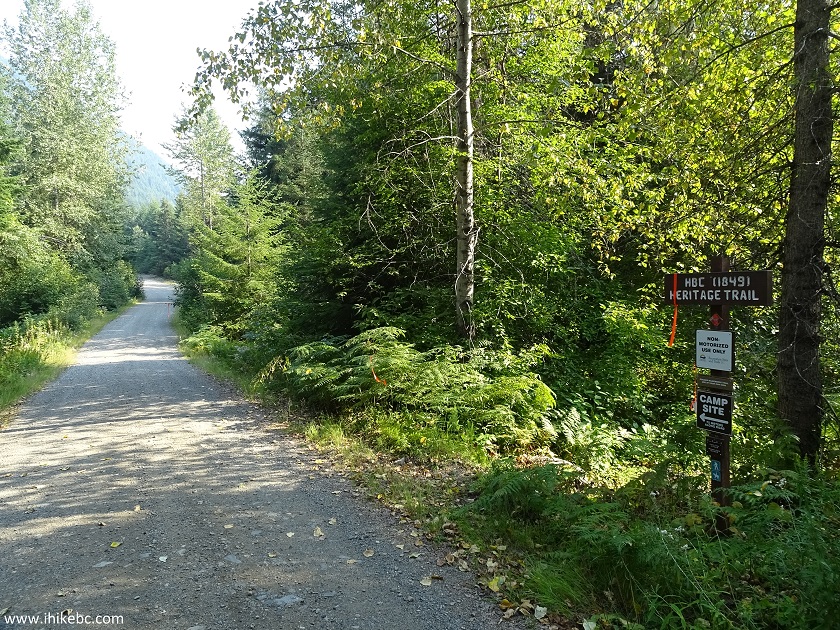
Sowaqua Creek FSR at HBC Heritage Trail near Hope British Columbia
Canada
23. Less than a hundred meters later, Sowaqua Creek / HBC Trail Recreation Site is on your right. There is a pit toilet there and two food storage containers.
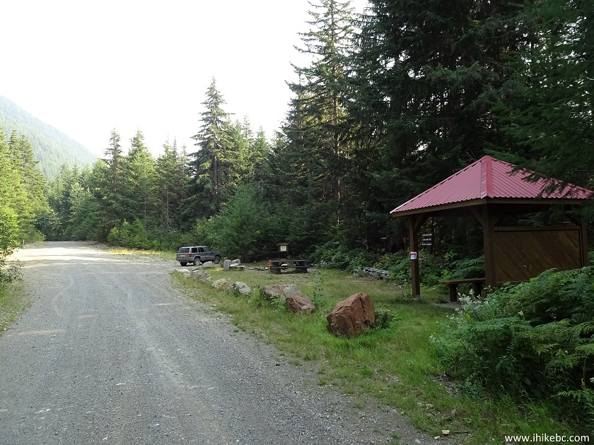
HBC Trail Recreation Site at Sowaqua Creek FSR near Hope BC Canada
24. There is also a very neat info board. Kudos to whoever put it there.
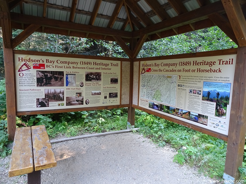
Information Board at HBC Trail Recreation Site by Sowaqua Creek FSR bear
Hope British Columbia Canada
25. Here is a map on the info board. We have marked on the map: Blue square - Highway 5 Exit 192 Sowaqua Creek. Red arrow - Sowaqua Creek FSR. Red square - this recreation site and the part of the HBC trail we hiked the next day. Yellow squares - two ends of the HBC (1849) Heritage Trail. Green square - Mount Outram Trail, which we hiked in 2010, and which is accessible from Highway 3 near Hope.
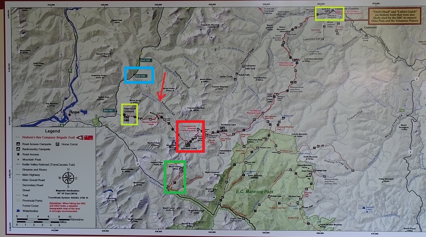
Area map near Sowaqua Creek Forest Service Near Hope BC Canada
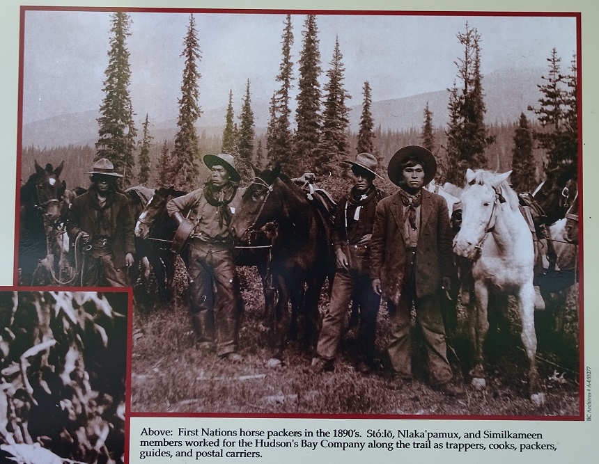
26. There is also this cool photo (courtesy of BC Archives) of Aboriginal packers, who used to transport goods for Hudson's Bay Company almost 130 years ago.
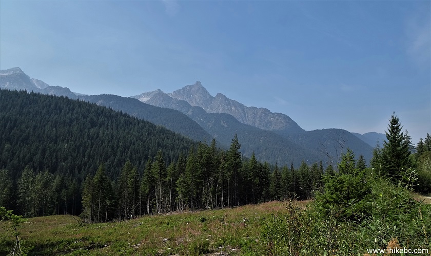
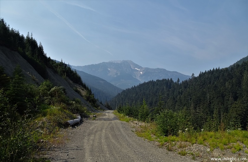
27. A neat mountain view arrives at the 20.6 km mark. Again, we took this photo in the morning the next day.
Mountain View off Sowaqua Creek FSR near Hope BC Canada
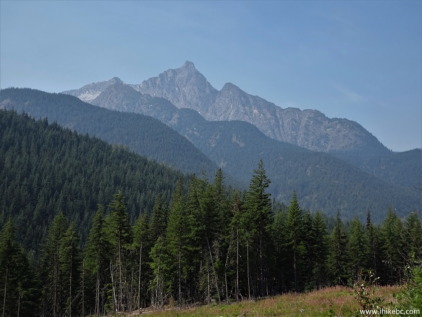
28. Zooming in.
Mountain View from Sowaqua Creek FSR near Hope BC Canada
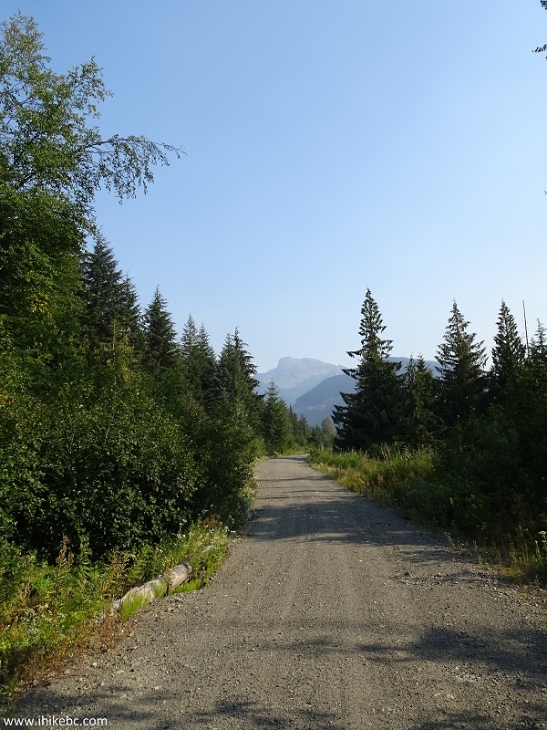
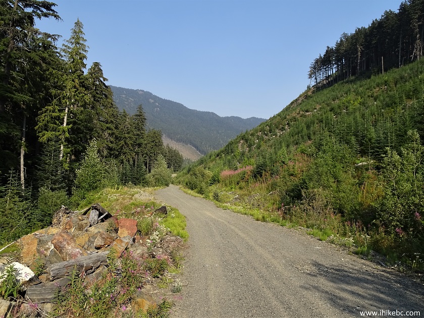
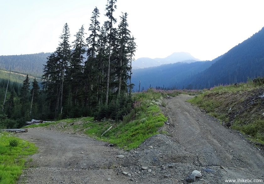
29. Sowaqua Creek Forest Service Road at the 21.6 km mark.
Sowaqua Creek Forest Service Road
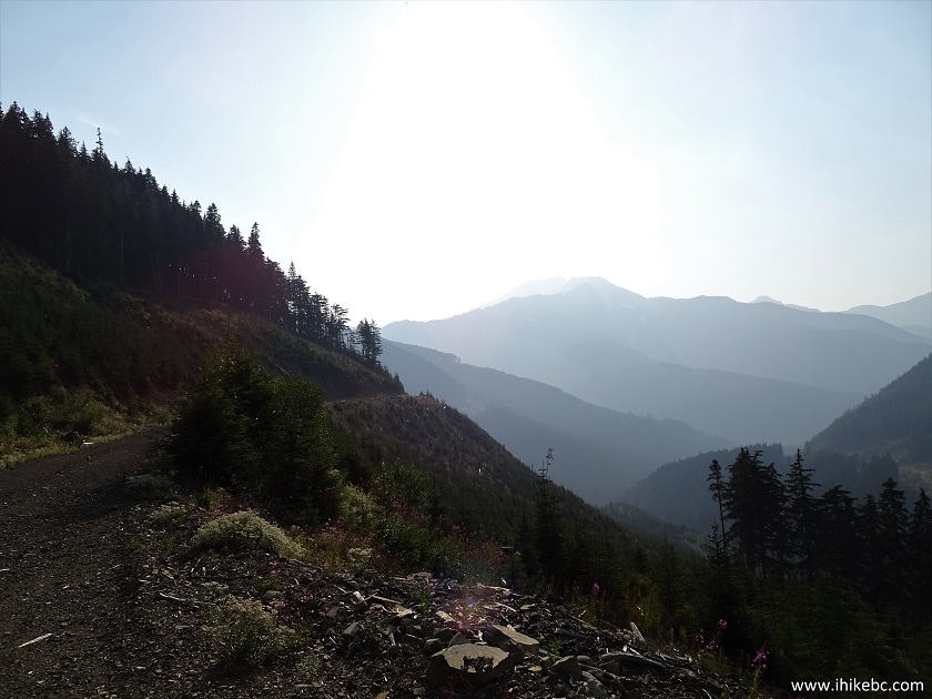
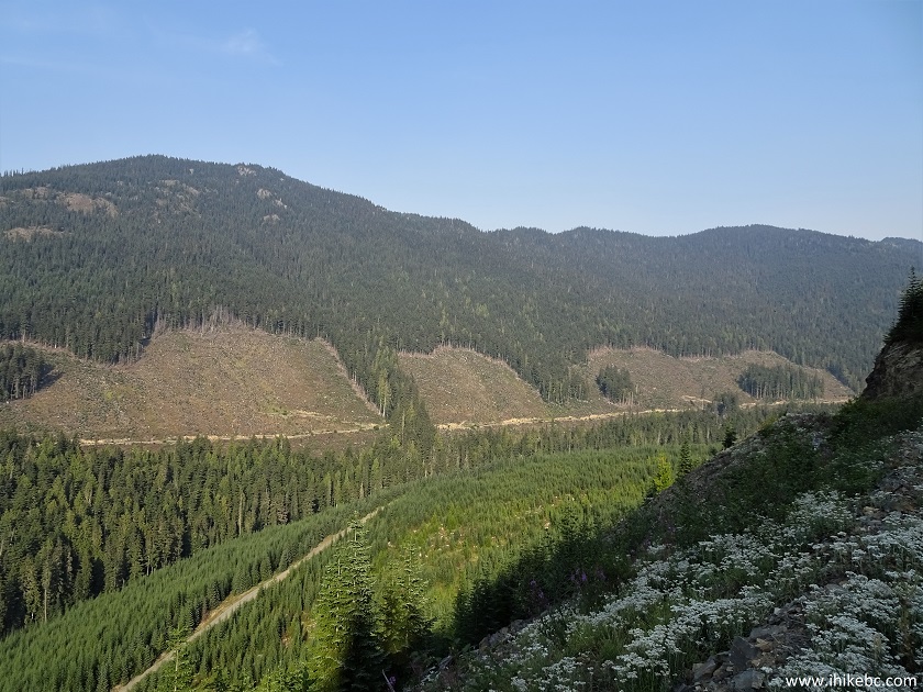
30. One more good view is at the 25.6 km mark (looking back).
Sowaqua Creek FSR near Hope British Columbia Canada
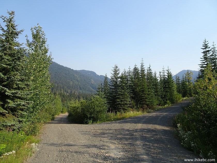
31. Several hundred meters later.
Sowaqua Creek Forest Service Road British Columbia Canada
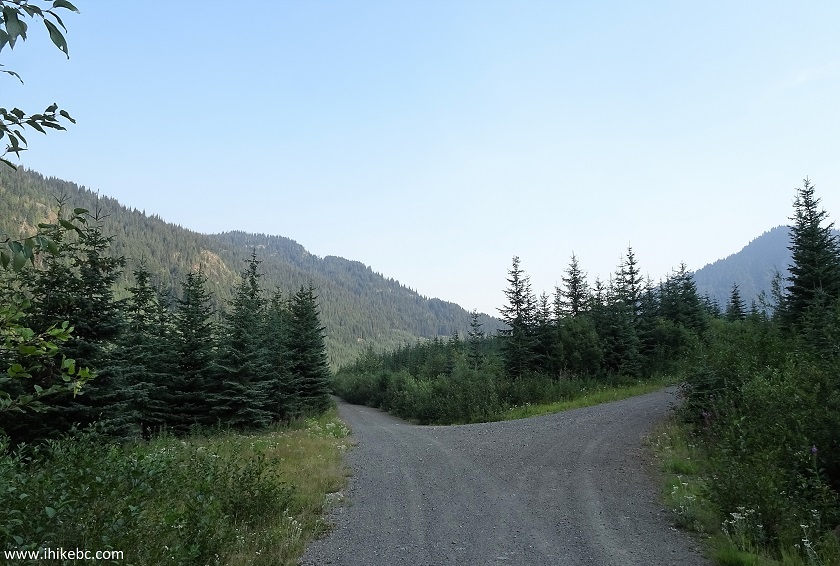
32. There is a split at the 27.1 km mark. Coordinates: N 49⁰18.511' W 121⁰03.369'. Elevation: 1,187 meters.
Sowaqua Creek FSR near Hope British Columbia Canada
33. We went to the right at first. Couldn't see much because of the sun, but the good views are out there.
View from Sowaqua Creek FSR near Hope British Columbia Canada
34. One and a half kilometers after the split, we could go no further. Coordinates: N 49⁰18.312' W 121⁰04.389'. Elevation: 1,216 meters. The photograph does not quite convey the depth of this cross-ditch, but it was deep enough that we did not want to risk any damage to our vehicle. Sowaqua Creek FSR does appear to end shortly thereafter.
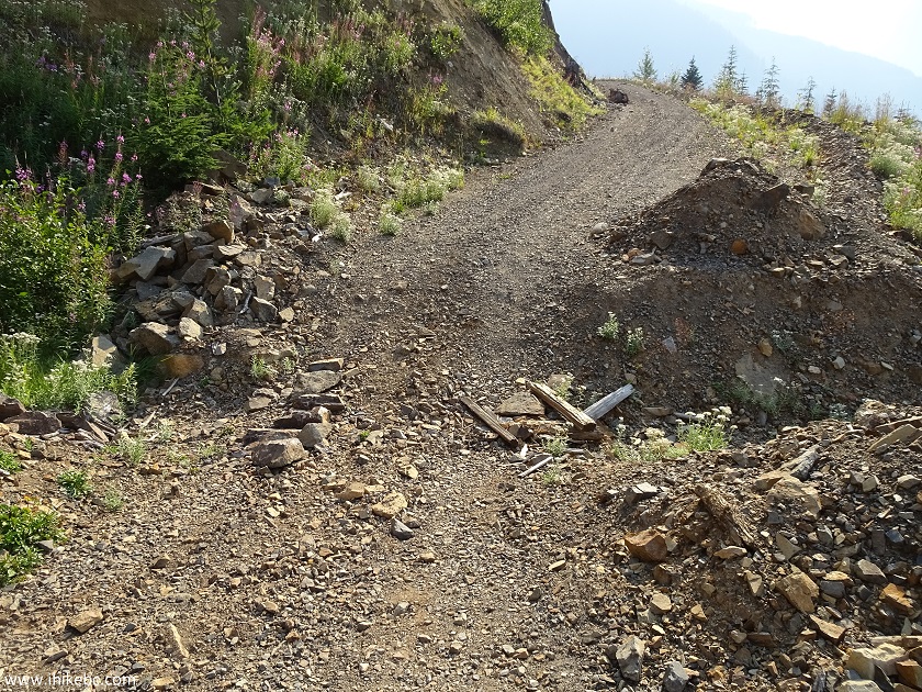
35. Looking back from close to the spot above, we can see extensive logging done in this area.
36. Now taking the left road from the 27.1 km split. We did not get far here either. First, there was one more split 700 meters later. We did not bother with the road on the right, and took the road on the left.
37. Taking a road on the left resulted in another cross-ditch which we did not feel like crossing - this one at the 28.4 mark. Coordinates: N 49⁰17.997' W 121⁰02.781'. Elevation: 1,236 meters. In any case, looking at our GPS and at the Backroad Mapbook, Sowaqua Creek FSR's end was within a few kilometers no matter which road we would have taken.
38. Just past that cross-ditch, there was this creek crossing the road on the left.
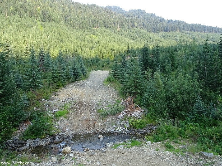
Sowaqua Creek Forest Service Road comes with dangers attached, but certainly leads to some very impressive views, as well as a really good hiking trail, partially covered in the next trip report.


|
 |
Other Trips in Hope BC Area:
|
|
|
|
|
|
|
|
|
|
|
|
|
|
|
|
|
|
|
 |
|
|
|
|


![]()
![]()
![]()
ihikebc.com Trip 150 - Sowaqua Creek Forest Service Road Trip (Near Hope BC) Page 2 of 2