![]()
![]()
![]()

Trip 018 - April 13, 2010 (Tuesday)
Eaton Lake Trail Hike (partial)
Near Hope BC
Distance From Vancouver: About 148 km on Highway 1 East. Take Exit 168. Get to Silver Skagit Road, and then drive for 16 km on Silver Skagit Road - look for the trail sign on your left.
Liked:
Several fine waterfalls, a pleasant forest, lack of any artificial noise (except for an occasional airplane), shade in the forest.Of note:
Access road (Silver Skagit Rd) may have industrial traffic and may be rough with numerous potholes (regular clearance 2WD vehicles - OK, but have good tires and carry a spare), moderately difficult trail, rocks and roots, several creek crossings required (wading might be necessary) hiking poles are highly recommended, and hiking boots are essential.Vancouver, Coast & Mountains Backroad Mapbook (2nd edition) Coordinates: Page 5 (Chilliwack Lake) G2.
103 Hikes in Southwestern British Columbia (2008 edition):
hike #76.Related Trip: 334 - Eaton Lake Trail Hike.
Other Trips in Hope BC Area:
Thacker Mountain
Trail,
Flat Iron Peak Trail,
Needle Peak Trail,
Sowerby Creek FSR Hike,
Dog Mountain Trail,
Jones Lake FSR Trip to
Jones Lake, Yak Peak Trail,
HBC Heritage Trail,
Sowaqua Creek
FSR, Zoa Peak Trail,
Skagit River Trail,
Skyline II Trail Hike,
Silver Skagit Road, Mount Outram Trail,
Othello Tunnels,
Mount Hope Lookout Trail,
Town of Hope BC.
>>>
![]()
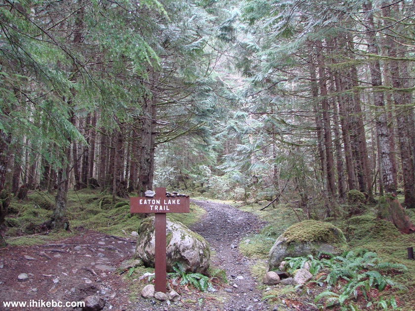
Eaton Lake Trailhead is located by Silver Skagit Road, 16.6 kilometres after Silver Skagit Road starts off Flood-Hope Road near Highway 1's Exit 168 by Hope, BC. Eaton Lake Trail is a very good hike, with several fine views. Today, the snow was so deep at around the 3 km mark that it made further progress unwise. However, in 2024 we made it to the lake. There are also three decent waterfalls (with the first one being the most impressive) along Eaton Lake Trail, and 700 meters is all it takes to get to that first waterfall, is all you want is a short hike.
There is also Eaton Creek Recreation Site by the trailhead with two camping spots and a pit toilet. Do note that the third waterfall viewing area is quite dangerous, and that several creek crossings on rather flimsy logs are required to make it to the lake. These crossings may be gone the next runoff season, and wading might be required.
1. To get to Eaton Lake Trail, drive on Highway 1
and take Exit 168. Follow signs to Skagit Valley, and you will end up on
Silver Skagit Road.
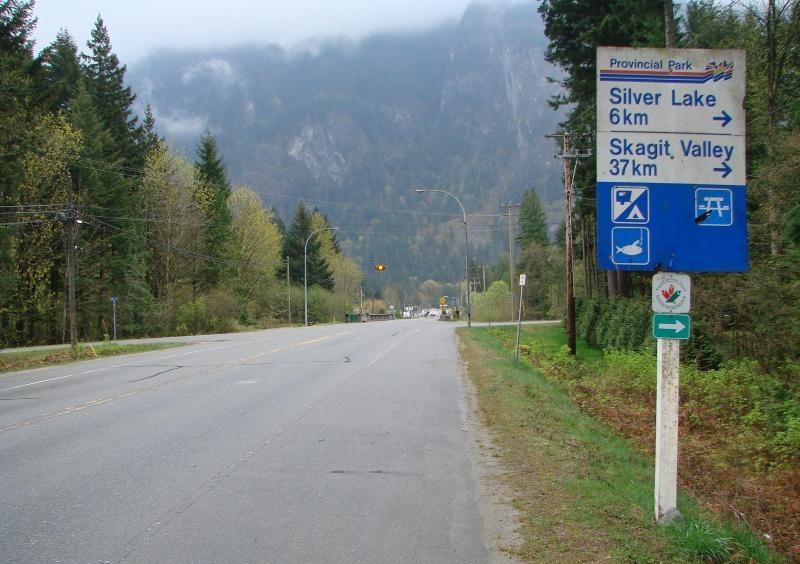
Sign to Silver Lake and Skagit Valley near Hope BC Canada
2. Once on Silver Skagit Road, check your odometer - you would be at the
turnoff to the trailhead about 16 kilometers later. Silver Skagit Road
is all gravel after a very short stretch of asphalt, and your vehicle
would likely get very dirty in short time.
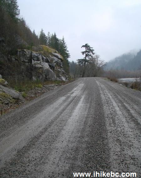
Silver Skagit Road near Hope BC Canada
3. Here is your turnoff. It is better to park on Silver Skagit Road, as
the short road to Eaton Lake Trail is steep and narrow, and parking
space is very limited up there.
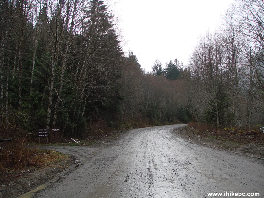
Silver Skagit Road near Eaton Lake Trail by Hope British Columbia Canada
4. If you have a small 4x4, you may try to proceed.
Eaton Lake Trail Entrance from Silver Skagit Road British Columbia
Canada
5. Here is that steep and narrow road.
Road leading to Eaton Lake Trail from Silver Skagit Road
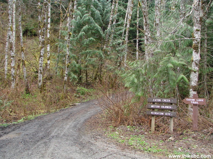
6. And about 200 meters later is the trailhead. A pit
toilet is located nearby.
Eaton Lake Trail trailhead - BC Hiking
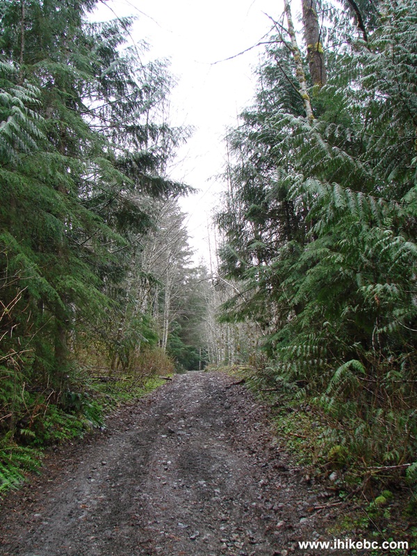
7. The trail starts nicely enough.
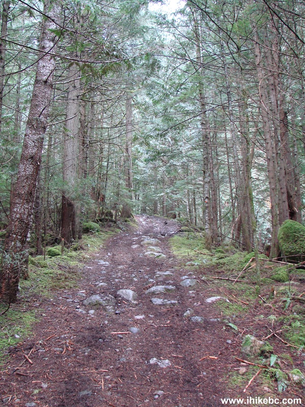
Eaton Lake Hiking Trail British Columbia Canada
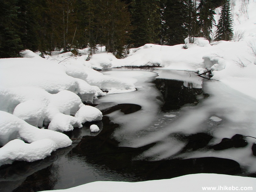
8. And, then, Eaton Creek makes an appearance.
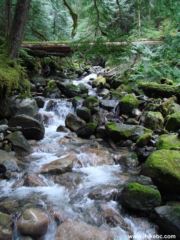
Eaton Creek BC Canada
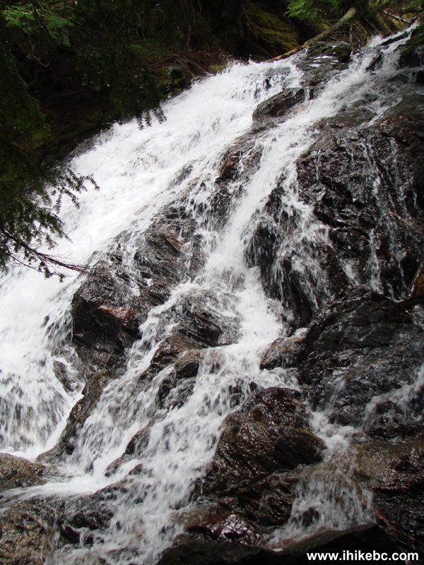
9. In about 25 minutes, you reach a very good waterfall. This could be a
final destination, if all you want is a short hike. In this photo you see a broken bridge and a log used as
an alternative.
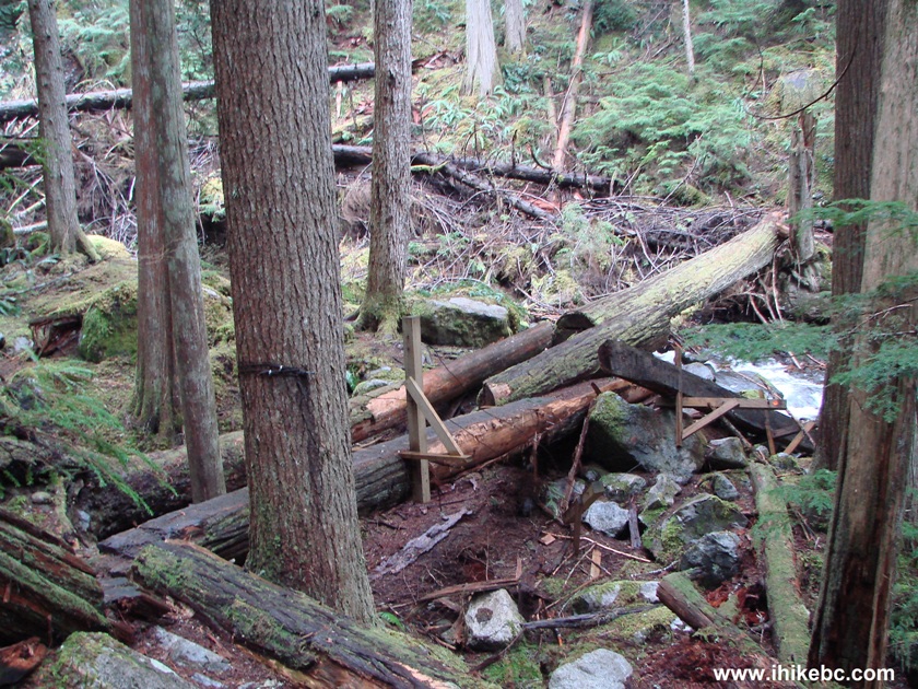
Eaton Trail bridge across Eaton Creek British Columbia Canada
10. There is no way to use the bridge on the right, so the log is the way
to go, but it is slippery, though wide.
Broken bridge across Eaton Creek - Hiking in BC
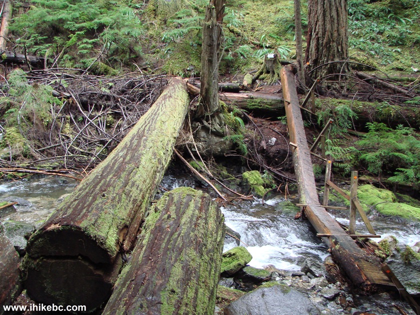
11. Waterfall view from the middle of the log.
Eaton Lake Trail Waterfall British Columbia Canada
12. We have crossed the creek and are now looking back. As you can see,
the bridge is way too broken to be of any use.
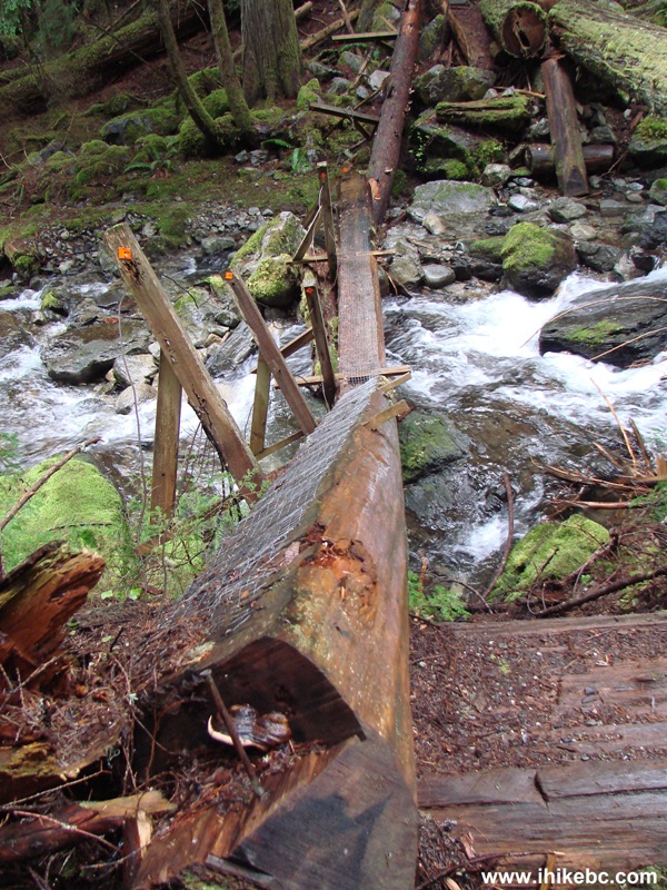
Photo of a broken Eaton Creek Bridge - Hiking in British Columbia Canada
13. If you manage to cross to the other side, this gorgeous stump view is
your reward.
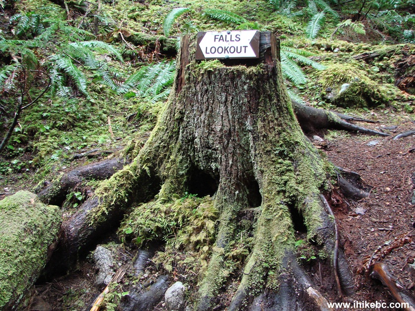
Eaton Lake Trail Stump near Silver Skagit Road by Hope British Columbia
Canada
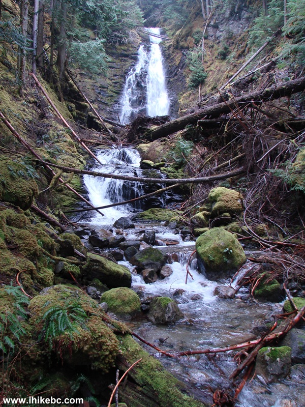
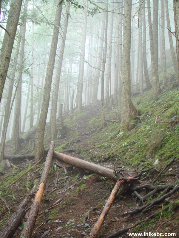
14. Falls lookout sounds promising. But, at first, a
debris obstacle course needs to be taken care of.
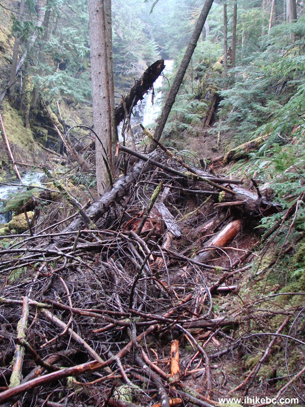
Eaton Lake Trail near a waterfall - Hiking in Hope BC Area
15. Actually, it is not that bad, and, once you manage to climb over
this very slippery and dangerous pile, there is a good path beyond it.
Waterfall seen from Eaton Creek Trail British Columbia Canada
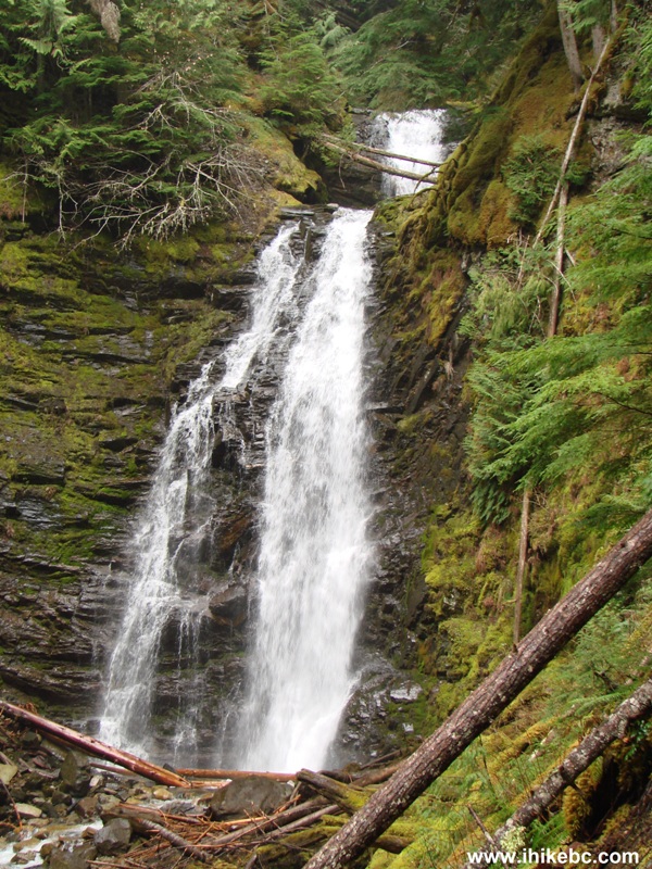
16. And, then, you can get right to the waterfall.
Here is our video of the waterfall:
More ihikebc videos are on
our YouTube Channel.
Picture of waterfall on Eaton Lake trail near Hope BC Canada
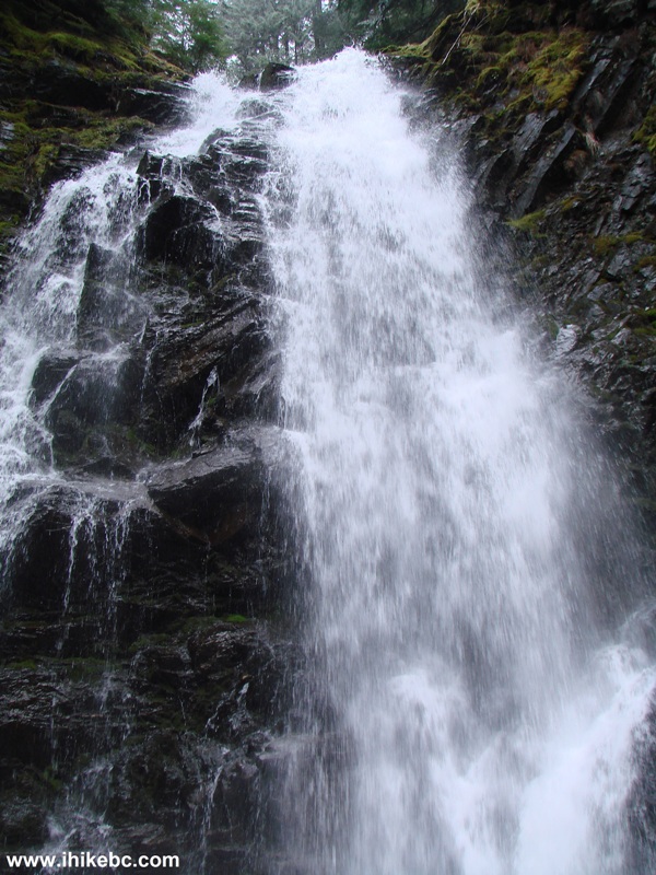
17. Time to move on. The fog was getting thicker the higher we climbed.
BC Hiking - Eaton Lake Trail near Hope British Columbia
18. And another waterfall, though not as big as the first one.
Hiking in BC - View from Eaton Lake Trail near the Town of Hope
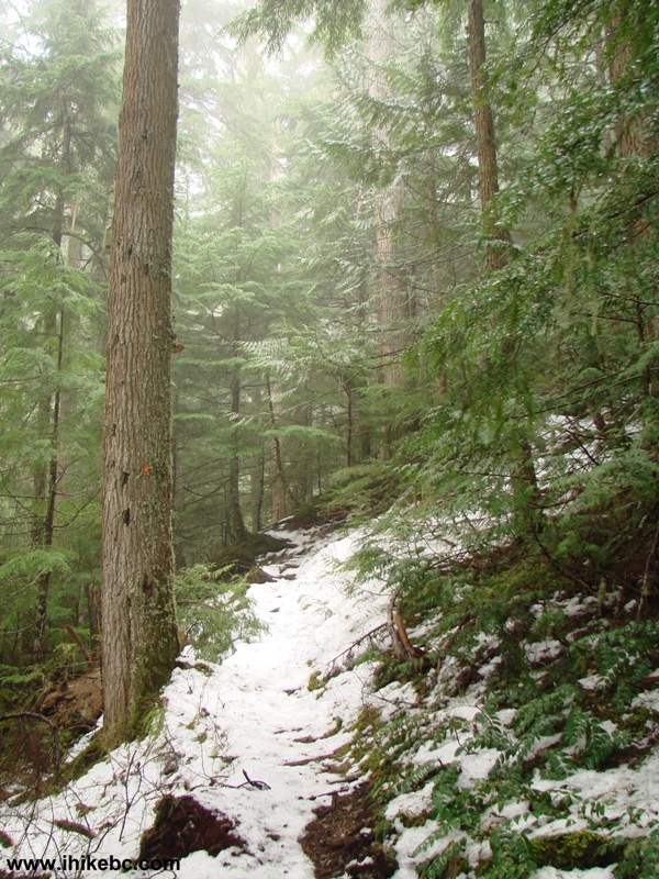
19. Just after the 2 km mark, the snow became a permanent presence on the ground. And we started hearing remote avalanches quite well.
Snow-covered Eaton Lake Trail - Hiking in Hope BC Area
20. An interesting tree (what's left of it).
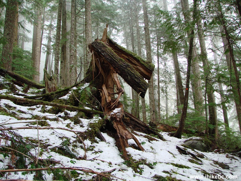
British Columbia Hiking - View from Eaton Lake Trail near Hope BC
21. Finally, a clearing. The snow was so deep at this point that proceeding any further would have been complicated, though we tried.
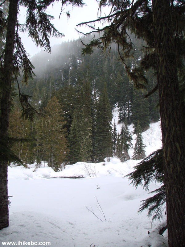
23. But it was still possible to enjoy a fine winter view.
Eaton Lake Trail is a good hike, and would likely be even better when the snow is gone. We finally made it to Eaton Lake in 2014 - here is our trip report.


|
 |
Other Trips in Hope BC Area:
|
|
|
|
|
|
|
|
|
|
|
|
|
|
|
|
|
|
|
 |
|
|
|
|


![]()
![]()
![]()
ihikebc.com Trip 018 - Eaton Lake Trail Hike (near Hope BC)