Trip 075 - September 24-25, 2014 (Wednesday-Thursday)
Squamish River FSR Washout
& Peaches & Crème Waterfall Visit
Distance From Vancouver to FSR: 85-90 km via Highway 1 West and
Highway 99 North (Sea-to-Sky). Then, as you are driving on Highway 99 through Squamish, turn left to
Squamish Valley Road and drive for
about 25-30 minutes until it ends, and Squamish River Forest Service Road
begins.
Liked: Peaches & Crème Waterfall, natural beauty in general.
Of note: This trip report highlights the danger of heading into the backcountry. Were it not for the fact that the washed out road was quickly repaired because active logging was occurring in the area and a logging truck was stuck too, we might have had to leave our vehicle behind and walk back to civilization.
Vancouver, Coast & Mountains Backroad Mapbook (2010 edition) Coordinates for the Beginning of the FSR: Page 22 (Squamish) A3.
Related Website: Sea-to-Sky District FSR Conditions.
Nearby FSR Trips: Squamish River Main, Squamish River Ashlu, Squamish River Ashlu Second Trip, Squamish River E-Main.
Other Forest Service Roads Trips: Chehalis (by Harrison Mills), Chilliwack Bench, Chilliwack Foley, Chilliwack Lake, Chuchinka-Colbourne (North of Prince George), Clear Creek (off Harrison East), Florence Lake (access to Stave Lake by Mission), Harrison East, Harrison East Second Trip, Harrison West, Jones Lake (near Hope), Lost Creek (by Mission), Mamquam River (by Squamish), Nahatlatch (near Boston Bar), Parsnip West (by Mackenzie), Scuzzy (by Boston Bar), Shovel Creek (off Harrison East), Sowaqua Creek (by Hope), Windfall Creek (by Tumbler Ridge).
>>> British Columbia Waterfalls Visits.
Follow @ihikebc Tweet
We have visited Squamish River Forest Service Road on many previous occasions, as this road leads to several interesting hikes, and is a very scenic drive by itself. For detailed instructions on how to get to Squamish River FSR, check out Squamish River FSR - Ashlu trip report. Unlike in years past, distance markers along Squamish River FSR are no longer in miles from Squamish, but in kilometers from the beginning of the FSR, which is very convenient. This time, we went to do some hiking far along the Squamish River S-Main (no trip report for that), and also visited Peaches & Crème Waterfall. And, on the way back, things got more interesting than anticipated.
1. We start with this photo of a sign which wasn't here a few years ago. It appears, a native band now runs a fishery on Squamish River, and wishes to keep visitors from overnight camping in this area. The sign is located 8.2 kilometers after the beginning of Squamish River FSR, and warns that private property extends to mile 27, which would be kilometer 43. There are numerous mobile homes (which weren't there several years ago) further along the road for a few kilometers, and then just nature. We did not stop to check if someone was living in those houses, but did not see any fishing going on either. This could be a seasonal thing, though can't tell for sure...
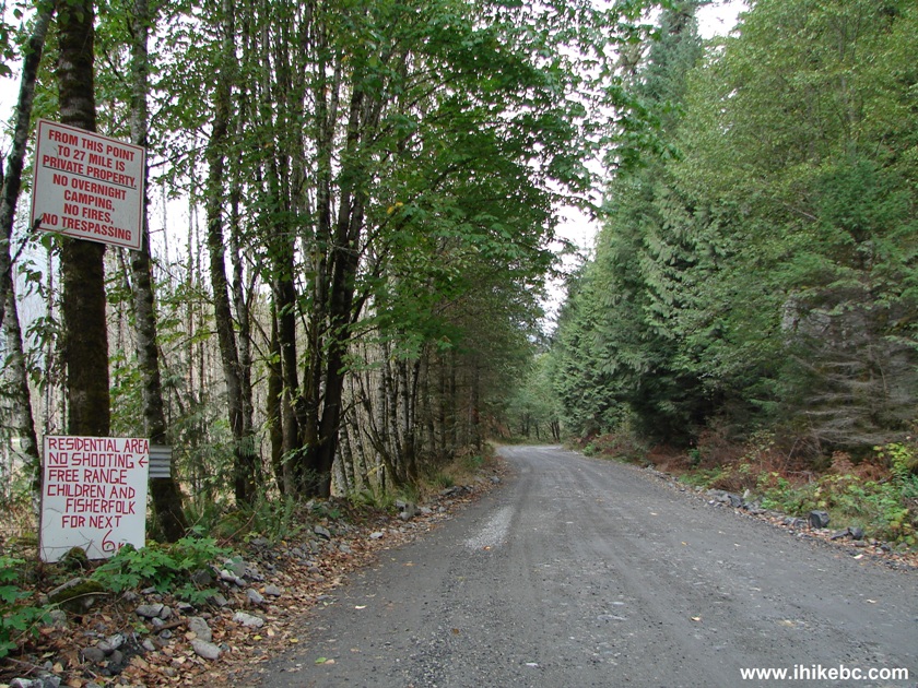
Squamish River FSR BC Canada
2. The way to Peaches & Crème Waterfall is as follows: zero your odometer at the beginning of Squamish River FSR. At the 27.9 km mark, turn left onto E-Main. Then, 9.8 km later (37.7 km mark), turn left onto G-Main. Here we are on E-Main, with a turnoff to G-Main appearing on the left side.
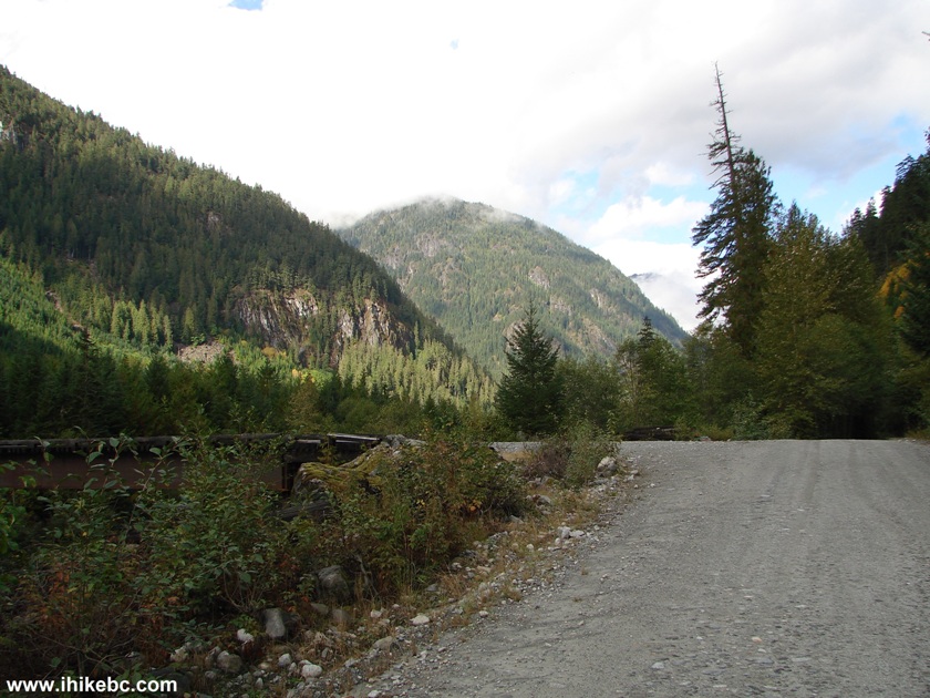
Squamish River FSR E-Main at G-Man BC Canada
3. Just a few meters later, we turned left and are now looking at the beginning of G-Main, which starts with a bridge across Elaho River. 1.9 kilometers later there would be a turnoff to Peaches And Crème Waterfall.
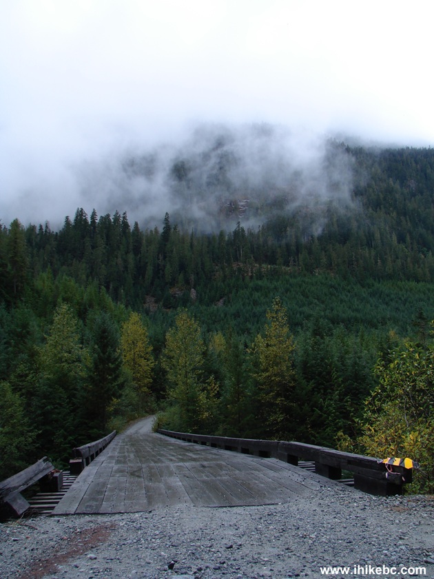
Bridge Across Elaho River British Columbia Canada
4. The view of Elaho River from the G-Main bridge.
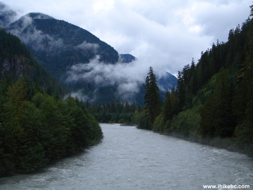
Elaho River Seen From G-Main Bridge BC Canada
5. Drive for 1.9 kilometers after turning onto G-Main. The photo below shows a spot where you would leave your vehicle (as there is not much space on the side road to turn around) and walk for one minute to reach the waterfall. We drove on G-Main three years ago, and had no idea that the waterfall was so close. The reason why you don't hear the waterfall is because Peach Creek, which crosses G-Main at this point, is so loud that it drowns (ahem) the noise from the waterfall. It's easy to find this turnoff point because the road all of a sudden becomes much wider and, besides, this creek is quite noisy, so it's impossible to miss. In the photo below, you see the sudden widening of G-Main, which then narrows to its usual width and continues on the right side of the photo. Peach Creek flows under the road where the closest trees are seen straight ahead. But, you would turn left exactly at the spot where we are standing. Don't cross the creek before turning left - there is another short road there which leads to a camping spot, but not to the waterfall.
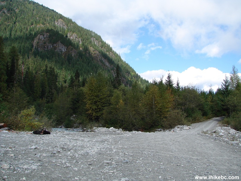
Photo of Squamish River FSR G-Main BC Canada
6. And this is just to the left of the photo above - a short road to the waterfall.
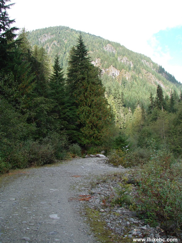
The road to Peaches & Crème Waterfall near
Squamish British Columbia Canada
7. Within a minute, you see this small staircase.
8. Once you climb up, the waterfall is right in front of you.
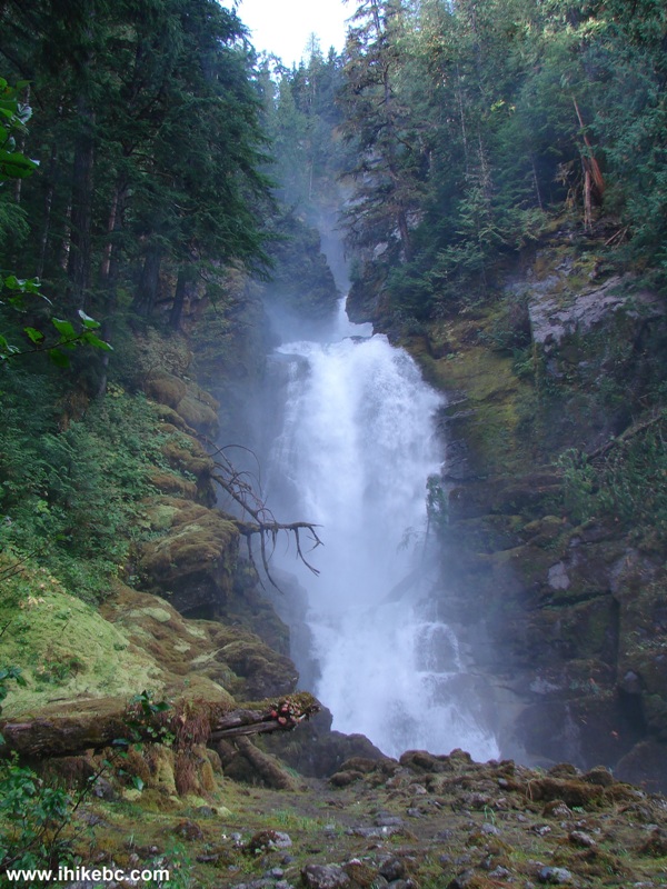
Peaches & Crème Falls BC Canada
9. Now we are looking to the right, where the waterfall turns into Peach Creek, which we did not cross. By the way, there isn't much to see along G-Main further down the road, though it's in a fairly decent shape for another 12 kilometers or so.
Here is our video of Peaches & Crème Falls:
10. Here we are driving back on G-Main towards E-Main, and this is the same bridge as seen in photo #3, except we are now looking from the other side. Plus, the sun is out.
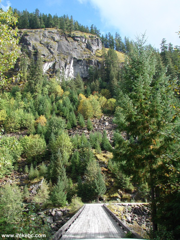
G-Main Bridge Across Elaho River British Columbia Canada
11. Another look at Elaho River from the bridge.
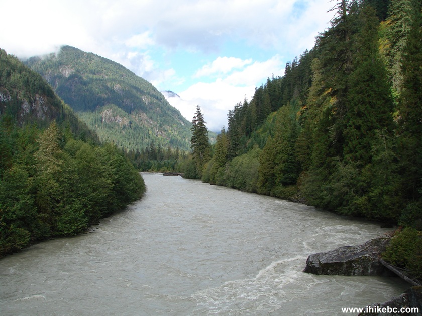
Elaho River British Columbia Canada
12. Then, we went hiking on S-Main, and found something which we will explore another time. A rain storm arrived at night, when we were camping on the side of the road. Perhaps, it's better to drive back to civilization, we thought, just in case. But the love for the outdoors prevailed, we stayed put, and the result the next day was as follows: we are driving back on Squamish River S-Main FSR, and, between kilometers 22 and 21, see a logging truck parked on the side of the road.
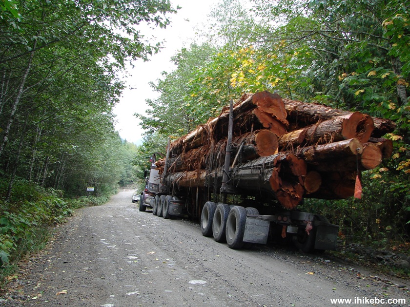
Photo of Logging Truck Squamish River Forest Service Road BC Canada
13. Just a bit further, this sign.
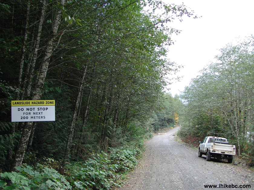
Landslide Hazard Zone Sign Squamish River FSR
14. And then...
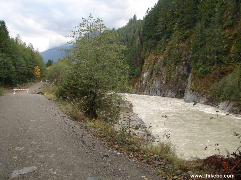
Squamish River and Squamish River Forest Service Road British Columbia
Canada
15. Yeah, the road's closed. More camping awaits!
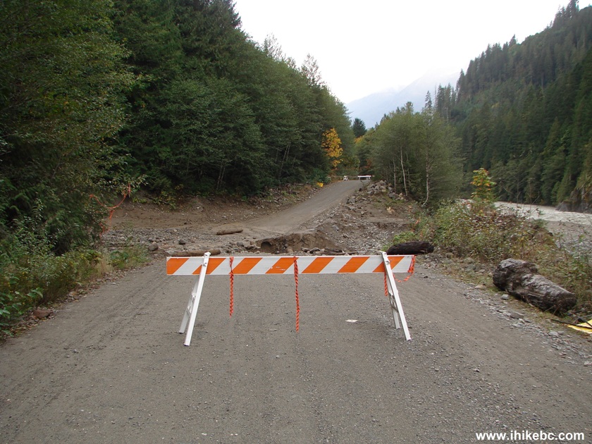
Blocked Squamish River FSR BC Canada
16. A logging worker later told us that the road was washed away at 3 AM - he was tasked with monitoring this part of the Squamish River FSR, because this is a problem area every time it rains.
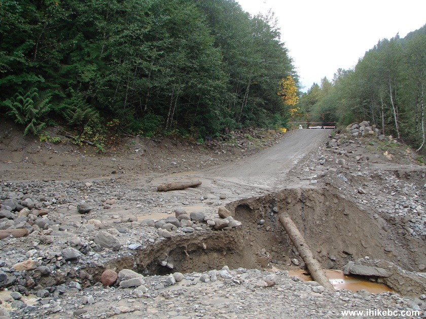
Photo of washout on Squamish River Forest Service Road
17. The force of nature on display.
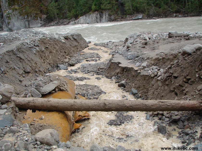
Squamish River FSR Washout BC Canada
18. Looking the other way. This is where the debris came from.
19. Looking from the other side of the closed Squamish River FSR.
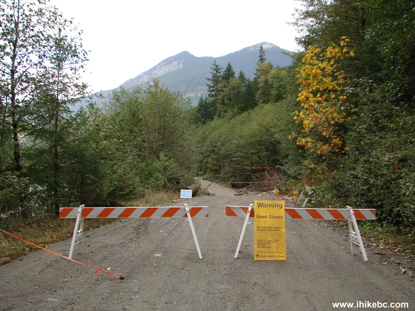
Blocked Squamish River FSR Due to a Washout
20. One more look at the washed-out road.
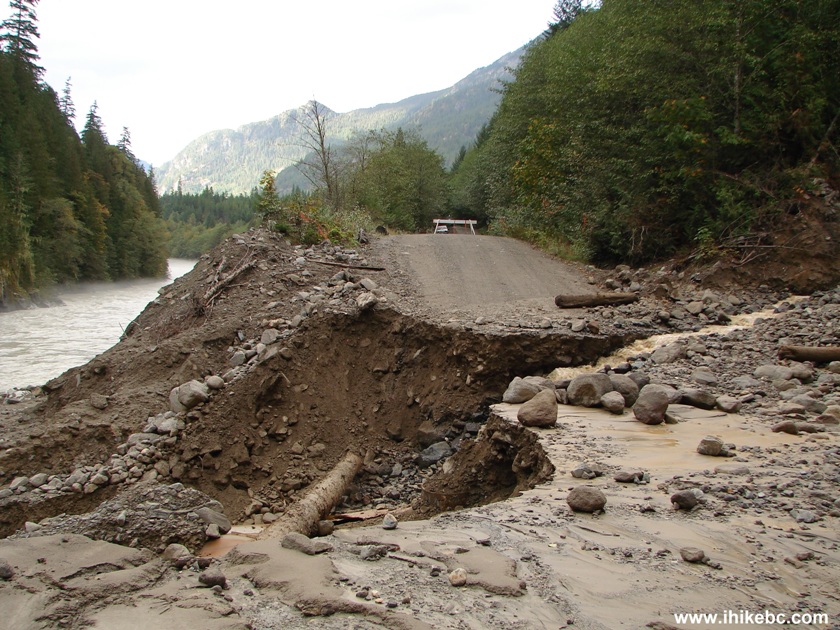
Squamish River FSR Washout British Columbia Canada
Here is our video of the washout:
More ihikebc videos are on our YouTube Channel.
21. As it was already September, and a weekday to boot, there was just one other camping party in the entire Squamish River FSR wilderness area - three men in two cars. They were somewhat prepared to unexpectedly extend their camping in the bush, though were a bit short on food. A group of kayakers arrived to check out the washout, as they planned on driving further before going down the river. One of them crossed the washout and asked if we wanted a ride to Squamish, or some food, perhaps. We declined both but did give him a note with our work phone number, asking that he call and tell them we might be late for our shift a few days from now. He then left. About half an hour later, a forestry worker, the same one who was watching this spot and observed the washout, came to say hello and also offered a ride to Squamish. We again declined and asked when the road was going to be repaired. He said tomorrow. And tomorrow it was. Two excavators arrived and began fixing the road.
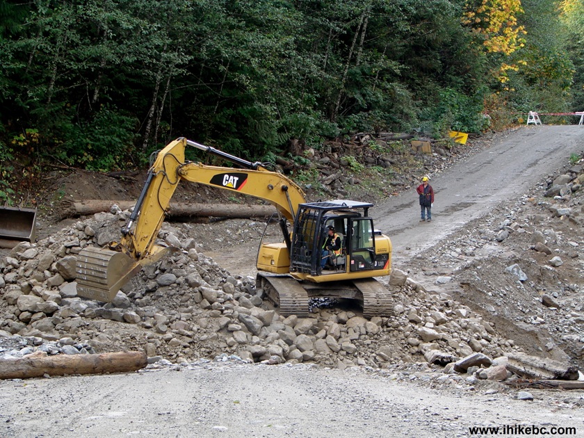
Excavator Repairing Squamish River Forest Service Road Washout BC Canada
22. Were it not for the fact that a logging operation was occurring in this area, chances are that there would have been no road repair for months, if ever. Keeping that in mind, take lots of food and water when heading into the wilderness, and be prepared to walk for many hours to get back to civilization, if something like this happens to you.
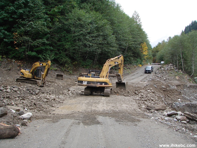
Excavators Fixing Squamish River FSR Washout BC Canada
23. Finally, the road is fixed, and we are moving again.
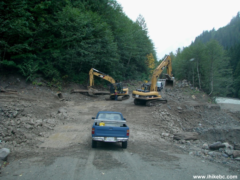
Squamish River FSR BC Canada After Being Repaired
24. On the way back to Vancouver, observed the sunset from Porteau Cove Provincial Park.
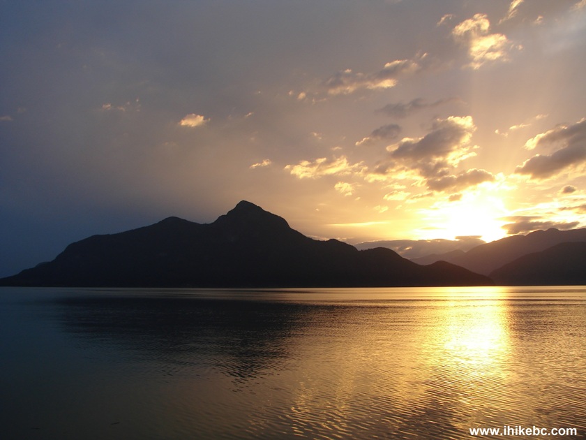
Sunset at Porteau Cove Provincial Park BC Canada
Quite a memorable trip it was. Squamish River FSR with
all of its side roads remains one of the best wilderness experiences
within a short driving distance from Vancouver.
|
 |
Other Trips in Squamish Area:
|
|
||
Follow @ihikebc Tweet
ihikebc.com Trip 075 - Squamish River FSR Washout


