![]()
![]()
![]()

Trip 041 - June 6-7, 2011 (Monday-Tuesday)
Chehalis FSR (+ Skwellepil Creek Campground)
Between Harrison Mills and Agassiz off BC Highway 7
Page 2 of 2
Distance From Vancouver:
100-120 km to
the beginning of the FSR
either via Highway 1 East, then via Highway 11 North and 7
East. Or via Highway 7 East (Broadway, turning into Lougheed Highway in Burnaby) directly from Vancouver. The FSR
itself ends shortly after the 31 km mark in a small washout and then a massive
rockslide.
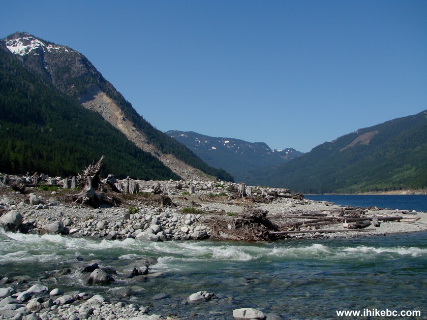
Liked: Natural views (especially great views of Chehalis Lake), peacefulness, fairly good gravel road with few potholes.
Of note: Chehalis FSR is suitable for 4x4 or high clearance 4x2 vehicles only, remote wilderness area, no cell phone signal, active logging area with frequent logging truck traffic. Chehalis FSR ends shortly after the 31st kilometer in a small washout followed shortly by an enormous rockslide.
Vancouver, Coast & Mountains Backroad Mapbook (2010 edition) Coordinates for the Beginning of the FSR: Page 4 (Chilliwack) C2.
Other Forest Service Roads Trips: Chilliwack Bench, Chilliwack Foley, Chilliwack Lake, Chuchinka-Colbourne (North of Prince George), Clear Creek (off Harrison East), Florence Lake (access to Stave Lake by Mission), Harrison East, Harrison East Second Trip, Harrison West, Jones Lake (near Hope), Lost Creek (by Mission), Mamquam River (by Squamish), Nahatlatch (near Boston Bar), Parsnip West (by Mackenzie), Scuzzy (by Boston Bar), Shovel Creek (off Harrison East), Sowaqua Creek (by Hope), Squamish River Main, Squamish River Ashlu, Squamish River E-Main, Squamish River FSR Washout, Windfall Creek (by Tumbler Ridge).
Follow @ihikebc Tweet
December of 2011 WARNING: The Provincial Government warns of a risk of a further landslide and resulting tsunami at Chehalis Lake. Reconsider your visit to the slide (starts at km 31 of Chehalis FSR and described in this trip report) and your use of any campsites by Chehalis Lake, including Skwellepil Campground described in this trip report.
21. We ended Page 1 of this trip report when we reached Skwellepil Creek Campground. It is located between km 30 and 31 of Chehalis Forest Service Road. Here is the close-up of the sign located on Chehalis FSR at the entrance to the campground.
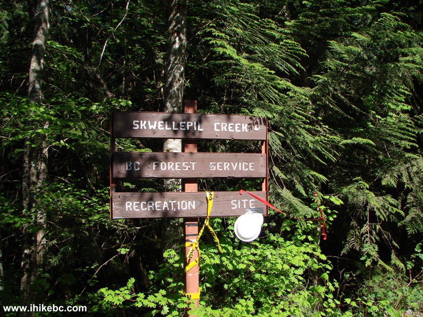
Skwellepil Creek BC Forest Service Recreation Site Sign - Chehalis FSR
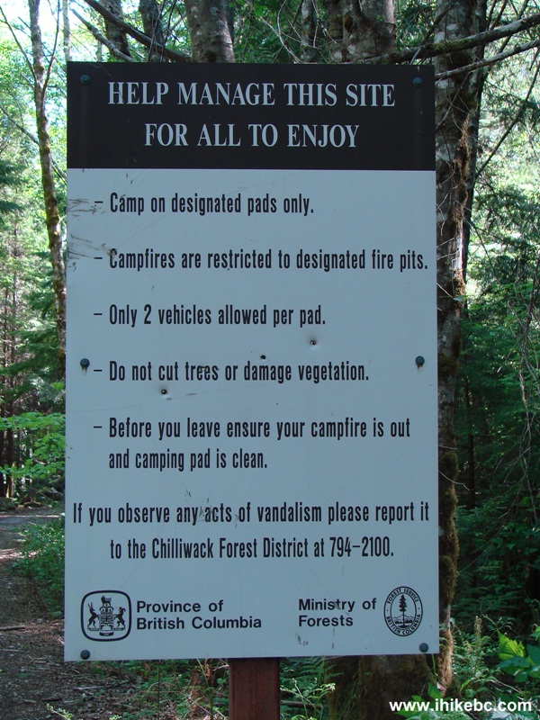
22. Another sign at the entrance.
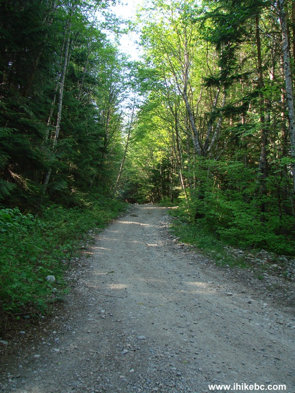
23. Once you turn to your right towards the campground, there is an open gate, followed by a gravel road heading down. Do not proceed, unless you have a 4x4, as the hill has loose surface further down, and a 4x2 may not be able to drive out.
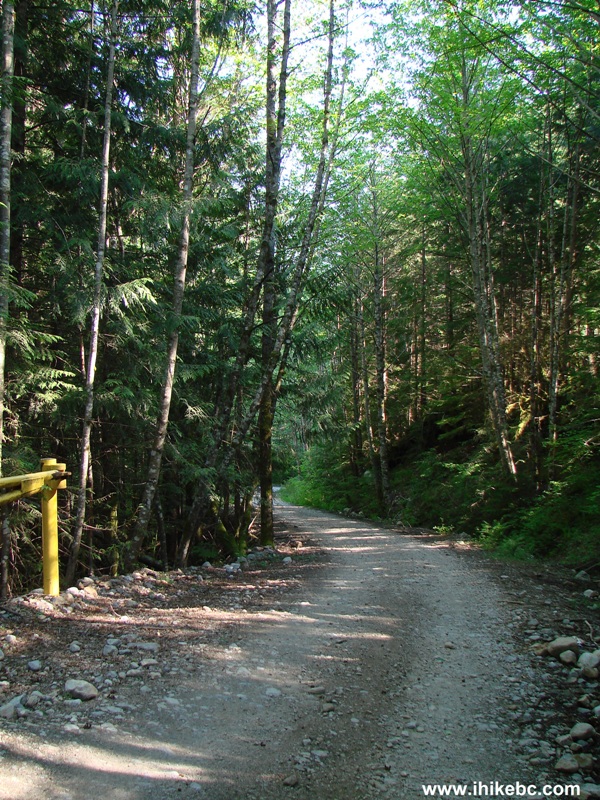
Road to Skwellepil Creek BC Forest Service Recreation Site
24. Here is this hill looking up. It sure does not look steep, but the ground is quite loose for about 20-30 meters at some point, and it was quite obvious how hard some vehicles were working to make it up the hill.
25. On this Monday, the campground was absolutely empty. It is probably not too popular, considering how far it is, and that it takes a fairly dangerous logging road to get here. Plus, there is little to do in this area but to relax and watch the beautiful lake. Not sure about the fishing opportunities. And there did not appear to be much of a beach. There are about 20 level sites, though some of them are full of garbage. Camping is free. There did not appear to be any maintenance going on. It is a BC Forest Service site, not a provincial campground. There are no signs at all either at the beginning or along Chehalis FSR pointing to this place. Here is one of the camping spots.
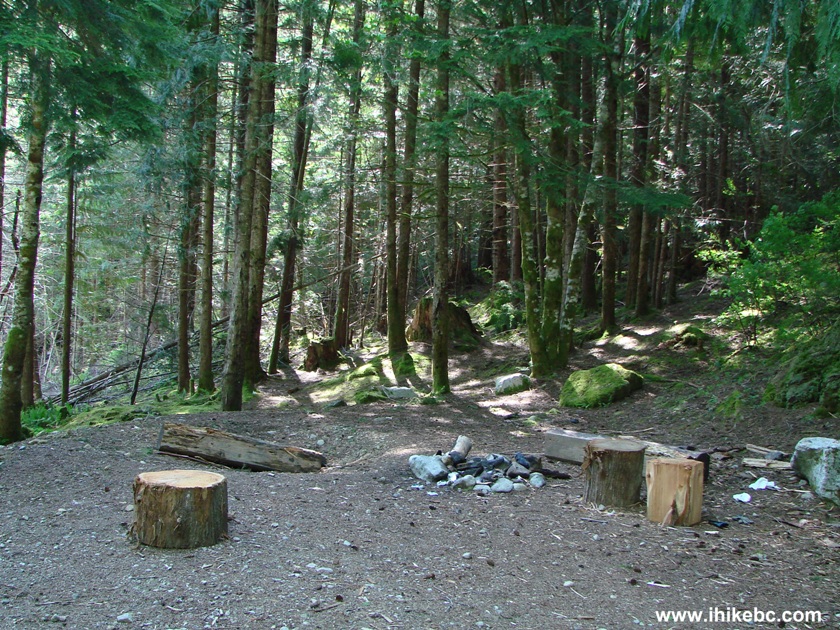
Skwellepil Creek Campground Chehalis FSR
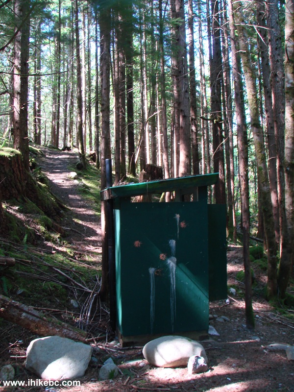
26. There are three pit toilets at the campground. This one is the closest to the entrance (note the paintball marks), and it featured obscene drawings and language. Be careful, if you come here with children.
26. A site you may want to avoid.
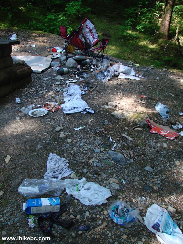
Photo of Garbage at Skwellepil Creek Campground
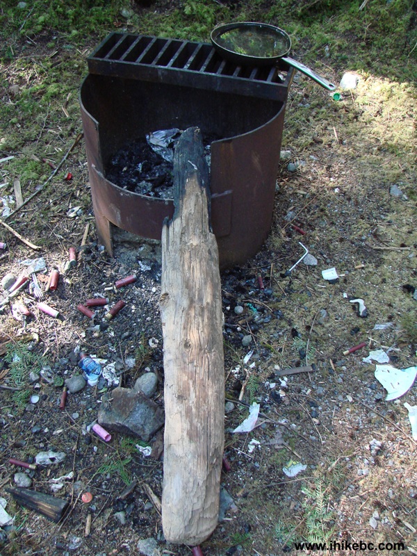
27. Are you looking for your frying pan? It is waiting at the Skwellepil Creek Campground.
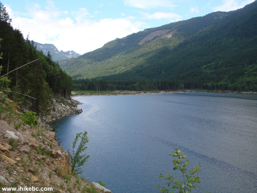
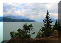
28. The sites are located in the forested area, but the beach is just a short road away, and from there the views of Chehalis Lake and the surrounding mountains are quite good.
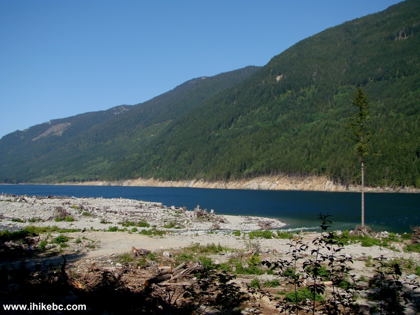
Chehalis Lake Seen From Skwellepil Creek Campground Chehalis FSR
Here is our video of Chehalis Lake from this spot:
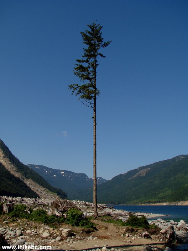
29. A tree on the beach.
30. The rockslide you see behind the greenery on the left side is where we would spend several hours tomorrow looking (in vain) to find the disappeared continuation of Chehalis FSR.
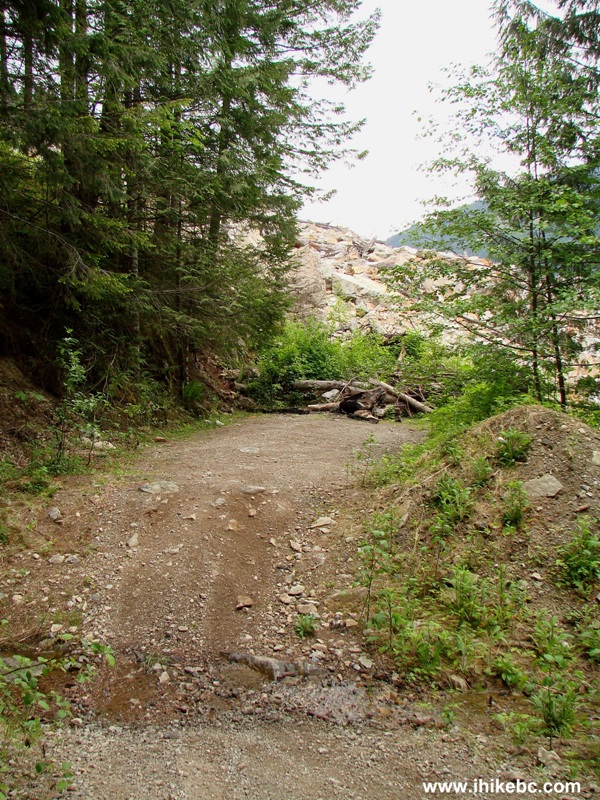
31. Having visited Skwellepil Creek Campground, we spent a peaceful night parked on the side of Chehalis FSR, and, in the morning, started walking further, in hopes of finding Statlu Lake hiking trail. Remember "deactivated due to washout" sign seen in photo #4? Here is this washout soon after km 31, which would definitely prevent just about any vehicle from moving forward.
Chehalis FSR Washout on Km 31
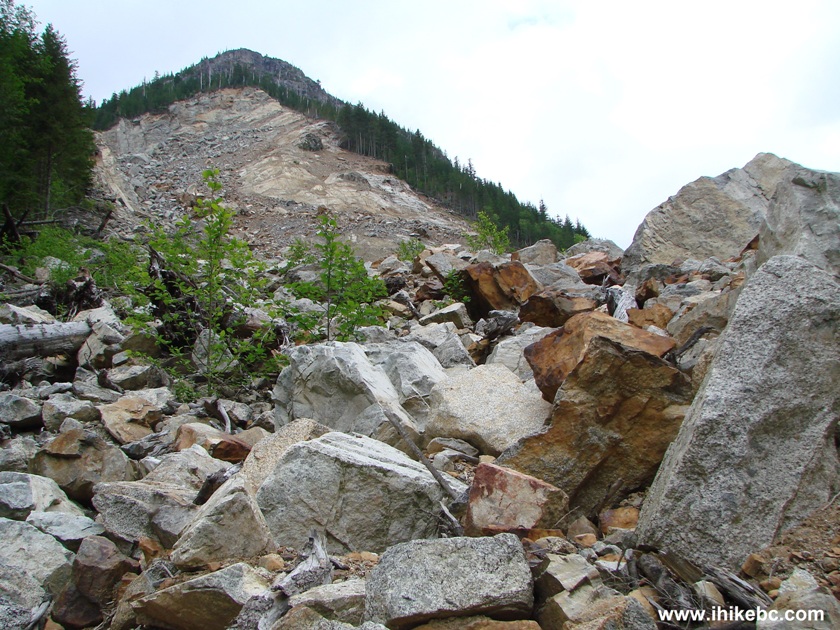
32. Walked for another 15 minutes, and ran into an enormous rockslide, which wiped out the forest service road. This rockslide happened in December of 2007, as reported by various Internet sites. We decided to cross the rockslide and find the FSR on the other side. We couldn't find it...and here is the deal. If you decide to visit the rockslide, be warned that this is a very dangerous area. We had proper footwear and hiking poles, yet went flying several times. The biggest danger is that the rocks appear to be sturdy, and almost all of them are. But some are not, so when we stepped on a loose stone on our way down, the left foot went forward, we turned around 180 degrees, and started falling downhill onto the rocks back first. We had a backpack on, and were in midair long enough to say a short prayer, before landing on our back. Thank God, this incident did not cause any injuries. But, it could have been bad.
Chehalis FSR just before the rockslide - British Columbia Canada
33. This photo does not do justice to how large the rockslide is. It took about 30 minutes to cross it.
Chehalis Lake Rockslide
Here is our video from the rockslide:
More ihikebc videos are on our YouTube Channel.
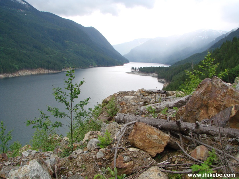
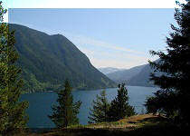
34. While crossing the rockslide, we observed Chehalis Lake, including the Skwellepil Creek Campground "beach" (a piece of land sticking out into the lake in the upper-middle right of the photo) from where photos 28 through 30 were taken the day before.
Chehalis Lake seen from Rockslide
35. We crossed the rockslide and found a deep forest on the other end. It figures there should have been an obvious continuation of Chehalis FSR, as there is no way for the forest to deeply cover a substantial road in just a few years. Yet, we could not find it. We then went down the rocks, hoping to find a path closer to the lake, but to no avail. You see how steep it is there.
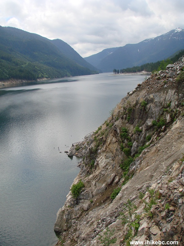
Chehalis Lake Province of BC Canada
36. At least, observed the other end of Chehalis Lake. But, it's very steep in the other direction too.
Chehalis Lake Picture
It's been a very interesting two days, and, thank God, we came away from that rockslide alive and well. However, if all you want is to drive a picturesque forest service road, and you do not mind numerous potholes, try Squamish River FSR before Chehalis. Of course, it is on the other end of Metro Vancouver, and that could be a factor. If you do decide to visit Chehalis FSR, watch out for logging trucks, and definitely don't go to the rockslide unless properly equipped, alert, and with a company.


|
 |
Other Trips in Harrison Hot Springs Area:
|
|
|
|
|
|
|
|
|
|
|
|


![]()
![]()
![]()
ihikebc.com Trip 041 - Chehalis Forest Service Road Visit (Off BC Highway 7) Page 2 of 2