![]()
![]()
![]()

Trip 118 - September 7, 2016 (Wednesday)
Prince Rupert BC Visit
Page 2 of 2
Prince Rupert Location: Near the Western end of BC Highway 16.
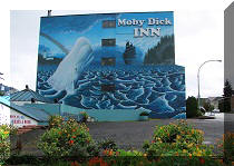
Liked: Numerous excellent wall art pieces, a variety of tasteful building colours, Cow Bay, lots of free parking, whale tail-shaped benches, the feel of a town with its own identity.
Of note: City of Prince Rupert is subject to a tsunami after an earthquake - head to a higher ground.
Northern BC Backroad Mapbook (3rd edition) Prince Rupert Coordinates: Page 16 (Prince Rupert) E3.
Related Websites: Tourism Prince Rupert, City of Prince Rupert (Wiki).
Other BC Cities, Towns and Locations We Have Visited: Agassiz, Bella Coola, Bralorne, Chilliwack, Fort Nelson, Gibsons, Gold Bridge, Harrison Hot Springs, Hope, Horseshoe Bay, Merritt, Mission, Nanaimo
(Old City Square), Port Alberni, Prince Rupert, Smithers, Squamish, Telkwa, Tofino, Tumbler Ridge, Vancouver (Seawall), Vancouver (Stanley Park), West Vancouver (Ambleside Park).
30. Cow Bay promenade is located a few hundred meters from the courthouse.
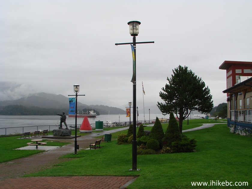
Cow Bay Promenade Prince Rupert BC Canada
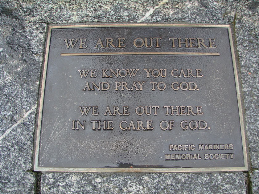
31. It has a statue dedicated to sailors lost at sea.
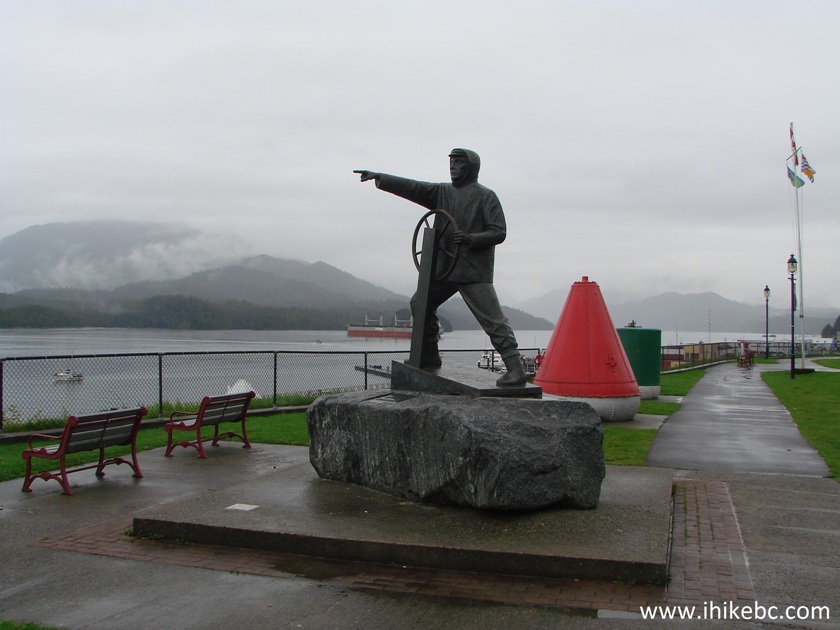
Sailor statue Prince Rupert British Columbia
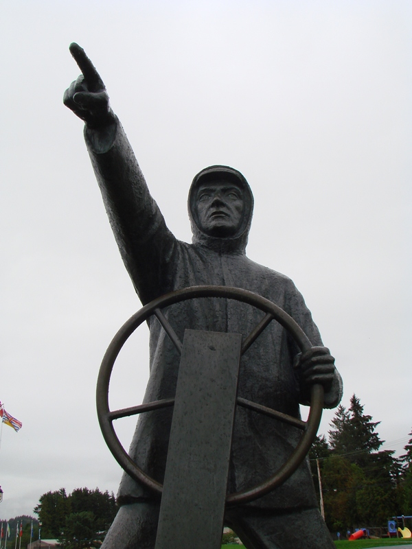
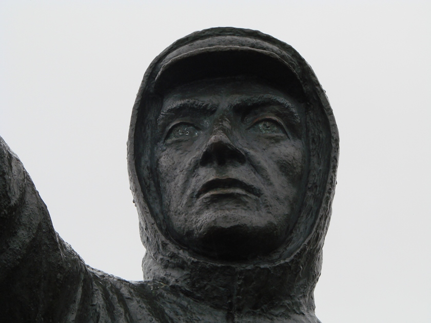
32. A very solemn statue indeed.
33...
34...
35. A good view of Cow Bay from the promenade. A beige-coloured building at the far end of the street below is part of a Waterfront Market, which contains a Visitor Information Centre and a souvenir shop, among other things.
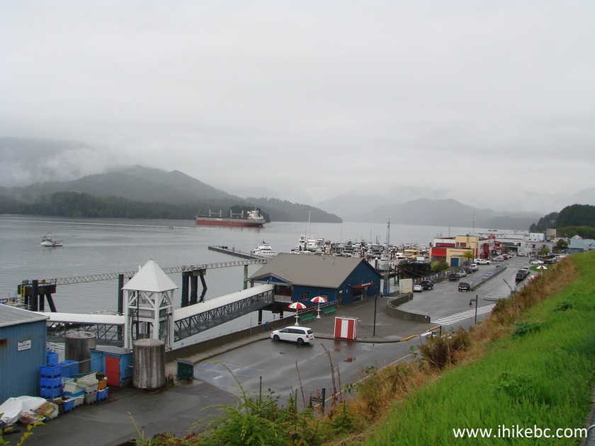
Cow Bay Prince Rupert British Columbia Canada
36. Kazu Maru memorial can be found slightly to the right of where we stood when taking the photo above. Kazu Maru is a name of a small Japanese fishing vessel, which its owner took to the open sea and disappeared. The ship emerged many months later in British Columbia's waters without its owner, and now it stands inside a Japanese-style building in memory of the captain.
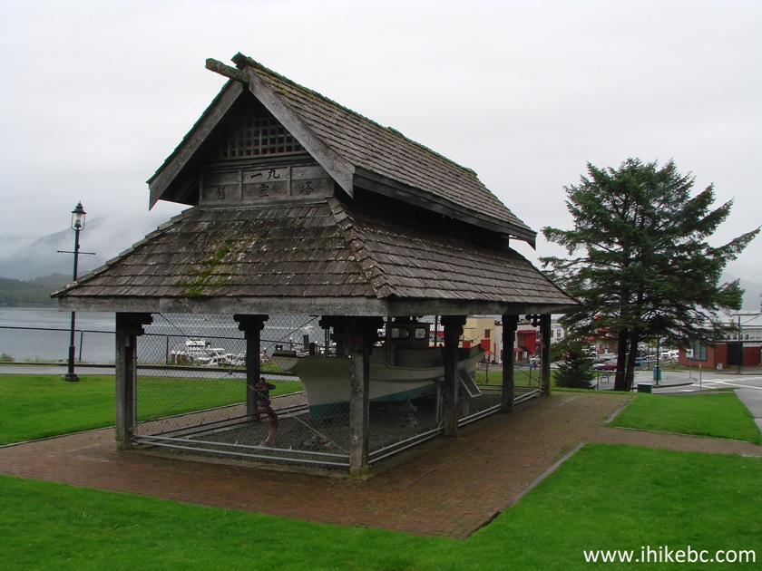
Kazu Maru Memorial Prince Rupert BC Canada
37. While enjoying Cow Bay, be aware of the need to run to a higher ground should there be an earthquake, lest you be subjected to a tsunami.
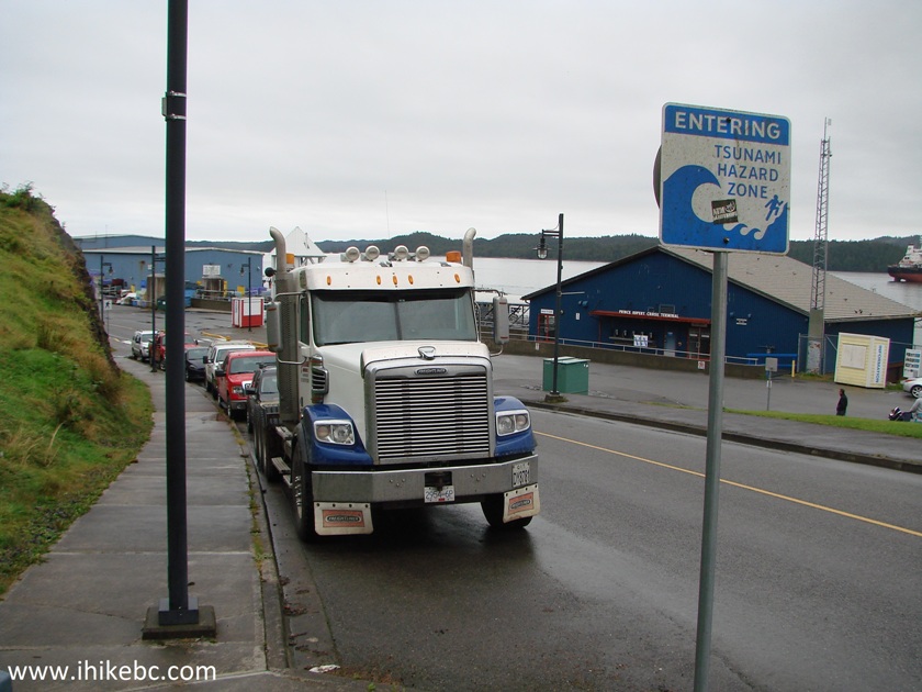
Tsunami Hazard Zone city of Prince Rupert BC
38. Just before the beige buildings seen in photo #35, there is a fence with several photos, and there are also two maps: a map of a waterfront walking tour...
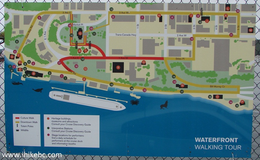
Prince Rupert BC map of waterfront walking tour
39...and a map of a city walking tour.
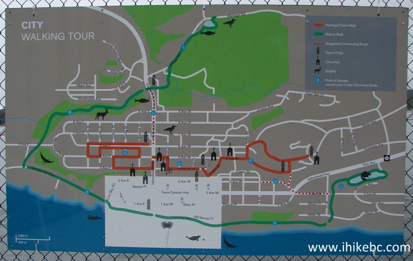
Prince Rupert BC map of city walking tour
40. We are getting closer to the Waterfront Market.
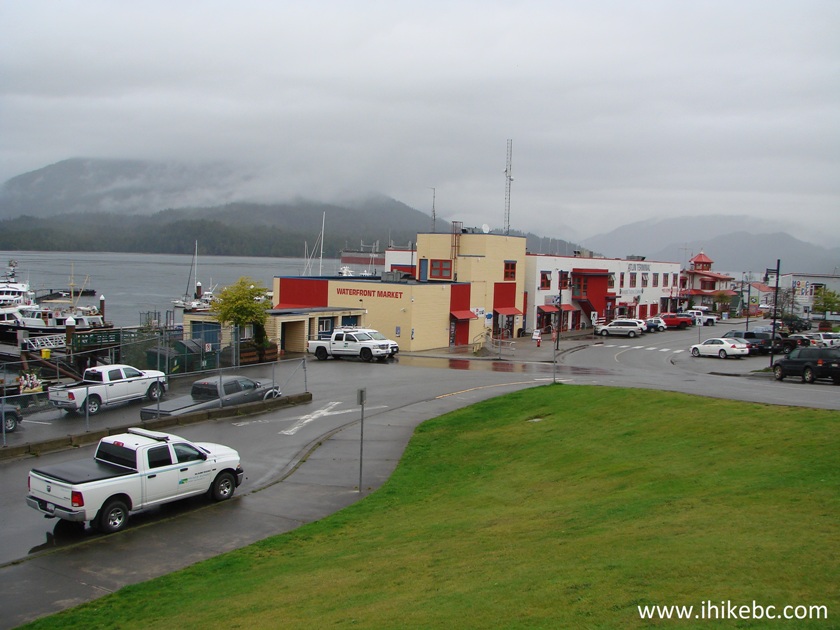
Prince Rupert British Columbia Canada
41. Here it is.
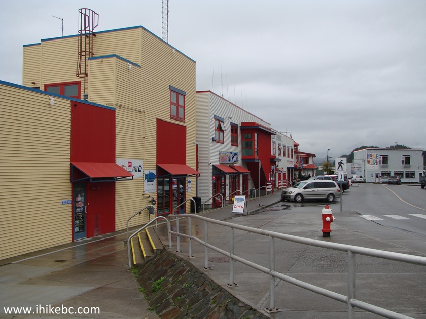
Waterfront Market Prince Rupert BC Canada
42. A bit of history displayed on the wall - there used to be a halibut exchange here, with large amounts of halibut being shipped from Prince Rupert to various markets across North America.
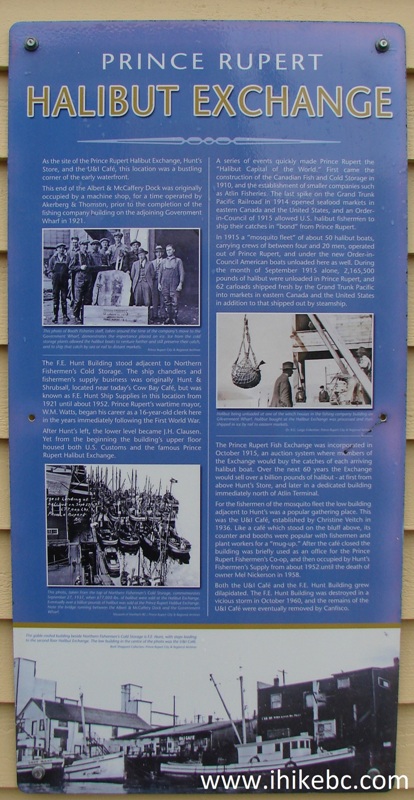
Prince Rupert Halibut Exchange Info Board
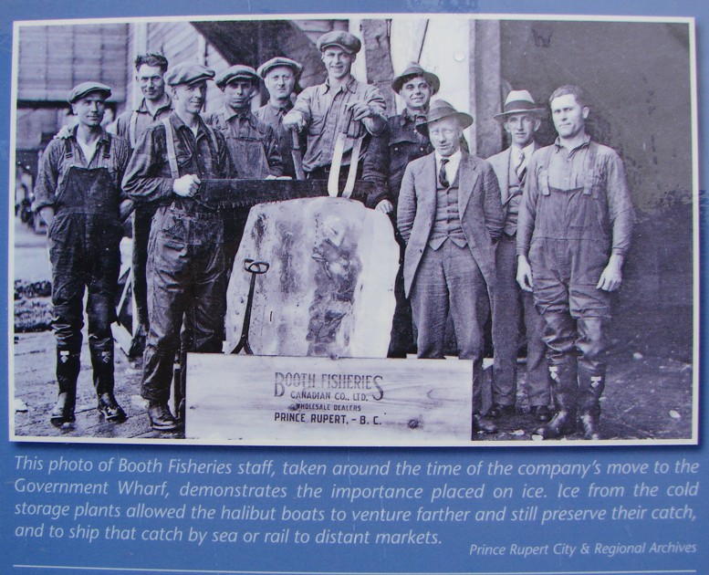
43. The participants of the halibut exchange.
44. We are walking on the other side of the Waterfront Market.
Waterfront Market Prince Rupert British Columbia
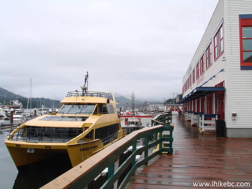
45. The Inside Passage ship.
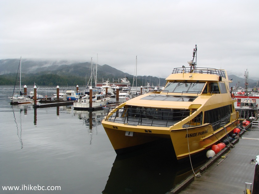
Inside Passage Ship docked in Prince Rupert BC
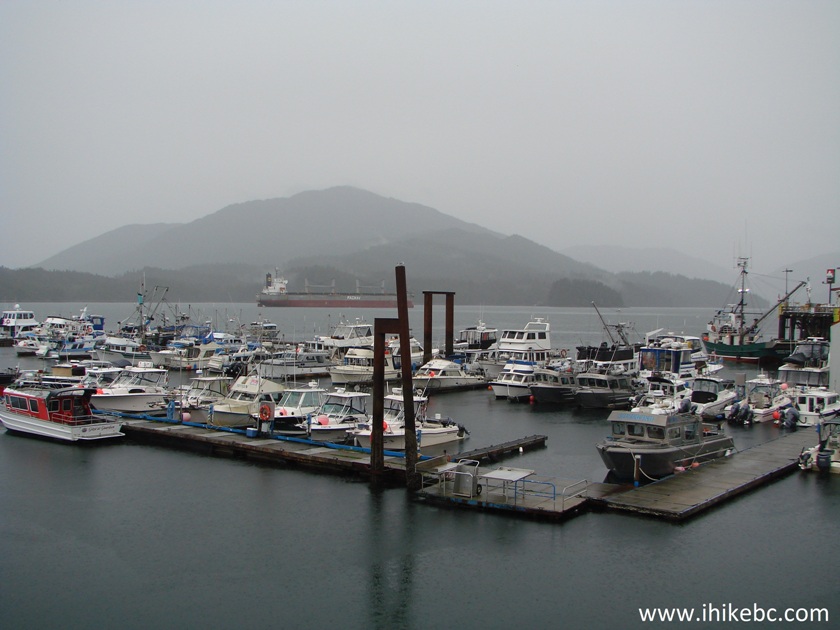
46. View of Cow Bay marina. So named after a Swiss entrepreneur unloaded cows for his farm.
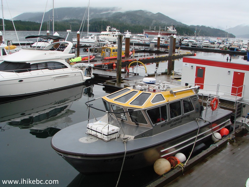
Cow Bay Marina - Prince Rupert British Columbia Canada
47. A cow head and a British-style telephone booth.
Prince Rupert BC
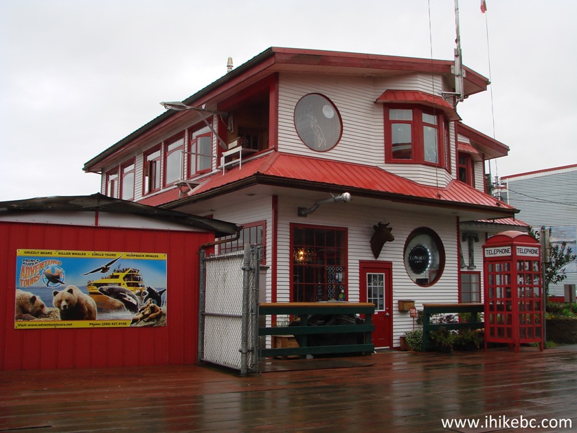
48. Eagle Bluff B&B at the end of the Waterfront Market.
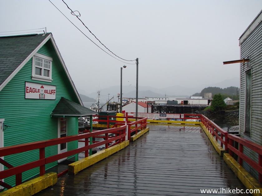
Eagle Bluff B&B in Prince Rupert BC Canada
49. A view of Cow Bay marina past Eagle Bluff B&B.
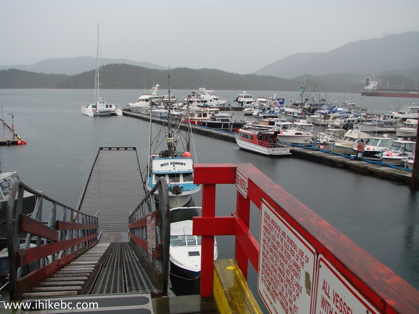
Cow Bay Marina Prince Rupert BC Canada
50. One more.
Cow Bay Marina Prince Rupert British Columbia
51. So, yeah, those cows...
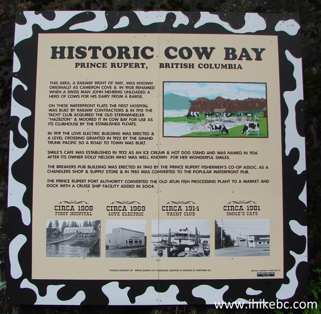
Cow Bay Information Board
52. Very stylish Smiles Cafe. So named after a smiling past owner.
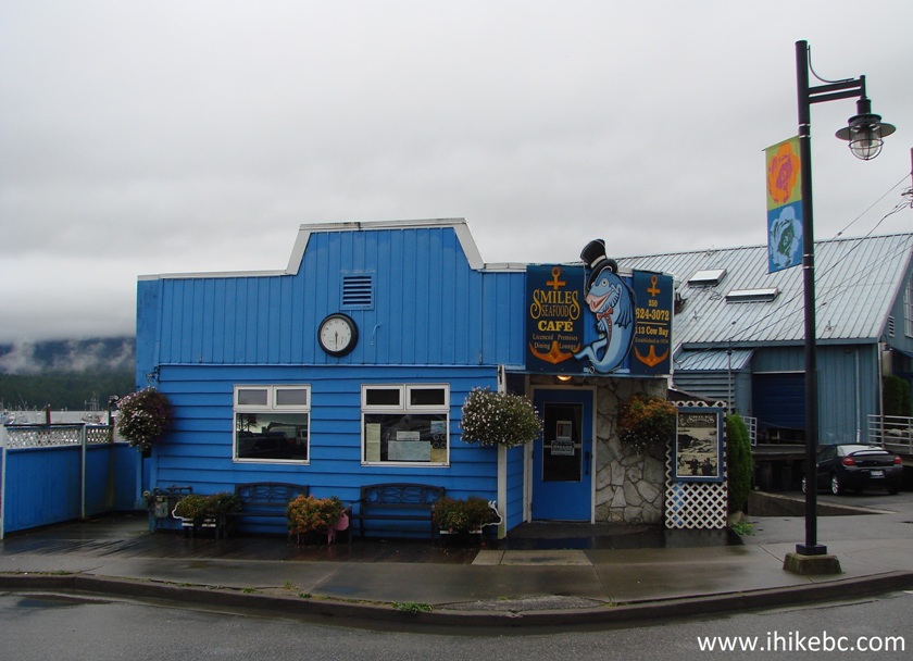
Smiles Cafe Prince Rupert BC Canada
53. Definitely a Prince Rupert thing - a bench in the shape of a whale tail.
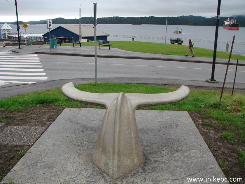
Whale tail bench Prince Rupert BC
If you are ever in the area, Prince Rupert has a lot to show to a traveler with a few hours to spare.
|
|


|
 |
![]()
![]()
![]()
ihikebc.com Trip 118 - Prince Rupert BC Visit Page 2 of 2