![]()
![]()
![]()

Trip 217 - June 21, 2021 (Monday)
Florence Lake FSR Visit
(to Stave Lake boat launch and beyond)
Near Mission BC
Page 2 of 2
Liked: Stave Lake and Alouette Lake views, fairly decent road conditions to 20.3 km, access to Stave Lake boat launch and several campgrounds, an unregulated camping spot by Stave Lake, very few bugs.
Of Note: Florence Lake
FSR is very popular up to the point of entry to the last recreation site at 12.8 km, logging trucks are present, dust from passing vehicles, the road past 20.3 km is very rough – 4WD high-clearance vehicles only. Alouette Lake views from the FSR past 20.3 km are getting overgrown. Noise from boats on Stave Lake while hiking to BC Hydro facility.Vancouver, Coast & Mountains Backroad Mapbook (5th edition) FSR Coordinates: Page 3 (Abbotsford) C2-D1, Page 13 (Stave Lake) D7-D6.
Other Forest Service Roads Trips: Chilliwack Bench, Chilliwack Foley, Chilliwack Lake, Chuchinka-Colbourne (North of Prince George), Clear Creek (off Harrison East), Harrison East, Harrison East Second Trip, Harrison West, Jones Lake (near Hope), Lost Creek (by Mission), Mamquam River (by Squamish), Nahatlatch (near Boston Bar), Parsnip West (by Mackenzie), Scuzzy (by Boston Bar), Shovel Creek (off Harrison East), Sowaqua Creek (by Hope), Squamish River Main, Squamish River Ashlu, Squamish River E-Main, Squamish River FSR Washout, Windfall Creek (by Tumbler Ridge).
36. At the 20.3 km split, we first took the 1.8 km-long road to the right, which leads to a BC Hydro facility and a very good Stave Lake view. The road has two gates within the first several hundred meters, so we used a bicycle to cycle down to the lake, and then hiked on the way up. Here is one of the gates.
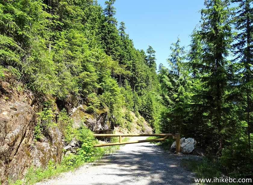
Gated side road off Florence Lake FSR
37. The road at 290 meters.
Road to BC Hydro Facility at Stave Lake
38. There are several switchbacks there, this being one of them.
39. Approaching the end of the road.
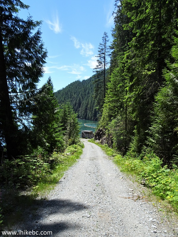
40. Here we are, 1.8 km from the 20.3 km split. Coordinates:
N 49⁰22.281' W 122⁰18.776'. Elevation: 107 meters.
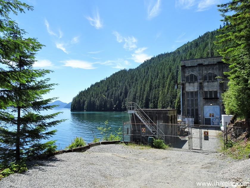
BC Hydro Facility at Stave Lake
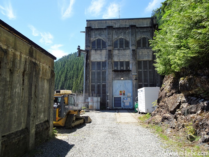
41. A cool old BC Hydro facility next to Stave Lake.
Old BC Hydro Facility at Stave Lake near Mission BC
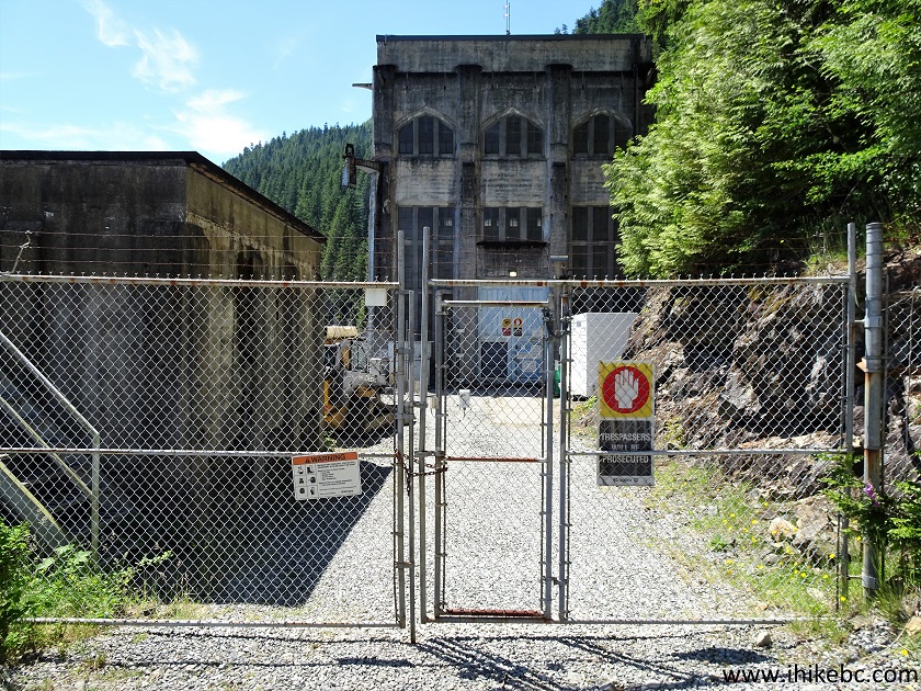
42. Visitors are strongly discouraged from going past the fence.
BC Hydro Facility
43. Zooming in. Note a motion-activated camera and a year 1927 sign.
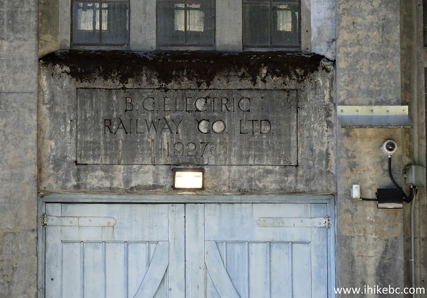
BC Electric Railway Co Ltd 1927 sign
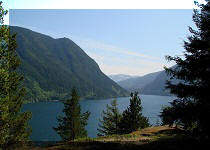
44-47. Stave Lake view from this spot. Left to right.

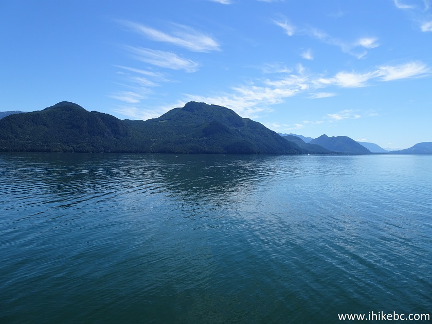
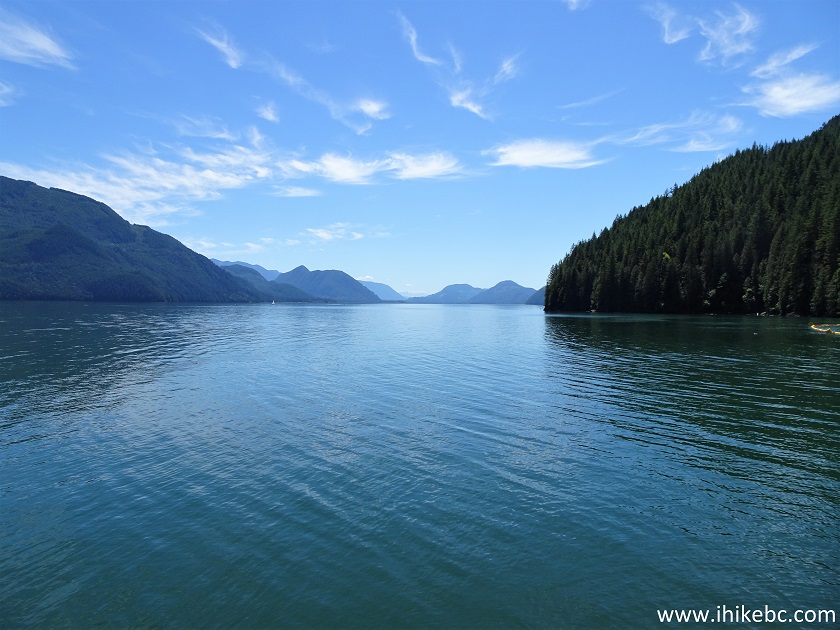
48. Now a panorama.
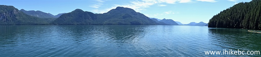
Stave Lake Panorama
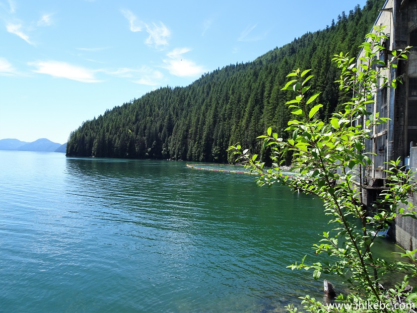
49. Boaters enjoy checking out this facility as well.
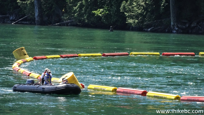
Boaters on Stave Lake
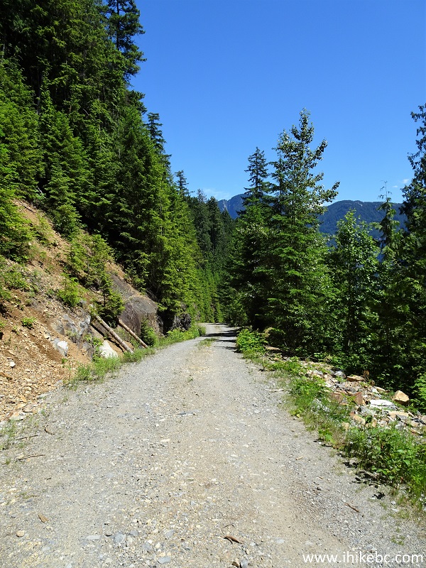
50. We then returned to the 20.3 km split, took the road on the left, and explored the rest of Florence Lake Forest Service Road, which goes for another 4 km from this spot. Only capable 4WD high-clearance vehicles would make it past this split.
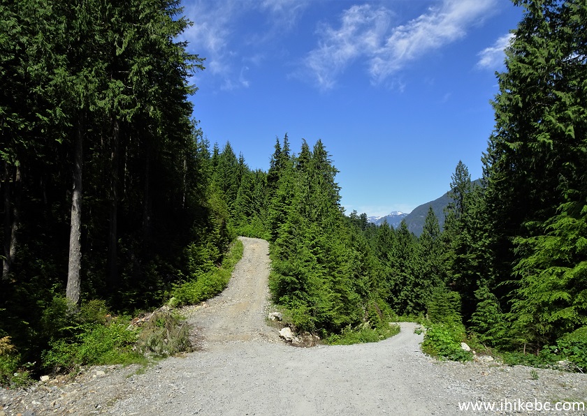
51. The remaining mileage is from the 20.3 km split, is based on a GPS odometer, and is approximate. At 40 meters here.
Florence Lake Forest Service Road
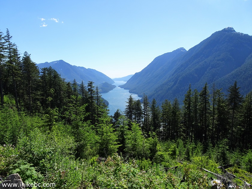
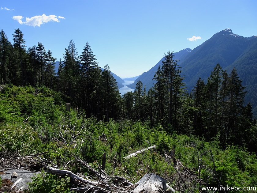
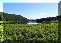
52. At 1.5 km, the first Alouette Lake view arrives on the left side, and is hard to spot in the bushes. Coordinates: N 49⁰22.835' W 122⁰18.866'. Elevation: 501 meters.
53. Here is an unzoomed view.
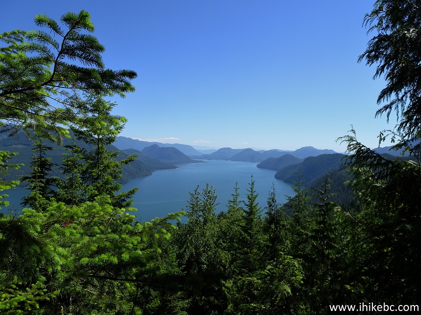
Alouette Lake View from Florence Lake FSR
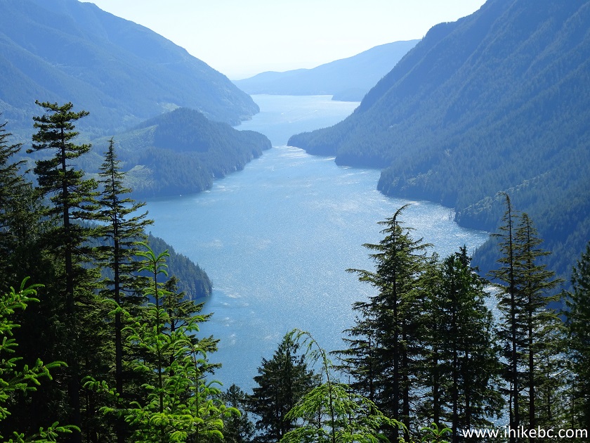
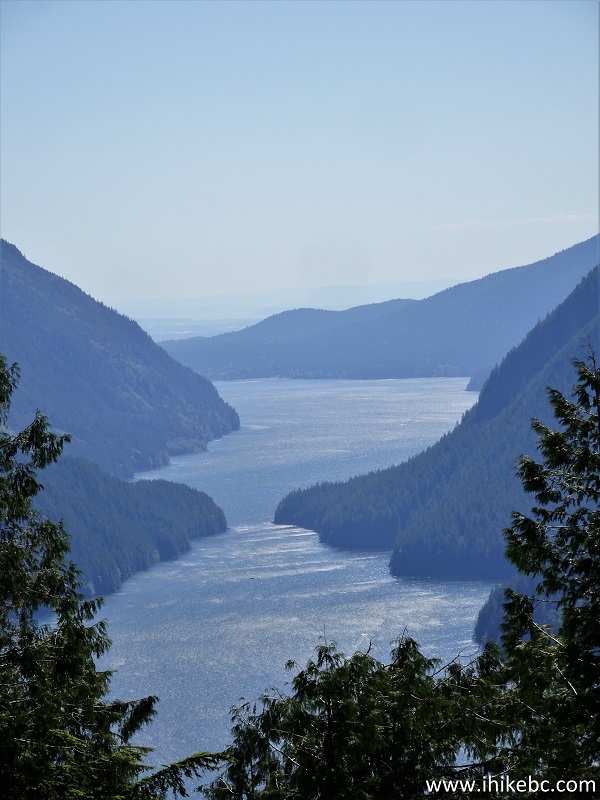
54. And a slightly zoomed view.
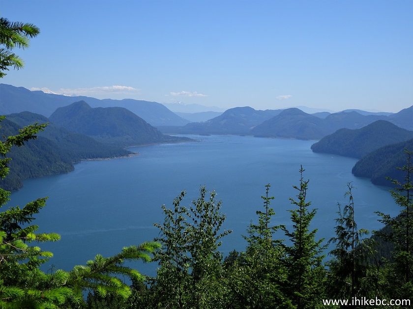
Alouette Lake
Here is our video of Alouette Lake from this location.
More ihikebc videos are on our YouTube Channel.
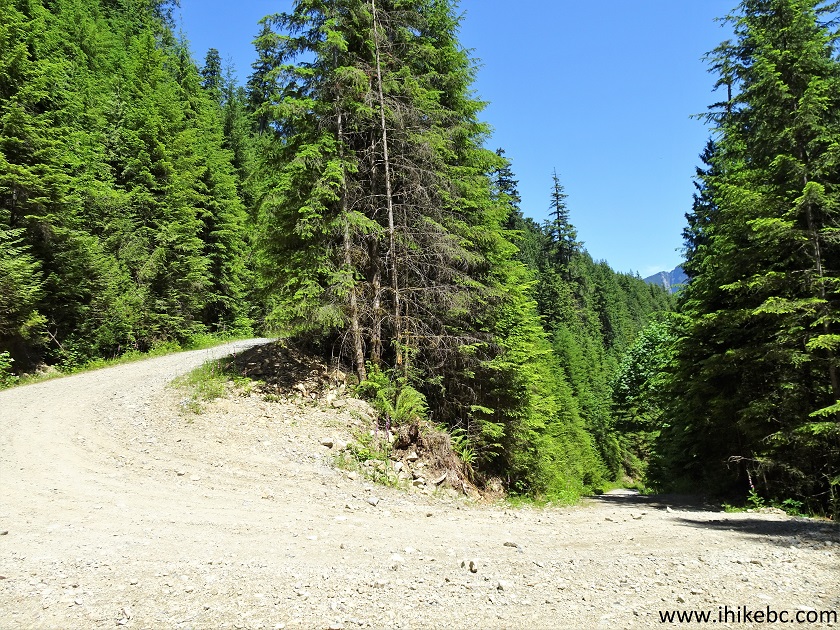
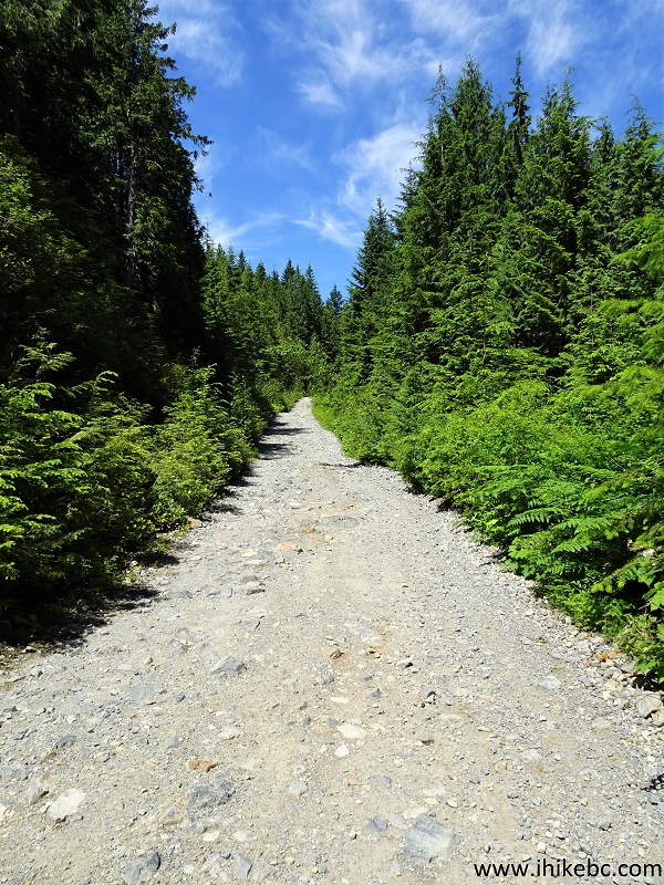
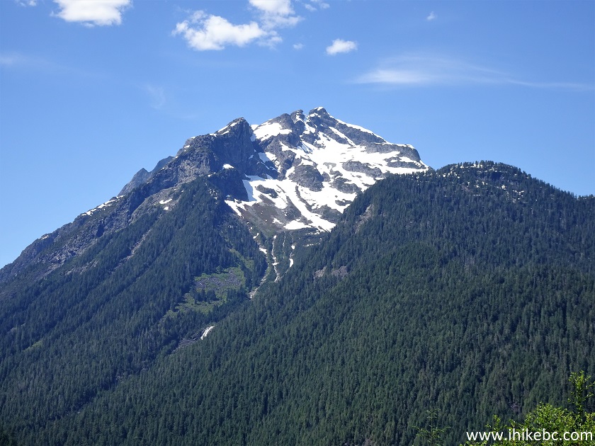
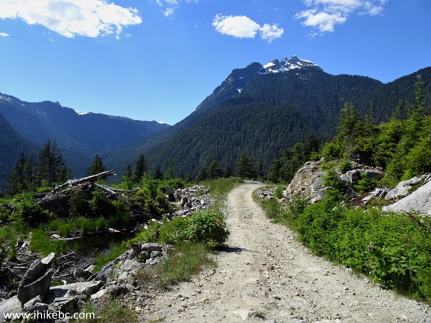
55-56. Several hundred meters later, a fine mountain view as well.
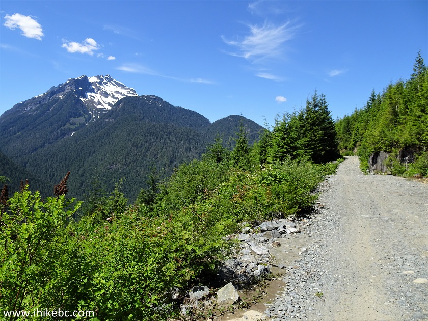
Florence Lake Forest Service Road
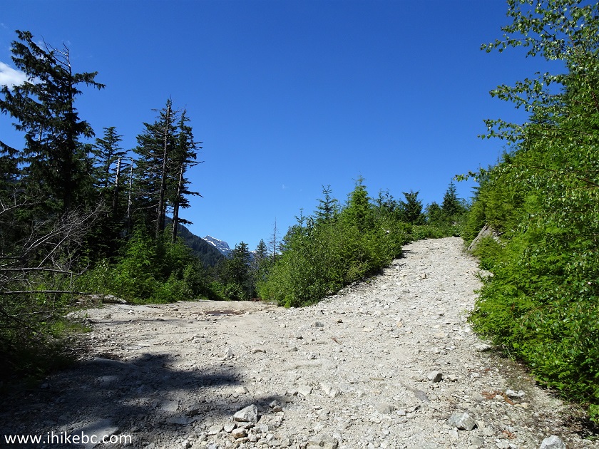
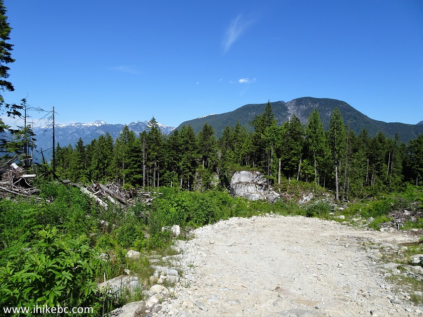
57. Now at 1.9 km of Florence Lake FSR past the 20.3 km split. A substantial climb here, and it's steeper than it looks.
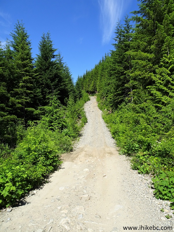
Florence Lake FSR near Mission BC
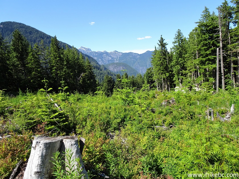
58. At 2.6 km, there is a split. Keep left. To the right is a camping spot within 30 meters.
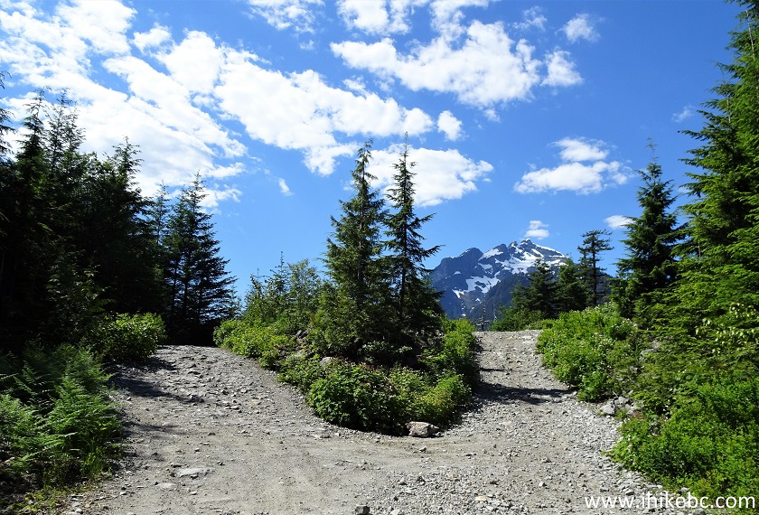
Florence Lake Forest Service Road British Columbia
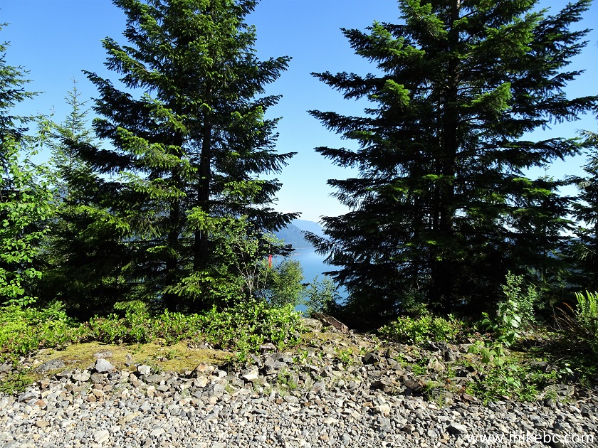
59. At 3.0 km, there is a second view of Alouette Lake. Coordinates: N 49⁰23.473' W 122⁰18.512'. Elevation: 586 meters.
Alouette Lake seen from Florence Lake FSR
60. With some zoom.
Alouette Lake British Columbia Canada
61. The final split arrives at 3.35 km. We went left, but both left and right roads showed as ending very soon on our GPS map.
Florence Lake Forest Service Road
62. Florence Lake FSR at 3.5 km past the 20.3 km split.
Florence Lake FSR
63-64. The third and final view of Alouette Lake is at 3.6 km. Coordinates: N 49⁰23.663' W 122⁰18.357'. Elevation: 571 meters.
Alouette Lake Canada
65. Several hundred meters later, Florence Lake Forest Service Road comes to an end. Coordinates: N 49⁰23.755' W 122⁰18.357'. Elevation: 554 meters.
End of Florence Lake FSR
66. Beyond that, it's just wild nature.
Florence Lake FSR offers a lot to see and a lot to do. Highly recommended.


|
 |
Other Trips in Mission BC Area:
|
|
|
|
|
|
|
|


![]()
![]()
![]()
ihikebc.com Trip 217 - Florence Lake FSR Trip (near Mission BC) Page 2 of 2