![]()
![]()
![]()

Trip 230 - September 1, 2021 (Wednesday)
Tofino BC Visit
Page 1 of 2
Liked:
Harbour/ocean/mountain views, interesting buildings, artistic garbage cans, quirky town feel.
Of Note: Tofino is a very small town with limited services. Tsunami hazard zone - head to higher ground after an earthquake and/or upon hearing tsunami sirens. Parking could be an issue.
Related Websites: Google Maps - Tofino, Tourism Tofino, Wiki - Tofino BC.
Vancouver Island Backroad Mapbook (9th edition) Tofino Coordinates: Page 14 (Tofino) C4.
Another Trip in Tofino Area: Pacific Rim National Park Reserve.
Other BC Cities, Towns and Locations We Have Visited: Agassiz, Bella Coola, Bralorne, Chilliwack, Fort Nelson, Gibsons, Gold Bridge, Harrison Hot Springs, Hope, Horseshoe Bay, Merritt, Mission, Nanaimo (Old City Square), Port Alberni, Prince George, Prince Rupert, Smithers, Squamish, Telkwa, Tumbler Ridge, Vancouver (Seawall), Vancouver (Stanley Park), West Vancouver (Ambleside Park).
The town of Tofino with all of its (give or take) 2,000 residents is located on the West coast of Vancouver Island, pretty much in the middle. It's very far from any city of substantial size, that being Port Alberni, 2 hours and 120 kilometers to the East via Highway 4. Another hour and 85 kilometers are needed to reach an even larger city of Nanaimo, which has several ferry terminals connecting Vancouver Island to the mainland British Columbia.
Tofino is known for its surfing, with several beaches right by the town, and with Pacific Rim National Park Reserve and all of its beaches (especially an enormous Long Beach) being very close, also along Highway 4. Today, we walked around downtown Tofino, where the majority of its attractions are located.
For those folks who are interested in camping in their vehicle, it's going to be complicated, as forest service roads are pretty far from Tofino, and there are dozens of others who want to camp there too. Camping on Tofino streets is not allowed. Overnighting on any of the Pacific Rim Park's lots is also a no go. So, it's either one of the fee-based campgrounds in the Tofino area, or a motel/hotel, or a pretty long drive to the nearest FSR.
We visited Tofino many years ago, and don't remember much about that visit. This time, Tofino pleasantly surprised with having an appearance of a nearly upscale resort location, with a quirky feel, numerous fine ocean/harbour/mountain vistas, and many very interesting-looking buildings. The only issue of note is that Tofino is very small and very popular, so finding a parking spot could be complicated during the busy season, especially for a larger RV. Numerous signs prohibit parking of RVs or trailers on the street in downtown Tofino, which is the most popular part of the town. It's a good idea to have a campground reservation before arriving to Tofino, park there, and then just walk to all of the attractions, which should not be too far.
There appears to be only one public washroom in Tofino downtown, and it's pretty easy to find - it's located in a park on Campbell Avenue (the continuation of Pacific Rim Highway / Hwy 4) between 3rd and 2nd Streets (closer to 2nd Street).
1. We are on Highway 4 (Pacific Rim Highway), entering the town of Tofino.
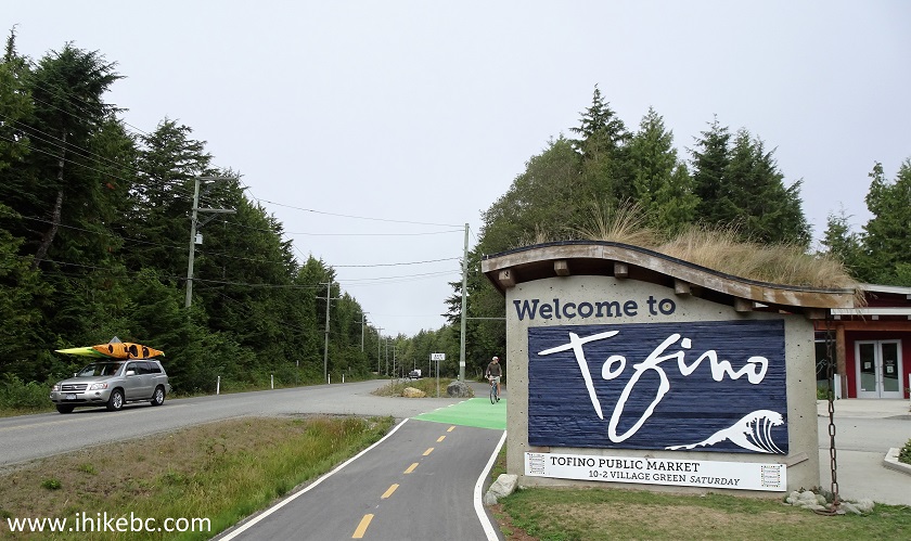
Welcome to Tofino Sign
2. Just behind the sign seen in the photo above, there is Tourism Tofino Info Centre. Parking is limited to 20 minutes, just to show you how popular this place is (we can't recall any other info centres in BC having such a short parking time limit). The only city bus (electric too) stops here before going around its Tofino route. A cool garbage can is located next to the Info Centre.
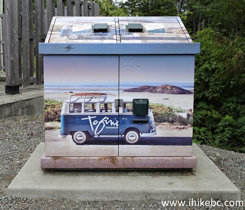
Artistic Garbage Can Tofino British Columbia Canada
3-5. Here is a map of Tofino, courtesy of the Info Centre. Top to bottom.
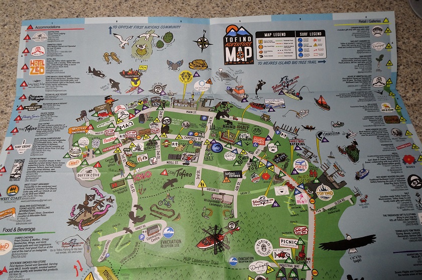
Tofino Map
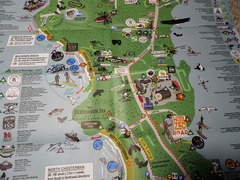
Tofino BC Map
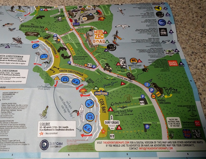
Map of Tofino
6. Here is our Tofino route. Red square - parking and starting point on Gibson Street, then follow the red line. Blue square - approximate end of the walk, then return to the parking point. We parked on Gibson Street, turned left onto Pacific Rim Hwy / Campbell St, reached Fourth Street, turned right, then left onto Main Street (where the majority of fine harbour views can be found), then turned right and went to the foot of First Street with its dock/pier (Tofino Air dock is there too), then back to Main Street, where we turned right and ended up on West Street (with very peculiar-looking structures - shown on Page 2), then back on Main Street to First Street again, then up First Street to Tofino General Hospital, then left onto Neill Street, left onto Third Street, and left onto Campbell Avenue.
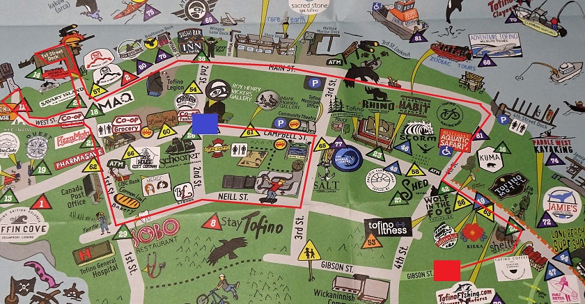
Downtown Tofino BC Map
7. Here we are on Pacific Rim Highway, approaching Gibson Street on the left side. It was fairly easy to find parking on Gibson Street, after circling around the downtown for several minutes and failing to find anything, despite parking being restricted to 4 hours between 10 AM and 4 PM, just like on much of Gibson Street. However, a bit further down Gibson Street, past Fourth Street, there is a small park with lots of parking, and no time limit signs.
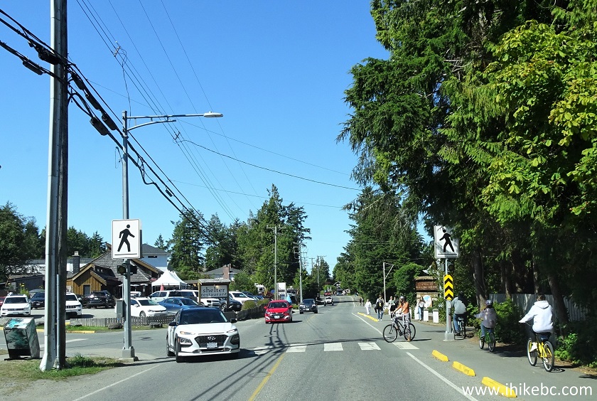
Pacific Rim Highway at Gibson Street Tofino British Columbia
8. Having parked on Gibson Street, we walked back to Pacific Rim Highway, and there it was, Tofino's only bus. Electric too.
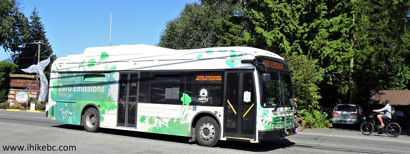
Tofino Bus
9. Very soon after turning left onto Pacific Rim Highway, there was Jamie's Whaling Station (whale watch tours, etc), with a whale tail sticking out of the ground.
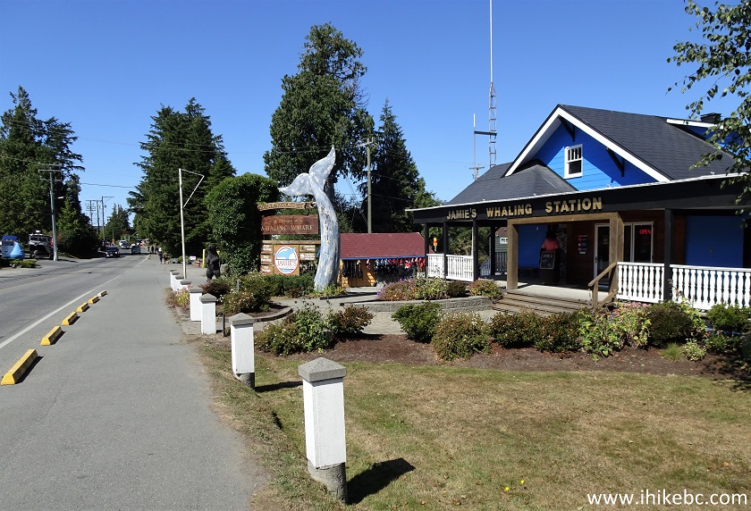
Jamie's Whaling Station Tofino BC
10. Shortly thereafter, an alley led to one of the harbour access points.
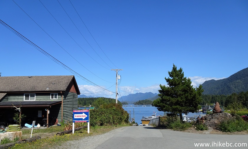
Tofino
Just past the big green tree seen in the photo above, we have stopped and observed a group of kayakers stretching a few hundred meters away. Then, Atleo River Air Service seaplane flew nearby preparing to land.
Here is our video of the kayakers and the seaplane.
More ihikebc videos are on our YouTube Channel.
11. Another interesting building on what is now Campbell Street is Tofino Motel.
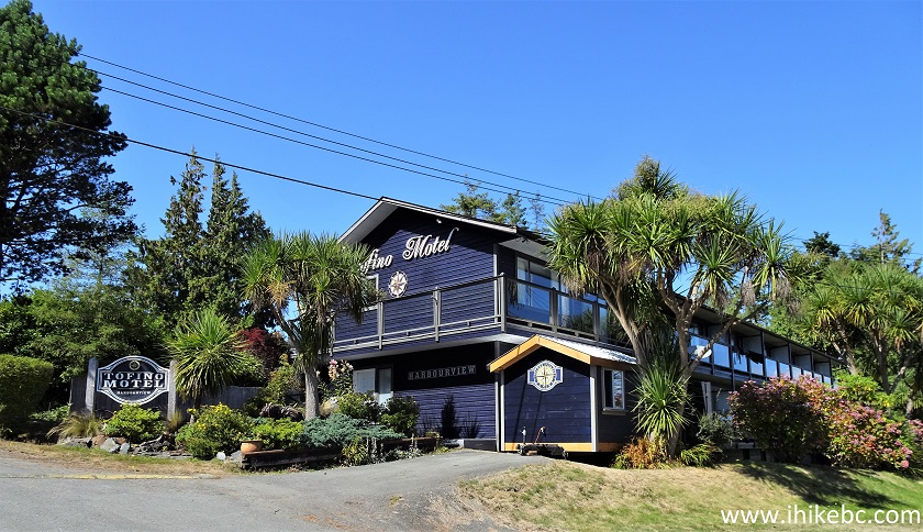
Tofino Motel
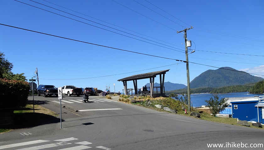
12. We then turned right onto Fourth Street.
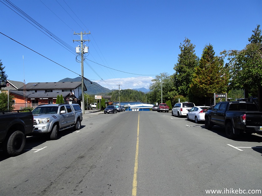
Tofino BC - Fourth Street
13. Parking restrictions are everywhere in downtown Tofino.
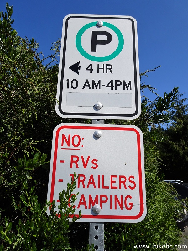
Downtown Tofino Parking Restrictions
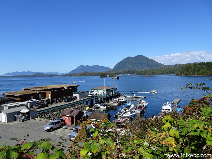
14. Now turning left from Fourth Street onto Main Street. The most picturesque part of our walk is about to begin.
Fourth Street at Main Street Tofino BC
15. The view from Main Street soon after the turn.
Tofino Harbour
16-17. Further down Main Street, at the foot of Third Street, there is an anchor and a totem pole.
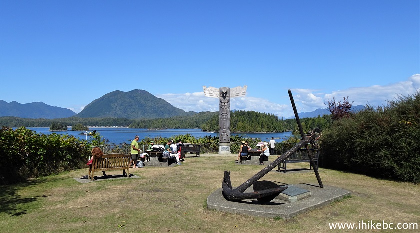
Totem Pole and Anchor in Tofino on Main Street at Third Street
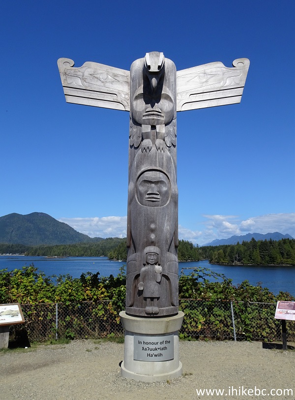
Totem Pole Tofino British Columbia
18. And a nice view too.
View From the Foot of Third Street Tofino Canada
19. Moving along on Main Street, there is a small lane right at the Seaplanes Helicopters sign, called Wingen Lane. There is no sign with the lane name that we could see, but Google Maps has it listed as such.
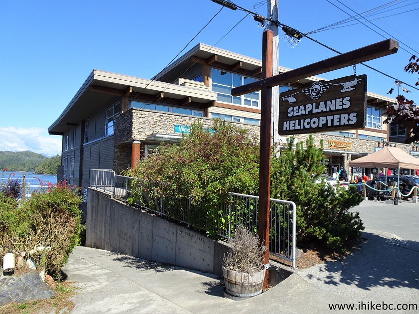
Main Street at Wingen Lake Tofino BC
20-21. Here is that lane.
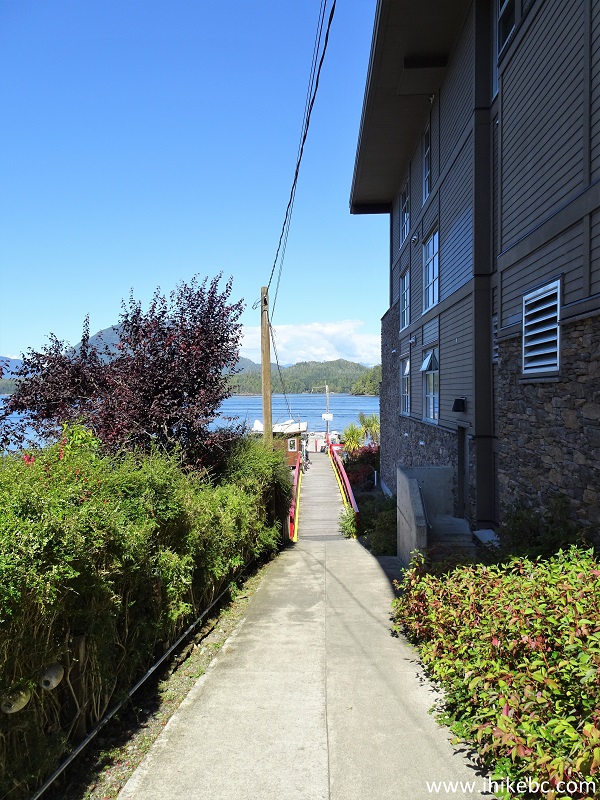
Wingen Lane Tofino British Columbia
Tofino Wingen Lane
22. At the end of the walkway there is a dock with boats and a seaplane.
Docks at the Foot of Wingen Lane Tofino British Columbia
23. The seaplane is likely the same Atleo River Air Service plane from the video above.
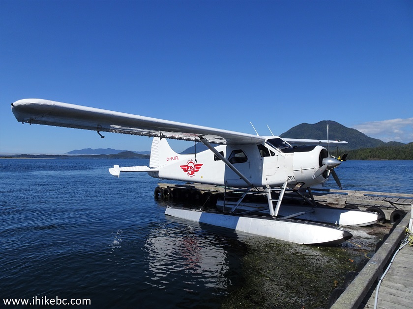
Atleo River Air Service Seaplane
24. The Inn at Tough City (Toughino?) is located at the corner of Main Street and Wharf Street.
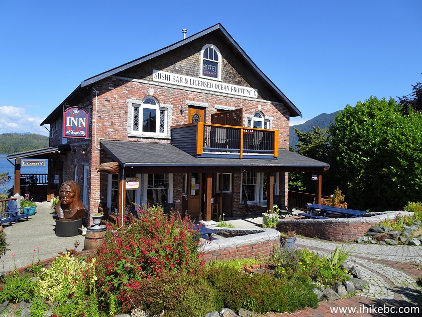
The Inn at Tough City Tofino BC Canada
25. Tofino garbage cans can really give their Port Alberni counterparts a run for their money. Very neat. Corner of Main Street and First Street.
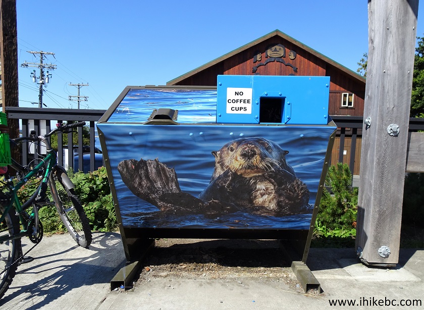
Artistic Garbage Can Tofino British Columbia Canada
26. Just behind the otter garbage can is this fine-looking House of Himwitsa Native Art Gallery.
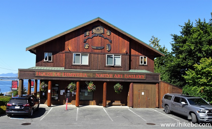
House of Himwitsa Native Art Gallery Tofino BC
27. Now on First Street, with Main Street just to our right. See the yellow building far ahead?
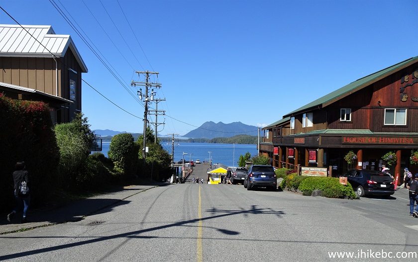
First Street at Main Street Tofino BC
28-29. That's Tofino Air office building, with a cute business sign on the wall.
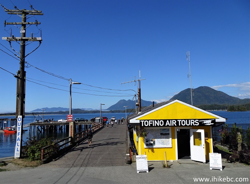
Tofino Air Office Building
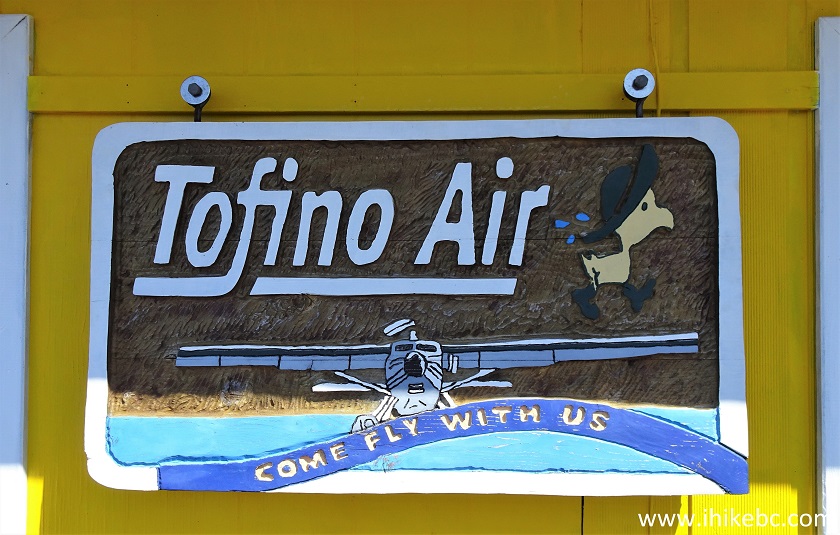
Tofino Air Business Sign
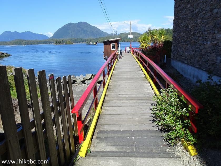
30. There is a dock/pier at the foot of First Avenue past Tofino Air office.
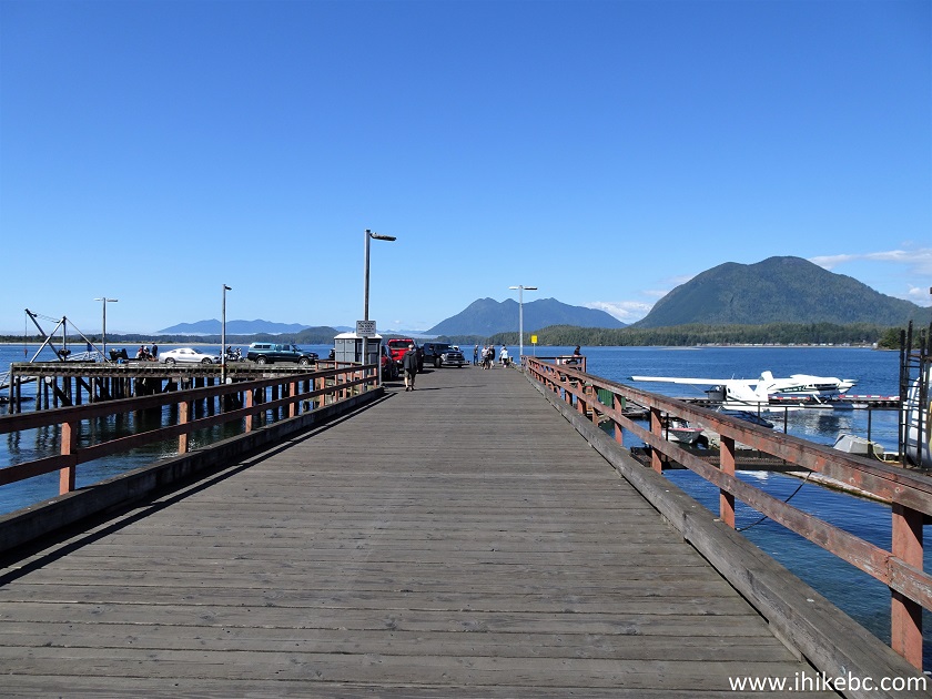
Pier at the Foot of First Avenue in Tofino BC
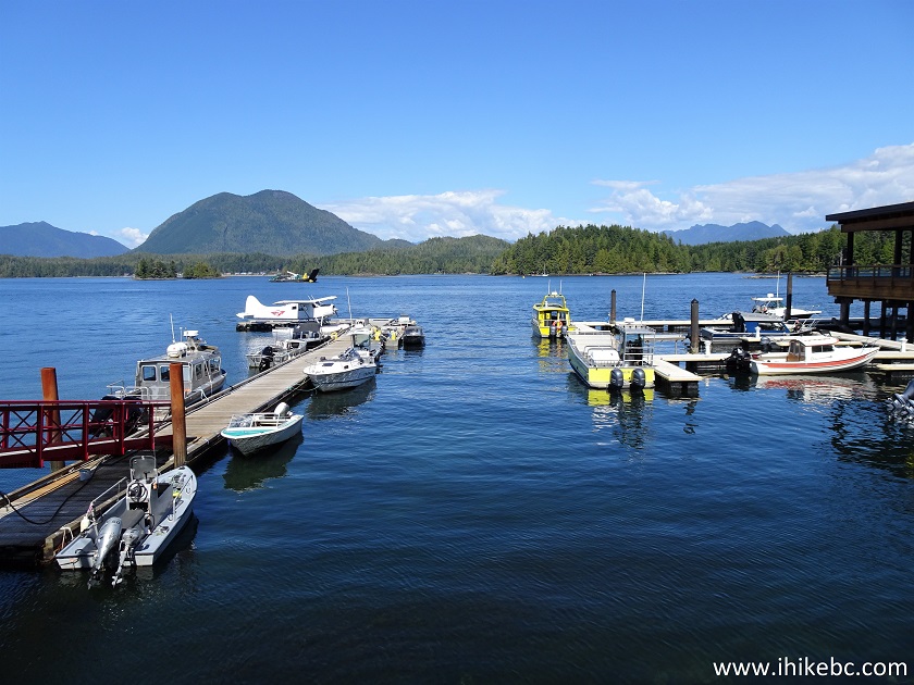
31. A fine view to the right.
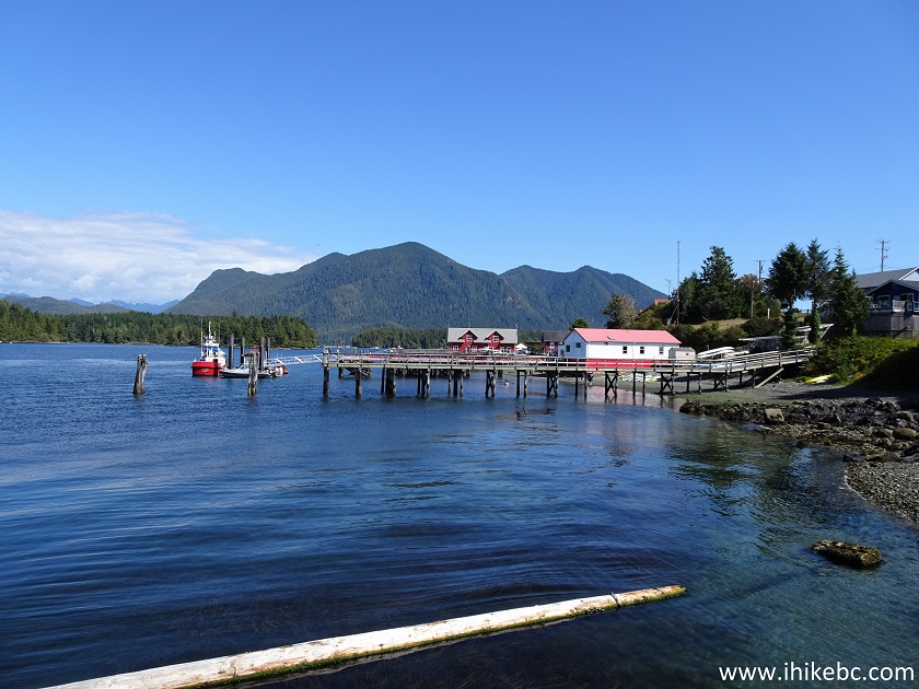
Tofino Harbour
32-33. And here are Tofino Air seaplanes.
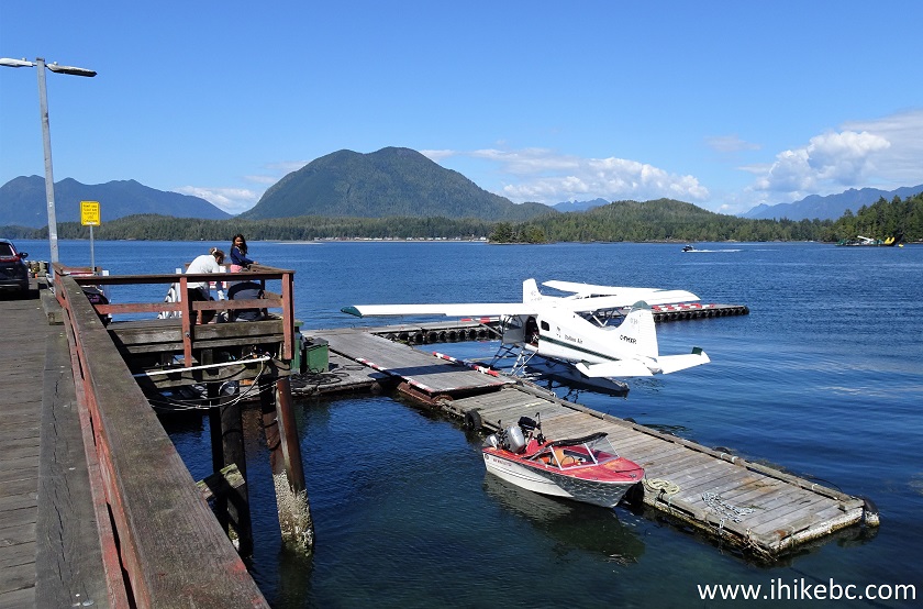
Tofino Air Seaplanes
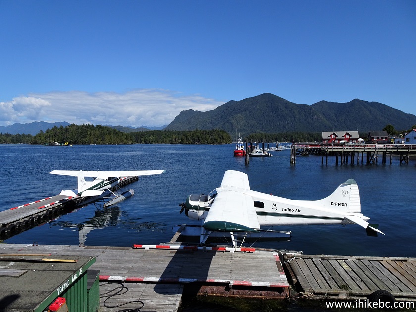
Tofino Air Seaplanes
34. It's a fairly large pier. Vehicles are allowed, so watch out for traffic.
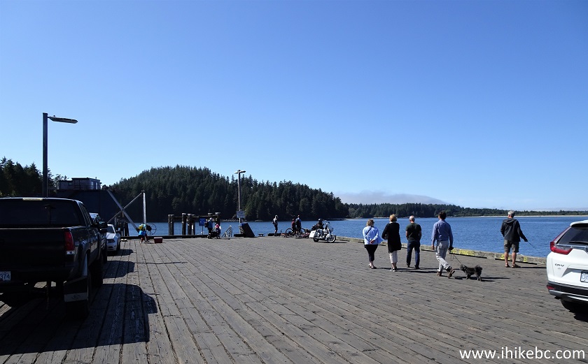
Pier in Tofino
35. Another good view from the pier.
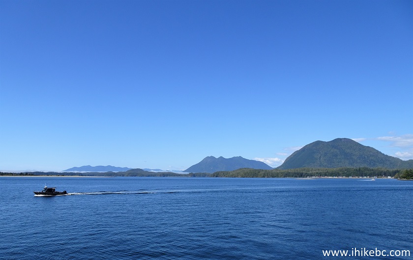
Tofino Harbour View From a Pier
36. This biker from Quebec asked us to take his picture on his phone. He sure looked good in the biker gear on this white motorcycle with a backdrop of blue ocean, green trees, and mountains. Also, we were surprised to hear a lot of French on the streets of Tofino. You may spend days in the Lower Mainland without hearing any French, and here, within several hours, we walked by three different French-speaking groups.
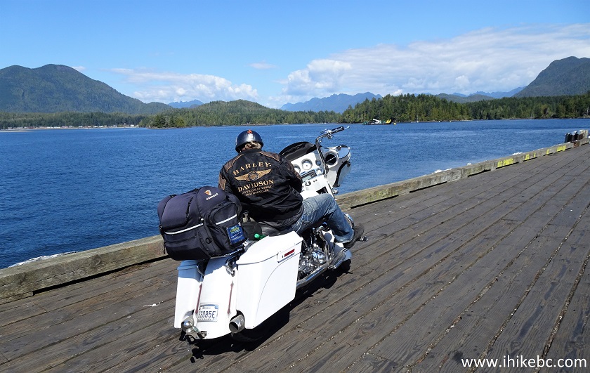
Biker from Quebec in Tofino BC
Our Tofino BC visit Continues on Page 2.


|
 |
![]()
![]()
![]()
ihikebc.com Trip 230 - Tofino BC Visit Page 1 of 2