![]()
![]()
![]()

Trip 074 - September 16, 2014 (Tuesday)
Mount Cheam Peak Trail Hike
Page 2 of 2
Distance From Vancouver (Grandview Hwy Entrance to Hwy 1 East) via Chilliwack Bench FSR: About 127 km: 93.5 km from Grandview Hwy entrance to Hwy 1 East to Exit 123 (Prest Road) - turn right (South), then 5 km on Prest Rd and turn left on Bailey Rd, then 700 meters later at a split stay right on Elk View Road. Continue on Elk View Road until it ends ten kilometers later, and Chilliwack Bench Forest Service Road begins. Then, 16.8 km later, turn left onto Chilliwack Chipmunk FSR. It's then about 10 kilometers more on Chilliwack Chipmunk FSR to the trailhead.
Distance From Vancouver (Grandview Hwy Entrance to Hwy 1 East) via Chilliwack Lake Road: About 137 kilometers: 90.5 km from Grandview Hwy entrance to Hwy 1 East to Exit 119 (Yale Rd / Vedder Rd) in Chilliwack. Then 5.5 km on Vedder Road to Chilliwack Lake Road. Then about 27 km on Chilliwack Lake Road to Chilliwack Foley FSR (turn left). Then 2 km to a 3-way intersection (Chilliwack Foley turns right, but you need to turn left onto Chilliwack Chipmunk FSR extension). Then, 1.8 km later, you are at the intersection of Chilliwack Chipmunk and Chilliwack Bench shown in photo #1 (except you would be arriving from the opposite side). It's then about 10 kilometers more on Chilliwack Chipmunk FSR to the trailhead.
Liked: Once you get to the trailhead, the trail is fairly easy, with just a few strenuous stretches. The views are great both of the mountains and the sub-alpine terrain.
Of note: Unless you have a high-clearance short-wheelbase 4x4 vehicle, numerous cross-ditches on Chilliwack Chipmunk FSR would cause at least minor damage to you ride. If you choose to hike Chipmunk FSR instead, it's going to be an extra 5 hours return up and down a fairly strenuous road. Or use a bicycle to the trailhead, and save a lot of time. There is very little tree cover on Chipmunk FSR and the trail itself, requiring sun protection on sunny days. Despite a substantial distance from populated areas, the trail is quite busy. Hiking boots and poles are recommended. There were lots of overly friendly flies at the peak itself.
Vancouver, Coast & Mountains Backroad Mapbook (2010 edition) Coordinates: Page 4 (Chilliwack) F5-G5.
103 Hikes in Southwestern British Columbia (2008 edition): hike #69.
Related Websites: Chilliwack District FSR Conditions.
Other Trips in Chilliwack Area: Flora Lake Trail, Williams Ridge Trail, Mount Thom Lookout Loop Trail, Vedder Rotary Loop Trail, Teapot Hill Trail Hike, Chilliwack Dyke Trail, Greendrop Lake Trail, Ling Lake Trail Hike (off Chilliwack Foley FSR), Chilliwack Foley FSR, Chilliwack Bench FSR, Elk-Thurston Trail, Slesse Memorial Trail, Downtown Chilliwack BC Visit, Chilliwack Lake FSR, Radium Lake Trail, Chilliwack Lake Provincial Park, Minter Gardens, Town of Agassiz BC, Bridal Veil Falls Provincial Park.
Follow @ihikebc Tweet
19. Just over an hour into the hike, we started walking around the left side of Mount Lady.
Chilliwack Hiking -
Mount Cheam Peak Trail BC Canada
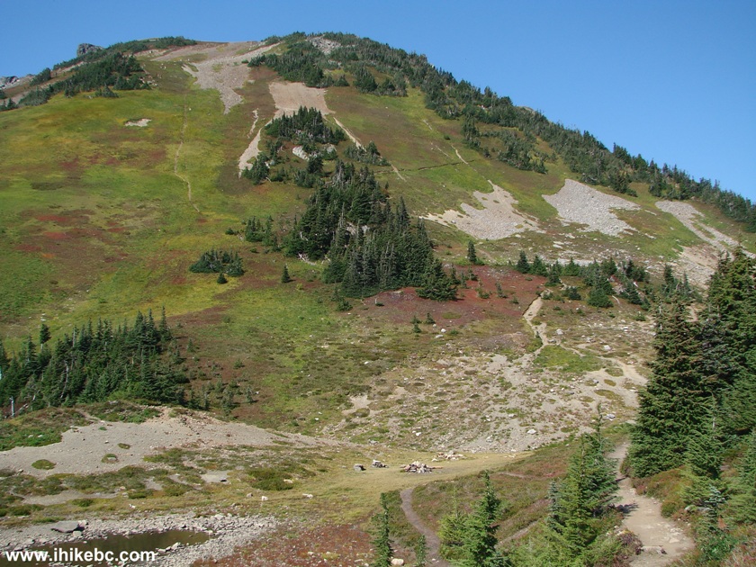
20. Mount Cheam then appeared in the front. The path went over the top of the mountain in the photo below, and the peak is not seen yet.
Chilliwack Hike -
Mount Cheam Trail British Columbia Canada
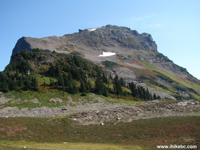
21. This side of Mount Lady looks great too.
Mount Lady Seen From Mount Cheam Peak Trail - Hiking in British Columbia Canada
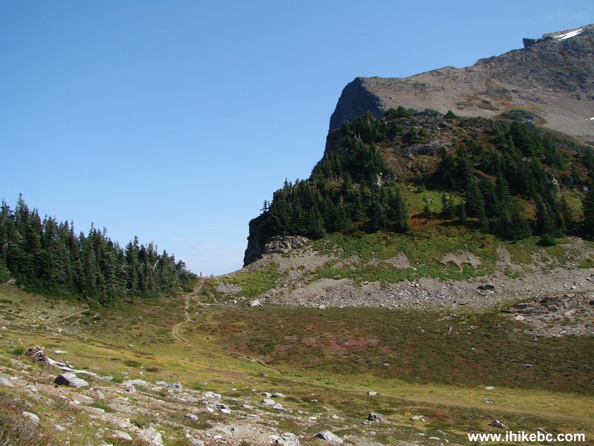
22. Just to the left is a short side trip to a point overlooking Wahleach (Jones) Lake. But you would get a good look at that lake from Mount Cheam peak too. It takes about an hour from here to get to the peak.
Chilliwack Hike - Mount Cheam Trail - Side Trail to Jones Lake Lookout
23. One of the surprises of this hike was that, despite the fact that it was a weekday, that not every vehicle would make it to the trailhead, and that this area is remote, we have encountered over twenty people. Here are two groups having just passed each other on the path seen in the photo above.
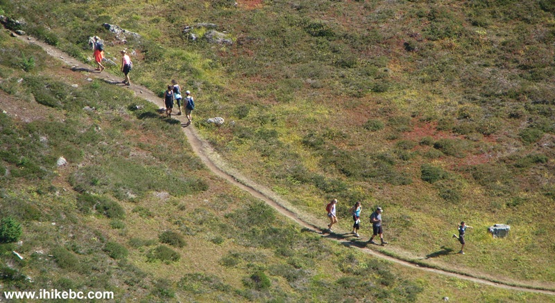
Hiking in British Columbia - Mount Cheam Hike near Chilliwack BC Canada
- Side Trail to Jones Lake Lookout
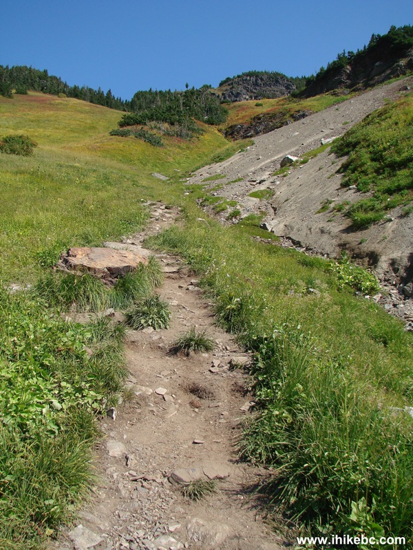
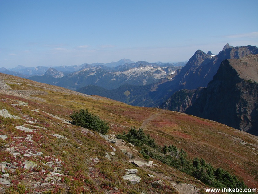
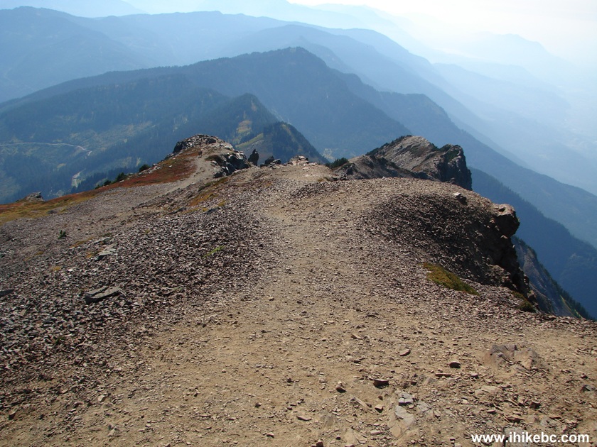
24. Meanwhile, we are going up Mount Cheam. This is where the trail becomes somewhat steep in places.
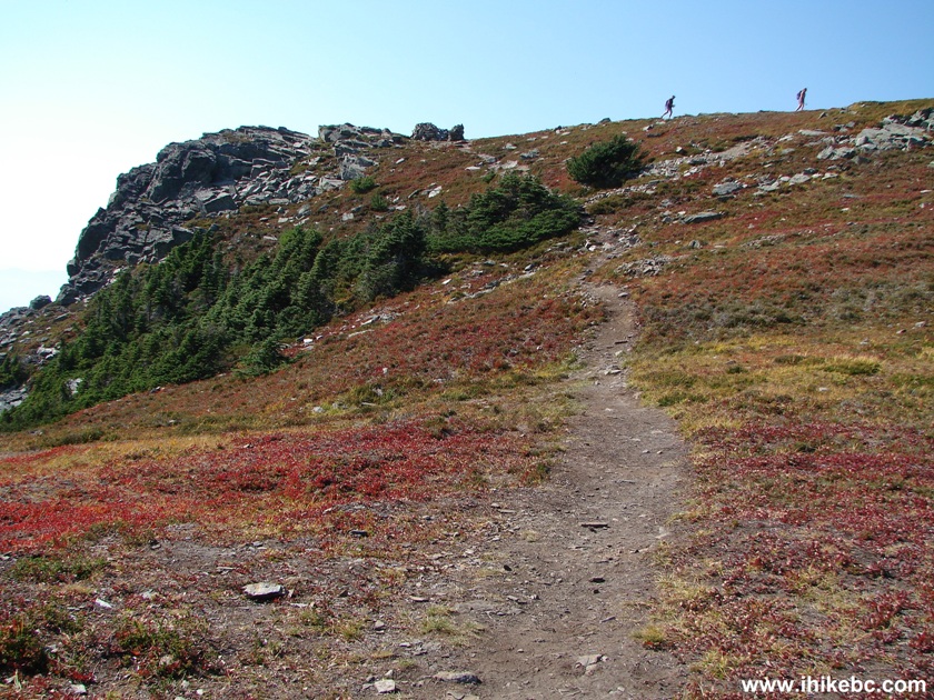
Chilliwack Hiking -
Photo of Mount Cheam Peak Trail British Columbia Canada
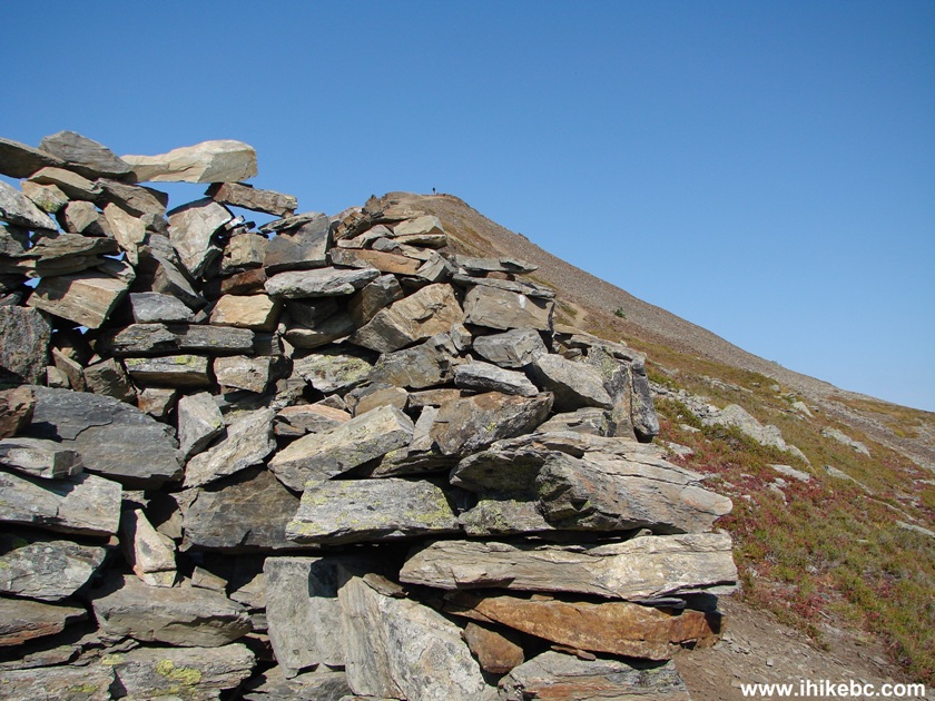
25. Close to the peak, there is this cairn and a flat area offering extensive views of Fraser Valley. Our time from the trailhead to the cairn: 2 hours 12 minutes.
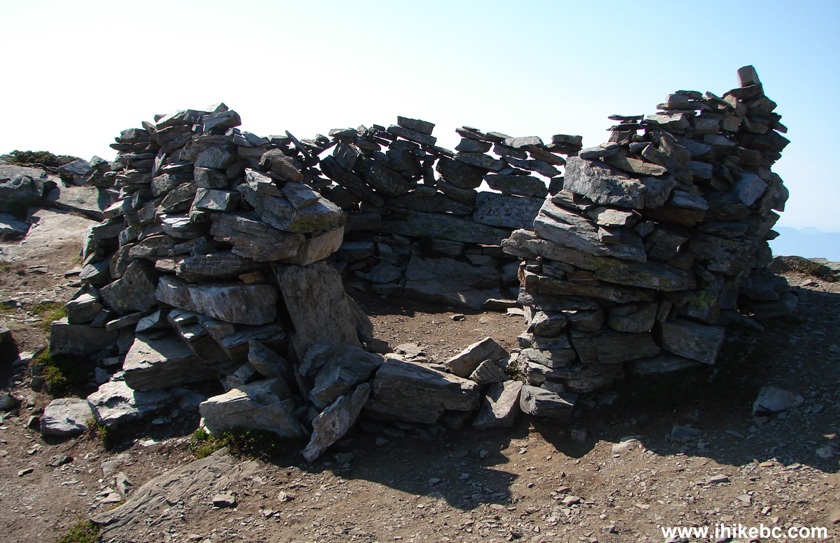
Cairn Mount Cheam Peak Trail - BC Hiking Canada
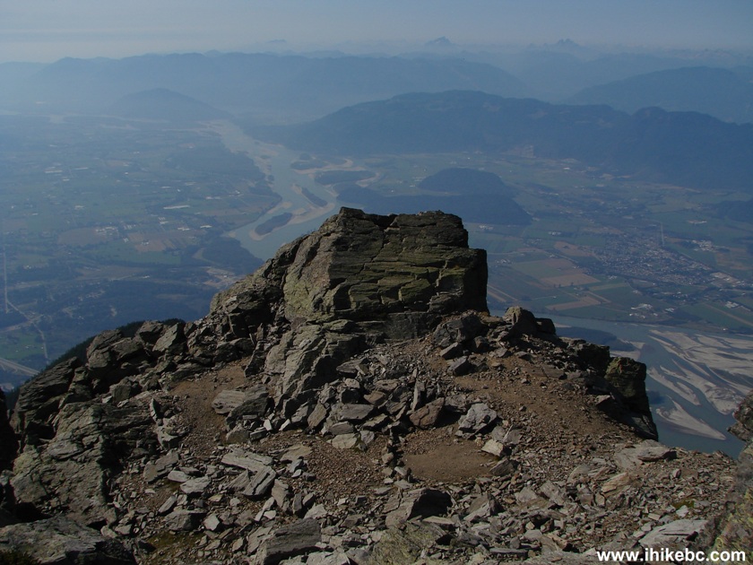
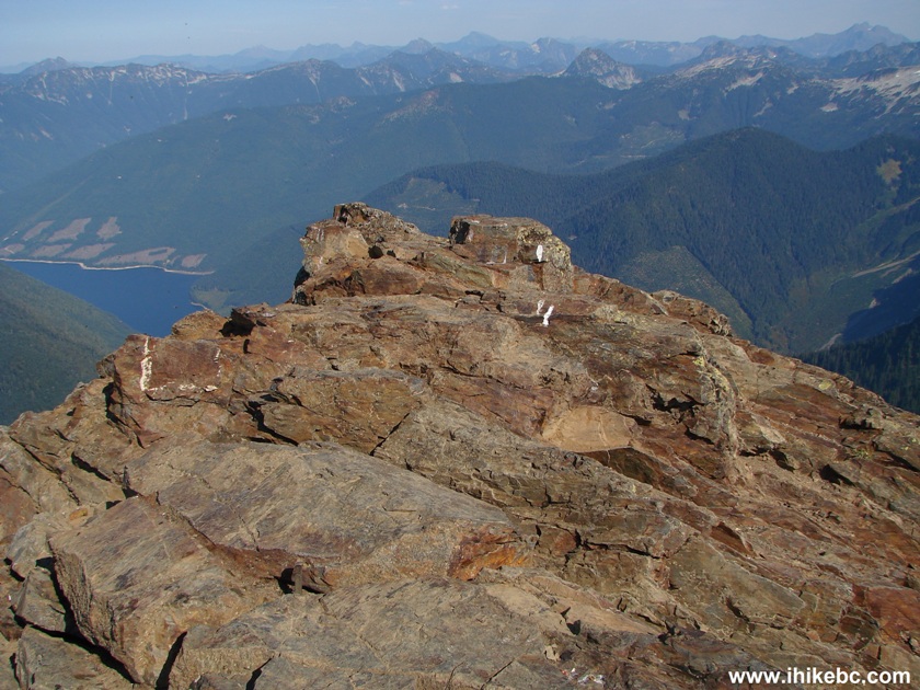
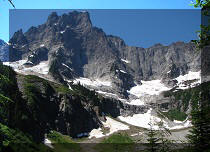
26. The peak seen from the cairn. Two people could be observed at the peak.
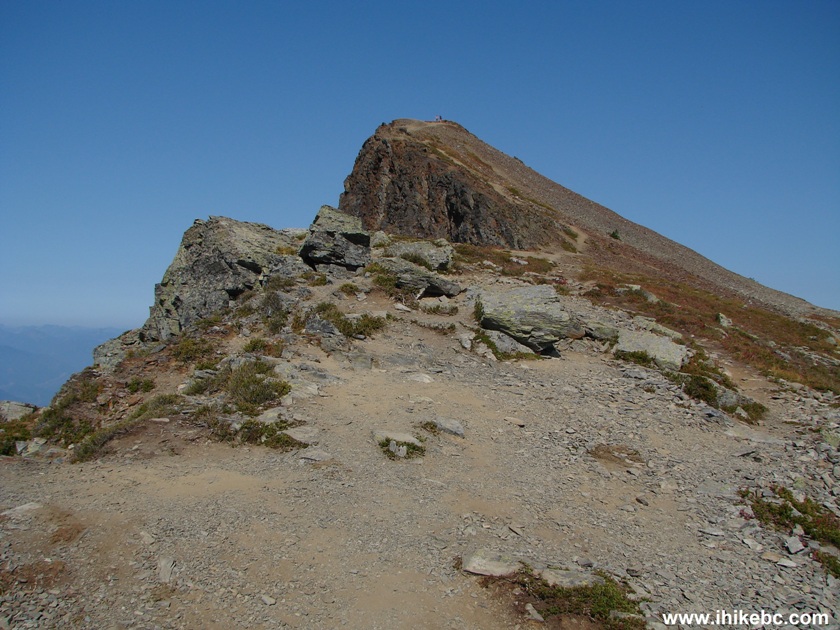
Mount Cheam Peak Trail - Hike British Columbia Canada
Here is our video of the views from the cairn area:
27. A local resident.
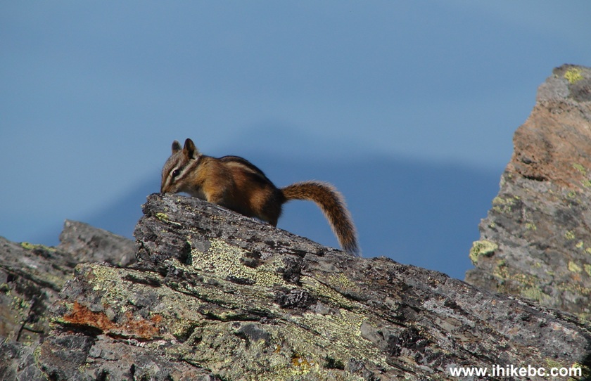
Photo of Chipmunk Mount Cheam Peak Trail BC Canada
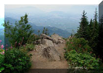
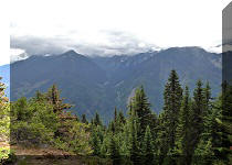
28. A view of Fraser Valley from the cairn area.
Fraser Valley Seen From Mount Cheam Peak Trail BC Canada
29. A view more to the right.
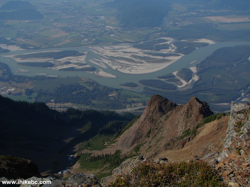
Fraser Valley Seen From Mount Cheam Peak Trail British Columbia Canada
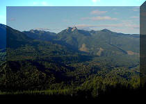
30. Now looking behind at Mount Lady.
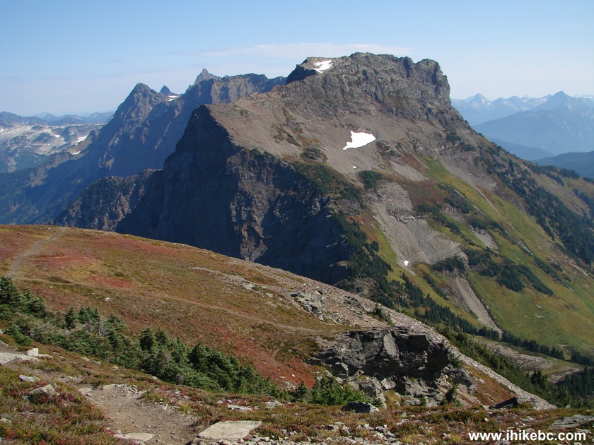
View of Mount Lady From Mount Cheam Peak Trail BC Canada
31. A bit to the left.
Picture of Mount Cheam Peak Trail BC Canada
32. We are still at the cairn and are looking at the peak of Mount Cheam.
Mount Cheam Peak Trail BC Canada
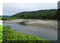
33. A few minutes later, we are at the peak. Wahleach (Jones) Lake is seen on the left side.
Mount Cheam Peak Province of British Columbia Canada
34. A better look at the lake. We have visited Jones Lake in May of 2020.
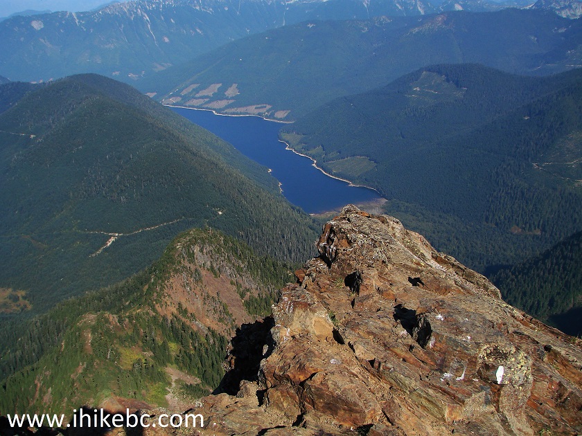
Wahleach (Jones) Lake Seen from Mount Cheam
35. Looking left, we see Fraser Valley one more time.
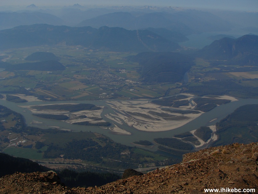
Photo of Fraser Valley Seen From Mount Cheam Peak Trail British Columbia
Canada
Here is our video of the views from the peak:
More ihikebc videos are on our YouTube Channel.
36. Now looking back from the peak toward the cairn area.
Mount Cheam Peak Trail BC Canada
It could be difficult to get to the trailhead, but, once you are there, the trail is fairly easy, and the views are great. Highly recommended.


|
 |
Other Trips in Chilliwack BC Area:
|
|
|
|
|
|
|
|
|
|
|
|
|
|
|
|
|
Greendrop Lake Trail
|
|
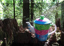
Teapot Hill Trail
|
|
Vedder Rotary Trail
|
|
Mount Thom Trail
|
|
Flora Lake Trail 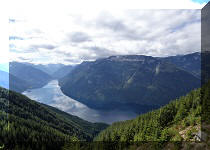 |


![]()
![]()
![]()
Follow @ihikebc Tweet
ihikebc.com Trip 074 - Mount Cheam Trail Hike (Near Chilliwack BC) Page 2 of 2