![]()
![]()
![]()

Trip 072 - September 9, 2014 (Tuesday)
Mamquam Lake Trail Hike
Garibaldi Provincial Park (Diamond Head Entrance)
Page 2 of 3
Distance From Vancouver to the Trailhead: 83 kilometers.
Drive for 65 kilometers on Highway 99 North (Sea-to-Sky) to Squamish.
Follow signs to Garibaldi–Diamond Head by turning right from Highway
99 onto Mamquam Rd 3.5 km after Squamish Adventure Centre (which itself
is located on the right side of the road several hundred meters past the
intersection of Highway 99 with Cleveland Avenue), then left on
Highlands Way South 1 km later. Take first right onto University Blvd at
a roundabout 700 meters later. 1.7 km after that make first right at yet
another roundabout, and 100 meters later (7.0 km after Squamish
Adventure Centre) turn left onto Mamquam Road (again). 500 meters later
paved road would end and gravel road would begin. You would drive on
that fairly smooth road (aside from the last 1.5 fairly rough
kilometers) for 10.8 kilometers and would reach the parking lot for
Garibaldi–Diamond Head, 18.3 km after passing by Squamish Adventure
Centre. If this sounds complicated, there are signs to the park before
every turn, so the parking lot is easy to find.
Liked: Many great mountain and nature views, mostly gentle grades, easy to follow trail, bicycles permitted up to Elfin Lakes.
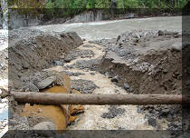
Of note: Remote wilderness area. No cell phone signal. This is a bear country. No tree cover beyond Red Heather shelter – sun protection essential on sunny days. Cloudy weather (like today) may obscure (most of) the views. Hiking poles and boots are recommended to Elfin Lakes, and are highly recommended beyond that area. There is a small but very treacherous trail washout between Opal Cone turnoff and Mamquam Lake – check out the photo in the trip report. Camping fees are required for anyone staying in the park overnight.
Vancouver, Coast & Mountains Backroad Mapbook (2010 edition) Trailhead Coordinates: Page 22 (Squamish) E5.
103 Hikes in Southwestern British Columbia (2008 edition): hikes #22 (Elfin Lakes) and #23 (Mamquam Lake).
Related Website: Garibaldi Provincial Park - BC Parks Official Site.
Follow @ihikebc Tweet
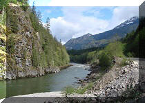
17. A bridge across Ring Creek at the bottom of the valley.
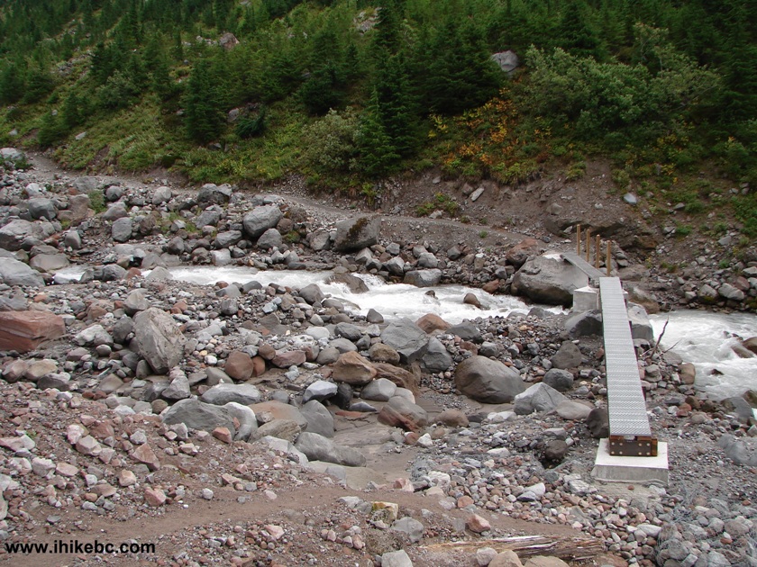
Bridge Across Ring Creek Garibaldi Provincial Park - Diamond Head BC
Canada
18. Ring Creek as seen from the bridge.
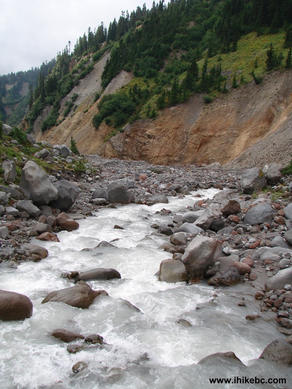
Ring Creek Garibaldi Provincial Park - Diamond Head British Columbia
Canada
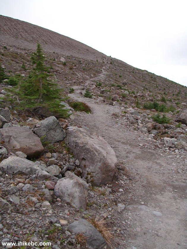
19. The path on the other side. We are ascending the valley now.
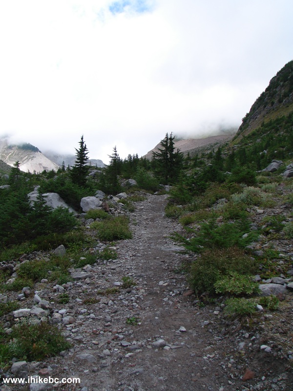
Squamish
Hiking - Mamquam Lake Trail
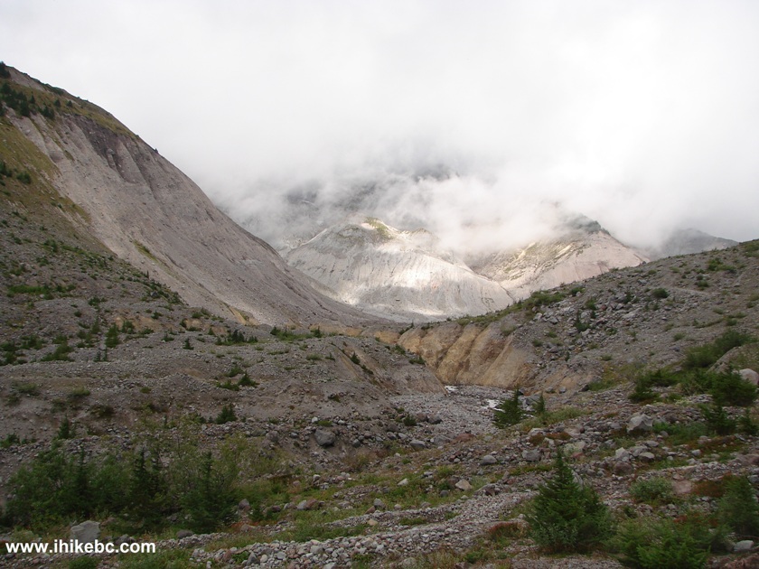
20. Looking back and zooming in, we get a good shot of Ring Creek.
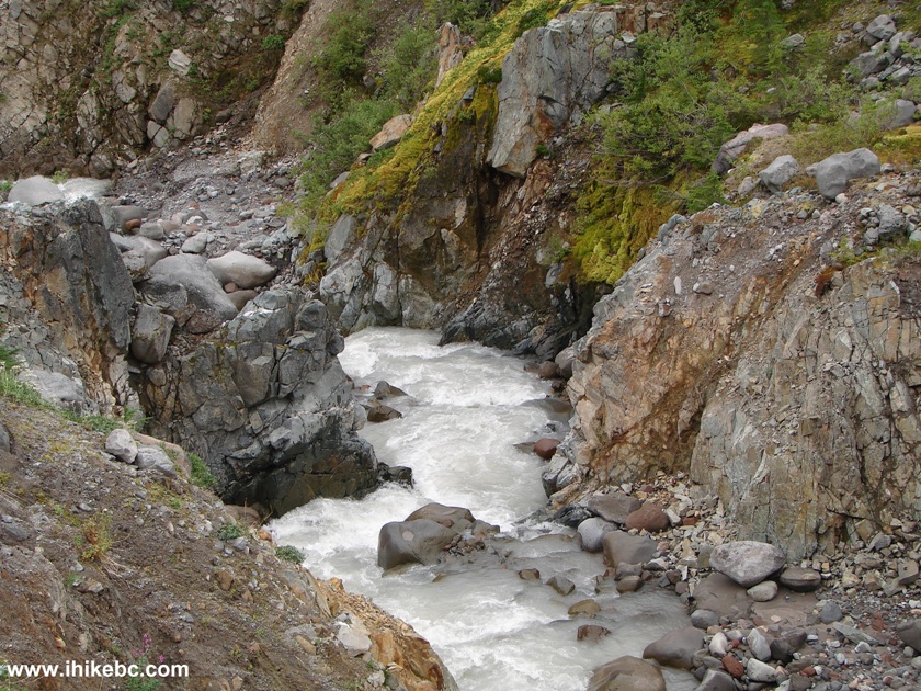
Ring Creek Garibaldi Provincial Park - Diamond Head British Columbia
Canada
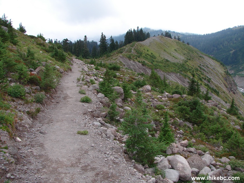
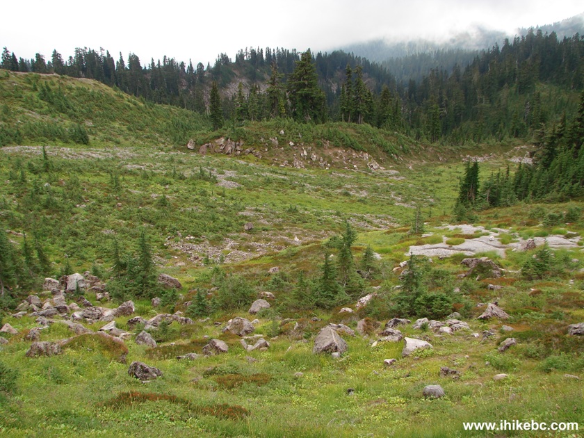
21. Continuing up the valley.
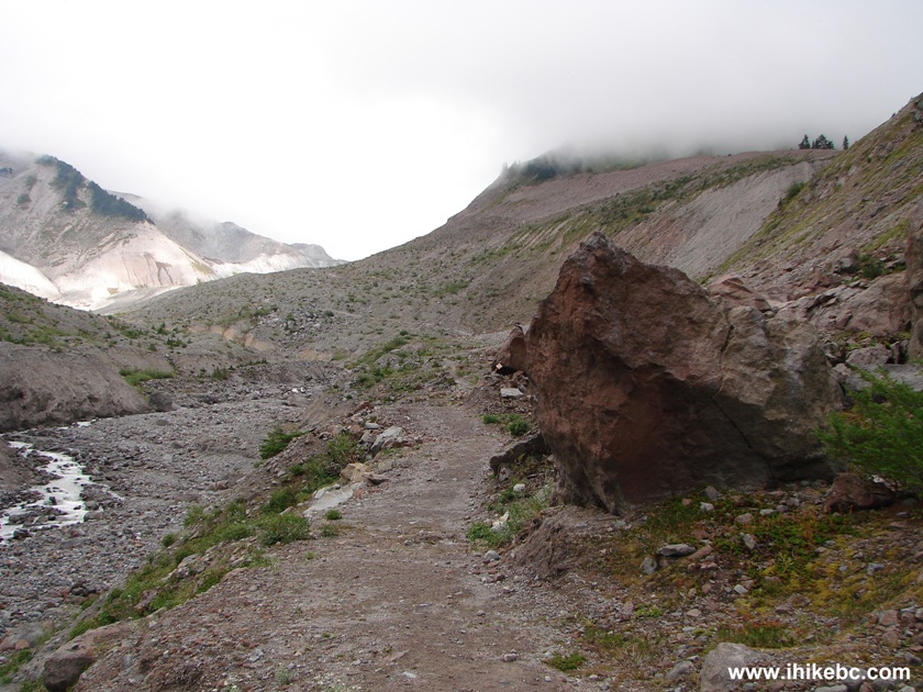
Hiking in Squamish Area - Mamquam Lake Trail in Garibaldi Provincial Park - Diamond Head BC
Canada
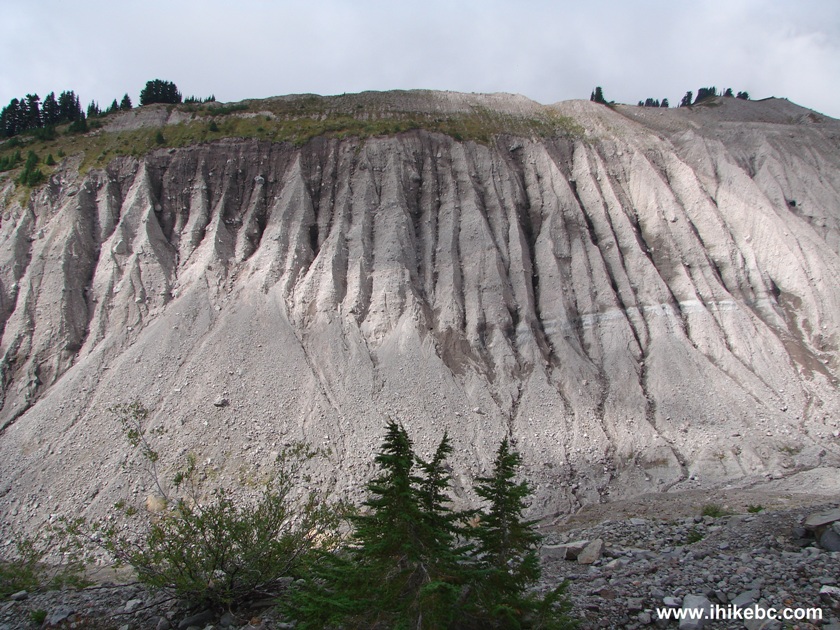
22. Good view to the left.
Picture of Garibaldi Provincial Park - Diamond Head BC Canada
23. Another one.
View From Mamquam Lake Hiking Trail Garibaldi Provincial Park - Diamond Head BC
Canada
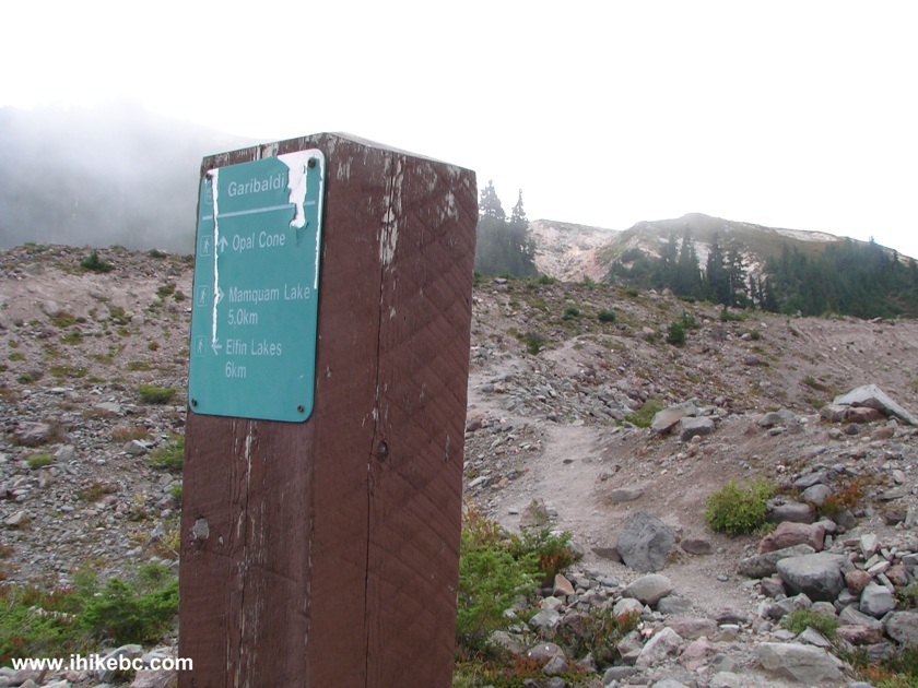
24. One hour and ten minutes after the Saddle Trail split, there is another split, and it's a tricky one. The sign on a piece of wood is hard to read, but the way to Opal Cone and Mamquam Lake is to the right. To the left (as seen in the photo below) is a long route to Garibaldi Lake.
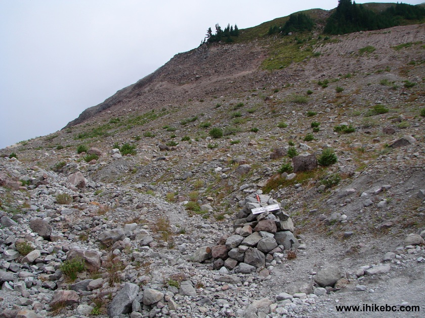
Garibaldi Provincial Park - Diamond Head - Hiking in British Columbia
Canada
25. We took the path to the right.
Path to Opal Cone and Mamquam Lake - Hike in Squamish area
26. Fifteen minutes after that split, we are finally finishing hiking this valley.
Hiking Trail Garibaldi Provincial Park - Diamond Head BC Canada
27. Looking back at our path.
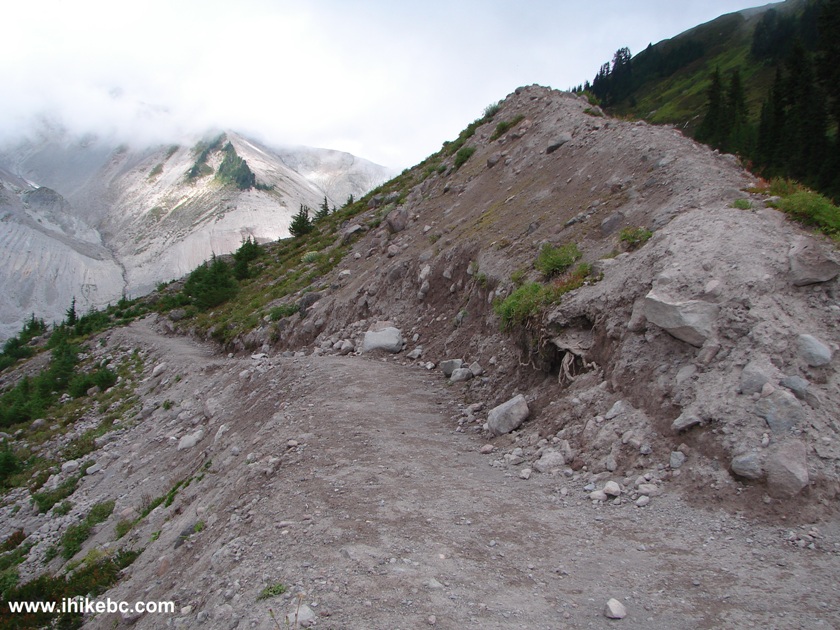
Hiking Trail Garibaldi Provincial Park - Diamond Head British Columbia
Canada
28. And now the other side of this "hill".
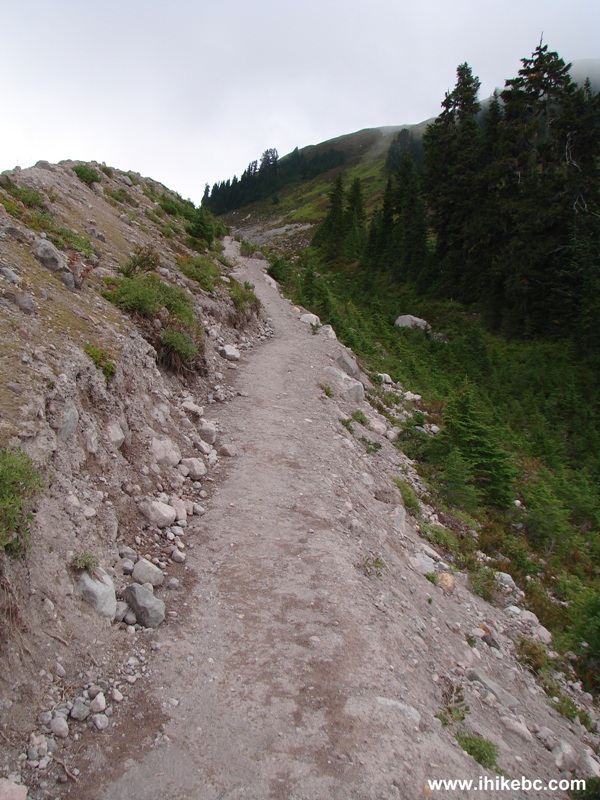
Hiking Trail Garibaldi Provincial Park - Diamond Head BC Canada
29. The view on the right side.
View From Hiking Trail Garibaldi Provincial Park - Diamond Head BC
Canada
30. Half an hour after the split with the trail to Garibaldi Lake, another split gives a choice of visiting Opal Cone, or continuing to Mamquam Lake for another five kilometers. Coordinates: N 49°49.064', W 122°58.369'. Elevation: 1522 meters.
Opal Cone Trail Split With Mamquam Lake Trail BC Canada
31. We continued to Mamquam Lake.
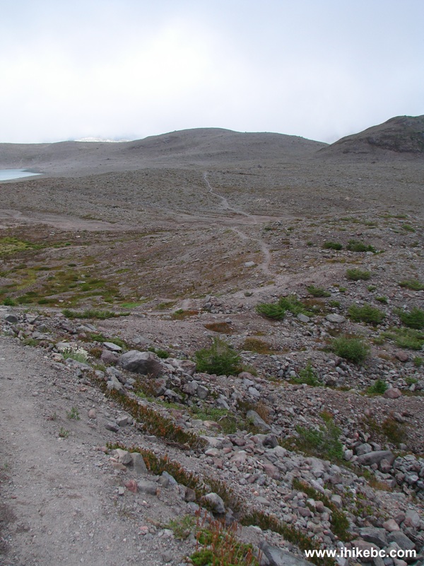
BC Hiking - Mamquam Lake Trail in Garibaldi Provincial Park - Diamond
Head
32. There was a glimpse of a glacier on the left side.
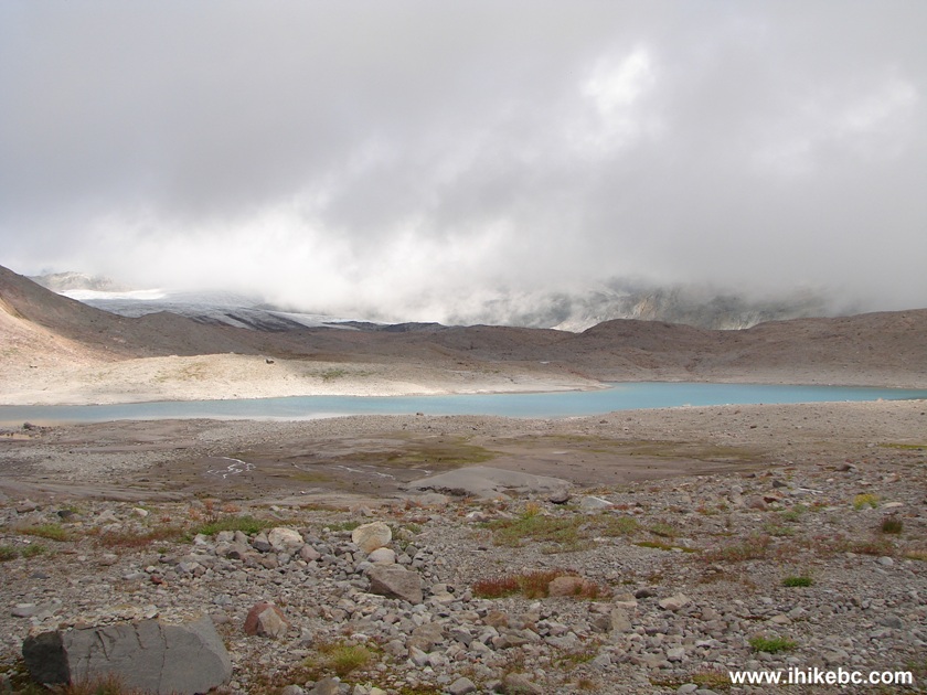
View from Mamquam Lake Hiking Trail BC Canada
33. We were now travelling through another valley, with a lone tree far ahead.
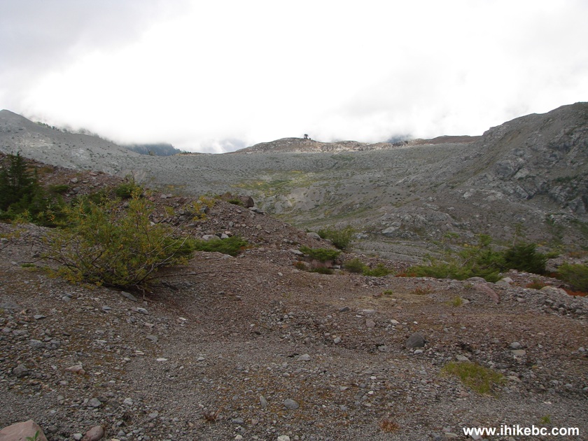
Crossing a Valley en route to Mamquam Lake
34. 12x zoom, and the tree gets closer.
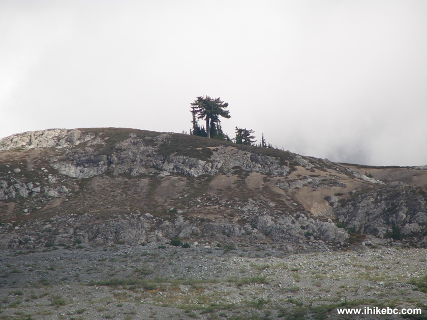
Tree By Mamquam Lake Hiking Trail Province of British Columbia Canada
35. And we are entering our final valley before the descent to Mamquam Lake begins.
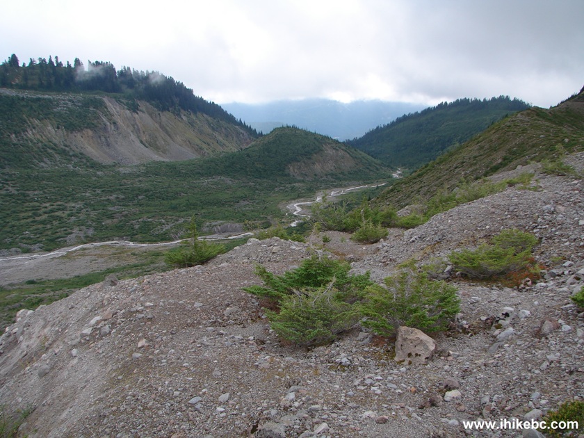
Valley En Route to Mamquam Lake Garibaldi Provincial Park BC Canada
Our Mamquam Lake Trail Hike Trip Report
Continues on Page 3.


|
 |
Other Trips in Squamish Area:
|
|
|
|
|
|
|
|
|
|
|
|
|
|
|
|
|
|
|
|
|
|
|


![]()
![]()
![]()
Follow @ihikebc Tweet
ihikebc.com Trip 072 - Mamquam Lake Trail Hike Page 2 of 3