![]()
![]()
![]()

Trip 070 - August 27, 2014 (Wednesday)
Ling Lake Trail (partial)
Off Chilliwack Foley Forest Service Road
Page 2
of 2
Distance From Vancouver to the Trailhead: About 133 km: 93.5 km from Grandview Hwy entrance to Hwy 1 East to Exit 123 (Prest Road) - turn right (South), then 5 km on Prest Rd and turn left on Bailey Rd, then 700 meters later at a split stay right on Elk View Road. Continue on Elk View Road until it ends ten kilometers later, and Chilliwack Bench Forest Service Road begins. Then, 18.7 kilometers later, Chilliwack Foley FSR appears ahead. Drive on Chilliwack Foley for about 5 km until, just past Foley Lake, you would reach a split seen in photo #1. If you have an ATV, it could be possible to ride it all the way to the rock fall in photo #28. A small 4x4 might make it all the way to the boulder in photo #20.
Liked: Several great mountain views, waterfall, fairly decent road surface most of the way, no bugs.
Of note: Remote wilderness area. No cell phone signal. Much of the road has no tree cover - sun protection recommended. Hiking boots and poles are recommended. Waterfall creek crossing could be a problem during spring runoff. Unable to find continuation of the trail to Ling Lake.
Vancouver, Coast & Mountains Backroad Mapbook (2010 edition) Coordinates to the likely beginning of the trail: Page 5 (Chilliwack Lake) D4.
Related Websites: Chilliwack District FSR Conditions.
Other Trips in Chilliwack Area: Flora Lake Trail, Williams Ridge Trail, Mount Thom Lookout Loop Trail, Vedder Rotary Loop Trail, Teapot Hill Trail Hike, Chilliwack Dyke Trail, Greendrop Lake Trail, Mount Cheam Peak Trail, Chilliwack Foley FSR, Chilliwack Bench FSR, Elk-Thurston Trail, Slesse Memorial Trail, Downtown Chilliwack BC Visit, Chilliwack Lake FSR, Radium Lake Trail, Chilliwack Lake Provincial Park, Minter Gardens, Town of Agassiz BC, Bridal Veil Falls Provincial Park.
Follow @ihikebc Tweet
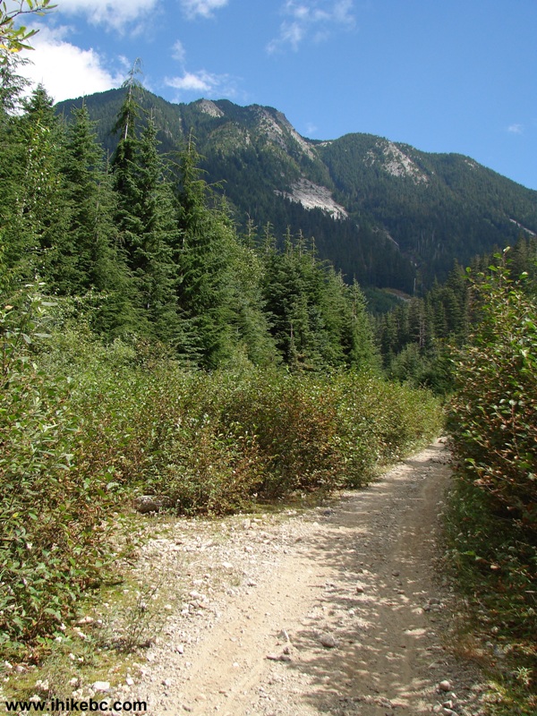
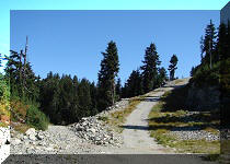
19. After the second bridge, the road becomes more narrow and rocky.
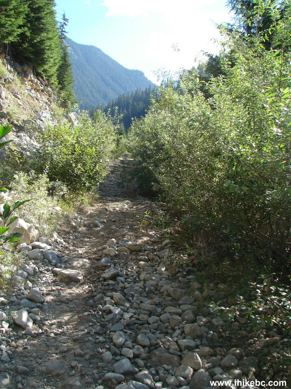
Chilliwack Foley FSR BC Canada
20. This boulder would most likely stop any 4x4 vehicle which made it this far, as the road here is very narrow with a steep drop-off on the other side. ATVs might make it past the boulder.
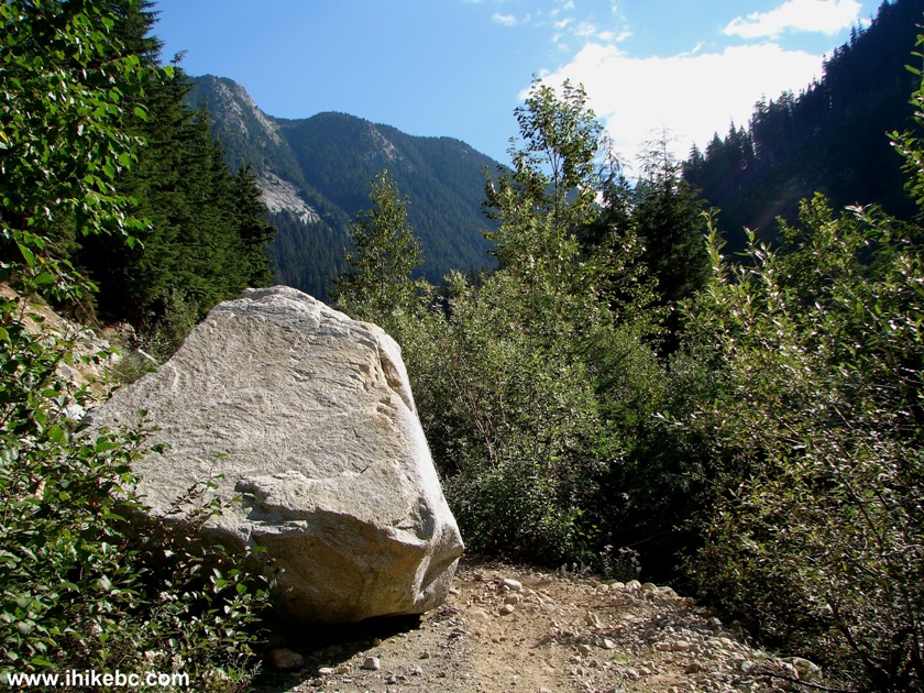
Photo of Chilliwack Foley Forest Service Road British Columbia Canada
21. Looking back - the boulder and the mountain.
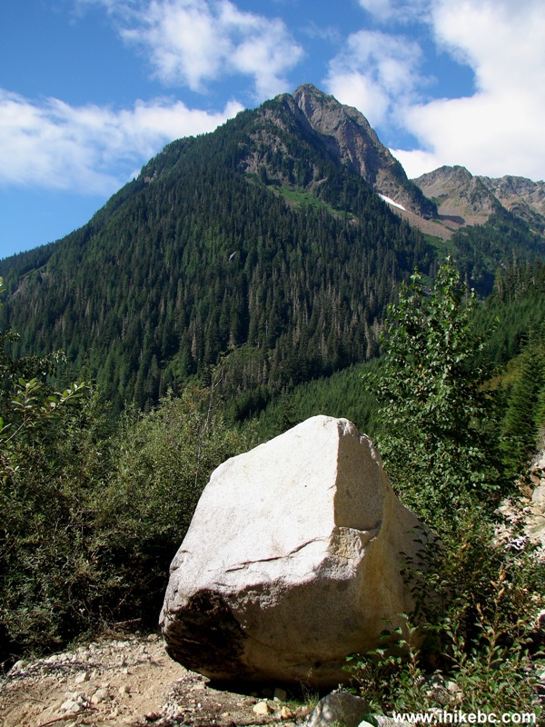
Chilliwack Foley FSR BC Canada
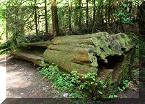
22. And this is where this boulder came from.
View From Chilliwack Foley FSR BC Canada
23. After a while, the tree cover returns and the road becomes overgrown. Still, ATV tracks are visible on the ground all the way to the rockfall.
Chilliwack Foley Forest Service Road BC Canada
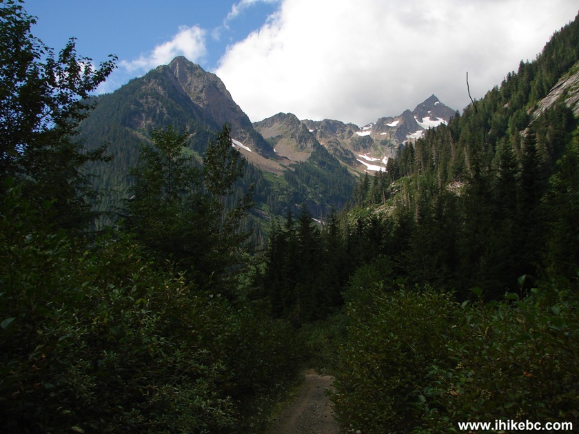
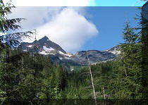
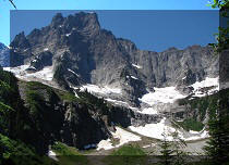
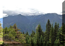
24. Near the rockfall, the mountain views are simply grand.
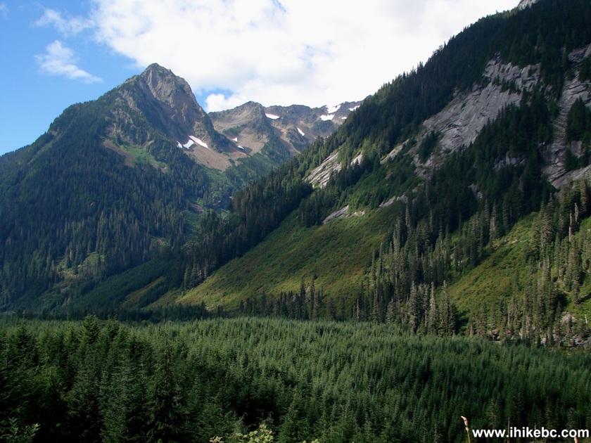
Mountain View Chilliwack Foley FSR British Columbia Canada
25. A bit to the left.
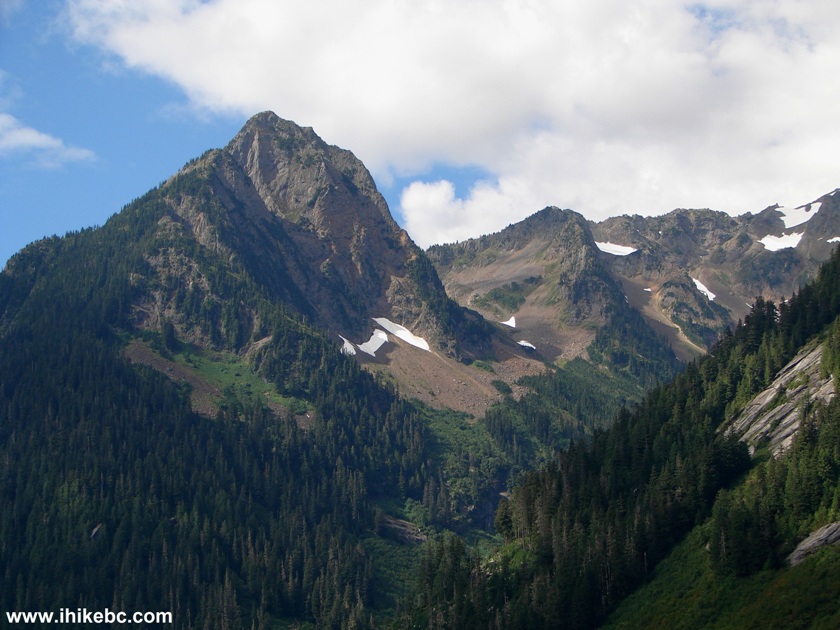
Mountain View Chilliwack Foley FSR BC Canada
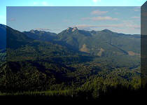
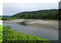
26. Also, right before the rockfall, you get to see Ling Lake from above.
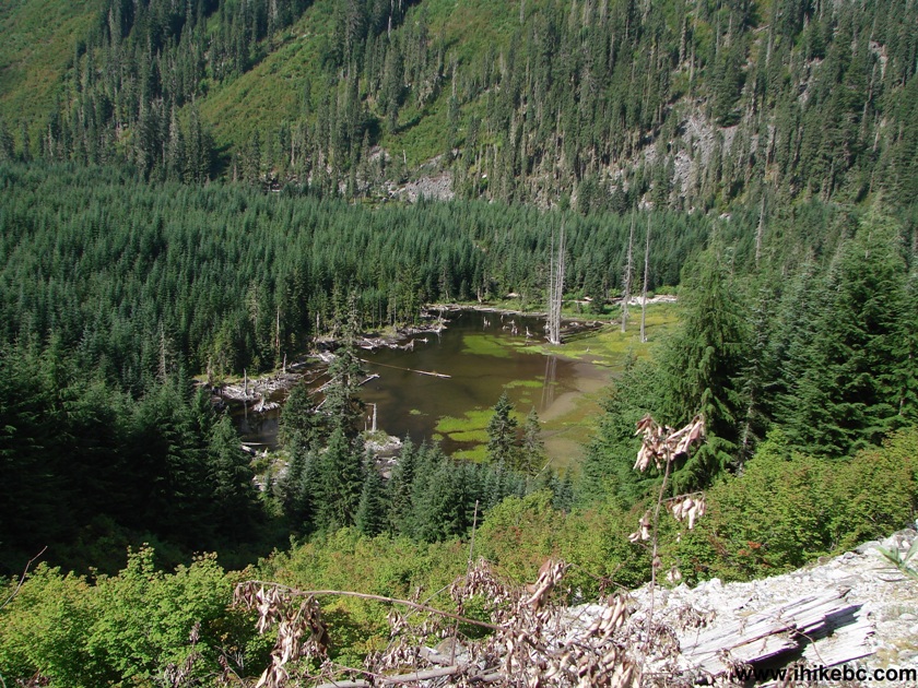
Ling Lake BC Canada
27. Then, Chilliwack Foley FSR gets badly overgrown...
Overgrown Chilliwack Foley FSR BC Canada
28. ...all because there is a rockfall here blocking the road. Coordinates: N 49⁰10.570' W 121⁰31.503'.
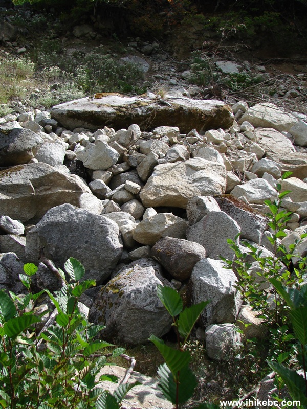
Rock fall Chilliwack Foley Forest Service Road BC Canada
Here is our video of the rockfall and of the views from this area.
More ihikebc videos are on our YouTube Channel
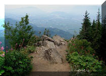
29. We reached the rockfall 3 hours and 15 minutes after starting our biking hike, and then turned around in search of the Ling Lake Trail turnoff. The view on the way back.
Chilliwack Foley FSR BC Canada
30. Here is the turnoff. There are no signs, flagging tape, or anything else indicating what it is, and we were not able to find Ling Lake. The reason this appears to be Ling Lake Trail is: 1) The coordinates match the Backroads Mapbook map for Ling Lake turnoff, 2) there are no other suitable turnoffs in this area, and 3) the turnoff leads to a path which was definitely cleared from excess bush growth, as numerous cut-off branches were littering the ground. The coordinates for the turnoff are: N 49⁰09.875' W 121⁰31.834', and you will find it on the left side (as seen in the photo below) some time after passing the second bridge seen in photo #18.
Chilliwack Foley FSR BC Canada Turn off to Ling Lake Trail
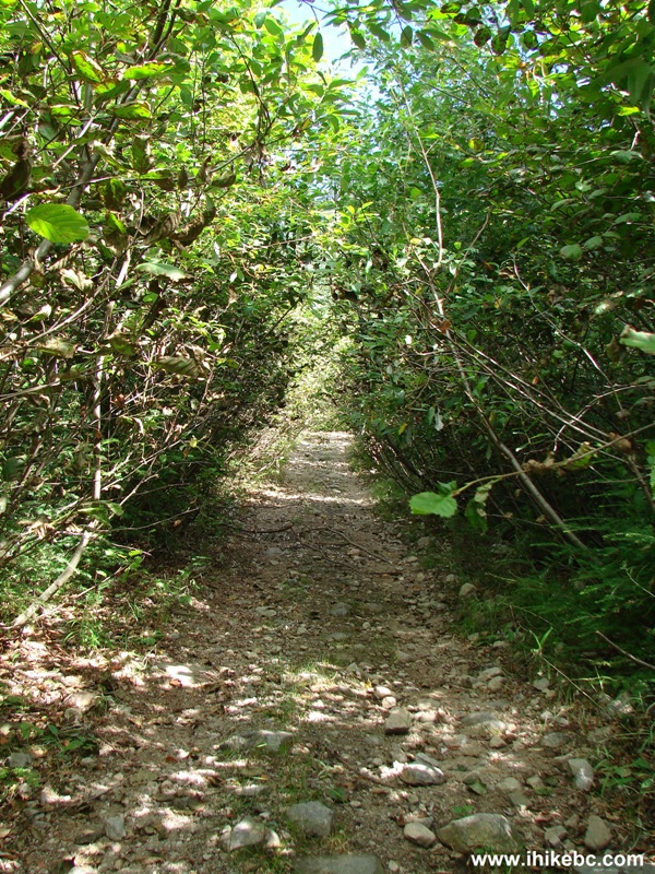
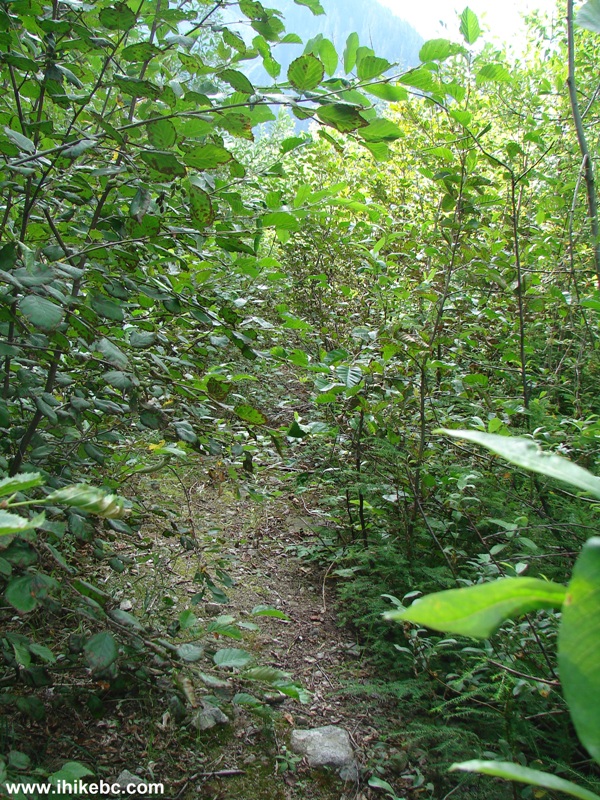
31. Immediately after turning left, here is what you see.
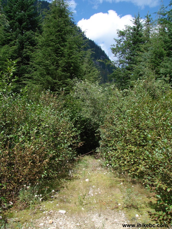
Ling Lake Trail BC Canada
32. It's possible to bike on this path, as it has been cleared. Check out the cut-off branches on the ground.

Ling Lake Trail British Columbia Canada
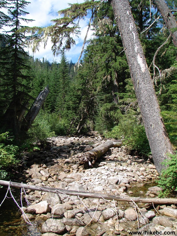
33. In fifteen minutes we have reached Ling Creek, and the path disappeared. We crossed the creek and explored the area for a bit to no avail. Here we are looking left after coming out of the woods.
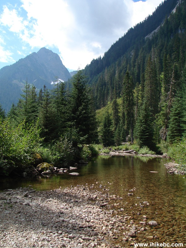
34. Looking right.
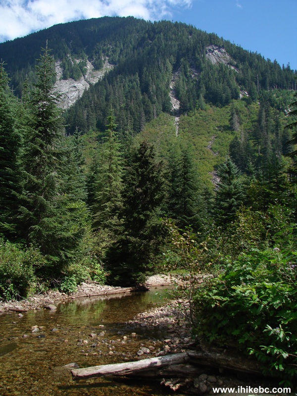
35. Crossed the creek, went further, looked around, but, alas...
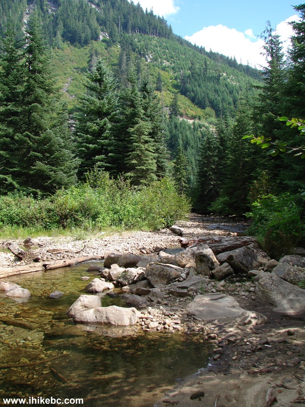
36. ...Ling Lake Trail has vanished.
Even though we did not make it to Ling Lake, this was a very good trip due to the mountain views and the waterfall.


|
 |
Other Trips in Chilliwack BC Area:
|
|
|
|
|
|
|
|
|
|
|
|
|
|
|
|
|
Greendrop Lake Trail
|
|
Teapot Hill Trail
|
|
Vedder Rotary Trail
|
|
Mount Thom Trail
|
|
Flora Lake Trail 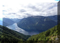 |


![]()
![]()
![]()
Follow @ihikebc Tweet
ihikebc.com Trip 070 - Ling Lake Trail Hike (Near Chilliwack BC) Page 2 of 2