![]()
![]()
![]()

Trip 267 - September 6, 2022 (Tuesday)
Boulder Canyon Trail Hike
Near Muncho Lake BC
Page 2 of 2
Liked: Canyon and mountain views, interesting stone formations, no bugs.
Of Note: No tree cover. The trail is semi-dangerous and is for (semi)-experienced and well-equipped hikers only, especially if hiking up the mountains past the creek bed. Some minor scrambling is required. Hiking on the creek bed is required for much of the trail, and may not be possible in high water. Very windy on the ridge in the alpine. Most of the trail is composed of loose stones of various sizes and dirt. Hiking poles and boots are essential.
Northern BC Backroad Mapbook (3rd edition) Approximate Trailhead Coordinates: Page 79 (Muncho Lake) E2.
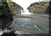
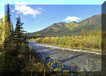
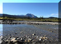
Boulder Canyon Trail (not to be confused with Boulder Gardens Route near Tumbler Ridge) is located in Northeastern British Columbia off BC Highway 97 (Alaska Hwy) just North of Muncho Lake, and approximately 268 km North of Fort Nelson, the last town with major services of any kind. Muncho Lake has two gas stations and Northern Rockies Lodge, and that's about it.
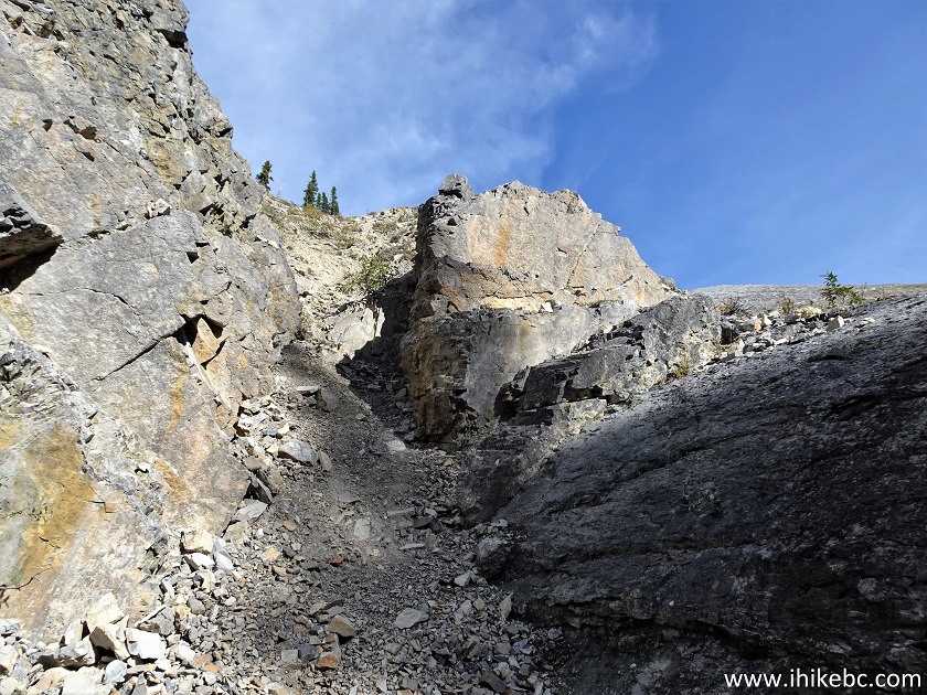
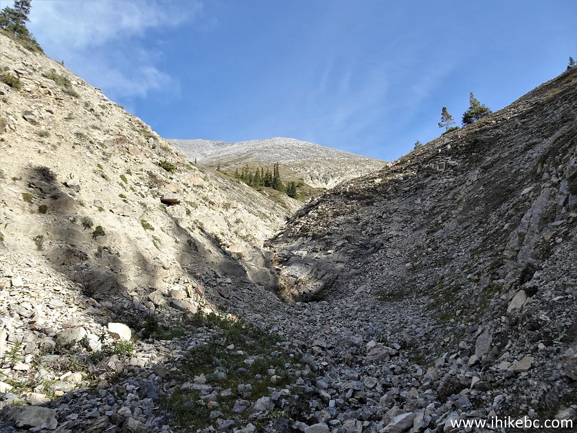
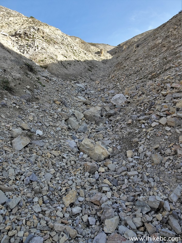
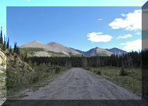
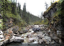
Boulder Canyon Trail is located 16.5 km North of Old Alaska Highway Trail South, which we covered in the previous trip report. Boulder Canyon is not as spectacular, but has enough good views to make it a very worthwhile hike for a properly equipped and (semi-)experienced hiker. The trail is composed of stones, large and small, which are frequently loose, mixed with dirt past the creek bed. The creek was dry during our hike late in the season, but any presence of water would make it complicated, if not impossible, to pass a few obstacles where some scrambling is required.
Also, once the first split arrives at about the 2.4 km mark of the hike, the going gets very tough, and the steepness of the terrain combined with a mix of loose stones and dirt would provide a real challenge. That said, the higher you climb, the better the views, so there is a good incentive to keep moving.
Today, we hiked past four splits, and climbed up for a bit, for a total one-way distance of about 5 kilometers. It is certainly possible to hike much further for potentially even better views.
The distances are as follows:
Trailhead to Split 1 (end of relatively easy hiking) - 2.4 km.
Split 1 to Split 2 - 400 meters.
Split 2 to Split 3 - 300 meters.
Split 3 to Split 4 - 310 meters.
Split 4 to hike end (possible to hike much further) - 1.5 km.
*All trail distances are based on a GPS odometer and are approximate.
34. Another scramble awaits 215 meters from Split 4. This is a tough one, and you might be better off detouring on the right side about 50 meters prior to that.
Boulder Canyon Hike
35. After the scramble.
Boulder Canyon Route
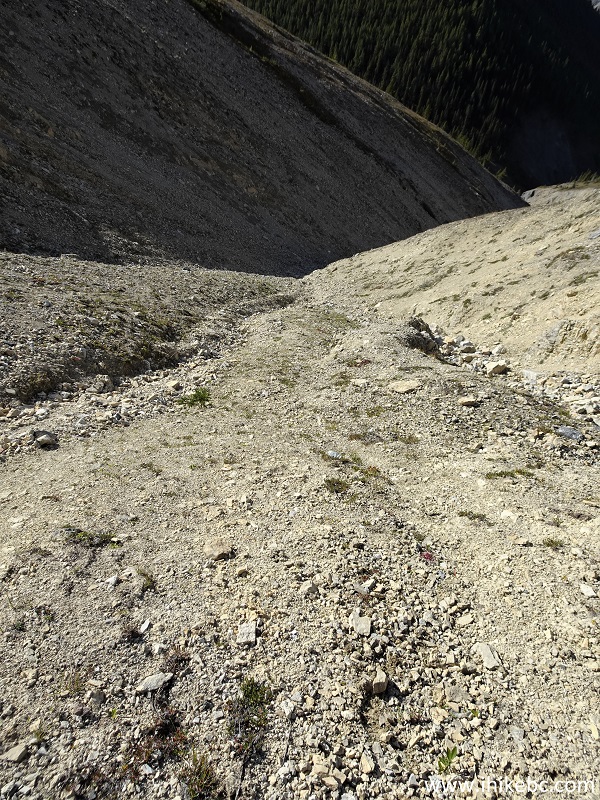
36. At 485 meters from Split 4 now. The steep terrain and loose stones/dirt make it a particularly difficult stretch.
Boulder Canyon Route Hike in Muncho Lake BC Area
37-38. At 610 meters, there is a stand-alone hoodoo on the left side.
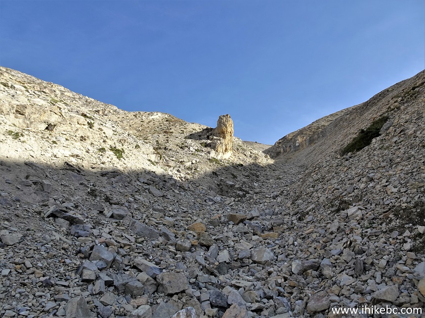
Boulder Canyon Route Hoodoo
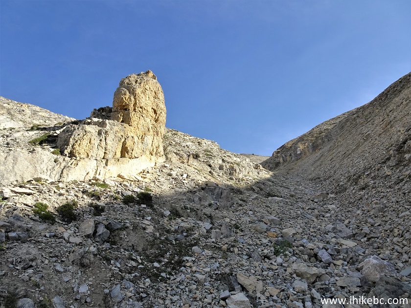
Hoodoo
39. Looking left by the hoodoo. Coordinates: N 59°04.798’ W 125°45.824’. Elevation: 1,405 meters.
Boulder Canyon Route - British Columbia Hiking
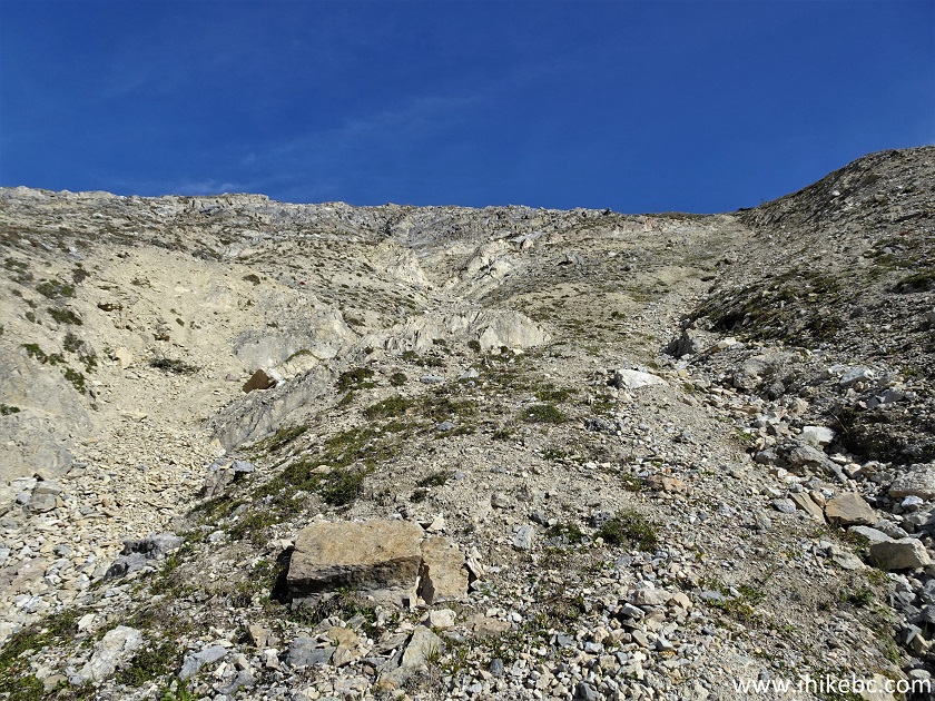
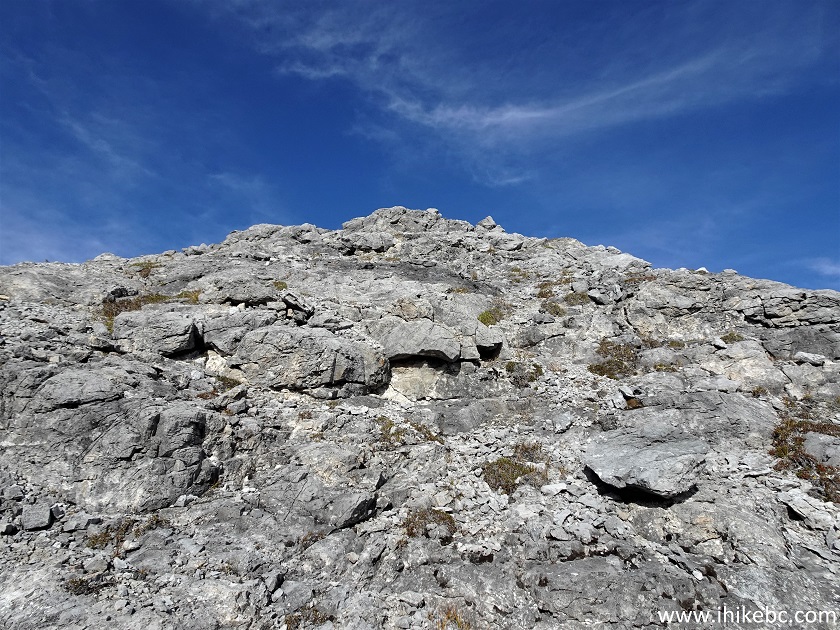
40. The terrain after the hoodoo is just as complicated as before. It is steeper than it looks.
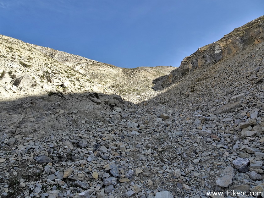
Boulder Canyon Route Hike - British Columbia Canada
41. Looking back at 680 meters from Split 4.
Boulder Canyon near Muncho Lake BC
42. It got even steeper after that.
Boulder Canyon Route Hike in Canada
43. Like, no kidding. Looking back again.
Steep Hiking - Boulder Canyon Route - Northern British Columbia
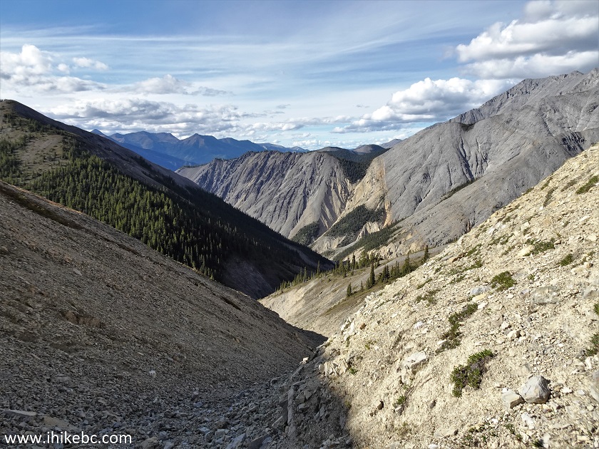
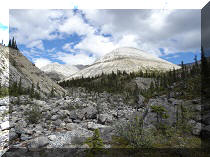
44. The canyon we came from.
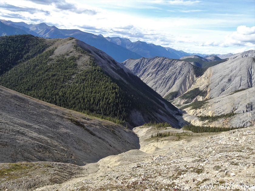
Boulder Canyon North of Fort Nelson BC
45. Finally, the terrain became less steep on the right side at about 880 meters. We went there for a bit prior to resuming the climb.
Hike in British Columbia - Boulder Canyon Route
46. This is also where we found a very obvious path, unclear if animal- or human-made. It went around the mountain on our right and veered to the left and out of sight.
Boulder Canyon Route near Muncho Lake BC Canada
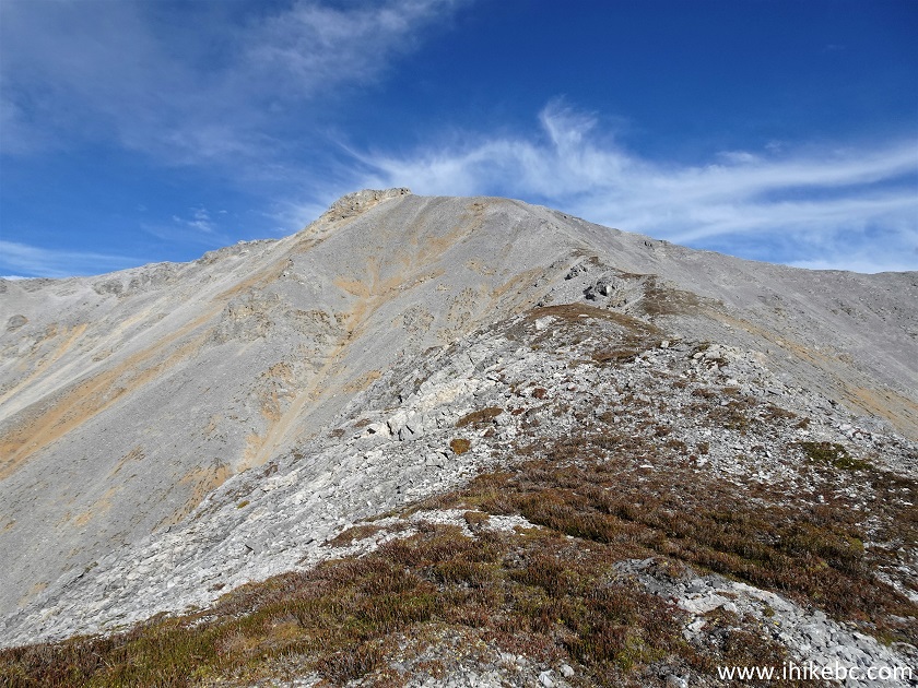
47. And here is the mountain ahead of us which we continued to climb.
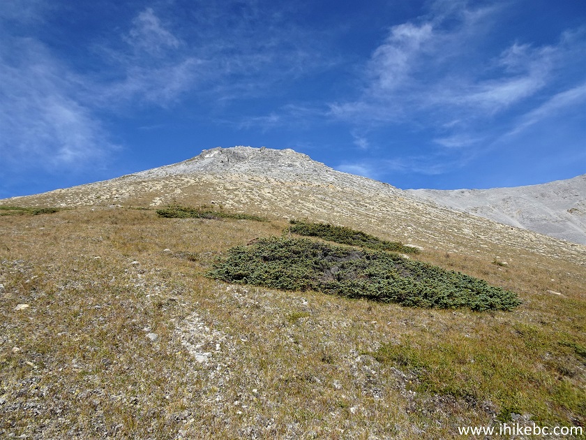
British Columbia Boulder Canyon Route Hike
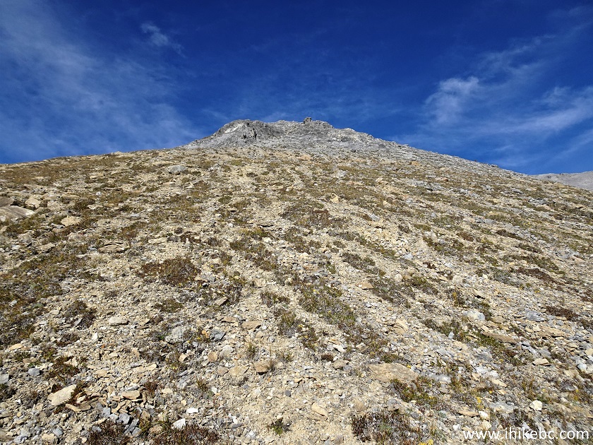
48. Steep again. At 1.01 km from Split 4.
Mountain Hiking in Northern British Columbia
49. Just a bit more...at 1.08 km here.
Northern Rockies Hiking
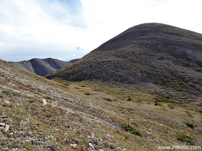
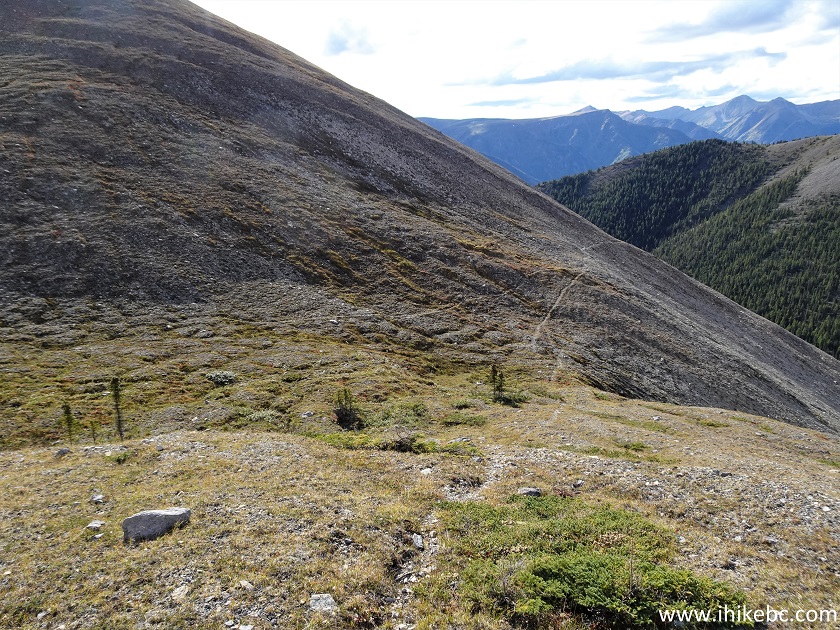
50. And we are on a ridge at 1.28 km from Split 4.
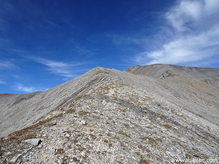
Canada Northern Rockies Hiking
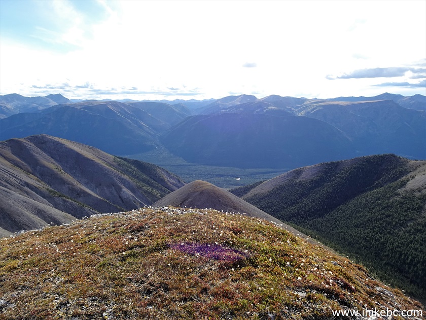
51. Looking back from the ridge.
Boulder Canyon Route Hike in Muncho Lake BC Area
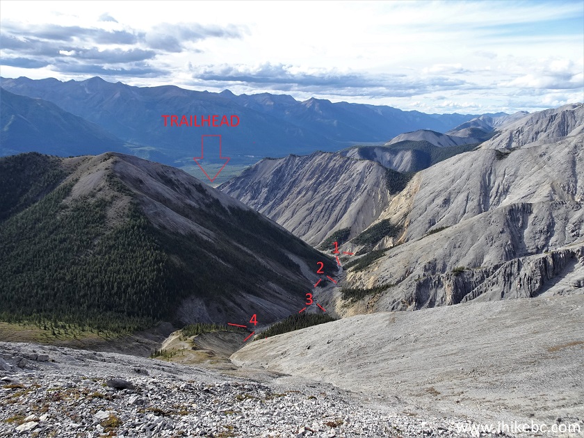
52. Looking back and to the right we see the general trailhead location and all four splits (we took the right split every time to end up where we ended up).
Boulder Canyon Route Northern British Columbia Canada
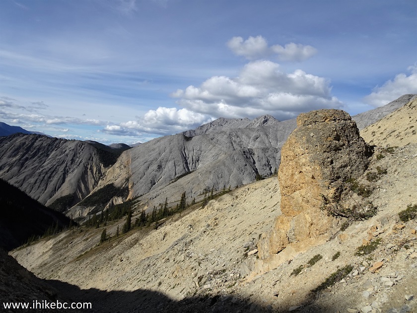
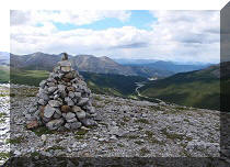
53. We continued up the ridge. It's not as steep as the earlier terrain. At 1.50 km from Split 4 there was still much left to be hiked, but we stopped right here. Coordinates: N 59°04.842’ W 125°45.245’. Elevation: 1,760 meters (665 meters elevation gain from Split 1 for an average grade of 44%).
Northern Rockies Hiking in British Columbia Canada
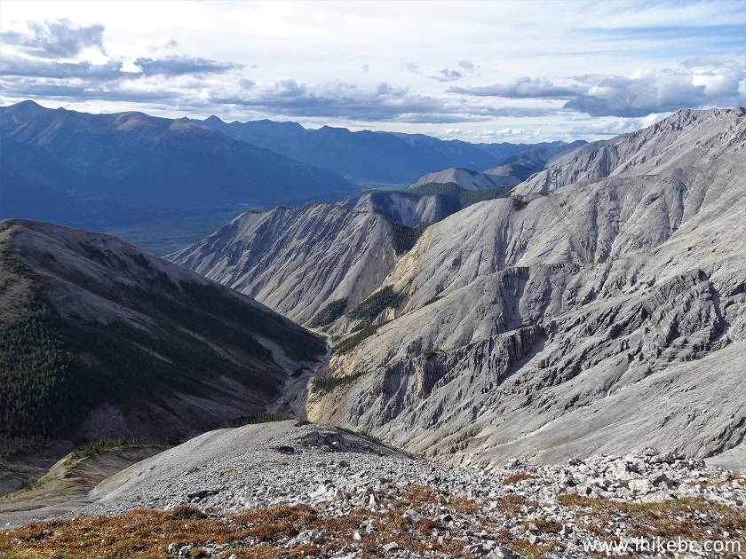
55. Looking back.
Northern Rockies BC Canada
56. Looking right.
Boulder Canyon near Muncho Lake BC
57. Looking left.
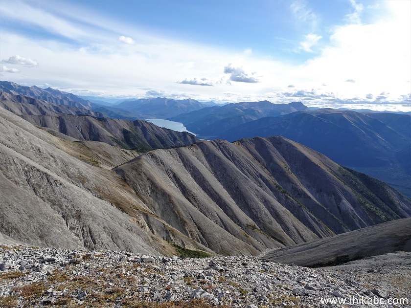
British Columbia Northern Rockies
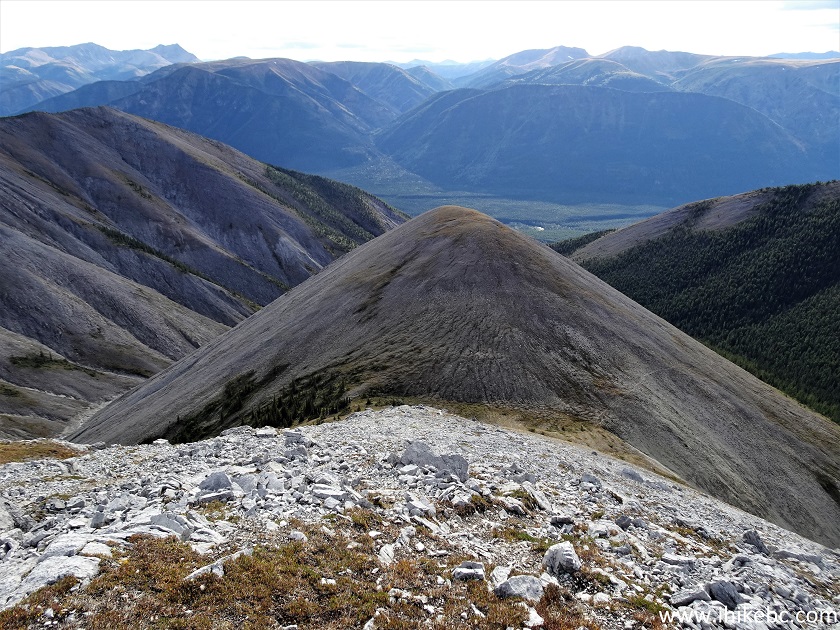
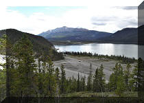
58. Now with a zoom. That's Muncho Lake in the distance.
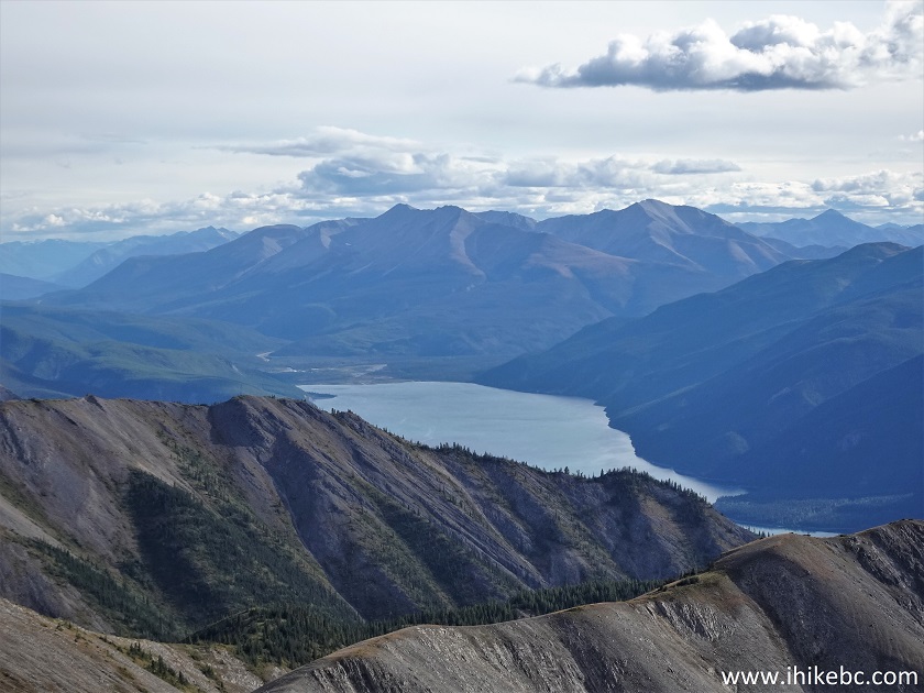
Muncho Lake
59. A panorama of the place.

Here is our video of the views from this location.
More ihikebc videos are on our YouTube Channel.
Boulder Canyon Trail is quite challenging, especially after the canyon, but has enough good views to make it a highly recommended hike for (semi-)experienced properly equipped hikers.


|
 |
Other Trips in Fort Nelson Area:
|
|
|
|
|
|
|
|
|
|
|
|
|
|
|
|


![]()
![]()
![]()
ihikebc.com Trip 267 - Boulder Canyon Trail Hike (Near Muncho Lake BC) Page 2 of 2