![]()
![]()
![]()

Trip 236 - September 13, 2021 (Monday)
Dunedin Trail Hike
Off Alaska Highway North of Fort Nelson BC
Liked: River view, mountain view, fairly easy trail, some shade, no bugs.
Of Note: Lots of mud and some swampy areas, three small creek crossings are required. The trail is open to motor vehicles.
Northern BC Backroad Mapbook (3rd edition) Fort Nelson Coordinates: Page 80 (Steamboat) C5.
Other Trips in Fort Nelson Area: Fort Nelson BC Visit, Teetering Rock Trail, Summit Peak Trail, Summit Ridge Trail, Stone's Sheep Trail.
Dunedin Trail is located in Northeastern British Columbia, North of Fort Nelson. This hike is fairly easy, save for the muddy and swampy areas, of which there are plenty. The trail starts right by Alaska Highway, passes by a small hunting camp, and then reaches Dunedin River 7.6 km after the start. The views are few and far in-between. There is one decent mountain view, and the river looks fine. However, this trail is very, very muddy. We hiked at the end of a fairly dry season, and still there was a whole lot of mud in some stretches, occasionally for hundreds of meters in a row. After a heavy rain or early in the season this would be a monumentally difficult trail to hike. Perhaps, for this reason the information board by the trailhead states 8 hours return for 15 kilometers of hiking? It took us 3 hours 20 minutes round trip, but this could certainly be a much longer hike, if the mud is more plentiful.
Even though there is a bicycle symbol on the information board, this is not a biking trail, unless you enjoy a slow and thoroughly exhausting biking through all the mud. Horse and ATV riders would certainly like it here much more.
1. We are Northbound on Alaska Highway (BC Highway 97), approximately 10 km North of Teetering Rock trailhead access road turnoff, and 106 km North of Fort Nelson.
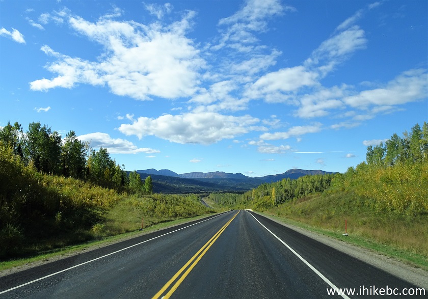
BC Highway 97 (Alaska Highway) North of Fort Nelson
2. Exactly 41.8 km from Teetering Rock access road turnoff, and about 137 km North of Fort Nelson, we are at Dunedin Trailhead seen on the right side. You can either park on the side of the highway, or, with a 4x4, drive up the trail for about 900 meters to the hunting camp, where there is a lot more space to park.
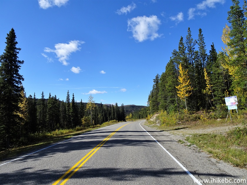
Alaska Highway (BC Highway 97) at Dunedin Trailhead
3. Here is Dunedin Trailhead. Coordinates:
N 58⁰39.552' W 124⁰34.646'. Elevation: 1,151 meters.
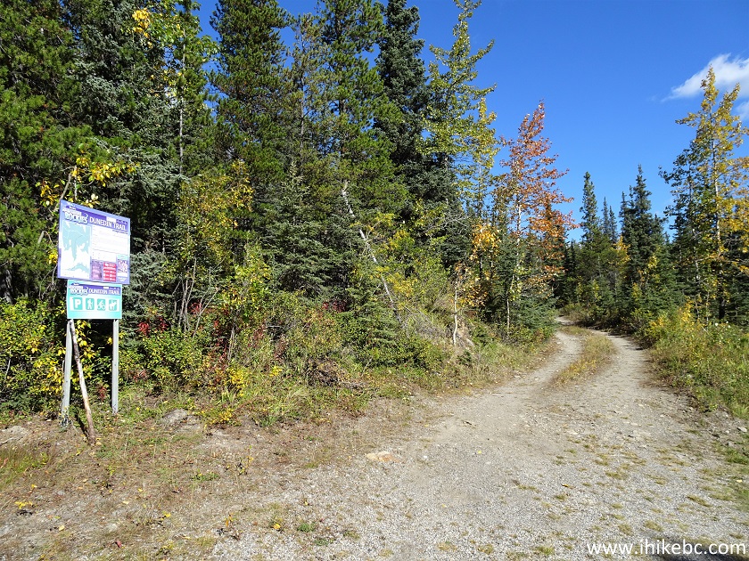
Dunedin Trailhead
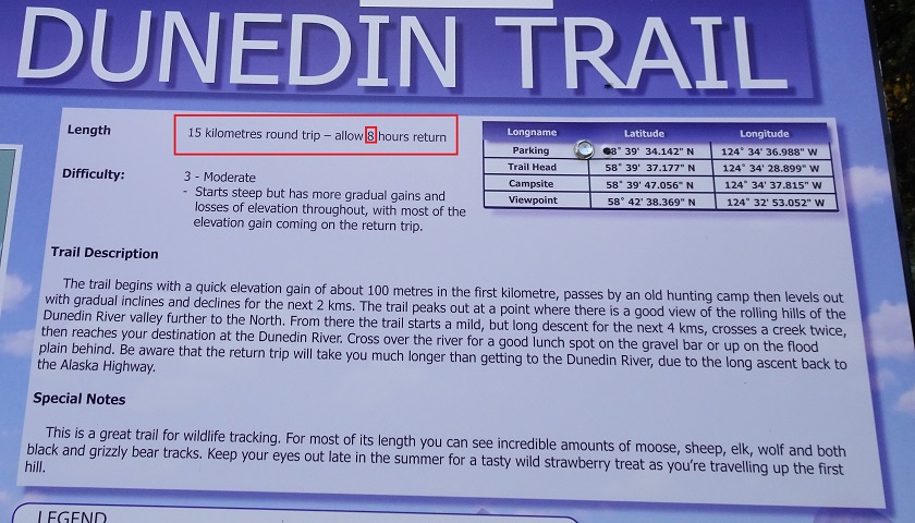
4-5. The information board by the trailhead talks about the trail and shows the trail map.
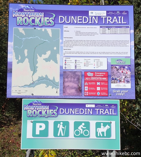
Dunedin Trail Information Board
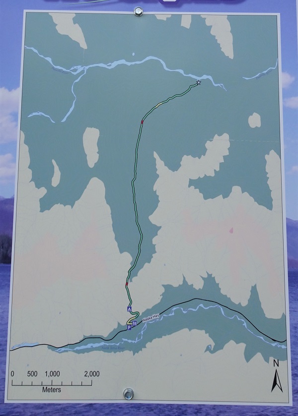
Dunedin Trail Map
6. Check this out - EIGHT hours return for a 15 km round trip hike. That's less than 2 km per one hour of hiking, something one would see only on the most difficult trails out there. Indeed, must be accounting for all the possible mud on the trail.
Information for Dunedin Trail in Northern British Columbia Canada
7. Dunedin Trail begins. Here at 70 meters from the trailhead (all distances are based on a GPS odometer and are approximate).
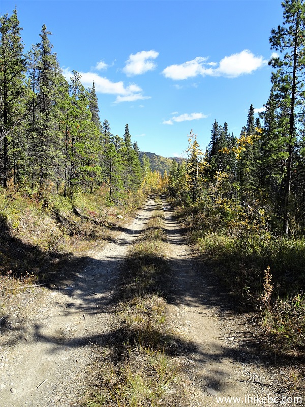
Dunedin Trail North of Fort Nelson BC Canada
8. Now at 530 meters of Dunedin Trail. It's a steady climb at first, though you actually lose altitude by the end of the trail near Dunedin River.
Dunedin Trail
9. Hunting camp is at 900 meters of the trail. There are no major muddy spots until the camp, and the trail is not too complicated aside from one somewhat steep stretch, so most 4WD vehicles with medium and high clearance should have no trouble getting here from the highway.
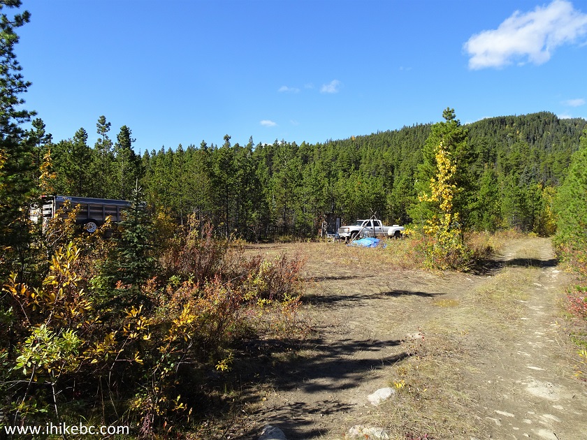
Hunting Camp in Northern British Columbia by Dunedin Trail
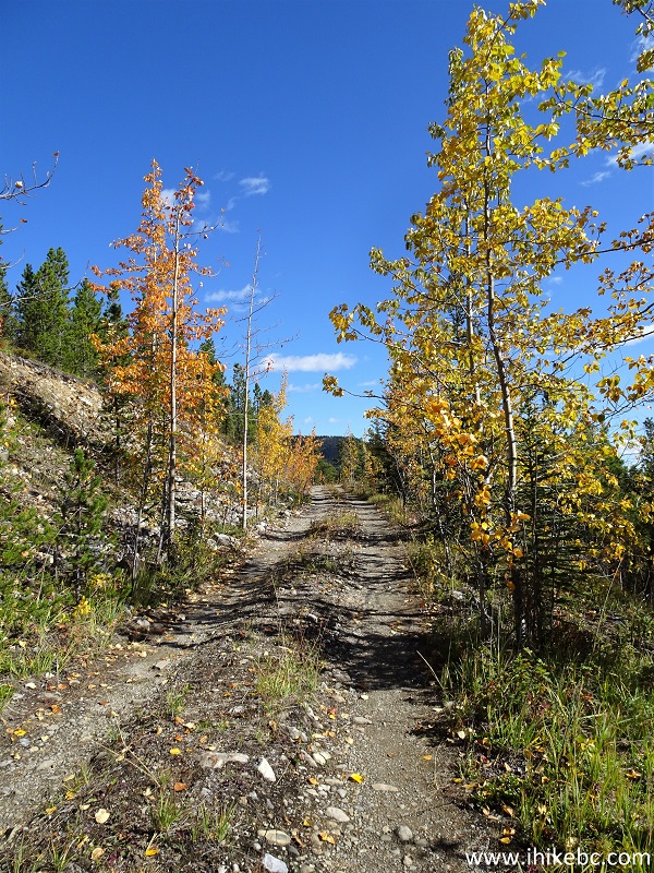
10. Unless you have an ATV, it's a good idea not to drive past the hunting camp, as the road narrows down substantially and gets very muddy in many spots. At 1.35 km here.
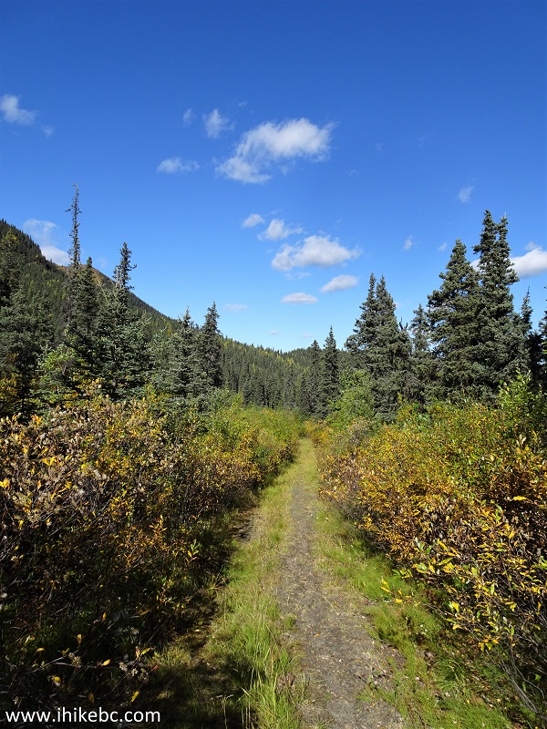
Dunedin Trail British Columbia Canada
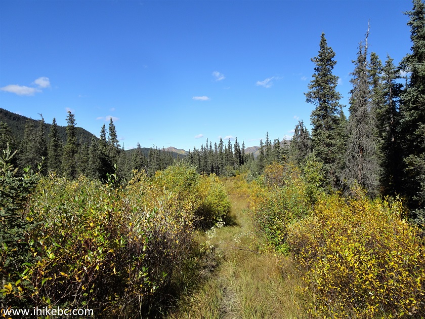
11-12. At 2.35 km, here comes the mud. Several hundred meters of it.
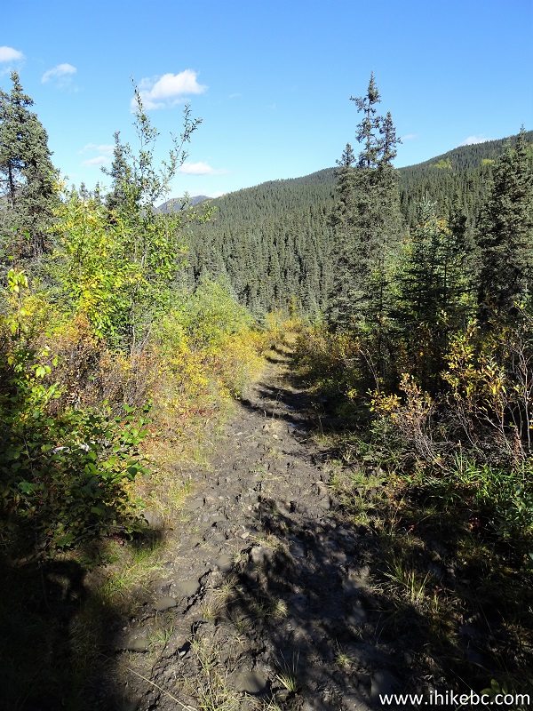
Muddy Dunedin Trail
Dunedin Trail Mud
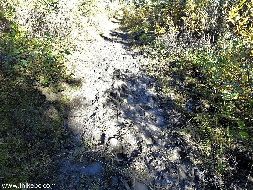
13. Now at 2.45 km. Still muddy.
British Columbia Hike - Dunedin Trail
14. Time for a small swamp. 2.90 km of Dunedin Trail.
Swampy Dunedin Trail in British Columbia Canada
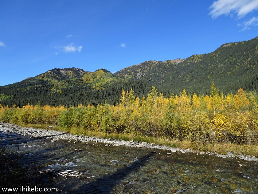
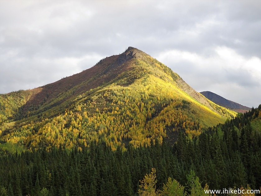
15-16. The only decent mountain view (until the end of the trail) is at 5.30 km.
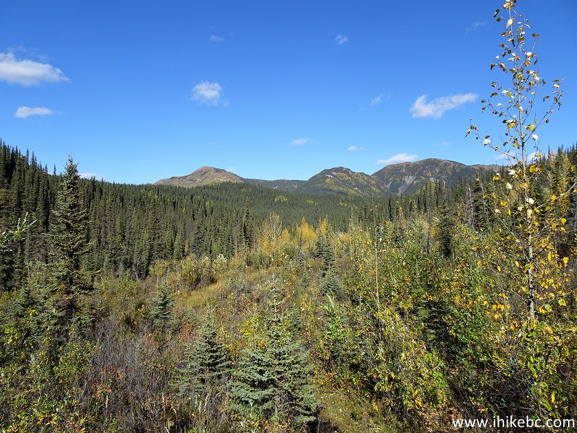
View from Dunedin Trail
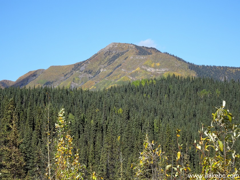
Mountain in Northern British Columbia Canada
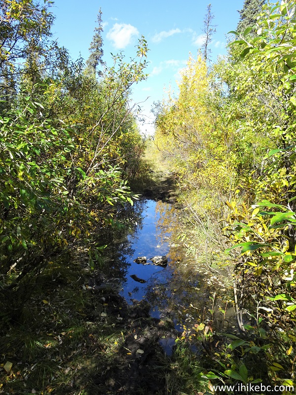
17-19. At 6.23 km, 6.30 km, and 7.16 km, there are three very similar creek crossing. They were easy enough today, but could become a serious challenge after a heavy rain or early in the season.
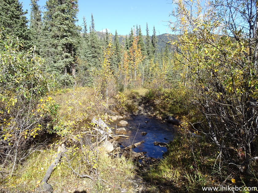
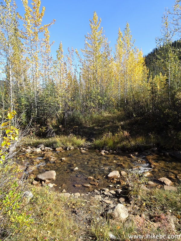
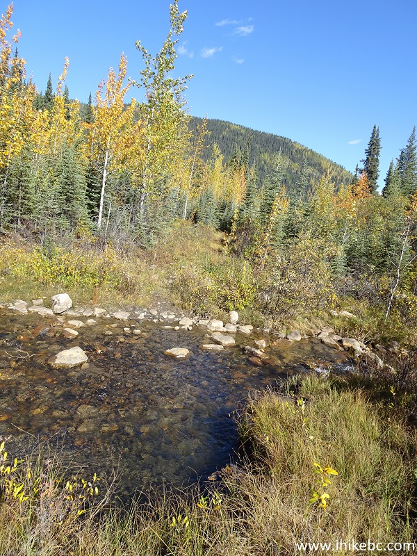
Dunedin Trail Creek Crossing
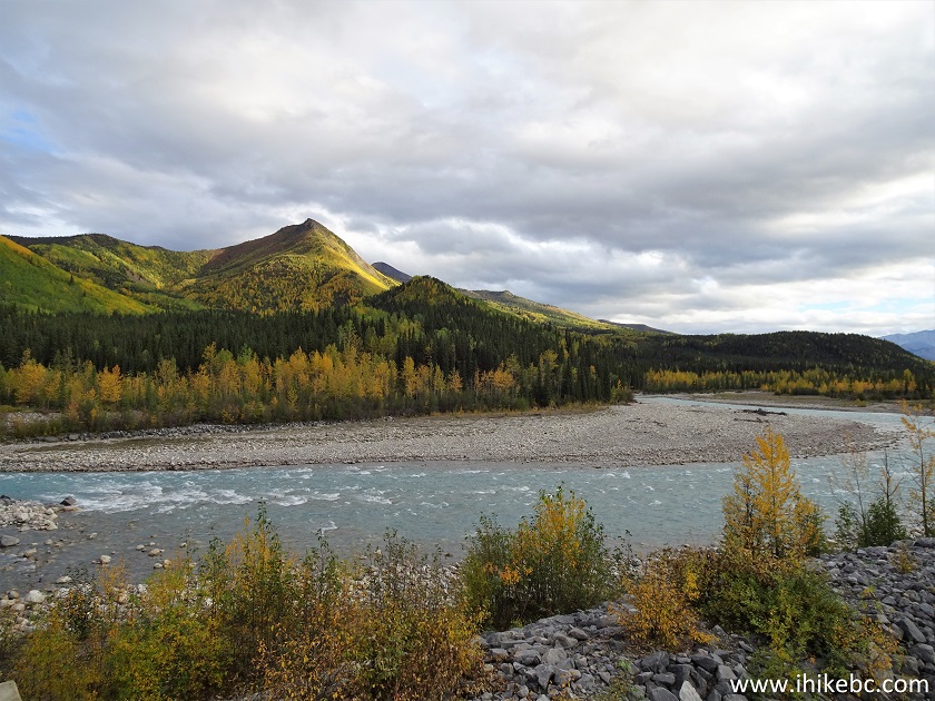
20-22. At 7.60 km, after 1 hour and 35 minutes of hiking, we have reached the end of the trail at Dunedin River. Coordinates:
N 58⁰42.629' W 124⁰32.874'. Elevation: 913 meters (238 meters elevation loss from the trailhead). Left to right.
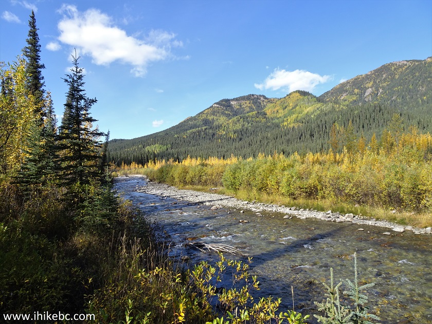
Dunedin River
Dunedin River British Columbia
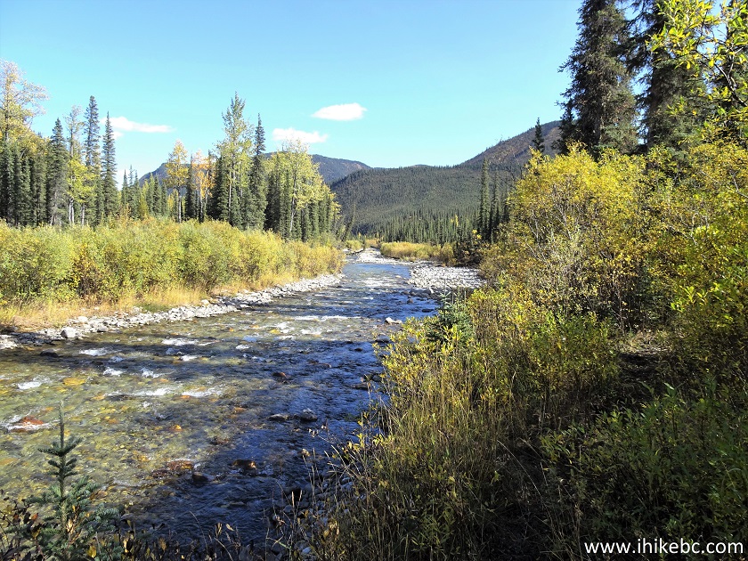
Dunedin River in Northern BC Canada
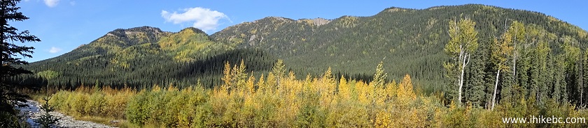
23. Now a panorama.
Here is our video of the views from this location.
It took us 1 hour and 45 minutes to get back to the trailhead. It's probably a good idea to wait until the end of the season to hike Dunedin Trail, which, aside from the mud and swampy areas, is a fairly decent hike, with several fine views. Recommended.
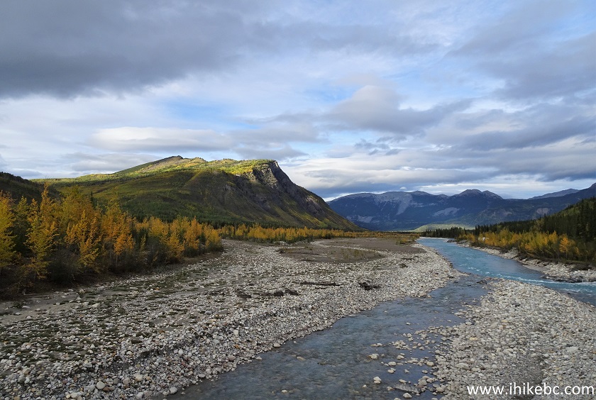
If you would continue driving North on Alaska Highway, 49 km from Dunedin Trail (186 km North of Fort Nelson) the highway crosses Racing River with very fine views on both sides.
1. Here is the bridge across Racing River. Looking South.
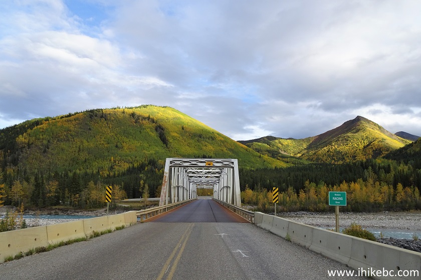
BC Highway 97 (Alaska Highway) at Racing River
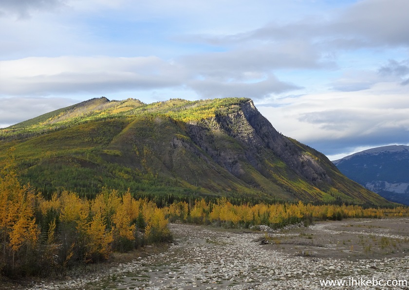
2-3. A bit more to the right, and a zoomed view of the mountain.
Mountain by Racing River British Columbia Canada
4-5. Now looking the other way.
View from near Alaska Highway in Northern British Columbia Canada
Here is our video of the views from this location.
More ihikebc videos are on
our YouTube Channel.


|
 |
Other Trips in Fort Nelson Area:
|
|
|
|
|
|
|


![]()
![]()
![]()
ihikebc.com Trip 236 - Dunedin Trail Hike (North of Fort Nelson BC)