![]()
![]()
![]()

Trip 193 - August 31, 2020 (Monday) and September 8, 2020 (Tuesday).
Coliseum Mountain Trail Hike
Lynn Headwaters Regional Park (Near North Vancouver BC)
Page 2 of 3
Trailhead Location: In Lynn Headwaters Regional Park, Near Norvan Falls, closer to the end of Headwaters Trail (via Lynn Loop Trail and Cedar Mills Trail).
Liked: Mountain views, ponds/tarns, white stones in the alpine. Easy access trails through a pleasant forest to the Coliseum Mountain trailhead. Boardwalks on the access trails. Shade in the forest. Few bugs.
Of Note: Coliseum Mountain Trail is very challenging – for experienced and well-equipped hikers only. Numerous steep and slippery sections – hiking poles and boots are essential. Steep unbarricaded drop-offs at viewpoints. Several muddy sections. The access trails, which lead to Norvan Falls too, are popular. Park gate closes at a set time, and one must be able to leave prior to that. Parking could be an issue on busy days.
Vancouver, Coast & Mountains Backroad Mapbook (5th edition) Trailhead Coordinates: Page 11 (North Vancouver) E6.
103 Hikes in Southwestern British Columbia (2008 edition): hike #42.
Related Website: Lynn Headwaters Regional Park - Metro Vancouver Official Site.
Related Trip: 005 - Norvan Falls Hike.
34. And here is that Headwaters Trail T-junction. Turn left to proceed to Coliseum Mountain trailhead.
Headwaters Trail T-junction at Cedar Mills Trail End
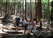
35. Now on Headwaters Trail in Lynn Headwaters Regional Park.
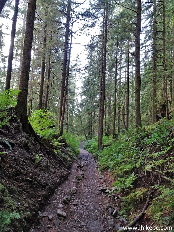
Headwaters Trail
36. Headwaters Trail is more challenging than Cedar Mills Trail, and, especially, Lynn Loop Trail, but not nearly as complicated as Coliseum Mountain Trail.
Headwaters Trail - North Vancouver Trail
37. There are also fewer people on Headwaters Trail, as most folks appear to head back where Cedar Mills and Headwaters trails meet.
Headwaters Trail in North Vancouver Area
38. A fine boardwalk/bridge on Headwaters Trail.
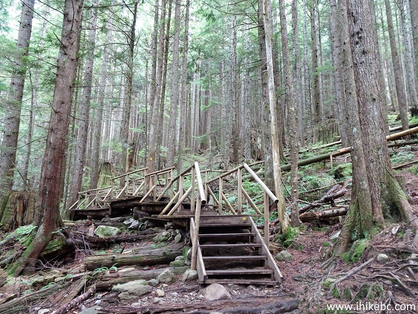
North Vancouver Hiking - Headwaters Trail in Lynn Headwaters Regional
Park
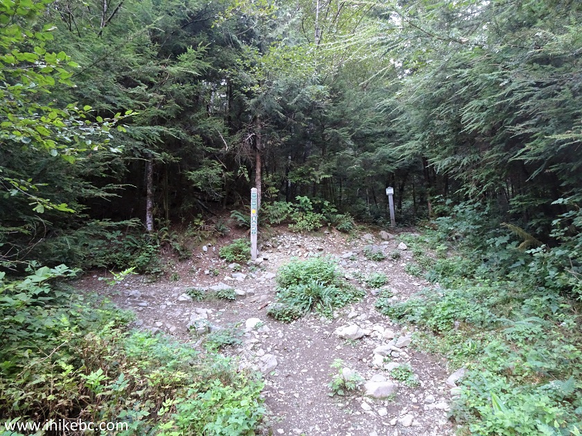
39. About 3 kilometers after the end of Cedar Mills Trail, and 7 kilometers from the parking lot, Headwaters Trail reaches Coliseum Mountain trailhead. Norvan Falls is, approximately, 300 meters further. And Lynn Lake Route is also in that direction.
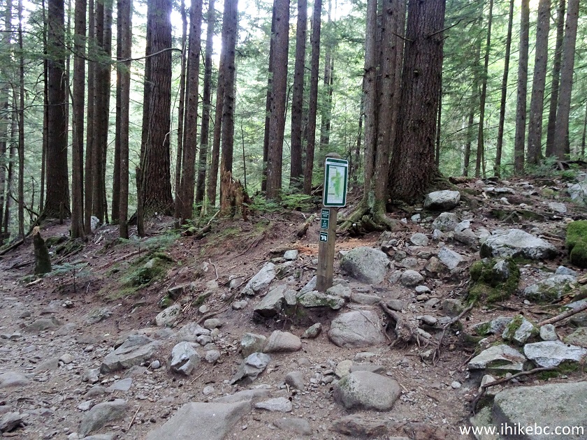
Headwaters Trail at Coliseum Mountain Trailhead - Hiking in North
Vancouver Area
40. So, here is Coliseum Mountain trailhead. Coordinates: N 49⁰24.840’ W 123⁰01.970’. Elevation: 387 meters (193 meters elevation gain from the trailhead by the parking lot). It's a very rough, dangerous trail, suitable for well-equipped, experienced hikers only. 7 hours return time is correct, though the distance is substantially more than 9.2 km (more like at least 13 km). Not sure where the 9.2 km number came from - perhaps, if one were to hike in a straight line, but it's all but impossible on this trail.
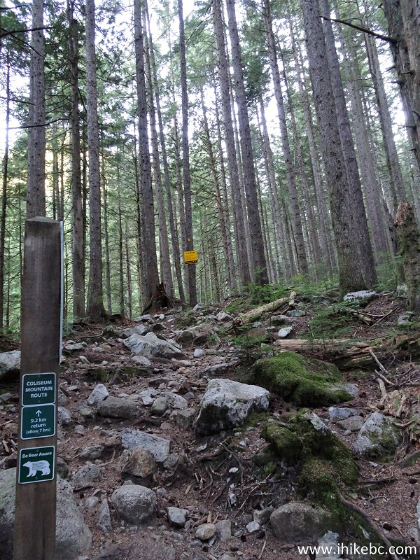
Coliseum Mountain Trailhead
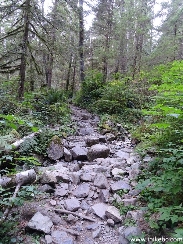
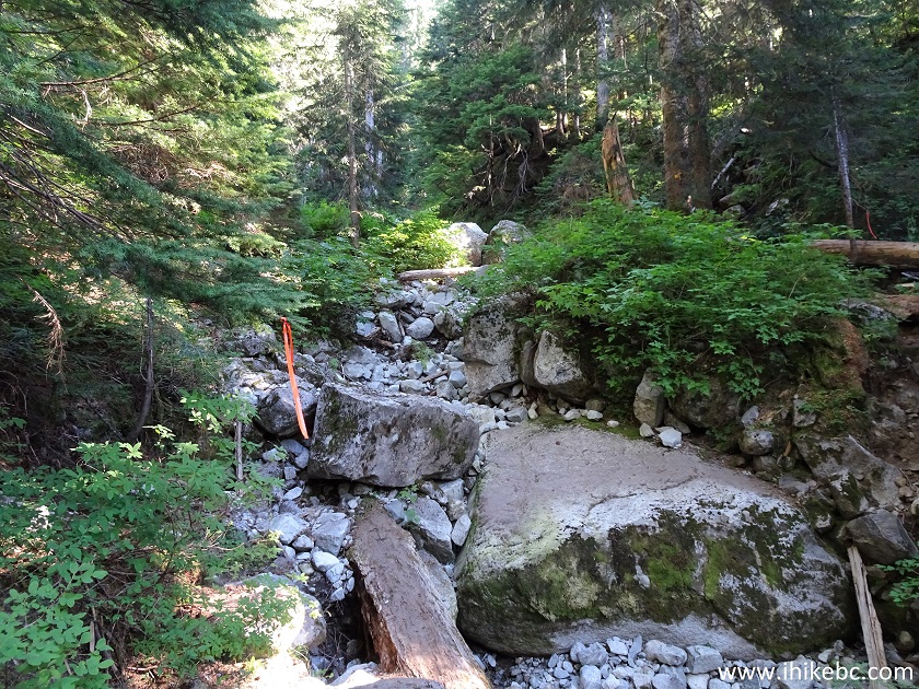
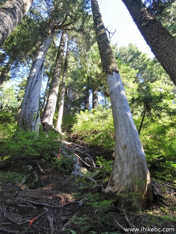
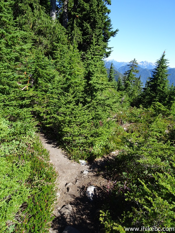
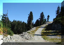
41. Coliseum Mountain Trail starts quite steep for the first 1.4 km.
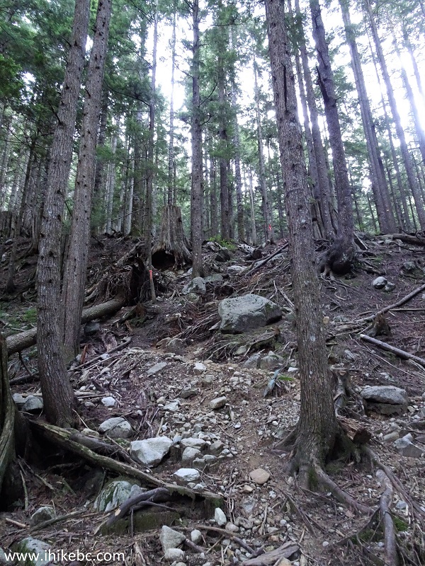
Coliseum Mountain Trail - Hike in North Vancouver Area
42. An especially steep section comes at 200 meters. A trail cam appears to record anyone making it to the top of this climb.
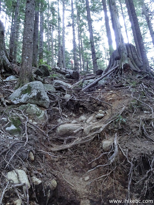
Coliseum Mountain Trail - North Vancouver Hike
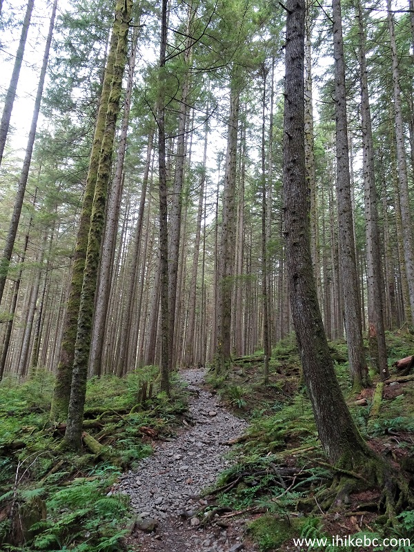
43. There is this wide climbing stretch after that.
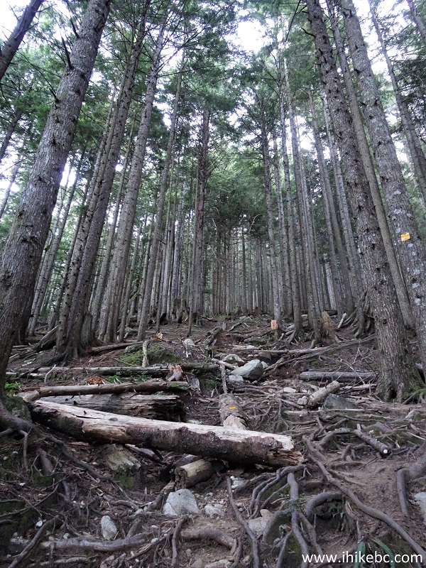
British Columbia Trail - Coliseum Mountain Trail
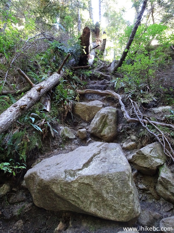
44. A brief levelling off comes at about 1.2 km, but then it become steep again.
British Columbia Hiking - Coliseum Mountain Trail
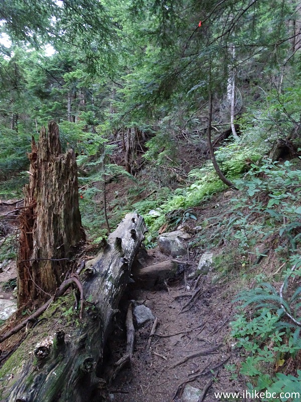
45. Finally, at about 1.4 km, this tree (under which you would have to duck) signals the end of the longest steep stretch of the trail. After that, the path is not as challenging, even though a few sections of the trail are very difficult.
Coliseum Mountain Trail in Lynn Headwaters Regional Park - Trail in
British Columbia
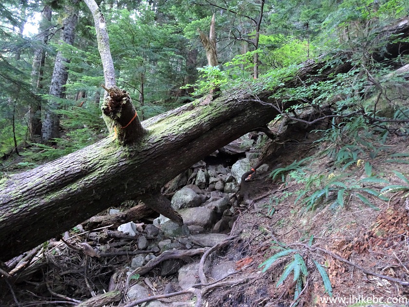
46. No other section of the trail proved more difficult to us than this one, about 4.1 km from the trailhead.
Coliseum Mountain Trail
47. After going forward as seen in the photo above, the trail makes a sharp right turn and goes steeply up.
Coliseum Mountain Trail - BC Hiking
48. In this area, on the way back, the following happened: we were descending, put one foot on the stone indicated with a red arrow, and, suddenly, slipped forward, tripped on a large sun-lit stone just to the left of the first stone, and ended up diving head first as if into a pool, except there was no water there. It was a freefall for at least two meters onto a stone indicated with a white arrow. Landed on a shoulder, got away with just a bruise, thanked God, carried on.
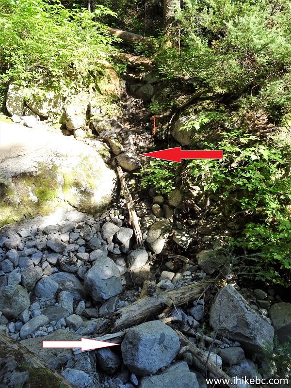
Coliseum Mountain Trail Danger
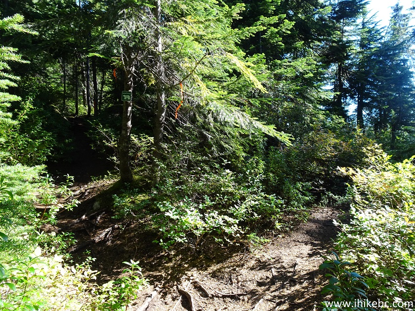
49. But that was on the way back. While going towards the end of the trail, there is a split at about 4.6 km. Coordinates: N 49⁰25.420’ W 123⁰00.085’. Elevation: 1,037 meters.
Coliseum Mountain Trail - Hiking in British Columbia
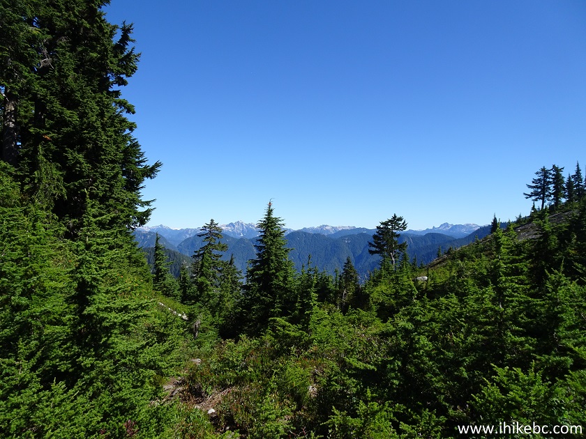
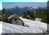
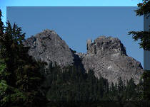
50. A short side trail on the right side leads to this mountain view.
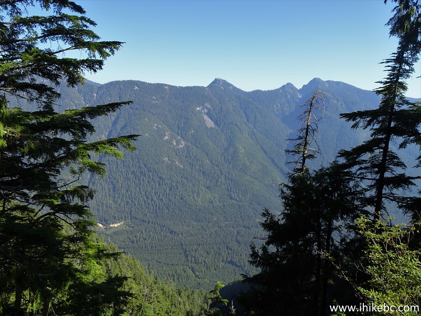
View from Coliseum Mountain Trail - Canada Hiking
51. Coliseum Mountain Trail shortly thereafter.
Coliseum Mountain Trail
52-53. At about 5.5 km, there is a neat lake by the trail. The second photo shows the same lake on August 31st, when there was too much fog for any mountain views to be seen.
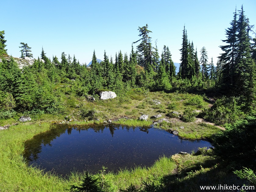
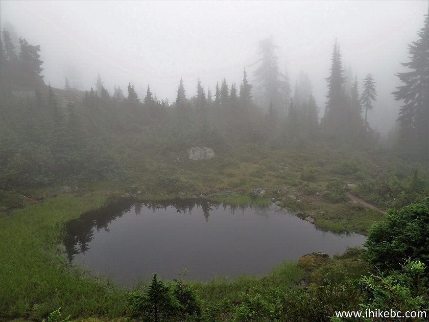
Tarn by Coliseum Mountain Trail
54. Very soon after the lake, with just over a kilometer to go to the main viewpoint, there is a major split. Coordinates: N 49⁰25.785’ W 123⁰00.061. Elevation: 1,220 meters. Our Garmin GPS with Backroad Mapbook software showed a split as well, and both trail ribbons were called "Coliseum Route" or something along those lines. From what we understood, the main trail continues on the left side, and we went there. But, going to the right, would also lead to some good views.
Hike in Canada - Coliseum Mountain Trail
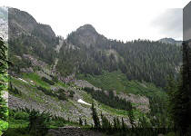
55. We did not have time to explore both trails, so walked on the path to the right for just a few meters. Here is a view.
Lynn Headwaters Regional Park
56. Now with a zoom.
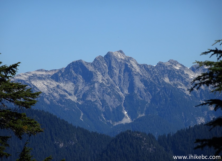
Mountain View from Coliseum Mountain Route
57. Continuing on the main path on the left side.
Coliseum Mountain Hike
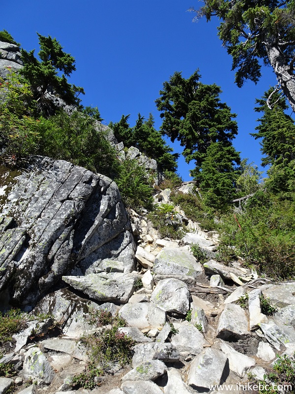
58. And, about 6 kilometers from the Coliseum Mountain trailhead, we have reached the first viewpoint. The most interesting part of the hike starts right here.
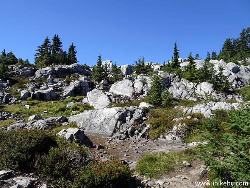
Lynn Headwaters Regional Park Hiking
Our Coliseum Mountain Trail Hike Trip Report Continues on Page 3.


|
 |
Other Trips in North Vancouver Area:
|
|
|
|
|
|
|
|
|
|
|
|

![]()
![]()
![]()
ihikebc.com Trip 199 - Coliseum Mountain Trail Hike (near North Vancouver BC) Page 2 of 3