![]()
![]()
![]()

Trip 027 - July 27, 2010 (Tuesday)
Goat Mountain Trail
Lynn Headwaters Regional Park - North Vancouver BC
Distance From Vancouver (South End of Lions
Gate Bridge) to Grouse Mountain parking lot:
7.4 km. Turn left onto Capilano Road in North Vancouver right after crossing the
Lions Gate Bridge. Or use Capilano Road exit from Highway 1 and go North. Upon
arriving to the Grouse Mountain parking lot, either take a gondola (a fee applies) or hike up via Grouse Grind (very tough trail) to the Grouse Mountain
Recreational Area. Then, follow the signs to the bear habitat, and, upon reaching a
fork with three roads, take the middle one to reach the trailhead in about 5
minutes.
Liked: Mountain views.
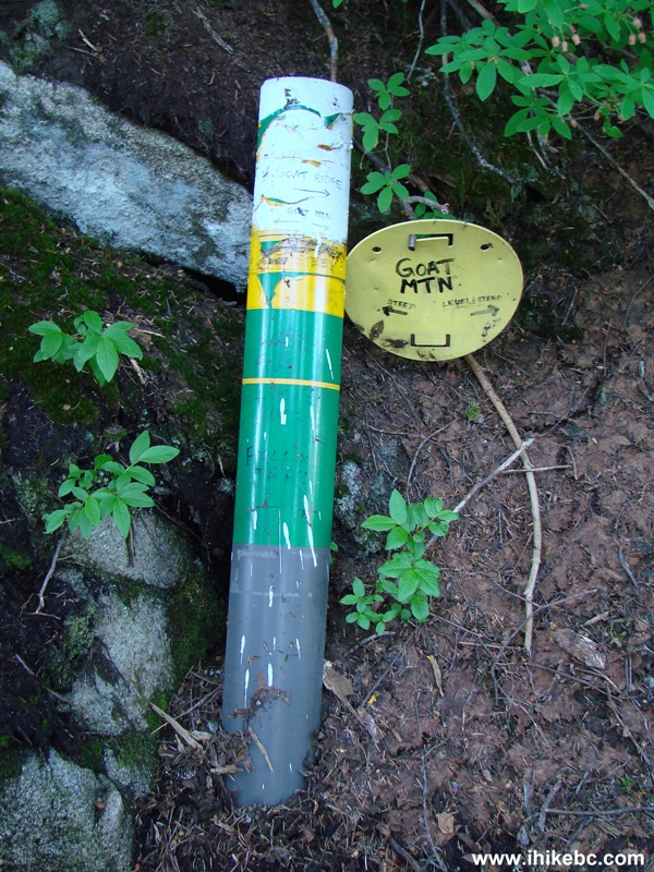
Of note: The trail is moderately challenging, with dangerous climbing stretches closer to the end. Hiking boots and poles are highly recommended. There was still snow on the ground at the end of July. Flies were a minor nuisance. Directional signs are worn out and may not last for much longer. September 2010 Update: directional signs have been replaced, but can still be confusing.
Vancouver, Coast & Mountains Backroad Mapbook (2010 edition) Coordinates: Page 11 (North Vancouver) D6.
Related Website: Grouse Mountain - Official Website.
Follow @ihikebc Tweet
Goat Mountain is a fairly short hike of 3-3.5 hours return trip (from the top of Grouse Mountain and back), which offers good views. Getting to the trailhead is somewhat burdensome, as first you have to pay for parking, and then shell $$$ for taking the Grouse Mountain gondola up from the parking lot, or hike Grouse Grind before hiking Goat Mountain (which is exactly what we did). But you won't escape saying good-bye to your cash, as the gondola ride to the parking lot costs $10, and there is a note prohibiting downhill travel on Grouse Grind.
Also, once we got to the Grouse Mountain Recreational Area (the top destination for the gondola riders and The Grind hikers) we could not find any sign pointing to the hiking trails, including the Goat Mountain trail. It's not such a bad thing, though, as the lack of signage prevents hordes of unprepared vacationers, who come to Grouse Mountain Recreational Area, from hitting the trails and discovering that flip-flops are a poor choice of footwear in the wilderness. For that matter, anything but sturdy hiking boots (along with hiking poles) would likely lead to an ankle sprain at best, as the Goat Mountain trail is challenging, especially closer to the top.
1a-1b. Goat Mountain Trail is part of Lynn Headwaters Regional Park. We hiked to Norvan Falls before, but that required a different access road, as described in trip #05. The two sides of Lynn Headwaters Regional Park are connected via the Hanes Valley Route (a one-way hike), visible in the map below. Our hike today was from the Grouse Mountain side of the park up to Goat Mountain. The map is courtesy of Metro Vancouver Regional Parks.
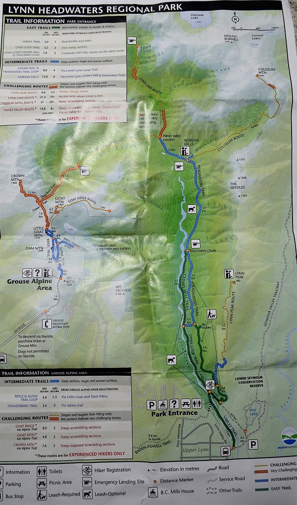
Lynn Headwaters Regional Park Trail Map
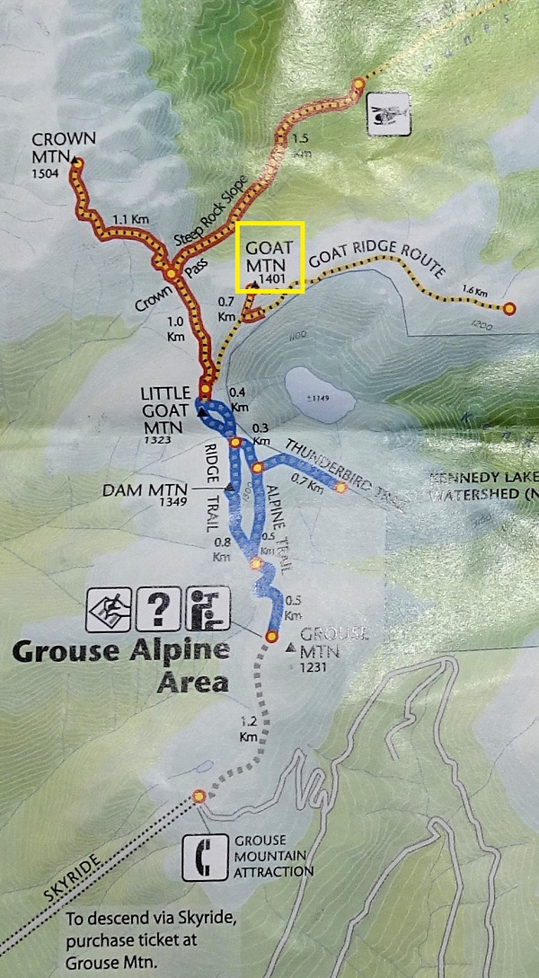
Goat Mountain Trail Map
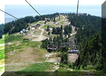
2. Once you get to the Grouse Mountain Recreational Area either via the Skyride gondola or Grouse Grind, follow the signs to Grizzly Bear Habitat. Once you approach the habitat, you will see three roads. The road to the left goes around the habitat. The road to the right goes uphill to the wind turbine. And the road in the middle (as shown by the arrow) is the one you need, as it leads to the Goat Mountain trailhead.
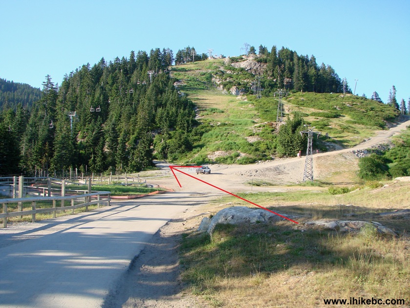
Grouse Mountain Recreational Area North Vancouver British Columbia
Canada
3. You would know that you have chosen the right road if, within a minute, you would be walking under the Scenic Chair lift.
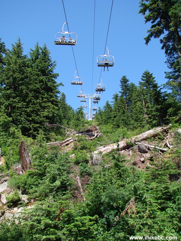
Photo of Scenic Chair lift Grouse Mountain North Vancouver British
Columbia Canada
4. In about five minutes, you reach the trailhead. The note advised that, as of July 24, there was still up to a meter of snow on the trails. It is a good idea to use the registration service near the information board.

Information Board before Goat Mountain Trail - Lynn Headwaters Regional
Park
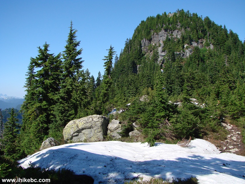
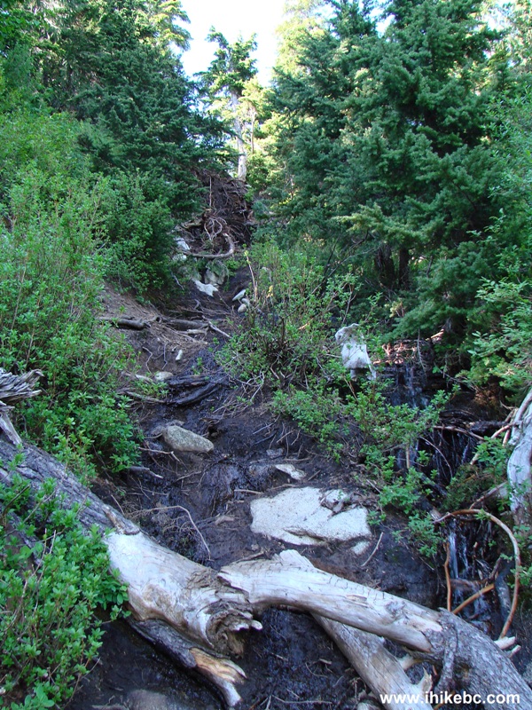
5. The trail looks easy at the beginning, but then gets worse.
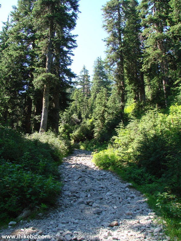
Goat Mountain Trailhead Lynn Headwaters Regional Park North Vancouver BC
Canada
6. You will pass the back of the wind turbine, and will hear the happy screams of zip-liners for quite some time.
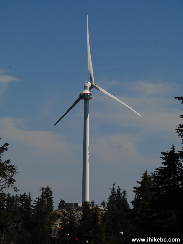
Wind turbine seen from Goat Mountain trail North Vancouver British
Columbia Canada
7. Hard to believe it's almost August, looking at this much snow.
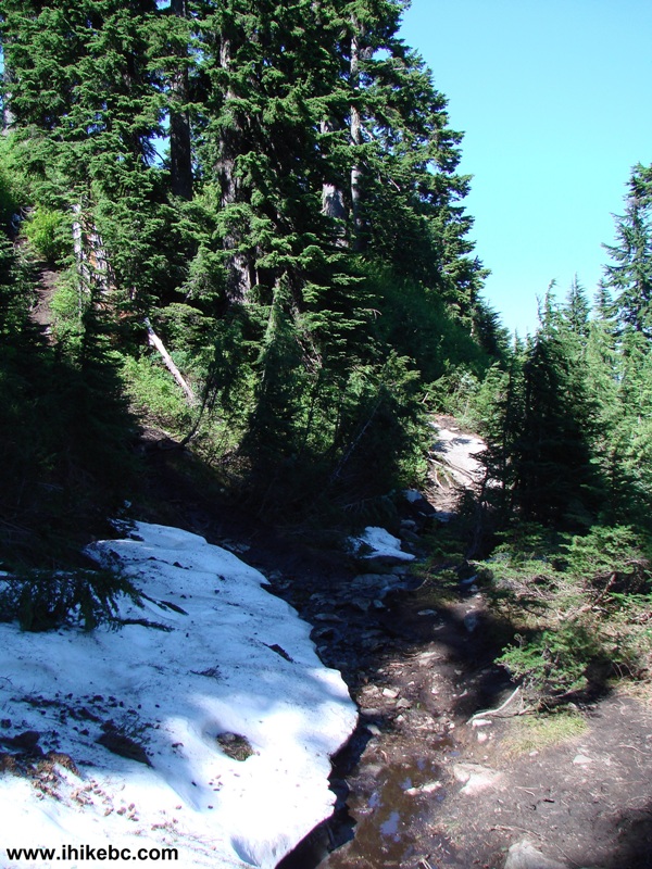
Goat Mountain Trail - hiking in North Vancouver Area of British Columbia
Canada
8. A local resident is checking us out.
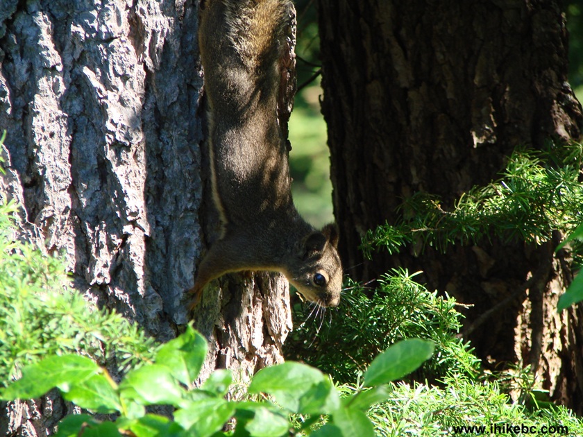
Squirrel on Goat Mountain Trail Lynn Headwaters Regional Park North
Vancouver British Columbia Canada
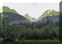
9. Here come the mountain views.
North Vancouver Area Hiking -
Mountain view from Goat Mountain Trail
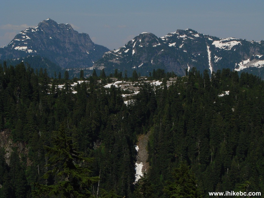
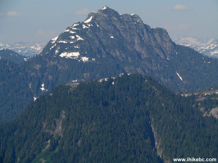
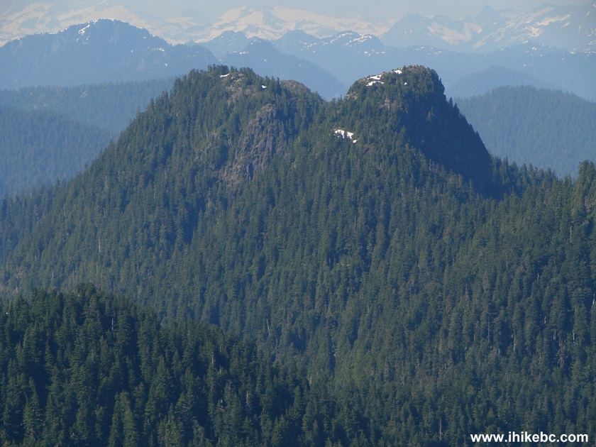
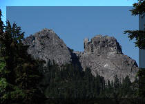
10. Crown (left) and Camel mountains, as described in "103 hikes in Southwestern British Columbia" by Jack Bryceland. Some zoom used.
Camel Mountain and Crown Mountain seen from Goat Mountain Trail - hiking
in North Vancouver
11. After 45 minutes, a split arrives. Go straight to Goat Ridge and Goat Mountain. Or turn left and go to Crown Mountain and Hanes Valley.
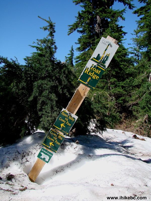
Crown Mountain and Hanes Valley trail split with Goat Mountain and Goat
Ridge
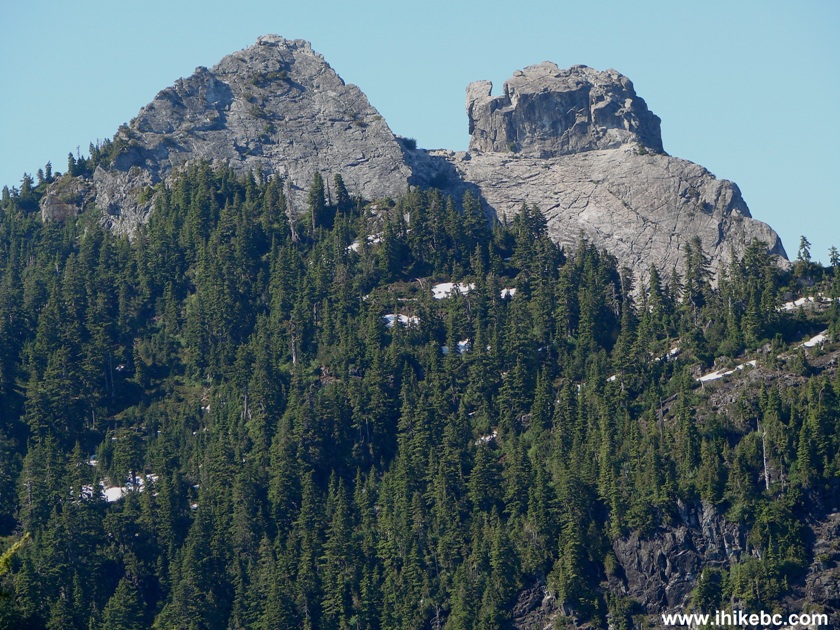
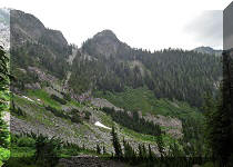
12. Goat Mountain ahead.
Goat Mountain - Lynn Headwaters Regional Park - North Vancouver Area
Hiking - British Columbia Canada
13. We are very close to the top, and now starts the most difficult part. There are two chains (hard to see in this photo) on this stretch of the hike. We slipped and fell on the way down while holding the top chain in our hands.
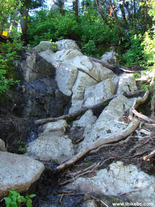
Goat Mountain Trail BC Canada
14. Once you conquer this climb, there is a sign offering you to go left or right to reach the top of Goat Mountain, or to go right to proceed to Goat Ridge.
Goat Mountain Trail North Vancouver British Columbia Canada
15. We went left, and soon faced another steep and slippery area.
Goat Mountain Trail - hiking in North Vancouver Area of the province of
British Columbia
16. After this last obstacle, you are pretty much at the top, and are rewarded with fine views.
View from Goat Mountain - North Vancouver Area Hiking
17. Don't know the name of this mountain, but it looks like a camel.
View from Goat Mountain Lynn Headwaters Regional Park BC Canada
18. Lots of snow on top of Goat Mountain.
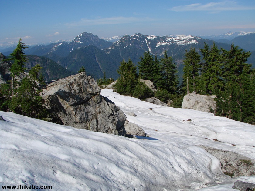
Snow on top of Goat Mountain British Columbia Canada
19. You can see much of Metro Vancouver too. Substantial zoom used.
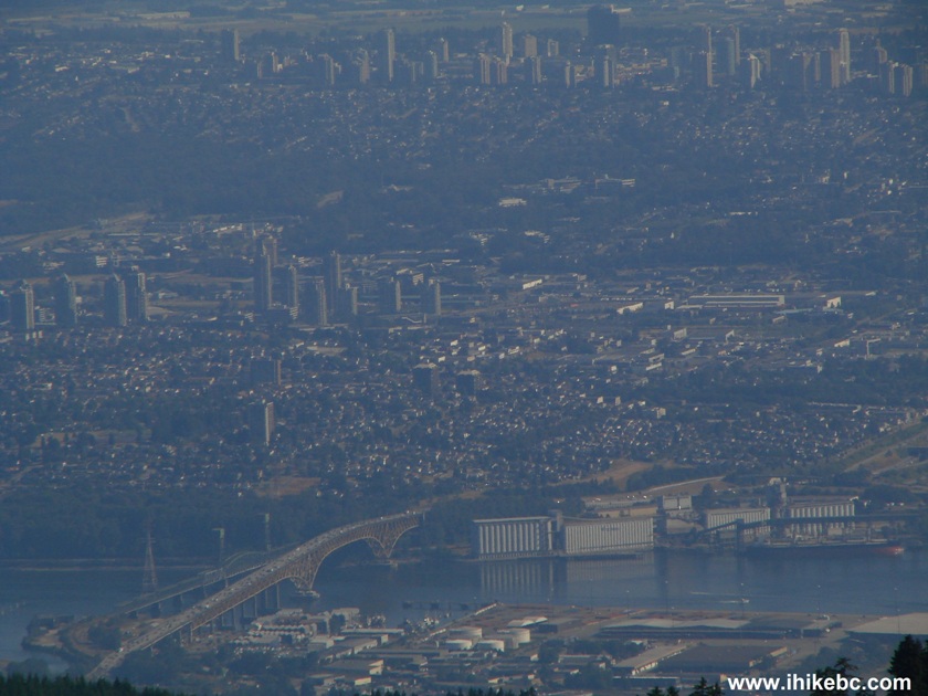
Metro Vancouver seen from Goat Mountain
Trip to the top from Grouse Mountain Recreational Area: 1 hour 25 minutes; Trip back: 1 hour 13 minutes.


|
 |
Other Trips in North Vancouver Area:
|
|
|
|
|
|
|
|
|
|
|
|

![]()
![]()
![]()
Follow @ihikebc Tweet
ihikebc.com Trip 025 - Goat Mountain Hike (near North Vancouver BC)